-
 Melbourne Tram Museum
Map, Melbourne & Metropolitan Tramways Board (MMTB), MMTB Route Maps, 1979
Series of colour maps for various tram and bus routes, dated 1979. Also contained, not scanned are letters, reports, and specifications for printing these maps for use in shelters etc. Some have the Transport Information Centre telephone printed on them. Some are finished with a plastic laminate finish on either one or both sides. Show the major cross streets, parks, schools, other tram routes, major stop numbers, and railway lines. See also item 3909 for another example of these. Trams 1 - City route guide - R9/77 - showing all route numbers and destinations that passed through the CBD. 2 - Bourke St tram routes - R4/77 - East Brunswick Blyth St and East Preston Tyler St and intermediate routes, routes 95, 96, 97, 90, 89 and 88. 3 - Malvern, East Malvern, Carnegie, and East Brighton Tram Routes (from St Kilda Junction) - R1/79 - shows routes 5, 3, 67, 66, 61, 62, and 64. 4 - Elizabeth St tram routes - R12/77 - Essendon Airport, West Maribyrnong, North Coburg lines, routes 50, 58, 60, 54, 57, 52. 49, 59, 18, 20 and 19 5 - Flinders St tram routes - R5/78 - North Balwyn, East Burwood, routes 48, 40, 41, Hartwell, 28, 74 and 75 6 - Kew - St Kilda Beach - R1/79 - Route 69. 7 - Mont - Albert City - R11/77, shows routes 43. 47. 45. 44 8 - St Kilda Rd Tram Routes R12/77 - details South Melbourne Beach, route 1 and route 2 and St Kilda Beach routes 15, 16, and 55 otherwise shows where the various routes branch off St Kilda Road 9 - Batman Ave tram routes - R9/77 - Wattle Park, North Richmond and Prahran - routes 70, 71, 78 and 79. 10 - Footscray - Moonee Ponds - R3/81 - Route 82 11 - Swanston St tram guide - R1/79 - lists all routes and route numbers that branch or cross Swanston St between Grattan St and St Kilda Junction. 12 - Toorak Camberwell and Glen Iris tram route with Camberwell Junction and Malvern Town Hall, R1/79, routes 8, 7, 6, 72, and 73 shown. 13 - West Preston - Beach tram routes - R12/77 - routes 10, 11, 9 and 12, 14 - William St tram routes - R12/77 - Route 55, 56, and 63 - South Melbourne Depot and Domain. Buses 1 - Footscray, Sunshine, Deer Park, Nth Altona & Fishermans Bend - R2/79 2 - Box Hill bus routes to Templestowe, Heidelberg & East Kew - R6/78 - notes superseded by R3/82 3 - Plan of Russell St Melbourne bus departure bays. 4 - Box Hill, Mitcham & Ringwood bus routes to East Doncaster & Warrandyte - R3/82 5 - City - Warrandyte & East Doncaster bus routes - R3/82 & R6/78 6 - Bulleen - City - Port Melbourne - Garden City Bus route - R6/78 7 - North Altona - City bus route - 11/78 8 - Clifton Hill - Elsternwick - R2/79 9 - La Trobe - Northland - West Heidelberg - City Bus Service via East Freeway - 11/79 and R3/81 10 - Box Hill, Mitcham & Ringwood Bus Routes to East Doncaster & Warrandyte - R10/84 - with the Metropolitan Transit logo.Yields information about tram and bus routes in late 1970s early 1980s.Book - brown comb binding, card and clear plastic covers containing both bound and unbound maps and documents.K C Painter on front cover in ink.tramways, mmtb, tram routes, maps, bus routes, route numbers, routes, route guide -
 Glenelg Shire Council Cultural Collection
Map, 1885
Significant collection relating to the social history across the shire.Map, Victoria. Skeleton map of Telegraph Circuits and Railways 1885. Scale 16 miles to 1 inch.map, skeleton map, telegraph, railways, 1885, 1880s -
 Bendigo Historical Society Inc.
Negative - BENDIGO CHINESE TEA HOUSE
Construction of the Chinese Tea House, Nolan Stret, Bendigo. Beside Lake Weeroona.buildings, commercial, tea house -
 Eltham District Historical Society Inc
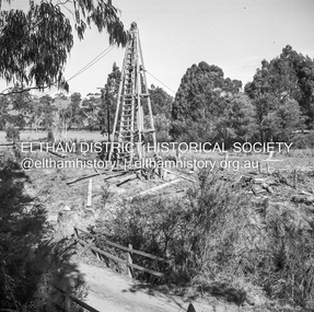
Negative - Photograph, J.A. McDonald, Laidlays Road, Arthurs Creek, April 1962
Bridge over Arthurs Creek Looking east April 1962Record of various Shire of Eltham infrastructure works undertaken during the period of 1952-1962 involving bridge and road reconstruction projects, sometimes with Eltham Shire Council Project Reference numbers quoted. It was during this period that a number of significant improvements were made to roads and new bridges constructed within the shire that remain in place as of present day (2022). In many situations, the photos provide a tangible visible record of infrastructure that existed throughout the early days of the Shire. The album was put together by or under the direction of the Shire Engineer, J.A. McDonald.1962-04, arthurs creek, bridge construction, infrastructure, laidlays road, shire of eltham -
 Eltham District Historical Society Inc
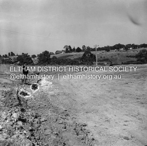
Negative - Photograph, J.A. McDonald, Reconstruction works, Lower Plenty Oval, Jan. 1961
3 February 1961 Looking towards Rattray RoadRecord of various Shire of Eltham infrastructure works undertaken during the period of 1952-1962 involving bridge and road reconstruction projects, sometimes with Eltham Shire Council Project Reference numbers quoted. It was during this period that a number of significant improvements were made to roads and new bridges constructed within the shire that remain in place as of present day (2022). In many situations, the photos provide a tangible visible record of infrastructure that existed throughout the early days of the Shire. The album was put together by or under the direction of the Shire Engineer, J.A. McDonald.1961-01, infrastructure, lower plenty oval, reconstruction works, shire of eltham -
Bendigo Historical Society Inc.
Map - JOHN WILLIAMS COLLECTION: PHOTO-MAP OF BENDIGO, 2007
Map, Photo-map of Bendigo,Australian Government Department of Defence,prepared and published by the Defence Imagery and Geospatial Organisation 2007.Copyright Commonwealth of Australia 2007.Australia Photomap 1:15 000. Edition 2-DIGO. WGS84.Grid 1000 metre UTM Zone 55. (number 407 in map cupboard 1)Defence Imagery & Geospatial Organisationmap, bendigo, city streets -
 Bendigo Historical Society Inc.
Map - JACK FLYNN COLLECTION: YARRAYNE, 6/01/1932
Map: Parish of Yarrayne, County of Bendigo. Parish plan.By Authority, H.J. Green, Govt., Printer. Photo-Lithographed at the Department of Lands and Survey, Melbourne. 5.1.32.map, bendigo, parish plan, yarrayne -
Ringwood and District Historical Society
Legal record - Conditions of Sale (C.E.Carter), Ringwood - Crown Portion 5, E Kennedy to D.A.Hunt - 1929
Particulars and Conditions of Sale of Property , from Edward Kennedy to Mr D. A. Hunt -
 Eltham District Historical Society Inc
Negative - Photograph, Shire of Eltham, Eltham Meadows Estate, Zig Zag Road subdivision, Jan. 1980
eltham, eltham meadows estate, k.g. mcgorlick pty ltd, mcgorlick real estate, zig zag road subdivision -
 Melbourne Tram Museum
Negative, Wal Jack, c1940
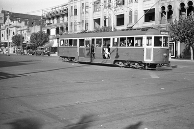
Black and white negative by Wal Jack of W4 670 (Moreland) east bound in Fitzroy St St Kilda, crossing the VR tram tracks at St Kilda Station. In the background is The George Hotel and other buildings. Photo undated, c1940.trams, tramways, fitzroy st, st kilda, moreland, w4 class, tram 670 -
 Eltham District Historical Society Inc
Negative - Photograph, Audrey Cahn (nee Osborne) aged two, c.1907-08
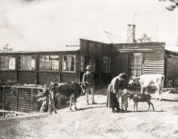
Negative copy of an original print and associated print copy of Ethel Osborne photos featuring William Alexander Osborne, Ethel Elizabeth Osborne, Audrey Josephine Osborne, two cows and a calf in front of their home in Warrandyte. Inscribed on reverse of print: WAO EEO Audrey aged 2 Warrandyte 1907-8Negative black and white film 120 6x9 format 2 strips Associated B&W printFuji Safety Neopan SSwarrandyte, audrey cahn, audrey osborne, ethel osborne, houses, william osborne, osborne family, farm animals -
 Eltham District Historical Society Inc
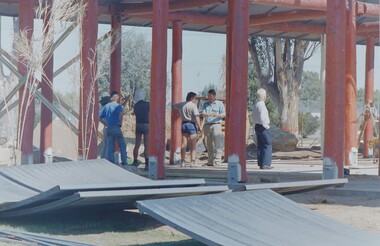
Negative - Photograph, Open Day, Eltham Living and Learning Centre, 7 Nov 1987
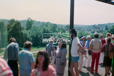
Open Day, Eltham Living and Learning Centre, part of the Eltham Community Festival activites, 7 Nov. 1987eltham, eltham festival, eltham living and learning centre, living and learning centre, open day -
 Churchill Island Heritage Farm
Negative - Negative of family standing near the cannon
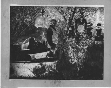
Churchill Island Heritage Farm has a large photograph collection dating from the nineteenth centuryNegative of a man standing next to the cannon with a group of people in the backgroundchurchill island, photograph -
Bendigo Historical Society Inc.
Map - SNOB'S HILL - PLAN OF SNOB'S HILL AREA
Plan drawn on tracing film of sand heap, dams, trig point and mines. Some un-named streets are also drawn in. Piece of notepaper has mines drawn in on a larger scale.map, bendigo, goldfields, snob's hill, plan of snob's hill area, new st mungo mullock heap, duchess trib, s devonshire, duchess of edinburough, w u devonshire, hopewell, phoenix, unicorn, princess alice, lady barkly, sadowa, e u devonshire, united devonshire, l?, ellenborough, belmont & saxby, snob's hill -
 University of Melbourne, Burnley Campus Archives
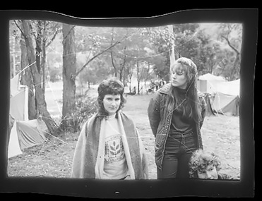
Negative - Black and white negative, Excursion, c. 1971
Dennis Gedye Graduated 19725 negatives, probably of an excursion or camp. In an envelope with, "Dennis Gedye Graduated 1972." handwritten.excursion, camp, dennis gedye -
 Melbourne Tram Museum
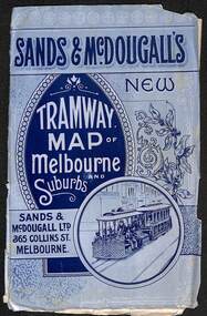
Map, Sands McDougall, "Tramway Map of Melbourne and Suburbs", c1906
Shows railways, cable and electric tram lines c1906. One of a number of maps produced by Sands McDougall of Collins St. Includes the MTOCo horse tram lines and the Caulfield horse tram lines. See items 2885 and 6573 for other editions. Yields information about Melbourne c1906 and its public transport lines. Map - folded sheet of paper 5 sections wide x 4 sections or folds deep contained within a light grey paper cover titled "Tramway Map of Melbourne and Suburbs"maps, melbourne, cable trams, tramways, railways, horse trams, nmetl, vr trams, sands mcdougall -
 Ballarat Tramway Museum
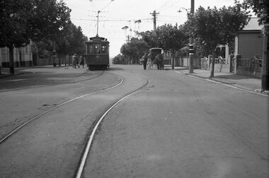
Negative, Wal Jack, late 1940s
Negative and Digital images of the Wal Jack Geelong Negative file of Geelong 9 at the junction in Pakington St between the Newtown and Chilwell lines. Note the two tram stops on either side of the line, one a compulsory stop and the other a request stop. On the right hand side is a horse drawn vehicle, possibly delivering bread given the basket in his hand. Photo possibly late 1940's. trams, tramways, geelong, pakington st, tram 9 -
 Whitehorse Historical Society Inc.
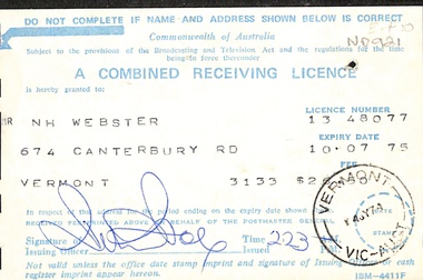
Legal record - Document, Radio & T. V. Licence, 10/07/1975
Combined Receiving Licence for Radio and T.V. issued in 1975.radio broadcasting, television broadcasting -
Stawell Historical Society Inc
Map, County of Ripon, 1858
County of Riponstawell -
 Marysville & District Historical Society
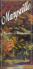
Map (Item) - Information brochure, Project Art & Photo, Marysville in the Mystic Mountains, Unknown
An information brochure on Marysville, the surrounding district and the natural attractions in the region published by Mystic Mountains Tourism.An information brochure on Marysville, the surrounding district and the natural attractions in the region published by Mystic Mountains Tourism.marysville, victoria, australia, information brochure, mystic mountains, mystic mountains tourism, cathedral range, lady talbot drive, cameron cascades, phantom falls, keppel falls, beech forest cascades, the beeches rainforest walk, the big tree, cumberland memorial scenic reserve, cambarville, cumberland falls, cora lynn falls, the big culvert, steavenson falls, lake mountain, marysville visitor information centre -
 Eltham District Historical Society Inc
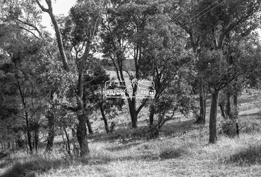
Negative - Photograph, Russell Yeoman, Maroondah Aqueduct, Kangaroo Ground, c.1980
Roll of 35mm colour negative film, 2 strips Colour print (x1)Kodak Safety 5035kangaroo ground, maroondah aqueduct -
 Ballarat Tramway Museum
Negative - Set of 3, Campbell Duncan, 1975 or 1976
Yields information about the appearance of No. 27 and Depot Junction mid 1970's.Set of 3 selected negatives from a group of about 22 negatives showing the activities by the BTPS in Wendouree Parade c1975/1976. Photographed by Campbell Duncan (could be Paul Nicholson). .1 - No. 27 arriving at Depot Junction with destination of Carlton St and a Twin Lakes sign. .2 - ditto, picking up passengers, with Richard Gilbert driving. .3 - ditto leaving Depot Junction. trams, tramways, btps, wendouree parade, depot junction, tram 27 -
 Melbourne Tram Museum
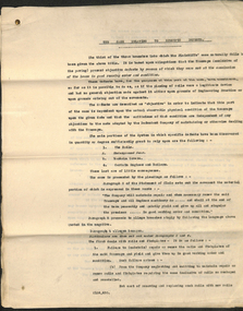
Legal record, Melbourne Tramways Trust (MTT), "The Case Relating to Specific Defects", 1916
"The Case Relating to Specific Defects" 1916 No 554 Tramway Board v Melbourne Tramway & Omnibus Coy Limited WB McCutcheon - Solicitor for the Board 18 page legal document relating to the above Supreme Court case. Tramway Board & MTOC arbitration case 1916 ."A4" written in red penciltrams, tramways, tramways, trackwork, supreme court -
Whitehorse Historical Society Inc.
Legal record - Document, Certificate of Title, 1927
Certificate of Title vol. 5411, fol. 1082004, 23 December 1927, pt. Crown Portion 108, Parish of Nunawading, Middleborough Road, owned by Albert Edwin Victor CavillCertificate of Title vol. 5411, fol. 1082004, 23 December 1927, pt. Crown Portion 108, Parish of Nunawading, Middleborough Road, owned by Albert Edwin Victor CavillCertificate of Title vol. 5411, fol. 1082004, 23 December 1927, pt. Crown Portion 108, Parish of Nunawading, Middleborough Road, owned by Albert Edwin Victor Cavillshire of blackburn and mitcham, middleborough road, burwood east -
Ballarat Tramway Museum
Legal Record - Legal Document, State Electricity Commission of Victoria (SECV), "Extract from ACT No. 3776"
Single page giving an "Extract from ACT No. 3776 - An Act to consolidate the Law relating to the State Electricity Commission of Victoria and the Power and Duties thereof" - 1928. Gives an extract from page 11, "Provisions relating to Councils and Other Undertakers." Carbon copy of the report typed onto paper with rounded corners.trams, tramways, sec, acts of parliament, power supply, councils -
 Ballarat Tramway Museum
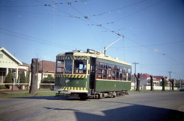
Negative, Travis Jeffrey, 5/08/1962 12:00:00 AM
Colour Negative No. N410, of the Bendigo No 11 turning from McCrae St into Nolan St, with in the background. Tram has the destination of Lake Weeroona. Photo taken possibly on Sept or Oct 1962, given the tree pruning in the background - pruned back stumps. Colour laser printed copy of image stored in box 73. Original negative hires scan and image updated 28/5/2020.In red pen on folder that contained negative, "NR65A" and "23 Feb 1962" and inside "26 Sep 1962" and "6 Oct 1962". and "55A" in pencil. trams, tramways, bendigo, nolan st, lake weeroona, tram 11 -
 Ringwood and District Historical Society
Map, Subdivision Plan - Adam Court area, North Ringwood, Vic. - circa 1960s
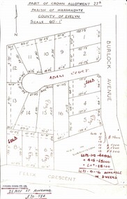
Single page plan printed showing allotments included in un-named subdivision layout surrounding Adam Court, Ringwood North. Subdivision includes Adam Court, Burlock Avenue, and Felix Crescent. Sold allotmenets marked in red, with price notations.Page heading - Part of Crown Allotment 27B Parish of Warrandyte County of Evelyn Scale 60'-1". Rubber stamp imprint and handwritten address at bottom of page - "Binburra Estates Pty. Ltd. 23 Pitt St., Ringwood, 870-1184". -
 Melbourne Tram Museum
Map, Melbourne & Metropolitan Tramways Board (MMTB), Report - "Melbourne and Metropolitan Tramways Board General Scheme", May. 1923
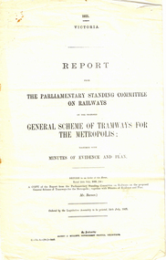
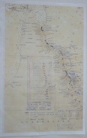
.1 - Printed document - 1923 - Report - 8 pages - The Parliamentary Standing Committee on Railways - General Scheme for Tramways for Metropolis - printed 24/7/1923. Gives details of the committee, the committee report, comments on the Board's financial position, the debate between tramways or railways, recommendations and views of the Railways Commissioners. .2 - Associated map - Map - drawing with a line back, titled "Melbourne and Metropolitan Tramways Board Proposals for General Scheme". Shows the proposed tram lines submitted to Parliament for the report into the General Scheme. Printed by Sands & McDougall Pty Ltd. Signed by J. P Strickland dated 27-8-1923. .3 - as for .1, but in good condition - added 27-3-2018 from donation of Norm Cross.trams, tramways, mmtb, general scheme, tramways, development, parliament, brighton, railways, finances, map -
Whitehorse Historical Society Inc.
Map, Map of Mitcham, Tunstall and Blackburn, c1937
Map of Mitcham, Tunststall and Blackburn showing the location of T.M. McDonnell, real estate agent, Whitehorse Road, MitchamMap of Mitcham, Tunststall and Blackburn showing the location of T.M. McDonnell, real estate agent, Whitehorse Road, MitchamMap of Mitcham, Tunststall and Blackburn showing the location of T.M. McDonnell, real estate agent, Whitehorse Road, Mitchammaps, mcdonnell, t.m. -
 Warrnambool RSL Sub Branch
Map - 1947 Minesweeping map, North Queensland minesweeping map, unknown
1947 an after-effect od WW2Laminated A3 Map plus A4 map in pocket (copies of original)shows location of minefields to be cleared in 1947 and names of minesweeping ships!947 ran history