Showing 127105 items
matching main-road
-
 City of Kingston
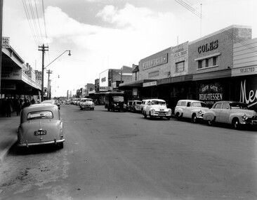
Photograph - Black and white, c. 1956
Black and white photograph depicting Centre Road Bentleigh, looking west. On the right hand side of the road there are two Coles stores. The one in the background is the newly opened store while the one in the foreground has been repurposed and is now a delicatessen. There are numerous cars parked on both sides of the road, including one that appears to be "double parked" on the right hand side of the road.Black and white photograph depicting Centre Road Bentleigh, looking west. On the right hand side of the road there are two Coles stores. The one in the background is the newly opened store while the one in the foreground has been repurposed and is now a delicatessen. There are numerous cars parked on both sides of the road, including one that appears to be "double parked" on the right hand side of the road.Handwritten in blue ink on a white sticker adhered to the reverse of the photograph: COLES BENTLEIGH c. 1956 / Centre Road looking west / The Old Coles store is in the foreground / and the new Coles is in the background.bentleigh, suburbs, shopping strip, cars -
 Sunshine and District Historical Society Incorporated
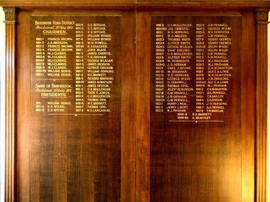
Honour Board, CHAIRMEN of BRAYBROOK ROAD DISTRICT 1860-1871 and PRESIDENTS of SHIRE OF BRAYBROOK 1871-1950, Unveiled 15 March 1940
By around circa 1850 Braybrook was already well established, and during the gold rush period also became a staging point for prospectors on their way to the diggings. Local government for the area began on 28th May 1860 when the BRAYBROOK ROAD BOARD DISTRICT was proclaimed, however this authority was soon superseded on 23rd January 1871 when the SHIRE OF BRAYBROOK came into existence. The Shire of Braybrook continued as the local government authority for the district until the CITY OF SUNSHINE was proclaimed in 1951. This Honour Board was unveiled on Monday 18th March 1940 at 8:30 p.m., and was hung in the Council Chamber, at the Shire of Braybrook Hall, Sunshine.The Honour Board is a historical record of the people who served as heads of local government in the district from 1860 to 1950.Large brown stained wooden structure comprised of two board sections positioned side by side to make one display board. Contains in gold coloured lettering the names of people who served as CHAIRMEN of the BRAYBROOK ROAD DISTRICT and as PRESIDENTS of the SHIRE OF BRAYBROOK during the years 1860 to 1950.braybrook road district, shire of braybrook, chairmen, presidents, 28 may 1860, 23 january 1871, 1950, sunshine., braybrook road district, shire of braybrook, chairmen, presidents, 28 may 1860, 23 january 1871, 1950, sunshine. -
 Melbourne Tram Museum
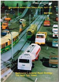
Document - Report, Ministry of Transport, Metropolitan Arterial Road Access Study, Apr. 1987
Report - 88 pages - perfect bound +card covers + fold out map, looks at the development of arterial roads in the various Melbourne regions, includes recommendations and road, management. Has table of contents, diagrams and maps. Includes findings of the studies, issues with freight transport, improvement proposals. Little work on public transport as such. Title "Metropolitan Arterial Road Access Study, April 1987 - Melbourne's Arterial Road Strategy the next 10 years - METRAS" - Has foreword signed off by Tom Roper, Minister for Transport. Report M6trams, tramways, public transport, road transport, minister for transport -
 Melbourne Tram Museum
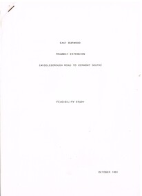
Document - Report, Melbourne & Metropolitan Tramways Board (MMTB)?, Ministry of Transport?, "East Burwood Tramway Extension - Middleborough Road to Vermont South - Feasibility Study, Oct. 1981
Report - 43 pages, photocopied, stapled in top left hand corner - titled "East Burwood Tramway Extension - Middleborough Road to Vermon South - Feasibility Study - October 1981". No details as who made the report, assumed Ministry of Transport or MMTB. Gives details of proposals considered, population and land use, existing services, patronage, operating costs, revenue and provides an assessment. Looks at costs for an extension only to Blackburn Road, Springvale Road and to Vermont South. Report showed the cost benefit ratio for Blackburn Road was 1, and less for the other possibilities.trams, tramways, east burwood, feasibility study, new tramway, mmtb, middleborough rd, vermont south -
 Surrey Hills Historical Society Collection
Photograph - Digital photograph, George L Coop, 692-694 Whitehorse Road Mont Albert, 1958
The donor George Lister Coop was about 21 years of age when he took this photo in 1958. This photo is of Annesley Home for the Aged at 692-694 Whitehorse Road. It was originally a Methodist, later a Uniting Church facility. The new sections in the photo was part of an extension built in 1958. A further extension encompassing 21 beds occurred in 1971. A Queen Anne / Edwardian brick attic home was built on No 694 in 1908 for William Pilkington, a manufacturer and was called 'St Martins'. Ownership stayed in this family until c1950. It was retained as part of the facility. Alan Holt's register of 3127 properties list 34 residents in 1980, of which all but 3 were female. The property was replaced by apartments in c2018 but had ceased function as a nursing home quite a number of years prior to this and in the interim appeared to be used for temporary accommodation. A street view of new brick veneer 2 storey extensions to Annesley Home for the Aged. It does not show the original home 'St Martin's' that the facility was built around. In the foreground the pile of soil relates to the excavation works undertaken in widening Whitehorse Road.george l coop, whitehorse road, mont albert, annesley home for the aged, uniting church, st martins, pilkington family -
 Phillip Island and District Historical Society Inc.
Photograph, 1911-12
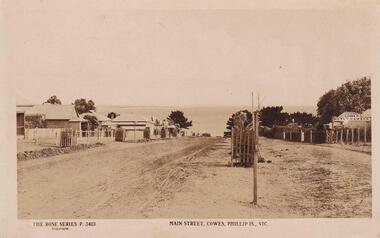
Part of collection donated to the Museum by Mr. Bernard Grayden. 1975View down Main Street to Bay and newly planted Cypresses within tree guards approx 1911-1912Main Street, Cowes, Phillip Island, Victoria. The Rose Series P 3413local history, documents, postcards, cowes, phillip island, sepia postcard, cypresses -
 Geelong Cycling Club
Framed Photograph, 1995
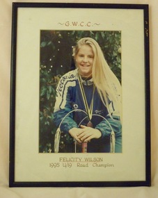
Felicity Wilson, Junior Cycling Champion, daughter of Don, Mexico City Olympian and twice Australian Open Road Champion. National Champion, Women in CyclingFramed photograph of the Geelong West Cycling Club 1995 U/19 Women's Road Champion. The photograph is in colour and is mounted on a white background. The frame has a thin wooden black border."GWCC/FelicityWilson/1995 U19 Road Champion"geelong cycling club; junior champion; felicity wilson; 1995; -
 Ringwood and District Historical Society
Photograph, Pumping Station in Lonely Valley, North Ringwood with Glenvale Road climbing to the left, 23 September 1979
E557 N24. Part of a 51-photo record of the development of the "Kubis" Estate, Ringwood North, including road works to Debbie Place, Kubis Drive, Werac Drive, Iluka Place and Glenvale Road. From the Jack Lundy Clarke collection. -
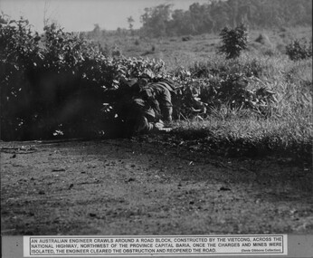 National Vietnam Veterans Museum (NVVM)
Photograph, Clearing Road Block
A black and white photograph of an Australian Engineers crawls around a road block constructed by VietCong across the National Highway North West of the Province capital Baria. Once the charges and mines were isolated, the Engineer cleared the obstruction and reopened the roadphotograph, nva/vc, engineers, baria, gibbons collection catalogue -
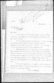 Whitehorse Historical Society Inc.
Document, Canterbury Road Tunstall, 29/01/19?5
Photocopy of letter to the Commercial Bank, Prahran re land and property valuation occupied by Mr Sliegner, north side of Canterbury Road, Tunstall (Now Forest Hill) close to Springvale Road. Land 2.5 acres with villa and out buildings.land values, sliegner (mr), canterbury road, forest hill, c. husband (estate agent) -
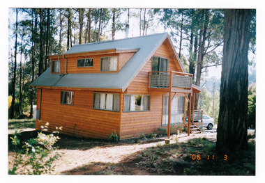 Marysville & District Historical Society
Photograph (Item) - Colour photograph, 11-03-2006
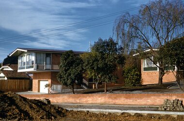
A colour photograph of a house taken in Kings Road in Marysville in Victoria.A colour photograph of a house taken in Kings Road in Marysville in Victoria. This house, along with most of Marysville's buildings, was destroyed in the 2009 Black Saturday bushfires.kings road, marysville, victoria, photograph, 2009 black saturday bushfires -
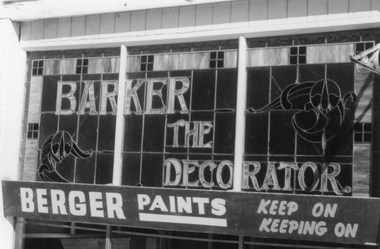 Stawell Historical Society Inc
Photograph, Barker the Decorator Leadlight Advert in Upper Main Street Stawell. c 1984
Photographs of "Barker The Painter" a business that operated in Stawell for 80 years. The black and white photo is simple of the leadlight in the top section of the front window. The Second photo, the building location in Upper Main Street Stawell beside the Albion Hotel. The file also contains an article from Stawell Times - News. Tuesday March 4, 1986, p.13. regarding the closing of the business. Mr. W. C. Barker started the business and it was continued for many years by his two daughter and son till it closed in 1986. The building is now replaced by a new building.Two photographs of "Barker The Painter" a business that operated in Stawell for 80 years. One photograph is a detail of the leadlight advertisement. The other a colour photograph of the building.Barker The Decorator - Berger Paints - Keep on Keeping onstawell business -
 Stawell Historical Society Inc
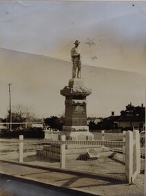
Photograph, Soldiers’ Memorial World War 1 in Main Street
Soldiers’ Memorial World War 1. Two black & white photos of World War 1. memorial. Granite base with rising sun army emblem 1914 -1919. with a statue of a soldier holding a Banet. The statue is enclosed in a cyclone fence. Houses can be seen in the background. The memorial is situated in the center of Main Street. The memorial is a tribute to all who paid the supreme sacrifice and to all who served. The figure of the soldier was imported from Italy in 1922. The cost of the memorial was 643 pounds. A number of donations were made to the Girls' Remembrance League Soldiers Memorial. Two black & white photographs of the World War 1 memorial. The memorial has a tiered granite base and a soldier on the granite column. Enclosed within a cyclone fence. "4x2 3/4 soldiers memorial" written in pencil.stawell ww1 -
 Eltham District Historical Society Inc
Slide - Photograph, Eltham Shire Council, Plan of Subdivision, Part of Crown Allotments 5 & 6, Section 10, Parish of Nillumbik, County of Evelyn (Foster Road, Eltham East), 1969
35mm colour positive transparency blue Agfacolour Service plastic mountC5(a) DU (Vic) D/L Foster Road, Eltham East, 4 August 1969infrastructure, map, planning, subdivison lots, abersham court, ancona close, eltham east, floriston grove, foster road, frank street, gladwyn court -
 Ringwood and District Historical Society
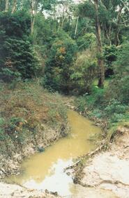
Photograph, Mullum Mullum Creek, east of Warrandyte Road 1986
Written on back of photograph, "3/8/86. Mullum Mullum Creek, east of Warrandyte Road." -
 Ringwood and District Historical Society
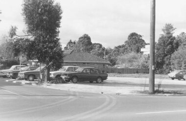
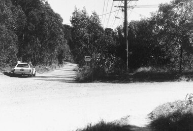
Photograph, Car park at corner of Dickson Cres. and Warrandyte Road, North Ringwood (undated)
Written on back of photograph, "Car park at corner of Dickson Cres. and Warrandyte Road, North Ringwood". -
 Ringwood and District Historical Society
Photograph, No.13 Oban Road, Ringwood - 1981
Written on back of photograph, "E623, N12, 1981. No.13 Oban Road, Victor Leggo & Co." -
 Ringwood and District Historical Society
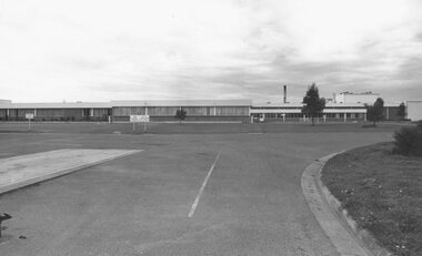
Photograph, Cadbury factory, Canterbury Road, Ringwood 1973, 'Church Paddock'
Written on backing sheet, "Cadbury factory, Canterbury Road, 30/9/73, 'Church Paddock'". -
 Ringwood and District Historical Society
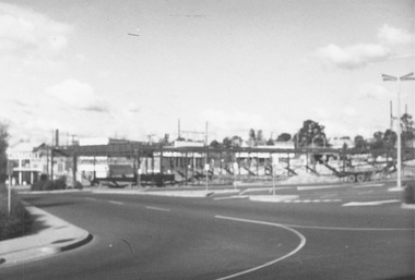
Photograph, Corner Warrandyte Road and Maroondah Highway, Ringwood c1971
Blurry PhotographWritten on back of photograph, "Corner Warrandyte Road and Maroondah Highway, approximately 1971. Safeways Store". -
 Ringwood and District Historical Society
Photograph, Opposite end of Mines Road on Maroondah Highway, Ringwood. 1981
Written on back of photograph, "24/7/81. Opposite end of Mines Road on Maroondah Highway." -
 Ringwood and District Historical Society
Photograph, Intersection Smedley Rd. (right) and Oban Road, North Ringwood. 1981
Written on back of photograph, "18/4/81. Intersection Smedley Rd. (right) and Oban Road." -
 Ringwood and District Historical Society
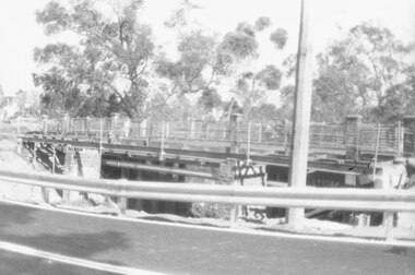
Photograph, Eastfield Road bridge just opened - looking east. Ringwood 1978
Written on back of photograph, "Late 1978. Eastfield Road bridge just opened - looking east." -
 Ringwood and District Historical Society
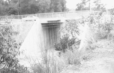
Photograph, The old Warrandyte Road bridge viewed across bypass. Ringwood, 1986
Written on back of photograph, "29.11.86. The old bridge viewed across bypass." (Warrandyte Road bridge) -
 Ringwood and District Historical Society
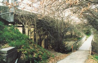
Photograph, Warrandyte Road Bridge over Mullum Mullum Creek, Ringwood 1986
Written on back of photograph, "3.8.86. Ringwood. Warrandyte Road Bridge over Mullum Mullum Creek". -
 Ringwood and District Historical Society
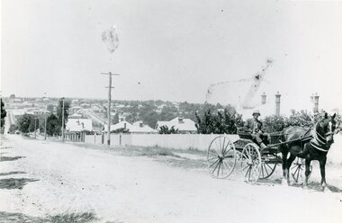
Photograph, Mr Clarence Hams in horse drawn carriage- Warrandyte Road, Ringwood. c1918
Black and white photograph"Written on back of photograph" Mr Clarence Hams in buggy at top of Kennedy's Hill - Warrandyte Road. -
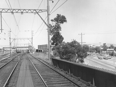
 Ringwood and District Historical Society
Photograph, Ringwood Railway Station, 1974, viewed from bridge over Warrandyte Road in foreground
Written on back of photograph, "Ringwood Railway Station, 1974. From bridge over Warrandyte Road". -
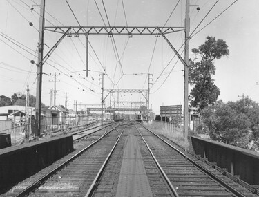
 Ringwood and District Historical Society
Photograph, Ringwood Railway Station overlooking Maroondah Hwy viewed from bridge over Warrandyte Road in foreground, 1974
Written on back of photograph, "Ringwood Railway Station, 1974 from bridge over Warrandyte Road." -
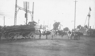 Ringwood and District Historical Society
Photograph, Paul Burns' bullock team at Pitt Street/Bedford Road railway crossing, 1924
Written on back of photograph, "Bedford Road railway crossing, 1924". Paul Burns' bullock team. -
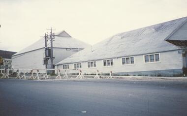 Ringwood and District Historical Society
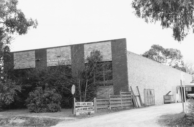
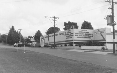
Photograph, Ringwood Cool Store, cnr Maroondah Hwy and Wantirna Road, - Dec, 1959
Coloured photographWritten on back of photograph: "The coolstore, corner Whitehorse and Wantirna Roads, Ringwood. 6/12/59". -
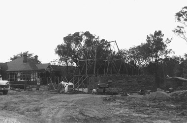 Ringwood and District Historical Society
Photograph, C of E being built Warrandyte Road. 2/5/70
Written on backing sheet, "C of E being built W'dyte Road. 2/5/70."