Showing 582 items
matching alpines
-
 Marysville & District Historical Society
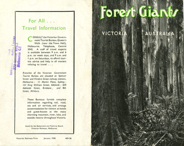
Ephemera (Item) - Information brochure, Victorian Government Tourist Bureau, Forest Giants Victoria Australia, 01-1938
An information brochure on where to see tall trees, Forest Giants, in Victoria, including Marysville, that was published in January, 1938.An information brochure on where to see tall trees, Forest Giants, in Victoria, including Marysville, that was published in January, 1938.Victorian Railways Print January, 1938 469-38 Stamp of Victorian/ Government Tourist Bureau/ 272 Collins Street/ Melbourne C.1victoria, australia, victorian government tourist bureau, betterment and publicity board, victorian railways, white mountain ash, red mountain ash, messmate, blue gum, mountain ash, cumberland valley, marysville, mount monda, healesville, acheron way, alpine highway, omeo, baw baws, strzelecki ranges, otway ranges, warburton, yarra junction, noojee, bulga and tarra valley park, yarram, turton's pass, otway forest, beech forest, apollo bay, information brochure, brochure -
 Marysville & District Historical Society
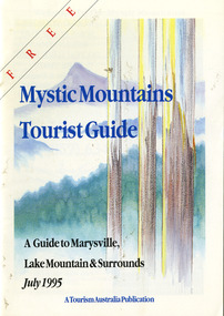
Ephemera (Item) - Tourist Guide, Graeme Haycraft, Mystic Mountains Tourist Guide July 1995, 07-1995
A tourist guide outlining services, accommodation, activities and places of interest to visit in and around Marysville, Lake Mountain and the local district.A tourist guide outlining services, accommodation, activities and places of interest to visit in and around Marysville, Lake Mountain and the local district.Acknowledgements/ Mystic Mountains Tourism Association, Marysville Office of the Dept. of Conser/ vation & Natural Resources, Mrs Elaine Postlethwaite, Ms Sue Henry & every/ advertiser without whose support this Guide would not have been possible.marysville, victoria, australia, tourist guide, mystic mountains, lake mountain, tourism australia, graeme haycraft, magic creek nursery, missing links miniature golf, phelps bakery, blackwood cottages, marysville hotel motel, tower motel, kerami house, marylands guest house, lomatia lodge, willowbank at taggerty, barree mud brick cottages, scenic motel, somerled mountain retreat, dalrymples guest cottages, nanda binya lodge, mathilde's of marysville country guest house, the birches resort, mystic mountains tourist information, marysville caravan park, the cumberland, igloo roadhouse, top shop pancake parlour, the silver birch restaurant, steavenson's restaurant, olde yarra track shoppe, danish coffee gardens, oscars take-away, country touch pottery studio & gallery, cumberland memorial scenic reserve, cathedral range state park, lady talbot forest drive, wishing well, taggerty river picnic area, taggerty river, phantom falls, keppels falls, the beeches walking track, mount sugarloaf, maryton park holiday cottages, snowviews, esa camping & conference centre, wirreanda festival, marysville post shop, hidden talent craft gallery, marysville automotive repairs, geoffrey pope & associates, beauty spot walk, tree fern gully walk, michaeldene track, marysville riding school, gerraty's ski centre, marysville holiday cottages, marysville triangle taxi service, fruit salad farm, lake mountain alpine resort, marysville ski hire, lake mountain ski school, cross country ski hire, lake mountain ski hire, marysville country club -
 Marysville & District Historical Society
Map (Item) - Tourist map, Mystic Mountains Tourism, OFFICIAL VISITORS' MAP MARYSVILLE LAKE MOUNTAIN, Unknown
A visitors' map of Marysville and Lake Mountain produced by Mystic Mountains Tourism for Visit Victoria.A visitors' map of Marysville and Lake Mountain produced by Mystic Mountains Tourism for Visit Victoria.The Marysville and Lake Mountain Visitor Map and Touring Guide has been compiled and/ published by Mystic Mountains Tourism Inc. Copyright./ Production and artwork Graph Attack P/Lmarysville, lake mountain, victoria, australia, visitor's map, official visitors' map marysville lake mountain, buxton, narbethong, taggerty, visit victoria, mystic mountains tourism inc, graph attack p/l, mystic mountains, marysville triangle, marysville visitor information centre, marylands country house, black spur, steavenson falls, lady talbot drive, cambarville, cathedral ranges, wirreanda festival, lake mountain summit walk, summit walk loop, leadbeaters loop, day loop walk, buxton hotel, igloo roadhouse, karmann waters, silverstream b&b cottages, buxton trout and salmon farm, the niche wine bar, buxton post office & general store, choppers buxton roadhouse, woodlands rainforest bungalows, chestnut glade, black spur inn, wombat cottage, abbey lake luxury b&b spa cottages, mystic mountain ski hire & outdoors, pnl 4wdriving, blue views holiday units & ski hire, marapana agistment park & farm stay b&b, danico design, things of sand & stone, mantirri blueberry farm, allawah country cottages, amberview cottages, ashlar cottage b&b, black spur motel & caravan park, blackwood deluxe cottages, blackwood courtyard b&b, dalrymples guest cottages, delderfield, el kanah guest house, fruit salad farm, kerami guest house, keppels hotel, lake mountain-snow gum lodge, lomatia lodge, lyell guest cottages, magnolia house, keppel waters, lyrebird apartments, marysville caravan park, all view spa apartments, riverside cottages, maryton park b&b country cottages, melina cottage, mountain lodge, mystic mountains holiday cottages, nanda binya lodge, rendezvous luxury cottages, scenic b&b motel, the cumberland, south cathedral farm, tower motel, willowbank at taggerty, woodlands rainforest retreat, marysville & district country club inc, mystic mountains ski hire & outdoors, rubicon valley horse riding, marysville trout and salmon ponds, gallipoli park, keppels lookout, cambarville-yarra ranges national park, lake mountain-yarra ranges national park, lady talbot drive-yarra ranges national park, cathedral range state park, steavenson river, taggerty river, acheron river, lake mountain alpine resort, bruno's art and sculpture garden, manical mechanicals, uncle fred & aunty val's old style lolly shop, carmyle farm boutique, crossways historic country inn, fraga's, gilberts restaurant, heights licensed bistro, the old woolshed cafe, cathedral view natural therapies, crystal journey -
 Marysville & District Historical Society
Flyer (item) - Information Flyer, Parks Victoria, Yarra Ranges National Park-Lady Talbot Drive, Cambarville and Lake Mountain-Visitor Guide, 01-2018
A flyer that was produced as a guide to Lady Talbot Drive, Cambarville and Lake Mountain.A flyer that was produced as a guide to Lady Talbot Drive, Cambarville and Lake Mountain. Lady Talbot Drive a 24 kilometer scenic rainforest car journey which passes a number of walks and waterfalls in the Yarra Ranges National Park. Lady Talbot Drive is named after Lady Sarah Elizabeth, the wife of Sir Reginald Talbot, who was the Governor of Victoria from 25th April, 1904 to 6th July 1908. Cambarville is notable for its giant mountain ash (Eucalyptus regnans) trees within the Cumberland Memorial Scenic Reserve, and relics from former sawmills and gold mining. The Big Culvert is located nearby on the Marysville-Woods Point Road, which was historically part of the Yarra Track. Cambarville was established as a timber mill town in the 1940s. Timber mill owners A Cameron and FJ Barton named Cambarville. They established the mill to salvage timber from trees destroyed in the 1939 bushfires. Cambarville was impacted by the 2009 Black Saturday bushfires and any remaining structures were destroyed. Lake Mountain is the closest alpine cross-country ski resort to Melbourne.lady talbot drive, lady talbot forest drive, cambarville, lake mountain, sir reginald talbot, lady sarah elizabeth talbot -
 Bright & District Historical Society operating the Bright Museum
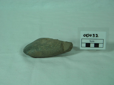
Axe Stone
Evidence of Aboriginal presence and activities in Buffalo River Valley near site of present Buffalo Dam.Evidence of Aboriginal presence and activities in North East and Alpine areas relatively uncommon.quartzite ground edge stone axe with edge damage axe, aboriginal artefact, buffalo river -
 Harrietville Historical Society
ingot mould
this ingot mould was used by the harrietville tronoh co. who operated the "tronoh" gold dredge from 1939 - 1954. this was the largest dredge in the southern hemisphere.when this dredge ceased operations it marked the end of dredging in the ovens valley.this dredge also brought electricity to harrietville.This item is significant asit is the only one in existence .This has been confirmed by former staff members. This mould represents an era which was very important to the story of HARRIETVILLE. The "tronoh" dredge commenced operations at a time when mining was at a low point . It provided employment for up to 60 men at it's peak & also connected harrietville to the electricity grid. When the tronoh dredge ceased operations it marked the end of gold dredging in the ovens valley. The enviromental damage caused by this dredge was one of the reasons behind a failed attempt to redredge the valley in the early 1980s. cast iron gold ingot mould with handle at each end,trapezoidel in shape.on inside base in relief in reverse 'H(T)L'gold, dredge. ingot mould -
 Galen Catholic College
Mount Stirling Camp, 2019
galen catholic college, galen college, outdoor education, outdoor expedition, 2019, mount stirling, alpine -
Victorian Aboriginal Corporation for Languages
Video, Koorie Heritage Trust Oral History Unit, Alpine gathering : Doonoch Dancers, 2005
videocassettedoonoch dancers, indigenous dance, koorie heritage trust -
 Victorian Aboriginal Corporation for Languages
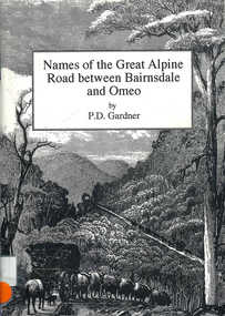
Book, P D Gardner, Names of the Great Alpine Road between Bairnsdale and Omeo : their origins, meanings and history, 1997
Lists the place names along the Victorian Alps, with descriptions and meanings.Maps, b&w illustrations, b&w photographsgunnai, kurnai, ngarigo, jaitmathang, brabiralung, tongiomunjie, tambo, tongio, bruthen, tambo, mount stringy, swifts creek -
 Victorian Aboriginal Corporation for Languages
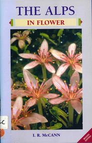
Book, I R McCann, The Alps in flower, 2001
Format using photographs and a brief description of each plant.Maps, colour photographsalps, victorian national parks association, bogong unit, alpine national park, mount buffalo national park, wonnangatta-moroka unit, kosciusko national park -
Lakes Entrance Regional Historical Society (operating as Lakes Entrance History Centre & Museum)
Book, Synan Peter, Secrets of Ghost Towns of the High Country featuring 50 Ghost Towns in and around Victorias Alpine Region, 1989
A history of the Gippsland Lakes Victoria as a transport system v for trade within the Lakes and River systems and coastal and interstate trade.ships and shipping, land settlement, waterways -
Lakes Entrance Regional Historical Society (operating as Lakes Entrance History Centre & Museum)
Book, Gardner P D, Names of the Great Alpine Road between Wangaratta and Omeo, 1998
Some of the place names appearing on the road between Wangaratta and Omeo, and explanations of their meanings. Illustrated with photographs, drawings and maps.township, social history -
Lakes Entrance Regional Historical Society (operating as Lakes Entrance History Centre & Museum)
Book, P D Gardner, Names of the Great Alpine Road between Bairnsdale and Omeo, 1990c
Some of the place names appearing on the road between Bairnsdale and Omeo and explanation of their meanings illustrated with photographs drawing and maps Bairnsdale VictoriaSigned persobally by author Peter Gardnertownship, social history -
Lakes Entrance Regional Historical Society (operating as Lakes Entrance History Centre & Museum)
Book, Holth, Tor and Barnaby, Jane, The Days of Mick Moon along the Snowy River
A history of the mountain cattlemen of the Australian Alps, bushcraft, and harsh lifestyle in the Bogong high plains.alpine region, aboriginals -
Lakes Entrance Regional Historical Society (operating as Lakes Entrance History Centre & Museum)
Book, Rogers, L. C, Lakes Entrance Community Health Centre Nineteenth Annual Report 1993/94, 1982
Day-to-day life in the Snowy River high country, East Gippsland, and across the border. The author also tells of his travels and lifestyle change in later life.settlers, alpine region -
Koorie Heritage Trust
Book, Beauglehole, A. C, The distribution and conservation of vascular plants in the alpine area, Victoria, 1981
One col. map on folded leaf in pocket. Bibliography: p. 9-11.indigenous vascular plants. distribution. victoria. alpine regions | botany -- victoria. -
 Ballarat Heritage Services
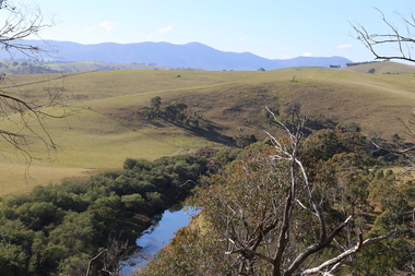
digital photographs, Lisa Gervasoni, Omeo High Plains, 2017
Colour photograph of the Omeo High Plains.2017, great alpine road, omeo high plains -
 Ballarat Heritage Services
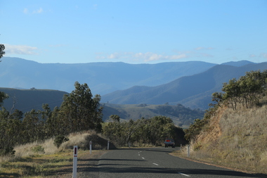
Digital Photograph, Road Near Omeo, Victoria, 2017
Colour photograph of the road near Omeo, Victoria.2017, great alpine road, omeo high plains, omeo, australian alps, high country -
 Ballarat Heritage Services
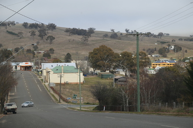
Photograph - Colour, Lisa Gervasoni, Omeo, 2017, 2017
Colour photograph of the Victorian town of Omeo.2017, great alpine road, omeo high plains, omeo, high country, streetscape -
 Ballarat Heritage Services
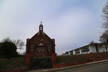
digital photographs, Lisa Gervasoni, Omeo Church, 2017, 2017
Colour photograph of a church in Omeo.2017, great alpine road, omeo high plains, omeo, high country, streetscape, bluestone, church -
 Ballarat Heritage Services
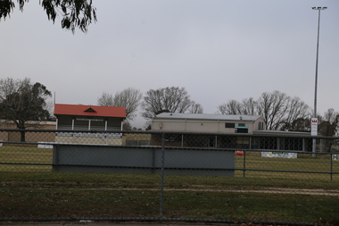
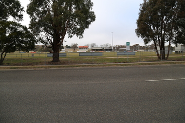
digital photographs, Lisa Gervasoni, Omeo, 2017
2017, great alpine road, omeo high plains, omeo, high country, football ground, oval, racecourse -
 Ballarat Heritage Services
digital photographs, Lisa Gervasoni, Omeo, 2017
2017, great alpine road, omeo high plains, omeo, high country, cemetery -
 Ballarat Heritage Services
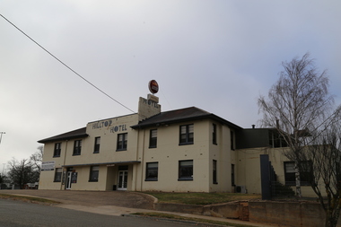
digital photographs, Omeo, 2017
Colour photograph of an hotel in Omeo, Victoria.2017, great alpine road, omeo high plains, omeo, high country, hotel, pub -
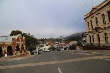
 Ballarat Heritage Services
digital photographs, Lisa Gervasoni, Omeo, 2017
2017, great alpine road, omeo high plains, omeo, high country, townscape, cityscape -
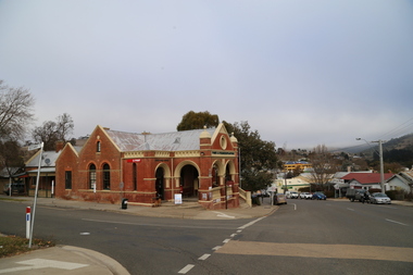 Ballarat Heritage Services
Photograph - Colour, Lisa Gervasoni, Omeo, Victoria, 2017, 2017
Colour photograph of Omeo, Victoria.2017, great alpine road, omeo high plains, omeo, high country, post office -
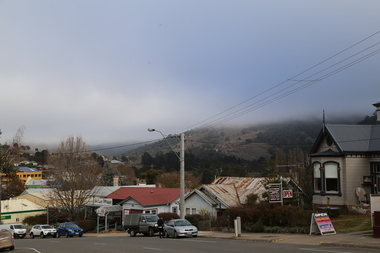
 Ballarat Heritage Services
digital photographs, Lisa Gervasoni, Omeo, 2017
Colour photograph of Omeo, Victoria.2017, great alpine road, omeo high plains, omeo, high country, post office, streetscape, heritage -
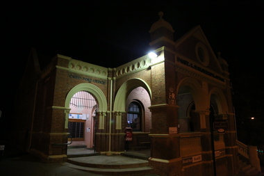
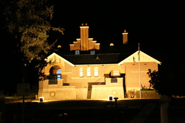 Ballarat Heritage Services
digital photographs, Lisa Gervasoni, Omeo, 2017
2017, great alpine road, omeo high plains, omeo, high country, streetscape, heritage, courthouse, court, night -
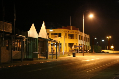 Ballarat Heritage Services
digital photographs, Lisa Gervasoni, Omeo, 2017
2017, great alpine road, omeo high plains, omeo, high country, streetscape, heritage, night, golden age, hotel -
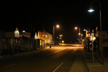 Ballarat Heritage Services
digital photographs, Lisa Gervasoni, Omeo, Victoria, 2017, 2017
Coloor photograph of a night view in the main street of Omeo.2017, great alpine road, omeo high plains, omeo, high country, streetscape, heritage, night -
 Ballarat Heritage Services
digital photographs, Omeo at Night, 2017
Colour photograph of a building in Omeo at night. 2017, great alpine road, omeo high plains, omeo, high country, streetscape, heritage, night