Showing 5536 items
matching australia - military
-
 Bendigo Military Museum
Photograph - RASvy Surveyors in the field, c1950s – 1960s
This is a set of 16 photographs of surveyors in the field measuring distances using chains, taking observations using theodolites and operating electric distance measurement equipment. They were probably employed in establishing mapping and geodetic control operations or the surveyors may have been in training. The photos were most likely taken in the 1950s and 1960s. Photos .1P to .6P feature personnel setting up geodetic survey chaining equipment to measure distances. The surveyor in Photo .5P is LTCOL Howard Angus Johnson MBE who served from 1936 to 1954. The RA Svy surveyor in photos .7P to .12P were using a theodolite to take angular measurements. They were usually supported by an observer who recording their readings on a booking form. The surveyor in Photo .10P and .11P is LTCOL Jorge Gruszka, who served from 1955 to 1985. He was CO of the Army Survey Regiment from 1982 to 1985. The surveyor in photo .13P is cutting an identification blaze on a tree using a hammer and chisel. The tellurometer in Photos .14P to .16P was a MRA1 microwave Electronic Distance Measuring instrument (EDM) introduced in 1958. It and later models were man-portable systems that improved geodetic survey efficiencies for rapid network extension and densification replacing triangulation with EDM and theodolite traverse sometimes using Bilby Towers to extend line lengths. The surveyor with the slouch hat is Colonel James ‘Jim’ Leslie Stedman, who served from 1941 to 1978. He was Director of Military Survey from 1975 to 1978 and was appointed as Colonel Commandant (honorary appointment, Retd) of the Royal Australian Survey Corps from 1978 to 1983. Jim Stedman is demonstrating EDM equipment.This is a set of 16 photographs of surveyors in the field measuring distances using chains, taking observations using theodolites and operating electric distance measurement (EDM) equipment. c1950s – 1960s. The photographs were printed on photographic paper and are part of the Army Survey Regiment’s Collection. The photographs were scanned at 300 dpi. .1) - Photo, black & white, c1950s, unidentified personnel using geodetic survey chaining equipment. .2) to .4) - Photo, black & white, c1950s, geodetic survey chaining equipment. .5) – Photo, black & white, Jim Stedman using geodetic survey chaining equipment to measure distances. .6) - Photo, black & white, c1950s, geodetic survey chaining equipment. .7) – Photo, black & white, mounted on card, c1950s. Unidentified personnel undertaking observations on a coral reef using a theodolite. .8) – Photo, black & white, c1950, unidentified personnel undertaking observations with a Tavistock theodolite. .9) – Photo, black & white, mounted on green card, c1950s. Unidentified personnel undertaking observations with a theodolite. .10) – Photo, black & white, c1955, Jorge Gruszka undertaking observations with a theodolite. 7/55 Basic Survey Course Balcombe. .11) – Photo, black & white, c1950s, Jorge Gruszka undertaking observations with a theodolite. .12) – Photo, black & white, c1950s, unidentified personnel undertaking observations with a theodolite. .13) – Photo, black & white, c1950s, unidentified personnel cutting a blaze in a tree. .14) and .15P – Photo, black & white, c1960s, Jim Stedman demonstrating EDM equipment. .16P – Photo, black & white, c1960s, L to R: probably Jim Stedman and unidentified personnel demonstrating EDM equipment..1P on back - First Order Chaining Equipment .2P on back - First Order Chaining Equipment .3P on back - Full catenary 1800 – 1960 replaced by EDM .4P on back - First Order Chaining Equipment .5P on back - H.A. Johnson, Benambra baseline? 1st Order Chaining .6P on back - Chaining .7P on front - Difficult observing conditions especially when the tide is in. The station is sighted (sic) on a coral reef. .8P on back - Tavistock. .10P on back of duplicate in Photo Folder 14 – George (sic) Gruszka 7/55 Basic Survey Course Balcomme (sic) 1955/56 .14P and .15P on back - Jim Stedman demonstrating early EDM equipment.royal australian survey corps, rasvy, army survey regiment, army svy regt, fortuna, asr, surveying -
 Bendigo Military Museum
Photograph - Personnel and Equipment, Army Survey Regiment, Fortuna, Bendigo. c1979, c1979
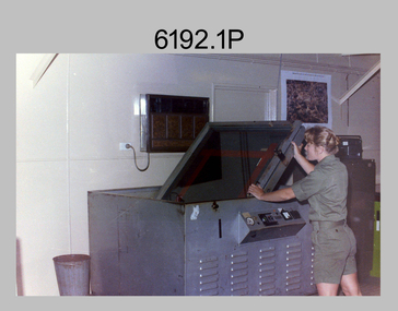
This is a set of 23 photographs of cartographic, aero-triangulation and lithographic equipment, and personnel at the Army Survey Regiment, Fortuna, Bendigo circa 1979. Photos .8P to .23P were taken in Lithographic Squadron’s printing, Camera, proofing rooms and external buildings. Cartographic Squadron’s SGT Jim McDonald operated the Editwriter type setting machine, as shown in photo .2P for a couple years in a room on the top floor of Fortuna Villa. This is a set of 23 photographs of cartographic, aero-triangulation and lithographic equipment, and personnel at the Army Survey Regiment, Fortuna, Bendigo, c1979. Black and white photos are on photographic paper and mounted on manilla card. They were scanned at 300 dpi. .1) - Photo, black & white, c1979, Typesetting machine, ‘Editwriter’ Model 7500, SGT Jim McDonald. .2) - Photo, black & white, c1979, Processor Model ACP101 & dual disk module (attached to Editwriter). .3) - Photo, black & white, c1979, Duplicating machine, stencil process electric ‘Gestetner’. .4) - Photo, black & white, c1979, Comparator photogrammetric stecometer, modified ‘Carl Zeiss’, CPL Jack Elverd. .5) - Photo, black & white, c1979, Point transfer device ‘Wild PUG IV. .6) - Photo, black & white, c1979, Zoom transfer scope, stereo ‘Bausch & Lomb’ .7) - Photo, black & white, c1979, Stereoplotter analytical automatic, ‘APC/3-1’. .8) - Photo, black & white, c1979, Prophylaxis unit, ‘Densply/Cavtron’ .9) - Photo, black & white, c1979, Machine punch register (made by Bendigo Ordnance Factory). .10) - Photo, black & white, c1979, Plan printer 122cm (48”) wide. ‘Admel Bruning’ Model - 5003A. .11) - Photo, black & white, c1979, Metal halide printing lamp. ‘Violight 5000 HV’ .12) - Photo, black & white, c1979, Densitometer transmission or reflection, ‘Macbeth’ Model – TR 524 MD. .13) - Photo, black & white, c1979, Machine whirling vertical type ‘Payne VLW’. .14) - Photo, black & white, c1979, Densitometer reflection, ‘Macbeth’ Model – RD917. .15) - Photo, black & white, c1979, Densitometer reflection, 240V ‘Cosar’ .16) - Photo, black & white, c1979, Printer contact ‘Hohlux’ Model RP-II, LCPL Martin Van der Maele. .17) - Photo, black & white, c1979, Frame printing vacuum vertical. .18) - Photo, black & white, c1979, Frame printing vacuum flip top 91cm x 117cm. .19) - Photo, black & white, c1979, Printer reduction stereo plotter diapositive ‘Wild’ Model – U3A modified and U4A modified to U4A plus. .20) - Photo, black & white, c1979, Printing press offset rotary lithographic 3 colour ‘Ultra-MAN-III’ .21) to. 23) - Photo, black & white, c1979, Camera cartographic consolidated super 100 32” x 32”The three personnel appearing in this set are identified. Most items have a full description, NSN, serial number, and the Repairer’s name, address and phone details and contact name. Just the full description is documented.royal australian survey corps, rasvy, army survey regiment, army svy regt, fortuna, asr -
 Bendigo Military Museum
Photograph - AUTOMAP 1 Production – Army Survey Regiment, Fortuna, Bendigo, c1979
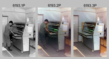
This collection of 19 photos was most likely taken in 1980. The AUTOMAP 1 computer assisted cartography and mapping system was introduced in 1975. The components of AUTOMAP 1 were the Input Sub-System of four Wild B8s stereoplotters and three Gradicon digitising tables, the Optical Line Following Sub-System – Gerber OLF, the Verification Sub-System – Gerber 1442 drum plotter, the General Purpose Sub-system – HP21MX computer and the Output Sub-System – Gerber 1232 flatbed plotter). The first map was published in 1978 (Strickland 3665-3, 1:50,000). AUTOMAP 1 was the first computer assisted cartography and mapping system utilised by the Survey Corps and was the first system used by Australian mapping organisations. The history of the AUTOMAP 1 system is covered in more detail with additional historic photographs, in pages 116-118 of Valerie Lovejoy’s book 'Mapmakers of Fortuna – A history of the Army Survey Regiment’ ISBN: 0-646-42120-4.This is a set of 19 photographs of Air Survey Squadron military and civilian personnel operating AUTOMAP 1 equipment at the Army Survey Regiment at Fortuna, Bendigo, c1979. The photographs were on 35mm negative film and were scanned at 96 dpi. They are part of the Army Survey Regiment’s Collection. .1) - Photo, colour, c1979, Gradicon edit table, SSGT John Bennett. .2) - Photo, colour, c1979, Gradicon edit table. .3) - Photo, colour, c1979, HP21MX computer General Purpose Sub-system. .4) - Photo, colour, c1979, HP21MX computer General Purpose Sub-system. L to R: CAPT Graham Baker, SPR Ian Belmont. .5) - Photo, colour, c1979, Gerber verification drum plotter. 1130 System administration, unidentified. .6) - Photo, colour, c1979, Gerber Optical Line Follower (OLF). .7) - Photo, colour, c1979, Gerber OLF .8) - Photo, black & white, c1979, Programming and system administration, L to R: WO1 Don Taylor, Robert Cox, Tony Spurling, SSGT John Bennett, SGT Alan Toogood. .9) to .14) - Photo, black & white, c1979, .15) - Photo, black & white, c1979, Gerber OLF, unidentified. .16) - Photo, black & white, c1979, Gerber verification drum plotter, unidentified using Gradicon edit table. .17) to .18) - Photo, black & white, c1979, - Photo, black & white, c1979, Programming and system administration, SSGT John Bennett. .19)- Photo, black & white, c1979, - Photo, black & white, c1979, HP21MX computer General Purpose Sub-system..1P to .19P No personnel are identified.royal australian survey corps, rasvy, army survey regiment, army svy regt, fortuna, asr, automap 1 -
 Bendigo Military Museum
Photograph - AUTOMAP 1 Production – Army Survey Regiment, Fortuna, Bendigo, c1978-1980
This collection of 20 photos was most likely taken in c1978. The AUTOMAP 1 computer assisted cartography and mapping system was introduced in 1975. The components of AUTOMAP 1 were the Input Sub-System of four Wild B8s stereoplotters and three Gradicon digitising tables, the Optical Line Following Sub-System – Gerber OLF, the Verification Sub-System – Gerber 1442 drum plotter, the General Purpose Sub-system – HP21MX computer and the Output Sub-System – Gerber 1232 flatbed plotter). The first map was published in 1978 (Strickland 3665-3, 1:50,000). AUTOMAP 1 was the first computer assisted cartography and mapping system utilised by the Survey Corps and was the first system used by Australian mapping organisations. The history of the AUTOMAP 1 system is covered in more detail with additional historic photographs, in pages 116-118 of Valerie Lovejoy’s book 'Mapmakers of Fortuna – A history of the Army Survey Regiment’ ISBN: 0-646-42120-4.This is a set of 20 photographs of Air Survey Squadron military and civilian personnel operating AUTOMAP 1 equipment at the Army Survey Regiment at Fortuna, Bendigo, c1978-1980. Black and white photos .1P to .18P are on photographic paper and were scanned at 300 dpi. Photo .4P is in colour and mounted with a duplicate on manilla card. Black and white photos .19P to .20P are on 35mm negative film and scanned at 96 dpi.They are part of the Army Survey Regiment’s Collection. .1) - Photo, black & white, c1978-1980, Gerber Optical Line Follower (OLF), SSGT John Bennett. .2) - Photo, black & white, c1978-1980, HP21MX computer General Purpose Sub-system. .3) - Photo, black & white, c1978-1980, Gerber OLF .4) - Photo, colour, c1978-1980, unidentified digitising on Gradicon edit table. .5) - Photo, black & white, c1978-1980, Gerber verification drum plotter. .6) - Photo, black & white, c1978-1980, Gerber OLF, CAPT Rob Bridge. .7) - Photo, black & white, c1978-1980, Programming and system administration, SGT Alan Toogood. .8) - Photo, black & white, c1978-1980, Unidentified digitising on Gradicon edit table. .9) - Photo, black & white, c1978-1980, CPL Rick Downie digitising on Gradicon edit table. .10) - Photo, black & white, c1978-1980, SPR Dave Irving digitising on Gradicon edit table. .11) - Photo, black & white, c1978-1980, Gerber OLF and CPL Rick Downie. .12) - Photo, black & white, c1978-1980, 1130 Computer System administration, L to R: unidentified, SSGT Les Dixon, SPR Geoff Havelberg. .13) - Photo, black & white, c1978-1980, AUTOMAP 1 tape administration, Maryanne De Groot. .14) - Photo, black & white, c1978-1980, AUTOMAP 1 tape drive. .15) - Photo, black & white, c1978-1980, HP21MX computer General Purpose Sub-system. .16) - Photo, black & white, c1978-1980, digitising topographic features with a Wild B8 stereo plotter, L to R: unidentified, CPL John Smith. .17) - Photo, black & white, c1978-1980, digitising topographic features with a Wild B8 stereo plotter, CPL John Smith. .18) - Photo, black & white, c1978-1980, digitising topographic features with a Wild B8 stereo plotter, CPL Adrian Rynberk. .19) - Photo, black & white, c1978-1980, Programming and system administration, SGT Alan Toogood. .20) - Photo, black & white, c1978-1980, Gerber OLF, CPL Chris Edwards. .1P to .20P - No personnel are identified.royal australian survey corps, rasvy, army survey regiment, army svy regt, fortuna, asr, automap 1 -
 Bendigo Military Museum
Photograph - Royal Australian Survey Corps Aerial Surveys, c1980
This is a set of nine photographs of technicians from the Royal Australian Survey Corps operating aerial surveys equipment c1980s. In photo .1P, CPL Steve Gloster was operating a RC10 air survey camera mounted in an Australian Army Pilatus Porter aircraft. The Wild RC10 super wide-angle air survey cameras were first introduced in 1971, were equipped with virtual distortion free lenses for supplementary, spot and special photography. In photo .2P, Roger Rees was operating Air Profile Recorder (APR) equipment. it was possibly taken during OP NERVOSE 84, sometime between June – August 1984 when based in Ngukurr, Northern Territory. The APR was operated at this time in unison with an RC10 camera. In 1963 the Royal Australian Survey Corps introduced the radar airborne profile recorder (Canadian Applied Research Ltd, Mark V, Airborne Profiler Recorder) was introduced for 1:100,000 mapping to replace terrain heighting by aneroid barometry. Later in 1974-1975, the Australian developed WREMAPS II airborne laser terrain profile recorder was introduced. In photo .3P, Neil Jones appears at the door of Airsearch Beechcraft Queen Air aircraft, Registration / Serial VH-MWX. This aircraft was typically used by RA Svy on air survey operations flying mission with Aerodist, APR and RC10 camera equipment. The Australian Army’s Pilatus Porter (short take-off and landing turbo propeller) was also equipped with a Wild RC10 aerial mapping camera for identification photography. The Pilatus Porter was also used on RA Svy’s map field checking operations. Photo .9P was taken at a survey station at an unknown location. In this photo an Australian Army Kiowa Light Observation Helicopter (LOH) is supporting a field survey party undertaking Magnavox AN/PRR-14 portable Doppler satellite observations. The satellite receiver’s antenna is plumbed over the survey ground mark surrounded by white plastic panels. The panels were used to identify the survey station on aerial photography. Introduced in 1974–1975, the Magnavox AN/PRR-14 portable Doppler satellite (US Navy Navigation Satellite System – TRANSIT) receivers and computing system provided independent three-dimensional point positions anywhere in the world, anytime, in any weather accurate to about 1.5metres with precise satellite ephemerides. The Bell OH-58 Kiowa LOH was a family of military helicopters used for observation, utility, and direct fire support. It was identified by RA Svy in the mid-1970s that considerable time was lost in replacing unserviceable remote equipment by road. Therefore Aerodist operations (pre-dating satellite receiver operations) were fully supported by Army’s Kiowa LOH aircraft. This is a set of nine photographs of technicians from the Royal Australian Survey Corps operating aerial surveys equipment c1980s. .1P to .3P, .5P to .9P - Colour and black and white photos on photographic paper and scanned at 300 dpi. .4P - Colour photo on 35mm slide film and scanned at 96 dpi. .1) & .2) - Photo, black & white, c1980s, CPL Steve Gloster operating an RC10 air camera. .3) - Photo, colour, 1984, Roger Rees operating Air Profile Recorder (APR) equipment. .4) - Photo, colour, c1980s, Neil Jones at the door of an Airsearch Beechcraft Queen Air aircraft, typically used by RA Svy on air survey operations. .5) - Photo, colour, c1980s. A Beechcraft King Air aircraft, also used by RA Svy on air survey operations. .6) - Photo, colour, c1980s. An Australian Army Pilatus Porter, used by RA Svy on air survey and map field checking operations. SGT Peter Mustart is possibly in the foreground. .7) to .8) - Photo, colour, c1980s. An Australian Army Pilatus Porter and unidentified personnel, used by RA Svy on air survey and map field checking operations. .9) - Photo, colour, c1980s. An Australian Army Kiowa helicopter supporting a field survey party undertaking Magnavox AN/PRR-14 portable Doppler satellite observations. There are biro marks on photos .4P to .9Proyal australian survey corps, rasvy, army survey regiment, asr, fortuna, aerial surveys -
 Bendigo Military Museum
Album - Photographic Identification Guide (PIG) of the Gove Penisula (Sic) Peninsula, Army Topographic Support Establishment, May 1997
These photographs and a video were captured in May 1997 by Jeff Ruiz and Wayne Walsh from the Army Topographic Support Establishment (ATSE). The video taken onboard an aircraft has not been located at this time. A flight line diagram showing the path of the aircraft taking the video is enclosed in the album. The Army Topographic Support Establishment was created to perform some of the functions of the Army Survey Regiment.A Large Purple covered Album with gold dots containing maps, plans and coloured photographs of Gove Peninsula.royal australian survey corps, rasvy, fortuna, army survey regiment, army svy regt, asr, atse -
 Bendigo Military Museum
Photograph - Demonstration of TI4100 GPS Receiver, Royal Australian Survey Corps, c1988
This is a set of two photographs of WO2 Graham Ragless from the Royal Australian Survey Corps demonstrating the operation of Global Positioning System equipment in c1988. The photos were probably taken at the School of Military Survey (SMS), Bonegilla, VIC. Texas Instruments TI4100 portable Global Positioning System (GPS) geodetic receivers were introduced from 1986–1988. The GPS receivers and Ferranti FILS3 helicopter and vehicle mounted Inertial Positioning System (IPS) replaced the TRANSIT satellite receivers. The equipment was deployed to establish the baseline for a GPS controlled air camera and photogrammetric system to significantly reduce the requirement for ground survey to accurately control air photography for topographic mapping. Personnel from the four field survey squadrons at this time were trained at the SMS to operate the TI4100 receivers. Field survey operations using GPS and IPS equipment followed in the late 1980s. This technology is described in more detail in the RA Svy booklet titled An Introduction to Topographic Mapping. See record ID - 6010. WO2 Graham Ragless progressed to the rank of WO1 and was appointed as RSM of the Army Survey Regiment from 1990 to 1992. Refer to item 6226.4P for more photographs of WO2 Graham Ragless demonstrating the TI4100.This is a set of two photographs of a technician from the Royal Australian Survey Corps demonstrating the operation of Global Positioning System equipment in c1988. Colour photos are on 35mm slide film and were scanned at 96 dpi. .1) and .2) - Photo, colour, c1988, WO2 Graham Ragless demonstrating the operation of a TI4100 GPS receiverThere are no annotations.royal australian survey corps, rasvy, army survey regiment, army svy regt, fortuna, asr, surveying -
 Bendigo Military Museum
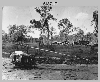
Photograph - Bell 47G-2 helicopter used in Royal Australian Survey Corps Field Operations, c1965
This is a set of four photographs of Bell 47G-2 helicopters used in Royal Australian Survey Corps Field Operations. c1965. From 1957, helicopter transport of survey parties revolutionised transport in remote areas. The most common helicopter used by the Royal Australian Survey Corps at this time was the civilian Bell 47G-2 and the Sioux, the Australian Army’s’s equivalent. equivalent. From 1964 an Aerodist MRC2 airborne Electronic Distance Measuring (EDM) system was extensively used for topographic surveys over long distances by trilateration to replace traverse requiring survey station intervisibility. In 1965 the command field survey unit personnel attached to the Army Survey Regiment’s Topographic Squadron were used mainly in support roles such as station clearing, tower operations, station monumenting, Aerodist computations, forward base operations, geodetic observations on the north-south traverse and logistic support for Remote teams. .1P is a photo of a civilian Bell 47G-2 helicopter Registration / Serial VH-UTB owned by Helicopter Utilities from Mascot, NSW c1965. In the background of this photograph is three personnel and vehicles at a field survey camp. The left-hand vehicle is a Willys Jeep with trailer and on the right is probably a Truck, 2 1/2 ton, 6x6, General Service GMC. The Bell 47G-2: VH-UTB was destroyed, and its pilot killed in tragic circumstances during a civilian survey operation on Cape York Peninsula in June 1966. .2P is a photo of a a civilian Bell 47G-2 helicopter Registration / Serial VH-IHB taken in Wyndham, WA. As the letters ‘TAA’ appear on the fuselage, the helicopter was charted from Trans Australian Airways. .3P is a photo of a Bell 47G-2: VH-UTC with survey camp in background. .4P is a photo of a Bell 47G-2 equipped with floats and unidentified personnel loading stores, possibly in Darwin. Acknowledgement: Royal Australian Survey Corps – Aerodist Years 1964-1975 Version 2021.0 Authored by Peter Jensen.This is a set of four photographs of civilian Bell 47G-2 helicopters used in Royal Australian Survey Corps Field Operations. c1965. The photographs were printed on photographic paper and are part of the Army Survey Regiment’s Collection. The photographs were scanned at 300 dpi. .1) - Photo, black & white, c1965, Bell 47G-2 helicopter: VH-UTB with survey camp in background. .2) - Photo, black & white, c1965, Bell 47G-2 helicopter: VH-IHB with survey station in foreground. .3) - Photo, black & white, c1965, Bell 47G-2 helicopter: VH-UTC with survey camp in background. .4) - Photo, black & white, c1965, Bell 47G-2 helicopter: Unidentified personnel loading stores possibly in Darwin..2P – annotated on bottom of photo ‘Wyndham Area – Helicopter drops observing party’ The other photographs are not annotated.royal australian survey corps, rasvy, army survey regiment, army svy regt, fortuna, asr, surveying -
 Bendigo Military Museum
Manual - TM5 - 245: (US) Department of the Army Technical Manual - Map Reproduction, US Department of the Army, United States of America, War Office, 10 Sep 1956
Nine Chapters describing all aspects of Map Reproduction. 224 pages, including 8 appendices, glossary and indexA soft covered military manual, 224 pages of text, diagrams and annotated photographs"AHQ Survey Regiment" stamped inside front and back covers. Number "149" handwritten inside front cover.royal australian survey corps, rasvy, fortuna, army survey regiment, army svy regt, asr, mapping -
 Bendigo Military Museum
Sign - Litho Squadron, Army Survey Regiment metal sign, Signwriter for Lithographic Squadron, circa 1970's
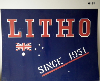
This large metal sign was affixed to the wall outside the entrance to the Lithographic Squadron at the Army Survey Regiment at Fortuna VillaA large metal sheet sign , painted dark blue with text "LITHO" in red, outlined in white. Text "SINCE 1951" painted in white underlined in red. An Australian flag in red and white is incorporated in the design."LITHO SINCE 1951"royal australian survey corps, rasvy, fortuna, army survey regiment, army svy regt, asr -
 Bendigo Military Museum
Flag - Lithographic Squadron, Army Survey Regiment Flag, Lithographic Squadron, circa 1970s
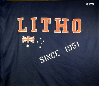
The Squadron Flag used by Lithographic Squadron, Army Survey Regiment members on social and ceremonial occasionsA Blue Flag with a 3.5cm diameter staff, 187cm long. Text "LITHO" , "SINCE 1951" and an Australian Flag logo silk screened onto it.royal australian survey corps, rasvy, fortuna, army survey regiment, army svy regt, asr -
 Bendigo Military Museum
Album - ALBUM, PHOTOGRAPH WW2, Original photographs C1946
Photograph contained within album Walter Ainsle STEVENSON. NX85457 & 21171. Enlisted 23 January 1942 aged 19 years. Discharged 4 October 1948 RANK PTE. (BCOF) ( no other info available) Kelvin Robert CORDELL. VX 146338 Enlisted 25 November 1943 aged 18 years Discharged 10 December 1946 with RANK PTE in Australian Training Centre ( no other info available)Photograph album Photographs- two colour photographs of Mt Fuji. Twenty tow sepia and black and white reproduction photographs of Japan, after 6th and 9th August 1945. Hiroshima by BCOF Soldiers Album - cardboard, pink colour vinyl padded cover, with plastic photograph sleeves with backing light cardboard. .2) Programme- white paper, black, blue and red print on folded A4 sheet, one illustration.Handwritten in blue pen beside half portrait of two soldiers “L.W. STEVENSON / R.K. CORDELL / 67 BATT / 1946” .2) Programme- “British Commonwealth Occupation Force Memorial Service June N.S.W. Cenotaph Thursday, 25th October,2108 / 11 amalbums, military history, ww2, japan -
 Bendigo Military Museum
Certificate - CERTIFICATE, DFC AWARD, C.1946
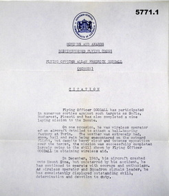
Item relates to Allan Frederick Goodall DFC, RAAF, refer Cat No 543.2 for his service details..1) Blue paper with the seal of the Govenor General of Australia at the top followed by black typed Citation of the award of the DFC to Flying Officer Allan Goodall. .2) Brown envelope for .1) .3) White paper typed version of .1) issued pre the award by the Govenor General."Flying Officer Allan Frederick Goodall (409828)"certificates, dfc, award -
 Bendigo Military Museum
Newspaper - NEWSPAPER ARTICLES, DFC, c.1946
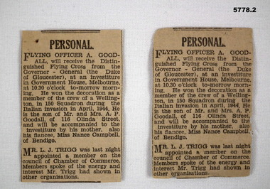
Item re Allan Frederick Goodall DFC, RAAF, refer Cat No 543.2 for his service details..1) .2) Two newspaper articles the same re the award of the DFC to A.F. Goodall at Govt House presented by the Govenor General of Australia.dfc, newspapers, articles -
 Bendigo Military Museum
Badge - SERVICE BADGE, WW2, Amor Sydney, C.1948
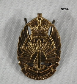
Item relates to John Henry Goodall VX95342, refer Cat No 5768 for his service details. Item in the Goodall collection re Allan Frederick Goodall DFC, RAAF, refer Cat No 543.2 for his service details. Allan and John were Brothers.Badge "Service Australia" crown at top and depiction of Army, Navy, Airforce with scroll under, rear has a pin attachment.On front, "Australia". On rear, stamped "22962", In raised form, "1948", Issued by the C'WTH GOVT", "Amor Sydney"badges, service -
 Bendigo Military Museum
Book - BOOK, SOLDIERS PAY, Mc & Co. Ltd London, 1914 - 1918
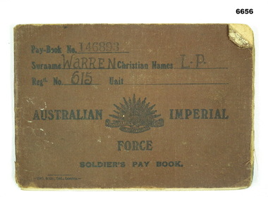
Pay book of CPL L. P. WARREN, Reg'n No. 615 Enlisted 18.8.1914 60th Battalion - AAVC 17.5.1917Small book, cotton cloth cover in brown colour with black print on cover. Rising Sun Insignia in centre. 19 pages.Paybook No. 146893. Surname WARREN Christian Names L.P. Reg'n No. 615 Unit AUSTRALIAN IMPERIAL FORCE SOLDIERS PAY BOOK.passchendaele barracks trust, ww1, aif, paybook -
 Bendigo Military Museum
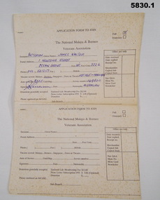
Document - APPLICATION FORM
Owner and donor details (See Cat no. 5826 P)1. Application form - paper, off white with black print on front. Applicant information has been partially completed. 2. Application form Part two - paper off white with black print on front.1. Applicant information - handwritten blue ink- "PATTERSON/JAMES WALTER/ 1 NEWCOMB STREET/ OCEAN GROVE/VIC/3226/ 052 561 257/ /SEPT 1945 - MARCH 1946/RAAF/149800/ J W Patterson/ AUSTRALIA" documents, military history, bcof, veterans -
 Bendigo Military Museum
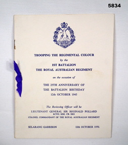
Programme - PROGRAMME, 25th ANNIVERSARY OF BATTALION OPENING, 1970
"TROOPING THE REGIMENTAL COLOUR/ by the/ 1ST BATTALION/ THE ROYAL AUSTRALIAN REGIMENT/ on the occasion of / THE 25th ANNIVERSARY OF THE BATTALION BIRTHDY/ 12th OCTOBER 1945"Programme - cover - cardboard, off white colour, dark blue print on front cover with Royal Australian Regiment Coat of Arms at top. 10 pages - cut, plain, glossy white paper. Illustrated in colour - two flags in centrefold. Stapled - metal, small purple ribbon decoration on front cover.souvenir, programme, military history, ceremonial, regimental colour -
 Bendigo Military Museum
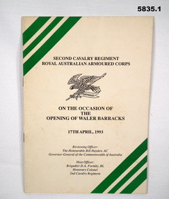
Programme - PROGRAMME, BARRACKS OPENING, 1993
1. "SECOND CAVALRY REGIMENT/ ROYAL AUSTRALIAN ARMOURED CORPS/ ON THE OCCASION OF/ THE/ OPENING OF THE WALER BARRACKS/ 17th APRIL 1993". 2. "THE AUSTRALIAN ARMY/ WHEELED/ ARMOURED/ FIGHTING/ VEHICLE."1. Programme - cover, cardboard, black and green print on front cover with illustration of eagle and rod crest of Second Cavalry Regiment, Royal Australian Armoured Corps. 16 pages - cut, plain, off white paper, illustrated - black and white photographs. Stapled - metal. 2. Leaflet - white glossy paper, Gold, green and white print on front. Colour photographs - back cover and inside leaflet.programme, military history, ceremonial, second cavalry regiment -
 Bendigo Military Museum
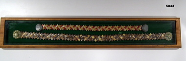
Souvenir - BUTTERFLY WAIST BELTS, FRAMED, 1941 - 1945
Made from selection of butterfly wings and cellophane from cigarette packets during WW2 on islands near Australia.Wooden frame, green felt lining, glass top contains; 1. Belt, shades of brown, cream hat shaped shell ends. 2. Belt, orange and cream, brown ends.souvenir, belts, framed item -
 Bendigo Military Museum
Uniform - BATTLE DRESS, WINTER, ARMY, 1967
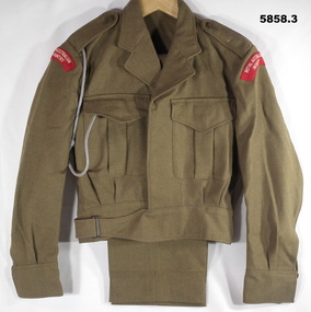
Refer to Cat 58251. Jacket - Thick woollen material - brown khaki colour, two breast pockets, held shut with a button on each. It has epaulettes and long sleeves, on the shoulders are red curved, sewn on, badges "Royal Australian Infantry". 2. Trousers - thick woollen material -brown khaki colour. Button fly. 3. Grey cord lanyard. Inside jacket is label 3795952, Patterson written in blue ink.winter uniform, vietnam war, army -
 Bendigo Military Museum
Book - BOOK, RECORD OF SERVICE, Commonwealth of Australia, 1910
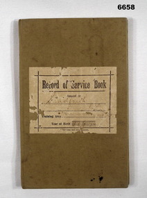
Record Book R. M. SHADFORTH. Registered 30.1.1913 - Schoolboy, 29 Wattle St. Bendigo. Apptn record - last entry 16.11.1937 - Promoted to MAJOR. Gazette Notice 31/37.Book - Cloth hard cardboard cover, khaki colour, 62 pages, black print."Record of Service Book" Issued to SHADFORTH R.M., Training Area, Area 67, Golden Square. Year of Birth 1899.passchendaele barracks trust, service book -
 Bendigo Military Museum
Photograph - Lithographic Technician Preparing Printing Plates at the Army Survey Regiment, Fortuna Villa Bendigo, c1990s
These six photographs were most likely taken from the 1960s to the 1980s in Lithographic Squadron at the Army Survey Regiment, Fortuna, Bendigo. In photos .1P to .6P the Printing Technician is placing a map film negative on top of the printing plate within a vacuum frame before light exposure. See items 6060.8P and 6191.11P for more photos and information on printing plate processing.This is a set of six photographs of lithographic technicians preparing printing plates at the Army Survey Regiment, Bendigo c1990s. The photographs were on 35mm negative film and were scanned at 96 dpi. They are part of the Army Survey Regiment’s Collection. .1) to .4) - Photo, black & white, c1990s, SPR Janet Murray preparing a printing plate in a vacuum frame. .5) to .6) - Photo, black & white, c1990s, printing plate vacuum frame..1P to .6P – there are no annotations.royal australian survey corps, rasvy, army survey regiment, army svy regt, fortuna, asr, litho -
 Bendigo Military Museum
Photograph - Print Technician operating a Plan Printer at the Army Survey Regiment, Fortuna Villa Bendigo, PrintTechnician operating a Plan Printer at the Army Survey Regiment, Fortuna Villa Bendigo, 1990
These three photographs were most likely taken in the 1990s in Lithographic Squadron at the Army Survey Regiment, Fortuna, Bendigo. In photos .1P to .2P the Print Technician is using the Admal Plan Printer to process the exposed contone (black & white) copy of a map sheet. This is a set of three photographs of a print technician operating a Plan Printer at the Army Survey Regiment, Bendigo c1990s. The photographs were on 35mm negative film and were scanned at 96 dpi. They are part of the Army Survey Regiment’s Collection. .1) - Photo, black & white, c1990s, CPL Roy Hicks operating Admal Plan Printer. .2) - Photo, colour, c1990s, CPL Roy Hicks operating Admal Plan Printer. .3) - Photo, colour, c1990s, Admal Plan Printer. .1P to .3P – there are no annotations.royal australian survey corps, rasvy, army survey regiment, army svy regt, fortuna, asr, litho -
 Bendigo Military Museum
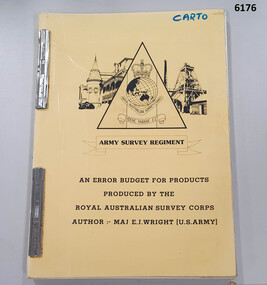
Administrative record - An Error Budget for Products produced by the RASvy Corps, Major Edward J Wright US Army Corps of Engineers, 1988
This document is an analysis determining the positional accuracy (size of errors) within Topographic Mapping Products produced by the Royal Australian Survey Corps.A yellow carboard covered booklet, 2 x "ARNOS" fasteners, Army Survey Regiment Unit emblem designed by SSgt Denis MacCarthy.royal australian survey corps, rasvy, fortuna, army survey regiment, army svy regt, asr -
 Bendigo Military Museum
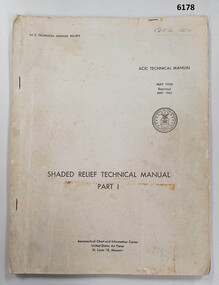
Manual - Shaded Relief Technical Manual - United States Air Force, Department of the Air Force, USA, May 1958
This manual describes how to hand create "Shaded Relief" or the appearance of hills. This manual was produced by the Aeronautical Chart Information Centre, United States Air Force, St Louis 18, Missouri. Shaded relief was produced by hand at the Army Survey Regiment in the 50's, 60's and 70's so that it could be shown on small scale topographical maps and RAAF Aeronauical Charts. Shaded relief continued to be produced by hand until the mid 1980's when it was replaced by digital production methods.Grey covered Manual, gloss paper, stapled together.royal australian survey corps, rasvy, fortuna, army survey regiment, army svy regt, asr -
 Bendigo Military Museum
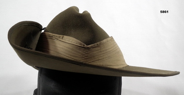
Headwear - HAT, SLOUCH, Dunkerley Ltd, 1968
Refer to Cat 5825.This is a slouch hat made of khaki fur felt. It has the left side raised and clipped up. It has a puggaree in a lighter khaki. On the raised edge is a copper coloured Royal Australian Infantry badge. Inside the hat is a leather liner. It is dried and cracking up.Written in ink on the leather liner is the name "Patterson".slouch hat, vietnam war, infantry -
 Bendigo Military Museum
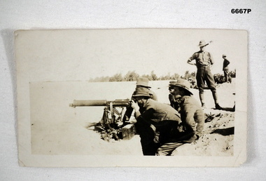
Photograph - PHOTOGRAPH, MACHINE GUN
Photo of Vickers Machine Gun Training. Used by British and Australian troops.Black and white photo of soldiers being trained in use of a machine gun - Vickers .303 inch.passchendaele barracks trust, vickers machine gun training -
 Bendigo Military Museum
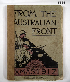
Book - BOOK, WW1, Cassell and Company Ltd/ London, New York, Toronto and Melbourne, "From The Australian Front Xmas 1917", 1917
Item in the collection re Ron Bollard VX14150, refer Cat No 5919P for his service details. Soft cover book. Cover - cardboard, black colour print on front and back. Front illustration 3 colour silhouette of two soldiers in a battle scene. Book illustration - Rising Sun Badge. 128 Badges - cut, plain, off white. Pictorial book containing black and white photographs and black and white illustrations and cartoons.Front end papers - owner's name, handwritten blue ink, Kevin Roberts/ 124 Fifth Ave/ Rosebud 3939/ 5986 6663". Next page handwritten - green pencil - child's drawing of 3 circles.books, military history, ww1 -
 Bendigo Military Museum
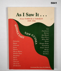
Book - BOOK, TOBRUK, Lieutenant Ken Joyce D.C.M., M.L.D, "AS I SAW IT..."
Owner and donor details. see Cat No. 5836.3. "As I saw it..." From Tobruk to Tarakan/ 1940-1945/ New Guinea/ Middle East" . "A short History of the 2/23rd Battalion " WW2.Soft cover book. Cover - cardboard, green, red and cream colour print on front cover with cream, green, red background. 88 pages - cut, plain, white. Illustrated black and white photographs and maps.books, military history, ww2, battalion history