Showing 3089 items matching survey
-
 Bendigo Military Museum
Photograph - Royal Australian Survey Corps Aerial Surveys, c1980
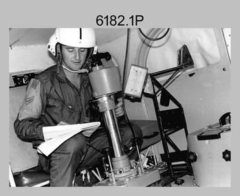
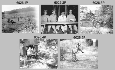
This is a set of nine photographs of technicians from the Royal Australian Survey Corps operating aerial surveys equipment c1980s. In photo .1P, CPL Steve Gloster was operating a RC10 air survey camera mounted in an Australian Army Pilatus Porter aircraft. The Wild RC10 super wide-angle air survey cameras were first introduced in 1971, were equipped with virtual distortion free lenses for supplementary, spot and special photography. In photo .2P, Roger Rees was operating Air Profile Recorder (APR) equipment. it was possibly taken during OP NERVOSE 84, sometime between June – August 1984 when based in Ngukurr, Northern Territory. The APR was operated at this time in unison with an RC10 camera. In 1963 the Royal Australian Survey Corps introduced the radar airborne profile recorder (Canadian Applied Research Ltd, Mark V, Airborne Profiler Recorder) was introduced for 1:100,000 mapping to replace terrain heighting by aneroid barometry. Later in 1974-1975, the Australian developed WREMAPS II airborne laser terrain profile recorder was introduced. In photo .3P, Neil Jones appears at the door of Airsearch Beechcraft Queen Air aircraft, Registration / Serial VH-MWX. This aircraft was typically used by RA Svy on air survey operations flying mission with Aerodist, APR and RC10 camera equipment. The Australian Army’s Pilatus Porter (short take-off and landing turbo propeller) was also equipped with a Wild RC10 aerial mapping camera for identification photography. The Pilatus Porter was also used on RA Svy’s map field checking operations. Photo .9P was taken at a survey station at an unknown location. In this photo an Australian Army Kiowa Light Observation Helicopter (LOH) is supporting a field survey party undertaking Magnavox AN/PRR-14 portable Doppler satellite observations. The satellite receiver’s antenna is plumbed over the survey ground mark surrounded by white plastic panels. The panels were used to identify the survey station on aerial photography. Introduced in 1974–1975, the Magnavox AN/PRR-14 portable Doppler satellite (US Navy Navigation Satellite System – TRANSIT) receivers and computing system provided independent three-dimensional point positions anywhere in the world, anytime, in any weather accurate to about 1.5metres with precise satellite ephemerides. The Bell OH-58 Kiowa LOH was a family of military helicopters used for observation, utility, and direct fire support. It was identified by RA Svy in the mid-1970s that considerable time was lost in replacing unserviceable remote equipment by road. Therefore Aerodist operations (pre-dating satellite receiver operations) were fully supported by Army’s Kiowa LOH aircraft. This is a set of nine photographs of technicians from the Royal Australian Survey Corps operating aerial surveys equipment c1980s. .1P to .3P, .5P to .9P - Colour and black and white photos on photographic paper and scanned at 300 dpi. .4P - Colour photo on 35mm slide film and scanned at 96 dpi. .1) & .2) - Photo, black & white, c1980s, CPL Steve Gloster operating an RC10 air camera. .3) - Photo, colour, 1984, Roger Rees operating Air Profile Recorder (APR) equipment. .4) - Photo, colour, c1980s, Neil Jones at the door of an Airsearch Beechcraft Queen Air aircraft, typically used by RA Svy on air survey operations. .5) - Photo, colour, c1980s. A Beechcraft King Air aircraft, also used by RA Svy on air survey operations. .6) - Photo, colour, c1980s. An Australian Army Pilatus Porter, used by RA Svy on air survey and map field checking operations. SGT Peter Mustart is possibly in the foreground. .7) to .8) - Photo, colour, c1980s. An Australian Army Pilatus Porter and unidentified personnel, used by RA Svy on air survey and map field checking operations. .9) - Photo, colour, c1980s. An Australian Army Kiowa helicopter supporting a field survey party undertaking Magnavox AN/PRR-14 portable Doppler satellite observations. There are biro marks on photos .4P to .9Proyal australian survey corps, rasvy, army survey regiment, asr, fortuna, aerial surveys -
 Bendigo Military Museum
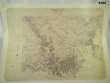
Map - Australian Topographical Survey SYDNEY / 56III Southern Half, NE Plane Table Field sheet 1915, Australian Survey Corps, 6 Dec 1915
This is a unique example of a hand drawn plane table sheet produced in the first year of the Australian Survey Corps by original members of the Corps. Of interest is the documented times that it took to create the original field sheet. Also of interest is the fact that this field sheet that was used to create the actual SYDNEY map sheet was contoured, many map sheets produced up until now were purely planimetric and lacked contouring that was needed for military use. This is a reproduction print of a photograph of the original field sheet and was printed at the Army Survey Regiment, Bendigo.Reprinted coloured Image of Australian Topographical Survey SYDNEY /56 III Southern Half, hand drawn NE Plane Table field sheet. Includes an itemized summary of work performed by HA Roseblade CSM Australian Survey Corps 1915, Signed by J Lynch Lieutenant.royal australian survey corps, rasvy, fortuna, army survey regiment, army svy regt, asr -
 Bendigo Military Museum
Photograph - First Topographic Map Printed on Speedmaster Press - Army Survey Regiment, Fortuna, Bendigo, c1992
This is a photograph of the Director Survey - COL Simon Lemon, CO Army Svy Regt - LTCOL Bob McHenry and probably OC Litho - MAJ Terry Lord inspecting the 1St topographic map printed on the new Heidelberg Speedmaster 102 Printing Press in c1992. *Estimated date based on the Director’s and CO’s period of appointment. The computer-controlled five colour lithographic offset printing press provided the Royal Australian Survey Corps vastly improved printing capability, as the five colours for a standard topographic map was printed in a single pass. The print room was named Wayzgoose Hall after a medieval printing house festival. Wayzgoose Hall and the Speedmaster printing capability was commissioned by the Commander of the 3rd Military District BRIG P. Davies AM, ADC on Wednesday 27th June 1990. This occasion is covered in more detail in page 145 of Valerie Lovejoy’s book 'Mapmakers of Fortuna – A history of the Army Survey Regiment’ ISBN: 0-646-42120-4. Colonel Simon Lemon was Director of the Royal Australian Survey Corps from January 1991 to June 1996.This is a photograph of three senior RASvy officers inspecting the first topographic map printed on the Heidelberg Speedmaster 102 Printing Press in Lithographic Squadron, Army Survey Regiment, Fortuna, Bendigo, c1992. The photograph is on 35mm black and white negative film and was scanned at 96 dpi. It is part of the Army Survey Regiment’s Collection. No personnel are identified. royal australian survey corps, rasvy, army survey regiment, army svy regt, fortuna, asr -
 Bendigo Military Museum
Map - Australian Topographical Survey NAGAMBIE SW Sheet, 1 inch:1 Mile, NW portion Plane Table Field sheet 1921, Australian Survey Corps, 1921
This is a coloured reproduction print of an original Plane Table compilation map sheet of Nagambie area 1inch to 1 Mile scale compiled by Sgt Jack Cullen Australian Survey Corps 30 September 1921. Jack was one of the foundation members of the Australian Survey Corps. Of particular interest is the fact that this is a heighted compilation with contouring (required for Military use) as many early maps were purely planimetric. A table on the right hand side details the number of days that it took to produce the compilation. The reverse side of this print is a copy of the Tallarook plane table South East field sheet.Reprinted coloured Image of Australian Topographical Survey NAGAMBIE SW Sheet,1 inch:1 Mile, NW portion hand drawn Plane Table Field sheet. Includes an itemized summary of work, signed by Sgt J Cullen Australian Survey Corps September1921.royal australian survey corps, rasvy, fortuna, army survey regiment, army svy regt, asr -
 Bendigo Military Museum
Photograph - Royal Australian Survey Corps Surveyors in the Field – PNG, 1962
This is a set of four photographs of surveyors and support staff in the field undertaking duties in Dogera, Milne Bay Province and Kerema, Gulf Province of PNG in 1962. The surveyors were employed in the establishment of mapping and geodetic control. In this era surveyors used theodolites to observe horizontal and vertical angles and tellurometers to measure base line distances between survey stations. From 1957 helicopter transport of survey parties revolutionised transport in remote areas.This is a set of four photographs of surveyors and support staff in the field undertaking duties in PNG in 1962. The photographs were printed on photographic paper and are part of the Army Survey Regiment’s Collection. The photographs were scanned at 300 dpi. .1) - Photo, colour, 1962. Unloading survey operation stores from a Landing Ship Medium (LSM) at Dogera, Milne Bay Province, PNG. .2) & .3) - Photo, colour, 1962. Hired civilian helicopter Bell 47G-2 helicopters operating at at Dogera, Milne Bay Province, PNG. .4) - Photo, colour, 1962. Survey party at survey station located near Kerema, Gulf Province southern PNG. L to R: Dave Owens, Keith Broadbent, with local villagers in background..1P to .4P annotated on back – personnel names, the year and the location. royal australian survey corps, rasvy, army survey regiment, asr, army svy regt, fortuna, surveying -
 Bendigo Military Museum
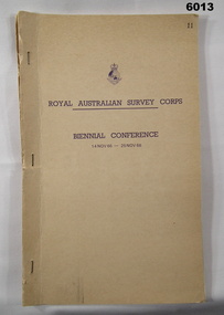
Administrative record - Report on Royal Australian Survey Corps Biennial Conference 14-25 Nov 1966, Army Survey Regiment, Nov 1966
Detailed Planning Report for the activities of the Royal Australian Survey Corps 1966-1968 as decided at the Corps Conference 14-25 Nov 1966Typed Report of decisions and plans for activities of the Royal Australian Survey Corps for 1996 -1998. Report includes names of attendees from all elements of the Survey Corps and their reports. paper report with light buff coloured card cover stapled along the left hand edge. 50 page report includes distribution list."Copy No 11" royal australian survey corps, rasvy, fortuna, army survey regiment, army svy regt, asr -
 Bendigo Military Museum
Photograph - Lithographic Technicians Preparing Printing Plates at the Army Survey Regiment, Fortuna Villa Bendigo, 1988
These six photographs were most likely taken in 1988 in Lithographic Squadron at the Army Survey Regiment, Fortuna, Bendigo. In these photos the technician preparing printing plates for offset printing. The Printing Technician in photos .1P to .4P is placing a map negative on top of the printing plate in a vacuum frame before light exposure. In photos .5P to .6P the technician is inserting the printing plate in the processor.This is a set of six photographs of lithographic technicians preparing printing plates at the Army Survey Regiment, Bendigo in 1988. The photographs were on 35mm negative film and were scanned at 96 dpi. They are part of the Army Survey Regiment’s Collection. The photos are not annotated.royal australian survey corps, rasvy, army survey regiment, army svy regt, fortuna, asr, litho, printing -
 Bendigo Military Museum
Photograph - Flag Day - Army Survey Regiment Verses School of Military Survey, Fortuna, Bendigo, c1984
These 11 photographs were taken at Flag Day, an annual sports competition between the Army Survey Regiment and the School of Military Survey, at Bendigo circa 1984. The two RASvy units took turns each year to host the event. The day competition usually comprised basketball, cross country, golf, sailing, squash softball, tennis, touch football, tug-of-war and volleyball. The evening competition often included darts, carpet bowls, hookey, quoits and snooker. The flag handover and speeches suggests a victory for the Army Survey Regiment.This is a set of 11 photographs of Flag Day, Army Survey Regiment (ASR) verses the School of Military Survey (SMS), at Bendigo circa 1984. There are more photographs available on 35mm negatives and 35mm positive proofs. The photographs were printed on photographic paper and are part of the Army Survey Regiment’s Collection. The photographs were scanned at 300 dpi. .1) to .3) - Photo, black & white, c1984, L to R: SMS 2IC MAJ Paddy Strunks, ASR CO LTCOL Jorge Gruszka, .4) - Photo, black & white, c1984, L to R: ASR CO LTCOL Jorge Gruszka, SMS 2IC MAJ Paddy Strunks, SMS RSM WO1 Ken Slater. .5) - Photo, black & white, c1984, ASR RSM WO1 Bob Mason, ASR CO LTCOL Jorge Gruszka, SMS RSM WO1 Ken Slater, SMS 2IC MAJ Paddy Strunks. .6) & .7) - Photo, black & white, c1984, SPR Gayle Humphrey. .8) - Photo, black & white, c1984, L to R: unidentified, SGT Alan Staley (partially obscured), SPR Gai (Robinson) Amato. .9) - Photo, black & white, c1984, L to R: SPR Steve Ellis, unidentified (x2). .10) - Photo, black & white, c1984, L to R: SPR Bob Hopper, SPR Jan (Caithness) Lampton-Young, SPR Wally Twidale. .11) - Photo, black & white, c1984, L to R: unidentified, CPL Scheryl Delforce, unidentified, SPR Wally Twidale..1P to .11P – No annotationsroyal australian survey corps, rasvy, army survey regiment, army svy regt, fortuna, asr, flag day, school of military survey -
 Bendigo Military Museum
Photograph - Orthophotomap Workstation, Lithographic Squadron – Army Survey Regiment, Fortuna, Bendigo, 1988
This collection of four photos was most likely taken at Lithographic Squadron, Army Survey Regiment, Fortuna, Bendigo in 1988. Orthophoto mapping provided the Survey Corps with the capability to produce map products quickly in the event of a crisis. These are four photographs of equipment used by the Army Survey Regiment to produce orthophotomaps. The OR1 orthophoto projector and workstation was introduced in the mid-1980s. It was the second-generation equipment used to orthorectify colour and monochrome film aerial photography, replacing the system introduced in 1973. Orthorectification is the process of removing geometric distortions and scale errors/variations from images. Images have tilt and relief distortions that make it difficult to compare accurately a map and an image of the same geographic area. Once an image is orthorectified, features on the image are shown in their planimetric locations. These four photographs of orthorectification equipment in operation were taken at the Army Survey Regiment at Fortuna, Bendigo, 1988. The photographs were on 35mm negative film and were scanned at 96 dpi. They are part of the Army Survey Regiment’s Collection. .1) to .4) - Photo, black & white, 1988, WILD OR-1 Orthorectification Workstation, SPR Carmel (Butler) Fauth.No personnel are identifiedroyal australian survey corps, rasvy, army survey regiment, army svy regt, fortuna, asr, litho -
 Bendigo Military Museum
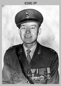
Photograph - CO of the Army Headquarters Survey Regiment - LTCOL Lionel ‘Bill’ Sprenger, Fortuna, Bendigo, 1969
These three formal photos of LTCOL Lionel ‘Bill’ Sprenger were taken at the Army Headquarters (AHQ) Survey Regiment, Fortuna, Bendigo on the 30th of September 1969. LTCOL Bill Sprenger joined the Australian Army on the 10th of June 1940 and after rising through the ranks, his career culminated in his appointment as CO of the Army Survey Regiment from 1969 to 1970. Despite suffering debilitating poor health during his appointment, LTCOL Sprenger led the Regiment on the unit’s first Freedom of Entry Parade held in Bendigo on the 14th of June 1970. For more information on this occasion, refer to item 6020.8P. Unfortunately, LTCOL Bill Sprenger passed away on the 5th of December 1970 and was farewelled with a full military funeral. He is remembered as a model of good leadership. More information on LTCOL Sprenger’s tenure as CO of the unit is provided in pages 98 to 99, 102 and 134 of Valerie Lovejoy’s book 'Mapmakers of Fortuna – A history of the Army Survey Regiment’ ISBN: 0-646-42120-4.These three formal photos of LTCOL Lionel ‘Bill’ Sprenger were taken at the Army Headquarters (AHQ) Survey Regiment, Fortuna, Bendigo on the 30th of September 1969. The black and white photographs were printed on photographic paper and are part of the Army Survey Regiment’s Collection. Photo .1) was scanned at 300 dpi and photos .2) & .3) were scanned at 600 dpi. .1) to .3) - Photo, black & white, 1969, LTCOL Lionel ‘Bill’ Sprenger - CO of AHQ Survey Regiment.‘Unit Photos 30 Sept 1969’, ‘1 Topo Svy Tp’, ‘ LT COL Sprenger’ . Note - Yellow tag is annotated with incorrect date (1970). royal australian survey corps, rasvy, army survey regiment, army svy regt, fortuna, asr -
 Bendigo Military Museum
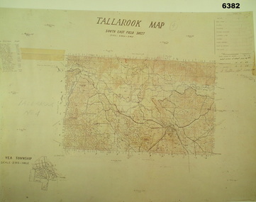
Map - Australian Topographical Survey TALLAROOK SE Sheet, 1 inch:1 Mile, NW portion Plane Table Field sheet 1923, Australian Survey Corps, 1923
This is a coloured reproduction print of an original Plane Table compilation map sheet of Tallarook area 1inch to 1 Mile scale compiled by Sgt Jack Cullen Australian Survey Corps 12 November 1923 and signed by Capt J Lynch. Capt Lynch and Sgt Cullen were both foundation members of the Australian Survey Corps. Of particular interest is the fact that this is a heighted compilation with contouring (required for Military use) as many early maps were purely planimetric. The reverse side of this print is a copy of the Nagambie plane table South West field sheet.Reprinted coloured Image of Australian Topographical Survey TALLAROOK SE field Sheet,1 inch:1 Mile, hand drawn contoured Plane Table Field sheet. Signed by Sgt J Cullen Australian Survey Corps November1923. An enlargement of YEA Township 2 Inches to 1 Mile Scale.royal australian survey corps, rasvy, fortuna, army survey regiment, army svy regt, asr -
 Bendigo Military Museum
Photograph - Photogrammetric Equipment – Army Survey Regiment, Bendigo and School of Military Survey Bonegilla, c1960s to c1980s
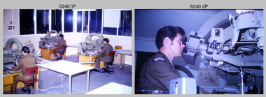
This is a set of 14 photographs of RA Svy technicians operating photogrammetric equipment in Air Survey Squadron, Army Survey Regiment, Fortuna, Bendigo; and the School of Military Survey Bonegilla c1960s to c1980s. The Wild B9 stereo plotter were introduced in 1962 and the Wild B8 stereo plotter was introduced in 1966. The Wild B9 and B8 stereo plotters were used for plotting topographic detail and contours. These analogue machines were manually controlled by adjusting the control knobs for the orientation of the 3D image. The B9s used a four and a half square, and the B8s used a nine-inch square photo image on a film or glass diapositive which allowed highly accurate extraction of map features. At first, plotting with B8 and B9 stereo plotters was undertaken at the aerial photography scale of 1:80,000 in pencil onto a controlled plotting sheet. Sheets were then inked up and reduced photographically to the 1: 100,000 publication scale for scribe impression production. In the early days topographic detail and contours were plotted with a pencil or ink pen mounted at the far end of the pantograph arm. The plotting procedure was upgraded to direct plotting in ink with photographic reduction to publication scale. In 1975 four B8s were upgraded with tri-axis locaters as part of the Input Sub-system to enable digital extraction to AUTOMAP 1’s topographic database. When AUTOMAP 2 was introduced in 1982 these B8s were upgraded, and additional machines added to expand the Army Survey Regiment’s digital capture capability. There are several more photos catalogued in the Victorian Collections database of RA Svy personnel operating Wild B9 and B8 stereo plotters.Photogrammetric Equipment – Army Survey Regiment, Fortuna, Bendigo c.1981. . .7) – Unidentified technician operating Wild B8 stereo plotter in AUTOMAP 1 at ASR. .8) - Wild B8 stereo plotter in AUTOMAP 1 at ASR. Photogrammetric Equipment – Army Survey Regiment, Fortuna, Bendigo. c1981. .9) – ASR’s CPL Dave Cook in AUTOMAP 1 operating a Wild B8 stereo plotter. This is a set of 14 photographs of RA Svy technicians operating photogrammetric equipment at the Army Survey Regiment (ASR), Bendigo and the School of Military Survey (SMS) Bonegilla. c1960s to c1980s. The photographs are on 35mm colour slides and were scanned at 96 dpi. .1) - Photo, colour, c1964. Unidentified ASR technicians operating analogue Wild B9 stereo plotters. .2) - Photo, colour, c1974. ASR’s SPR Mick Minchin operating an analogue Wild B8 stereo plotter. .3) to .6) - Photo, colour, c1980. Photogrammetry Instructor SGT Neil ‘Ned’ Kelly at the SMS operating an analogue Wild B8 stereo plotter. .7) - Photo, colour, c1981. Unidentified technician operating Wild B8 stereo plotter in AUTOMAP 1 at ASR. .8) - Photo, colour, c1981. Wild B8 stereo plotter in AUTOMAP 1 at ASR. .9) to .14) - Photo, colour, c1981. ASR’s CPL Dave Cook in AUTOMAP 1 operating a Wild B8 stereo plotter..1P to .14P - Some of the equipment is annotated on the frame of the 35mm slides.royal australian survey corps, rasvy, army survey regiment, army svy regt, fortuna, asr, photogrammetry -
 Bendigo Military Museum
Photograph - Army Survey Regiment – CAPT Jack Cullen (Ret), Fortuna, Bendigo, c1978
This is a photograph of CAPT Jack Cullen (Ret) and an unidentified person besides the front steps of Fortuna Villa, Bendigo, c1978. Jack Cullen served for many years in the Royal Australian Survey Corps from 1920 to 1952, after active service with the AIF in WW1. His service at Fortuna began in 1944 when he was a Lieutenant in charge of a map compilation section. Jack Cullen’s service is covered in more detail with additional historic photographs, in Valerie Lovejoy’s book 'Mapmakers of Fortuna – A history of the Army Survey Regiment’ ISBN: 0-646-42120-4This is a photograph of CAPT Jack Cullen (Ret) and an unidentified person at the Army Survey Regiment, Fortuna, Bendigo, c1978. The photograph was printed on photographic paper and is part of the Army Survey Regiment’s Collection. The photograph was scanned at 300 dpi. Photo, black & white, c1988: L to R: CAPT Jack Cullen (Ret), unidentified person‘Jack Cullen’ is annotated on back of the photoroyal australian survey corps, rasvy, army survey regiment, army svy regt, fortuna, asr -
 Bendigo Military Museum
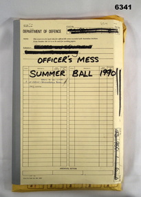
Administrative record - Army Survey Regiment Officers Mess Ball 1990, Army Survey Regiment, Bendigo, 12 Feb - 8 Mar 1990
The Army Survey Regiment held Annual Balls at Fortuna Villa. This folder contains the documentation for the Logistics and activities associated with the planning and running of the Officers Mess Summer Ball held in 1990.Manilla Correspondence Folder with grey cloth binding containing correspondence about the Army Survey Regiment Officers Mess Summer Ball of 1990.royal australian survey corps, rasvy, fortuna, army survey regiment, army svy regt, asr -
 Bendigo Military Museum
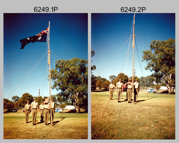
Photograph - Lowering of the Australian Flag by Army Survey Regiment personnel, Australia Day, Kerang, 1996
These two photographs of a contingent from the Army Survey Regiment lowering the Australian flag were taken on Australia Day in Kerang, Victoria on the 26th of January 1996. Most units of the Australian Defence Force (ADF) provide contingents to regional towns in their local area to assist in commemoration ceremonies on days of national significance, such as Australia Day, ANZAC Day and Remembrance Day. This was most likely one of the last occasions before the closure of the Army Survey Regiment. The use of an improvised flagpole is unknown.These two photographs of a contingent from the Army Survey Regiment lowering the Australian flag, were taken on Australia Day in Kerang, Victoria on the 26th of January 1996. The photographs were printed on photographic paper and are part of the Army Survey Regiment’s Collection. The colour photographs were scanned at 300 dpi. .1) and .2) - Photo, colour, contingent of unidentified Army Svy Regt personnel. There are no annotations.royal australian survey corps, rasvy, army survey regiment, army svy regt, fortuna, asr, kerang shire, australia day -
 Bendigo Military Museum
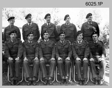
Photograph - Army Survey Regiment’s Officers, Warrant Officers and Sergeants and Squadrons, at Fortuna, Bendigo, 1982
This is a set of six staff photographs of the Army Survey Regiment’s Officers, Warrant Officers and Sergeants, and each of its four Squadrons at Fortuna, Bendigo in December 1982. Note - Air Survey Squadron’s photo was probably taken in July 1982 as they appear in winter dress. Air Survey Squadron was responsible for aerotriangulation, photogrammetric feature extraction and the AUTOMAP 1 system. Typical tasks were flight planning the acquisition of aerial photography, pugging, mensuration and block adjustments, photogrammetric extraction of topographic features from aerial photography, digital feature editing, map compilation, operating the scanner/plotter, operating the AUTOMAP 1 system and computer programming by civilians. Cartographic Squadron was responsible for the production of the following military products: Joint Operation Graphics, small-scale RAAF Air Charts, large-scale topographic line maps and orthophotomaps. Cartographic technician tasks were scribing, compiling, retouching, masking, type setting, type stickup, terrain embossing, correcting and proving quality control. Headquarters Squadron was responsible for the planning and coordination of map production and contracts. It also performed administrative and support functions such as personnel administration, pay, finance, transportation, records, map Library, kitchens, messes and facility maintenance. It was staffed by Army personnel from RASvy, RACT, AACC, RAAOC and RAEME corps. Other supporting staff at this time included the RAAF Liaison Officer, RAN Liaison Officer and several civilians employed in administration, the Q-Store and grounds maintenance. A component of the Army Svy Regt’s cartographic map production was carried out by the Detachment, a sub-unit located at Bonegilla next to the School of Military Survey. Lithographic Squadron was responsible for the reproduction of map materials and printing of military map products. The main tasks undertaken by photographic technicians were photographic enlargements, reductions and duplication of map reproduction material and processing of aerial photography. Printing technician tasks included platemaking, offset printing, map stock despatching and proofing.This is a set of six staff photographs of the Army Survey Regiment’s Officers, Warrant Officers and Sergeants, and its four Squadrons, at Fortuna, Bendigo, 1982. The black and white photographs were printed on photographic paper and are part of the Army Survey Regiment’s Collection. The photograph was scanned at 300 dpi. No personnel are identified. No personnel are identified. .1P – Annotated on front “OFFICERS MESS DEC ’82” .2P – Annotated on back “SGTS MESS DEC ’82” .4P– Annotated on front “CARTO SQN DEC ’82” .5P– Annotated on front “HQ SQN DEC ’82”royal australian survey corps, rasvy, army survey regiment, army svy regt, fortuna, asr, air survey, carto, litho -
 Bendigo Military Museum
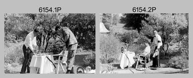
Photograph - Silver Service Morning Tea – Army Survey Regiment, Fortuna, Bendigo, 1991
These six photos were taken in the grounds of the Army Survey Regiment, Fortuna in spring 1991. MAJ Ray Redman appears in his mess dress by the Roman fountain, serving a silver service morning tea to CPL Pat Drury, as a result of a losing bet on the 1991 Rugby League Grand Final. Pat Drury was a very keen rugby league supporter and followed Penrith, who lost its first Grand Final appearance to the Canberra Raiders in 1990. Penrith reversed the result the following year against Canberra winning their first premiership. This occasion is covered on page 152 of Valerie Lovejoy’s book 'Mapmakers of Fortuna – A history of the Army Survey Regiment’ ISBN: 0-646-42120-4.This is a set of six photographs of two Army Survey Regiment personnel in the grounds of Fortuna, Bendigo, 1991. The photographs were on 35mm negative film and were scanned at 96 dpi. They are part of the Army Survey Regiment’s Collection. .1) to .6) - Photo, black & white, 1991, MAJ Ray Redman and CPL Pat Drury. No personnel are identified.royal australian survey corps, rasvy, army survey regiment, army svy regt, fortuna, asr -
 Bendigo Military Museum
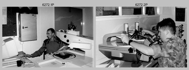
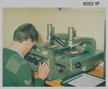
Photograph - Aerotriangulation Production – Army Survey Regiment, Fortuna, Bendigo, c1993
This is a collection of eight photographs of Air Survey Squadron personnel operating aerotriangulation equipment at the Army Survey Regiment at Fortuna, Bendigo, c1993. PUG4 devices were used by technicians to stereoscopically view the photography containing the survey control points and the mapping aerial photography. The Control points were transferred from the control photography to the mapping diapositives of aerial photography by drilling their locations into the photographic emulsion. The Zeiss (Jena) Stecometer analytic stereocomparator for air photography shown in photo .1P was introduced at Air Survey Squadron in 1963. Wild PUG4 point transfer devices shown in photos .2P to .4P were introduced in c1968 superseding the PUG2 devices. See item 6195.19P for more photos and descriptions of Air Survey Squadron personnel and aerotriangulation equipment.This is a set of eight photographs of Air Survey Squadron personnel operating aerotriangulation equipment at the Army Survey Regiment at Fortuna, Bendigo, c1993. The photographs were on 35mm negative film and were scanned at 96 dpi. They are part of the Army Survey Regiment’s Collection. .1) - Photo, black & white, c1993, Zeiss (Jena) Stecometer, SPR Kim Baker. .2) - Photo, black & white, c1993, Wild PUG4 point transfer device, CPL Paul Bouton. .3) to .4) - Photo, black & white, c1993, Wild PUG4 point transfer device, L to R: CPL Darren Scott, CPL Paul Bouton. .5) to .6P) - Photo, black & white, c1993, CPL Doug Willis. .7) - Photo, black & white, c1993, WO2 Noel ‘Macca’ McNamara. .8) - Photo, black & white, c1993, SGT Barry Miller..1P to .8P - There are no annotations.royal australian survey corps, rasvy, army survey regiment, army svy regt, fortuna, asr, aerotrig -
 Bendigo Military Museum
Administrative record - Army Survey Regiment Officers Mess - Insurance Invoices and Receipts, Army Headquarters Survey Regiment, 1957-1967
Various Insurance Company invoices and receipts, all pertaining to the Officers Mess at Army Headquarters Survey Regiment Foolscap size folder. All paper pages of various sizes from a number of different Insurance companies pertaining to the Officers Mess at AHQ Survey Regiment during the years 1957 to 1967.royal australian survey corps, rasvy, fortuna, army survey regiment, army svy regt, asr -
 Bendigo Military Museum
Photograph - Royal Australian Survey Corps Surveyors in the Field – Project Cutlass, New Guinea, 1956 – 1957
This is a set of 23 photographs of surveyors and support staff in the field undertaking tasks in New Guinea 1956 – 1957. The surveyors were employed in the establishment of mapping and geodetic control for Project Cutlass, the “Ship-Shore” survey of the New Ireland province. In this survey operation surveyors used theodolites to observe horizontal and vertical angles and chains to measure base line distances between survey stations. Bob Skitch shown in photo .7P was in the 2nd year of his career in the Australian Army. He achieved the rank of Lieutenant-Colonel, and his last appointment was the CO of the Army Survey Regiment from 1976 to 1980.This is a set of 23 photographs of surveyors and support staff in the field undertaking duties during Project Cutlass located in New Ireland, New Guinea 1956 – 1957. The photographs were printed on photographic paper and are part of the Army Survey Regiment’s Collection. The photographs were scanned at 300 dpi. .1) - Photo, colour, 1956. Surveyors travelling main road from Kavieng to Namatanai, New Ireland. .2) - Photo, colour, 1956. Unidentified surveyors assessing recovery of their vehicle after bridge collapsed on west side of New Ireland. .3) - Photo, colour, 1956. Unidentified surveyors assessing recovery of their vehicle after bridge collapsed over flooded creek on west side of New Ireland. .4) - Photo, colour, 1956. Survey personnel L to R: Bev Uwins, John Lambie, Bob Thompson, New Ireland. .5) - Photo, colour, 1956. Survey base camp, New Ireland. .6) - Photo, black & white, 1956-1957. Geoff Helsham with possible human remains, New Ireland. .7) - Photo, black & white, 1956-1957. Bob Skitch undertaking survey observations using Wild T2 theodolite, New Ireland. .8) - Photo, black & white, 1956-1957. Chas Beach undertaking survey observations using Wild T2 theodolite, New Ireland. .9) & .10) - Photo, black & white, 1956-1957. Kev Parker (cook) New Ireland. .11) - Photo, colour, 1957. Brian Berkery taking a break, Top Manor Island, Lihir Island Group off New Ireland. Latitude -2° 46”, Longitude 152° 40”. .12) - Photo, colour, 1957. Survey base camp L to R: Chas Beach, Bev Uwins, Feni Islands, New Ireland. Latitude -4° 05”, Longitude 153° 45”. .13) - Photo, colour, 1957. A Hous Kiap. (Kiaps, known formally as district officers and patrol officers, were travelling representatives of the British and Australian governments), New Ireland. .14) & .15) - Photo, colour, 1957. L to R: Joe Farrington, Tom Royle Bob undertaking survey observations using theodolites from an improvised timber tower, New Ireland. .16) & .17) - Photo, colour, 1957. US Army ship FS216 used for ship-to-shore triangulation docked at Rabaul, New Britain. .18) - Photo, colour, 1957. US Army ship FS216 used for ship-to-shore triangulation docked at Kavieng, New Ireland. Sight target on top of mast. .19) - Photo, colour, 1957. Survey personnel onboard US Army ship FS392, L to R: Peter Frodsham, Bob Thompson, Doc Reid, John Underwood, remainder unidentified, New Ireland. .20) - Photo, colour, 1957. Survey base line party heading ashore, New Ireland. .21) - Photo, colour, 1957. Survey personnel rowing US Army assault boat L to R: Kev Parker, Chas Beach, folded up survey beacons overhanging stern, New Ireland. .22) - Photo, colour, 1957. Les Bailey onboard US Army ship departing Rabaul, New Britain for Brisbane. .23) - Photo, colour, 1957. Ron Newman onboard US Army ship departing Rabaul, New Britain for Brisbane. Active volcano in background..1P to .23P annotated on back – ‘Operation Cutlass’, personnel names, the year and the location. royal australian survey corps, rasvy, army survey regiment, fortuna, a, army svy regt, asr, surveying -
 Bendigo Military Museum
Photograph - Royal Australian Survey Corps Course Photographs, c1960s, 1948
The first three photographs of Royal Australian Survey Corps training courses were probably taken in the 1960s. As they lack any annotation, the course title/type, trainee and instructor names, dates and locations are unknown. The courses were possibly conducted at the Army Survey Regiment at Fortuna, Bendigo; or the School of Military Survey either at Balcombe Victoria; or Bonegilla, Victoria. The fourth photograph is annotated with the course title and date, however the course type, trainee and instructor names and location are unknown.This is a set of photographs of Royal Australian Survey Corps courses from the 1960s and 1948. All four photographs were printed on photographic paper and are part of the Army Survey Regiment’s Collection. The photographs were scanned at 300 dpi. .1) Photo, black & white RASvy course trainees c1960s .2) Photo, black & white RASvy course trainees and instructors c1960s .3) Photo, black & white RASvy course trainees c1960s .4) Photo, black & white RASvy 1/48 Basic Course trainees 1948.1) to .3) no annotation .4) “1/48 Basic Course” written on backroyal australian survey corps, rasvy, army survey regiment, army svy regt, fortuna, asr -
 Bendigo Military Museum
Photograph - Army Survey Regiment – Regimental Training, c1960s
These photographs of RASvy personnel from the Army Survey Regiment undertaking regimental training lack any annotation that could identify names, dates and locations. The training was possibly conducted at Balcombe and Dromana, located on the Mornington Peninsula, Victoria. There is no explanation on the meaning of the annotation on back of the last photograph.This is a set of photographs of Army Survey Regiment personnel undertaking regimental training in the 1960s. All eight photographs were printed on photographic paper and are part of the Army Survey Regiment’s Collection. The photographs were scanned at 300 dpi. .1) to .7) Photo, black & white, Regimental Training .8) Photo, black & white, possibly Regimental Training.1) to .7) annotated on back “Regimental Training” .8) annotated on back “Fatted Pig-Coal Lift-Western Mines”royal australian survey corps, rasvy, army survey regiment, army svy regt, fortuna, asr -
 Bendigo Military Museum
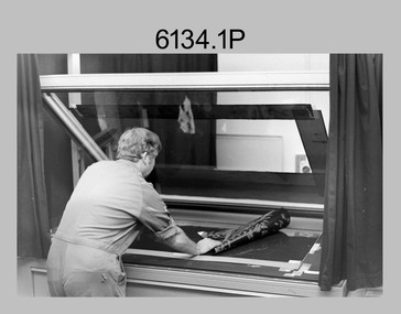
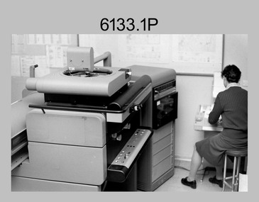
Photograph - Army Survey Regiment Map Production Equipment, c1980s, c1990s
Photos .1P, .2P, .4P and .5P were most likely taken in the 1980s and photo .3P in the c1990s at the Army Survey Regiment, Fortuna, Bendigo. Despite lacking annotation on exact dates, locations and personnel, they are positively identified. CPL Ian Nelson in photo .1P is operating a Wild Pug 4 point transfer device in Air Survey Squadron c1980s. Control points were transferred onto the mapping diapositives of aerial photography by drilling their locations into the photographic emulsion. SPR Viv (Hawkins) Doherty in photo .2P and SPR Jeanette Drury-Lane in photo .5P are operating a Wild B8 Stereoplotter coupled to a digital workstation in Air Survey Squadron c1980s. Topographic features were extracted with the B8 in 3D and feature coded with attributes, using keyboard, menu, keypad and voice inputs to the computer. The features were stored in the AUTOMAP 2 digital database for subsequent cartographic production and printing. CPL Mick Ellis in photo .3P is operating the Optronix 4040 Scanner/Film Writer in Lithographic Squadron c1990s. In scanning mode, compilation sheets were mounted on the drum and scanned. The resultant raster file was vectorized, feature coded with attributes and stored by cartographic technicians in the AUTOMAP 2 database. In film writing mode, digital cartographic files were output at very high resolution for each print colour on photosensitive film, for subsequent finalisation, platemaking and printing.This is a set of five photographs of technicians operating map production equipment at the Army Survey Regiment, Bendigo. The photographs were printed on photographic paper and are part of the Army Survey Regiment’s Collection. The photographs were scanned at 300 dpi. .1) - Photo, colour, c1980s. CPL Ian Nelson operating a Wild Pug 4 point transfer device in Air Survey Squadron. .2) - Photo, colour, c1980s. Wild B8 Aviograph stereoplotter feature extraction, SPR Viv (Hawkins) Doherty in Air Survey Squadron. .3) - Photo, colour, c1990s. CPL Mick Ellis operating the Optronics 4040 Scanner in Lithographic Squadron. .4) - Photo, colour, c1984. AUTOMAP 2 Graphic Edit Workstation, SPR Craig Kellet in Cartographic Squadron. .5) - Photo, colour, c1989. Wild B8 Aviograph stereoplotter feature extraction, SPR Jeanette Drury-Lane in Air Survey Squadron. .1P – no annotations .2P – annotated “Stereoplotter Workstation. The operator has the use of keyboard, menu, keypad and voice for input to the computer. Feedback is given through voice and screen messages.” .3P to .5P – no annotationsroyal australian survey corps, rasvy, army survey regiment, army svy regt, fortuna, air survey, litho, aerotrig -
 Bendigo Military Museum
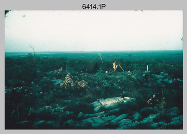
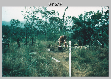
Photograph - Royal Australian Survey Corps Surveyors in the Field – Northern Territory and Queensland, 1959 – 1960
This is a set of 10 photographs of surveyors and support staff in the field undertaking duties in the Northern Territory and North Queensland in 1959 – 1960. The surveyors were employed in the establishment of mapping and geodetic control. In this era surveyors used theodolites to observe horizontal and vertical angles and tellurometers to measure base line distances between survey stations. Laplace survey observations seen in Photo .1P was a series of precise observations carried out at geodetic survey stations to determine astronomic latitudes, longitudes and azimuths to achieve maximum precision in the survey network. Laplace observations were necessary in a geodetic network at every 6th survey station, however the National Mapping Council specified at this time the spacing would be ideally between 4-6 survey stations. The cairn shown in photo .4P was built by RASvy as a landmark over a trigonometric survey station. It was dismantled in 1960 to enable re-occupation and survey observations. It was not restored to the condition shown in the photo.This is a set of 10 photographs of surveyors and support staff in the field undertaking duties in the Northern Territory (NT) and Queensland (QLD) in 1959 – 1960. The photographs were printed on photographic paper and are part of the Army Survey Regiment’s Collection. The photographs were scanned at 300 dpi. .1) - Photo, colour, 1959. Tony Slattery occupying a Laplace survey station on a hill in the Mount Young area of the NT. .2) - Photo, colour, 1959. Surveyors’ camp in the Mount Young area of the NT, L to R: Spencer Snow and Tony Slattery. .3) - Photo, colour, 1959. Surveyors’ camp in the Peckman Hill area, near Katherine in the NT. .4) - Photo, colour, 1959. Cairn on Trig Hill, Borroloola, NT. Built by Spencer Snow, Tom Royle and Jack McCabe. .5) - Photo, colour, 1959. Survey party taking a break next to their Austin Champ vehicle, in transit between Katherine, NT and Wyndam WA. L to R: Tony Slattery, Dave Owens, John Van De Graff. .6) - Photo, colour, 1960. Surveyors’ camp between Mount Isa, QLD and Borroloola, NT. L to R: Pat Cox and John Van De Graff prepare their meal on an open fire. .7) - Photo, colour, 1960. Surveyor - Dennis Woods undertaking survey observations, using MRA1 tellurometer to measure base-line distances NW of Mount Isa, QLD. .8) - Photo, colour, 1960. Unidentified surveyors assessing recovery of their stalled Studebaker truck vehicle after attempting a water crossing in the NT. .9) - Photo, colour, 1960. Unidentified surveyor making batches of bread at a camp in the NT. Seen in the photo placing a lid with hot coals onto the camp oven. .10) - Photo, colour, 1960. Unidentified survey party occupying a survey station on a hill in the Mount near the Lawn Hill area, NW of Mount Isa, QLD. A MRA1 tellurometer to measure base-line distances appear on the right side of the photo. .9) - Photo, colour, 1960. Unidentified surveyors assessing recovery of their stalled Studebaker truck vehicle after attempting a water crossing in the NT. .10) - Photo, colour, 1960. Unidentified surveyor making batches of bread at a camp in the NT. Seen in the photo placing a lid with hot coals onto the camp oven. .1P to .10P annotated on back – personnel names, the year and the location. royal australian survey corps, rasvy, army survey regiment, asr, army svy regt, fortuna, surveying -
 Bendigo Military Museum
Photograph - Royal Australian Survey Corps Surveyors in the Field – North Queensland and Torres Strait, 1961
This is a set of five photographs of surveyors and support staff in the field undertaking duties in North Queensland and Torres Strait in 1961. The surveyors were employed in the establishment of mapping and geodetic control. In this era surveyors used theodolites to observe horizontal and vertical angles and tellurometers to measure base line distances between survey stations. In photo .2P Joe Farrington is seen taking survey observations using a Tavistock V500 Series Tavistock theodolite at a survey station between the Edward River and Aurukun in the Cape York Peninsula. The Gulf of Carpentaria appears in the background. From 1957 helicopter transport of survey parties revolutionised transport in remote areas. The civilian helicopter was hired from TAA. This is a set of five photographs of surveyors and support staff in the field undertaking duties in North Queensland and Torres Strait in 1961. The photographs were printed on photographic paper and are part of the Army Survey Regiment’s Collection. The photographs were scanned at 300 dpi. .1) - Photo, colour, 1961. Andy Millar occupying a survey station on a hill in the Cape York Peninsula, QLD. .2) - Photo, colour, 1961. Joe Farrington taking observations with a V500 Series Tavistock geodetic theodolite at a survey station in the Cape York Peninsula, QLD. .3) - Photo, colour, 1961. Daryl Parker taking a break from survey observations on a hill located on Duaun Island QLD, in the Torres Strait, a few miles south of the PNG coastline. Hill height was 975 ft. .4) - Photo, colour, 1961. Three Torres Strait divers L to R: unidentified, Darku and Ray Mau Daryl standing behind a Tavistock geodetic theodolite on a hill located on Duaun Island QLD, in the Torres Strait, a few miles south of the PNG coastline. .5) - Photo, colour, 1961. Andy Millar holding meat from a small turtle on Duaun Island QLD, in the Torres Strait, a few miles south of the PNG coastline. An unidentified Duaun Island local appears in the background..1P to .5P annotated on back – personnel names, the year and the location. royal australian survey corps, rasvy, army survey regiment, asr, army svy regt, fortuna, surveying -
 Bendigo Military Museum
Photograph - Army Survey Regiment – Corps Day Parade, Fortuna Villa, Bendigo, 1990
This set of 32 photographs were taken at the Corps Day Parade held at the Army Survey Regiment, Bendigo on the 28th of June 1990. The Parade Commander was CO LTCOL Rene van den Tol, and the Reviewing Officer was the Director of the Survey Corps - COL Don Swiney MBE. The Corps Day Parade was held on a wet and miserable day to commemorate the 75th anniversary of the formation of the Royal Australian Survey Corps. This occasion was one of several events held in 1990 to commemorate the 75th anniversary of the formation of the Royal Australian Survey Corps. More information is provided in pages 147 and 150 of Valerie Lovejoy’s book 'Mapmakers of Fortuna – A history of the Army Survey Regiment’ ISBN: 0-646-42120-4.This is a set of 32 photographs of the Corps Day Parade held at the Army Survey Regiment, Fortuna, Bendigo on the 28th of June 1990. The colour photographs were printed on photographic paper and are part of the Army Survey Regiment’s Collection. The photographs were scanned at 300 dpi. .1) - Photo, colour, June 1990. Lithographic Squadron marching onto parade ground. L to R: WO2 Keith Fenton RE – UK Exchange, CPL Peter Dillon, CPL Penny Knott, SPR Andrew Morrison-Evans, unidentified, SPR Greg Howell, LCPL Damien Cole, SPR Graeme Spong, SPR Andrew Arman, unidentified (x2) CPL Rob Jones, CPL Peter Swandale. .2) - Photo, colour, June 1990. Lithographic Squadron marching onto parade ground. L to R: WO2 Keith Fenton RE – UK Exchange, SSGT Peter Imeson (blurred in foreground), LCPL Damien Cole, unidentified, SPR Andrew Morrison-Evans, SPR Andrew Arman, SPR Graeme Spong, SPR Greg Howell, unidentified (x2), CPL Rob Jones, CPL Peter Swandale. .3) &.4) - Photo, colour, June 1990. Lithographic Squadron formed up on parade ground. L to R: WO2 Keith Fenton RE – UK Exchange, LCPL Damien Cole, unidentified, SPR Andrew Arman, SPR Andrew Morrison-Evans, SSGT Peter Imeson, CPL Peter Swandale, CPL Rob Jones, remaining front rank unidentified, WO2 Rob Bogumil. .5) - Photo, colour, June 1990. Lithographic Squadron formed up on parade ground. L to R: SGT Brian Paul (background), SPR Andrew Arman, SPR Graeme Spong, SPR Greg Howell, SPR Michelle Withers, unidentified, CPL Peter Dillon, remaining rear rank unidentified. .6) - Photo, colour, June 1990. Lithographic Squadron’s SSGT Peter Imeson. .7) - Photo, colour, June 1990. Lithographic Squadron’s WO2 Keith Fenton RE – UK Exchange. .8) - Photo, colour, June 1990. Headquarters Squadron formed up on parade ground. L to R: (x3), CPL Wolfgang Hofbauer, CPL Paul Richards (background), SSGT Peter Mustart, WO2 Paul Cheater(background), PTE Mark Bird, unidentified, CPL Roger Pearson, remaining front rank unidentified, WO1 Ken Slater. .9) - Photo, colour, June 1990. Officers ready to take posts. L to R: MAJ Neil Taylor, LT Steve Hledik, CAPT Dave McLachlan, unidentified, MAJ Peter Clark, LT Geoff Ford, LT Craig Hersant, remainder unidentified. .10) - Photo, colour, June 1990. Officers ready to take posts. L to R: MAJ Neil Taylor, LT Steve Hledik, CAPT Dave McLachlan, remainder unidentified. .11) to .13) - Photo, colour, June 1990. Officers ready to take posts. L to R: MAJ Neil Taylor, LT Steve Hledik, CAPT Dave McLachlan, unidentified, MAJ Peter Clark, LT Geoff Ford, LT Craig Hersant, remainder unidentified. .14) - Photo, colour, June 1990. MAJ Neil Taylor at ease after taking post. .15) - Photo, colour, June 1990. 2IC MAJ Duncan Burns hands over Army Survey Regiment parade to CO LTCOL Rene van den Tol. .16) - Photo, colour, June 1990. Air Survey Squadron fixing bayonets. L to R: unidentified (x5), SSGT ‘Andy’ Capp, SGT Paul Hopes, SSGT Noel McNamara. .17) - Photo, colour, June 1990. Army Survey Regiment salutes and presents arms. SPR Gordon Santo in readiness to greet Reviewing Officer, Director of Survey - COL Don Swiney MBE. .18) - Photo, colour, June 1990. SPR Gordon Santo greets Reviewing Officer, Director of Survey - COL Don Swiney MBE. LT Steve Hledik saluting in background. .19) - Photo, colour, June 1990. L to R: WO2 Rhys De Laine, Reviewing Officer, Director of Survey - COL Don Swiney MBE. .20) - Photo, colour, June 1990. CO LTCOL Rene van den Tol salutes the Reviewing Officer, Director of Survey - COL Don Swiney MBE. .21) - Photo, colour, June 1990. Reviewing Officer, Director of Survey - COL Don Swiney MBE returns the Army Survey Regiment’s salute. .22) - Photo, colour, June 1990. Unidentified Chaplains. .23) - Photo, colour, June 1990. CO LTCOL Rene van den Tol escorts the Reviewing Officer, Director of Survey - COL Don Swiney MBE to Headquarters Squadron. L to R: CPL Wolfgang Hofbauer, CPL John ‘Flash’ Anderson, SGT Wolfgang Thun, SPR Paula (Golding) Brinsmead, remainder unidentified. .24) - Photo, colour, June 1990. Unidentified Army Survey Regiment personnel firing volleys. .25) - Photo, colour, June 1990. Air Survey Squadron firing volley salute. Front rank L to R: unidentified (x5), CPL Chris Brown, SSGT ‘Andy’ Capp, SGT Paul Hopes, SSGT Noel McNamara. Centre rank L to R: unidentified, SPR Jo Otto, SPR Rachel (Stanford) Scott, SGT John ‘Shep’ Shepard, LCPL Paul Boulton. Rear rank L to R: unidentified (x2), SPR Phuc ‘Charlie’ Tran, SGT Andy Boath, SGT Frank Downie, LCPL Stuart Midgley. .26) - Photo, colour, June 1990. Army Survey Regiment personnel firing volley salute. Foreground Officers L to R: 2IC MAJ Duncan Burns, unidentified, CAPT Bob Williams, unidentified, MAJ Ray Redman. CAPT Noel ‘Nesty’ Coulthard. .27) - Photo, colour, June 1990. Unidentified Army Survey Regiment personnel firing volley salute. .28) - Photo, colour, June 1990. Cartographic Squadron firing volley salute. Front rank R to L: SSGT Mick Hogan, unidentified, CPL Dan Cirsky, remainder unidentified. Centre rank R to L: unidentified, SPR Allan Blake (in battledress). .29) - Photo, colour, June 1990. Unidentified Cartographic Squadron personnel firing volley salute. .30) - Photo, colour, June 1990. End of parade. Air Survey Squadron giving three cheers to the Royal Australian Survey Corps. Front rank L to R: unidentified (x5), CPL Chris Brown, SSGT ‘Andy’ Capp, SGT Paul Hopes, SSGT Noel McNamara. Centre rank L to R: unidentified, SPR Jo Otto, SPR Rachel (Stanford) Scott, SGT John ‘Shep’ Shepard, LCPL Paul Boulton. Rear rank L to R: unidentified (x2), SPR Phuc ‘Charlie’ Tran, SGT Andy Boath, SGT Frank Downie, LCPL Stuart Midgley. WO2 Neil ‘Ned’Kelly on right. .31) & .32) - Photo, colour, June 1990. Army Survey Regiment squadrons at front of Fortuna Villa preparing to fall out..1P to .4P, .7P to .18P, .20P to .32P – There are no personnel identified. .5P – annotated ‘Corps Day parade’, ‘Corps Day 1990’ .6P - annotated ‘SGT Imeson Corps Day parade’, ‘Corps Day 1990’ .19P – annotated ‘CO, Corps Day parade’, ‘Corps Day 1990’royal australian survey corps, rasvy, army survey regiment, army svy regt, fortuna, asr -
 Bendigo Military Museum
Photograph - Visit by unidentified Australian General to the Army Headquarters Survey Regiment, Fortuna, Bendigo, c1965
This is a set of two photographs of a visit to the Army Headquarters Survey Regiment, Fortuna. Bendigo circa 1965 by an unidentified Australian General. He was escorted by the CO - LTCOL Frank Buckland OBE, MID. It’s evident in these photos were taken at an open day. In November 1965 an open day was held to celebrate the 50th anniversary of the Royal Australian Survey Corps’ formation. LTCOL Frank Buckland OBE, MID was the CO of the Army Headquarters Survey Regiment from 1962 to 1965. After promotion to Colonel, he was appointed as Director of the Royal Australian Survey Corps from March 1967 to August 1972. COL Buckland OBE, MID was promoted to Brigadier (retired) to the honorary position as Colonel Commandant from January 1973 to January 1976. He served in the Australian Army from 01 June 1938 to 31 October 1972.This is a set of two photographs of an unidentified Australian General’s visit to the Army Headquarters Survey Regiment, Fortuna, Bendigo circa 1965. The photographs were printed on photographic paper and are part of the Army Survey Regiment’s Collection. They were scanned at 300 dpi. .1) - Photo, black and white, c1965. L to R: unidentified Australian General, CO LTCOL Frank Buckland OBE, MID. .2) - Photo, black and white, c1965. L to R: MAJ LTCOL Bob Skitch, unidentified Australian General, CO LTCOL Frank Buckland OBE MID; unidentified (x2). .1P to .2P – no annotationsroyal australian survey corps, rasvy, army survey regiment, army svy regt, fortuna, asr -
 Bendigo Military Museum
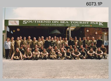
Photograph - Group Photos of Lithographic Squadron, Army Survey Regiment, c1990s
These three photographs of Lithographic Squadron were taken in the 1990s. Photos .2P and .3P were taken at the Army Survey Regiment, Fortuna, Bendigo. .1P was taken as the background sign indicates, at the Southend on Sea Tourist Park, close to the township of Millicent in South Australia. Lithographic Squadron was in this location probably as part of Regimental or Adventurous Training in 1992.This is a set of photographs of Lithographic Squadron, Army Survey Regiment, Bendigo c1990s. The photographs were printed on photographic paper and are part of the Army Survey Regiment’s Collection. The photographs were scanned at 300 dpi. .1) - Photo, colour, 1992, Lithographic Squadron .2) - Photo, colour, 1991, Lithographic Squadron .3) - Photo, colour, Sep 1993, Lithographic Squadron.1P and .2P - annotated on back with date .3P – annotated on front with dateroyal australian survey corps, rasvy, army survey regiment, army svy regt, fortuna, asr, litho -
 Bendigo Military Museum
Photograph - Army Survey Regiment - Defence Force Service Medal Presentations, c1977
These photographs were taken at a formal medal presentation at the Army Survey Regiment in 1977. The Director of the Survey Corps presented the Defence Force Service Medal to personnel in recognition of 15 years of efficient remunerated service, or the Clasp for 5 years of additional service.These four colour photographs were taken at a Defence Force Service Medal Presentation in c1977 at the Army Survey Regiment, Bendigo. The photographs were printed on photographic paper and are part of the Army Survey Regiment’s Collection. The photographs were scanned at 300 dpi. .1) Photo, colour, unidentified personnel .2) Photo, colour, unidentified personnel .3) Photo, colour, L to R: WO1 Roger Rix, WO1 Alex Munro, COL Jim Stedman, MAJ Peter Eddy .4) Photo, colour, L to R: WO1 Roger Rix, WO1 Alex Munro, MAJ Peter Eddy, COL Jim Stedman.1 to. 4P - no annotationsroyal australian survey corps, rasvy, army survey regiment, asr, fortuna -
 Bendigo Military Museum
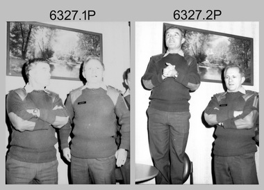
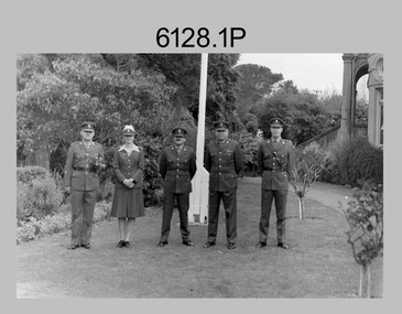
Photograph - Senior Leadership – Army Survey Regiment, Fortuna, Bendigo, c1986
These two photos were taken in front of the flagpole at the Army Survey Regiment, Fortuna probably in 1986. LTCOL Don Swiney MBE was appointed as CO of the Army Survey Regiment from 1985 to 1987. He was subsequently promoted to Colonel and was Director of the Royal Australian Survey Corp from November 1988 to January 1991, and the honorary position as Colonel Commandant from January 1993 to January 1996. WO1 Jeff Lynch’s appointment period as RSM was 1986 to 1988.This is a set of two photographs of the Survey Regiment’s senior leadership at Fortuna, Bendigo, 1986. The photographs were on 35mm negative film and were scanned at 96 dpi. They are part of the Army Survey Regiment’s Collection. .1) - Photo, black & white, 1986, L to R: RSM - WO1 Jeff Lynch, LT Alison Black, MAJ Terry Edwards, CO – LTCOL Don Swiney MBE, CAPT Andrew McLeod. .2) - Photo, black & white, 1986, L to R: RSM - WO1 Jeff Lynch, LT Alison Black, MAJ Terry Edwards, CO – LTCOL Don Swiney MBE, CAPT Andrew McLeod.No personnel are identifiedroyal australian survey corps, rasvy, army survey regiment, army svy regt, fortuna, asr