Physical description
1 map, folding, showing parish boundaries and land ownership.
Inscriptions & markings
Photo - lithographed at the Department of Lands and Survey Melbourne by T. F. McGauran. 21.7.03.
We acknowledge the Traditional Owners of the place now called Victoria, and all First Peoples living and working on this land. We celebrate the history and contemporary creativity of the world’s oldest living culture and pay respect to Elders — past, present and future.
Please be aware that this website may contain culturally sensitive material — images, voices and information provided by now deceased persons. Content also may include images and film of places that may cause sorrow.
Aboriginal and Torres Strait Islander people are advised that this website may contain culturally sensitive material — images, voices and information provided by now deceased persons. Content also may include images and film of places that may cause sorrow.
Some material may contain terms that reflect authors’ views, or those of the period in which the item was written or recorded but may not be considered appropriate today. These views are not necessarily the views of Victorian Collections.
Users of this site should be aware that in many areas of Australia, reproduction of the names and photographs of deceased people is restricted during a period of mourning. The length of this time varies and is determined by the community.
Reuse of any Aboriginal or Torres Strait Islander material on this site may require cultural clearances. Users are advised to contact the source organisation to discuss appropriate reuse.

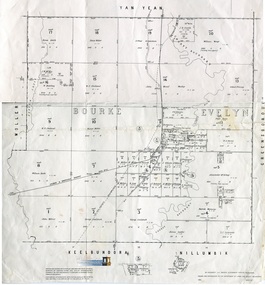
Merriang, County of Bourke
Can you reuse this media without permission? No (with exceptions, see below)
All rights reserved
This media item is licensed under "All rights reserved". You cannot share (i.e. copy, distribute, transmit) or rework (i.e. alter, transform, build upon) this item, or use it for commercial purposes without the permission of the copyright owner. However, an exception can be made if your intended use meets the "fair dealing" criteria. Uses that meet this criteria include research or study; criticism or review; parody or satire; reporting news; enabling a person with a disability to access material; or professional advice by a lawyer, patent attorney, or trademark attorney.
Please acknowledge the item’s source, creator and title (where known)
Have a question? Contact Whittlesea Historical Society Inc.
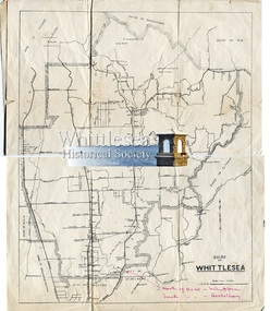


1 map, folding, showing parish boundaries and land ownership.
Photo - lithographed at the Department of Lands and Survey Melbourne by T. F. McGauran. 21.7.03.
Archive Box with lid - Whittlesea Historical Society - WHS - Maps. 1. Contents: 1. Green binder Folder, labelled "Maps", with inventory of contents. Contents: 1. Map Parish of Keelbundora, 11 June 1956, large sheet 2. Map Parish of Keelbundora, undated, one sheet 3. Map Parish of Keelbundora, 1946 4. Map Parish of Keelbundora 5. Map Parish of Keelbundora, 5 Jun 1953 6. Map Parish of Keelbundora, blue sheet 7. Morang - Portions 11-14, A4 page 8. Golden Wattle Estate, 23 Feb 1962, A3 sheet 9. Range View Estate, A4 sheet 10. Golden Wattle Ranges Estate, 22 Feb 1962, A4 sheet 11. Golden Wattle Estate Hurstbridge, A3 12. Shire of Whittlesea including Epping Station, Nov 86, A3 13. Whittlesea, including Epping Road, A3 14. Station Estate Thomastown including Thomastown Railway Station 15. Station Estate Thomastown including Thomastown Railway Station 16. Thomastown Estate, date prior to decimal currency, A3 poster 17. Certificate of Title - Thomastown Station subdivision, 18 Oct 1926, Transfer of Lands Act Titles 18. Plan of Subdivison of Stages 1 & 2 Thomastown 19. Poster - Auction Sale Thomastown, 27 Oct 1923 20. Thomastown, 24 Nov 1907.
Grey coloured Archive Box containing maps
Whittlesea Historical Society - WHS - Maps. Box 1.
map, archive, achival box
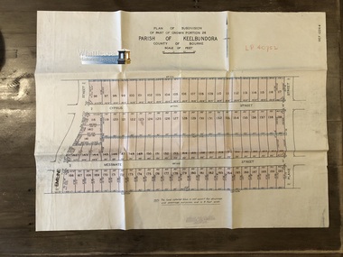
Subdivision of Part of Crown Portion 26, Lalor, Vic. French Street, Messmate Street, Cyprus Street and Plane Street recorded on the map.
Map shows subdivision of blocks numbered 96 - 190, sizes of the blocks, and names of the surrounding streets. Map 2 of 20 in green folder.
Garlick and Stewart, Engineers and Surveyors, Melbourne. LP 40752. Not dated, assumed 11 Jul 1956.
map, subdivision map, messmate street, cyprus street, french street, lalor, plane street, lalor map
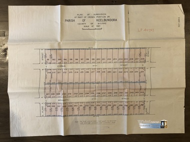
Subdivision of Part of Crown Portion 26, Lalor, Vic. Messmate Street, Cyprus Street, Ash Street and Plane Street recorded on the map.
Map shows subdivision of blocks numbered 191 - 262, sizes of the blocks, and names of the surrounding streets. Map 3 of 20 in green folder.
Garlick and Stewart, Engineers and Surveyors, Melbourne. LP 40753. Not dated, assumed 11 Jul 1956.
map, subdivision map, messmate street, cyprus street, lalor, plane street, lalor map, ash street
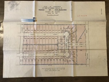
Subdivision of Part of Crown Portion 26, Lalor, Vic. Messmate Street, Cyprus Street, Ash Street, Maple Street and Daltons Road recorded on the map.
Map shows subdivision of blocks numbered 263 - 329, sizes of the blocks, and names of the surrounding streets. Map 4 of 20 in green folder.
Garlick and Stewart, Engineers and Surveyors, Melbourne. LP 40754. Not dated, assumed 11 Jul 1956.
map, subdivision map, messmate street, cyprus street, lalor, plane street, lalor map, ash street
Subdivision of Part of Crown Portion 26, Lalor, Vic. Map 1: Station St, David St, William St, May St, French St and Dalton Road. Map 2: David St, William St, Munro St, Jean St, Lorne St, Plane St, Ash St and Dalton Road. Messmate Street, Cyprus Street, Ash Street, Maple Street and Daltons Road recorded on the map.
Two sheets, attached. The maps are fragile and have tears along the fold lines. Map 1. shows subdivision of blocks numbered 19 - 124, sizes of the blocks, and names of the surrounding streets. Map 2. shows subdivision of blocks numbered 19 - 124, sizes of the blocks, and names of the surrounding streets. Map 5 of 20 in green folder.
Map 1. LP 29211. Map 2. LP 29212. Both maps, Sealed 13 May 1953. Gulliver & Sim, Licensed Surveyors, 15 Lorrean Avenue, East Brighton. S6. Tel. X54780.
map, subdivision map, lalor, plane street, lalor map, ash street, david street, william street, may street, french street, dalton road
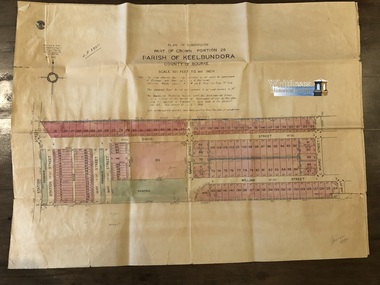
Plan of Subdivision of Part of Crown Section 25, at Thomastown, Parish of Keelbundora, County of Bourke Epping Road, Mount View Road, Tramoo St, Hurtle St, Arndell St, Travers St, Westall St, Chappell St, and Pleasant Road, recorded on the map.
Blue sheet. Aged sticky tape on map. Map 6 of 20 in green folder. Shows subdivision of blocks numbered 1 - 340, sizes of the blocks, and names of the surrounding streets.
LP 13050. Undated.
map, subdivision map, thomastown map, thomastown, epping road, mount view road, tramoo street, hurtle street, arndell street, travers street, westall street, chappell street, pleasant road
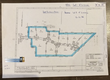
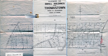
Morang is now as Mernda. Plan of Subdivision, County Bourke, Parish Morang, Crown Portions 11 & 14 (Part). Gordons Lane and Fitzgerald Court, recorded on the map.
A4 page. Map 7 of 20 in green folder. Shows subdivision of Crown Portions 11 &14 (part) blocks numbered 2 - 8 and 19 - 20, sizes of the blocks, and names of the surrounding streets.
LP 214276E Undated. Peyton Waite Pty. Ltd, Consulting Land Surveyors, 353 Plenty Road, Preston. Vic.
map, subdivision map, morang, mernda, gordons road, fitzgerald court, morang map, mernda map, plan of subdivision
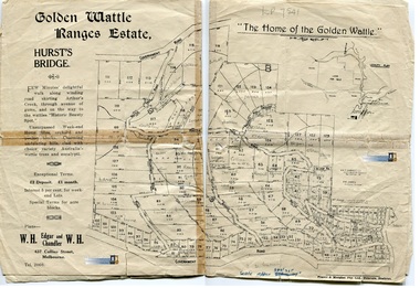
Land for Sale in Hurst's Bridge (now Hurstbridge), Vic.
Undated, 1 sheet. Map 8 of 20 in green folder. Shows land for sale, sizes of the blocks, and names of the surrounding streets, Hurstbridge Rialway Station, Cool Stores, Wine Cafe 7 Billiard Saloon, Shops and Hall. The map is fragile and held together with sticky tape. It was scanned in 2 sections along the fold line and then joined to form 1 image. Previous inventory notes map is dated 23/2/62.
A. K. T. Sambell C. F., Civil & Hydroolic Engineer, 421 Collins Street. P. M. James, Licensed Surveyor, Victoria St. Plans - W. H. Edgar and W. H. Chandler, 437 Collins St, Melbourne.
map, subdivision map, hurst's bridge, hurstbridge, hurstbridge railway station, hurstbridge cool stores, hurstbridge billiard saloon
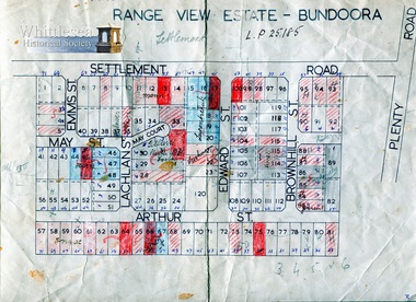
Range View Estate - Bundoora, Settlement Road near Plenty Road, including Elms St, May St, May Court, Lachlan St, Edward St, Brownhill St and Arthur St.
Undated, A4 sheet. Map 9 of 20 in green folder. Shows block number and names of the surrounding streets names, one section bounded by Settlement Road.
L.P 25185
map, subdivision map, range view estate, bundoora, settlement road bundoora, plenty road bundoora, may st, lachlan st, brownhill st, arthur st, elms st
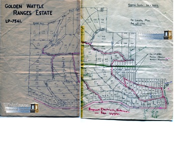
LP - 7541.
1 sheet. Map 10 of 20 in green folder. Shows sizes of the blocks, and names of the surrounding streets, with proposed Electricity extension in red, 23/2/62.
A. K. T. Sambell C. F., Civil & Hydroolic Engineer, 421 Collins Street. P. M. James, Licensed Surveyor, Victoria St. Plans - W. H. Edgar and W. H. Chandler, 437 Collins St, Melbourne.
map, hurst's bridge, hurstbridge, electricity extension
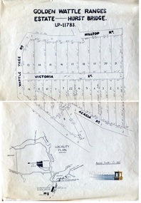
1 sheet. Map 11 of 20 in green folder. Land for Sale Locality Plan. Shows sizes of the blocks, and names of the surrounding streets, Dorset House, Hurstbridge Railway Station
LP - 11783.
map, hurst's bridge, hurstbridge, land for sale, golden wattle ranges estate, hurst bridge, dorset house
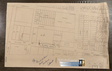
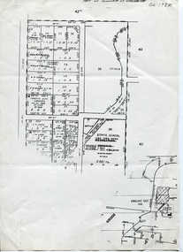
1 sheet. Map 12 of 20 in green folder. Locality Plan. Shows sizes of the blocks, and names of the surrounding streets, Epping State School, Shire Office. Originally inventory states, incl. Epping Station.
11/86. 325600.
map, land for sale, epping
1 sheet. Map 13 of 20 in green folder. Shows sizes of the blocks, names of the surrounding streets, Thomastown Station, Whittlesea Railway, Epping Road and Germain Road. Originally inventory states, incl. Epping Station.
map, thomastown, thomastown station, epping road, whittlesea railway
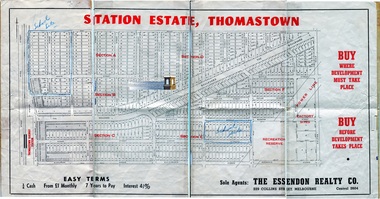
1 sheet, (also second duplicate, original). Maps 14 & 15 of 20 in green folder. Not dated. Sticky tape along fold lines, very fragile joins. Shows Sections A - F, sizes of the blocks, names of the surrounding streets, in close proximity to Thomastown Railway Station.
Sole Agents: The Essendon Realty Co., 229 Collins Street, Melbourne.
map, thomastown, station estate thomastown
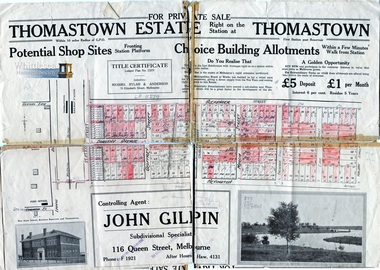
1 sheet, not dated (prior to decimal currency). Map 16 of 20 in green folder. Sticky tape along fold lines, very fragile, has torn along the fold lines. Shows sizes of the blocks, names of the surrounding streets, in close proximity to Thomastown Railway Station.
Title Certificate Lodged Plan No. 11279. Controlling Agent: John Gilpin, Subdivisional Specialist, 116 Queen Street, Melbourne.
map, thomastown, thomastown estate, john gilpin, thomastown railway station
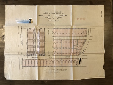
1 sheet. Map 17 of 20 in green folder. Dated December 1926, shows sizes of the blocks, names of the surrounding streets, Mount View Road, Epping Road, Main Street, Pleasant Road, Central Avenue, Highlands Road.
"A" Part of Crown Portion 25, Parish of Keelbundora, County of Bourke. Certificate of Title Volume 5179 Folio 1035791.
map, thomastown, crown portion 25, parish of keelbundora, subdivision, 1926
Green A4 ring binder folder containing maps numbered 1 - 20.
Maps
map, archive, folder
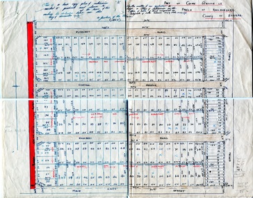
Subdivision of Part of Crown Portion 26, Lalor, Vic. Station Street, Messmate Street, May Street, Cyprus Street and French Street recorded on the map.
Map shows subdivision of blocks numbered 1 - 95, sizes of the blocks, and names of the surrounding streets. Map 1 of 20 in green folder.
Garlick and Stewart, Engineers and Surveyors, Melbourne. LP 40751. Sealed 11 Jul 1956
map, subdivision map, station street, messmate street, may street, cyprus street, french street, lalor
Title in the name of Hornby Fletcher Lowe of 29 Glanfield Street, Northcote, Plumber, Lot 18 on Plan of subdivision 12114, part of Crown portion 25, Parish of Keelbundora County of Bourke, dated 7th January 1942.
1 p. colour
subdivision, northcote, hornby fletcher lowe, highlands road thomastown
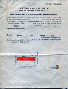
Title in the name of Thomastown Station Subdivisions Propriety Limited of 94 Queen Street, Melbourne, 32 acres being part of Portion 25 at Thomastown, Parish of Keelbundora County of Bourke, dated 18th October 1926.
1 p. colour
subdivision, thomastown, thomastown station subdivisions, epping road, main street thomastown, portion 25 thomastown
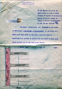
Subdivision of part of Crown Portion 25 Parish of Keelbundora County of Bourke, consent to the width of Mount View Road.
1 p. colour
subdivision, thomastown, thomastown station subdivisions, epping road, main street thomastown, portion 25 thomastown, mount view road thomastown
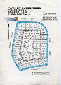
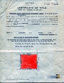
Linton Drive, Milgrove Avenue, Queenscliff Road, Grovedale Close, Thomastown
1 sheet, coloured, copy, undated. Map 18 of 20 in green folder.
Beveridge Williams & Co., P.L.
map, thomastown
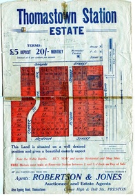
Map shows location of Thomastown Railway Station, Methodist Church, Epping Road, Spring Street, Clarke Street, Newton Street and McLeod Street
1 sheet, double sided, coloured, original. Map 19 of 20 in green folder. Very fragile, sticky tape along fold lines, torn around edges.
Agents: Robertson & Jones, Auctioneer and Estate Agents, Corner High & Bell Sts., Preston
map, thomastown, thomastown station estate, epping road thomastown, thomastown railway, thomastown statiom, land auction, thomastown methodist, spring street thomastown, clarke street thomastown, newton street thomastown, mcleod street thomastown
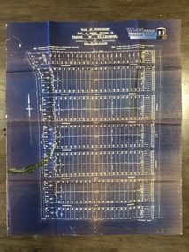
1 sheet, folded. Map 20 of 20 in green folder. Shows sizes of the blocks, between Yan Yean Pipe Track to the west and Plenty Road Bundoora to the east.
J. V. Smith. Photo - lithographed at the Department of Lands and Survey Melbourne by T. F. McGauran. 4.12.07.
map, yan yean pipe track, plenty road bundoora, maroondah aqueduct
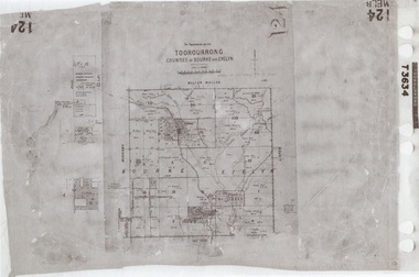
1 map, folding, showing parish boundaries and land ownership.
Photo-lithographed at the Department of Lands and Survey, Melbourne by J. Noone. 26.8.78
map, morang, counties of bourke & evelyn, morang parish
1 map, folding, showing parish boundaries and land ownership.
Photo - lithographed at the Department of Lands and Survey, Melbourne by T. F. McGauran. 11.3.36.
map, toorourrong, counties of bourke and evelyn, toorourrong parish
Coonan's Estate
1 map, folding, showing parish boundaries and land ownership.
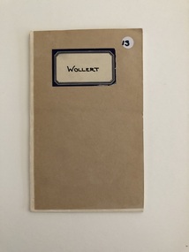
Photo - lithographed at the Department of Lands and Survey Melbourne by J. Noone. 19.8.78
map, wollert, county of bourke, wollert parish, coonan's estate
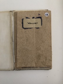
1 map, folding, showing parish boundaries and land ownership.
Photo - lithographed at the Department of Lands and Survey, Melbourne by J. Noone. 19.8.78
map, wollert, wollert parish map, county of bourke
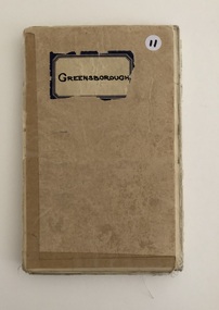
1 map, folding, showing parish boundaries and land ownership.
Drawn and reproduced at the Department of Lands and Survey, Melbourne. 1961.
map, greensborough, county of evelyn, greensborough parish map
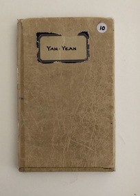
1 map, folding, showing parish boundaries and land ownership.
Photo - lithographed at the Department of Lands and Survey, Melbourne. 21.12. 31. Price 5/-
map, parish of yan yean, counties of evelyn & bourke, yan yean map
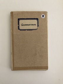
1 map, folding, showing parish boundaries and land ownership.
Drawn and reproduced at the Department of Lands and Survey, Melbourne. 1961.
map, queenstown, queenstown parish, county of evelyn
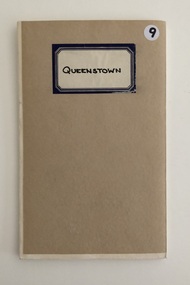
1 map, folding, showing parish boundaries and land ownership.
Drawn and produced at the Department of Lands and Survey, Melbourne. 1961. Price 2/-
map, queenstown, queenstown parish, county of evelyn
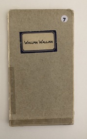
1 map, folding, showing parish boundaries and land ownership, Wallan Wallan, County of Bourke.
Drawn and reproduced at the Department of Lands and Survey, Melbourne, Victoria. October, 1946. Price 2/-
map, wallan wallan, wallan wallan parish map, county of bourke
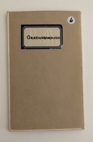
1 map, folding, showing parish boundaries and land ownership.
Drawn and reproduced at the Department of Lands and Survey, Melbourne. 1961.
map, greensborough parish map, county of evelyn
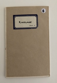
1 map, folding, showing parish boundaries and land ownership.
Drawn and reproduced at the Department of Lands and Survey, Melbourne. 1959.
map, kinglake, kinglake sheet 2, kinglake parish map
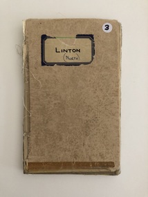
1 map, folding, showing parish boundaries and land ownership.
Drawn and reproduced at the Department of Lands and Survey, Melbourne. 22.1.44.
map, linton north, linton parish map, county of evelyn
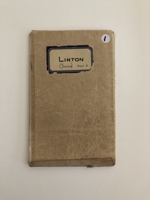
The allotments coloured brown are Freehold.
1 map, folding, showing parish boundaries and land ownership.
Drawn and reproduced at the Dept. of Lands and Survey, Melbourne, Victoria. 17.7.1944.
map, freehold, linton, county of evelyn, linton parish map
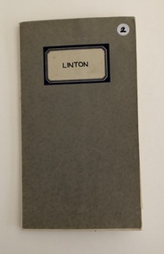
1 map, folding, showing parish boundaries and land ownership.
Drawn and reproduced at the Department of Lands and Survey, Melbourne. 22.1.44.
map, linton south sheet 2, linton parish map, parish map
Photocopy, B & W, 1 A4 sheet, showing parish boundaries and land ownership.
Toorourrong T3634
map, counties of bourke & evelyn, toorourrong, hughes estates
Photocopy, B & W, 1 A4 sheet, showing parish boundaries and land ownership.
Robert Mason, Ass. Surveyor
map, counties of bourke & evelyn, toorourrong, parish of toorourrong, town of whittlesea, sherwins station, george sherwin, sherwin family
Photocopy, B & W, 1 A4 sheet, showing parish boundaries and land ownership.
GL 17291
map, kinglake east, township of kinglake
South Yan Yean is identified on the map which would date this to pre-1913. Originally known as Morang until 1893, then South Yan Yean, the name Mernda was given in 1913.
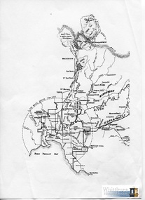
Photocopy, B & W, 1 A4 sheet, showing the ten-mile radius from Melbourne G.P.O.
map, 10 mile radius, south yan yean, mernda map, south yan yean map
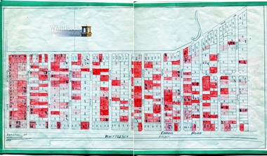
1 sheet, folded in half, Map, shows Portions 1 - 20, sizes of the blocks, and names of landowners.
Drawn and reproduced at the Department of Lands and Survey, Melbourne. 1965. Price 10/-
map, morang map, morang, counties of bourke and evelyn, fitzroy and whittlesea railway
1 sheet, folded, Map, shows street names, shire boundaries. The map has multiple rips and tears along the fold lines.
1953
map, shire of whittlesea map, 1953 map
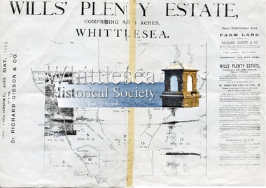
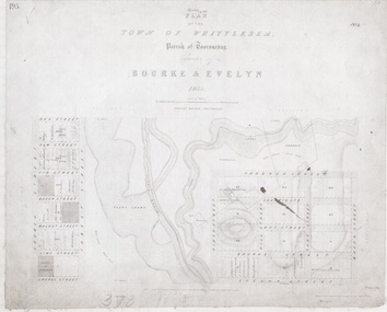
The Will's Plenty Estate containing about 4,056 acres, surrounding the Township of Whittlesea, was originally purchased by Thomas Wills in 1839, and divided into tenant farms. The sale of the Wills Estate was one of the earliest functions conducted in the Whittlesea Mechanics Institiute on Thursday 20th May, 1886. Thomas Wills (1800-1872) was a J.P., and a son of Edward Spencer Wills an influential Sydney merchant. In 1840 he purchased 176 acres of land at the junction of Darebin Creek and the Yarra River, in what is now Alphington, and there he built a two-storey house named 'Lucerne', the grandest home of its day. In later years he built another large home just across the river from Lucerne which he called Willsmere. He was a good friend of Governor La Trobe who is said to have been a frequent visitor.
1 sheet, photocopy, a plan of subdivision showing the sale by auction of allotments with map showing location of tenants and layout. The document has torn along the middle fold line and has sticky tap on it.
Richard Gibson & Co.
wills estate, whittlesea, tenant farm, thomas wills, map of whittlesea, whittlesea mechanics institute, map, whittlesea subdivision
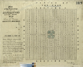
Parish of Yan Yean, includes description of the allotments, for the township of Separation (now Mernda).
1 map, copy
Penrose Nevins, surveyor, Melbourne.
map, township of separation, mernda map, separation map, section 18 morang, county of bourke, morang
1898 Victoria. Department of Mines. Issued by James Travis, Acting Secretary for Mines, under the Authority of the Hon. Henry Foster, M. P., Minister of Mines. Report on the Plenty River Vally. By. H. S. Whitelaw, Assistant Geological Surveyor.
1 sheet, with coloured map, a report on the inspection of the Plenty River Valley to ascertain alluvial deposits. The document has torn along the middle fold line and has sticky tap on it.
whittlesea, map of whittlesea, department of mines, alluvial deposits, jack's creek, report on the plenty river valley
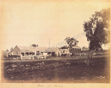
C. 1860’s. Grant’s Morang Hotel, Morang
2019, Bear's Castle, Yan Yean Reservoir
Whittlesea State School No. 2090 (date unknown)
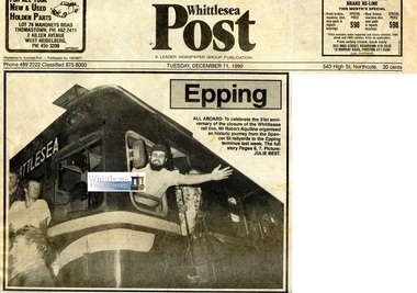
To celebrate the 31st anniversary of the of the closure of the Whittlesea rail line, Robert Aquilina organised an historic journey from the Spencer Street railyards to the Epping terminus.
3 pages newsprint with images.
Epping All Aboard
whittlesea rail line, robert aquilina, epping rail terminus, number 55 rail motor, mrs rosemary hall, ray jeffrey, arthur jeffrey, ken jeffery
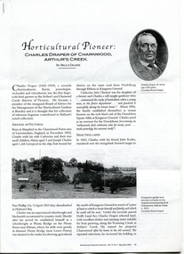
Horticultural Pioneer Charles Draper of Charnwood, Arthurs Creek. By Bruce Draper. Published in Australian Garden History Vol. 15 No. 5 May/June 2004.
6 pages photocopied.
Horticultural Pioneer Charles Draper of Charnwood, Arthurs Creek. By Bruce Draper.
charles draper, draper family, bruce draper, charnwood arthurs creek, fruit grower, reid family
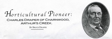
Horticultural Pioneer Charles Draper of Charnwood, Arthurs Creek. By Bruce Draper. Published in Australian Garden History Vol. 15 No. 5 May/June 2004.
.pdf document
Horticultural Pioneer Charles Draper of Charnwood, Arthurs Creek. By Bruce Draper.
charles draper, draper family, bruce draper, charnwood arthurs creek, fruit grower

A newspaper article on the restoration of the historic Farm Vigano in South Morang. Florentino chef Guy Grossi agreed to become a patron of Farm Vigano.
Historical building of South Morang.
1 page newsprint with coloured images.
Chef joins Vigano fight
farm vigano, vigano family, south morang, maria theresa vigano, mario vigano, italian immigrants, guiliana mercoli
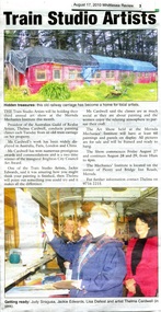
A newspaper article on the Train Studio Artists holding their third annual art show at the Mernda Mechanics Institute.
1 page newsprint with coloured images.
Train Studio Artists
train studio artists, mernda, mernda mechanics institute, old train carriage, judy siragusa, jackie edwards, lisa dallest, thelma cardwell
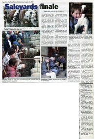
A newspaper article on the closure of the livestock market site at Mernda.
History of Australian Agriculture
1 page newsprint with coloured images.
Saleyards finale
mernda market, mernda saleyards, rod carnegie, quiney family, quiney mawbey, thomas beesely
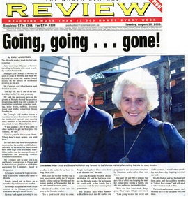
A newspaper article on the closure of the livestock market site at Mernda. Allan Lloyd from Beveridge and Bessie McMahon of Kinglake are pictured attending the last day of the market.
1 page newsprint with coloured image.
Going going gone
mernda market, mernda saleyards, rod carnegie, allan lloyd, bessie mcmahon
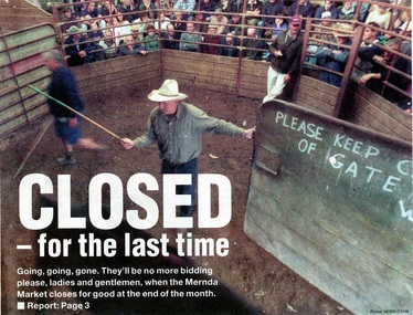
A newspaper article on the closure of the 117-year-old livestock market at Mernda.
Historic buildings of Mernda.
2 pages newsprint with coloured images.
Closed for the last time
mernda market, mernda saleyards, rod carnegie, quiney family, neil clark
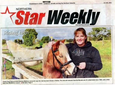
A newspaper article on the relocation of the Findon Pony Club from the Mernda site with some financial assistance from the Whittlesea Council.
The Findon Pony Club have been at the Mernda site since 1965.
2 pages newsprint with coloured images.
Kelly House Rescued
findon pony club, bernice muldoon
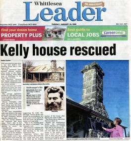
A newspaper article on stabilisation works on Ned Kelly's childhood home in Beveridge by heritage architects.
1 page newsprint with coloured images
Kelly House Rescued
ned kelly house, kelly house at beveridge, beveridge, john kelly, sharon consiglio
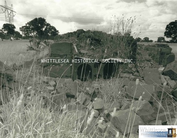
One of a series of photographs taken in 1988-1989 around the Shire of Whittlesea by Evan Meades.
Photograph print also digital image.
Zimmer Farmhouse Wollert Apr 89.
evan meades collection, wollert, zimmer farmhouse, zimmer family
One of a series of photographs taken in 1988-1989 around the Shire of Whittlesea by Evan Meades.
Photograph print also digital image.
Zimmer Farmhouse Wollert Apr 89.
evan meades collection, wollert, zimmer farmhouse, zimmer family
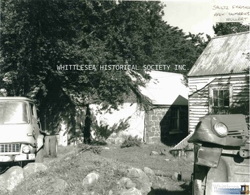
One of a series of photographs taken in 1988-1989 around the Shire of Whittlesea by Evan Meades.
Photograph print also digital image.
Zimmer Farmhouse Wollert May 89.
evan meades collection, wollert, zimmer farmhouse, zimmer family
One of a series of photographs taken in 1988-1989 around the Shire of Whittlesea by Evan Meades.
Photograph print also digital image.
Zimmer Farmhouse Wollert April 89.
evan meades collection, wollert, zimmer farmhouse, zimmer family
One of a series of photographs taken in 1988-1989 around the Shire of Whittlesea by Evan Meades.
Photograph print also digital image.
Zimmer Farmhouse Wollert May 89.
evan meades collection, wollert, zimmer farmhouse, zimmer family
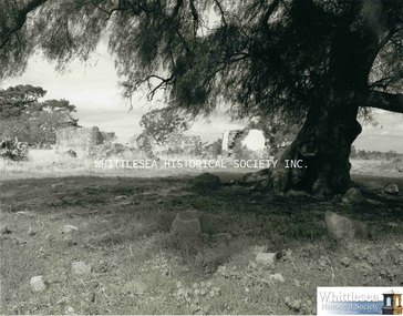
One of a series of photographs taken in 1988-1989 around the Shire of Whittlesea by Evan Meades.
Photograph print also digital image.
Shultz Farmhouse Apex Quarries Wollert July 89
evan meades collection, wollert, shultz family, shultz farmhouse, apex quarry wollert, bluestone house
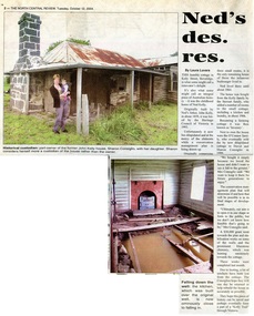
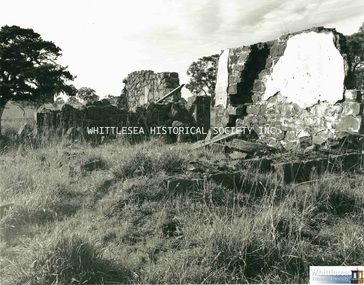
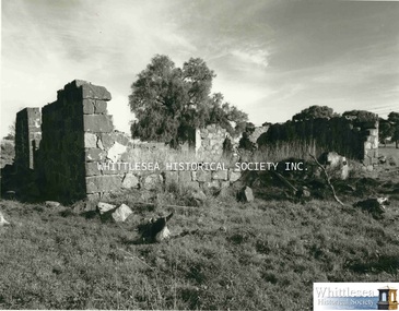
An article on the dilapidated state of the original childhood home of Ned Kelly, in Kelly Street, Beveridge. Originally built by Ned's father, John Kelly, in about 1859, and now part-owned by Sharon Consiglio.
1 page newsprint with 2 coloured images
Ned's des. res.
ned kelly house, kelly house at beveridge, beveridge, john kelly, sharon consiglio
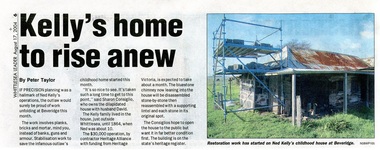
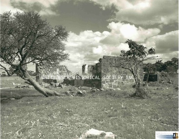
Stabilisation work to save Ned Kelly's childhood home in Beveridge.
1 page newsprint with image
Kelly's home to rise anew.
ned kelly house, kelly house at beveridge, beveridge
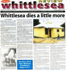
The original Whittlesea Primary School was torn down on 7 August 2010.
Historical building in Whittlesea since demolished.
Newsprint 1 p. text with colour photograph.
Whittlesea dies a little more
whittlesea primary school, demolished
A giant pine tree blew over at the Thomastown Lutheran Church Cemetery and obliterated the tombstones of the Shultz and Siebel plots. Sylvia Shultz and her son Paul, descendants of both settlers, are pictured.
Newsprint 1 p. text with colour photograph.
Australia Day honour for Whittlesea legend, Les Russell.
thomastown lutheran church cemetery, shultz family, siebel family, sylvia shultz, paul shultz
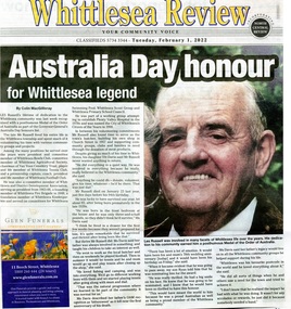
Les Russell was posthumously awarded a Medal of the Order of Australia as part of the Australia Day honours list.
Newsprint 1 p. text with colour photograph.
Australia Day honour for Whittlesea legend, Les Russell.
les russell, russell family, order of australia, whittlesea, australia day honour
Les Russell was posthumously awarded a medal of the Order of Australia for his services to the community of Whittlesea.
Newsprint 1 p. text with colour photograph.
les russell, russell family, order of australia, whittlesea
A4 print copy of photograph
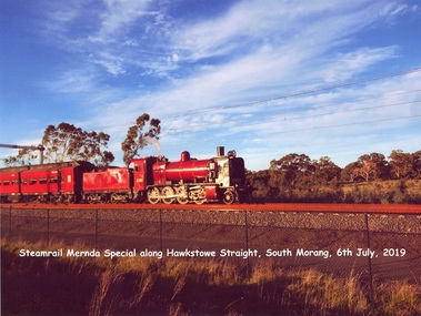
Steamrail Mernda Special along Hawkstowe Straight, South Morang, 6th July, 2019
steam train, mernda
Lindsay Mann recalls his memories of the day it snowed at Yan Yean on July 19, 1951.
Stapled 3 pages and .pdf file.
The Magic of Snow! A Tribute to School Days at Yan Yean Primary. By Lindsay Mann.
lindsay mann, yan yean school, snow at yan yean, snow, 1951
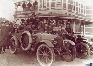
Photograph showing members of the Carlton Football Club with two cars outside the Commercial Hotel in South Morang.
A4 print copy of photograph
a. g. baldwin, commercial hotel south morang, pub, hotel, cars, carlton football club
The foundation stone of a new bridge over the Plenty River at Morang (now Mernda) was laid by Mrs. John Wilton of Wilton Vale, in August 1866. The silver trowel was presented to Mrs. Wilton by Moses Thomas, chairman of the road board. The bluestone bridge was officially opened by Moses Thomas on the 12th of February 1867.
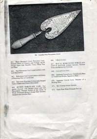
The location of the silver trowel in this rare image is unknown.
A4 single page (double sided) with image and a list of items numbered 461 - 495.
Item 486. Important Australian Silver Presentation Trowel., inscribed "Presented to Mr John Wilkin of Wilkin Dale Morang on the Occasion of the Laying of the Foundation Stone, the Bridge of the Plenty River at the Junction of the Parishes of Morang and Yan Yean by the Morang District Road Board, August 1866, Fine Engraved Scroll Decorated Border, Turned Ivory Handle, Maker R. R. Illustrated Page 27.
silver trowel, morang bridge, mernda bridge, john wilton, wilton family, moses thomas, wilton vale
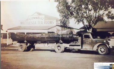
Gordon Keith's truck carting a log outside Connell's Whittlesea Tea Rooms in Whittlesea. After leaving the air force when World War II ended, Gordon Keith started driving trucks. He carted logs and sawn timber from Kinglake, Yea, and Murrindindi to Whittlesea Sawmill, Grange Timber in Northcote, and Fairfield Paper Mills.
Photograph print
gordon keith, federal truck, whittlesea tea rooms, connell family, keith family
Victorian Collections acknowledges the Australian Aboriginal and Torres Strait Islander peoples as the first inhabitants of the nation and the traditional custodians of the lands where we live, learn and work.