


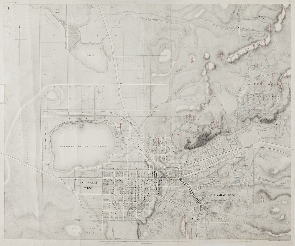
Historical information
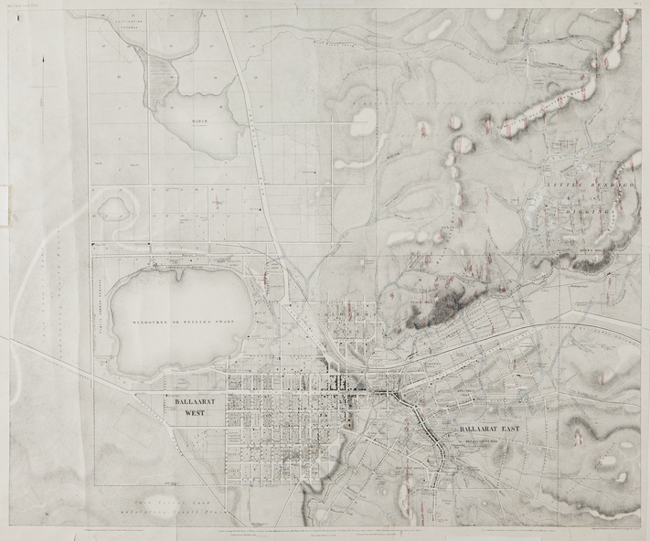
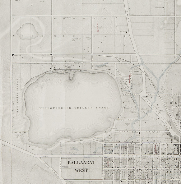
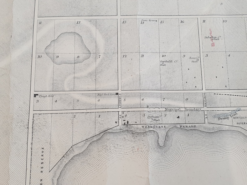
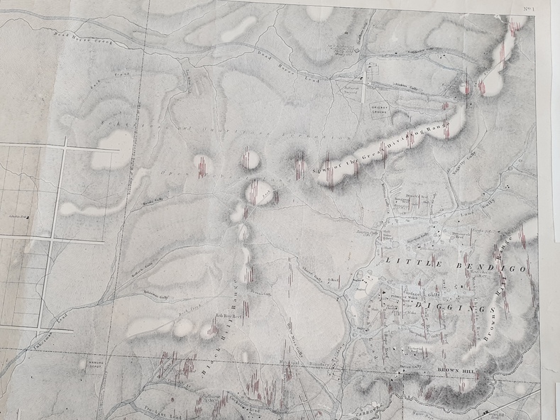
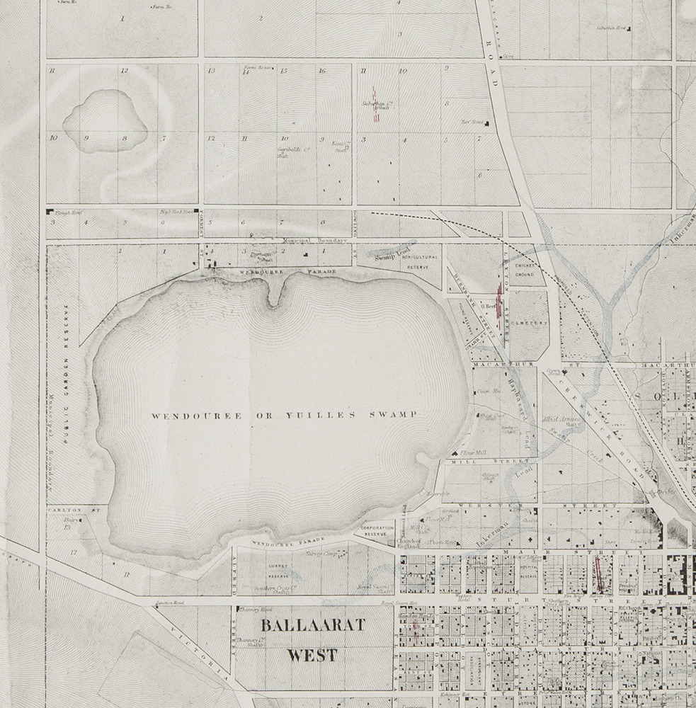
A party of surveyors camped by Yuille's Swamp (later Lake Wendouree) and surveyed the countryside for a map to be produced by the Geological Survey of Victoria.
In November 2004 the Central Highlands Regional Library presented a special edition of 200 copies of the 1861 map reproduced from a copy in their collection.
Physical description
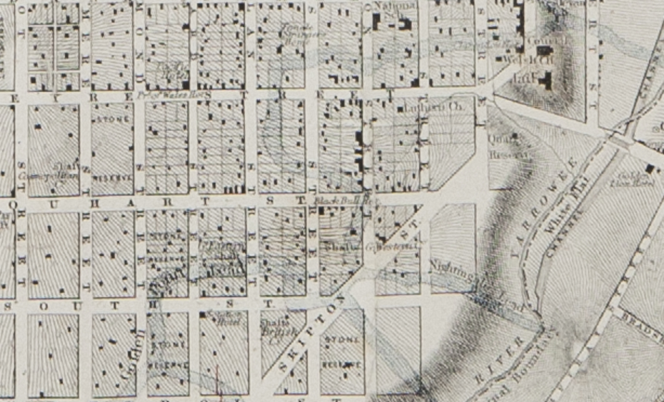
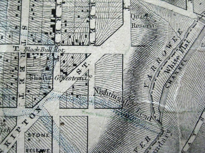
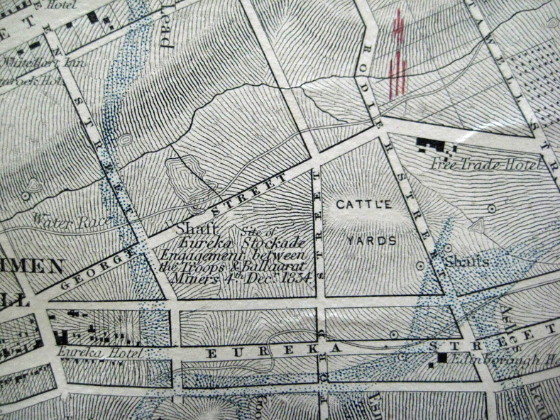
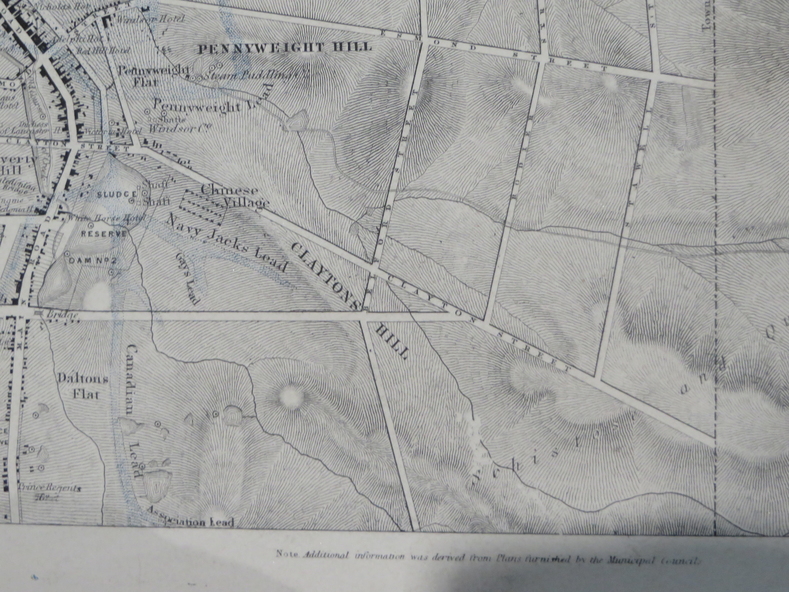
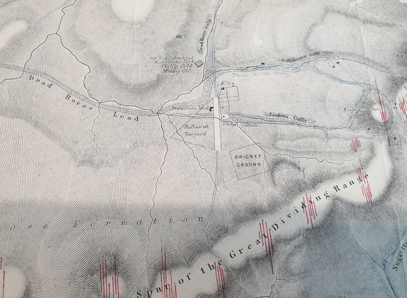
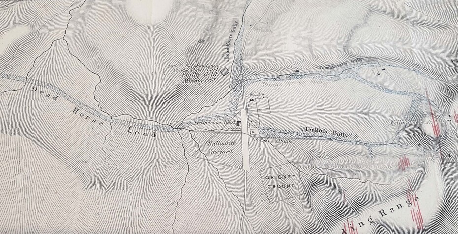
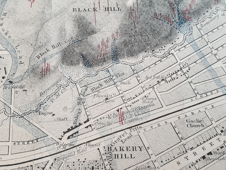
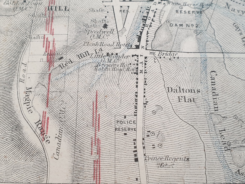
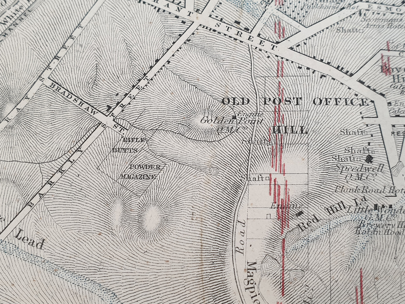
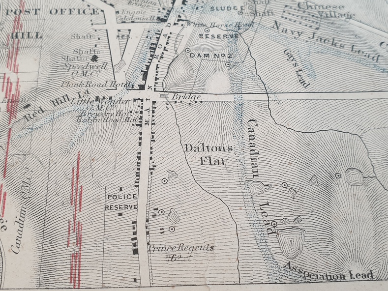
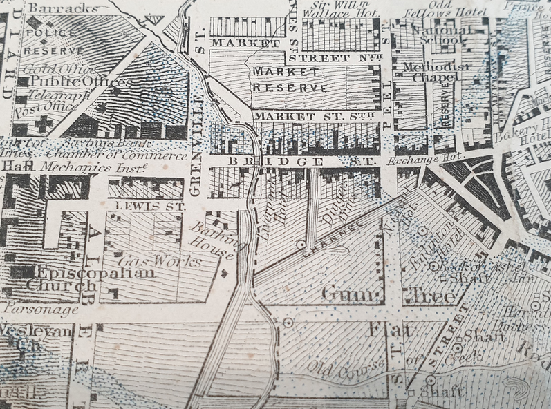
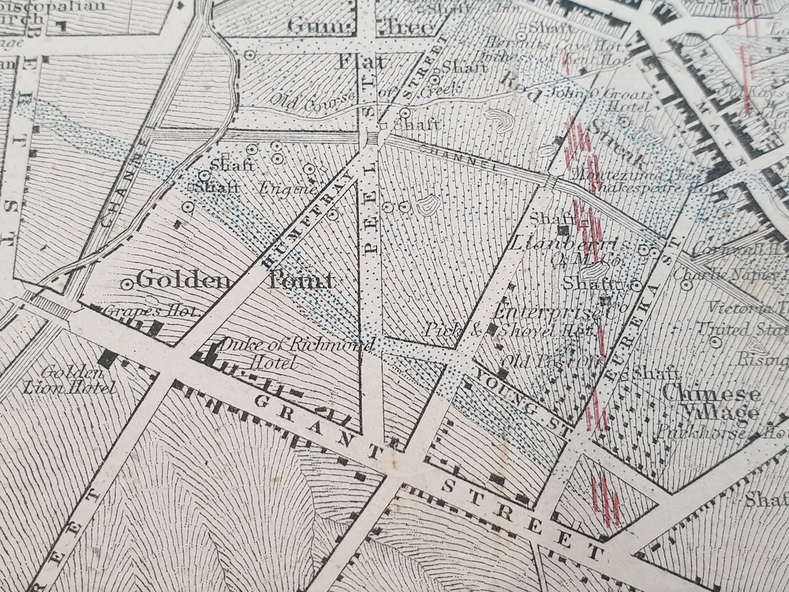
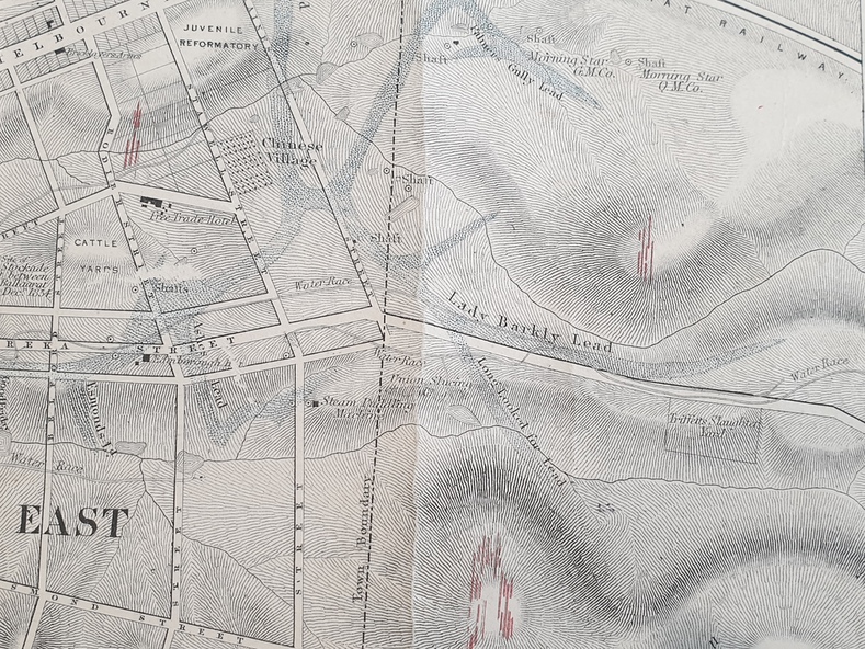
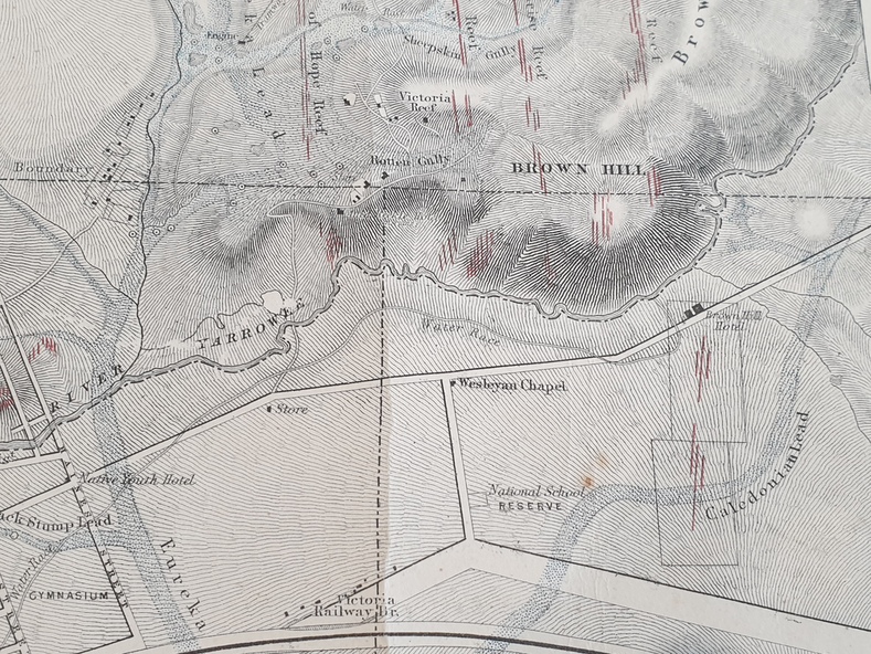
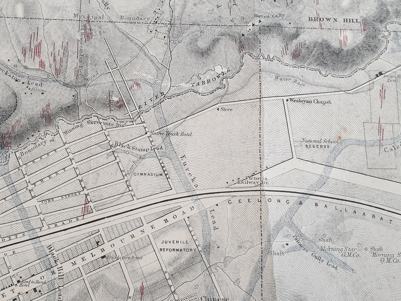
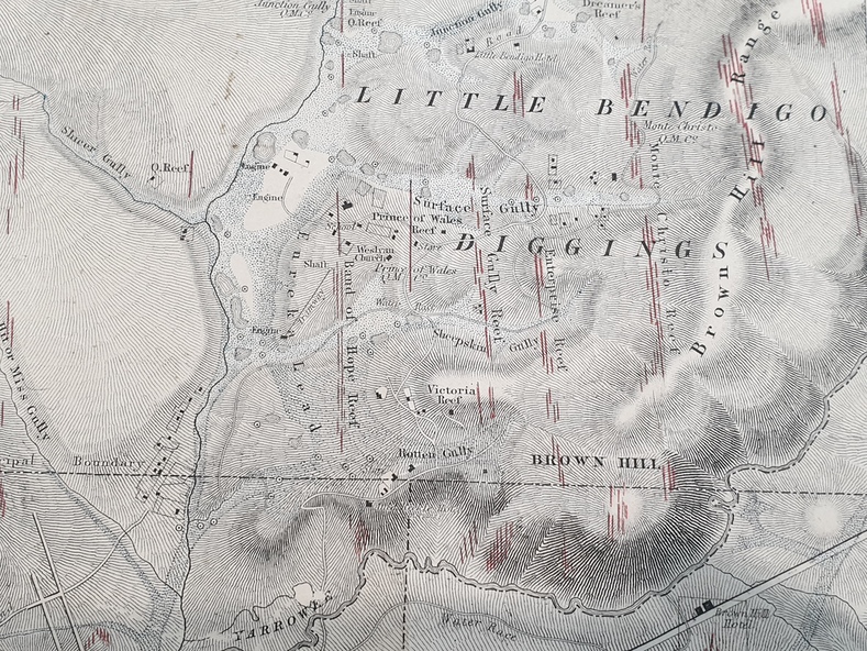
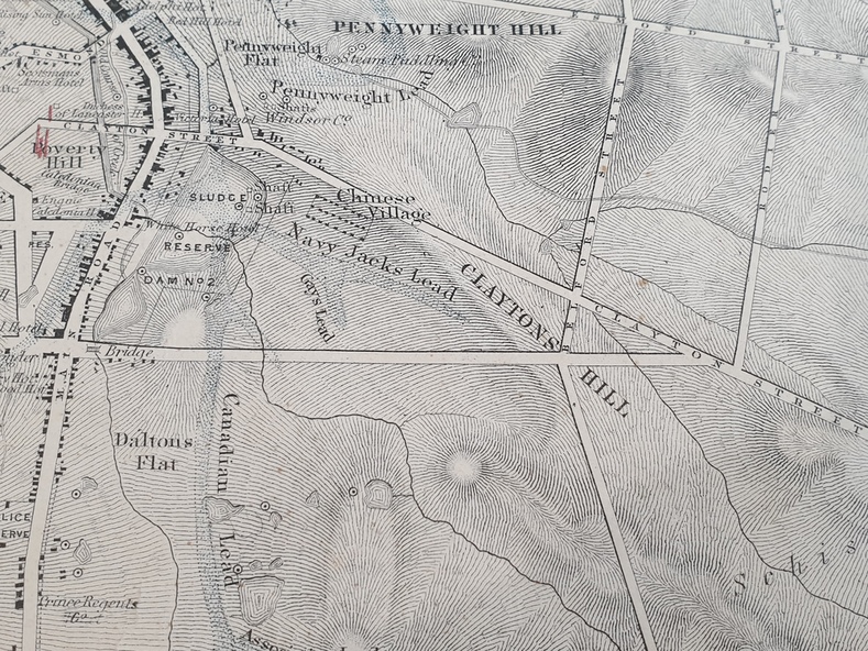
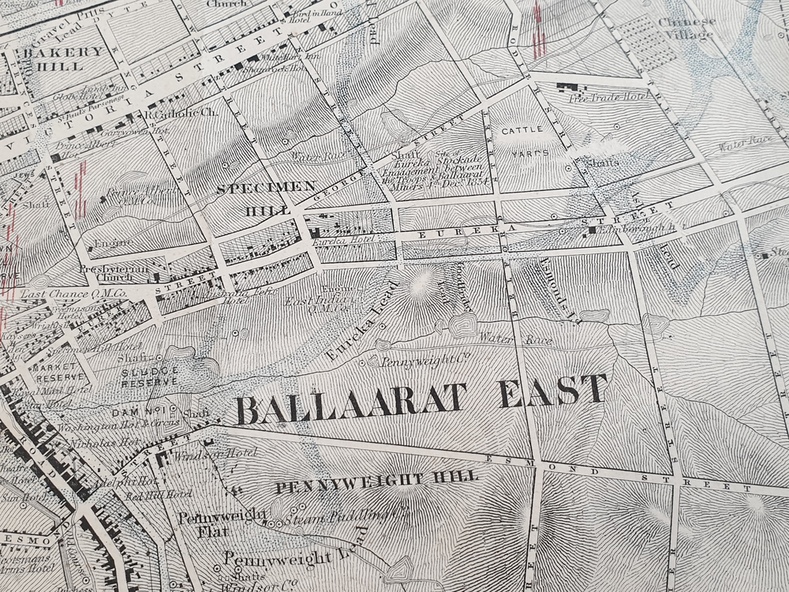
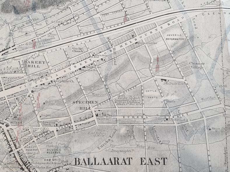
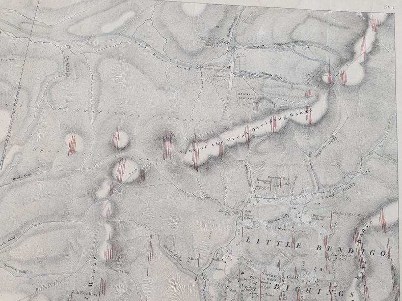
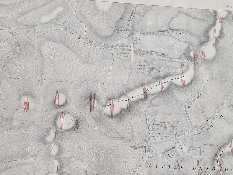
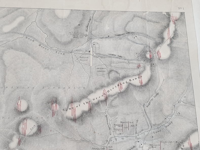
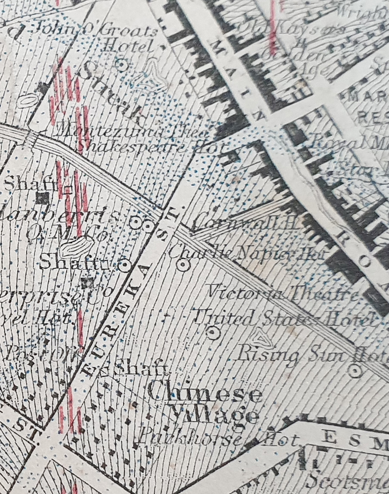
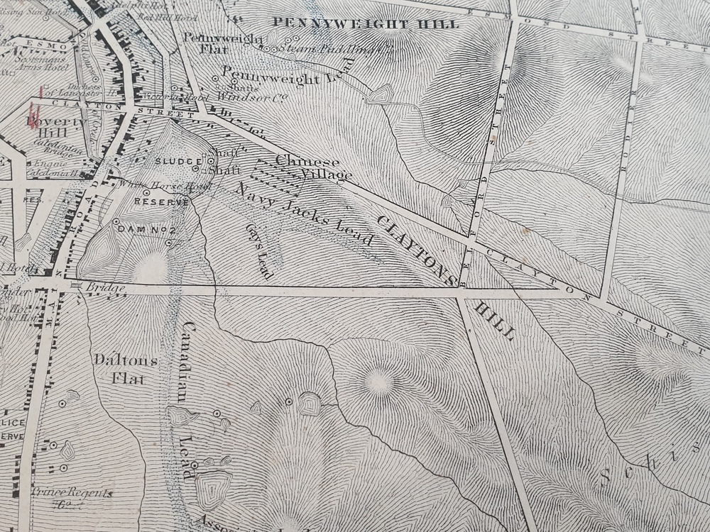
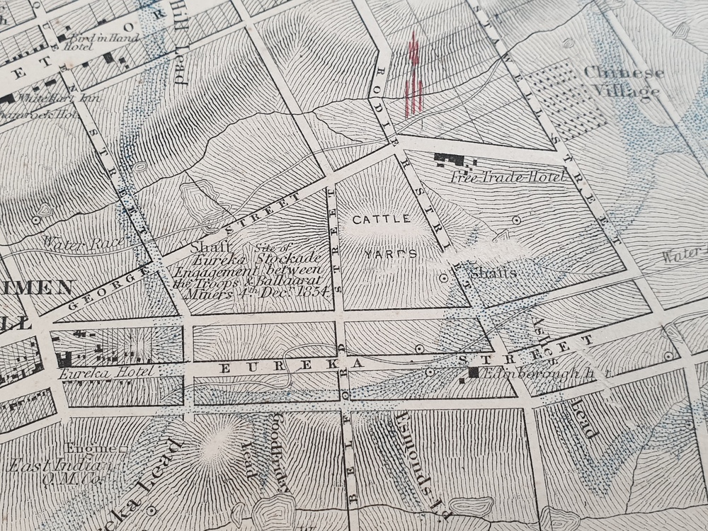
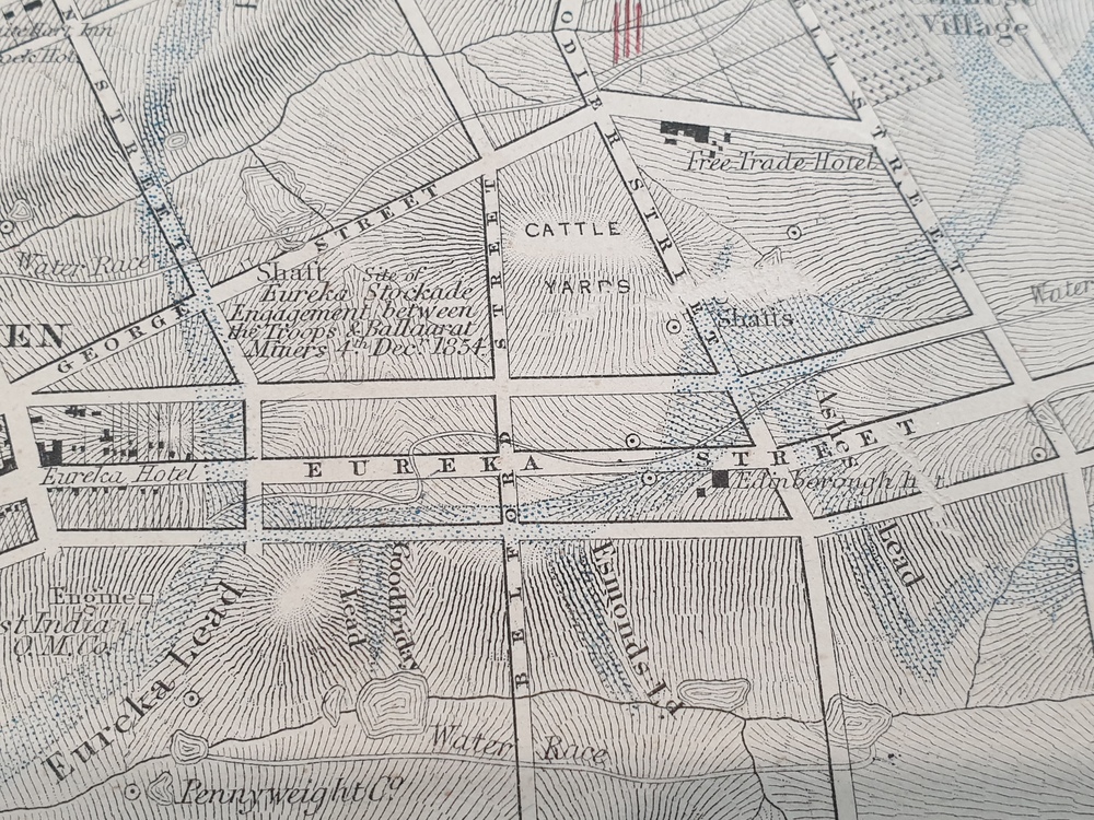
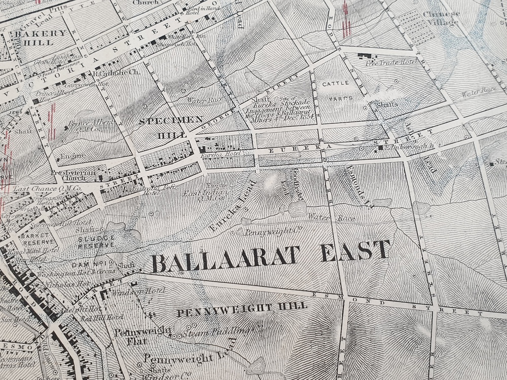
Original 1861 map of Ballarat showing streets and leads. Blue dots indicate gold leads, and red lines indicate auriferous quartz reef and outcrops of quartz veins.
Inscriptions & markings
"Compiled & Drawn from the Survey of Mining Surveyors Davidson, Fitzpatrick and Cowan & the Plans in the Surveyor General's Office by J. Brahe, 21st October 1861. R. Brough Smyth, Secretary for Mines. The Honourable J.B. Humffray, M.L.A. Commr of Mines.”
Subjects
- ballarat,
- map,
- ballarat east,
- lake wendouree,
- survey,
- mines,
- robert davidson,
- ballarat gold field 1861,
- yuille's swamp,
- wendouree swamp,
- little bendigo diggings,
- gold leads,
- old post office hill,
- specimen hill,
- bakery hill,
- black hill,
- dead horse creek,
- brown hill,
- pennyweight hill,
- clayton hill,
- soldiers hill,
- golden point,
- gum tree flat,
- white flat,
- poverty hill,
- chinese village,
- robert brough smyth,
- ballarat map 1861,
- ballaarat vineyard,
- dead horse gully,
- deadhorse creek,
- invermay,
- black hill flat,
- gaelic church,
- police reserve,
- magpie range,
- dalton's flat,
- caadian lead,
- rifle butts,
- powder magazine,
- bathing house,
- government camp,
- gold office,
- chinese,
- llanberrris,
- victoria theatre,
- charlie napier hotel,
- united states hotel,
- grape's hoel,
- clayton's hill,
- cattleyard hill,
- free trade hotel,
- esmond lead,
- bakery hill,
- black hill lead,
- juvenile reformatory,
- ballarat orphanage,
- lady barkly lead,
- triffet's slaughter yard,
- little bendigo,
- melbourne road