E.J. Barker is a past principal of the School of Mines Ballarat and the Library at the Mt Helen Campus is named after him. School of Mines is a predecessor of Federation University
Letters, Reports Plans, Ephemera and Clipboard associated with E.J. Barker and the School of Mines Ballarat
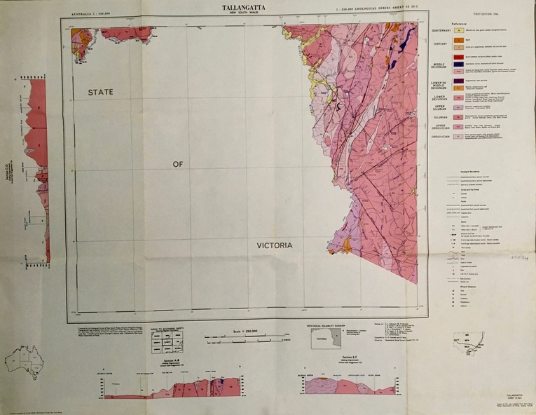
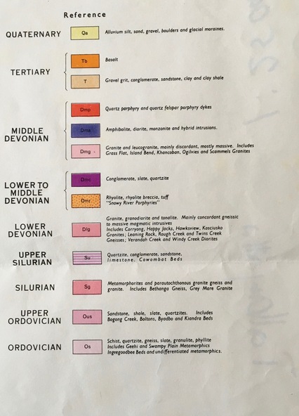
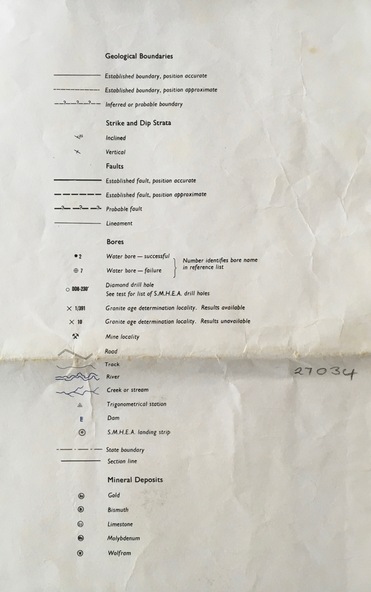
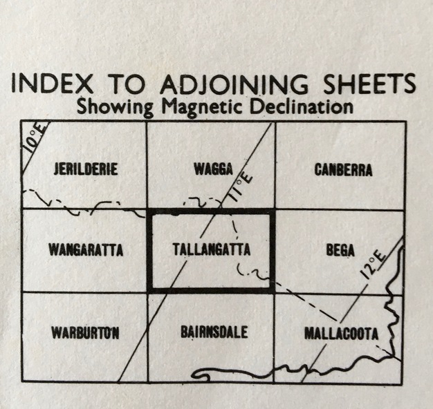
planning requirements, individual rooms, dr ron wild, school of mines and industries ballarat, institute profile, location map, university of ballarat, campus plan, great hall/arts complex, notes, 1970-72 building program, operations and decisions, report to council, visit by principal, priorities, electrical engineering, mt helen, minutes of special council meeting, university of melbourne, engineering, mt helen development report, administration building, technical art school, former ballarat gaol, the court house, smb community centre, trust news, articles, discovery day, k.j. flecknoe, retirement, membership of sub committee, n.a crouch, e.j. barker, k.l. cross, w.j. gribble, l.f.j. hillman, r.c lovett, d. nicholson, g. robertson, p.r. shiells, b. tanner, r. feary, i. harris, b.c. mclennan, m. stevens, t.a. wiseman, d.r. bolster, p.h. dixon, r. dunlop, r. furness, e.j. lumsdon, a. mccaffrey, p.r. davies, d. farnsworth, j. harrison, k. mcfarlane, j. mills, s.a. mendelson, i. robinson, d.j. fraser, j. van dreven, k. alsop, b. bridges, m. palmer, r. sutton, l. snibson, h. van hammond, t. runnalls, p. sculley, g. shearer, t. slater, michael ronaldson, robert lovett, edward john barker, e.j. barker building, council membership, clipboard, n.g curry, state college of victoria, articles of association, memorandum, australian conference of principles of colleges of advanced education, commonwealth ministerial working party, victorian post secondary education commission, australian institute of physics symposium, royal australian institute of public administration, premier of victoria, r.j. hamer, m.b. john, new south wales institute of technology, phone messages, peter o'loughlin, annual report, signing of agreement, position description, certificates, fifth form