


Historical information
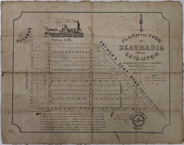
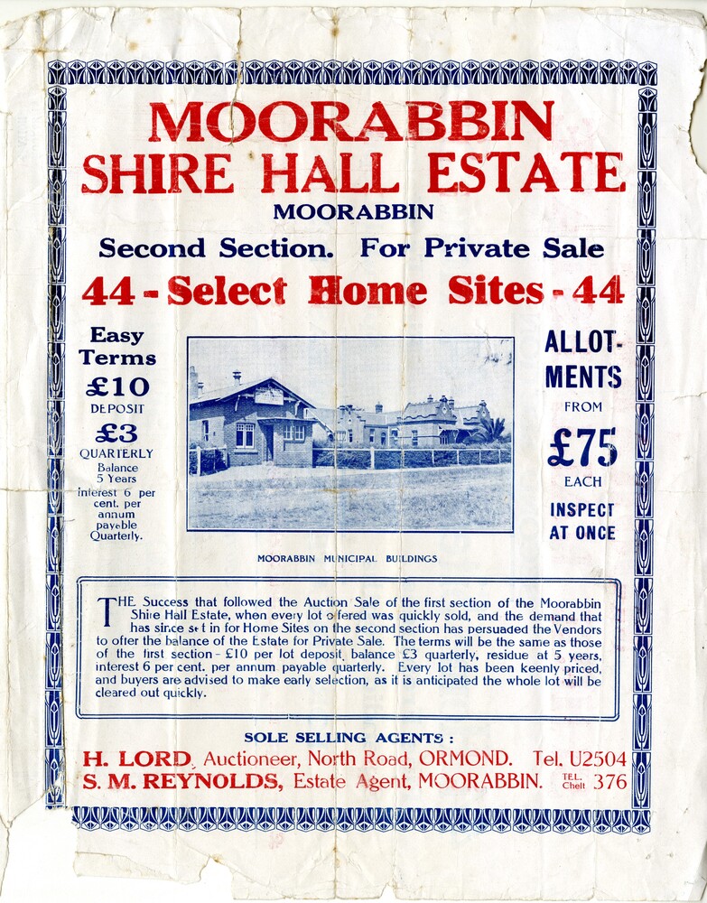
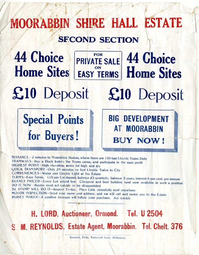
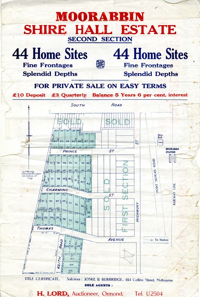
Sales plan for land in the suburb of Moorabbin, bounded by South Road and Highbury Street, including Prince Street, Charming Street, Thomas Avenue and Keith Road.
Significance
The developing urban area of Moorabbin within the City of Kingston. This land sale pamphlet illustrates the subdivision of land within the municipality and the changing demographic of the district as new houses are constructed close to infrastructure.
Physical description
Colour pamphlet advertising for private sale the Moorabbin Shire Hall Estate, Moorabbin. Incorporates a map of the estate bordered by South Road and Highbury Street, including Prince Street, Charming Street, Keith Road and Thomas Avenue.
Inscriptions & markings
Handwritten in grey pencil on subdivision map below subdivision 63: £4
Handwritten in grey pencil on subdivision map below subdivision 66: 4
Handwritten in grey pencil on subdivision map below subdivision 80: 3.
Handwritten in grey pencil on subdivision map below subdivision 81: 4
Handwritten in grey pencil on subdivision map below subdivision 83: 2
Handwritten in grey pencil on subdivision map below subdivision 96: £3
Handwritten in grey pencil on subdivision map below subdivision 97: 3
Handwritten in grey pencil on subdivision map to the left of subdivision 102: 3
Handwritten in grey pencil on subdivision map on the corner of Thomas Avenue and Highbury Street: vertical line next to a square with a cross in it.


