-
 University of Melbourne, Burnley Campus Archives
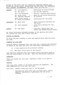
Plan, VCAH Burnley College - Site Plan Fire Services Survey, 1991
Plan with Buildings named, External Hydrant Sources and Main Entry Points marked. Scale 1:1000. Dated January 1991.vcah, burnley, fire safety -
Glenelg Shire Council Cultural Collection
Administrative record - Police Report - Criminal Offence Cattle Stealing Branxholme, Victoria, 15/05/1912
Hand written supplementary Police Report of Criminal Offence - cattle stealing, Branxholme police station -
 Stawell Historical Society Inc
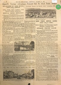
Archive - Newspaper Supplement, The Sun News Pictorial - Stawell's Various Advantages pointed out to Ideal Town Judges
Promotional Material for Ideal Town CompetitionPage 18 Wednesday October 21 1931tourism -
 Ringwood and District Historical Society
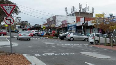
Archive, Heathmont History Collection (Parent record)
This is the parent record for the RDHS collection of Heathmont material. -
Kew Historical Society Inc
Archive (series) - Subject File, Kew, City of - Amalgamation, 1994
Various partiesReferenceKHS OrderThe City of Kew was amalgamated into the City of Boroondara in 1994. The new city comprised the former Cities of Hawthorn, Kew and Camberwell. This archive file contains primary sources and publications relating to the amalgamation. The earliest item in the file is a newspaper article/clipping from the Eastern Standard (1986) recording a request from Hawthorn Council to Kew Council to consider amalgamating. The file also includes other newspaper articles/cuttings (some undated) reporting on opposition to the amalgamation. An interesting item in the file is a photocopy of a coloured digital photograph of the members of the last Kew Council. [The original still has to be discovered]. The file also contains a commemorative edition of Kewriosity [magazine] (1994), which lists all the chairmen and mayors of Kew (1861-1994) and three copies of the City of Kew Final Commemorative Council Meetingb14 June 1994. kew - history, local government - amalgamations - kew (vic) - boroondara (vic)kew - history, local government - amalgamations - kew (vic) - boroondara (vic) -
 Federation University Historical Collection
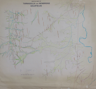
Plan, Sketch Map of Tarnagulla and Newbridge Goldfields, 1979
Pmap on paper with hand colouringtarnagulla, newbridge, map -
Port Melbourne Historical & Preservation Society
Plan - Annotated and handcoloured by Peter Libbis to indicate his research into Libbis family residences and hotels on copy of a section of an MMBW map, Melbourne and Metropolitan Board of Works, c. 1980s
Peter LIBBIS obtained these copies from the MMBW when he researched his family history in the 1980s. He has annotated them, colour in hotels etc. Donated to Society in 1997.One of a group of 19 photocopies of various 20th century MMBW plans, annotated/coloured in to indicate residences of Libbis family and local hotels, by Peter LIBBIS in family and hotel research - Harper's and lagoon, 1950s?business and traders - hotels, built environment - domestic, transport - railways, melbourne and metropolitan board of works, libbis family -
Port Melbourne Historical & Preservation Society
Archive - Alan Mathews and family
The Mathews family have been in continuous ownership of 395 Howe Parade (was 8 Howe Parade until 1964 when addresses re-assigned), Port Melbourne from 1938 to the present (Sept 2019)Six folders of assorted documents relating to the life of Alan Mathews and his family. Details of insurances and purchases Letter from Eagle Star Insurance Co Ltd re purchase at James McEwan & Codomestic life, alan mathews -
Lakes Entrance Regional Historical Society (operating as Lakes Entrance History Centre & Museum)
Administrative Record, 1958
hard cover, 164 pages, pages 1-70 have been used, some loose leaf pages inserted inside front cover. TSHS 400Minute book produced by Lakes Entrance Carnival Committeeminute books -
Moorabbin Air Museum
Plan (item) - C.A.C Single Seat Fighter XP46
-
 Kew Historical Society Inc
Plan, Melbourne & Metropolitan Board of Works : Borough of Kew : Detail Plan No.1591, 1905
The Melbourne and Metropolitan Board of Works (MMBW) plans were produced from the 1890s to the 1950s. They were crucial to the design and development of Melbourne's sewerage and drainage system. The plans, at a scale of 40 feet to 1 inch (1:480), provide a detailed historical record of Melbourne streetscapes and environmental features. Each plan covers one or two street blocks (roughly six streets), showing details of buildings, including garden layouts and ownership boundaries, and features such as laneways, drains, bridges, parks, municipal boundaries and other prominent landmarks as they existed at the time each plan was produced. (Source: State Library of Victoria)This plan forms part of a large group of MMBW plans and maps that was donated to the Society by the Mr Poulter, City Engineer of the City of Kew in 1989. Within this collection, thirty-five hand-coloured plans, backed with linen, are of statewide significance as they include annotations that provide details of construction materials used in buildings in the first decade of the 20th century as well as additional information about land ownership and usage. The copies in the Public Record Office Victoria and the State Library of Victoria are monochrome versions which do not denote building materials so that the maps in this collection are invaluable and unique tools for researchers and heritage consultants. A number of the plans are not held in the collection of the State Library of Victoria so they have the additional attribute of rarity.Original survey plan, issued by the MMBW to a contractor with responsibility for constructing sewers in the area identified on the plan within the Borough of Kew. The plan was at some stage hand-coloured, possibly by the contractor, but more likely by officers working in the Engineering Department of the Borough and later Town, then City of Kew. The hand-coloured sections of buildings on the plan were used to denote masonry or brick constructions (pink), weatherboard constructions (yellow), and public buildings (grey). That area of Kew bordered by Cotham Road, Park Hill Road, Ermington Lane (now Ermington Place), and Belmont Avenue contained some of the significant homes owned by Kew pioneers. Chief among these was ‘Park Hill’ on an enormous lot facing Park Hill Road. The Jubilee History of 1910 noted, six years after this plan was drawn, that: ‘Park Hill Road, forming the southern boundary of the cemetery, takes its name from Park Hill, the residence of Mr. Thomas Judd, who has resided there since December, 1852.’ Other named houses on the plan include ‘Ferndale’ facing Cotham Road; ‘Ermington’ adjacent to Judd’s Park Hill, facing Park Hill Road; and ‘Gilden’ and ‘Mont Belmont’ facing Belmont Avenue. Mont Belmont was designed by the architectural firm of Reed, Henderson and Smart for William George Lilley in 1887 and was completed in 1888. Lilley was Mayor of Kew in 1887-88, a Justice of the Peace and a member of the first Board of Guardians of Kew’s St. Hilary’s Church of England.melbourne and metropolitan board of works, detail plans, survey plans - borough of kew, mmbw 1591, cartography -
University of Melbourne, Burnley Campus Archives
Administrative record, Victorian College of Agriculture and Horticulture, Accreditation of Tertiary Awards, 1987-1988
re-accreditation, victorian college of agriculture and horticulture, vcah, awards -
Stawell Historical Society Inc
Archive, Shares Account Book 1870 – 1890, 1870 - 1890
Handwritten Mining Detailsstawell, mining -
Port Melbourne Historical & Preservation Society
Plan - Raglan Street, Port Melbourne, Borough of Sandridge, 1890s
Plan of Raglan Street showing longitudinal section.Chas Clay (Borough Surveyor):E. Clark (Town Clerk):John Clang (Contractor ?)raglan street, engineering - roads streets lanes and footpaths, town clerks, charles clay, edward clark -
 Bendigo Military Museum
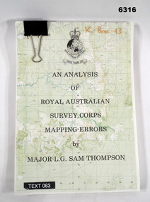
Administrative record - An analysis of Royal Australian Survey Corps mapping errors by Major LG Sam Thompson, Major LG Sam Thompson US Army Corps of Engineers at Army Survey Regiment, circa 1978
The purpose of the report is to analyze and study the map making procedures at the Army Survey Regiment to quantify the accuracy of the mapping to see if they meet acceptable accuracy standards. This was achieved through the study of possible errors.A4 loose leaf booklet held together with a "bulldog" paper clip. Cover part of an a RASvy 1:50,000 map. 1x Cover, 7x Introductory pages, 103x report pages.Marked on front cover "X - Box - 13", "TEXT 063"royal australian survey corps, rasvy, fortuna, army survey regiment, army svy regt, asr -
 Vision Australia
Administrative record - Text, Minutes of the White Cane Day Committee 1981, 1981
Minutes of the third White Cane Day organising committee, led by Bryan Sitlington.22 pages of typed meeting minutes on white paperwhite cane day, guide dogs for the blind association victoria, allen egerton, bryan sitlington, jennie lawrey, royal victorian eye & ear hospital, villa maria society, ross johnstone, val whitehead, mark jones, phyllis gration, adrienne kemp, jennifer gordon, national federation of blind citizens, royal victorian institute for the blind, braille and talking book library, association for the blind -
Glenelg Shire Council Cultural Collection
Plan - Ship Plan / Mould, n.d
Wooden pattern for mould for boat fitting. Flat, rectangular, rounded edges. Two halves of a 3cm diameter cylinder attached to either side of rectangle, about 12cm in from one long edge. Hollow cylinder 7.8cm diameter attached to either end of 'split' cylinder, 3cm cylinder fitted into hollow cylinders. Painted white. -
Glenelg Shire Council Cultural Collection
Administrative record - ACCOUNT BOOK, c. 1969
Page from account book, for Portland Saddlery 16 Gawler St. 1969 Dr. to H.L. Vivian Saddler & harness maker. Account blanksaddlery, industry, trade, vivian -
Glenelg Shire Council Cultural Collection
Administrative record - Port of Portland 26th Annual Report for the year ended June 30, 1977, Osborn Mannett, 1977
Formerly Bower Bird Museum, Sherwoodport of portland -
Moorabbin Air Museum
Plan (Item) - Assorted plans/schematic drawings RAAF, Assorted plans/schematic drawings
RAAF -
 Kew Historical Society Inc
Plan - Subdivision Plan, Cotham Vale Estate, 1919
Pru Sanderson, in her groundbreaking ‘City of Kew Urban Conservation Study : Volume 2 - Development History’ (1988), summarised the periods of urban development and subdivisions of land in Kew. The periods that she identified included 1845-1880, 1880-1893, 1893-1921, 1921-1933, 1933-1943, and Post-War Development. These periods were selected as they represented periods of rapid growth or decline in urban development. An obvious starting point for Sanderson’s groupings involved population growth and the associated economic cycles. These cycles also highlighted urban expansion onto land that was predominantly rural, although in other cases it represented the decline and breakup of large estates. A number of the plans in the Kew Historical Society’s collection can also be found in other collections, such as those of the State Library of Victoria and the Boroondara Library Service. A number are however unique to the collection.The Kew Historical Society collection includes almost 100 subdivision plans pertaining to suburbs of the City of Melbourne. Most of these are of Kew, Kew East or Studley Park, although a smaller number are plans of Camberwell, Deepdene, Balwyn and Hawthorn. It is believed that the majority of the plans were gifted to the Society by persons connected with the real estate firm - J. R. Mathers and McMillan, 136 Cotham Road, Kew. The Plans in the collection are rarely in pristine form, being working plans on which the agent would write notes and record lots sold and the prices of these. The subdivision plans are historically significant examples of the growth of urban Melbourne from the beginning of the 20th Century up until the 1980s. A number of the plans are double-sided and often include a photograph on the reverse. A number of the latter are by noted photographers such as J.E. Barnes.The Cotham Vale Estate was a subdivision of land between Alfred, Thomas, Rowland and John Streets. It was promoted in the same time as the nearby Normanby Heights Estate. Cotham Vale included 28 allotments. Contemporary newspaper advertisements noted that the Estate ‘is most conveniently situated in a well elevated position, only 2 minutes from Cotham rd. Electric Cars, penny section to Kew station’.subdivision plans - kew, cotham vale estate, rowland street -- kew (vic.), thomas street -- kew (vic.), john street -- kew (vic.) -
 Bendigo Historical Society Inc.
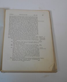
Administrative record - The Land Act 1869
The Victorian Parliament passed Land Acts in 1860, 1862 and 1869, which offered settlers land within defined agricultural areas. Settlers paid for half of an allotment on selection at a uniform price of £1 per acre and paid rent on the other half for usually 7 years. By the end of the period, to obtain title to the land, settlers would have had to pay the balance of the purchase price and make certain improvements. (from Wikipedia)Blue book missing front cover, some loose pages. The book contains amendments to the land act 1869. throughout the book there are handwritten notes with names and localitiesRed pen mark at the front Land(?) 869. some of the nameswriten are: Sanderson, O'Brien, H. Jackson, R. Wharton, W. Porter, J. Stewart, Foley and Mortonland act, victorian legislation -
Glenelg Shire Council Cultural Collection
Administrative record - Account - Dunlop Perdriau Rubber to Mr Campbell, Aug-39
Account rendered from Dunlop Perdriau Rubber Co Ltd to Mr. MH Campbell, Portlandaccounts, trade, portland -
Glenelg Shire Council Cultural Collection
Plan - Ship Plan / Mould, n.d
Wooden pattern for mould for boat fitting. Scoop shaped, curved front, square, open back with hole drilled inbase. Wooden cylinder plugging hole inf ront base. Painted white. -
Port Melbourne Historical & Preservation Society
Plan - Soundings, Station Pier, Port Melbourne, Operation Division, Port of Melbourne Authority, Sep 1978
Plan: soundings taken at Station Pier, Port Melbourne: East and West Berths, 1978melbourne harbor trust - port of melbourne authority -
 Federation University Historical Collection
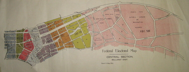
Plan - Plans, Tulloch & King, Federal Electoral Map Subdivision of Ballarat, c1901
It is thought that these are the first federal electorial plans for the Subdivision of Ballarat. The first member of Ballarat was Alfred Deakin.May of the Federal subdivision of Ballarat, with each section depicted in a different colour. The plans include Lake Wendouree, Central Ballarat subdivision; Soldiers Hill subdivision; Ballarat East subdivision, and Central Section Ballarat East, including the Ballarat East Botanic Garden .ballarat, federation, alfred deakin, elections, plan, electoral division, electoral map, polling -
 Heidelberg Golf Club
Administrative record - Reports, Heidelberg Golf Club, Directors' Reports: Book 21: February 1991 - December 1991, 1991
Typed reports to Directors of Heidelberg Golf Club from the various sub committees: February 1991 - December 1991Volume 21 of a set of reports to Directors. Black arch file binder, multiple pages, unnumbered. committee reports, directors' reports -
 Heidelberg Golf Club
Administrative record - Folder, Heidelberg Golf Club, Women's Golf Victoria Pennant, 2006: Ladies Pennant Book 7, 2006
Manilla folder containing lists of players and caddies for HGC team; draw for each section of Pennant competition; a WGV 2006 Tournament Handbook; a WGV 2006 Metropolitan Pennant Handbook. Volume 7 of a set of women's pennant resultsCollection of team sheets, caddies and draw, WGV tournament handbook, a WGV 2006 Metropolitan Pennant Handbook. Housed in manilla folder.women's golf, associates, ladies' golf, pennant, womens golf victoria -
 Bendigo Military Museum
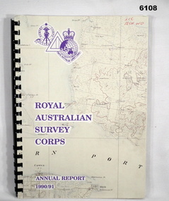
Administrative record - Royal Australian Survey Corps - Annual Report 1990/91, Royal Australian Survey Corps, Late 1991
Annual Report detailing the status of Australian mapping, charting and geodesy for the period 1 Jul 90 - 30 Jun 91A4 soft covered book, glossy paper pages and plastic pockets containing maps. Plastic ring bindingTop right hand corner "2IC Tech WO"royal australian survey corps, rasvy, fortuna, army survey regiment, army svy regt, asr -
 Vision Australia
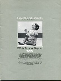
Administrative record - Text, 96th Annual Report Royal Blind Society of N.S.W. (1976), 1976
Articles in the annual report include: the reduced subsidies provided by government and the increased need for public support, success of family counselling and support programs have reduced numbers at nursery and kindergarten, plans for Low Vision Clinic, reconditioning and assembly of bicycles in workshop, retirement of Matron Scott and Mrs McCallum (heads of Victor Maxwell nursery and Sandy Robertson kindergarten respectively), continued success of Mitchell Street Theatre, and all the NSW blind participants who attended the Toronto Olympiad won medals.1 volume of text and imagesroyal blind society of new south wales, corporation records