-
 Moorabbin Air Museum
Administrative record (item) - CAC Collection - Ledger Dated 1937
-
 Melbourne Tram Museum
Negative, Travis Jeffrey, 11/06/1960 12:00:00 AM
Negative of tram 918 in Victoria St, Melbourne at Therry St. Tram has destination Camberwell and Route No 7. In the background is the Army depot and Alex H Mackie General Engineer and Boiler maker premises. The tram has advertisements for "Sharps doors of distinction" and Castrol oil.Paper folder that contained the negative had "NR48A" written in red ink, "M13" written in pencil, "38A" written in blue ink, and date stamped as 23 Sep 1961.trams, tramways, sw6 class, victoria st, route 7, tram 918 -
Bendigo Historical Society Inc.
Map - NEILBOROUGH, October 21 1859
Map:Township of Neilborough, Elysian Flat, near Sandhurst,County unnamed. Parish plan.Backing is a part of another parish mapmap, bendigo, neilborough, elysian flat -
 Eltham District Historical Society Inc
Negative - Photograph, George W. Bell, Shillinglaw Cottage, Main Road, Eltham, c.1964
Shillinglaw Cottage on its original site (present day 895 Main Road) showing old picket fence c.1964. The cottage and land were purchased by the Shire of Eltham as the site for a new shire office building. The cottage was destined for demolition but members of the community concerned at losing one of the areas earlist buildings (built c.1859) initiated a fund-raising campaign to save the cottage. In 1964 the cottage was dis-assembled, all the bricks numbered and reassembled several hundred meters to the south on a site between the Gahan house and the Eltham Railway Trestle Bridge (present-day Panther Place), which bcame known as the Eltham Common.This photo forms part of a collection of photographs gathered by the Shire of Eltham for their centenary project book,"Pioneers and Painters: 100 years of the Shire of Eltham" by Alan Marshall (1971). The collection of over 500 images is held in partnership between Eltham District Historical Society and Yarra Plenty Regional Library (Eltham Library) and is now formally known as the 'The Shire of Eltham Pioneers Photograph Collection.' It is significant in being the first community sourced collection representing the places and people of the Shire's first one hundred years.Digital image 4 x 5 inch B&W Negsepp, shire of eltham pioneers photograph collection, eltham, shillinglaw cottage, fences, george w. bell collection, houses, main road -
 Wodonga & District Historical Society Inc
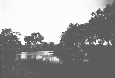
Negative - Haeusler Glass Negatives Collection - Water view near Wodonga, c1910
The Wodonga Historical Society Haeusler Collection provides invaluable insight into life in late nineteenth and early twentieth century north east Victoria. The collection comprises manuscripts, personal artefacts used by the Haeusler family on their farm in Wodonga, and a set of glass negatives which offer a unique visual snapshot of the domestic and social lives of the Haeusler family and local Wodonga community. The Haeusler family migrated from Prussia (Germany) to South Australia in the 1840s and 1850s, before purchasing 100 acres of Crown Land made available under the Victorian Lands Act 1862 (also known as ‘Duffy’s Land Act’) in 1866 in what is now Wodonga West. The Haeusler family were one of several German families to migrate from South Australia to Wodonga in the 1860s. This digital image was produced from one of the glass negatives that form part of the collection, probably taken by Louis Haeusler (b.1887) with the photographic equipment in the Wodonga Historical Society Haeusler Collection. This item is unique and has well documented provenance and a known owner. It forms part of a significant and representative historical collection which reflects the local history of Wodonga. It contributes to our understanding of domestic and family life in early twentieth century Wodonga, as well as providing interpretative capacity for themes including local history and social history.Digital image created from the Haeusler Glass negative collection. A view of water between trees near Wodonga, Victoria C. 1910wodonga pioneers, haeusler family, glass negatives, dry plate photography, wodonga -
 Bendigo Military Museum
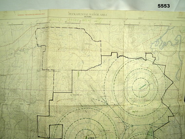
Map - MAP of PUCKAPUNYAL, RAAF et al, 1958
Refer to Cat 5547, Matheson.This is a large map, printed in colour on one side only. Scale 1:25,999. The grid squares are 1000 x 1000 metres. it shows the camp, ranges and bush areas used by the military.This map is covered in a large number of added colour shadings, nav lines, airstrips and circles.puckapunyal army base, military training, map -
 Eltham District Historical Society Inc
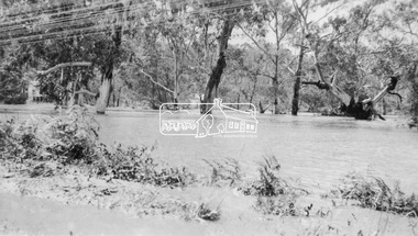
Negative - Photograph, Floodwaters, Diamond Creek, Eltham, 1934
The Diamond Creek in flood near the Main Road bridge at Eltham, Victoria. The Yarra also was in flood. In early December 1934 the "Greatest flood in the history of the Yarra" occured, according to The Argus newspaper. Bridges and houses were swept away with hundreds of people left homeless across the state. The historic 1934 flood of the Diamond Creek and Yarra River set the criteria for future planning with respect to flood water rise. Noted on reverse of print - Copied by Hugh Fisher, 82 Lygon St., BrunswickThis photo forms part of a collection of photographs gathered by the Shire of Eltham for their centenary project book,"Pioneers and Painters: 100 years of the Shire of Eltham" by Alan Marshall (1971). The collection of over 500 images is held in partnership between Eltham District Historical Society and Yarra Plenty Regional Library (Eltham Library) and is now formally known as the 'The Shire of Eltham Pioneers Photograph Collection.' It is significant in being the first community sourced collection representing the places and people of the Shire's first one hundred years.Digital image 4 x 5 inch B&W Neg (2 frames on one neg) Print 9 x 15.5 cmOn reverse of print - "Copied by Hugh Fisher, 82 Lygon St., Brunswick" (for Shire of Eltham)sepp, shire of eltham pioneers photograph collection, eltham, floods, 1934 flood, diamond creek (creek), floodwater -
 Eltham District Historical Society Inc
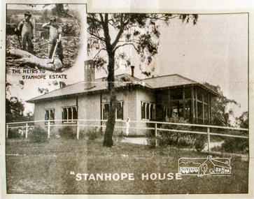
Negative - Photograph, Stanhope House
Stanhope Estate, Eltham; great suburban subdivisional auction, New Year's Day - Tuesday 1st January 1924 Subdivision of Stanhope property into 80 blocks; auction sale 1 Jan 1924 Roll of 35mm colour negative film, 3 stripsKodak CL 200 5093butcher, coghill and haughton, eltham, eltham railway station, railway station, real estate agent, stanhope estate, stanhope house -
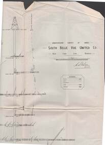 Bendigo Historical Society Inc.
Map - STRUGNELL COLLECTION: UNDERGROUND SURVEY OF MINES, BENDIGO, 29-3-01
Map, Underground Survey of Mines, Bendigo, South Belle Vue United Co.,New Chum Line.Transverse Section. Signed H.S.Whitelaw29.3.01 Drawing appears to show samples of connecting horizontal shafts with their respective mineral contentsH.S.Whitelawmap, bendigo, south belle vue united co.. -
 Eltham District Historical Society Inc
Negative - Photograph, Russell Yeoman, Shire of Eltham War Memorial, Memorial Park, Garden Hill, Eltham-Yarra Glen Road, Kangaroo Ground, c.1980
Shire of Eltham War Memorial Tower at Kangarooo Ground; view from the east and close up of entrance including Honour Roll. On November 11th 1926 the Shire of Eltham War Memorial Tower at Kangaroo Ground was opened. It is regarded as one of Melbourne’s most outstanding lookout towers. It commands a magnificent 360 degree panorama from Kinglake across the Diamond Valley to Macedon and the You Yangs. It is built on a peak which was once a volcano, 237 metres above sea level. After World War one a memorial cairn was erected on the site, and in 1925 a committee of public-minded citizens began to plan for a tower. Many generous donations of material and money were forthcoming so that in 1926 the Governor General Lord Stonehaven was able to unveil the plaque before a crowd of 500 people There was some concern in the 1960s when the Forests Commission wanted to build a firespotters cabin on the top. At first R.S.L. branches opposed the idea, but it was realised that this use could combine with its use as a tourist attraction, and would ensure its maintenance for the future. Today the Kangaroo Ground tower provides one of the best views around Melbourne and is a fitting memorial to those who died in two world wars. From: Historic items for Diamond Valley Community Radio September 1990 (EDHS collection) On November 8th, 1951, the memorial was re-dedicated by the Governor of Victoria, Sir Dallas Brooks with the addition of the names of men from the Shire of Eltham who fell in the Second World War. Further wreaths were added subsequent to this image in time for the 2001 Reembrance Day service to commemorate the men from th shire who had fallen in the Malayan, Korean, Borneo and Vietnam campaigns.Roll of 35mm colour negative film, 2 strips Kodak Safety 5035 Colour print (x1)Kodak Safety 5035garden hill, kangaroo ground, kangaroo ground memorial, memorial park, shire of eltham war memorial, shire of eltham war memorial tower, war memorial, kangaroo ground relief committee -
Bendigo Historical Society Inc.
Map - BENDIGO WEST IRRIGATION SETTLEMENT, 13/02/1909
Map: Bendigo West Irrigation Settlement, Parish of Sandhurst, County of Bendigo. Parish plan. ( number 191 in Map Cupboard 1)map, bendigo, irrigation settlement, bendigo west irrigatioon settlement -
Clunes Museum
Administrative record - BOOK, SANDS & McDOUGALL PTY. LTD, 1911
BOOK WAS USED TO RECORD CUSTOMER'S ACCOUNTS AT UNION BANK, CLUNES BRANCH.BOOK, BANK LEDGER FOR ACCOUNTS, LEATHERETTE BOUND.LEDGER INDIVIDUAL ACCOUNTS. VOL.14 FEB.28TH.1913 TO AUG. 31ST.1915 THE UNION BANK OF AUSTRALIA LIMITEDlocal history, book, accounts, banks, union -
Kew Historical Society Inc
Administrative record, City of Kew, City of Kew Voters Roll 1990-1991 Willsmere Ward, 1990-1991
non-fictionlocal government -- electoral rolls -- kew (vic) -
Stawell Historical Society Inc
Map, Moyston, County of Borung, 1951
Moyston, County of Borungstawell -
 Eltham District Historical Society Inc
Negative - Photograph, Cottlesbridge-Strathewen Road, Strathewen, c.Nov. 1987
Photos taken during a review of road and bridge/culvert condition by Eltham Shire Council engineers. A number of the trees were badly burnt or destroyed in the Black Saturday bushfire, 7 Feb. 2009 but some remained standing and identifiable as of 2014 (Google Streetview).Roll of 35mm colour negative film, 4 stripsKodak GB 200 5096bridge, chads creek, chads creek road, cottlesbridge-strathewen road, culvert, infrastructure, roads, school ridge road, strathewen -
 Ballarat Tramway Museum
Negative - Set of 5, Campbell Duncan, Carey Grammar school visit to Ballarat, 13/09/1969 12:00:00 AM
Yields information about the visit of the Carey Grammar school visit to Ballarat and the Eureka siding in 1969.Set of five negatives of the Carey Railway Club visit to Ballarat on Saturday 13/9/1969. .1 - 34 with the destination of Mt Pleasant at Carlton St loop, though running a Special .2 - 17 and 34 with another single trucker at Gardens Loop - 17 has a Twin Lakes sign and destination of Gardens via Sturt St West. 34 showing Special. .3 - side on view of 34 at Carlton St Loop - with a SEC electric cooking roof advert. .4 - DERM entering the Eureka Siding. .5 - DERM leaving the Eureka Siding, has the Millar Bros engineering works in the background.trams, tramways, tours, eureka, wendouree parade, carlton st loop, carlton st, railways, tram 34, tram 17 -
Glenelg Shire Council Cultural Collection
Administrative record - Book - C.R. Formularies and Lectures of the Ancient Order of Foresters Friendly Society, c. 1939
The Ancient Order of Foresters, which originated in England in the mid 1700s, established its first branch (Court) in Victoria in 1849. Foresters was set up as a non-profit organisation, the founding principles of the Society being to provide financial and social benefits as well as support to members and their families in times of unemployment, sickness, death, disability and old age. The Society is now known as the Foresters Friendly Society and in July 1999 was incorporated as a public company limited by shares and guarantee.Emerald green hard cover booklet, RITUAL in gold, front cover. -
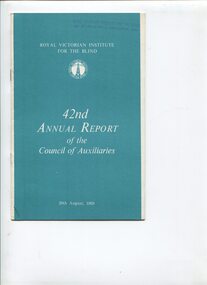 Vision Australia
Administrative record - Text, 42nd Annual Report of the Council of Auxiliaries, 1969
Report on the combined efforts of RVIB Auxiliaries2 x A4 sheets stapled and foldedroyal victorian institute for the blind, auxiliaries -
Port Melbourne Historical & Preservation Society
Financial record - Annual Statement, Town of Port Melbourne, 1899
Municipal Statement of Accounts Town of Port Melbourne 1899local government - town of port melbourne -
Bendigo Historical Society Inc.
Map - HUNTLY, 9th June 1880
Map:Huntly, County of Bendigo. Parish plan Canvas backed. ( number 138 in Map Cupboard 1)map, bendigo, city streets, huntly, county of bendigo -
Port Melbourne Historical & Preservation Society
Financial record - PMHPS, Pat Grainger, Annual Report 2003, Aug 2003
PMH&PS was incorporated in 1994, and from 1995 was required to hold an AGM and present an Annual Report. These were compiled, designed, printed on photocopier and bound by the Secretary, except for the Tenth anniversary edition.Annual Report of the PMH&PS, 2003 A4 12 pp plus cover - graduated blue, Tenth Anniversary issue. Contains financial reports, list of members, photos and details of Society's activities since inception.societies clubs unions and other organisations, port melbourne historical & preservation society, pmhps, graham bride -
Bendigo Historical Society Inc.
Map - BENDIGO SHEET 2, Circa 1900
Map: Bendigo sheet 2 . Parish planmap, bendigo, parish plan, bendigo -
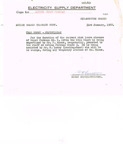 Ballarat Tramway Museum
Administrative record - Memorandum, State Electricity Commission of Victoria (SECV), "Tram Depot Supervision", 31/01/1968 12:00:00 AM
Yields information about the depot supervision and names of people involved., Yields information about the depot supervision and names of people involved.Memorandum on Electricity Supply Department letterhead, half foolscap, from the Works Superintendent to the Acting Branch Tramways Superintendent, dated 31/1/1968 with a copy to the Acting Depot Foreman, advising of "Tram Depot Supervision" while Depot Foreman D Irvin on sick leave, depot being supervised by F Minns and assisted by S Lakey, Leading Hand. Signed H W Linakertrams, tramways, depot, personnel, staff -
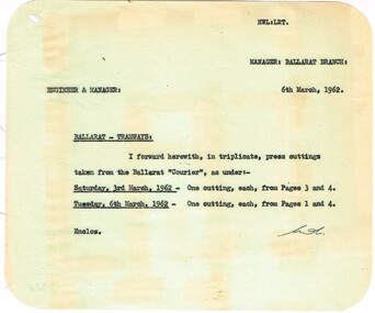 Ballarat Tramway Museum
Administrative record - Memorandum, State Electricity Commission of Victoria (SEC) and The Courier Ballarat, cuttings from The Courier re possible closure, 6/03/1962 12:00:00 AM
Yields information about the method of advising SEC Management of letters to the Editor concerning the possible closure of the SEC Ballarat system., Yields information about the method of advising SEC Management of letters to the Editor concerning the possible closure of the SEC Ballarat system.Memorandum to the Engineer & Manager from the Ballarat Manager, on green paper - all with rounded corners. 1 - enclosing cuttings from The Courier, 3/3 and 6/3 (dated 6/3/62) See Reg Item 7929 for these items. trams, tramways, closure, letter to the editor, editorial -
Lakes Entrance Regional Historical Society (operating as Lakes Entrance History Centre & Museum)
Administrative Record - Ledger, Lindenow MUIOOF Members, 41610
Entries are hand written in ink, first 74 pages have been used, followed by 48 blank pages, miscellaneous entries on last 4 pages, leather bound with heavy cardboard cover.A ledger containing members of the MUIOOF Loyal Lindenow Lodge, Victoriaaccounts book -
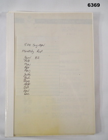 Bendigo Military Museum
Administrative record - 5 Fd Svy Sqn Monthly Report: Jan - Dec 1982, 5 Fd Svy Sqn, 1982
Monthly Reports were required of all Royal Australian Survey Corps Units. This report covers the activities of 5 Fd Svy Sqn during the period Jan - Dec 1982Plastic bound and plastic covered report containing A4 Paper pages. Most pages are bound except for 12 x pages that are loose.Numerous distribution stamps exist throughout the document.royal australian survey corps, rasvy, fortuna, army survey regiment, army svy regt, asr -
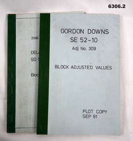 Bendigo Military Museum
Administrative record - Report on the Block Adjustment of the Gordon Downs and Delemere 1:250,000 Maps, Army Survey Regiment, 1 Sep 1991, .2 Jan 1988
All mapping produced at this time were produced using Aerial Photography. These booklets contain the adjusted mathematical solution to joining this group of photographs together..1 Blue covered booklet with green tape binding. Block adjusted values for Gordon Downs SE 52-10 1:250 000 map Adjustment number 309 Sep 1991 .2 Blue covered booklet with green tape binding. Block adjusted values for Delamere SD 52-16 1:250 000 map Adjustment number 272 Jan 1988royal australian survey corps, rasvy, fortuna, army survey regiment, army svy regt, asr -
Canterbury History Group
Map - Camberwell and Boroondara, Melbourne and Metropolitan Board of Works, c.1905
Copy of Melbourne and Metropolitan Board of Works Plan no. 71 for Camberwell and Boroondaracanterbury, maps, melbourne and metropolitan board of works -
Bendigo Historical Society Inc.
Map - KOOYOORA, July 23rd 1857
Map: The Township of Kooyoora and suburban allotments in the Parish of Kingower. This plan has been applied to a newer backingmap, township, kooyoora, allotments, parish of kingower -
Heidelberg Golf Club
Administrative record - Reports, Heidelberg Golf Club, Directors' Reports: Book 9: December 1968 - February 1970, 1968 - 1970
Typed reports to Directors of Heidelberg Golf Club from the various sub committees: December 1968 - February 1970Volume 9 of a set of reports to Directors. Hard cover book, light brown cover. Pages not numbered, typed reports pasted in.committee reports, directors' reports