Showing 12124 items
matching documentation
-
 Moorabbin Air Museum
Manual (Item) - Cost of military pilot training, Government Aircraft Factories Project Note F2/2
-
Moorabbin Air Museum
Manual (Item) - Lycoming aircraft engines, Lycoming Parts Catalog Model GO-480
Avco Lycoming Division -
Moorabbin Air Museum
Manual (Item) - Aviation Hydraulics Manual
Description: 150 pages. Published by Bureau of Naval Personnel. Published on unknown date. NAVPERS 10310. Navy Training Course for Aviation Structural Mechanic H 3 & 2 Level of Importance: World. -
Stawell Historical Society Inc
Map, Boroka, County of Borung, 1958
Boroka, County of Borung stawell -
Moorabbin Air Museum
Manual (Item) - Mobile Stinger Antenna System, Instruction Manual Model AC-31 Mobile " Stinger" Antenna System
Spilsbury & Tindall Radio Commuications -
National Vietnam Veterans Museum (NVVM)
Manual, Sioux aircraft maintenance manual
australia - royal australian airforce - service manuals, sioux (helicopter) - service manual -
Moorabbin Air Museum
Manual (collection) - Victa 100 Operations Manual - Pilot's Notes, Victa100 Operations Manual Pilot's Notes
Royal Aero Club of South Australia -
Moorabbin Air Museum
Manual (Item) - Dakota Maintenance & Hydraulic & Electrical & Controls System Manual
-
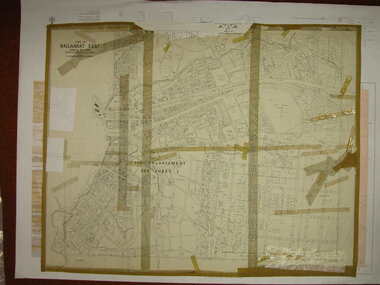 Federation University Historical Collection
Plan, Ballarat East, 1916, 24/05/1916
Plan of streets and allotments in Ballarat East. Includes: Bakery Hill, Canadian Station, Eureka Cemetery, Orphan Asylum, Eureka Gardens and Reserve, Gun Clubballarat east, bakery hill, eureka stockade site, eureka gardens, ballarat orphanage -
Stawell Historical Society Inc
Map, Gampola, County of Borung, 1957
Gampola, County of Borungstawell -
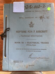 Moorabbin Air Museum
Manual (item) - (SP) AAP 7215.002-2-13 Neptune P2V-7 Aircraft Technical Information Book 3A-Electrical Trades (Wiring Data)
-
Bendigo Historical Society Inc.
Map - CITY OF BENDIGO RESURVEY SHEET 1, 5/06/1903
Map: City of Bendigo resurvet sheet 1. Parish plan ( number 219 in Map Cupboard 1)map, bendigo, parish plan, bendigo resurvey -
Moorabbin Air Museum
Manual (Item) - AAP 717.01 Vol 3 Part 1 Sect 1 Chap 2 1st Edition RAAF Schedule of Spare Parts Equipment and Scales for De Havilland and Hamilton Propeller and Constant Speed Control Unit Spares and Tools
-
Moorabbin Air Museum
Manual (collection) - Ground Handling, Servicing & Airframe Maintenance USAF Series C130A & C130D Aircraft Technical Manual
-
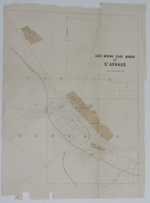 Federation University Historical Collection
Map, Gold Mining Lease Blocks at St Arnaud, not dated
Printed map on paper with shadingst arnaud, lexell creek, st arnaud creek, wilsons hill, lord nelson -
Moorabbin Air Museum
Manual (Item) - RTCA - Minimum performance standards airborne distance measuring equipment (DME) operating within radio frequency range of 960-1215 megahertz, RTCA Document DO-151A
-
Bendigo Historical Society Inc.
Map - HARCOURT, December 1951
Harcourt, County of Bendigo, Walmer, Castlemaine, Sutton Grange. Mt.Alexander Trig. Station, Barkers Creek, Faraday, Calder Highway, Northern Railway. By Authority J.J.Gourley, Government Printer, Melbourne,Drawn and Reproduced at the Dept. of Lands and Survey, Melbourne, Victoria. December 1951. Price 5/-per sheet. (number 35 in map cupboard 1)J.J.Gourley, Government Printer, Melbourne.map, bendigo, harcourt -
Moorabbin Air Museum
Manual (Item) - Lycoming Parts Catalogue
Description: 35 pages. Published by Kearfott Company Inc. Published July 1952. Navigational Systems Operating Instructions (magnetic slaved, directional gyro-stablized compass system) Level of Importance: World. -
Moorabbin Air Museum
Manual (item) - Pratt & Whitney Double Wasp CB Overhaul Manual - buut water damaged
-
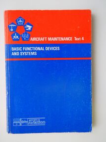 Moorabbin Air Museum
Manual (item) - Aircraft Maintenance Text 4, Basic Functional Device and Systems: Department of Aviation
-
Moorabbin Air Museum
Manual (Item) - Bristol Hercules 730 Engine Spare Parts Catalogue, BS Hercules 730 Engine Spare Parts Catalogue
Bristol Siddeley Engines Ltd -
Moorabbin Air Museum
Manual (Item) - Bendix/King Control Display Unit Installation Manual, System Maintenance Manual: Bendix/King KCU 1051 Control Display Unit
-
Moorabbin Air Museum
Manual (item) - CAC Collection Engineering Change E5900 to E6049, CAC Changes E5900 to E6049
CAC Collection -
Moorabbin Air Museum
Manual (Item) - Pilot's Flight Operating Instructions For Army C-54A , Navy Model R5D-1 Airplanes
-
Moorabbin Air Museum
Manual (item) - Partenavia P-68C Maintenance Manual, Partenavia Maintenance Manual P68C
-
Moorabbin Air Museum
Manual (Item) - Bristol Type 170 Aircraft Mk 21 Parts Manual Page 33 - 54B plus some illustrations
-
Moorabbin Air Museum
Manual (item) - Sikorsky MH-53E Trainer Manual - CAC
-
Moorabbin Air Museum
Manual (item) - AAP 948 Canberra U Mk.10 Pilot's Notes
-
Moorabbin Air Museum
Manual (item) - F4-E Technical Orders IF-4C-33-1-1 & IF-4C-33-1-2, F-4E Technical Orders IF-4C-33-1-1 & IF-4C-33-1-2
-
National Vietnam Veterans Museum (NVVM)
Journal, Remembrance: official magazine of the Shrine of Remembrance, Melbourne
Box also contains some annual reports for the Shrineshrine of remembrance (melbourne, vic.), war memorials - victoria - melbourne