Showing 2587 items matching "aerial"
-
 Bendigo Military Museum
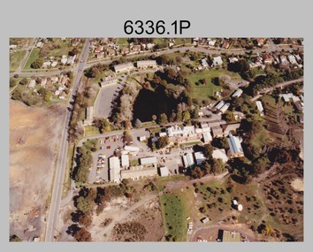
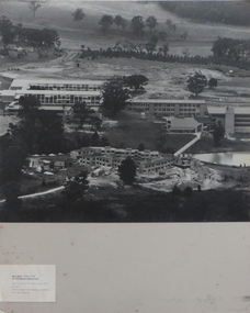
Photograph - Army Survey Regiment aerial photos, Fortuna, Bendigo, c1990
This is a set of two aerial photographs of the Army Survey Regiment, Fortuna, Bendigo taken in c1990. These photos are indicative of a series of 23 aerial photos in the collection taken from multiple angles and elevations. It is possible the photographs were taken from a hot air balloon. The approximate date of the photos is based on the existence of the new printing building - Wazgoose Hall and the new records building.This is a set of two aerial photographs of the Army Survey Regiment, Fortuna, Bendigo taken circa 1990. Colour photographs are on photographic paper and scanned at 300 dpi. They are part of the Army Survey Regiment’s Collection. .1) to .2) - Photo, colour, c1990. Army Survey Regiment aerial photos.royal australian survey corps, rasvy, army survey regiment, army svy regt, fortuna, asr -
 Bendigo Military Museum
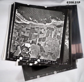
Photograph - Aerial Photography - Mohogany Ship Search Warrnambool Victoria, Victorian Lands Department, 3.1.1981
These Victorian Lands Dept Aerial Photographs were acquired by the Army Survey Regiment to help locate a Mohogany Ship wreck near Warrnambool Victoria as part of a unit Regimental Training ExerciseSeven Aerial photographic Prints and Film Negatives and positives of the same images. Images are Numbered 3562- 15,16,17,18,19, 29 and 30.royal australian survey corps, rasvy, fortuna, army survey regiment, army svy regt, asr -
 Ithacan Historical Society
Photograph, Aerial photograph - Platrithia, Ithaca, c1970s
The photograph is an aerial view of the village of Platrithia in northern Ithaca, overlooking Afales Bay. The Taxiarchi Church is located at the top of the hill, around which the village is located.A discoloured landscape of an aerial view of Aphales Bay and Platrithia with the church of Taxiarches and the road which leads to Marmaka located on the other side of the mountain.aphales, villages -
 Ringwood and District Historical Society
Aerial Map, R.A.A.F, Aerial photograph of Mitcham and part of Ringwood (RAAF) 1931, 1931
Aerial photographs of Mitcham and part of Ringwood by RAAF 1931 with a covering explanatory text. The quality of the picture is poor as it is a copy of a paper copy. Page signed by Ken Baxter.1.Aerial photographs of Mitcham and part of Ringwood by RAAF 1931 - B&W.; 2. Text with explanations - white A4 page. +Additional Keywords: Baxter, Ken -
 Federation University Historical Collection
Photograph - Photograph - Black and White, Ballarat College of Advanced Education, Aerial view of the Mt Helen campus from the north, c1975
black and white photograph: Aerial view of Mt Helen campus from the north mount helen campus, mount helen campus aerial, student residences, p building, f building, g building, l building, mt helen library, union building, u building, e.j. barker library, aerial -
Stawell Historical Society Inc
Map, Crocodile Gold Corp, Photographic Aerial View of Big Hill showing underground workings and surface workings and proposed Big Hill Open Pit proposal, December 2014
Crocodile Gold Corp SGM photo Map showing Magdala Decline& Wonga Decline December 2014 Produced for Public Consultation over Big Hill Open Pit Proposal. Aerial Views Stawellmining, gold, map -
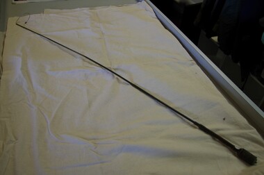 Running Rabbits Military Museum operated by the Upwey Belgrave RSL Sub Branch
Aerial
long radio aerialequipment, vietnam, army -
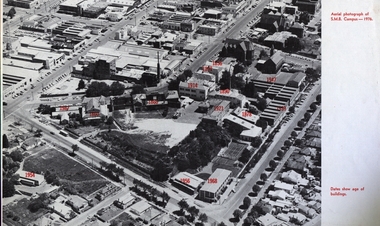 Federation University Historical Collection
Image, Ballarat School of Mines Aerial View with Dates of Buildings, 1976
Aerial photograph of the Ballarat School of Mines, with establishment date for each building. ballarat school of mines, aerial, buildings, former ballarat gaol, mining laboratory, hillman hall, former supreme court, administration building, ballarat technical art school, former wesley church, ballarat girls technical school, ballarat junior technical school, albert street, grant street, lydiard street south, armstrong street south, dana street -
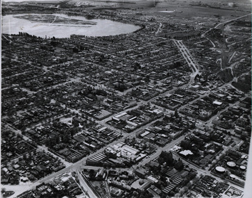 Federation University Historical Collection
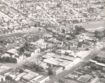
Photograph - Photograph - Black and White, Aerial photograph of Ballarat, including the Ballarat School of Mines Campus, c1960
Four black and white aerial photograph of Ballarat, including the Ballarat School of Mines Campus, former Ballarat Gaol, Lake Wendouree, Ballarat Gasometers, M.B. John Valves (Lydiard Street)ballarat, aerial, ballarat school of mines, ballarat gaol, balllarat brewery, lake wendouree, wendouree -
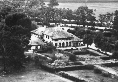 Stawell Historical Society Inc
Photograph, “Warranooke” Homestead in Glenorchy 1867 -- aerial view
Aerial View of “Warranooke” Homestead. “Warranooke” Homestead built 1867 enlarged 1926. Shows extensive gardens at front. A very early property in our district Warranooke The main names associated with the property Ayrey - Darnell - Nicoll, later Campbell. Mrs. Campbell built Charles Ayrey's daughter. The Campbells built up the station buildings. The homestead was virtually rebuilt in brick, making it one of the largest and most elaborate in the East Wimmera. Warranooke homestead built 1867, enlarged 1926 destroyed by fire 13th Feb. 1979.Black and white aerial photograph of building showing landscape around the homestead. The photo is on a card with some gold decorations.glenorchy -
Stawell Historical Society Inc
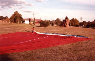
Photograph, Aerial Photos of Stawell from a Hot Air Balloon 1985 -- 11 Photos
Series of 11 Aerial Photos of Stawell. Hot Air Balloon 1985. Photo were taken during a second balloon ride in July 1985. Take off venue was the oval at Stawell West Primary School. The balloon course was parallel to the Western Highway out over Deep Lead. 1. Ride left from Stawell West Primary Oval. 2. School Children were brought out to see the balloon launch. 3. Western Highway Green School oval. 4. Central Park Lower Main St. 5. Taylor's Gully Park Sloane St. 6. Shadow of Hot Air balloon on low cloud over Western Highway. 7. North Western Woolen Mills. 8. Pleasant Creek special school. 9. Looking back at Stawell. 10. Grampians & Lake Lonsdale. 11. Over Deep Lead. Series of 11 colour photographs of aerial photos of balloon rides over a town. stawell -
 Stawell Historical Society Inc
Photograph, Aerial Photos of Stawell from a Hot Air Balloon 1985 -- 12 Photos
Series of 12 Aerial Photos of Stawell. Hot Air Balloon 1985. Photos taken during hot air balloon rides May & June 1935. The rides left from land near leisure complex, Houston St and Newington Rd corner. The rides first over Stawell and drifted towards the Black Range. This vacant site is now the location of Stawell indoor heated and outdoor pools. 1 & 2. Setting up balloon. 3. North Park Area Lamont St. 4. Netball & Tennis courts Athletic track. 5 Wimmera St, Trotting track & Drive-in Scallan St. & Main St. 6. State School 502 Jenning-Campbell & Houston St's. 7 Ligar St. crosses Campbell & Houston St's. 8. Ord St, 502 School yard. 9. Central Park Napier, Wakeham & Shirreff St's also Railway & Foot Bridge. 10. Central Park. 11. Sloane St. on left Trotting track & Drive-in. 12. The Old Lake oval. Series of twelve photos mostly consisting of aerial photos and two of a large balloon on the ground. stawell -
 Bayside Gallery - Bayside City Council Art & Heritage Collection
Photograph - type C photograph, Newmark Aerial Photography, Kamesburgh, North Road, Brighton, 1996
kamesburgh, north road, brighton, historic house, aerial, photograph, newmark aerial photography, anzac hostel, william kerr thomson, lloyd tayler, italianate, streets -
 Bayside Gallery - Bayside City Council Art & Heritage Collection
Photograph - type C photograph, Newmark Aerial Photography, Billilla, Halifax Street, Brighton, 1996
brighton, historic house, aerial, photograph, newmark aerial photography, streets, billilla, weatherly, william weatherly, smith and johnson, walter richmond butler, halifax street -
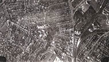
 Federation University Historical Collection
Photograph - Photograph - Black and White, Aerial View of Federation University SMB Campus, c1967
This photograph was taken around the time that the Ballarat School of Mines obtained the Former Ballarat Gaol site and the Ballarat Brewery site.Black and white photograph showing an aerial View of Federation University SMB Campus. The image shows the former Ballarat Gaol (now demolished), Ballarat Brewery, (now demolished) and White Flat Oval.ballarat school of mines, ballarat gaol, ballarat brewery, white flat, ballarat townscape, smb campus, ballarat school of mines campus, lydiard street, aerial -
 Federation University Historical Collection
Photographs - black and white, Ballarat College of Advanced Education, Aerial views of the Mt Helen campus from the north, not dated
2 black and white aerial photographs .1) Aerial view of Mt Helen campus from the north .2) Aerial view from the northmount helen campus, mount helen campus aerial, student residences -
 Ringwood and District Historical Society
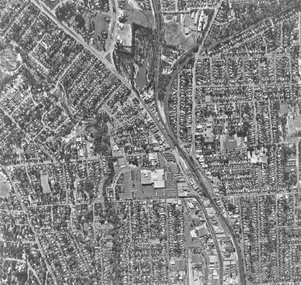
Photograph, Aerial photograph of Ringwood - 1962
Aerial photographWritten on backing sheet, 'Ringwood 1962'. -
 Ringwood and District Historical Society
Photograph, Aerial view of Park Orchards and Ringwood - c.1960
Catalogue card reads, "Aerial view of Ringwood". -
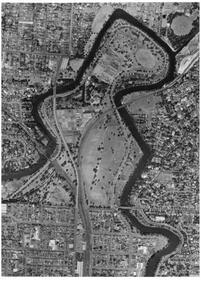
 Kew Historical Society Inc
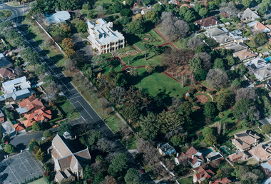
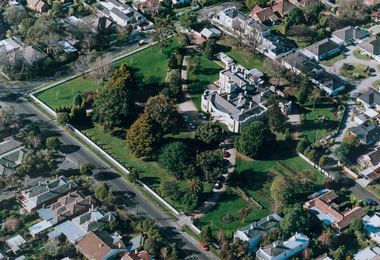
Photograph - Aerial Photograph, Aerial Photograph of Willsmere, circa 1980, c. 1980
This aerial photograph shows the Kew Cottages, and doctors/clergy residences on the north side of Wills Street, before the State Government sold the land for residential development. The doctors residences in Wills street were made of 'Glen Iris' Olympic Bricks. According to neighbours of the time most of the buildings were demolished overnight in the 1980s.Aerial photograph of Willsmere and the Kew Cottages bounded by the Boulevard, the Chandler Highway, Princess Street and Fellows Street. The roundabout at the intersection of Princess Street, Wills Street, and Eglinton Street is at the top left. The Eastern Freeway is at the lower edge of the photograph.kew cottages, eastern freeway, willsmere, yarra river, aerial photographs -- kew (vic), kew boulevard, willsmere mental hospital, kew mental hospital, kew childrens cottages -
 Bayside Gallery - Bayside City Council Art & Heritage Collection
Photograph - type C photograph, Newmark Aerial Photography, Brighton Town Hall, Wilson Street, Brighton, 1996
brighton, aerial, photograph, newmark aerial photography, streets, brighton town hall, brighton library, brighton court house, court house, library, gardens, wilson street, carpenter street, boxshall street, khyatt's hotel, council chambers, brighton police station -
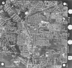
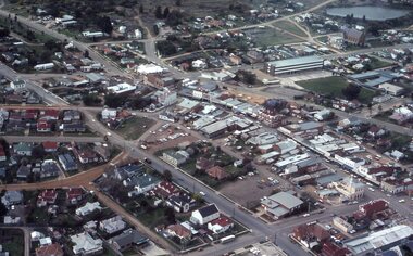
Stawell Historical Society Inc
Map, Aerial Photograph of Stawell, c1980
Aerial Photograph of Stawellstawell -
 University of Melbourne, Burnley Campus Archives
Photograph - Black and white print, Aerial View of Burnley Campus, 1972
Black and white photograph. Aerial View of Burnley Campus. Enlargement of B92.553C. Aerial view of Burnley Campus.Inscribed on reverse, "30.1.72 2602/62."burnley campus, aerial view, freeway -
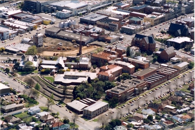 Federation University Historical Collection
Photograph - Photograph - Colour, Aerial Photograph of the Ballarat School of Mines Campus, c1995
Colour aerial photograph of the Ballarat School of Mines campus. Albert street is shown on the lower right side and Grant Stret on the left. The M.B. John Building is present along Albert Street, the Ballarat Brewery has been demolished in preparation for the building of the Brewery Building. ballarat school of mines, aerial, m.b. john building, e.j. tippett library, corbould hall, brewery building, brew tower, brewery chimney, ballarat school of mines creche -
Federation University Historical Collection
Photograph - Photograph - Black and White, N.L. Harvey & Sons Photographers, Ballarat School of Mines Aerial View
The Ballarat School of Mines Campus is a campus of Federation University Australia.Aerial view of the Ballarat School of Mines campus from the Grant Stret/Eyre Street corner. The photograph was taken after the demolition of the gaol and before the E.J. Tippett Library and Hillman Recreation Reserve were built. The Ballarat Girls' Technical School is present in Grant Street, and in sthe Ballarat SChool of Mines Mining Laboratory in Albert Street. The Ballarat Brewery (then Carton and United Breweries) is present in Lydiard Street South.aerial, ballarat school of mines, ballarat gaol, ballarat school of mines tennis court, grant street, ballarat girls' junior technical school -
 Ringwood and District Historical Society
Photograph, Aerial view of Ringwood -1972
Black and white aerial photographSimilar photograph -Reg 926 located in NWD 02-09-07 - Item no G0033 -
Ringwood and District Historical Society
Photograph, Aerial photograph of Ringwood, c.1975
Framed aerial photograph of RingwoodVIC3016-75 -
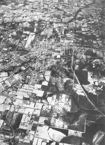
 Stawell Historical Society Inc
Photograph - Slides, Ian McCann, Aerial View 1976, 1976 - 1984
Aerial Colour Photograph of Stawell -
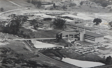
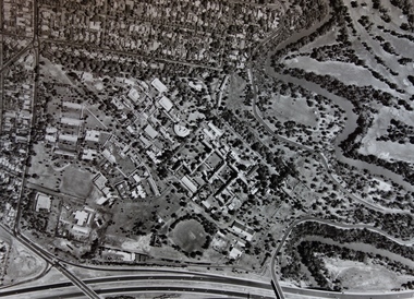
Federation University Historical Collection
Photograph, Mount Helen Campus Aerial Views, 10/1983
Aerial Photos of the Mount Helen Campusbuildings, mount helen campus, aerials -
Federation University Historical Collection
Photograph, Mount Helen Campus Aerial Views, 1984-1988
Aerial Photos of the Mount Helen Campusbuildings, mount helen campus, aerials -
 Ringwood and District Historical Society
Photograph, Aerial photograph of Ringwood - 1972
Black and white aerial photograph of Ringwood.Written on backing sheet, "Ringwood 1972".