Showing 36 items
matching alpine national park'
-
 Forests Commission Retired Personnel Association (FCRPA)
Beechworth FCV District office sign
This sign proudly hung outside the Forests Commission Victoria (FCV) Beechworth office which is now site of the Forestry Heritage Museum. The granite building in the Beechworth's historic precinct was once the Gold Warden's Office and is one of the town's original buildings. The FCV was the main government authority responsible for management and protection of State forests in Victoria between 1918 and 1983. The Commission was responsible for ″forest policy, prevention and suppression of bushfires, issuing leases and licences, planting and thinning of forests, the development of plantations, reforestation, nurseries, forestry education, the development of commercial timber harvesting and marketing of produce, building and maintaining forest roads, provision of recreation facilities, protection of water, soils and wildlife, forest research and making recommendations on the acquisition or alienation of land for forest purposes″. The Forests Commission had a long and proud history of innovation and of managing Victoria's State forests but in September 1983 lost its discrete identity when it was merged into the newly formed Victorian Department of Conservation, Forests and Lands (CFL) along with the Crown Lands and Survey Department, National Park Service, Soil Conservation Authority and Fisheries and Wildlife Service. After the amalgamation the management of State forests and the forestry profession continued but the tempo of change accelerated, with many more departmental restructures occurring over the subsequent four decades. Responsibilities are currently split between the Department of Energy, Environment and Climate Action (DEECA), Forests Fire Management Victoria (FFMV), Parks Victoria, Melbourne Water, Alpine Resorts Commission, the State Government-owned commercial entity VicForests and the privately owned Hancock Victorian Plantations (HVP).Large office sign. Hand painted in traditional FCV mission brown and gold colour scheme.forests commission victoria (fcv), forest signs -
 Wodonga & District Historical Society Inc
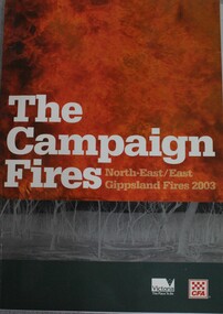
Book - The Campaign Fires - North-East/East Gippsland Fires 2003, Lyndel Hunter, 2003
... and forests, including 60 per cent of the Alpine National Park and 81 ...A description of efforts to fight the bushfires in Gippsland in 2003, including maps and illustrations This volume was published as a tribute to the work of staff and volunteers who put themselves at risk to protect local communities. It shows the impact on those communities in Victoria and the support they gave to those involved in fighting largest bushfires in Victoria for 60 years. The Alpine bushfires started on 8 January 2003, a day of Total Fire Ban. Lightning ignited 87 fires in the North-East and East Gippsland regions. Eight of these fires were unable to be contained; they joined together to form the largest fire in Victoria since the Black Friday fires in 1939. The majority of the area burnt in Victoria was public land, 1.19 million hectares of parks and forests, including 60 per cent of the Alpine National Park and 81 per cent of the Mt Buffalo National Park. Firefighting efforts were made difficult in hard to access, remote forest terrain. Approximately 90,000 hectares of private land was burnt.This publication of 119 pages features text, colour images, maps and detailed information related to the 2003 bushfires in Victoria.non-fictionA description of efforts to fight the bushfires in Gippsland in 2003, including maps and illustrations This volume was published as a tribute to the work of staff and volunteers who put themselves at risk to protect local communities. It shows the impact on those communities in Victoria and the support they gave to those involved in fighting largest bushfires in Victoria for 60 years. The Alpine bushfires started on 8 January 2003, a day of Total Fire Ban. Lightning ignited 87 fires in the North-East and East Gippsland regions. Eight of these fires were unable to be contained; they joined together to form the largest fire in Victoria since the Black Friday fires in 1939. The majority of the area burnt in Victoria was public land, 1.19 million hectares of parks and forests, including 60 per cent of the Alpine National Park and 81 per cent of the Mt Buffalo National Park. Firefighting efforts were made difficult in hard to access, remote forest terrain. Approximately 90,000 hectares of private land was burnt.forest fires -- victoria, bushfires, fires prevention and control -
 The Beechworth Burke Museum
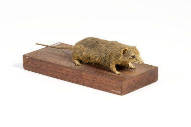
Animal specimen - Dusky Antechinus, Trustees of the Australian Museum, 1860-1880
The dusky antechinus was first described in 1840 by English naturalist George Robert Waterhouse, making it the second species of antechinus to be formally recorded. It was named in honor of zoologist and artist William Swainson, with the holotype likely originating from the Tasman Peninsula in Tasmania, collected by Swainson’s associate, Thomas Lempriere. The dusky antechinus is distributed across southeastern Queensland to southwestern Victoria, as well as in Tasmania. It is most frequently found in mountainous areas, including Kosciuszko National Park and the Brindabella Ranges, where it inhabits alpine heath and tall open forests with dense understorey vegetation. While the species is not considered threatened, some local populations have declined due to habitat loss caused by controlled burning and the replacement of native forests with pine plantations. Additionally, predation by cats and red foxes is believed to negatively impact its numbers. This specimen was originally identified as a bandicoot and is part of a collection of almost 200 animal specimens that were originally acquired as skins from various institutions across Australia, including the Australian Museum and the National Museum of Victoria, as well as individuals such amateur anthropologist Reynell Eveleigh Johns between 1860-1880. These skins were then mounted by members of the Burke Museum Committee and put-on display in the formal space of the Museum’s original exhibition hall where they continue to be on display. This display of taxidermy mounts initially served to instruct visitors to the Burke Museum of the natural world around them, today it serves as an insight into the collecting habits of the 19th century. This specimen is part of a significant and rare taxidermy mount collection in the Burke Museum. This collection is scientifically and culturally important for reminding us of how science continues to shape our understanding of the modern world. They demonstrate a capacity to hold evidence of how Australia’s fauna history existed in the past and are potentially important for future environmental research. This collection continues to be on display in the Museum and has become a key part to interpreting the collecting habits of the 19th century.Small sized dusky antechinus with a pointy snout, small rounded eyes made of glass, a thin tail, small rounded ears, and sharp clawed legs. The fur in colouring is golden brown with streaks of dark brown, and is of medium length and fine.On wooden mount: BMM5896/ On Catalogue Tag (attached to left foreleg): Bandicoot Mou(...)/ Catalogue, Page. 45/ burke museum, taxidermy, taxidermy mount, fauna, animal, animalia, reynell eveleigh johns, bandicoot, marsupial, peramelemorphia, dusky antechinus, antechinus swainsonii, swainson's antechinus, dusky marsupial mouse -
 Falls Creek Historical Society
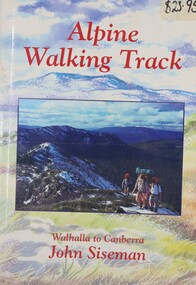
Book - Alpine Walking Track - Walhalla to Canberra, John Siseman, 1993
... through three major alpine nationals parks, ascends the highest ...A guide for travellers of the Alpine Walking Track which stretches 750 kilometres through three major alpine nationals parks, ascends the highest mountains in Victoria, New South Wales and the Australian Capital Territory. It features information about alternative routes and side trips. and is illustrated, with maps and photographs.A light hearted look at the world of skiing featuring cartoons.non-fictionA guide for travellers of the Alpine Walking Track which stretches 750 kilometres through three major alpine nationals parks, ascends the highest mountains in Victoria, New South Wales and the Australian Capital Territory. It features information about alternative routes and side trips. and is illustrated, with maps and photographs.alpine walking track, bushwalking, walhalla -
 Falls Creek Historical Society
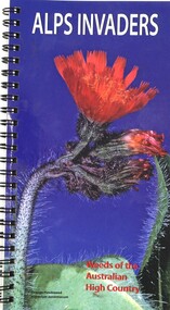
Book - Alps Invaders - Weeds of the Australian High Country, John Hosking, Geoff Sainty, Surrey Jacobs, 2006
The Australian Alps National Parks are relatively weed free compared with other environments that have been exploited by humans. By identifying weeds that pose the greatest threat to native vegetation, all users and visitors to these parks can assist park staff to locate weeds that require control. This identification guide has been produced for those concerned about weed invasions in these areas.A spiral volume of 62 pages including illustrations, a table of contents, map and index. The back cover includes logos of sponsors of the publication.The Australian Alps National Parks are relatively weed free compared with other environments that have been exploited by humans. By identifying weeds that pose the greatest threat to native vegetation, all users and visitors to these parks can assist park staff to locate weeds that require control. This identification guide has been produced for those concerned about weed invasions in these areas.alpine threats, australian environmental threats -
 Wooragee Landcare Group
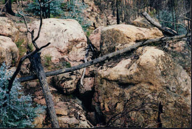
Photograph, circa April 2003
This is a photograph taken in the Chiltern - Mount Pilot National Park near Chiltern in Victoria. On this day, the Wooragee Landcare Group was in the national park looking for signs of the tiger quoll. Tiger quolls can be found in few places with the Chiltern - Mount Pilot National Park being one of them. This photograph is of a tiger quoll nesting site as tiger quolls often nest between large rocks. This image also shows the damage caused by the 2003 bushfires. These bushfires happened at the same time as the 2003 Alpine bushfires. This bushfire started by lightning and quickly became the largest fire in Victoria since the 1939 Black Friday bushfires. The Alpine bushfires destroyed 1.3 million hectares and burnt for 59 days before it could be controlled. The 2003 bushfires severely damaged the environment and concern was raised about the safety of tiger quoll. This photograph displays how the nesting site was damaged by the fire. This meant that the quoll itself could have also been impacted by the fire. Hence why the Wooragee Landcare group went for a search for signs of the quoll.This photograph is significant because it shows a tiger quoll nesting site. Tiger quolls are a highly valuable species because they live in very few places. This, in turn, makes their nesting site valuable. This photograph also signifies the impact of the 2003 bushfires on the Chiltern - Mount Pilot National Park. The image displays burnt trees which makes it clear that the fire was deeply damaging. The fallen log over the nesting site demonstrates how the bushfire must of put the tiger quolls at risk because of how the fire damaged their nesting site. Landscape coloured photograph printed on gloss paperReverse: WAN NA 0ANA0N0 NNN+ 1 1636 / [PRINTED] (No.9) / 923bushfires, mount pilot chiltern national park, mount pilot, chiltern, victoria, wooragee landcare group, wooragee landcare, wooragee, national park, tiger quoll, 2003 bushfires, beechworth, rocks, nesting site, photograph, 2003 alpine bushfires, 1939 black friday, 2003, hectares, fire, damage, burnt, burn