National Wool Museum
Ephemera - Photograph Envelope, Small's Snapshot Service, Herbert Small Pty Ltd, 1928-1929
... , Suez, Birregurra (Vic), Alexandra (Vic), Ballangeich (Vic... Naples, Port Said, Suez, Birregurra (Vic), Alexandra (Vic ...
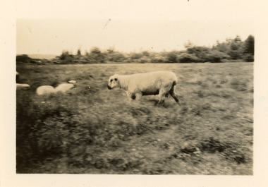
This envelope was found loose in the first of three albums compiled and owned by J W Allen, Secretary of New South Wales Grazier's, and is associated with the New South Wales Graziers Association world tour of sheep 1928-1929.
The album contains photographs of travel, sheep, farms, stations, people and landscapes from around the world.
Locations include Naples, Port Said, Suez, Birregurra (Vic), Alexandra (Vic), Ballangeich (Vic), Keith (SA), Mt Gambier (SA), Buckland Park (SA), Tasmania, Winton (QLD), Sydney Harbour, Canberra (ACT), Toowoomba (QLD), Rockhampton (QLD), Tocal (NSW), Deepwater (NSW), Glen Innes (NSW), Longreach (QLD), Moree (NSW), Barraba (NSW) and Mudgee (NSW).
Properties depicted include Mooleric, Turkeith, Woolongoon, Minadale, Crower Station, Merrindie, Koomooloo Station, Cappeedee, Koonoona, Rathmore, Ellenthorpe, Camden Park Station, Glenlegh, Strathmore Station, Ilparran Station, Binneguy, Midkin, Terlings, Ashley, Bereen, Plumthorpe, Mayvale and Havilah.
The album was found in a clean out at the Great Southern Agricultural Research Institute and donated to the National Wool Museum, along with other related material such as photographs, glass lantern slides and ephemera.Printed paper fold out envelope featuring a blue image and text on the front, showing a woman holding a camera. The inside has two paper pockets and the back features a blue printed image of a camera with bellows and blue printed text. Envelope has hand written and printed text.front: SMALL’S / Snapshot Service / HERBERT SMALL Pty. Ltd. / 308-310 COLLINS STREET., MELBOURNE / (Corner Collins and Elizabeth Streets). / 243 Pitt St., Sydney. / 16 Grenfell St., Adelaide.agriculture, sheep, farming, stations, research, breeding, photography, travel
 National Wool Museum
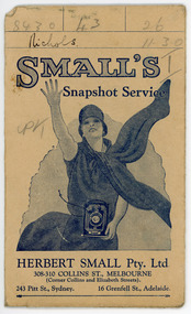 National Wool Museum