Showing 38 items
matching comet hill
-
 Bendigo Historical Society Inc.
Document - VICTORIA HILL - SELF TOUR OF GOLDFIELDS NO 1
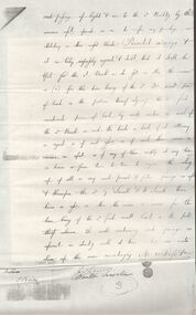
Two copies (a & b) of a Royal Historical Society of Victoria, Bendigo Branch Self Tour of Goldfields No 1. The guide is to enable the tourist to locate and see for himself some of the gold mining area of Bendigo. Mines mentioned are: Deborah, North Deborah, Central Deborah, The Fortuna Hustlers, Hustlers Royal Reserve (City Mine), Great Extended Hustlers, The Hustlers Reef, Lansell's Comet, The United Hustlers and Redan, Garden Gully United, Central Nell Gwynne, The Old Chum, The New Chum and Victoria, The Lazarus, The New Chum United, The New Chum Consolidated, The Garibaldi, Advance, Lansell's 180, The Victoria Quartz, North Old Chum, The Ironbark, The Hercules, The Carlisle United, The Mungo Group, The Ellenborough, The St. Mungo, The Lady Barkly, South St. Mungo. Notes also include wages at the Fortuna Hustlers in 1906 and 1907, gold yield, depth of shaft, Dividends and Calls. Notes compiled by Mr. A. Richardson.document, gold, victoria hill, victoria hill, self tour of goldfields no 1, deborah (big deborah), north deborah, central deborah, the fortuna hustlers, hustlers royal reserve (city mine), great extended hustlers, the hustlers reef, lansell's comet, the united hustlers and redan, garden gully united, central nell gwynne, the old chum, the new chum and victoria, the lazarus, the new chum united, the new chum consolidated, the garibaldi, advance, lansell's 180, the victoria quartz, north old chum, the ironbark, the hercules, the carlisle united, the mungo group, the ellenborough, the st. mungo, the lady barkly, south st. mungo, hustlers hill, new chum hill, jonathan harris, j hustler, messrs latham and watson, buckell & jeffrey, camp hill school, mechanics institute eaglehawk, duke of edinborough, geo lansell, the k k shaft, williamsons, little's claim, rosalind park, mr pryor, gold mines hotel, burrowes and sterry, bonatti, menzies, hildebrant and koch's, ellesmere, p m g repeater station, mr lazarus, mt alvernia hospital, mr clarke magee, rae's, jeweller's shop, hopetoun band room, manchester arms hotel, wattle gully mine chewton, long gully post office, 'pope pius' roman catholic church, kentish, mr j b watson, california gully state school, duke of edinborough, new st mungo, duchess tribute, south devonshire, duchess of edinborough, west united devonshire, united devonshire, princess alexandra, hopewell, miners' phthisis, bendigo goldfields, mr a richardson -
 Bendigo Historical Society Inc.
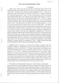
Document - LANSELL RELATED DOCUMENTS
Document.Copy of Williamstown Historical Society Newsletter No 17 (1977).On the second and third page of this Newsletter is an article entitled ''The guns of the 'Nelson''', written by Doug Mills, Castlemaine. The Warship NELSON underwent alterations in 1860, including cut down to two decks and lengthened, her armaments reduced to 72 guns. Two 7inch 68 pounder guns were added to her armament. In February 7 1867 she was officially given to the Colony of Victoria by the Imperial Government. At the time her Commander was Captain Charles B. Payne. The Warship reached Melbourne in 4th February 1868. Relics of the NELSON were auctioned at Williamstown Victoria Naval Depot, and her two anchors are preserved for public display at Williamstown. An active demand for a share of the guns from various towns in the State. Ballarat received four (4) guns, Bendigo and Castlemaine two (2) each, while one has been given to each of the following towns: - Ararat, Tarnagulla, Hamilton, Bacchus Marsh, Echuca and Geelong. Collection of Lansell related documents: a. Copy of photograph - Lansell's Big 180 Victoria Hill - early 1870s - New Chum Hill in background. B. Lansell Estate mines - compiled from the annual report of the Hon Minister of Mines for Victoria, 1906. A listing of the George Lansell Mining Company interests at the time of his death. These were, New Moon Co, N.L., Clarence, New Prince Of Wales Co. N.L., Virginia G. M. Co., Catherine Reef United Co N.L., Great Northern Co N.L., Williams United, McDuff Amalgamated Co, South Mungo Co, South Prince Of Wales Consolidated, Constellation Co. Golden Pyke Co, Johnson's Reef Extended Company, Golden Age Co., Princess Dagmar Co, New St Mungo Co, Johnson's Reef Co, North Johnson's Co, Collman and Tacchi Co, Confidence Extended Co, G. Lansell Sandhurst Mines, Pearl Co., Windmill Hill Co., United Hustlers and Redan, Koch's Pioneer Co., Hercules and Energetic Co., Lansell's Comet, Cornish United Co., Ironbark Co., Hustler's Reef Co., and No. 1 Lansell's 83, Carlisle Co., Great Extended Hustler's Co., Victoria Consolidated Co., Great Central Victoria Co., Victoria Quartz Co., Victory and Pandora , Lansell's Big 180, Tambour Major, New Chum and Victoria Co., Garden Gully United Co., G. Lansell, Lansell's 222, Lazarus Co., Sea Amalgamated Co., Hustler's Royal Reserve Co., Horwood and Burrowe's Co., New Chum Consolidated Co., G Lansell's Sheepshead, Gariboldi Co., Londonderry Co., Shamrock Co., Great Britain Co., Fortuna Hustler's Co., Eureka Extended Co., G. Lansell's G.V.L., New Red White and Blue Consolidated, Great Southern Co., Lansell's Concord Mines, True Blue Co., G. G. Consolidated Co., Extended Red White and Blue Co., Great Columbian, Sedgwick and New Birthday. Also, a listing: ''Among the biggest yields to ate (sic) (date?) in ozs or Pounds were''; New Moon.Co. N.L. 180,087 ounces, Clarence £303,932, Catherine Reef United N.L. £762,815, Great Northern Co Ltd £394,525, Johnson's Reef Co 277,320ounces, Windmill Hill Co. 113,842ounces, Hustler's Reef Co. And No.1 1,144,923ounces, Carlisle Co 307,835ounces, Great Extended Hustlers Co £1,038,125, Garden Gully United Co. £1,653,900, Great Southern 97,752ounces, New Chum Consolidated 89,526ounces. This part (b) has handwritten inscription ''compiled by J Sarvaas MCE(??) Certified Mining Surveyor; 22/8/06''; c. Copy of Deed dated Dec 1886 between George Lansell, Wooten Lansell and the Bank of New South Wales relating to a wall and windows and openings etc etc. (3 pages of legalese!!!!!). Also, a (related?) page copy of a Grant -by purchase to the Bank of New South Wales with a date of August 1855 on it ''Enrolled in the Office of the Registrar of the Supreme Court of the Colony of Victoria - signed by Acting Registrar.document, gold, mines -
 Swan Hill Regional Art Gallery
Print, ROBINSON, Sally, Halley's Comet, 1986
... Swan Hill Regional Art Gallery Horseshoe Bend Swan Hill ... -
Ballarat Heritage Services
Document, Gary Vines, The Historical Archaeology of Forest Based Sawmilling in Victoria 1855-1940, 1985
Masters thesissawmilling, industrial heritage, d=forestry, hall's whiskey creek mill, wombat forest, comet mill, mount disapointment, new asa mill, upper yarra forest, mill construction -
 Bendigo Historical Society Inc.
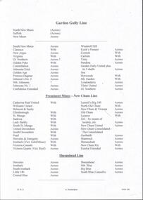
Document - DRAINAGE PROBLEMS - BURST WATER MAIN UNDER GARDEN GULLY SANDHEAP
... Northern, (partly), Specimen Hill, Clarence, New Argus, Comet, Gt...) Specimen Hill Clarence New Argus Comet Gt Central Victoria Victoria ...Handwritten notes from a Bendigo Advertiser report 7 Jan 1907. Three shifts of men working all Saturday and Sunday had not located the main. A large are of Eaglehawk and the City are without water. Had to timber a hole to a depth of 25 ft. Victoria Quartz, Windmill Hill, Needle, Confidence Ext'd, Princess Dagmar, Golden Age, Golden Pyke, Macduff, constellation, Gt Northern, (partly), Specimen Hill, Clarence, New Argus, Comet, Gt Central Victoria and Victoria Consols had to close because they had no water and five to six hundred men believed to be out of work. City Council will put water-carts on and supply residents free of charge. New Moon, South Moon, Virginia , Catherine and Devonshire mines get their water direct from the water race so they did not close down. Document from Albert Richardson Collection of mining history.gold, drainage problems, drainage problems, burst water main under garden gully sandheap, bendigo advertiser, 7/1/1907, victoria quartz, windmill hill, needle, confidence ext'd, princess dagmar, golden age, golden pyke, macduff, constellation, gt northern, (partly), specimen hill, clarence, new argus, comet, gt central victoria, victoria consols, north johnsons, johnson's reef, snobs hill line, new moon south moon, virginia, catherine, devonshire, albert richardson -
 Bendigo Historical Society Inc.
Document - MINING REPORTS - LOCATION OF SHAFT WITH THE REEF
BHS CollectionHandwritten list by Albert Richardson, with typed copy, of mines on the Garden Gully, Sheepshead, Hustlers, Nell Gwynne and the Deborah, Paddy Gully and Derby Lines of Reef. Also a list of prominent mines on the New Chum Line. document, gold, mining reports, mining reports, location of shaft with the reef, north new moon, suffolk, new moon, south new moon, clarence, new argus, virginia, gt northern golden pyke, constellation, johnsons extd, golden age, princess dagmar, johnson's no 2, nth johnsons, johnsons no 1, confidence extended, windmill hill, koch's pioneer, cornish, carlisle, pandora, garden gully united, catherine reef united, williams united, belmont & saxby, ellenborogh, st mungo, sadowa, lady barkly, south st mungo, united devonshire, south devonshire, pearl, hercules & energetic, ironbark (vict gold mines), victoria consols, victoria quartz (vict reef), lansell's big 180, north old chum, new chum & victoria, old chum, lazarus, 222, new chum united, new chum consolidated - the consolidated, garibaldi, shamrock, hercules, ironbark, south ironbark, little 180, central blue, sheepshead, nth blue, big blue, south blue (lansell's), united hustlers & redan, the redan, comet (lansell's), hustlers reef plus no 1 shaft, old hustlers, gt extended hustlers plus 'pups', royal hustlers reserve nos 1 & 2, fortuna hustlers, new chum syncline, central nell gwynne, monument hill, central deborah, north deborah, deborah, collman &tacchi, lansells sandhurst needle, johnsons no 3 (nelsons) -
 Bendigo Historical Society Inc.
Document - Great Extended Hustlers Gold Mine, Albert Richardson
Seven men were killed at the Great Extended Hustler's mine disaster on 2nd May 1914 by an explosion of dynamite occurring as the men were waiting at the plat to ascend the mine at the end of their shift. No blame was attached to anyone in the findings of the inquisition. It was unknown what caused the dynamite to explode. This document formed part of the research done at the time by Bendigo Historical Society, of the 100 years commemoration of the mine disaster, held at Hustlers Hill in 2014. Six page copy of research document, describing the history and geology of the Great Extended Hustlers Mine and the Great Extended Hustlers Reef Q.M. Co.. Topics include: general overview of history, mines along the Hustlers line, characters of the saddle reefs, gold occurrences, effect of pitch, influence of faulting, payable reefs and saddle reefs and spurs. Mine overview researched by Mr. Albert Richardson. great extended hustlers, goldmining, hustlers consols, united hustlers and redan, k.k. mine, comet, hustlers reef no. 1, hustlers reef, hustlers royal reserve co., park shaft, hustlers royal reserve no. 2, city shaft, fortuna hustlers -
 Bendigo Historical Society Inc.
Document - Geological Survey of Victoria, Hustlers Line of Reef, Bendigo, April, 2014
Seven men were killed at the Great Extended Hustler's mine disaster on 2nd May 1914 by an explosion of dynamite occurring as the men were waiting at the plat to ascend the mine at the end of their shift. No blame was attached to anyone in the findings of the inquisition. It was unknown what caused the dynamite to explode. This document formed part of the research done at the time by Bendigo Historical Society, of the 100 years commemoration of the mine disaster, held at Hustler's Hill in 2014. Seven page photocopy of Department of Mines, Bulletin, Geological Survey of Victoria, Hustlers Line of Reef, Bendigo, No. 33 by H.S. Whitelaw. Includes plan of Hustlers Royal Reserve No. 2, (main shaft) showing location on Pall Mall, and location of Post Office and Law Courts; plan of location of Hustlers Royal Reserve No. 2 (Park Shaft) showing Jail (sic), Camp Hill State School, two 'lagoons' in between tennis court, croquet court and bowling green; a plan of the Great Extended Hustler's Shaft and two copied images of Hustler's Hill showing mining buildings, poppet heads and chimneys. Comet, K.K., Hustler's No. 1, Old Comet and United Hustler's and Redan Mines are shown in the images. great extended hustlers, goldmining, accident, quartz, mining, k.k. mine, comet mine, hustler's line of reef, old comet, united hustler's, redan