Showing 1146 items
matching garden city reserve
-
 Federation University Historical Collection
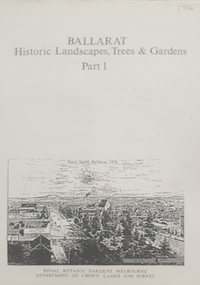
Book, Peter Lumley et al, Ballarat: Historic Landscapes, Trees & Gardens, 1983, 1983
Lisa Green and Lisa Morcom of Ballarat College of Advanced Educatiion contributed to this report.275 page landscape study of Ballarat including Trees in the Victorian Landscape; Plant sources early Ballarat nurseries, Botanical Gardens, Lake Wendouree, Fairy Gardens, Victoria Park, Ballaarat Old Cemetery, Eastern Oval, City Oval, Ballarat East Town Hall Gardens, Eureka Stockade, Observatory, Yarrowee, Black Hill, Sovereign Hill, Cheek Channels, Canadian Creek, Poverty Point Reserve, Goldmining Relics, Woah Hawp, Buninyong, street plantings, Russell, Victoria, Bridge Mall, Sturt Street Gardens, Avenue of Honour, Webster, Elms, ballarat, trees, nursery, r.u. nicholls, francis moss, ballarat botanical gardens, victoria park, lake wendouree, ballaarat old cemetery, eastern oval, ballarat east town hall gardens, ballarat school of mines botanical gardens, eureka stckade recreation reserve, ballarat observatory, yarrowee creek, black hill reserve, sovereign hill, ballarat avenue of honour, victoria street plantings, bridge mall plantings, george longley -
 Federation University Historical Collection
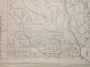
Plan, City of Ballarat (Part) (Ballaarat East), 08/05/1928
Crown Cadastral Plan showing Governement Roads, Crown Parcels, Dimensions, Crown grantees, dated of grants, etc in Ballarat East. The plan shows features such as Bakery Hill, Canadian Station, recreation reserves, timber reserves, Yarrowee Creek, Black Hill Reserve, Eureka Reserve and Garden, Orphan Asylum, Rifle Butts Reserve, Ballarat Woollen Mill, Ballarat Observatory, Sovereign Hill Recreation Reserve, Specimen Vale, Market Reserve, Cemetery WGS 84 Centroid 37 degrees 33' 55" S 143 degrees 52' 38" E E.W. Extent; 5 km N-S Extent; 4 kmmap, plan, ballarat east, ballarat woollen mill, ballarat railway line, ballarat railway station, eureka reserve, eureka cemetery, ballarat orphanage, russell square, bakery hill -
 Federation University Historical Collection
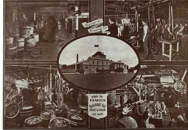
Book, Ballarat Illustrated : Under the Seals of the City & Town Councils, c1920
This book was a donation to Federation University Australia's Professor David Battersby from Vice-Chancellor Professor Scott Bowman of Central Queensland University.Soft cover. Front cover with some red. 80 pages. Back cover Plan of Ballarat Map. Photographic plates. Brief history of Ballarat and the topics photographed. . Ballarat City Municipal Chambers . The Ballarat Banking Company Limited . Art Gallery Ballarat . The Ballarat Trustees, Executors & Agency Company Limited . John MacLeod & Coy Pty Ltd . The Ballaarat Gas Coy . Ballarat's Homes . J. J. Goller & Co. . Ballarat East Views . Star Office . The Ballarat Courier . Morshead's . M. B. John Ballarat - The largest Inland Brass Foundry in Australia . Rowlands Koomah Spa . Huttons the Jewellers . Botanical Gardens Ballarat . Millers the Clothiers . Jas Smith Agricultural Machinery . Views of Lakes Learmonth & Burrumbeet . Coles & Pullum Stock & Station Agents . Harry Davies & Co. . Views about the City . Benoit's Sun Foundry . Ballarat College (for Boys) . Wm Paterson's . Lydiard Street Views . Eureka Terra-cotta & Tile Co. of Australia Limited . Churches of Ballarat . The Ballarat Woollen & Worsted Co. Ltd Sunnyside Mills . Red Shop Tea Rooms . Tyler's - Bridge Street, Ballarat . Allchin Bros Ballarat . Loreto Abbey Mary's Mount Ballarat . Brinds - Dunnstown . Ballarat Brewing Co. . Turnbridge's Arcade . Zoological Gardens Ballarat . A. Cant Plumber & Gasfitter . Interiors of some Ballarat Churches . Hugh Jones & B . W. F. Coltman . Views in Eureka Reserve . Loveland & Haslem, Moter Engineers . Public Institutions Ballarat . G. Warner & Co. Prop. Ltd . The Electric Supply Company of Victoria Limited . Ballarat East Views . Longhurst's Specialities . P. C. Thornton Proprietor Sturt St Ballarat . Cowley's Eureka Ironworks Pty Ltd . W. Owen Sports Depot & Tobacconist . Clarendon Ladies' College . Crocker's . Evening Echo Office . London Bank Chambers . Proprietors of Business . Broadbent Bros & Co. Gifted by Vice-Chancellor Professor Scott Bowman Central Queensland University, 2014.ballarat, school of mines, evening echo, john scullin -
 Federation University Historical Collection
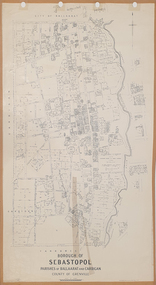
Plan, Borough of Sebastopol, 1940, 01/07/1940
Sebastopol became a suburb of the City of Ballarat.Plan showing the streets, allotments creeks in the Borough of Sebastopol, Parishes of Ballaarat and Cardigan, County of Grenville, in 1940. sebastopol, t. rider, yarrowee creek, leigh river, st george's reserve, leigh creek, sebastopol public gardens, sebastopol recreation reserve, gravel reserve, night soil depot, sanitary depot, rubbish depot -
 Federation University Historical Collection
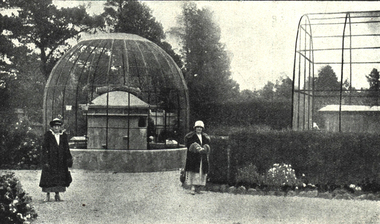
Photograph - Image, Scene in the Ballarat Zoological Gardens, c1923, c1923
In 1923 the Ballarat Zoo was open 2-5pm daily and 10-5 on Saturday. The entrance fee was 3 pence. When Ballarat pioneer citizen, Ben Jahan, died he left his fortune of nearly 11,000 pounds to the City of Ballarat for the purpose of establishing a zoo.Black and white image of the Ballarat zoo which was situated in the north-west corner of the Ballarat Botanical Gardens Reserve.ballarat zoo, ballarat zoological gardens, ballarat botanical gardens, ben jahn, parks and gardens -
 Bendigo Historical Society Inc.
Document - MINING IN BENDIGO COLLECTION: NOTES ON MINING IN BENDIGO
Handwritten notes on mining in Bendigo. Notes mention the size of the Bendigo Goldfield, the number of lines of reef and a brief history of goldmining in Bendigo.document, gold, mining in bendigo, mining in bendigo, notes on mining in bendigo, ravenswood sheep run, survey regiment, california hill state school, lansell's 222, mr lansell, camp hill school, high school, park mine (royal hustler's reserve no 1), memorial hall, city mine ( royal hustlers reserve no 2), mining stock exchange, beehive buildings, allan's walk, buckell & jeffrey, fortuna hustlers, great extended huatlers, garden gully united, mining exchange, garden gully united, wattle gully mine, ironbark mine, manchester arms hotel, extended hustlers mine, south belle vue, new chum railway, eureka extended, shenandoah, victoria quartz, the big 180, old chum, gt extended hustlers -
 Bendigo Historical Society Inc.
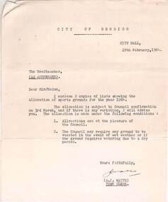
Document - NORMAN OLIVER COLLECTION: ALLOCATION OF SPORTS GROUNDS FOR SCHOOLS 19 FEBRUARY 1964
The Norman Oliver collection. Norman Oliver was three times Mayor of Bendigo - 1950-51, 1964-65, 1970-71. Three typed pages - a covering letter from City Hall dated 19th February 1964, to the Head teacher regarding the allocation of sports grounds for 1964, a weekly timetable for the use of each ground by a particular school, and a list of special allocations. The grounds allocated are : Queen Elizabeth Oval, Showgrounds, Kennington, Golden Square, Ewing Park, Wilkie Park, Centenary Oval, Garden Gully, Garden Gully (new Basketball courts), North Bendigo Recreation Reserve, Allingham St., Quarry Hill, White Hills, Long Gully, and Londonderry. Weeroona Oval and the Olympic Pool are included in the special allocations list for events such as annual sports days, inter-school sports and school swimming carnivals.bendigo, council, norman joseph oliver , councillor norman oliver. mayor of bendigo. school sports. bendigo sports grounds. -
 Bendigo Historical Society Inc.
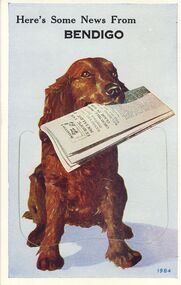
Postcard - NOVELTY POSTCARD BENDIGO VIEWS 1984
14.5cm X 9.2cm Postcard of Retriever dog holding paper with 9 fold-out Bendigo Views. Printed 1984 City Hall, Civic Buildings, Central Deborah Mine, Alexandra Fountain, Look-out Tower, Conservatory Gardens, Soldiers Memorial Hall, Post-Office. Pall Mall, The Lake Upper Reserve.Valentine's Mail Postcard.bendigo, buildings, heritage buildings -
 Bendigo Historical Society Inc.
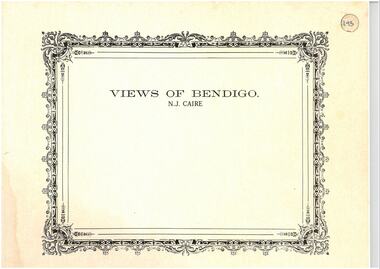
Photograph - VIEWS OF BENDIGO: COPIES OF 52 PHOTOS, 1850 - 1900
Copies of Photographs from - Views of Bendigo by Nicholas Caire Originals in Box 13 No.1 Sandhurst east/ City Reserve x 2 No 2 New Chum Line of Reef No 3 Sandhurst to North from top of Masonic Hall No.4 Hustler's Line of Reef No.5 Battery of stampers for crushing quartz x 2 No.6 View Sandhurst from top of Masonic Hall x 2 No.7 Excavation Quartz Reef, Ironbark Hill. No 8 St. Paul's Church. No.9 View Camp Reserve from Court House. No.10 View of Nth. Old Chum. No.11 View Camp Hill near the Lodge x 2 No.12 Garden Gully. No.13 Shamrock Hotel, Sandhurst. No.14 View from Court House, east end Pall Mall. No.15 Wesleyan Church, Golden Square x 2 No.16 Savings Bank, Sandhurst No.17 Bendigo District Hospital. No.18 Interior Wesleyan Church x 2 No.19 View Golden Square township. No.20 The Town Hall, Sandhurst. No 21 The City Hotel,Sandhurst. No 22 Pall Mall Sandhurst, No 23 Sandhurst City Market No 24 Pall Mall looking west x 2 No 25 Camp Hill x 2 No 26 Charing Cross No 27 View Sandhurst. x 2 No 28 Long Gully. No 29 Railway station and sheds No 30 Cemetery Back Ck. No 31 Kock's Pioneer Quartz Crushing Plant Long Gully. No 32 Masonic Hall. No 33 Bendigo Benevolent Asylum. No 34 Bendigo Flat. No 35 Old Chum Hill x 2 No 36 New Chum Gully No 37 Township of Eaglehawk No 38 From St Paul's tower looking west No 39 Tunnel Big Hill. No 40 From St Paul's tower looking south x 2 No 41 From St Paul's tower looking eastward x 2 No 42 From St Paul's tower looking north west x 2 No 43 Great Extended Hustlers Quartz Mining Claim No 44 Big Hill Rail line x 2 No 45 From St Paul's tower looking westward x 2 No 46 From St Paul's tower looking north west No 47 Big Hill Ranges Buick. x 2 No 48 St.Paul's Tower x 2 No 49 Eaglehawk township. No 50 Mitchell Street No 51 Botanical gardens, White Hills x 2 No 52 View Point, Sandhurst. .N.J. Caire.place, bendigo, bendigo area., views of bendigo. -
 Bendigo Historical Society Inc.
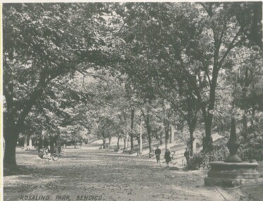
Photograph - VIEWS OF BENDIGO
Photographs - 8 of (small) black & white. Photo's of Pall Mall (no.22), Civic Buildings (no.1), The Baths Upper Reserve (no.13), Alexandra Fountain (no.6), Conservatory Gardens (no.29), City Hall (no.8), Central Deborah Mine (no.19), Rosalind Park (no.5). Handed in by Barry & Vicki Mulvena of 48 Lord St.,m Roseville, NSW 2069.Valentine's Snapshots.place, bendigo, picturesque views of bendigo., views of bendigo. -
 Bendigo Historical Society Inc.
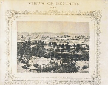
Photograph - NICHOLAS CAIRE VIEWS OF BENDIGO
Full set (52 photos) of Nicholas Caire ''Views of Bendigo'' photographs. 1) Sandhurst East with a portion of the City Reserve. 2) New Chum line of reef. 3) Sandhurst-North part as seen from the top of the Masonic Hall. 4) The Hustler's line of reef seen from Redan Hill. 5) Battery of stampers for crushing quartz 6) View of Sandhurst as seen from the top of the New Masonic Hall. 7) Excavation of quartz reef near Ironbark Hill. 8) St. Paul's Church, tower and belfry. 9) View of the Camp Reserve as seen from the Court House. 10) View of North Old Chum showing surface excavations. 11) View as seen from the Camp Hill near the lodge. 12) Garden Gully amalgamated claims. 13) Shamrock Hotel, Sandhurst. 14) View as seen from Court House showing the willows & East Pall Mall. 15) Wesleyan Church, Golden Square. 16) Savings bank, Sandhurst. 17) The Bendigo district hospital. 18) Interior of the Wesleyan Church, Golden Square. 19) View of Golden Square township. 20) The Town Hall, City of Sandhurst. 21) The City Hotel, Sandhurst. 22) Pall Mall, Sandhurst. 23) Sandhurst City Market. 24) Pall Mall, Sandhurst looking west. 25) View from Camp Hill looking north - east 26) View of Charing Cross, Sandhurst. 27) View of Sandhurst as seen from Knipe's Castle. 28) Township of Long Gully. 29) View taken from St. Paul's tower. 30) View of the Sandhurst cemetery at back creek. 31) Kock's pioneer quartz crushing plant, Long Gully. 32) The New Masonic Hall, Sandhurst. 33) The Bendigo benevolent asylum and industrial school. 34) Bendigo flat as seen from Wattle Hill. 35) View of Old Chum Hill. 36) New Chum Gully as seen from Specimen Hill. 37) Township of Eaglehawk. 38) View from St. Paul's tower looking south west. 39) View of the railway tunnel through the Big Hill, near Mt. Herbert. 40) View taken from St. Paul's looking south. 41) Scene taken from St. Paul's tower looking eastward. 42) View of Sandhurst from St. Paul's tower looking north-west. 43) The great extended Hustler's co's. quartz mining claim. 44) View from the Big Hill showing the line of railway to Melbourne. 45) View from St. Paul's Church tower looking westward. 46) View from St. Paul's Church tower looking north-west. 47) Scene near the Big Hill ranges taken from Mr. Buick's residence. 48) View from St. Paul's Church tower looking north eastward. 49) Township of Eaglehawk 50) View of Mitchell Street, Sandhurst. 51) Botanical gardens near the White Hills. 52) View Point, Sandhurst.bendigo, streetscape, various views, nicholas cairne -
Port Melbourne Historical & Preservation Society
Document - Naming of Olive's Corner, Nov 1999
City of Port Phillip instigated the competition re the 'no-name' plaza in October 1999, and the winner was announced 14 Nov at the PMH&PS's 'Lee-ar-day Days' event. Judging panel (Cr Julian Hill, Bruce McKeon and Pat Grainger) met 8.11.1999 to decide winner.Eight pages used in judging the 1999 naming competition for the reserve at Bay and Liardet Streets that through this process became known as 'Olives Corner' (or more formally, Olive Zakharov's corner'). Includes list of entries and copies of all written submissions. Short listing of judges indicated. .09 nomination form to COPP .10 thank you condolence card .11 "Quick reads' newspaper column on Olive's cornerJudge has indicated in green ink the eliminations, finalists etc.parks and gardens, memorials, olive zakharov, julian hill, bruce mckeon, pat grainger -
Port Melbourne Historical & Preservation Society
Plan - Proposed layout for Murphy's Reserve, Fred Cook, City Engineer, 1948
Small (reduced) copy of a 1948 pencil drawing of proposed layout of Murphy's Reserve (original in Port Phillip City Collection)Notes in pencil on back, also numeral '807'built environment - recreational facilities, parks and gardens, sport - recreational grounds, city engineers, fred cook -
 Port Melbourne Historical & Preservation Society
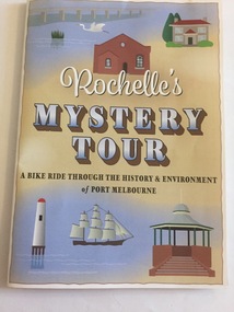
Pamphlet - Rochelle's Mystery Tour, bicycle tour of Port Melbourne identifying historic locations, Rochelle BELL, Rochelle's Mystery Tour, Jan 2017
Coloured 4 fold pamphlet with map, photographs of historic bike tour through Port Melbourne. Inside is large map marked with points of interest corresponding to photo and information on reverse sideRochelle's Mystery Tour a ride through the history and environment of Port Melbournebuilt environment, recreation, social activities, celebrations fetes and exhibitions, piers and wharves - princes pier, piers and wharves - station pier, rochelle bell, social health inclusion program (ship), danielle mccaffrey, centenary bridge, natural environment - beaches and foreshore, band rotunda, westgate park, lagoon reserve, liardet community centre, sandridge trugo club, garden city -
Port Melbourne Historical & Preservation Society
Photograph - Station Hotel, Sandridge, Roger Gould?, 1871
Photographed in 1872 by William PATERSON as one of a series for the Melbourne Exhibition of 1873; original mount hanging in Engineering Department at Port Melbourne Town Hall at 19-9-1994 but now in Port Phillip,City Collection. This set of original prints belonged to Town Clerk Syd ANDERSON, then to his daughter-in-law Phyllis ANDERSON (donor). Accompanied by list of captions, both hand written and typed (the latter a partial listing). Glossy print, copy of photo c1871 of early Station Hotel from the footbridge over the railway line, prior to extension of Bridge Street over the railway. Shows Presbyterian Church, carriages, a number of people, geese on the Railway Reserve.religion - presbyterian church, costume, transport - horse, parks and gardens, sydney sims anderson, town clerks, bridge street, railway reserve, business and traders - hotels -
Port Melbourne Historical & Preservation Society
Photograph - Railway reserve, looking from Bridge Street, Port Melbourne towards the city, 1950s
B&W photo of the railway reserve, looking from Bridge St towards the city. North Port Station is in the centre, Albion Hotel and Dunlop on the left. A large plantation of elm trees is on the left. CoPP image.transport - railways, parks and gardens, north port railway station, dunlop, albion hotel, railway reserve -
Port Melbourne Historical & Preservation Society
Photograph - Port Melbourne Council horse and cart, Railway Reserve, 1920
Photo of council horse and (water?) cart 'Port Melbourne Town Council No. 3' on railway reservation, Station Street in background'Raglan St?' on backparks and gardens, local government - city of port melbourne -
Port Melbourne Historical & Preservation Society
Map, City of Port Melbourne, Oct 1963
Gives a visual understanding of the Port Melbourne area in 1963A detailed map of the Port Melbourne area in October 1963. Details roads and laneways, undeground cables, light and power poles, sewer, bridges, piers reserve and park areas.local government, built environment, piers and wharves, natural environment - beaches and foreshore, parks and gardens, piers and wharves - princes pier, piers and wharves - station pier, engineering - roads streets lanes and footpaths, engineering - canals and drainage -
 Bendigo Historical Society Inc.
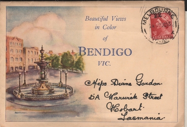
Postcard - VIEWS OF BENDIGO - FOLD OUT PHOTOS IN FOLDER
Sepia coloured folder, enclosing photos of Bendigo. On front 'Beautiful Views in Color of Bendigo Vic.' Photo of Alexandra Fountain on LH side. 3 1/2d stamp on top RH corner. Folder addressed to Miss Diane Gordon 5A Warwick Street, Hobart, Tasmania. Colour photos include : Alexandra Fountain, The City Hall, The Botanic Gardens, Hargreaves Street, The Conservatory Gardens, Rosalind Park, Pall Mall, The Upper Reserve Lake and The Conservatory Gardens. Photos appear to be from the 1940's. Enclosed letter states that the donor's grandfather 'mailed them me during his visit to your city in what appears to be 1953. Diane Palmer'Valentine Publishing Co Pty Ltdbendigo, tourism, post card folder -
 Bendigo Historical Society Inc.
Map - GUIDE MAP OF BENDIGO & EAGLEHAWK, Late 1920's
Map. Guide Map of Bendigo & Eaglehawk. Light brown coloured booklet containing folded map of Bendigo and Eaglehawk. Outer cover is printed in blue and red ink and states - With compliments of J H Curnow & Son, Auctioneers, Real Estate Agents, Farm & Dairy Produce Merchants, Bendigo. Printed by J B Young, Lithographer. Map shows tramways & bus routes. Map shows Agricultural Showgrounds located between Park Street, Water Street, Barnard Street and Bridge Lane. Also shows Acclimitization Reserve located behind The Botanical Gardens at White Hills. Shows the location of Sailors Gully, Peg-Leg Gully, Jobs Gully, California Gully, Long Gully, Ironbark Gully, Golden Gully, Poverty Gully, Sheepshead Gully, Charcoal Gully, Eaglehawk Creek, Bendigo Creek and Back Creek. Contains interesting facts about Bendigo - Area 7,900 acres. Population - 26,000. First Council elected - 1855. Proclaimed a Borough - 1863. Proclaimed a City - 1871. Gold Rush broke out - 1851. For first 10 years gold yield averaged 8,600 ozs. per week . Total gold yield to 1923 - 572 tons valued at 82,000,000 pounds. Deepest mines - Victoria Quartz 4,614 ft., New Chum Railway 4,318 ft. 13 mines over 3.000 ft. deep. 53 mines over 2,000 ft. deep. Sewering of City commenced 1922, all principal buildings now sewered. Map printed by Arnall & Jackson, General Printers, Stationers & Engravers, 476 Collins Street. Map displays advertisement for J H Curnow & Son, Bendigo's leading Auctioneer and Estate Agents, Mitchell & Queen Sts. Bendigo. Map Scale 20 chs. = 1 in.cottage, miners, guide map of bendigo and eaglehawk -
 Bendigo Historical Society Inc.
Map - GUIDE MAP OF BENDIGO & EAGLEHAWK, Late 1920's
Map. Guide map of Bendigo & Eaglehawk. Folded map of Bendigo & Eaglehawk with blue outer cover booklet. Map is compiled by E E Parker, Eaglehawk. Map shows tramways, bus routes and cost one shilling. Map shows Agricultural Showgrounds located between Park Street, Water Street, Barnard Street and Bridge Lane. Also shows Acclimitization Reserve located behind the Botanical Gardens at White Hills. Shows the location of Sailors Gully, Peg-Leg Gully, Jobs Gully, California Gully, Long Gully, Ironbark Gully, Golden Gully, Poverty Gully, Sheepshead Gully, Charcoal Gully, Eaglehawk Creek, Bendigo Creek and Back Creek.Contains interesting facts about Bendigo:- Area - 7,900 acres, Population - 26,000, First Council elected - 1855, Proclaimed a City - 1871. Gold Rush broke out - 1851. For first 10 years gold yield averaged 8,600 ozs. Per week. Total gold yield to 1923 - 572 tons valued at 82,000,000 pounds. Deepest mines - Victoria Quartz 4,614 ft., New Chum Railway 4,318 ft., 13 mines over 3,000ft. deep, 53 mines over 2,000 ft. deep. Sewering of City commenced 1922. All principal buildings now sewered. Map printed by Arnall & Jackson, General Printers, Stationers & Engravers, 476 Collins Street. Outer map blue cover printed in red and blue ink by J B Young, Lithographer. Map displays advertisement for Bendigo Timber Co. Outer blue cover displays advertisement for Campbell Connelly & Co. Pty. Ltd, Ironmongers, Timware Manufacturers, Plumbers, Sewerage Contractors, High and Forest Sts, Bendigo 9outside back cover) and for Hartleys ( J L Shoosmith) Bendigo, displaying Indian Motor Cycles (inside back cover).map, bendigo, township, guide map of bendigo & eaglehawk -
 Bendigo Historical Society Inc.
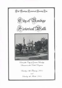
Book - CITY OF BENDIGO HISTORICAL WALK BOOK, 2001
Photocopy mock up of original booklet of The Bendigo Historical Society Inc. 'City of Bendigo Historical Walk' containing photographs of historic buildings to be seen on the walk. Front cover Queen Victorian Gardens, Town hall, Mechanics Institute/School Of Mines and Industry, H. M. Prison Bendigo, Camp Hill Police Barracks, Sandhurst Corporate High School, Central State School No. 1976, The Cascades, District Lands Office (Dudley House), Masonic Temple and Hall, Sandhurst Volunteer Rifle Brigade Orderly Room, Bank of Victoria, Henry Jackson's Store View Point,Alexandra Fountain, Beehive Store/Mining Exchange, Colonial Bank. Hustlers Royal Reserve NO. 2/R.S.L. Memorial Hall, Post Office 3rd 4th and final, Bendigo Law Courts, Shamrock Hotel 2nd and another view. Important Bendigo Dates; 1851, April gold discovered at Golden Square by Margaret Kennedy,1851 Approx. 200,000Troy oz. of gold found in Bendigo, 1852 475,857 Troy oz. Gold for the year, 1853 November 31st Bendigo Hospital admits first patient,1853 December 9th Bendigo Advertiser first issue printed, 1854 First Land Sales and streets are surveyed and named for the first time, 1854 Census of Bendigo showed 15,480 residents plus 4,000 Chinese, 1855 Sandhurst Municipal District formed, 1861 Sandhurst Proclaimed a Town. 1862 Railway to Melbourne opened, 1867 Visit by His Royal Highness the Duke of Edinburgh, 1871 July 21st Sandhurst proclaimed a City, 1881 Population of Sandhurst 14,577 residents, 1882 First telephone communications introduced, 1890 Electric trams (battery) commenced running, 1891 May 18th City of Sandhurst changes its name to City of Bendigo.book, bendigo, buildings, historic -
 Yarra City Council
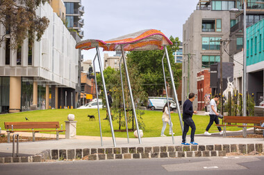
Artwork, other - Installation/Sculpture, William Eicholtz, Close Knit, 2023
'Close Knit' was conceived based around providing the high density accommodation of the area with what many residents will never experience; the iconic ‘Aussie’ backyard, symbolised by washing on a Hills Hoist. This concept was transposed into several elements, including two large flying jumper sculptures. These stainless steel and fibreglass structures are supported on slanted poles, reminiscent of Hills Hoist arms. The jumpers appear to catch the breeze, and billow up, like washing on the clothesline on a sunny day, and cast lovely shadows across the paths and gardens. They are bright and joyful reminders of simple homespun joys. The handcraft theme is also featured in knitted concrete garden walls throughout the gardens. As if the wind is captured in the movement of the Hellenistic drapery, these panels echo the Lady of Justice, an earlier work of mine on the Victorian County Court. These feature walls bring a softness to the park and hark back to classic European garden design. There are 6 finial/balls of wool marking gateways and entrances to the park, as well as a couple randomly scattered throughout to be discovered. There is also a draped plinth at the Peel street entrance which has my signature. Again these elements echo traditional garden design and are a tactile and recognizable link to the hand knit themes of the park. Given the strong themes of domesticity and handcrafts, I have titled my work ‘Close Knit’, as it applies to the purpose of this public space as well as the works scattered throughout. Yarra City Council delivered Cambridge Street Reserve in partnership with the Victorian Government, who have supported the project with $1.3m funding. Yarra City Council has invested a further $731,130 towards the project. Urban Imitative Landscape Design worked with artist William Eicholtz at the beginning of the design process to consider the needs of a growing high-density population of the area. At double the size, with extensive park seating and a large lawn space which is shaded by native trees, Cambridge Street Reserve is now the largest park in Collingwood. 'Close Knit' by William EicholtzTwo knitted fibreglass 'jumpers' over stainless steel framework; six concrete balls of wool throughout the park; 25 metres of cast (drapery) concrete walls; concrete plinth at Peel street entry which is draped with a concrete knit and a ball of wool on top as finial; reverse rope reliefs on the front façade of eastern stairs. Artist name and date 'William Eicholtz 2023' inscribed on plinth with ball of wool on top as finial. handcrafts, domesticity, aussie icons, european garden design, public space, high density accomodation -
Whitehorse Historical Society Inc.
Article, Job advertisements, 1977
Photocopy of a collection of advertisements for municipal councils.Photocopy of a collection of advertisements for municipal councils. Includes position of Assistant Superintendent of Parks and Gardens with the City of Nunawading.Photocopy of a collection of advertisements for municipal councils.city of nunawading, council staff, parks and reserves -
Whitehorse Historical Society Inc.
Pamphlet - Periodical, Calendar 2004, 2003
City of Whitehorse 2004 calendar. Photographs of local wildlife and flowers. Includes advice about gardening, conservation of energy.City of Whitehorse 2004 calendar. Photographs of local wildlife and flowers. Includes advice about gardening, conservation of energy. Appeals for volunteers to assist care for parks and gardens.City of Whitehorse 2004 calendar. Photographs of local wildlife and flowers. Includes advice about gardening, conservation of energy.city of whitehorse, wildlife, native plants, conservation of natural resources, parks and reserves, moodie, ian, gardening -
Whitehorse Historical Society Inc.
Article, Reserve balance is right: residents, 2014
Open space and housing balance proposed by the Whitehorse Council.Open space and housing balance proposed by the Whitehorse Council has been approved by many residents and Friends of Healesville Freeway Reserve. The Nunawading Community Gardens will be retained.Open space and housing balance proposed by the Whitehorse Council. nunawading community gardens, friends of healesville freeway reserve, makhijani, anne, healesville freeway reserve, vicroads, city of whitehorse -
 Whitehorse Historical Society Inc.
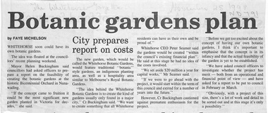
Newspaper - Article, Botanic Gardens Plan, 25/11/1998
Two articles in the Whitehorse Gazette and Whitehorse Post on the possibility of setting up a botanic garden on the site of the Whitehorse City's 'Bicentennial Orchard' situated between Hawthorn Road and Jolimont Road. Whitehorse Council have called for a feasibility report from an operational and financial point of view..parks and reserves, bicentennial orchard, hawthorn road, forest hill, jolimont road, springvale road -
 Whitehorse Historical Society Inc.
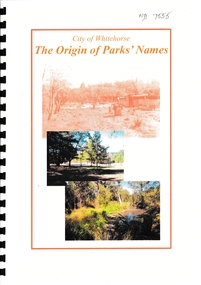
Booklet - The Origin of Parks' Names, City of Whitehorse Parks and Reserves: Names and Origins
List of more than 50 Whitehorse Parks and Reserves and the Name OriginAn incomplete list of more than 50 parks and reserves in Whitehorse and the origin of their names. Printed copy with plastic spiral binding with front and back plastic covers. Some photo originals faded.non-fiction List of more than 50 Whitehorse Parks and Reserves and the Name Origincity of whitehorse, parks and reserves, halliday park, box hill gardens, yarran dheran, schwerkolt cottage, gardiners creek reserve, whitehorse reserve, walker park, slater reserve, old strathdon orchard, morton thomas, boer war memorial linsey park, kyalite, elmore walk, john gardiner, bruce and daisy campbell, upton house, ballyshanassay, blackburn lake -
 Whitehorse Historical Society Inc.
Photograph, Slaters Reserve - Community Garden, 1/08/2009
See the following relating Slater & the Reserve NP2000, 3558, 4396, 5141 & 5824.Coloured Photograph of the City of Whitehorse Community Garden to the north of the Stadium. This was the second Community Garden in this City established by the former City of Nunawading. The Community Garden in Jolimont Road Nunawading was the first garden established. It was also the first Community Garden established in Australia.slaters reserve, stadium, basketball, community gardens -
 Whitehorse Historical Society Inc.
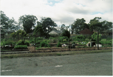
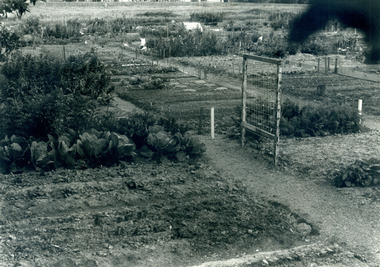
Photograph, Nunawading Community Garden
Black and white photograph of the Nunawading Community Garden in Jolimont Road, Forest Hill established in October 1977. This photo would have been taken 1977-78community gardens, city of nunawading, nunawading community garden, parks and reserves