Showing 287 items
matching greensborough - maps
-
 Greensborough Historical Society
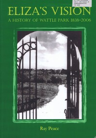
Book, Ray Pearce, Eliza's vision: a history of Wattle Park 1838-2006, 2006
An outline of the history of Wattle Park (Vic).207 p., illus., colour map.non-fictionAn outline of the history of Wattle Park (Vic).urban parks - melbourne, wattle park (vic.), parks - melbourne - history -
 Greensborough Historical Society
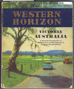
Book, Australian Publicity Council, The Western horizon of Victoria Australia, 1960c
A glossy publicity publication for the state of Victoria.111 p., illus. (some col.), maps.non-fictionA glossy publicity publication for the state of Victoria.victoria - history, western district (vic.), melbourne - history -
 Greensborough Historical Society
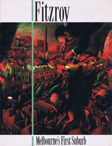
Book, Fitzroy Historical Society, Cutten History Committee, Fitzroy: Melbourne's first suburb, 1991
A history of the inner Melbourne suburb of Fitzroy354 p., illus., maps.non-fictionA history of the inner Melbourne suburb of Fitzroyfitzroy (vic.) - history, melbourne history -
 Greensborough Historical Society
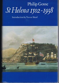
Book, Philip Gosse, St Helena 1502-1938 by Philip Gosse, 1990
A history of the island of St Helena in the South Atlantic Ocean.447 p., illus., maps.non-fictionA history of the island of St Helena in the South Atlantic Ocean. -
 Greensborough Historical Society
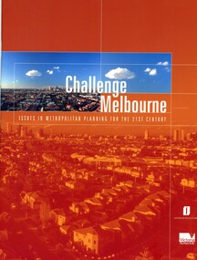
Book, Victoria. Department of Infrastructure, Challenge Melbourne: issues in metropolitan planning for the 21st century, 2000
A report on Melbourne's future growth and a strategic plan to manage this growth, 2000.36 p., text, col. illus., maps and col. plansmelbourne (victoria), town planning, infrastructure victoria -
 Greensborough Historical Society
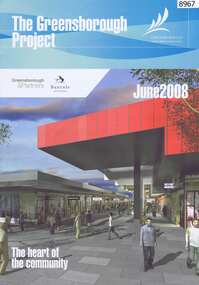
Newsletter, The Greensborough Project, 2008, 2016
... each, colour illus., maps. The Greensborough Project Newsletter ...The Greensborough Project June 2008 and Greensborough Community Update 2016 by Banyule City Council2 Newsletters, 4 pages each, colour illus., maps.urban development, greensborough, greensborough project -
 Greensborough Historical Society
Pamphlet - Directory, Greensborough Plaza directories, 2000s
... centre map. greensborough plaza advertising images 4 advertising ...Various shopping directories for Greensborough Plaza: 2001, 2007, and 2 undated pamphlets. Includes centre map.4 advertising pamphlets. Folded with colour illustrations and map.greensborough plaza, advertising images -
 Greensborough Historical Society
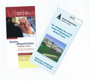
Pamphlet - Pamphlets, Austin & Repatriation Medical Centre 2001, July 2001
2 Pamphlets with information about the Austin & Repatriation Medical Centre and the Mercy Hospital for Women redevelopment in 2001.2 Colour pamphlets with text and photos, map.austin hospital, mercy hospital for women, heidelberg repatriation hospital, austin & repatriation medical centre -
 Greensborough Historical Society
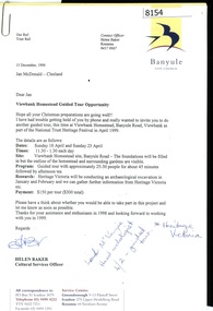
Letter - Correspondence, Banyule City Council, Viewbank Homestead Guided Tour Opportunity, 1998, 15/12/1998
Invitation from Banyule Cultural Services Officer to Jan Macdonald to participate in a guided tour and archaeological dig at Viewbank Homestead January, February and April 1999Comprises letter, with unbound information pamphlet and mapviewbank homestead, archaeological digs -
 Greensborough Historical Society
Newsletter, Greenhills and North Greensborough Progress Association, Community News: official journal of the Greenhills and Nth. Greensborough Progress Association and the Apollo Parkways Progress Association. July 1978. Edition No. 6/78, 07/1978
Orchids can still be found!, Yandell Bushland Reserve: a management study, School news, This and that, Did you know?, From the Council Chamber, A quarry in Plenty???, The restoration of access from Pinehills to Greensborough,Newsletter, 16 p., illus., map.greenhills and north greensborough progress association, greenhills, apollo parkways progress association, apollo parkways -
 Greensborough Historical Society
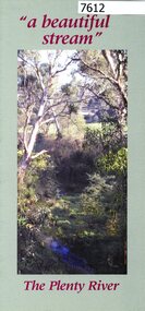
Pamphlet, Friends of the Plenty River, "a beautiful stream": The Plenty River, 2004_04
A publicity pamphlet for "Friends of the Plenty River", a group formed in 1995 to help rehabilitate the Plenty River and adjacent land.2 p., illus., map. Tri-fold pamphlet.plenty river, lower plenty, friends of the plenty river -
 Greensborough Historical Society
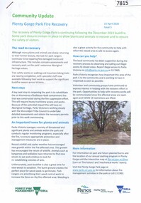
Article, Gary Vines, Mills of the Plenty River, by Gary Vines, 2017_10
Transcript of conference paper on flour mills on the Plenty River, including Arthur Sergeantson's Carome Mill, George Coulstock's Janefield Mill and Moses Thomas's Mayfield Mill. The paper was presented at the 19th Australasian Engineering Heritage Conference in Mildura, October 2017Transcript of conference paper, 26 pages, illus. (some col.), maps.plenty river, flour mills -
![Map - Maps, [John Batman in Melbourne], 1976](/media/collectors/4f729f5697f83e03086015b8/items/60965f673c71fad916b3a651/item-media/60965fc33c71fad916b3a805/item-fit-380x285.jpg) Greensborough Historical Society
Greensborough Historical SocietyMap - Maps, [John Batman in Melbourne], 1976
Photocopies of 4 maps showing aspects of John Batman's time in Melbourne: Map of the settlement of the Yarra 1837; Batman's map of Port Phillip and his route of exploration, 1835, drawn by Wedge; Proposed route of Batman's initial exploratiion, and Enlargement of the Geelong region of Batman's map. No citations on any copy.Photocopy of maps, 4 pages.john batman, melbourne, port phillip -
 Greensborough Historical Society
Document, Parliament of Victoria, Ministers & Members search - the Hon. Colin Brooks (Bundoora), 23/04/2021
Biographical details of the Hon. Colin Brooks, MLA for Bundoora, taken from Parliament of Victoria - Ministers and Members website; and, map of the electoral district of Bundoora.2 p. text and colour photograph, with colour map of Bundoora Electoral Districtbrooks family, victoria parliament, colin brooks, bundoora -
 Greensborough Historical Society
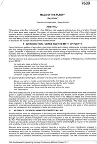
Booklet, Parks Victoria et al, Plenty Gorge Park fire recovery, 15/04/2020
Community update on rehabilitation of the section of Plenty Gorge Park affected by a bushfire in December 20196 p. text and colour photographs and mapplenty gorge park, bushfires, blue lake, yellow gum park, plenty -
 Greensborough Historical Society
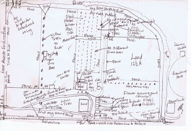
Map, Gary Partington, Alwyn at Whatmough Park, 1960s
The property "Alwyn" was owned by the Partington family and was compulsorily acquired by the Shire of Diamond Valley to become Whatmough Park. This plan was drawn from memory by Gary Partington and illustrates land use when his father, Alan Partington, owned the property.This plan illustrates the rural nature of land around Greensborough prior to the 1960s.Drawing of land use in 1960s at "Alwyn", a property currently occupied by Whatmough Park alwyn, partington family, whatmough park -
 Greensborough Historical Society
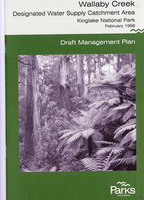
Booklet, Parks Victoria, Wallaby Creek: designated water supply catchment area. Kinglake National Park: Draft management plan 1998, 1998_02
Wallaby Creek is part of Kinglake National Park, and is a restricted access catchment area to protect quality of water supplied to Melbourne's water supply system. 26 p. black print on white paper, green cover, three folded mapskingllake national park, water supply, wallaby creek, parks victoria -
 Greensborough Historical Society
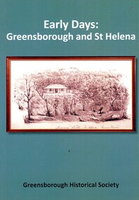
Book, Peter Van Eeken, Early days: Greensborough and St Helena, 2021
... on white paper, illus., maps. Early days: Greensborough and St ...History of the Greensborough and St Helena areas 1837-1900GHS produced publication113 p. black print on white paper, illus., maps.st helena, greensborough, greensborough historical society -
 Greensborough Historical Society
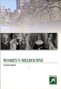
Book, Celestina Sagazio, Women's Melbourne by Celestina Sagazio, 2010
This book contains maps and walking tours of Melbourne with a focus on places that are important to the development of women's rights over the years.96 p., paperback, illus. (some col.), maps.melbourne, women, women's rights, walking tours -
 Greensborough Historical Society
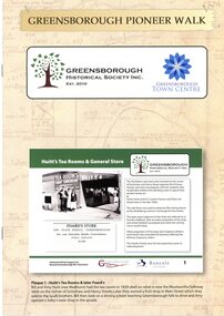
Booklet, Greensborough Historical Society Inc, Greensborough Pioneer Walk, 2021
... society 8 p., photographs, captions and map Greensborough Pioneer ...A guide to the historic photographs which have been mounted on 12 plaques in Greensborough Town Centre. 8 p., photographs, captions and mapgreensborough, pioneer walks, greensborough historical society -
 Greensborough Historical Society
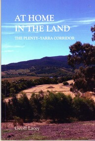
Book, Geoff Lacey, At home in the land: the Plenty-Yarra corridor, 2021
111 p., paperback, col. photographs, mapsnon-fictionindigenous plants, indigenous fauna, plenty river, yarra river -
 Greensborough Historical Society
Map - Map (Copy), C. Hodgkinson, District Surveyor et al, Parish of Yan Yean 1856: Village site during construction of the Yan Yean Reservoir, 1978
Copy of map part Sec. 13, Parish of Yan Yean 1856, Map 3, Village site... Scale: 8 chains to 1 inch. Drawn by C. Hodgkinson, District Surveyor, redrawn by A. R. Blair 1978. 1 p. photocopy of map. yan yean reservoir, yan yean -
 Greensborough Historical Society
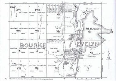
Map, Dianne Edwards, Part of Parish of Yan Yean 1878, 1978
Map includes Crown Portions V - XVII, showing Yan Yean Reservoir, Melbourne-Whittlesea Railway route, names of landowners, roads and various other features west of Greensborough Road. Redrawn by A. R. Blair in 1978.1 p. black and white photocopy of mapyan yean reservoir, yan yean -
 Greensborough Historical Society
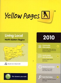
Book - Directory, Telstra Corporation Limited, Yellow Pages: Living local North Eastern Region 2010, 2010
Yellow Pages is a listing of businesses and organisations and their telephone numbers and addresses within the north eastern region of Melbourne432 p black print on white and yellow paper, paperback, includes UBD Street maps and street indextelephone directories, north east melbourne -
 Greensborough Historical Society
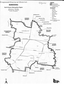
Map - Map (Copy), Electoral Boundaries Commission, Proposed electoral district: Bundoora, 01/07/2021
Proposed revised electoral boundaries for the electoral district of Bundoora (North-Eastern Metropolitan Region) as at 01/07/20211p. black and white copy of mapelectoral boundaries, bundoora - maps, victoria - parliament -
 Greensborough Historical Society
Business Card, Clements Avenue Automotive, Clements Avenue Automotive, Bundoora, 2018c
Clements Avenue Automotive is an automobile repair and service business in BundooraBusiness card, printed in colour both sidesLocation map, contact detailsautomotive repairs, bundoora, clements avenue bundoora -
 Greensborough Historical Society
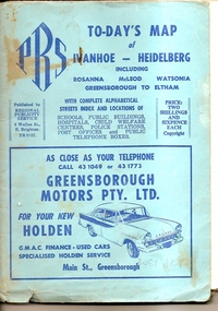
Map, To-day's Map of Ivanhoe - Heidelberg; including Rosanna, McLeod, Watsonia, Greensborough to Eltham, 1937-1953
... greensborough eltham Fold out map in pale blue cover. Cover dimensions ...Map of the suburbs of Ivanhoe, Heidelberg, Rosanna, Macleod, Watsonia, Greensborough and Eltham. Dates to mid 1950s. An Advertiser on this map may be found in the Hurstbridge Advertiser Friday 17 December 1937, page 7: "Lyon Bros, of Eltham garage, suggest in their advertisement on the front page of this issue. that motorists should have their cars checked over by them before Christmas, so that any 5mall defects which might militate against the pleasure of the trip, might be remedied." As does "The Montsalvat Plant Farm" in The Age of Saturday 5 September 1953, page 48.Shows early streets and open space in these areas.Fold out map in pale blue cover. Cover dimensions: 21.5x15cm. Map is surrounded by advertising for local businesses.ivanhoe, maps, heidelberg, rosanna, macleod, watsonia, greensborough, eltham -
 Greensborough Historical Society
Book, Angus & Robertson Ltd, Official History of Australia in the War of 1914-18; by C. E. W. Bean. 8th edition, 1938_
The official history of Australia in WW1 written by C. E. W. Bean12 volumes. Hard cover, dark red binding. Maps and black and white illustrationsPresented to James Gordon Saunders Longfellow St Norman Park Q July 1950c e w bean, world war i, australia army, gallipoli -
 Greensborough Historical Society
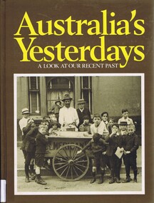
Book, Australia's yesterdays: a look at our recent past, 1974_
An illustrated history of 20th century Australia until 1978Hard cover book, 360 pages, illus (some colour), maps. Front cover: black and white illustration of boys in Sydney 1914, gathered around an ice cart.Inscribed with owner's name: Faye Isobel Fortaustralia history, australia social conditions, cyril pearl -
 Greensborough Historical Society
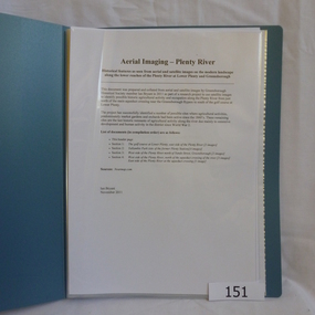
Folder, Aerial Imaging - Plenty River: by Ian Bryant, 2011_11
Investigates early land use along the Plenty River from north of the main aqueduct crossing in Greensborough to south of the golf course in Lower PlentyHistorical features seen from aerial and satellite images of the modern landscape may indicate earlier agricultural land usage.9 x A4 pages of text and colour annotated maps downloaded from nearmap.com.plenty river, ian bryant, lower plenty, greensborough, yallambie park, aerial photography