Showing 101 items matching "main road eltham roundabout"
-
 Eltham District Historical Society Inc
Slide - Photograph, Airlie Road, Montmorency, c.Apr. 1988
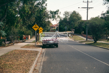
The Shire of Eltham was introducing a number of traffic calming measures throughout the shire such as speed humps, roundabouts, chicanes and took a photographic record of various new installations.35mm colour positive transparency (1 of 11) Mount - whiteProcess Date "Apr M"infrastructure, roads, airlie road, montmorency, speedhumps -
 Eltham District Historical Society Inc
Slide - Photograph, Airlie Road, Montmorency, c.Apr. 1988
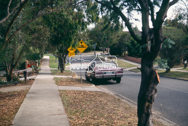
The Shire of Eltham was introducing a number of traffic calming measures throughout the shire such as speed humps, roundabouts, chicanes and took a photographic record of various new installations.35mm colour positive transparency (1 of 11) Mount - whiteProcess Date "Apr M"infrastructure, roads, airlie road, montmorency, speedhumps -
 Eltham District Historical Society Inc
Slide - Photograph, Airlie Road, Montmorency, c.Apr. 1988
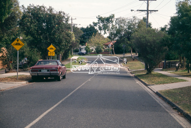
The Shire of Eltham was introducing a number of traffic calming measures throughout the shire such as speed humps, roundabouts, chicanes and took a photographic record of various new installations.35mm colour positive transparency (2 of 11) Mount - whiteProcess Date "Apr M"infrastructure, roads, airlie road, montmorency, speedhumps -
 Eltham District Historical Society Inc
Slide - Photograph, Nyora Road, Eltham, c.1993
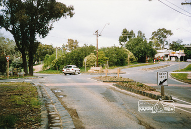
The east end of Nyora bewteen Stokes Place and Reynolds Road was unsealed. This section was only a fire access track as evidenced by the trees growing in the middle of the road. Real Estate agents would advertise homes as down a (dusty) country lane. The Nyora Road Resident Action Group arose to address concerns with Council regarding the dangerous conditions and traffic from outside the area using it as a 'rat-run' to avoid Main Road. Council traffic monitors showed that the amount of traffic was only 20% less than that of Mt Pleasant Road. The Action Group wanted the road closed at reynolds Road however Council elected to install speed calming devices along the sealed section between Stokes Place and Eucalyptus Road. Chicanes were added at several locations and a roundabout installed at Stokes Place in 2004. This remaining dirt section was sealed post 2004.35mm colour positive transparency Mount - Black and Whiteinfrastructure, roads, eltham, nyora road -
 Eltham District Historical Society Inc
Folder, Eltham War Memorial Garden and Property; Notes compiled by Harry Gilham, 1996-1997, 1996-1997
Contents: 1. Notes concerning impact upon Eltham War Memorial Garden of a proposed roundabout at Dudley Street, Eltham, September 1996 - In 1996 Nillumbik Shire Council proposed the provision of traffic lights or a roundabout to alleviate traffic concerns at the intersection of Main Road with Dudley street and Panther Place. The Society had no real concerns with Panther Place as it had no perceived impact upon Shillinglaw Cottage however survey pegs for a new road alignment to provide for a roundabout at Dudley Street were placed within the Eltham War Memorial Gardens which was significant concern. Harry Gilham, then President of the Society was on the working group with Council and the RSL to discuss this proposal. Ultimately it did not proceed and traffic lights were installed. No action occurred at Panther Place. 2. Notes pertaining to Eltham Town Focus Group and the Eltham War Memorial Trust property, c.January 1997 - These notes from Harry Gilham relate to a draft report "A Community Vision for 'The Eltham War Memorial Trust' Property Main Road, Eltham" being prepared at the request of Chief Commissioner Don Cordell, Nillumbik Shire Council, 31st January 1997. Harry handed over these notes to Jim Connor on 14 March 2010. Jim had replaced Harry as President of the Eltham District Historical Society in 2009. They also reference Stanley S. Addison's Outline History of the Eltham War Memorial Trust30 pages of various types, mainly A4, printed and with notes by hand or handwritten notes (drafts)chief commissioner don cordell, dudley street, eltham rsl sub-branch, eltham town focus group, eltham war memorial garden, eltham war memorial trust, main road, panther place, returned services league, roundabouts, shire of nillumbik, stanley s addison -
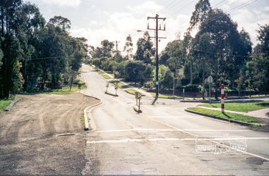
 Eltham District Historical Society Inc
Photograph, Looking north along Ryans Road at intersection with Kerrie Crescent, Eltham, c.October 1989, 1989
Ryans Road was reconstructed and sealed to the north of Kerrie Crescent in 1983. Roundabout and southern reconstruction added later. This photo is probably shortly after construction of roundabout (before 1991 when Doug Orford photographed all the Shire boundaries as roundabout was well planted at that stage) Cross Ref: 04070 and 01878-25Roll of 35mm colour negative film, 1 stripsFuji 100eltham north, kerrie crescent, round about, ryans road, streets -
 Eltham District Historical Society Inc
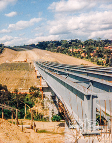
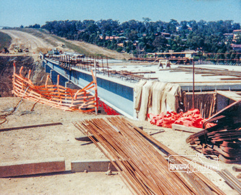
Photograph, Looking east across the new bridge construction across the Plenty River from the western side up to the new roundabout at Civic Drive; Greensborough Bypass construction, c.1986, 1986c
Colour photograph originally located in a magnetic style album titled 'Greensborough Bypass 1990s 5' suffering significant degradation. No information contained in album or on reverse of photos except where noted. Relocated to archival photosafe storage.greensborough bypass, road construction, greensborough, bridge construction -
 Eltham District Historical Society Inc
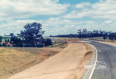
Photograph, Looking east from the new bridge towards the newly completed pedestrian overpass and the roundabout at the end of the Bypass at Civic Drive; Greensborough Bypass construction, c.1986, 1986c
Note the two cyclists riding along the newly sealed road up the hill.Colour photograph originally located in a magnetic style album titled 'Greensborough Bypass 1990s 5' suffering significant degradation. No information contained in album or on reverse of photos except where noted. Relocated to archival photosafe storage.greensborough bypass, road construction, greensborough -
 Eltham District Historical Society Inc
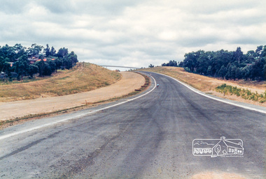
Photograph, Looking east along the newly sealed road from the pedestrian overpass to the new roundabout at Civic Drive; Greensborough Bypass construction, c.1986, 1986c
Colour photograph originally located in a magnetic style album titled 'Greensborough Bypass 1990s 5' suffering significant degradation. No information contained in album or on reverse of photos except where noted. Relocated to archival photosafe storage.greensborough bypass, road construction, greensborough -
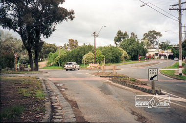
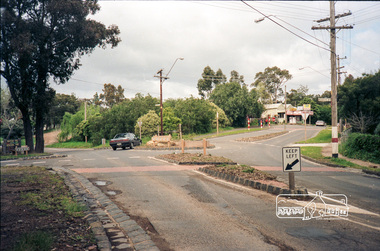
 Eltham District Historical Society Inc
Photograph, Intersection of Beard Street and Valonia Drive, Eltham before the roundabout
Roll of 35mm colour negative film, 5 of 7 stripsKodak GA 100 5095shire of eltham, roads, eltham east, beard street, valonia drive -
 Eltham District Historical Society Inc
Photograph, Intersection of Beard Street and Valonia Drive, Eltham before the roundabout
Roll of 35mm colour negative film, 5 of 7 stripsKodak GA 100 5095shire of eltham, roads, eltham east, beard street, valonia drive -
 Eltham District Historical Society Inc
Photograph, Intersection of Merritts Road and Kangaroo Ground-St Andrews Road, Panton Hill
Roll of 35mm colour negative film, 5 of 7 stripsKodak GA 100 5095shire of eltham, kangaroo ground-st andrews road, roundabouts, merritts road, panton hill, roads -
 Eltham District Historical Society Inc
Photograph, Panton Hill Store near the intersection of Merritts Road and Kangaroo Ground-St Andrews Road, Panton Hill, c. Oct 1987, 1987
Roll of 35mm colour negative film, 5 of 7 stripsKodak GA 100 5095shire of eltham, kangaroo ground-st andrews road, roundabouts, merritts road, panton hill, roads -
 Eltham District Historical Society Inc
Photograph, Intersection of Kangaroo Ground-St Andrews Road with Rodger Road and Church Road, Panton Hill, c. Oct 1987, 1987
Roll of 35mm colour negative film, 5 of 7 stripsKodak GA 100 5095shire of eltham, kangaroo ground-st andrews road, roundabouts, panton hill, roads, rodger road, church road -
 Eltham District Historical Society Inc
Photograph, Heidelberg-Kinglake Road, Hurstbridge; looking north east towards Kinglake
Two colour photographs taken near the location of the present roundabout intersection of Anzac Road (on right) and Arthurs Creek Road (on left) with the Heidelberg-Kinglake Road at Hurstbridge. [37�38'14.8"S 145�11'39.6"E -37.637459, 145.194322]main street, kinglake road, heidelberg/kinglake road, hurstbridge -
 Eltham District Historical Society Inc
Photograph, Main Road, Panton Hill
Colour photograph of Main Road Panton Hill showing roundabout at Bishops Road.main road, st andrews road, kangaroo ground/st andrews road, bishops road, roundabouts, panton hill -
 Eltham District Historical Society Inc
Photograph, Main Road, Panton Hill
Six colour photographs of Main Road Panton Hill showing Bishops Road roundaboutmain road, st andrews road, kangaroo ground/st andrews road, bishops road, roundabouts, panton hill -
 Eltham District Historical Society Inc
Photograph, Main Road, Panton Hill
Two colour photographs of Main Road Panton Hill showing Bishops Road roundaboutmain road, st andrews road, kangaroo ground/st andrews road, bishops road, roundabouts, panton hill -
 Eltham District Historical Society Inc
Photograph, Main Road, Panton Hill
Two colour photographs of Main Road Panton Hill showing roundabout at Church Road/Roger Road intersectionmain road, st andrews road, kangaroo ground/st andrews road, church road, roger road, roundabouts, panton hill -
 Eltham District Historical Society Inc
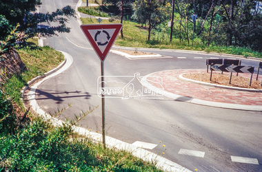
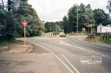
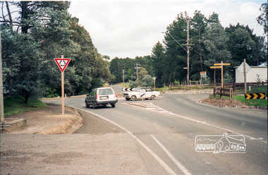
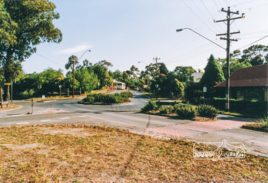
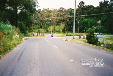
Photograph, Eucalyptus Road and Pitt Street/Nyora Road roundabout, Eltham
Looking north along Eucalyptus Road, showing roundabout at intersection of Pitt Street and Nyora Road, Eltham. Parks Victoria owns and manages the Pauline Toner Eltham Copper Butterfly Reserve on the left of the image. Colour photographeucalyptus road, pitt street, nyora road, roundabouts, eltham, pauline toner eltham copper butterfly reserve, pauline toner butterfly nature conservation reserve -
 Eltham District Historical Society Inc
Photograph, Main Road, Research
Three colour photographs of Main Road between Research and Eltham East; two showing the bike path looking tworads Eltham and one viewed from Warrandyte Road near the roundabouteltham east, research, main road, research warrandyte road, warrandyte road, paths, bike paths -
 Eltham District Historical Society Inc
Photograph, Research-Warrandyte Road, Research
Three colour photographs of Research-Warrandyte Road, Research including roundabout at Main Roadresearch, research warrandyte road, warrandyte road, main road, roundabouts -
 Eltham District Historical Society Inc
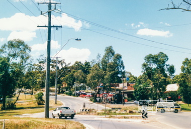
Photograph, Research Shops, Feb 1990, 1/2/90
... melbourne main road research shops roundabouts Six colour ...Six colour photographs of Research Shopping Centre and precinct including roundabout at Ingrams Roadmain road, research, shops, roundabouts -
 Eltham District Historical Society Inc
Photograph, Research Shops precinct
Two colour photographs in the vicinity of Research Shops: 1. At Main Road and Warrandyte Road roundabout looking south east towards the shops 2. At the north end of the shops at intersection of Raglan Road and Main Road looking north eastmain road, research, ingrams road, shops, roundabouts -
 Eltham District Historical Society Inc
Photograph, Kinglake near shops
Three colour photographs showing the various road junctions near Kinglake shops. 1. St Andrews Road, Kinglake on left; Toolangi Road to left before roundabout 2. Whittlesea Road on left with Kinglake Hotel 3.kinglake, kinglake whittlesea road, hurstbridge road, kinglake healesville road -
 Eltham District Historical Society Inc
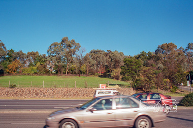
Photograph, Fitzsimons Lane Reserve bounded by Main Road, Bolton Street and Fitzsimons Lane, Eltham, c.May 2001
Viewed from Main Road just east of Bolton Street, approaching Fitzsimons Lane roundabout. Now partially developed as the Monarch Ridge housing estateRoll of 35mm colour negative film, 7 stripsAgfa HDC 200 plus-2eltham, streets, main road, fitzsimons lane reserve, houses, monarch ridge estate