Showing 110 items
matching map - gold mines in victoria
-
 Federation University Historical Collection
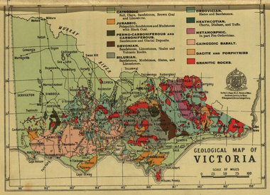
Photograph - colour, William Baragwanath, Department of Mines: Geological map of Victoria, c1935
Photograph included in book "Victoria: Gold and Minerals" issued by Mines Department Victoria, 1935Photographmap, department of mines, victoria, key to land formations, time periods, jurassic, geological map -
 Federation University Historical Collection
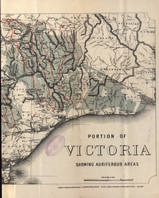
Map - Map and Information, Department of Mines: Map and Suggestions to Prospectors, 1891
... in 1894 gold auriferous areas department of mines victoria map ...The map outlines the auriferous (gold bearing) areas in Victoria. The information for prospectors was prepared by the Department of Mines in 1894Document: 4 page type written Map: Portion of Victoria divided into Counties of 1891. Auriferous areas with red.Reference section on mapgold, auriferous areas, department of mines, victoria, map of victoria, prospectors, commissioner of crown lands, hon a mclean, alexander black, surveyor general, a mclean -
 Bendigo Historical Society Inc.
Book - HISTORICAL GUIDE TO BENDIGO
Five copies of ' The Royal Historical Society of Victoria Bendigo Branch Historical Guide to Bendigo. Including Self Tours of Bendigo's Famous Goldfields' .Cambridge Press, Bendigo.' maps, photos, illustrations. Three copies do not contain maps, however, these three copies have number stickers on the bott left front ccover, 0064.2 PAR, 0064.3 PAR, 0064.4 PAR.bendigo, history, gold mining, book, books, bendigo, bendigo history, history, gold mining, mines, the royal historical society of victoria bendigo branch, victoria, goldfields, victorian history, australian history -
 Bendigo Historical Society Inc.
Book - HISTORICAL GUIDE TO BENDIGO
Five copies of 'The Royal Historical Society of Victoria Bendigo Branch Historical Guide to Bendigo. Including Self Tours of Bendigo's Famous Goldfields.' Revised Edition. Printed by Cambridge Press, Bendigo 1968. photos, maps, illustrations. Two copies only have WITH FREE MAP stamped on the front cover.bendigo, history, gold mining, book, books, bendigo, history, royal historical society of victoria bendigo branch, gold, goldfields, victoria, victorian history, gold mines, gold, australian history, gold discoveries, mining. sticker bottom left front cover of two copies only 0064.5 par. 0064.6 par -
 Bendigo Historical Society Inc.
Document - JOAN O'SHEA COLLECTION: VICTORIA HILL GOLDMINING AREA BOOKLET, March 1972
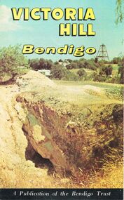
Joan O'Shea Collection. Victoria Hill Bendigo Gold Mining on the Richest Quartz Reef in Bendigo, from 1854 to 1916. Colour and Black and White Booklet 16 Pages. Includes Maps of the Victoria Hill Area, photographs of the remains of a twenty head crushing battery, burnt ground from quartz roasting, The Victoria Quartz Mine Photograph from Australian Mining Standard June 1899, The compressor beds and concrete foundations for the poppet legs all that remain today of the Victoria Quartz Mine deepest mine on Bendigo Goldfield 4613 feet or 1406.04 metres. Also included photograph of the view of Victoria Hill from The New Chum Hill in the 1870s. The Location of the 3 mines Ballerstedt's open cut, North Old Chum and Lansell's 180 are marked. A depiction of Rae's Open Cut gives an understanding of the primitive nature of early workings on the Goldfields. The Booklet also provides a brief history of Victoria Hill itself.Bendigo Trust Publication March 1972. Printed in Bendigo Cambridge Press.bendigo, mining, victoria hill -
 Bendigo Historical Society Inc.
Book - MINE, WOMEN AND THRONG
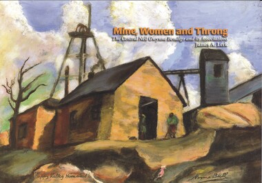
Mine, Women and Throng, The Central Nell Gwynne Bendigo and its Associations, soft cover 116 pages with colour & black and white photographs, maps & graphs. Signed inside cover by author, printed by BartnPrint.James Lerkbendigo, gold mining, central nell gwynne, gold mines-gold mining victoria-bendigo-history -
 Bendigo Historical Society Inc.
Map - DEVONSHIRE GROUP OF MINES BENDIGO
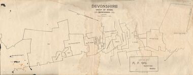
Map showing the mining leases that include the Devonshire group of mines - leases shown from north to south are: Catherine Reef United , William United, Ellenborough, Sadowa, St. Mungo, Lady Barkly, South St. Mungo, Phoenix, United Devonshire, Duchess of Edinburgh, New St. Mungo, South Devonshire, Extended South Devonshire, New Victoria Catherine, Pearl, Hercules and Energetic.Issued by M. P. Kelly, Sharebroker, Bendigomap, bendigo, goldfields, catherine reef united , williamd united, ellenborough, sadowa, st. mungo, lady barkly, south st. mungo, phoenix, united devonshire, duchess of edinburgh, new st. mungo, south devonshire, extended south devonshire, new victoria catherine, pearl, hercules and energetic. mining, gold mines -
 Bendigo Historical Society Inc.
Photograph - COBB & CO,., MAP OF COACH RUN TO BENDIGO
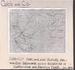
black and white image ( copy ) on board : image shows map of roads to all gold mines in Victoria., showing Cobb & Co., routes. Written on board: Cobb and Co., Cobb & Co's first and most historic run was from Melbourne to the goldfields of Castlemaine and Bendigo Creek, Jan 1854./// image shows -'Map of the roads to all gold mines in Victoria., showing the Cross roads from one mine to another with indications of various stations divided into squares of ten miles to easily calculate the distance of any new mines when discovered ///There is a list of towns with their distance from Melbourne and to & from distances for other destinations Cobb & Co., routesbusiness, transport, cobb & co., cobb & co., bendigo, transport -
 Bendigo Historical Society Inc.
Document - LONG GULLY HISTORY GROUP COLLECTION: VICTORIA HILL
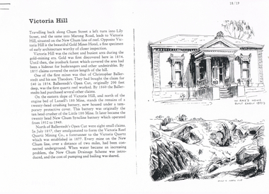
Three pages numbered 18/19, 20/21 and 22/23 titled Victoria Hill. First page has some information on Victoria Hill, a sketch of W Rae's Home and Rae's Open cut. The second page has a map of the Victoria Hill Area showing streets and the New Chum Anticline, a sketch of Ballerstedt's Open Cut and a Key to Victoria Hill Area Map. The third page mentions the Victoria Quartz mine, Tributors and quartz roasting. It also has sketch of a 20 Head Crushing Battery, Victoria Hill.bendigo, history, long gully history group, the long gully history group - victoria hill, gold mines hotel, christopher ballerstedt, theodore ballerstedt, ballerstedt's open cut, lansell's 180 mine, little 180 mine, new chum syncline battery, victoria reef quartz mining co, victoria quartz, new chum drainage scheme, a roberts and sons, tributors, william rae's bon accord mine and open cut, william rae, adventure and advance open cuts, central nell gwynne, heinz butcher shop -
 Bendigo Historical Society Inc.
Book - MINING & GEOLOGICAL JOURNAL. VOL,4. NO,4, 1951
Mining and Geological Journal, Volume 4, No.4. September 1951. Published by Department of Mines Victoria with 65 pages of articles on gold, coal & oil mining, Illustrations, maps, photographs including photographs of Bendigo mines. Name noted on front A.E.Richardson 29 Harrison St Bendigo.Dept of Mines Victoriamagazine, organization, mining, mining - mines - mining equipment, bendigo mines. -
 Bendigo Historical Society Inc.
Book - MINING & GEOLOGICAL JOURNAL. VOL,4. NO.3, 1951
Mining and Geological Journal, Vol.4, No.3. March 1951. Published by Department of Mines Victoria with articles on Mines & mining including Bendigo mines with Photographs, Illustrations, Maps & Advertisements. Name on front A.Richardson 29 Harrison St Bendigo.Dept of Mines Victoria.gold mines, mining, mining - mines - mining equipment, central deborah mine. -
 Bendigo Historical Society Inc.
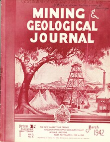
Book - MINING & GEOLOGICAL JOURNAL. VOL.S,NO.6, 1942
Mining & Geological Journal, Vol.2, No.6. March 1942. Published by Department of Mines Victoria, with articles on mines and mining including Bendigo mines, Photographs, Illustrations, Maps & Advertisements. Name on cover A Richardson 29 Harrison St Bendigo.Dept of Mines Victoriagold mines, mining, mining - mines - mining equipment. bendigo mines. -
 Bendigo Historical Society Inc.
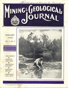
Book - MINING & GEOLOGICAL JOURNAL VOL.2, NO2, 1940
Mining & Geological Journal, January 1940, Vol.2, No.2. Published by Department of Mines Victoria, 136 pages of Mine Reports, articles on mines, photographs, illustrations, maps & advertisements. Name on cover A.Richardson 29 Harrison St Bendigo.Dept of Mines Victoriagold mines, mining, mining - mines - mining equipment, axedale - fletchers mine. -
 Bendigo Historical Society Inc.
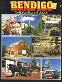
Book - BENDIGO, THE GOLDEN HEART OF VICTORIA
Bendigo The Golden Heart Of Victoria 22 pages with colour photos and maps.Rosalie Trower, Annette Boylebendigo, tourism, bendigo, sacred heart cathedral, sandhurst town, central deborah gold mine, talking tram. -
 Bendigo Historical Society Inc.
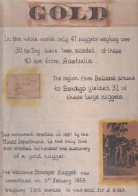
Document - 'GOLD' POSTER WITH DESCRIPTION OF NUGGETS
Poster heading - 'Gold' - 'In the whole world, only 47 nuggets weighing over 30lbs Troy have been recorded. Of these 40 are from Australia. The region from Ballarat around to Bendigo yielded 32 of these large nuggets. This monument erected in 1897 by the Mines Department, is the only one ever erected to honour the discovery of a gold nugget. The 'Welcome Stranger' nugget was unearthed on 5th February, 1869, weighing 2316 ounces and it was sold for 9.553 pounds'. Poster includes a map of Victoria depicting the main gold mining areas, also mention of gypsum, and tin in northern Victoria. A photo of the monument to the discovery of the 'Welcome Stranger' nugget found 1 1/4 miles from Moliagul in the bottom corner.document, gold -
 Bendigo Historical Society Inc.
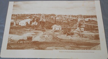
Photograph - Photograph of New Chum Line of Reef
BHS CollectionSepia coloured print of a photograph of the New Chum Line of Reef looking south from the Snobs Hill group of mines. The photo shows several poppet heads and chimneys, bridges and houses. New Chum Line of Reef. includes Victoria Hill possibly the richest spot on the field.On the back a drawing of a poppet head with the words: Bendigo gold project. A small map of Victoria is also printed on the back. bendigo mines, new chum line of reef, mining -
 Bendigo Historical Society Inc.
Document - STRUCTURE OF BENDIGO GOLDFIELD BULLETIN NO. 47
Booklet, 36 pages, that describes the structure of the Bendigo Goldfield. Booklet is enclosed in an envelope. On front of booklet : 1923 Victoria, Department of Mines, Bulletins of the Geological Survey of Victoria, W. Baragwanath, Director. Structure of Bendigo Goldfield, by H. Herman, late Director of Geological Survey. Maps under catalogue number 3769 accompanied the booklet and are listed as 'plates' on the contents page. Plans and Sections to accompany Bulletin No 47, Structure of Bendigo Gold-Field, by H Herman, B.C.E., M.M.E., F.G.S., late Director of Geological Survey.Geological Survey of Victoriabendigo, gold mining, structure of goldfield, bendigo, goldfield, gold mining, geology -
Bendigo Historical Society Inc.
Map - MAP: VIRGINIA MINE GARDEN GULLY LINE OF REEF
Map of Virginia Mine on the Garden Gully line of reef, Eaglehawk, transverse section. Shaft, levels and Garden Gully anticlinal axial line drawn. Key shows types of formations - quartz, spurs, sandstone, slate, cleavage, lava. This map forms part of the Geological Survey of Victoria, Structure of Bendigo Goldfield report, No. 47, 1923. H.Herman, late Director of Geological Survey.Geological Survey Victoria, Geological Survey Office, Bendigo.bendigo, gold mining, virgina mine eaglehawk, eaglehawk, bendigo, gold mining, virginia mine, garden gully line of reef. -
 Bendigo Historical Society Inc.
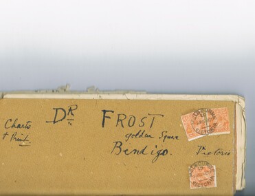
Document - MCCOLL, RANKIN AND STANISTREET COLLECTION: DR FROST, 1920
Correspondence to Dr. Frost re Badak Tin Mine. Binti Binti, Sweet Nell, Bettina, Mascotte & Maconi. Report on inspection of mine reports by Mr. M. Sheard (Mine Manager) & Dr. C. W. Laver of Kalgoorlie, map of Binti lease. Des Frost Golden Square Bendigo Victoria, charts and print.MCCOLL RANKIN & STANISTREETorganization, business, gold mining, mccoll rankin & stanistreet -
 Bendigo Historical Society Inc.
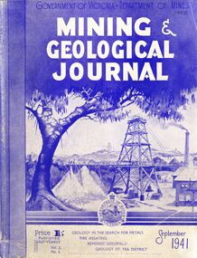
Book - MINING & GEOLOGICAL JOURNAL, September, 1941
Mining & Geological Journal September 1941, Geology in the search for metals, fire assaying, Bendigo goldfields, Geology of Yea district published half yearly by the Department of Mines Victoria contains photographs, maps and illustrations.gold, mining, journal -
 Bendigo Historical Society Inc.
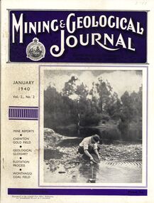
Book - MINING & GEOLOGICAL JOURNAL, 1940
Mining & Geological Journal January 1940 Vol.2 No.2 Mine reports Chewton Gold Field, Geological Glossary, Flotation Process, Wonthaggi Coal Field published hald yearly by he Department of Mines Victoria contains photographs, maps and illustrations.gold, mining, journal -
 Bendigo Historical Society Inc.
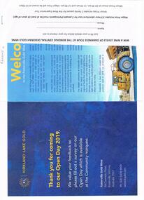
Document - FOSTERVILLE GOLD MINE COLLECTION: OPEN DAY 2019
Two page document for Kirkland Lake Gold Open day 2019. Open Day activities include: bus tours, technical services display, geology, exploration, processing, community and environment display, minerals council of Australia, Swick drilling, Central Deborah Gold Mine, Face painting, Goldfields Re-vegetation, Delecca's hire equipment, MacMahon underground mining services, Sandvik, and ISH24 safety specialists. Map of 'Fosterville Gold Mine Site Map' with activities highlighted. Fosterville is Victoria's larges gold producer and in 2918 a records 356,230 ounces at an average grade of 24.9 g per tonne. The mine has over 600 full time employees in 2019. Entry for '9 levels of darkness' tour at Central Deborah Mine attached.bendigo, mining, fosterville gold mine -
 Bendigo Historical Society Inc.
Map - GUIDE MAP OF BENDIGO & EAGLEHAWK, Late 1920's
Map. Guide Map of Bendigo & Eaglehawk. Light brown coloured booklet containing folded map of Bendigo and Eaglehawk. Outer cover is printed in blue and red ink and states - With compliments of J H Curnow & Son, Auctioneers, Real Estate Agents, Farm & Dairy Produce Merchants, Bendigo. Printed by J B Young, Lithographer. Map shows tramways & bus routes. Map shows Agricultural Showgrounds located between Park Street, Water Street, Barnard Street and Bridge Lane. Also shows Acclimitization Reserve located behind The Botanical Gardens at White Hills. Shows the location of Sailors Gully, Peg-Leg Gully, Jobs Gully, California Gully, Long Gully, Ironbark Gully, Golden Gully, Poverty Gully, Sheepshead Gully, Charcoal Gully, Eaglehawk Creek, Bendigo Creek and Back Creek. Contains interesting facts about Bendigo - Area 7,900 acres. Population - 26,000. First Council elected - 1855. Proclaimed a Borough - 1863. Proclaimed a City - 1871. Gold Rush broke out - 1851. For first 10 years gold yield averaged 8,600 ozs. per week . Total gold yield to 1923 - 572 tons valued at 82,000,000 pounds. Deepest mines - Victoria Quartz 4,614 ft., New Chum Railway 4,318 ft. 13 mines over 3.000 ft. deep. 53 mines over 2,000 ft. deep. Sewering of City commenced 1922, all principal buildings now sewered. Map printed by Arnall & Jackson, General Printers, Stationers & Engravers, 476 Collins Street. Map displays advertisement for J H Curnow & Son, Bendigo's leading Auctioneer and Estate Agents, Mitchell & Queen Sts. Bendigo. Map Scale 20 chs. = 1 in.cottage, miners, guide map of bendigo and eaglehawk -
 Bendigo Historical Society Inc.
Map - GUIDE MAP OF BENDIGO & EAGLEHAWK, Late 1920's
Map. Guide map of Bendigo & Eaglehawk. Folded map of Bendigo & Eaglehawk with blue outer cover booklet. Map is compiled by E E Parker, Eaglehawk. Map shows tramways, bus routes and cost one shilling. Map shows Agricultural Showgrounds located between Park Street, Water Street, Barnard Street and Bridge Lane. Also shows Acclimitization Reserve located behind the Botanical Gardens at White Hills. Shows the location of Sailors Gully, Peg-Leg Gully, Jobs Gully, California Gully, Long Gully, Ironbark Gully, Golden Gully, Poverty Gully, Sheepshead Gully, Charcoal Gully, Eaglehawk Creek, Bendigo Creek and Back Creek.Contains interesting facts about Bendigo:- Area - 7,900 acres, Population - 26,000, First Council elected - 1855, Proclaimed a City - 1871. Gold Rush broke out - 1851. For first 10 years gold yield averaged 8,600 ozs. Per week. Total gold yield to 1923 - 572 tons valued at 82,000,000 pounds. Deepest mines - Victoria Quartz 4,614 ft., New Chum Railway 4,318 ft., 13 mines over 3,000ft. deep, 53 mines over 2,000 ft. deep. Sewering of City commenced 1922. All principal buildings now sewered. Map printed by Arnall & Jackson, General Printers, Stationers & Engravers, 476 Collins Street. Outer map blue cover printed in red and blue ink by J B Young, Lithographer. Map displays advertisement for Bendigo Timber Co. Outer blue cover displays advertisement for Campbell Connelly & Co. Pty. Ltd, Ironmongers, Timware Manufacturers, Plumbers, Sewerage Contractors, High and Forest Sts, Bendigo 9outside back cover) and for Hartleys ( J L Shoosmith) Bendigo, displaying Indian Motor Cycles (inside back cover).map, bendigo, township, guide map of bendigo & eaglehawk -
 Bendigo Historical Society Inc.
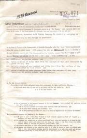
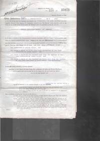
Document - MCCOLL, RANKIN AND STANISTREET COLLECTION: DEBORAH EXTENDED GOLD MINING COMPANY N/L GOLD MINING LEASE, 18 April 1957
Document Deborah Extended Gold Mining Company N/L document - gold mining lease document, Vol 334 071, dated 18 April 1957, 4 pages with map. Map adjoins Bendigo Cemetery. Lease between Deborah Extended Gold Mining Company N/L and the State of Victoria. No. 11339, Vol 334 Fol 071.organization, mining, gold mining lease, deborah extended gold mine, gold mining lease -
 Bendigo Historical Society Inc.
Document - MCCOLL, RANKIN AND STANISTREET COLLECTION: GOLD MINING LEASE RONALD ALEXANDER RANKIN, 1941
Document: McColl, Rankin and Stanistreet: lease document between Ronald Alexander Rankin of Bendigo and the State of Victoria. 3 pages with map - lease adjoins Bellevue Road. Lease transferred to Deborah Gold Mines NL in 1945.organization, mining, gold mining lease, mccoll, rankin and stanistreet:, ronald alexander rankin, lease document, gold mining -
 Bendigo Historical Society Inc.
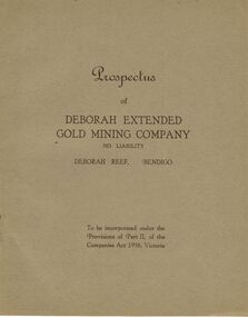
Document - MCCOLL, RANKIN AND STANISTREET COLLECTION: DEBORAH EXTENDED GOLD MINING COMPANY NL, 1940
McColl Rankin & Stanistreet, 12 Copies of Prospectus of Deborah Extended Gold Mining Company No Liability, Deborah Reef, Bendigo. To be incorporated under the Provisions of Part II, of the Companies Act 1938, Victoria. Application form and map of mines included in book form, dated 1940. Profit and Loss Account for Term ended 31st August, 1945 also included on separate sheet (has been folded in half across). Auditors: Wm. R. McKie & W. J. Sparkman.organization, mining, deborah extended gold mining cpy nl, mccoll rankin & stanistreet, deborah extended gold mining company nl, prospectus, profit and loss account for 31 august 1945, map of mine, form application -
 Bendigo Historical Society Inc.
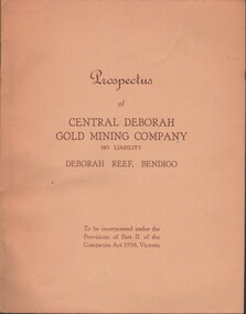
Document - MCCOLL, RANKIN AND STANISTREET COLLECTION: CENTRAL DEBORAH GOLD MINE NL: PROSPECTUS, 1939
Document: McColl, Rankin & Stanistreet Collection: Central Deborah Gold Mine NL - 4 copies of prospectus. Buff covered booklet. Written on front ' Prospectus of Central Deborah Gold Mining Company No Liability Deborah Reef, Bendigo. To be incorporated under the Provisions of Part II of the companies Act 1938. Victoria.' Details capital, proposed directors and manager. Contains map of Central and North Deborah mines and Monument Hill.organization, business, central deborah gold mine, mccoll, rankin & stanistreet collection: central deborah gold mine nl. gold mining -
 Bendigo Historical Society Inc.
Document - MCCOLL, RANKIN AND STANISTREET COLLECTION: NAPOLEON REEF GOLD MINING CO. N.L, 22 August 1950
Document: 5 Page legal document with map of lease area, Lease No. 11273 Bendigo, Vol.331, Fol. 36453, 15 year lease from 12 December 1949, in vicinity of Inglis, Harvey & Curnow Streets, Signed by Dallas Brooks, Gov of Victoria & J.J. Stanistreet, Mine Manager.organization, business, industrial - mining, mccoll rankin & stanistreet, mining, gold mining, napoleon reef -
Bendigo Historical Society Inc.
Map - BIG 180 SHAFT POSITION, No date visible
... Bendigo mining plan Mining Gold Mines. Victoria Hill Big 180 Map ...Map: Plan showing the location of various shafts in the Victoria Hill area, hand draughted in pencil. Scale 2 Chains to 1 inchmap, bendigo, mining plan, mining , gold mines. victoria hill, big 180