Showing 37 items matching "north east railway victoria"
-
 Wodonga & District Historical Society Inc
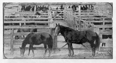
Photograph - Horse Sales at Wodonga Saleyards
The sale of stock in Wodonga goes back to its earliest history with yards being operated on the site now occupied by Elgin's Hotel and the Centro Shopping Centre, located close to the railways. Horse sales were an important part of the history of the Wodonga Saleyards. Horses were bred in north-east Victoria for the Indian Market, and records show that a truck load of horses left Wodonga Station in 1875. Campbell & Sons commenced selling horses at the Elgin Street site in 1895 and they conducted regular sales in association with Younghusband Ltd. Campbell & Sons was a Melbourne-based company, which eventually merged with Wright Stephenson & Co. Wodonga and Towong Sentinel of Friday 3rd March 1899 reported “Buyers attended from Bendigo, Ballarat, Calcutta, Madras, Singapore, The Islands, Gippsland, Dandenong, and Melbourne. Indian remounts brought up to £32 10s, draughts to £25, medium draughts to £18, town hacks and harness horses to £32, buggy pairs to £65, and light weedy sorts to £5.” After World War II, large numbers of mainly Clydesdale working horse teams were driven to Wodonga for sale. The March horse sale was the biggest and most important event of the year with overall yardings of 1,000 horses sold over two or even three days. It was a very busy period. All the horses were put through the ring singly, usually by Felix Grundy and generally caught and mouthed by Harold Boon, Andy Elliot or Toy Mulqueeney. The majority of the horses sold were trucked by rail from Wodonga. With developments in technology and the changing role of the horse in modern society, the sale of horses dwindled although horse sales at Wodonga continued until the early 1980s.These items are significant because they represent an important industry in Wodonga's past as a major centre of livestock sales in Victoria.Photographic images of horses on sale at Wodonga Saleyards.wodonga saleyards, horse sales wodonga -
 Wodonga & District Historical Society Inc
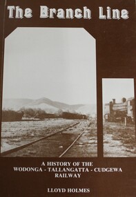
Book - The Branch Line : A history of the Wodonga - Tallangatta - Cudgewa Railway, Lloyd Holmes, 1985
This railway story concerns just one of the many branch lines that snaked across the landscape of Victoria. This book concentrates on the Wodonga - Tallangatta - Cudgewa line, a railway that took 32 years to complete from starting point to eventual terminus. The first section of the Wodonga to Tallangatta line opened in 1889 and was further extended in 1891. It was a vital community link until the passenger service closed in September 1961. The last regular goods train on the line ran on 21st April 1978. The north- east train line to Wodonga remained a significant factor in the development of Wodonga as a rural city in the 20th century.non-fictionThis railway story concerns just one of the many branch lines that snaked across the landscape of Victoria. This book concentrates on the Wodonga - Tallangatta - Cudgewa line, a railway that took 32 years to complete from starting point to eventual terminus. The first section of the Wodonga to Tallangatta line opened in 1889 and was further extended in 1891. It was a vital community link until the passenger service closed in September 1961. The last regular goods train on the line ran on 21st April 1978. The north- east train line to Wodonga remained a significant factor in the development of Wodonga as a rural city in the 20th century.railroads -- victoria, northeastern victoria, tallangatta, wodonga railways, cudgewa railroad -
 Glen Eira Historical Society
Document - Historic Conservation Areas Project
Contains 4 items relating to historic conservation: 1/Five newsletters (one page each newsletter, dated 07/1975, 08/1975, 09/1975, 10/1975 and the final one 12/1975) describing how the project evolved, project funds, progress, study method, project 1 report, project 2 report and summary as no further funds available. Project was to include all of Melbourne but funding did not allow this. Note: newsletters stamped with Caulfield Historical Society. 2/Letter (one page on official city of Caulfield letterhead) from Andrew Rodda (manager planning) to Hazal Ford (dated 13/11/1989) describing ‘council resolved on 18/07/1989 to proceed with preliminary conservation survey’ and mentions that a copy is included. 3/Preliminary conservation survey for the City of Caulfield (nine pages) describing background, study area, budget, purpose, study outline, timeframe, report format, ownership, tasks and background information (mentions number and types of houses and properties as at 1986 and 1988) and a map of City of Caulfield. 4/Booklet (28 pages) titled ‘Heritage Area – Caulfield North Draft Heritage Guidelines July 1999 – City of Glen Eira’, containing Caulfield North Heritage Area, cultural heritage, Heritage Overlay Area, architectural description, common architectural forms and features, development guidelines, key design checklist. It includes a map of the Caulfield North Heritage Overlay Area, two illustrations about the development envelope and many black-and-white photographs of houses and architectural features.historic conservation areas project niven barbara, newsletters, town planning, historic buildings, heritage studies, housing, royal historical society of victoria (rhsv), read michael, plans, local government, historical societies, committee for urban action (cua), national trust, hopkins sherry ms., ford hazel, preliminary conservation survey, town planning, heritage studies, rodda andrew, city of caulfield, housing estates, victoria national estate grants program, australia icomos, burra charter, buildings structures and establishments, land surveys, suburbs, historic buildings, architectural significance, ‘caulfield’s heritage study’, soloman geulah dr., caulfield library, dandenong road, nepean highway, hotham street, iknerman road, orrong road, north road, poath road, ‘plan of the city of caulfield’, north ward, east ward, south ward, west ward, kooyong road, neerim road, bambra road, balaclava road, shire of caulfield, railways, world war 1914-1918, depression 1929-1939, rippon lea, labassa, parks, mansions, community services, ‘caulfield north draft heritage guidelines july 1999’, city of glen eira, caulfield north heritage area, glen eira heritage management plan, mayfield grove, normanby avenue, carnarvon street, glenferrie street, arthur street, malakoff street, normanby road, heritage advisory service, construction materials, victorian style, mediterranean style, spanish mission style, californian bungalow style, federation style, architectural style, architectural features, heritage conservation design, building construction, building regulations, aboriginal peoples, carnarvon road -
 Victorian Railway History Library
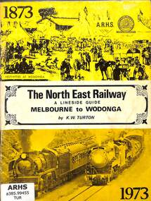
Book, Turton, Keith, The North East Railway A Lineside Guide Melbourne to Wodonga, 1973
... Railway's North East Railway from Melbourne to Wodonga in Victoria ...A lineside guide to the Victorian Railway's North East Railway from Melbourne to Wodonga in Victoria, for the North East Railway Centenary Special Train Tour on the 24th November 1973.ill, maps, p.51.non-fictionA lineside guide to the Victorian Railway's North East Railway from Melbourne to Wodonga in Victoria, for the North East Railway Centenary Special Train Tour on the 24th November 1973.railroad construction - victoria - history, railroad operations - victoria - history -
 Victorian Railway History Library
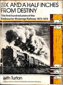
Book, Turton, Keith, Six and a Half Inches From Destiny, 1973
A history of the Victorian Railway's North East Railway from Melbourne to Wodonga in Victoria from 1873 to 1973.index, ill, maps, p.133.non-fictionA history of the Victorian Railway's North East Railway from Melbourne to Wodonga in Victoria from 1873 to 1973.railroad construction - victoria - history, railroad operations - victoria - history -
 Ballarat Tramway Museum
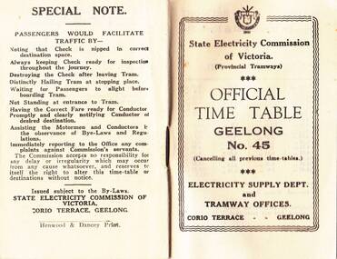
Photograph - Digital image, State Electricity Commission of Victoria (SECV), "Official Timetable Geelong No. 45"
Digital image or copy of the SEC "Official Timetable Geelong No. 45", 16 image files - 32 pages, giving details of the fares, transfers, luggage or parcels, lost property, times of each tram on the Belmont (1), Chilwell (2), East Geelong (3), Eastern Park (4), Newtown (5), North (6), West Geelong (7). Gives details of railway station trams, transfer ticket arrangements, depot workings and the night signs carried out each tram. Based on the 4d max fare, it is a circa 1949 timetable - see reference. See also Reg Item 5629 for Timetable No. 39, c1943 and 8552 for a photocopy of No. 47, March 1953 and 9821 for a photocopy of No. 46. See BTM document, "SEC fare changes - by law references etc.doc, dated 3/9/2006.trams, tramways, geelong, timetables -
 Wooragee Landcare Group
Photograph, 5 September 2004
Wooragee Landcare Group took a bus trip Sunday 5th September to Samaria, Tatong area (near Benalla) to look at land use on small farms. Around this time, Wooragee Landcare were looking into how small land holders could run some enterprises. This photo was taken at Tatong Tavern where the group had lunch. The Tatong Tavern is an old English style pub situated in the foothills of the Great Dividing Range the small community of Tatong 23km south-east of Benalla. The original weatherboard hotel was originally built in the 1880s by William Worrall who was listed as Hotel Keeper from 1886 to 1910. It was destroyed by fire in 1923 and replaced by the current building, which has undergone many changes over the past 100 years. The name has also changed from the Tatong Hotel or ‘Pub’ to the current name of Tatong Tavern.Tatong is a rural village in north-east Victoria, set in undulating country that rises southwards to the Tolmie ranges. The name is thought to derive from an Aboriginal expression, possibly referring to something unseen. The Tatong pastoral run was taken up in 1847 and farm selections began in the 1870s. A school opened in 1890 (closed in 2006). Dairy herds were grazed on the Tatong flats and a cooperative creamery operated from 1892 until 1918. In 1914 a branch railway line was opened from Benalla to Tatong that carried farm produce and timber to Tatong, which had two sawmills in the 1920s. There was also a general store, a police station, and a livestock trucking yard. St Albans Church of England was built in 1921. Most of those buildings have now disappeared. The Tatong Tavern along with the Hall built in 1904 are the only remaining buildings. The Tatong Tavern is a significant tangible and visual representation of the area’s cultural and social history over the past 100 years. Coloured rectangular photograph printed on paperReverse: WAN NA E0NA2N2. NNN- 14240/ (No. 20) 373/ tatong, tatong pub, tatong tavern, tolmie ranges, tatong flats, benalla, wooragee landcare, wooragee landcare group, bus trip, samaria, land use, william worrall, 1800s, 2004, mount samaria