Showing 10945 items matching "plenty"
-
 Greensborough Historical Society
Slide - Photograph, John Ramsdale, Flood plain of the Plenty River: Slide 90, 1990s
Photograph shows farmland on the flood plain of the Plenty River, north of MerndaPart of the John Ramsdale collection of slides and audio visual material.Colour photograph scanned from slide.No maker's marks. Caption on slide "Plenty"plenty river, mernda -
 Eltham District Historical Society Inc
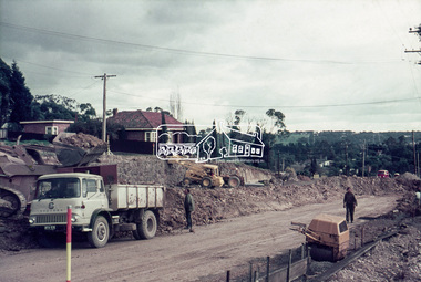
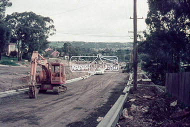
Slide, Looking southwest across to 184 Main Road, Lower Plenty during road widening works, 20 July 1970, 1970
Road works to widen and duplicate Main Road at Lower Plenty from top of hill near Grand Boulevard, Montmorency to shire border at Lower Plenty bridge35 mm colour positive transparency Mount - Agfacolor Service (Blue)duplication, lower plenty, main road, road construction -
 Eltham District Historical Society Inc
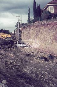
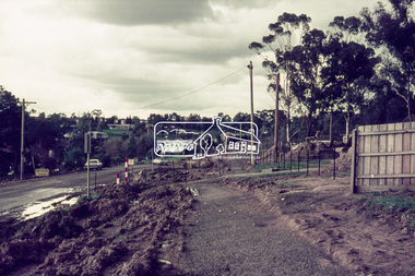
Slide, Looking east along Main Road, Lower Plenty near No. 184 during road widening works, 20 July 1970, 1970
Road works to widen and duplicate Main Road at Lower Plenty from top of hill near Grand Boulevard, Montmorency to shire border at Lower Plenty bridge35 mm colour positive transparency Mount - Agfacolor Service (Blue)duplication, lower plenty, main road, road construction -
 Eltham District Historical Society Inc
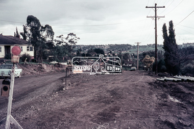
Slide, Looking southwest along Main Road, Lower Plenty near No. 169 during road widening works, 20 July 1970, 1970
Road works to widen and duplicate Main Road at Lower Plenty from top of hill near Grand Boulevard, Montmorency to shire border at Lower Plenty bridge35 mm colour positive transparency Mount - Agfacolor Service (Blue)duplication, lower plenty, main road, road construction -
 Eltham District Historical Society Inc
Slide, Looking southwest along Main Road, Lower Plenty near No. 167 during road widening works, 20 July 1970, 1970
Road works to widen and duplicate Main Road at Lower Plenty from top of hill near Grand Boulevard, Montmorency to shire border at Lower Plenty bridge35 mm colour positive transparency Mount - Agfacolor Service (Blue)duplication, lower plenty, main road, road construction -
 Eltham District Historical Society Inc
Slide, Looking northeast along Main Road, Lower Plenty near No. 122 during road widening works, 20 July 1970, 1970
Road works to widen and duplicate Main Road at Lower Plenty from top of hill near Grand Boulevard, Montmorency to shire border at Lower Plenty bridge35 mm colour positive transparency Mount - Agfacolor Service (Blue)duplication, lower plenty, main road, road construction -
 Greensborough Historical Society
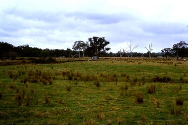
Slide - Photograph, John Ramsdale, Plenty River behind football ground: Slide 51, 1990s
Photograph shows a river and bushland. This is the Plenty River behind the football ground in Greensborough.Part of the John Ramsdale collection of slides and audio visual material.Colour photograph scanned from slide.No maker's marks. Caption on slide "Plenty"plenty river greensborough, plenty river -
 Eltham District Historical Society Inc
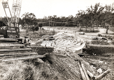
Photograph, Construction of new bridge over the Plenty River, Main Road, Lower Plenty, c.Aug. 1966
Construction of the Main Road bridge over the Plenty River. Includes structural members, construction personnel, vehicles and a Clarke mobile crane.Local significanceBlack and white printMarking on back of photograph - Plenty River Bridge Main Road 1969 (sic)lower plenty, main road, plenty river, bridge, bridge construction, civil engineering, cranes, mobile cranes -
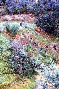 Greensborough Historical Society
Slide - Photograph, John Ramsdale, Slumping erosion along the Plenty River: Slide 110, 1990s
Photograph shows a man standing on an embankment which is being eroded. This is slumping erosion along the Plenty River.Part of the John Ramsdale collection of slides and audio visual material.Colour photograph scanned from slide.No maker's marks. Caption on slide "Plenty"plenty river, erosion -
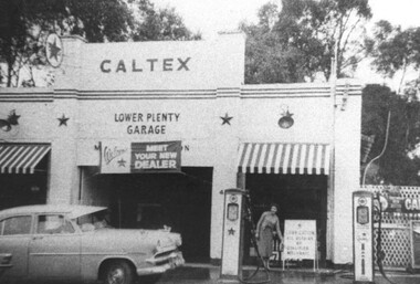 Greensborough Historical Society
Photograph - Digital Image, Lower Plenty Garage, 1950s
Lower Plenty Garage (a Caltex service station) on Main Road Lower Plenty (previously Old Eltham Road) in the 1950s. This photograph shows the garage with petrol pumps out front and a Caltex sign above door.Digital copy of black and white photographlower plenty, lower plenty garage, main road lower plenty, old eltham road lower plenty, caltex garage lower plenty -
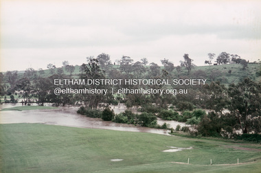 Eltham District Historical Society Inc
Slide, Floodwater, west from Clubhouse of Rosanna Golf Club, Lower Plenty, November 1971, 1971
Many parts of Melbourne flooded including Rosanna Golf Club, Lower Plenty in Novembere 1971. Many surburban roads, including the new south-eastern freeway were cut by flood waters. Here the level of the Plenty River floods onto the golf course. 35 mm colour positive transparency Mount - Agfacolor Service (Blue)floods, lower plenty, rosanna golf club, flooding, plenty river -
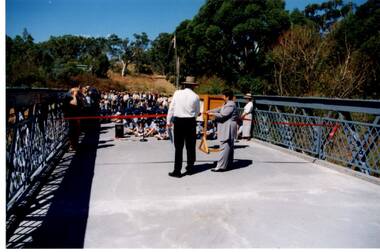 Greensborough Historical Society
Photograph - Digital Image, Anne Paul, Opening of restored Old Lower Plenty Bridge 2001, 14/03/2001
The opening of the restored Old Lower Plenty Bridge, opened on 14/03/2001 by the Minister for Environment and Conservation Sherryl Garbutt MLA and Mayor of Banyule Cr Dale Peters. The project was jointly funded by Banyule Council and Parks Victoria. The restored bridge is the oldest remaining bridge in the former Shire of Eltham and forms part of the Plenty River Trail.Digital copy of colour photographlower plenty, lower plenty bridge, sherryl garbutt, dale peters, banyule council, parks victoria -
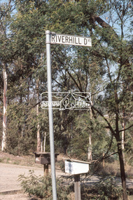 Eltham District Historical Society Inc
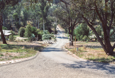
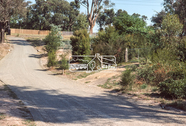
Photograph, Riverhill Drive intersection with Rosehill Road, Lower Plenty, c.March 1981, 1981
Infrastructure features used by Eltham Shire Council in the construction of Riverhill Drive, Lower Plenty, c.March 198135mm colour positive transparency Kodak Kodachrome cardboard mountbell, g. stevens, infrastructure, lower plenty, riverhill drive, road construction, rosehill road, streets -
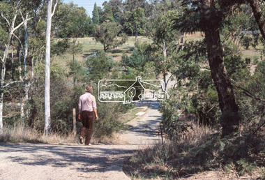 Eltham District Historical Society Inc
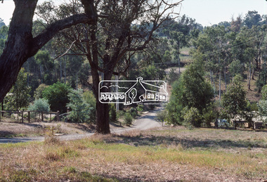
Photograph, Looking down Riverhill Drive from intersection of Rosehill Road, Lower Plenty, c.March 1981, 1981
Infrastructure features used by Eltham Shire Council in the construction of Riverhill Drive, Lower Plenty, c.March 198135mm colour positive transparency Kodak Kodachrome cardboard mountinfrastructure, lower plenty, riverhill drive, road construction, rosehill road, streets -
 Eltham District Historical Society Inc
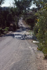
Photograph, Width and stand of construction, Riverhill Drive, Lower Plenty, c.March 1981, 1981
Infrastructure features used by Eltham Shire Council in the construction of Riverhill Drive, Lower Plenty, c.March 198135mm colour positive transparency Kodak Kodachrome cardboard mount Also Kodak Enlargement of slide 27 x 35.5 cminfrastructure, lower plenty, riverhill drive, road construction, streets -
 Eltham District Historical Society Inc
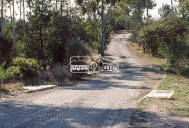
Photograph, Curvilinear design, Riverhill Drive, Lower Plenty, c.March 1981, 1981
Infrastructure features used by Eltham Shire Council in the construction of Riverhill Drive, Lower Plenty, c.March 198135mm colour positive transparency Kodak Kodachrome cardboard mountinfrastructure, lower plenty, riverhill drive, road construction, streets -
 Eltham District Historical Society Inc
Photograph, Vegetation, Riverhill Drive, Lower Plenty, c.March 1981, 1981
Infrastructure features used by Eltham Shire Council in the construction of Riverhill Drive, Lower Plenty, c.March 198135mm colour positive transparency Kodak Kodachrome cardboard mountinfrastructure, lower plenty, riverhill drive, road construction, streets -
 Eltham District Historical Society Inc
Photograph, Water drainage pits with double side entry, Riverhill Drive, Lower Plenty, c.March 1981, 1981
Infrastructure features used by Eltham Shire Council in the construction of Riverhill Drive, Lower Plenty, c.March 198135mm colour positive transparency Kodak Kodachrome cardboard mountinfrastructure, lower plenty, riverhill drive, road construction, streets -
 Eltham District Historical Society Inc
Photograph, Rollover kerb sprayed and Lilydale topped, Riverhill Drive, Lower Plenty, c.March 1981, 1981
Infrastructure features used by Eltham Shire Council in the construction of Riverhill Drive, Lower Plenty, c.March 198135mm colour positive transparency Kodak Kodachrome cardboard mountinfrastructure, lower plenty, riverhill drive, road construction, streets -
 Eltham District Historical Society Inc
Photograph, Lilydale topping on final surface, Riverhill Drive, Lower Plenty, c.March 1981, 1981
Infrastructure features used by Eltham Shire Council in the construction of Riverhill Drive, Lower Plenty, c.March 198135mm colour positive transparency Kodak Kodachrome cardboard mountinfrastructure, lower plenty, riverhill drive, road construction, streets -
 Eltham District Historical Society Inc
Photograph, Curvilinear design, Riverhill Drive, Lower Plenty, c.March 1981, 1981
Infrastructure features used by Eltham Shire Council in the construction of Riverhill Drive, Lower Plenty, c.March 198135mm colour positive transparency Kodak Kodachrome cardboard mountinfrastructure, lower plenty, riverhill drive, road construction, streets -
 Eltham District Historical Society Inc
Photograph, Rollover kerb sprayed and Lilydale topped, Riverhill Drive, Lower Plenty, c.March 1981, 1981
Infrastructure features used by Eltham Shire Council in the construction of Riverhill Drive, Lower Plenty, c.March 198135mm colour positive transparency Kodak Kodachrome cardboard mountinfrastructure, lower plenty, riverhill drive, road construction, streets -
 Eltham District Historical Society Inc
Photograph, T-bowl and extended drive, Riverhill Drive, Lower Plenty, c.March 1981, 1981
Infrastructure features used by Eltham Shire Council in the construction of Riverhill Drive, Lower Plenty, c.March 198135mm colour positive transparency Kodak Kodachrome cardboard mountinfrastructure, lower plenty, riverhill drive, road construction, streets -
 Eltham District Historical Society Inc
Photograph, Rollover kerb sprayed and Lilydale topped, Riverhill Drive, Lower Plenty, c.March 1981, 1981
Infrastructure features used by Eltham Shire Council in the construction of Riverhill Drive, Lower Plenty, c.March 198135mm colour positive transparency Kodak Kodachrome cardboard mountinfrastructure, lower plenty, riverhill drive, road construction, streets -
 Eltham District Historical Society Inc
Photograph, T-bowl, Riverhill Drive, Lower Plenty, c.March 1981, 1981
Infrastructure features used by Eltham Shire Council in the construction of Riverhill Drive, Lower Plenty, c.March 198135mm colour positive transparency Kodak Kodachrome cardboard mountinfrastructure, lower plenty, riverhill drive, road construction, streets -
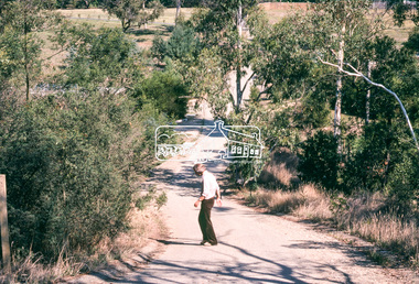
 Eltham District Historical Society Inc
Photograph, Riverhill Drive from T-bowl to Rosehill Road, Lower Plenty, c.March 1981, 1981
Infrastructure features used by Eltham Shire Council in the construction of Riverhill Drive, Lower Plenty, c.March 198135mm colour positive transparency Kodak Kodachrome cardboard mountinfrastructure, lower plenty, riverhill drive, road construction, streets -
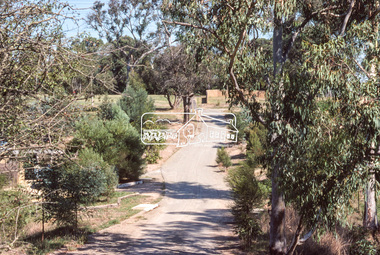
 Eltham District Historical Society Inc
Photograph, General view, Riverhill Drive, Lower Plenty, c.March 1981, 1981
Infrastructure features used by Eltham Shire Council in the construction of Riverhill Drive, Lower Plenty, c.March 198135mm colour positive transparency Kodak Kodachrome cardboard mountinfrastructure, lower plenty, riverhill drive, road construction, streets -
 Eltham District Historical Society Inc
Photograph, General view of Riverhill Drive showing pits, Lower Plenty, c.March 1981, 1981
Infrastructure features used by Eltham Shire Council in the construction of Riverhill Drive, Lower Plenty, c.March 198135mm colour positive transparency Kodak Kodachrome cardboard mountinfrastructure, lower plenty, riverhill drive, road construction, streets -
 Eltham District Historical Society Inc
Photograph, Water drainage pits at low point, Riverhill Drive, Lower Plenty, c.March 1981, 1981
Infrastructure features used by Eltham Shire Council in the construction of Riverhill Drive, Lower Plenty, c.March 198135mm colour positive transparency Kodak Kodachrome cardboard mount Also Kodak Enlargement of slide 27 x 35.5 cminfrastructure, lower plenty, riverhill drive, road construction, streets -
 Eltham District Historical Society Inc
Photograph, Driveway detail, Riverhill Drive, Lower Plenty, c.March 1981, 1981
Infrastructure features used by Eltham Shire Council in the construction of Riverhill Drive, Lower Plenty, c.March 198135mm colour positive transparency Kodak Kodachrome cardboard mountinfrastructure, lower plenty, riverhill drive, road construction, streets