Showing 251 items matching "roundabout"
-
 Marysville & District Historical Society
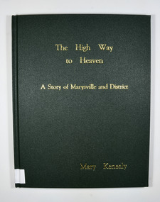
Book, Mary Kenealy, The High Way to Heaven-A Story of Marysville and District, 2006
A history of Marysville and the local district.Dark green cover. Title and author in gold letteringnon-fictionA history of Marysville and the local district.marysville, history, local history, timber, tourism, victoria -
 Eltham District Historical Society Inc
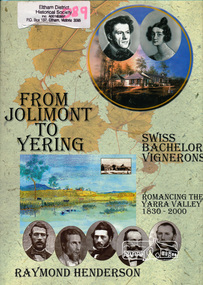
Book, Raymond Henderson, From Jolimont to Yering and along our Yarra valleys with Neuchatel's bachelor vignerons / Raymond Henderson, 2006c
Hardback with dust jacket; 426 p. : ill. (some col.), geneal. tables, maps, ports. ; 31 cm.ISBN 0958135851yarra river valley, wine making, vineyards -
 Ringwood and District Historical Society
Book, David Mitchell - A Forfar Man, 1992
Story of David Mitchell's life told by his great grand daughter. -
 Ringwood and District Historical Society
Book, A Tour of the Lilydale Cemetery 1861-1994 Volume One, 1995
Map and history of some of the graves in Lilydale Cemetery, compiled By Sandy Ross, Lilydale and District Historical Society. +Additional Keywords: Mary Hussey / Daniel Cameron / Captain Alexander John Herbert Robertson / Ernest Buckmaster / Jimmy Ah Tak / David Mitchell / Dame Nellie Melba / Jessie Mary Vasey O.B.E., C.B.E. / William Blamire Young -
 Ringwood and District Historical Society
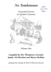
Book, No Tombstones - Unmarked Graves at Lilydale Cemetery Volume One, circa 2000
Collection of information gathered by family members on their ancestors who lay in unmarked graves at the Lilydale Cemetery. -
 Ringwood and District Historical Society
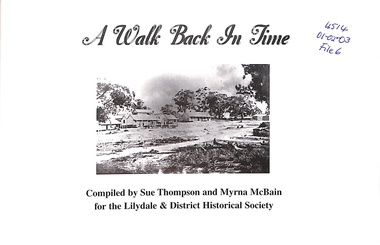
Book, A Walk Back in Time, circa 1996
Pictorial history of Lilydale Compiled by Sue Thompson and Myrna McBain for the Lilydale and District Historical Society -
 Lilydale RSL Sub Branch
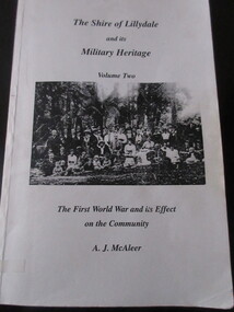
Book - Book (Paperback), A J McAleer, The Shire Of Lillydale and its Military Heritage Vol2 - The First World War and its effect on the Community, 1995
Book -
 Lilydale RSL Sub Branch
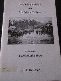
Book - Book (Paperback), A J McAleer, The Shire Of Lillydale and its Military Heritage Vol 1 - The Colonial Years, 1994
Book -
 Victorian Railway History Library
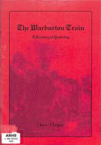
Harper, Gary, The Warburton Train: A Railway of Yesterday, 1997
A brief history of the remains of the Warburton railway from Lilydale in Melbourne.ill, p.27.non-fictionA brief history of the remains of the Warburton railway from Lilydale in Melbourne.yarra valley railway - victoria - history, railroad construction - victoria - history -
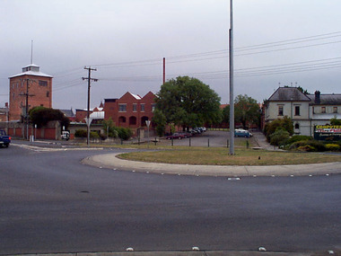
 Eltham District Historical Society Inc
Photograph, Roundabout, Osborne and Fawkner streets, South Yarra, c.1986, 1986c
Shire of Eltham infrastructure benchmark studiesRoll of 35mm colour negative film, 4 strips Fuji 100-Sbenchmark studies, fawkner street, infrastructure, osborne street, round about, south yarra -
 Federation University Historical Collection
Photograph, Ballarat School of Mines from the Armstrong Street Roundabout
The Ballarat School of MInes Time Capsule should have been opened in 2020 for the 150th anniversary since the establishment of the Ballarat School of Mines, but due to the Covid 19 pandemic and the associated lockdowns it was not opened untll 2022. This image was on a CD-ROM in the time capsule. Photograph of the Ballarat School of Mines Brewery Building exteriortime capsule, ballarat school of mines, armstrong street south, brew tower, former ballarat supreme courthouse -
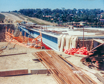
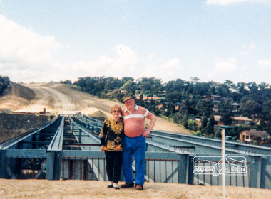 Eltham District Historical Society Inc
Photograph, Looking east across the new bridge construction across the Plenty River from the western side up to the new roundabout at Civic Drive; Greensborough Bypass construction, c.1986, 1986c
Colour photograph originally located in a magnetic style album titled 'Greensborough Bypass 1990s 5' suffering significant degradation. No information contained in album or on reverse of photos except where noted. Relocated to archival photosafe storage.greensborough bypass, road construction, greensborough, bridge construction -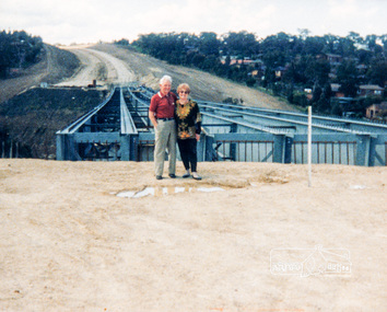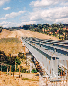
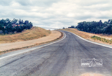 Eltham District Historical Society Inc
Photograph, Looking east from the new bridge towards the newly completed pedestrian overpass and the roundabout at the end of the Bypass at Civic Drive; Greensborough Bypass construction, c.1986, 1986c
Note the two cyclists riding along the newly sealed road up the hill.Colour photograph originally located in a magnetic style album titled 'Greensborough Bypass 1990s 5' suffering significant degradation. No information contained in album or on reverse of photos except where noted. Relocated to archival photosafe storage.greensborough bypass, road construction, greensborough -
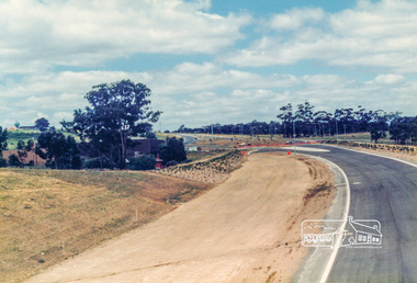 Eltham District Historical Society Inc
Photograph, Looking east along the newly sealed road from the pedestrian overpass to the new roundabout at Civic Drive; Greensborough Bypass construction, c.1986, 1986c
Colour photograph originally located in a magnetic style album titled 'Greensborough Bypass 1990s 5' suffering significant degradation. No information contained in album or on reverse of photos except where noted. Relocated to archival photosafe storage.greensborough bypass, road construction, greensborough -
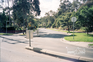
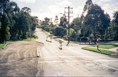 Eltham District Historical Society Inc
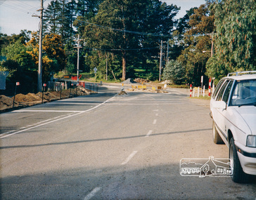
Photograph, Intersection of Beard Street and Valonia Drive, Eltham before the roundabout
Roll of 35mm colour negative film, 5 of 7 stripsKodak GA 100 5095shire of eltham, roads, eltham east, beard street, valonia drive -
 Eltham District Historical Society Inc
Photograph, Intersection of Beard Street and Valonia Drive, Eltham before the roundabout
Roll of 35mm colour negative film, 5 of 7 stripsKodak GA 100 5095shire of eltham, roads, eltham east, beard street, valonia drive -
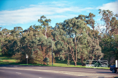 Eltham District Historical Society Inc
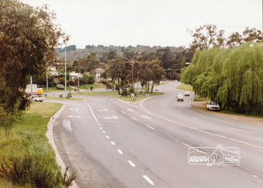
Photograph, Looking west to reserve bounded by Main Road, Bolton Street and Fitzsimons Lane from Fitzsimons Lane roundabout, Eltham, c.May 2001
Roll of 35mm colour negative film, 7 stripsAgfa HDC 200 plus-2eltham, streets, main road, fitzsimons lane reserve, fitzsimons lane -
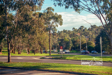 Eltham District Historical Society Inc
Photograph, Looking northwest along Main Road from Fitzsimons Lane roundabout, Eltham, c.May 2001
Roll of 35mm colour negative film, 7 stripsAgfa HDC 200 plus-2eltham, streets, main road, fitzsimons lane reserve, monarch ridge estate, houses -
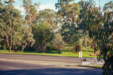 Eltham District Historical Society Inc
Photograph, Looking northwest along Main Road from Fitzsimons Lane roundabout, Eltham, c.May 2001
Roll of 35mm colour negative film, 7 stripsAgfa HDC 200 plus-2eltham, streets, main road, fitzsimons lane reserve, monarch ridge estate, houses -
 Eltham District Historical Society Inc
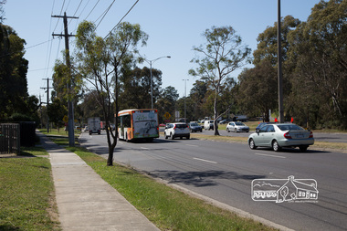
Photograph, Peter Pidgeon, Main Road looking east towards Fitzsimons Lane roundabout during Bolton Street upograde, 13 November 2017, 13/11/2017
North bound lane closure. Born Digitalbolton street, bolton street upgrade, eltham, streets, main road, fitzsimons lane -
 Eltham District Historical Society Inc
Photograph, Roundabout construction, Main Road, Panton Hill, c. Oct 1987, 1987
Date based on other similar display panels visible in images of the Shire of Eltham display at the Eltham Community Festival, 7 November 1987Colour photographdisplay panel, eltham festival, infrastructure, shire of eltham, main road, roundabouts, panton hill -
 Eltham District Historical Society Inc
Photograph, Main Road-Fitzsimons Lane Roundabout, c. Oct 1987, 1987
Fitzsimons Lane was originally known as the Eltham-Templestowe Road north of the Yarra and Fitzsimons Lane south of the Yarra River. Date based on other similar display panels visible in images of the Shire of Eltham display at the Eltham Community Festival, 7 November 1987Colour photographdisplay panel, eltham festival, infrastructure, shire of eltham, main road, roundabouts, fitzsimons lane -
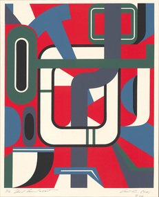
 Horsham Regional Art Gallery
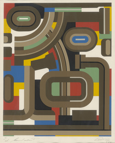
Print, Doug CROSTON, Roundabout, 1975
Gift of Mr Reg Collins, 1982 -
 Horsham Regional Art Gallery
Print, Doug CROSTON, Second roundabout, 1976
Gift of Mr Reg Collins, 1982 -
 Horsham Regional Art Gallery
Print, Doug CROSTON, Third roundabout, 1977
Gift of Mr Reg Collins, 1982 -
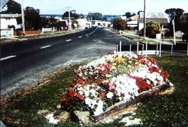 Inverloch Historical Society
000868 - Photograph - March 1980 - Inverloch - corner Williams St and Bayview Avenue - Les Swift's garden beds - Note no roundabout at corner of Williams and A'Beckett Sts - from Hazel Swift
-
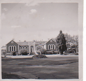 Department of Health and Human Services
Photograph, Front of building and roundabout of Pleasant Creek Special School - Stawell - Circa 1940 to 1950
Pleasant Creek Colony history in brief Warning about distressing information Patient information Disclaimer Source On this page: Pleasant Creek Colony history in brief Warning about distressing information Patient information Disclaimer Source Pleasant Creek Colony history in brief In 1861, the Pleasant Creek Hospital opened as a medical facility for the population of Stawell and district. Another building was added in 1904, Syme Ward for convalescent patients. In 1933, the facility was replaced by a newly-built hospital in the town of Stawell. In 1934, the Mental Hygiene Department acquired the old Pleasant Creek Hospital site and converted it to accommodate children with disabilities, which became Pleasant Creek Special School. The first residents (18 boys) were admitted in 1937 from Royal Park Depot. At the end of 1937, there were 98 children living at Pleasant Creek. In 1968 the Pleasant Creek Special School was renamed Pleasant Creek Training Centre, caring for people with intellectual disabilities. From the 1950s to the 1980s, there were several building developments: •1957, Lonsdale Unit expanded capacity to 113 •1969, Bellfield and Fyans Units increased numbers to 196 •1977, Alexandra Unit converted to recreational and lecture room facility. •1977, Day Centre, Nurses' Home and Clinical Services Administration buildings •1985, Nara Unit closed for renovations and residents moved to the previous staff living quarters. https://www.findingrecords.dhhs.vic.gov.au/CollectionResultsPage/Pleasant-Creek-Colony