Showing 35 items
matching township of sandhurst
-
 Bendigo Historical Society Inc.
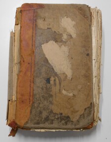
Document - REGISTRATION OF RESIDENCE AREAS 9433 - 13296: 1899 - 1905, 1899 - 1905
Document: hard cover journal, originally dark cover with burgundy binding on spine. In very poor condition, pages loose. Details: left hand page: date of registration, holder or owner, miners right etc., description of allotment, township or parish, memo, registration. Right hand page: same. Details land registrations in Bendigo and district.bendigo, sandhurst, land sales, residence licences -
 Bendigo Historical Society Inc.
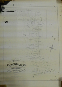
Document - MARKS COLLECTION: MAP OF VICTORIA REEF MINING CLAIMS
Copy of map. On bottom LH side: Plan of the Victoria Reef Sandhurst January 1867, Compiled by G.W. Hart, Mining Surveyor. Published by John N. Macartney, Argus Agent, Sandhurst. Price 4/- each. On bottom Rh side J.W. Pearson & Co. Lith. Melbourne Plan shows mining claims and names of holders, scale (4 chains to one inch) Loddon Road, Mount Korong Road, Ironbark Gully, township of Long Gully, Quartz Miners' Arms and Gold Mines Hotel on Loddon Road.bendigo, mining, victoria reef plan -
 Bendigo Historical Society Inc.
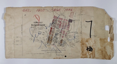
Map - NEILBOROUGH RAVENSWOOD, October 21 1859
Map:Township of Neilborough, Elysian Flat, near Sandhurst,County unnamed. Parish plan. Backing is a part of Ravenswood Township map.map, bendigo, neilborough, elysian flat, ravenswood -
 Bendigo Historical Society Inc.
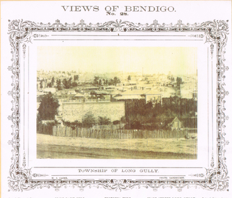
Photograph - LONG GULLY HISTORY GROUP COLLECTION: TOWNSHIP OF LONG GULLY
BHS CollectionYellow tone photo of the Township of Long Gully. At the top is Views of Bendigo No. 28. There is a decorative frame around the photo. The photo has tall chimneys in the background. Iron Bark Hill and Victoria Hill are mentioned. There are houses in the centre and in the foreground is a rough picket fence. It is a N J Caire Photo Sandhurst and a Carey & Wenhorn's Print. Forbes & Holmes, Agents. The photo is mounted on a yellow card which is mounted on a purple card and laminated.bendigo, history, long gully history group, the long gully history group - township of long gully, views of bendigo no 28, casey & wenburn's print, iron bark hill, victoria hill, forbes & holmes, n j caire -
 Bendigo Historical Society Inc.
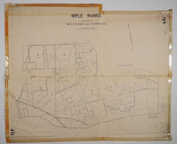
Map - CAMPBELL COLLECTION: BENDIGO AND DISTRICT MAPS
Map. Rifle Range, Parishes of Wellsford and Sandhurst. Scale 20 chains to 1 inch. Total area in plan is 5916 acres. Wallan and Bendigo Railway to Axedale Township and station 8 miles, to Longlea Railway Station 2 1/2 - 3 miles. Rifle Range. Compiled in W.P.B. from Assessment and Parish Plans, by H.A.D. 8-7-29H.A.D.(Darby).map, bendigo, allotments, bendigo rifle range, sandhurst parish, wellsford parish