Showing 35 items matching "weather map"
-
 University of Melbourne, Burnley Campus Archives
Book - Report, E.B. Littlejohn, Victoria 1944 State Regional Boundaries Committee Report on Regional Boundaries, 1944
See paper catalogue for complete contents. Item formerly property of E.B. LittlejohnReport includes maps of Regions for Planning and Development, geographical, weather, power, water resources, crops, livestock, etc.e.b. littlejohn, planning, development, regions -
B-24 Liberator Memorial Restoration Australia Inc
Map - Silk Map of South West Pacific Ocean, Ocen Currents and Surface winds of the West pacific Area May-October
These maps were carried by air crew flying in the Pacific Ocean areas.Square silk mapOCEAN CURRENTS AND SURFACE WINDS FOR THE WEST PACIFIC AREA MAY- OCTOBER COMPILED BY THE 2ND AND 3RD OPERATIONS ANALYSIS SECTIONS,HQ, FEAF, FROM OCEAN CURRENT CHARTS DEIGNED BY THE SCRIPTS INSTITUTE OF OCEANOGRAPHY, AND FROM WIND CHARTS PREPARED BY THE U.S. WEATHER BUREAU. REPRODUCED BY R.A.A.F HEADQUARTERS [cartographic section] OCTOBER 1944 RESTRICTED -
Moorabbin Air Museum
Book - Meteorology, Meteorology for Pilots
... Weather maps Structure of the atmosphere Moisture Heat energy ...Text on meteorology forM us Civil Aeronautics Administrations War Training Services, circa 1943non-fictionText on meteorology forM us Civil Aeronautics Administrations War Training Services, circa 1943aviation weather, meteorological elements, weather maps, structure of the atmosphere, moisture, heat energy, fronts, wind, circulation, fog, storms, ice on aircraft, miscellaneous weather topics -
Moorabbin Air Museum
Book - Meteorology, Meteorological Handbook for Pilots and Navigators
... Altimeters Weather maps Miscellaneous UK air ministry overview ...UK air ministry overview of meteorology for pilots & navigators, circa 1942non-fictionUK air ministry overview of meteorology for pilots & navigators, circa 1942cloud & fog, weather, air density, visibility, altimeters, weather maps, miscellaneous -
 Falls Creek Historical Society
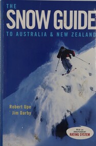
Book - The Snow Guide to Australia and New Zealand, Robert Upe & Jim Darby, 2005
The must-have guide to the snowfields of Australia and New Zealand including information about 42 resorts and 26 towns. It contains 52 detailed maps as well as tips on weather, equipment, mountain wear, mountain driving, snow safety and fitness, plus tips for first timers. Snow fields are assessed on a ratings system covering slope difficulty (beginner, intermediate and advanced), road access, kid appeal, basic facilities, food and shelter.A publication of 315 pages including an index, colour illustrations and maps.The must-have guide to the snowfields of Australia and New Zealand including information about 42 resorts and 26 towns. It contains 52 detailed maps as well as tips on weather, equipment, mountain wear, mountain driving, snow safety and fitness, plus tips for first timers. Snow fields are assessed on a ratings system covering slope difficulty (beginner, intermediate and advanced), road access, kid appeal, basic facilities, food and shelter.australian snowfields, new zealand snowfields