Showing 25223 items
matching north
-
 Ringwood and District Historical Society
Newsletters, Newton Press, 'The Spirit' Quarterly newsletters: Mar-1985 and Jun-1985. Published by the people of the Holy Spirit Parish, North Ringwood, 1985
'The Spirit' Quarterly newsletters: Mar-1985 and Jun-1985. Published by the people of the Holy Spirit Parish. -
 Horsham Regional Art Gallery
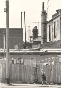
Photograph, Mark STRIZIC, In North Melbourne, 1972 (printed 1989)
Donated through the Australian Government's Cultural Gifts Program by Dr Jonathan Hartley, 2006silver gelatin photograph -
 Wheen Bee Foundation
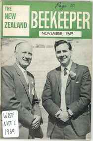
Publication, National Beekeepers' Association of New Zealand, The New Zealand Beekeeper (national Beekeepers' Association of New Zealand), North Shore, 1969, 1969
-
 Wheen Bee Foundation
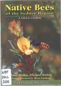
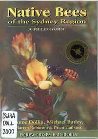
Publication, Dollin, A., Batley, M., Robinson, M. & Faulkner, B, Native Bees of the Sydney Region: A Field Guide (Dollin et al.), North Richmond, 2000, 2000
-
 Wheen Bee Foundation
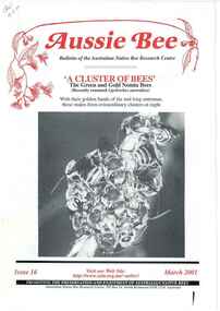
Publication, Aussie Bee (Australian Native Bee Research Centre), North Richmond, 2001, 2001
-
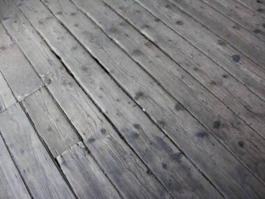 Ballarat Heritage Services
Photograph - Photograph - Colour, Timber Floor on the North Platform, Ballarat Railway Precinct, 2017
Colour photograph of fwell worn timber floor boards at the Ballarat Railway Station. ballarat railway station, floor boards -
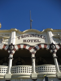 Ballarat Heritage Services
Photograph - Colour, Provincial Hotel, Lydiard Street North, Ballarat, 2015, 15/12/2015
Colour photograph of a detail of the facade of the Provincial Hotel in Ballarat.provincial hotel, hotels, ballarat -
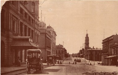 Ballarat Heritage Services
Photograph - Image, Lydiard Street Ballarat Looking North, C1890
Lydiard Street is a street in central Ballarat known for its Victorian architecture. The building with clock tower is the former Ballarat Post Office, the tower stage of the building dating from 1885. It sits on the corner of Sturt Street. Black and white photograph of Lydiard Street Ballarat.lydiard street ballarat, ballarat post office, tram, streetscape, architecture, vintage cars -
 Whitehorse Historical Society Inc.
Photograph, Old Orchard Shopping Centre Blackburn North, 10/11/2010 12:00:00 AM
The Old Orchard Shopping Centre was completed by October 1965Coloured photograph of land on the eastern side of Springfield Road being cleared for the building of the Old Orchard Shopping Centre. Station wagon on left. Pole in centre.old orchard shopping centre, blackburn shopping centres -
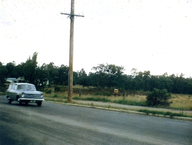
 Whitehorse Historical Society Inc.
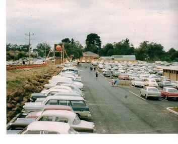
Photograph - Coloured Photograph, Old Orchard Shopping Centre, Blackburn North, 1965
Coloured photograph of cars parked along Springfield Road and in the car park of the Old Orchard Shopping Centre on opening day - October 1965old orchard shopping centre, blackburn shopping centres -
 Ballarat Heritage Services
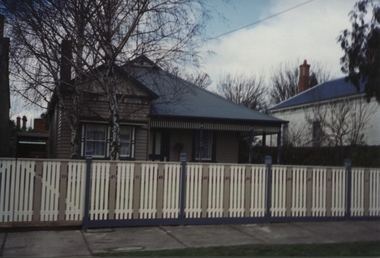
Photograph - Photograph - Colour, 10 Raglan Street North, Ballarat Central
Raglan Street is located within the heritage precinct of central Ballarat. This house was built around the turn of the century, with sewerage being added in 1908. The hallway is lined with pressed metal, the remainder of the metal being used at Talbot Hall. The building was occupied by Dr Pern.Postcard size colour photo of a weatherboard house in Raglan St Ballarat.raglan street, ballarat, house, garden, architecture -
 Old Colonists' Association of Ballarat Inc.
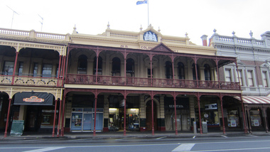
Photograph - Photograph - Colour, Old Colonists' Hall, Lydiard Street North, Ballarat
The Old Colonists' Association Hall opened in 1887.Photograph of the Ballarat Old Colonists' Hall taken on Christmas Day when there were no cars parked out the front. old colonists' association ballarat, old colonists' club ballarat, ballarat old colonists' hall, lydiard street, shopfront, r.f. scott and son -
![Publication, 56th annual conference: 7 May 2010. (North-Eastern Apiarists' Association of Victoria Inc.). [np], 2010, 2010](/media/collectors/51d110e42162ef12e06aa06b/items/535eff162162ef07189092c2/item-media/53717c742162ef165899c8ff/item-fit-380x285.jpg) Beechworth Honey Archive
Beechworth Honey ArchivePublication, 56th annual conference: 7 May 2010. (North-Eastern Apiarists' Association of Victoria Inc.). [np], 2010, 2010
1 volume, various paginations. -
![Publication, 57th annual conference, 8 May 2011. (North-Eastern Apiarists' Association of Victoria Inc.). [np], 2011, 2011](/media/collectors/51d110e42162ef12e06aa06b/items/535effe52162ef071890a1cf/item-media/53717d8e2162ef165899e316/item-fit-380x285.jpg) Beechworth Honey Archive
Beechworth Honey ArchivePublication, 57th annual conference, 8 May 2011. (North-Eastern Apiarists' Association of Victoria Inc.). [np], 2011, 2011
1 volume, various paginations. -
 Beechworth Honey Archive
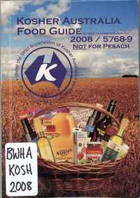
Publication, Kosher Australia food guide: 2008 edition (Kosher Australia Pty. Ltd.), Caulfield North, 2008, 2008
-
 Beechworth Honey Archive
Publication, Native bees of the Sydney region: a field guide (Dollin, A. et al), North Richmond, 2000, 2000
-
 Beechworth Honey Archive
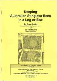
Publication, Keeping Australian stingless bees in a log or box. (Dollin, Anne and Heard, Tim). North Richmond, NSW, 1997, 1997
14 pages, illustrated -
 Ringwood and District Historical Society
Photograph, Looking north down Werac Drive, North Ringwood with lake headwater's site behind light standard on left in February 1979
B552 N19 Part of a 51-photo record of the development of the "Kubis" Estate, Ringwood North, including road works to Debbie Place, Kubis Drive, Werac Drive, Manuelo Drive, Iluka Place and Glenvale Road. From the Jack Lundy Clarke collection. -
 Ringwood and District Historical Society
Photograph, Kubis Estate, North Ringwood in February 1978. The site of Loughnan's Lake seen from the north end of the wall. The rope tree was on the hillside on the left
E546 N2 Part of a 51-photo record of the development of the "Kubis" Estate, Ringwood North, including road works to Debbie Place, Kubis Drive, Werac Drive, Manuelo Drive, Iluka Place and Glenvale Road. From the Jack Lundy Clarke collection. -
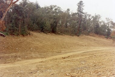 Ringwood and District Historical Society
Photograph, "Kubis Estate", North Ringwood, in April 1978. Looking north-east over Loughnan's Lake greatest width. The rope tree was on the slope in the centre. The spillway was on the near left of the image
E548 N17 Part of a 51-photo record of the development of the "Kubis" Estate, Ringwood North, including road works to Debbie Place, Kubis Drive, Werac Drive, Manuelo Drive, Iluka Place and Glenvale Road. From the Jack Lundy Clarke collection. -
Whitehorse Historical Society Inc.
Document, History of Blackburn North State School No 4715, c1970
Document re establishment of Blackburn North Primary School on 5 acres of land on the North Side of Springfield Road. Opened 5 April 1954 with initial enrolment of 237 pupils, also listing staff and school committee members.blackburn north primary school, primary schools, jenkins, p, cole, j -
Ringwood and District Historical Society
Documents, Ringwood and North Ringwood Community Fairs - documents 1995, 7-May-95
Group includes Ringwood Art Society and Norwood Park Centre, including promotions update.Documents about the organisation for the Ringwood and North Ringwood community fairs - May 1995. 10pp. -
Glenelg Shire Council Cultural Collection
Photograph, Refrigerated shipping containers on railway carriages at North Portland, n.d
Port of Portland Authority archives.Front: (no inscriptions) Back: (no inscriptions) -
Ringwood and District Historical Society
Envelope, Packet: Records of reports and accounts of Ellie Pullin Pre-School, Tortice Drive North Ringwood
Records of reports and accounts of Ellie Pullin Pre-School, Tortice Drive North Ringwood -
Whitehorse Historical Society Inc.
Book, Blackburn North Baptist Church, c1985
Blackburn North Baptist Church : a church that cares. History of the church written as a school assignmentBlackburn North Baptist Church : a church that cares. History of the church written as a school assignmentBlackburn North Baptist Church : a church that cares. History of the church written as a school assignmentblackburn north baptist church, school assignment -
 Whitehorse Historical Society Inc.
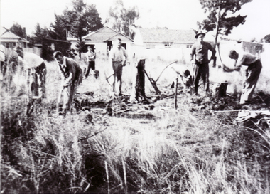
Photograph, North Blackburn Methodist Church, 1/05/1955 12:00:00 AM
Black and white photograph of the clearing of the site for the North Blackburn Methodist Church, May 1955.north blackburn methodist church, bird, neville -
 Whitehorse Historical Society Inc.
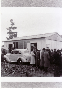
Photograph, North Blackburn Methodist Church, 1955
Black and white photograph of North Blackburn Methodist Church known as the 'Folding Church' in 1955.north blackburn methodist church, bird, neville, folding church -
 Whitehorse Historical Society Inc.
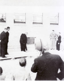
Photograph, North Blackburn Methodist Church, 1957
Black and white photograph of laying of foundation stone for the North Blackburn Methodist Church in 1957.north blackburn methodist church, bird, neville -
 Whitehorse Historical Society Inc.
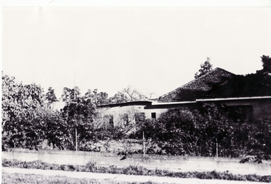
Photograph - B/W Photograph, House in Blackburn North incorporating part of Slater's Perfume Distillery, 1/06/1969 12:00:00 AM
Black and white photo of House in Blackburn North incorporating part of Slater's Perfume Distillery.June 1969slater house, perfumery -
 Whitehorse Historical Society Inc.
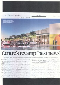
Article, North Blackburn Shopping Centre Revamp
North Blackburn Shopping Centre is awaiting council approval for a revamp costing $40 million.North Blackburn Shopping Centre is awaiting council approval for a revamp costing $40 million.North Blackburn Shopping Centre is awaiting council approval for a revamp costing $40 million.blackburn north shopping centre, city of whitehorse