Showing 302 items
matching park avenue
-
 Ringwood and District Historical Society
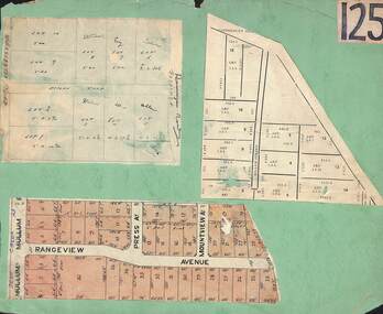
Card, Collage of Residential Subdivision Map Clippings - Ringwood, Victoria - (Undated)
Three maps mounted on green cardboard - Hand-drawn map of residential allotments off Warrandyte Road in Milne Road and Berringa Road Park Orchards. Map with acres roods and perches measurements of allotments in Canterbury Road and Miller Street Heathmont. Clipping from a land sale brochure with street names not existing together in the area - Rangeview Avenue, Press Avenue and Mountview Avenue. -
 Chelsea & District Historical Society Inc
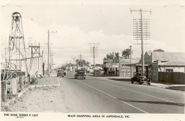
Photograph - Shopping Area, Aspendale, c 1930's
Black and white postcard showing shops on the right hand side of Point Nepean Road and the railway line, Aspendale railway station and the Aspendale Fire Station with the bell tower beside it. One car driving along the road and two cars parked. The shops in view are a cafe, a general store, the Aspendale Picnic Grounds, which included Palais De Dance.The Rose Series P. 1037 MAIN SHOPPING AREA IN ASPENDALE, VIC.point nepean road, nepean highway, aspendale, taylor avenue, shops, aspendale fire station, aspendale picnic grounds