Showing 640 items
matching landscape gardener
-
 Federation University Historical Collection
Book, Trees and Gardens from the Goldmining Era: A Study of the Maldon Landscape, 1981
... trees gardens Royal Botanic Gardens parks and gardens landscape ...This book was prepared by the Royal Botanic Gardens, Mebourne Yellow soft covered book of 99 pages.maldon, trees, gardens, royal botanic gardens, parks and gardens, landscape -
Federation University Historical Collection
Book, Maldon Historic Reserve Management Plan, 1989, 1989
This book was prepared by the Royal Botanic Gardens, Mebourne Soft covered report of 83 pages, including 10 folded leaves of plates , and 11 maps (some coloured). maldon, geology, flora, vermin, parkin's reef, derby hill, beehive reef, long gully, union hill, mount tarrengower, eaglehawk gully, porcupine flat, neggetty range, peg leg gully, sandy creek, smiths creek, landscape -
 Federation University Historical Collection
Book, Ballarat Conservation Guidelines, 1981, 1981
The Guidelines were commissioned by the City of Ballarat , Historical Buildings Preservation Council and the Australian Heritage Commission.Cream soft coloured book of 60 pages. Contents include - Contributary Commercial Buildings, New COmmercial Buildings, Contributary residential Buildings, New Residential Development, Public and In stitutiona Buildings, Railways, Cemeteries, Botanic Gardens, Lake Wendouree, Public Open Spaces, Street Works, Fences and Landscaping, Advertising Guidelines, Lydiard/Camp Street Precinct Case Studyballarat, conservation guidelines, lydiard/camp street precinct case study, railway, botanic gardens, guttes, footpaths, signs, signage, fences, robin nuttall, gerald jenzen, ray tonkin, conservation study, architectural styles, verandahs, shopfronts, cast iron, wndy jacobs, miles lewis, gary vines, heritage planning, heritage guidelines -
 Federation University Historical Collection
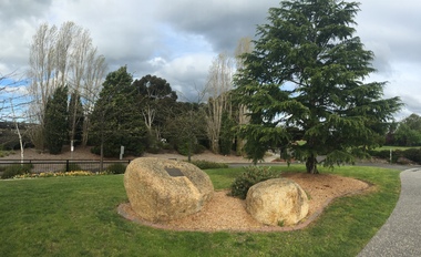
Photograph, Clare Gervasoni, Memorial To Jock Lawson at the Federation University Churchill Campus
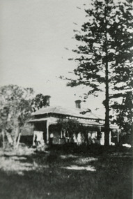
Federation University Australia was established on 1 January 2014. Formerly known as the University of Ballarat, its enabling legislation was the University of Ballarat Amendment (Federation University Australia) Act 2013. On 1 January 2014, the University of Ballarat amalgamated with the Monash University Gippsland Campus to form Federation University Australia. The Gippsland Campus also had a long lineage dating back to 1928 with the establishment of the Yallourn Technical School which became a predecessor institution to the Gippsland College of Advanced Education formed in 1968. In 1990, it was renamed the Monash University College and in 1993 became the Gippsland Campus of Monash University. In 2016, Federation University Australia announced plans to take possession, over a two-year period, of Monash’s Berwick Campus in the south-east corridor of Melbourne. Federation University Australia, or FedUni, is headquartered in Ballarat and offers programs in Higher Education and Vocational Education and Training to regional Victoria and beyond. The University’s commitment to educational and social equity, teaching excellence, research distinction, environmental sustainability and regional capacity building has enabled it to develop in a way that draws on its proud heritage to inform its future. Its regional character sets a framework for the University’s priorities but does not constrain it from serving wider community interests, nationally and internationally. The name Federation University Australia was chosen to convey the scope and capacity of an expanded regional university with a federated network of campuses. Three photographs showing a tree planted as a memorial to Jock Lawson, and a memorial plaque. The memorial is located on the Federation University Gippsland Campus, Churchill.This memorial was erected as a tribute to Mr Jock Lawson BEM (1901-1988) for his valuable contribution to the landscape design of the Gippsland Institute of Advanced Education. Mr Lawson's expert guidance set the basis for the fine gardens in which the Institute Community takes pride. gippsland institute of advanced education, churchill, garden, jock lawson, gippsland campus, memorial -
Federation University Historical Collection
Photograph - Photograph - black and white, Ballarat Scenes
... shop tom nichol ness nichol landscape parks and gardens Eight ...Eight black and white images of scenes around Ballarat. .1) Eureka Stockade Memorial .2) Ballarat Town Hall and Burk and Wills Memorial .3) Ballarat Botanical Gardens .4) Ballarat Botanical Gardens .5) Ballarat Arch of Victory .6) Boatsheds on Lake Wendouree .7) Statue 'Ruth' .8) Statue 'Honesty' .9) Statue 'Flight From Pompei' .10) Statue 'Susannah' .11) Statue 'Rebekah .12) Old Curiosity Shop eureuka stockade memorial, ballarat town hall and burk and wills memorial, ballarat botanical gardens, ballarat arch of victory, boatsheds on lake wendouree, statue 'ruth', statue 'honesty', statue 'flight from pompei', statue 'susannah', statue 'rebekah, old curiosity shop, tom nichol, ness nichol, landscape, parks and gardens -
 Federation University Historical Collection
Pamphlet, Ballarat, Victoria, Australia, c1960
The former gold town of Ballarat is situated in Central Victoria, Australia.Stapled colour brochure outlining places to visit in Ballarat.ballarat, ballarat botanical gardens, wildflowers, canadian, floral clock, lal lal falls, arch of victory, ballarat avenue of honour, landscape -
 Federation University Historical Collection
Photograph - Photograph - Colour, Clare Gervasoni, Ballarat Technical Art School (Gribble) Building, 2015, 03/03/2015
... school of mines botanical gardens gardens landscape Views ...Views of Ballarat looking towards Mount Warenheip from the Ballarat School of Minesballarat technical art school, ballarat school of mines, ballarat school of mines botanical gardens, gardens, landscape -
Federation University Historical Collection
Booklet, Ballarat and UNESCO Historic Urban Landscape Approach, 2013, 2013
Full colour booklet with a photograph of the Ballarat Botanical Gardens on the cover. Anne Beggs Sunter is in a red jumper on the first page, under the verandah of the Buninyong Cake Shop. unesco, historic urban landscape (hul), league of historical cities, urban heritage, ron van oers, burke and wills time capsule, ballarat heritage award, peel st story, landscape -
Federation University Historical Collection
Reports, John Beetham et al, Ballarat Historic Landscapes Trees and Gardens, 1983, 1983
... garden Report on Ballarat's historic landscapes. Sections ...Report on Ballarat's historic landscapes. Sections on Ballarat East Town Hall Gardens, and Ballarat School of Mines garens only.ballarat east town hall gardens, ballarat school of mines botanical garden -
 City of Moorabbin Historical Society (Operating the Box Cottage Museum)
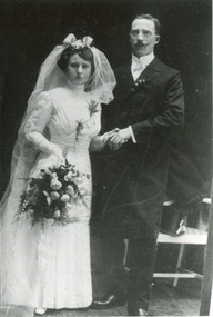
Photograph, B/W, x3 Wedding August & Frieda Rietmann 1910 and Certicicate, 1910,1915
August Rietmann (1877-1951) of Lustdorf ,Switzerland, married Maria Frieda Oesschlager (2/21878- 22/7/1942) of Baden Baden, Germany on 6/8/1910 In 1915 August and his wife Frieda migrated to Melbourne, Victoria, Australia. They leased Box Cottage, Ormond in 1917 and raised two children, Stefanie (1918 -2006) and William (1920- 1997). 1935 August purchased the property and the family used the Cottage during the day and slept in the Front House. August was a monumental mason, potter and sculptor, and was employed at Corbens Ltd Clifton Hill, to carve war memorials in Victoria post WW1 c 1915-1922. During the 1920's August set up his own business in pressed cement making pot plants, columns,paving slabs and lampstands. He continued to carve headstones and figures and took contract work for Artists eg Paul Mountford. He built a workshop in the Barn and used the Cottage for plaster moulding. His son William joined the business and and the family continued to use the site after August died in 1951. Rietman's Landscaping Ltd moved to Bay Road Highett in 1953 and later to Carrum. The land, containing the Box Cottage, was sold to Lewis Timber Pty Ltd in 1970 and Mr Lewis proposed that Moorabbin City Council should preserve the heritage Cottage. In 1984 the Cottage was dismantled and reconstructed in the adjacent Joyce Park.The Rietman family is an example of the diverse nationalities that lived and worked productively in Moorabbin Shire 1871–1933 , the City of Moorabbin 1934-1994 and continues today in the Cities of Glen Eira, Kingston, Bayside, and Monash. August, a sculptor and stone mason, was employed by Corben Pty Ltd Clifton Hill to carve WW1 Memorials before establishing his own successful masonry business in the Box Cottage during the latter 1920s. After becoming interested in pressed cement casting, he took on apprentices (1930s Depression) and among his products were garden furniture, pots and also street lamp standards, some of which were installed in St Kilda Road. After August’s death in 1951, his family continued the business ‘Rietman’s Landscaping Ltd.’, at Highett and Carrum.a) Photograph Black & White August & Frieda Rietmann Wedding 6/8/1910 in Baden Baden ; b) Passport Photograph August Rietmann 1915; c) Photograph Frieda Rietmann 1915; d) Document Wedding Certificate August & Frieda Rietmann Baden Baden 1910a) b) c) Handwritten information d) Official Document in Germanrietmann august, rietman august, rietmann frieda, rietman frieda, stonnington city town hall, war memorials, world war 1 1914-1918, rietman stefanie, rennick stefanie, francis stefanie, rietman william, rietman ray, mountford paul, malvern city town hall,box cottage museum ormond, box william, box elizabeth, joyce park ormond, rietman's landscaping pty ltd, bay road highett, macrobertson pty ltd, coleraine soldier memorial 1921, -
 City of Moorabbin Historical Society (Operating the Box Cottage Museum)
Documents, x3 Printed, Census Lustdorf 1914,15, Swiss Citizen Pass1915, 1914-1915
August Rietmann (1877-1951) of Lustdorf ,Switzerland, married Maria Frieda Oesschlager (2/21878- 22/7/1942) of Baden Baden, Germany on 6/8/1910 In 1915 August and his wife Frieda migrated to Melbourne, Victoria, Australia. They leased Box Cottage, Ormond in 1917 and raised two children, Stefanie (1918 -2006) and William (1920- 1997). 1935 August purchased the property and the family used the Cottage during the day and slept in the Front House. August was a monumental mason, potter and sculptor, and was employed at Corbens Ltd Clifton Hill, to carve war memorials in Victoria post WW1 c 1915-1922. During the 1920's August set up his own business in pressed cement making pot plants, columns,paving slabs and lampstands. He continued to carve headstones and figures and took contract work for Artists eg Paul Mountford. He built a workshop in the Barn and used the Cottage for plaster moulding. His son William joined the business and and the family continued to use the site after August died in 1951. Rietmann Landscaping Ltd moved to Bay Road Highett in 1953 and later to Carrum. The land, containing the Box Cottage, was sold to Lewis Timber Pty Ltd in 1970 and Mr Lewis proposed that Moorabbin City Council should preserve the heritage Cottage. In 1984 the Cottage was dismantled and reconstructed in the adjacent Joyce Park. The Rietman family is an example of the diverse nationalities that lived and worked productively in Moorabbin Shire 1871–1933 , the City of Moorabbin 1934-1994 and continues today in the Cities of Glen Eira, Kingston, Bayside, and Monash. August, a sculptor and stone mason, was employed by Corben Pty Ltd Clifton Hill to carve WW1 Memorials before establishing his own successful masonry business in the Box Cottage during the latter 1920s. After becoming interested in pressed cement casting, he took on apprentices (1930s Depression) and among his products were garden furniture, pots and also street lamp standards, some of which were installed in St Kilda Road. After August’s death in 1951, his family continued the business ‘Rietman’s Landscaping Ltd.’, at Highett and Carrum.Documents a) Census 1914 Household Register Lustdorf, Switzerland; b) Census 1915 Household Register Lustdorf, Switzerland; c) Swiss Confederation Citizen ship I.D Pass Frieda Rietman 4/8/1915;Printed Government Documents in Swiss Language lustdorf switzerland, rietmann august, rietman august, rietmann frieda, rietman frieda, stonnington city town hall, war memorials, world war 1 1914-1918, rietman stefanie, rennick stefanie, francis stefanie, rietman william, rietman ray, mountford paul, malvern city town hall,box cottage museum ormond, box william, box elizabeth, joyce park ormond, rietman's landscaping pty ltd, bay road highett, macrobertson pty ltd, coleraine soldier memorial 1921,, box cottage museum ormond -
 City of Moorabbin Historical Society (Operating the Box Cottage Museum)
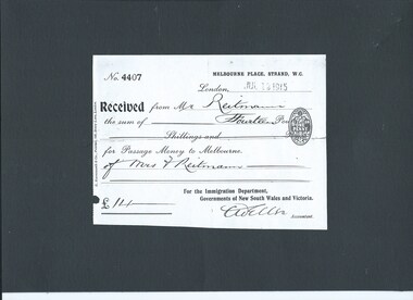
Document, x 2 ,Photograph colour x1, Reciept NSW Govt. Immigration Dept., Ticket Orient Line 'Osterley' 1915 Mr Rietmann, Osterley steam ship, 1915
August Rietmann (1877-1951) of Lustdorf ,Switzerland, married Maria Frieda Oesschlager (2/21878- 22/7/1942) of Baden Baden, Germany on 6/8/1910 In August 8th 1915 August and his wife Frieda migrated to Melbourne, Victoria, Australia sailing on the Steam Ship ‘Osterley’ from Marseilles to Melbourne They leased Box Cottage, Ormond in 1917 and raised two children, Stefanie (1918 -2006) and William (1920- 1997). 1935 August purchased the property and the family used the Cottage during the day and slept in the Front House. August was a monumental mason, potter and sculptor, and was employed at Corbens Ltd Clifton Hill, to carve war memorials in Victoria post WW1 c 1915-1922. During the 1920's August set up his own business in pressed cement making pot plants, columns,paving slabs and lampstands. He continued to carve headstones and figures and took contract work for Artists eg Paul Mountford. He built a workshop in the Barn and used the Cottage for plaster moulding. His son William joined the business and and the family continued to use the site after August died in 1951. Rietmann Landscaping Ltd moved to Bay Road Highett in 1953 and later to Carrum. The land, containing the Box Cottage, was sold to Lewis Timber Pty Ltd in 1970 and Mr Lewis proposed that Moorabbin City Council should preserve the heritage Cottage. In 1984 the Cottage was dismantled and reconstructed in the adjacent Joyce Park. 'Osterley' SS of the Orient Line, 12,129 tons, was a Royal Mail Steam- Ship sailing to and from Australia c1915The Rietman family is an example of the diverse nationalities that lived and worked productively in Moorabbin Shire 1871–1933 , the City of Moorabbin 1934-1994 and continues today in the Cities of Glen Eira, Kingston, Bayside, and Monash. August, a sculptor and stone mason, was employed by Corben Pty Ltd Clifton Hill to carve WW1 Memorials before establishing his own successful masonry business in the Box Cottage during the latter 1920s. After becoming interested in pressed cement casting, he took on apprentices (1930s Depression) and among his products were garden furniture, pots and also street lamp standards, some of which were installed in St Kilda Road. After August’s death in 1951, his family continued the business ‘Rietman’s Landscaping Ltd.’, at Highett and Carrum.Printed Documents a) Mr A Rietmann Receipt from Immigration Department of New South Wales Australia; b) Original Ticket Orient Line Ship 'Osterley' Marseilles to Melbourne 1915 c) Photograph colour of 'Osterley' Steam Shipa) No. 4407 MELBOURNE PLACE, THE STRAND W.C. /London July 12 1915/ Received from Mr Rietmann Fourteen Pounds for passage Money to Melbourne b) ORIENT LINE/ ROYAL MAIL STEAM-SHIPS TO AUSTRALIA/ ............THIRD CLASS PASSENGER CONTRACT TICKET..............OSTERLEY ... to take in passengers of the Port of Marseilles for ..........MELBOURNE............on the Eighth day of August 1915 ..........Mr August Rietmann .......................£15:4 : - to be paid before embarkation c) Osterly Steam ship en route to Melbourneport of marseilles france, melbourne australia, orient steam ship line, osterley steam ship,rietmann august, rietman august, rietmann frieda, rietman frieda, stonnington city town hall, war memorials, world war 1 1914-1918, rietman stefanie, rennick stefanie, francis stefanie, rietman william, rietman ray, mountford paul, malvern city town hall,box cottage museum ormond, box william, box elizabeth, joyce park ormond, rietman's landscaping pty ltd, bay road highett, macrobertson pty ltd, coleraine soldier memorial 1921, -
 City of Moorabbin Historical Society (Operating the Box Cottage Museum)
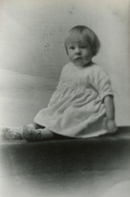
Photographs x 2 B/W, Stefanie & William Rietman c1920, c1920
Stefanie and William Rietman were the children of August and Frieda Rietmann. Stefanie became a school teacher and designed and made resin jewellery, Later she established a Native grass garden in Joyce park, Ormond, William joined August's business and after his death continued the development of Rietman's Landscaping and pottery firm . His son Ray also continued the family business in Bay Road Highett and the Carrum. August Rietman 1877-1951 and his wife Frieda 1878-1942 leased the Cottage in 1917 and raised 2 children Stefanie 1918-2006, and William 1920– 1997. August was a Monumental Mason / Potter / Sculptor and he was employed at Corbens Ltd Clifton Hill, to make the War Memorials for many towns post WW1. August purchased the property 1935,and established a pressed concrete business using the cottage as a workshop and storeroom After August died in 1951, William, his son, continued to work in the business from the site until the land was sold to Lewis Co. Ltd Timber Merchants in 1970. Rietman's Landscaping Ltd moved to Bay Road Highett 1953 and later to Carrum. The Rietman family is an example of the diverse nationalities that lived and worked productively in Moorabbin Shire 1871–1933 , the City of Moorabbin 1934-1994 and continues today in the Cities of Glen Eira, Kingston, Bayside, and Monash. August, a sculptor and stone mason, was employed by Corben Pty Ltd Clifton Hill to carve WW1 Memorials before establishing his own successful masonry business in the Box Cottage during the latter 1920s. After becoming interested in pressed cement casting, he took on apprentices (1930s Depression) and among his products were garden furniture, pots and also street lamp standards, some of which were installed in St Kilda Road. After August’s death in 1951, his family continued the business ‘Rietman’s Landscaping Ltd.’, at Highett and Carrum.Photographs x 2 Black & White, of Stefanie Amilie Rietman, and William Henry Rietman c 1920 at Ormond AustraliaHand written namesrietmann august, rietman august, rietmann frieda, rietman frieda, stonnington city town hall, war memorials, world war 1 1914-1918, rietman stefanie, rennick stefanie, francis stefanie, rietman william, rietman ray, mountford paul, malvern city town hall, box cottage museum ormond, box william, box elizabeth, joyce park ormond, rietman's landscaping pty ltd, bay road highett, macrobertson pty ltd, coleraine soldier memorial 1921, resin jewellery, australian native grasses, schools, education, craftwork, pottery, ceramics, ormond state school -
 City of Moorabbin Historical Society (Operating the Box Cottage Museum)
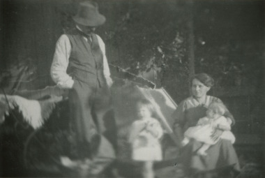
Photographs, x 2 B/W Rietmann Family c1920's, c1920s
August Rietmann (1877-1951) of Lustdorf ,Switzerland, married Maria Frieda Oesschlager (2/2/1878- 22/7/1942) of Baden Baden, Germany on 6/8/1910 In August 8th 1915 August and his wife Frieda migrated to Melbourne, Victoria, Australia sailing on the Steam Ship ‘Osterley’ from Marseilles to Melbourne They leased Box Cottage, Ormond in 1917 and raised two children, Stefanie (1918 -2006) and William (1920- 1997). 1935 August purchased the property and the family used the Cottage during the day and slept in the Front House. August was a monumental mason, potter and sculptor, and was employed at Corbens Ltd Clifton Hill, to carve war memorials in Victoria post WW1 c 1915-1922. During the 1920's August set up his own business in pressed cement making pot plants, columns,paving slabs and lampstands. He continued to carve headstones and figures and took contract work for Artists eg Paul Mountford. He built a workshop in the Barn and used the Cottage for plaster moulding. His son William joined the business and and the family continued to use the site after August died in 1951. Rietmann Landscaping Ltd moved to Bay Road Highett in 1953 and later to Carrum. The land, containing the Box Cottage, was sold to Lewis Timber Pty Ltd in 1970 and Mr Lewis proposed that Moorabbin City Council should preserve the heritage Cottage. In 1984 the Cottage was dismantled and reconstructed in the adjacent Joyce Park. The Rietman family is an example of the diverse nationalities that lived and worked productively in Moorabbin Shire 1871–1933 , the City of Moorabbin 1934-1994 and continues today in the Cities of Glen Eira, Kingston, Bayside, and Monash. August, a sculptor and stone mason, was employed by Corben Pty Ltd Clifton Hill to carve WW1 Memorials before establishing his own successful masonry business in the Box Cottage during the latter 1920s. After becoming interested in pressed cement casting, he took on apprentices (1930s Depression) and among his products were garden furniture, pots and also street lamp standards, some of which were installed in St Kilda Road. After August’s death in 1951, his family continued the business ‘Rietman’s Landscaping Ltd.’, at Highett and Carrum.Photographs x2 Black & White of August and Frieda Rietmann with children and friends at Ormond and Sorrento in 1920sHand written a) at Ormond 1921 ; b) at Sorrento c 1920'ssorrento beach victoria, box cottage museum, ormond, rietmann august, rietman august, rietmann frieda, rietman frieda, stonnington city town hall, war memorials, world war 1 1914-1918, rietman stefanie, rennick stefanie, francis stefanie, rietman william, rietman ray, mountford paul, malvern city town hall, box cottage museum ormond, box william, box elizabeth, joyce park ormond, rietman's landscaping pty ltd, bay road highett, macrobertson pty ltd, coleraine soldier memorial 1921 -
 City of Moorabbin Historical Society (Operating the Box Cottage Museum)
Photographs x 3 B/W Box Cottage Front House with Pine Trees at Ormond, Frieda in garden c 1921, c1921
In 1855 William and Elizabeth Box migrated from Sussex England to Melbourne and in 1868, 1869 purchased 2 x 10acre Lots in part of Henry Dendy's Special Survey Brighton 1841. A Cottage was already on the land and they established a flower garden and raised 13 children. In 1888 William sold one Lot and built a new Front House . William died 1902 and Elizabeth sold the land except 1 acre and retained both the Cottage and the Front House. After her death in 1914, her daughters Violet and Ada leased the Cottage and Front House to tenants until August Rietmann purchased the property in 1935. August Rietmann (1877-1951) of Lustdorf ,Switzerland, married Maria Frieda Oesschlager (2/2/1878- 22/7/1942) of Baden Baden, Germany on 6/8/1910. In August 8th 1915 August and his wife Frieda migrated to Melbourne, Victoria, Australia sailing on the Steam Ship ‘Osterley’ from Marseilles to Melbourne They leased Box Cottage, Ormond in 1917 and raised two children, Stefanie (1918 -2006) and William (1920- 1997). 1935 August purchased the property and the family used the Cottage during the day and slept in the Front House. August was a monumental mason, potter and sculptor, and was employed at Corbens Ltd Clifton Hill, to carve war memorials in Victoria post WW1 c 1915-1922. During the 1920's August set up his own business in pressed cement making pot plants, columns,paving slabs and lampstands. He continued to carve headstones and figures and took contract work for Artists eg Paul Mountford. He built a workshop in the Barn and used the Cottage for plaster moulding. His son William joined the business and and the family continued to use the site after August died in 1951. Rietmann Landscaping Ltd moved to Bay Road Highett in 1953 and later to Carrum. The land, containing the Box Cottage, was sold to Lewis Timber Pty Ltd in 1970 and Mr Lewis proposed that Moorabbin City Council should preserve the heritage Cottage. In 1984 the Cottage was dismantled and reconstructed in the adjacent Joyce Park. The Rietman family is an example of the diverse nationalities that lived and worked productively in Moorabbin Shire 1871–1933 , the City of Moorabbin 1934-1994 and continues today in the Cities of Glen Eira, Kingston, Bayside, and Monash. August, a sculptor and stone mason, was employed by Corben Pty Ltd Clifton Hill to carve WW1 Memorials before establishing his own successful masonry business in the Box Cottage during the latter 1920s. After becoming interested in pressed cement casting, he took on apprentices (1930s Depression) and among his products were garden furniture, pots and also street lamp standards, some of which were installed in St Kilda Road. After August’s death in 1951, his family continued the business ‘Rietman’s Landscaping Ltd.’, at Highett and Carrum.Photographs x 3 Black & White of the Front House with Pine Trees at Ormond and Frieda Rietmann in garden c1921 Photograph x 1 Colour Digital by Glen Lewis of these Pine Trees in situ Lewis Timber Pty Ltd Ormond 2020Handwritten a) path to Front House c 1921; b) Pine trees and Front House c) Frieda in garden c1921box william, box elizabeth, box cottage museum ormond, dendy henry, dendy's special survey brighton 1841, market gardeners, seedling nurseries, rietmann august, rietman august, rietmann frieda, rietman frieda, stonnington city town hall, war memorials, world war 1 1914-1918, rietman stefanie, rennick stefanie, francis stefanie, rietman william, rietman ray, mountford paul, malvern city town hall, joyce park ormond, rietman's landscaping pty ltd, bay road highett, macrobertson pty ltd, coleraine soldier memorial 1921 -
 City of Moorabbin Historical Society (Operating the Box Cottage Museum)
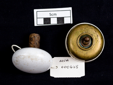
Lights, porcelain, wall, electric light switch; Door Knob Porcelain, early 20th C
Both the Light switch and Door knob were used in Box Cottage during the late 19thC and early 20thC by the Box and Rietman families. William and Elizabeth Box purchased the two ten acre Lots of land with the Cottage in 1868 where they raised their family of 12 children and developed a flower garden producing seedlings. August and Frieda Rietman rented the Cottage 1917 with 1 acre of land and purchased it in 1935 where they raised 2 children while August established Rietman's Landscaping Pty Ltd making pressed concrete garden furniture. Porcelain is a ceramic material made by heating materials, generally including kaolin, in a kiln to temperatures between 1,200 and 1,400 °C The toughness, strength and translucence of porcelain, relative to other types of pottery, arises mainly from vitrification and the formation of the mineral mullite within the body at these high temperatures. Porcelain and other ceramic materials have many applications in engineering, especially ceramic engineering. Porcelain is an excellent insulator for use at high voltage, especially in outdoor applications, see Insulator (electricity)#Material. Examples include: terminals for high voltage cables, bushings of power transformers, insulation of high frequency antennas and many other components. Both the Light switch and Door knob were used in Box Cottage during the late 19thC and early 20thC by the Box and Rietman families. William and Elizabeth Box purchased the land with Cottage in 1868 and raised their familya) An electric light switch that would be attached to a wall. An Ivory Porcelain Base Single Light Switch with antique Brass top b) A porcelain door knob Both items used in Box Cottage early 20th Ca) On base BRITISH MADE / ENGLAND / 4 / 6959 lights, porcelain, electricity, early settlers, moorabbin, cheltenham, bentleigh, box william, box elizabeth, rietman august, rietman frieda, market gardeners, flower gardens, seedling nurseries, world war 1 1914-18, war memorials, sculpture, pottery, pressed concrete, door handles, door knobs -
 City of Moorabbin Historical Society (Operating the Box Cottage Museum)
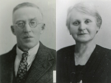
Photographs, x 3 B/W August and Frieda Rietman c 1939 and Gravestone c 1990, 1939
August Rietmann (1877-1951) of Lustdorf ,Switzerland, married Maria Frieda Oesschlager (2/2/1878- 22/7/1942) of Baden Baden, Germany on 6/8/1910 In August 8th 1915 August and his wife Frieda migrated to Melbourne, Victoria, Australia sailing on the Steam Ship ‘Osterley’ from Marseilles to Melbourne They leased Box Cottage, Ormond in 1917 and raised two children, Stefanie (1918 -2006) and William (1920- 1997). 1935 August purchased the property and the family used the Cottage during the day and slept in the Front House. August was a monumental mason, potter and sculptor, and was employed at Corbens Ltd Clifton Hill, to carve war memorials in Victoria post WW1 c 1915-1922. During the 1920's August set up his own business in pressed cement making pot plants, columns,paving slabs and lampstands. He continued to carve headstones and figures and took contract work for Artists eg Paul Mountford. He built a workshop in the Barn and used the Cottage for plaster moulding. His son William joined the business and and the family continued to use the site after August died in 1951. Rietmann Landscaping Ltd moved to Bay Road Highett in 1953 and later to Carrum. The land, containing the Box Cottage, was sold to Lewis Timber Pty Ltd in 1970 and Mr Lewis proposed that Moorabbin City Council should preserve the heritage Cottage. In 1984 the Cottage was dismantled and reconstructed in the adjacent Joyce Park. The Rietman family is an example of the diverse nationalities that lived and worked productively in Moorabbin Shire 1871–1933 , the City of Moorabbin 1934-1994 and continues today in the Cities of Glen Eira, Kingston, Bayside, and Monash. August, a sculptor and stone mason, was employed by Corben Pty Ltd Clifton Hill to carve WW1 Memorials before establishing his own successful masonry business in the Box Cottage during the latter 1920s. After becoming interested in pressed cement casting, he took on apprentices (1930s Depression) and among his products were garden furniture, pots and also street lamp standards, some of which were installed in St Kilda Road. After August’s death in 1951, his family continued the business ‘Rietman’s Landscaping Ltd.’, at Highett and Carrum.Photographs x 2 Black & White, of August and Frieda Rietmann World War 11 Registration 1939; Photograph x1 Black & White of the Rietmann Memorial at Cheltenham new Cemetery c1990Hand written informationrietmann august, rietman august, rietmann frieda, rietman frieda, stonnington city town hall, war memorials, world war 1 1914-1918, rietman stefanie, rennick stefanie, francis stefanie, rietman william, rietman ray, mountford paul, malvern city town hall, box cottage museum ormond, box william, box elizabeth, joyce park ormond, rietman's landscaping pty ltd, bay road highett, macrobertson pty ltd, coleraine soldier memorial 1921, box cottage ormond -
 City of Moorabbin Historical Society (Operating the Box Cottage Museum)
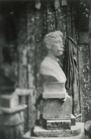
Photograph x 1 B/W 'MacRobertson' Bust , Letter, Envelope 1922 August Rietmann sculptor, 1922
1922 August Rietmann was commissioned to sculpt a bust of Sir MacPherson Robertson 1859-1945, confectionery maker, ( famous for Freddo Frogs and Cherry Ripe chocolate bar). The Bust was installed at Mac Robertson Girls High School for which he had donated funds for the building. 'MacRob' also funded the bridge over the Yarra River and the herbarium in the Botanical Gardens that all bear his name. August Rietmann (1877-1951) of Lustdorf ,Switzerland, married Maria Frieda Oesschlager (2/2/1878- 22/7/1942) of Baden Baden, Germany on 6/8/1910 In August 8th 1915 August and his wife Frieda migrated to Melbourne, Victoria, Australia sailing on the Steam Ship ‘Osterley’ from Marseilles to Melbourne They leased Box Cottage, Ormond in 1917 and raised two children, Stefanie (1918 -2006) and William (1920- 1997). 1935 August purchased the property and the family used the Cottage during the day and slept in the Front House. August was a monumental mason, potter and sculptor, and was employed at Corbens Ltd Clifton Hill, to carve war memorials in Victoria post WW1 c 1915-1922. During the 1920's August set up his own business in pressed cement making pot plants, columns,paving slabs and lampstands. He continued to carve headstones and figures and took contract work for Artists eg Paul Mountford. He built a workshop in the Barn and used the Cottage for plaster moulding. His son William joined the business and and the family continued to use the site after August died in 1951. Rietmann Landscaping Ltd moved to Bay Road Highett in 1953 and later to Carrum. The land, containing the Box Cottage, was sold to Lewis Timber Pty Ltd in 1970 and Mr Lewis proposed that Moorabbin City Council should preserve the heritage Cottage. In 1984 the Cottage was dismantled and reconstructed in the adjacent Joyce Park. The Rietman family is an example of the diverse nationalities that lived and worked productively in Moorabbin Shire 1871–1933 , the City of Moorabbin 1934-1994 and continues today in the Cities of Glen Eira, Kingston, Bayside, and Monash. August, a sculptor and stone mason, was employed by Corben Pty Ltd Clifton Hill to carve WW1 Memorials before establishing his own successful masonry business in the Box Cottage during the latter 1920s. After becoming interested in pressed cement casting, he took on apprentices (1930s Depression) and among his products were garden furniture, pots and also street lamp standards, some of which were installed in St Kilda Road. After August’s death in 1951, his family continued the business ‘Rietman’s Landscaping Ltd.’, at Highett and Carrum.Photograph x 1 Black & White Sculptured bust of Sir MacPherson Robertson c 1922; b) Letter, printed , typed from Sir MacPherson Robertson to August Rietmann (Richman) with payment for the Bust - £65-5-0 - ; c) Envelope, printed, typed addressed to Mr Rietmann { Richman) at Corbens Ltd.; d) reverse of envelope printed a) 1922; b) printed letter MacRobertson Pty Ltd ; c) printed envelope MacRobertson Ltdmacrobertson chocolate ltd., macrobertson girls high school, fitzroy town hall, rietmann august, rietman august, rietmann frieda, rietman frieda, stonnington city town hall, war memorials, world war 1 1914-1918, rietman stefanie, rennick stefanie, francis stefanie, rietman william, rietman ray, mountford paul, malvern city town hall, box cottage museum ormond, box william, box elizabeth, joyce park ormond, rietman's landscaping pty ltd, bay road highett, macrobertson pty ltd, coleraine soldier memorial 1921, box cottage ormond, freddo frog chocolate, cherry ripe chocolate bar, cadbury schweppes ltd., robertson sir macpherson 1859-1945, confectionery, chocolate -
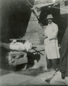 City of Moorabbin Historical Society (Operating the Box Cottage Museum)
Photographs, x3 B/W August Rietmann working at Corbens Ltd c1915-22, c1915 -1922
August Rietmann (1877-1951) of Lustdorf ,Switzerland, married Maria Frieda Oesschlager (2/2/1878- 22/7/1942) of Baden Baden, Germany on 6/8/1910 In August 8th 1915 August and his wife Frieda migrated to Melbourne, Victoria, Australia sailing on the Steam Ship ‘Osterley’ from Marseilles to Melbourne They leased Box Cottage, Ormond in 1917 and raised two children, Stefanie (1918 -2006) and William (1920- 1997). 1935 August purchased the property and the family used the Cottage during the day and slept in the Front House. August was a monumental mason, potter and sculptor, and was employed at Corbens Ltd Clifton Hill, to carve war memorials in Victoria post WW1 c 1915-1922. During the 1920's August set up his own business in pressed cement making pot plants, columns,paving slabs and lampstands. He continued to carve headstones and figures and took contract work for Artists eg Paul Mountford. He built a workshop in the Barn and used the Cottage for plaster moulding. His son William joined the business and and the family continued to use the site after August died in 1951. Rietmann Landscaping Ltd moved to Bay Road Highett in 1953 and later to Carrum. The land, containing the Box Cottage, was sold to Lewis Timber Pty Ltd in 1970 and Mr Lewis proposed that Moorabbin City Council should preserve the heritage Cottage. In 1984 the Cottage was dismantled and reconstructed in the adjacent Joyce Park. The Rietman family is an example of the diverse nationalities that lived and worked productively in Moorabbin Shire 1871–1933 , the City of Moorabbin 1934-1994 and continues today in the Cities of Glen Eira, Kingston, Bayside, and Monash. August, a sculptor and stone mason, was employed by Corben Pty Ltd Clifton Hill to carve WW1 Memorials before establishing his own successful masonry business in the Box Cottage during the latter 1920s. After becoming interested in pressed cement casting, he took on apprentices (1930s Depression) and among his products were garden furniture, pots and also street lamp standards, some of which were installed in St Kilda Road. After August’s death in 1951, his family continued the business ‘Rietman’s Landscaping Ltd.’, at Highett and Carrum.a) Photograph Black & White, August working at Corbens Ltd Clifton Hill c 1915-1922 b) Photograph, Black & White, August with sculpture of Jack Eugene Riva, 1922 c) Photograph, Black & White, August carving a WW1 Soldier Memorial c 1922Handwritten August at Corbens Ltdcorbens ltd clifton hill, rietmann august, rietman august, rietmann frieda, rietman frieda, stonnington city town hall, war memorials, world war 1 1914-1918, rietman stefanie, rennick stefanie, francis stefanie, rietman william, rietman ray, mountford paul, malvern city town hall, box cottage museum ormond, box william, box elizabeth, joyce park ormond, rietman's landscaping pty ltd, bay road highett, macrobertson pty ltd, coleraine soldier memorial 1921, box cottage ormond -
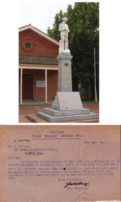 City of Moorabbin Historical Society (Operating the Box Cottage Museum)
Photograph, Colour , WW1 Memorial at Coleraine, Letter to August Rietmann, c1921, c 1990
August Rietmann (1877-1951) of Lustdorf ,Switzerland, married Maria Frieda Oesschlager (1878- 1942) of Baden Baden, in Germany on 6/8/1910 In August 8th 1915 August and his wife Frieda migrated to Melbourne, Victoria, Australia sailing on the Steam Ship ‘Osterley’ from Marseilles to Melbourne August and Frieda leased the Box Cottage in 1917 and raised 2 children Stefanie 1918-2006, and William 1920– 1997. August was a Monumental Mason / Potter / Sculptor and he was employed at Corbens Ltd Clifton Hill, to make the World War 1 Memorials for many Victorian towns c1920. This Soldier Statue at Coleraine was typical of many carved by August, however it was not usual for him to sign this work .Records have only been found for the Towns of Boort, Morewell and Coleraine. Other Soldier statue memorials in the same style are at Myrtleford, Benalla, Bonnie Doon and Yarck and possibly other towns. August purchased the property 1935,and established a pressed concrete business using the cottage as a workshop and storeroom After August died in 1951, William, his son, continued to work in the business from the site until the land was sold to Lewis Co. Ltd Timber Merchants in 1970. Rietman's Landscaping Ltd moved to Bay Road Highett 1953 and later to Carrum. The Rietman family is an example of the diverse nationalities that lived and worked productively in Moorabbin Shire 1871–1933 , the City of Moorabbin 1934-1994 and continues today in the Cities of Glen Eira, Kingston, Bayside, and Monash. August, a sculptor and stone mason, was employed by Corben Pty Ltd Clifton Hill to carve WW1 Memorials before establishing his own successful masonry business in the Box Cottage during the latter 1920s. After becoming interested in pressed cement casting, he took on apprentices (1930s Depression) and among his products were garden furniture, pots and also street lamp standards, some of which were installed in St Kilda Road. After August’s death in 1951, his family continued the business ‘Rietman’s Landscaping Ltd.’, at Highett and Carrum.a) Photograph , colour of the WW1 Memorial at Coleraine, Victoria carved by August Rietman st Corbens Ltd. c1921. b) Letter from The Secretary of the Coleraine Fallen Soldiers' Memorial Funda) Handwritten information b) Typed letter signed by Goldbergrietmann august, rietman august, rietmann frieda, rietman frieda, stonnington city town hall, war memorials, world war 1 1914-1918, rietman stefanie, rennick stefanie, francis stefanie, rietman william, rietman ray, mountford paul, malvern city town hall, box cottage museum ormond, box william, box elizabeth, joyce park ormond, rietman's landscaping pty ltd, bay road highett, macrobertson pty ltd, coleraine soldier memorial 1921, box cottage ormond, box elizab -
 City of Moorabbin Historical Society (Operating the Box Cottage Museum)
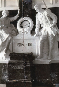
Photograph, B/W, WW1 Memorial Stonnington( Malvern ) Town Hall by P Montford, August Rietmann 1931, c1931
August Rietmann (1877-1951) of Lustdorf, Switzerland, married Maria Frieda Oesschlager (1878-1942) of Baden Baden, in Germany on 6/8/1910 8/8/1915 August and his wife Frieda migrated to Melbourne, Victoria, Australia sailing on the Steam Ship ‘Osterley’ from Marseilles to Melbourne They leased Box Cottage, Ormond in 1917 and raised two children, Stefanie (1918 -2006) and William (1920- 1997). 1935 August purchased the property and the family used the Cottage during the day and slept in the Front House. August was a monumental mason, potter and sculptor, and was employed at Corbens Ltd Clifton Hill, to carve war memorials in Victoria post WW1 c 1915-1922. During the 1920's August set up his own business in pressed cement making pot plants, columns,paving slabs and lamp-stands. He continued to carve headstones and figures and took contract work for Artists . Around the same time, prestigious sculptor, Paul Raphael Montford (1868–1938), who had won the competition to sculpt the Malvern War Memorial in 1928, asked August to ‘rough carve’ the marble figures destined for the foyer of Stonnington ( former Malvern) Town Hall — unveiled 1931. August built a workshop in the Barn and used the Cottage for plaster moulding. His son William joined the business and and the family continued to use the site after August died in 1951. Rietmann Landscaping Ltd moved to Bay Road Highett in 1953 and later to Carrum. The land, containing the Box Cottage, was sold to Lewis Timber Pty Ltd in 1970 and Mr Lewis proposed that Moorabbin City Council should preserve the heritage Cottage. In 1984 the Cottage was dismantled and reconstructed in the adjacent Joyce Park. The Rietman family is an example of the diverse nationalities that lived and worked productively in Moorabbin Shire 1871–1933 , the City of Moorabbin 1934-1994 and continues today in the Cities of Glen Eira, Kingston, Bayside, and Monash. August, a sculptor and stone mason, was employed by Corben Pty Ltd Clifton Hill to carve WW1 Memorials before establishing his own successful masonry business in the Box Cottage during the latter 1920s. After becoming interested in pressed cement casting, he took on apprentices (1930s Depression) and among his products were garden furniture, pots and also street lamp standards, some of which were installed in St Kilda Road. After August’s death in 1951, his family continued the business ‘Rietman’s Landscaping Ltd.’, at Highett and Carrum.Photograph, Black & White of the WW1 memorial in Stonnington (Malvern) Town Hall carved by August Rietmann c1931rietmann august, rietman august, rietmann frieda, rietman frieda, stonnington city town hall, war memorials, world war 1 1914-1918, rietman stefanie, rennick stefanie, francis stefanie, rietman william, rietman ray, mountford paul, malvern city town hall, box cottage museum ormond, box william, box elizabeth, joyce park ormond, rietman's landscaping pty ltd, bay road highett, macrobertson pty ltd, coleraine soldier memorial 1921, box cottage ormond -
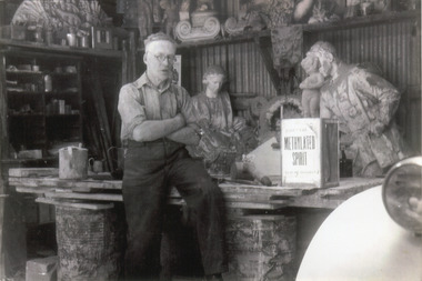 City of Moorabbin Historical Society (Operating the Box Cottage Museum)
Photographs x 2 B&W, August Rietmann with sculptures at Box Cottage Ormond c1931, c1931
August Rietmann (1877-1951) of Lustdorf ,Switzerland, married Maria Frieda Oesschlager (1878-1942) of Baden Baden, in Germany on 6/8/1910 I8/8/1915 August and his wife Frieda migrated to Melbourne, Victoria, Australia sailing on the Steam Ship ‘Osterley’ from Marseilles to Melbourne They leased Box Cottage, Ormond in 1917 and raised two children, Stefanie (1918 -2006) and William (1920- 1997). 1935 August purchased the property and the family used the Cottage during the day and slept in the Front House. August was a monumental mason, potter and sculptor, and was employed at Corbens Ltd Clifton Hill, to carve war memorials in Victoria post WW1 c 1915-1922. During the 1920's August set up his own business in pressed cement making pot plants, columns,paving slabs and lamp-stands. 1930s he continued to carve headstones and figures and took contract work for Artists eg Paul Montford. He built a workshop in the Barn and used the Cottage for plaster moulding. His son William joined the business and and the family continued to use the site after August died in 1951. Rietmann Landscaping Ltd moved to Bay Road Highett in 1953 and later to Carrum. The land, containing the Box Cottage, was sold to Lewis Timber Pty Ltd in 1970 and Mr Lewis proposed that Moorabbin City Council should preserve the heritage Cottage. In 1984 the Cottage was dismantled and reconstructed in the adjacent Joyce Park. The Rietman family is an example of the diverse nationalities that lived and worked productively in Moorabbin Shire 1871–1933 , the City of Moorabbin 1934-1994 and continues today in the Cities of Glen Eira, Kingston, Bayside, and Monash. August, a sculptor and stone mason, was employed by Corben Pty Ltd Clifton Hill to carve WW1 Memorials before establishing his own successful masonry business in the Box Cottage during the latter 1920s. After becoming interested in pressed cement casting, he took on apprentices (1930s Depression) and among his products were garden furniture, pots and also street lamp standards, some of which were installed in St Kilda Road. After August’s death in 1951, his family continued the business ‘Rietman’s Landscaping Ltd.’, at Highett and Carrum.a) & b) Photographs Black and White showing August Rietmann working on sculptures at Box Cottage Ormond c1931handwritten informationrietmann august, rietman august, rietmann frieda, rietman frieda, stonnington city town hall, war memorials, world war 1 1914-1918, rietman stefanie, rennick stefanie, francis stefanie, rietman william, rietman ray, montford paul, malvern city town hall, box cottage museum ormond, box william, box elizabeth, joyce park ormond, rietman's landscaping pty ltd, bay road highett, macrobertson pty ltd, coleraine soldier memorial 1921, box cottage ormond -
 City of Moorabbin Historical Society (Operating the Box Cottage Museum)
Photograph, B/W Stefanie Rennick nee Rietman c1999; Newspaper clipping 1996, 1996, 1999
August Rietmann (1877-1951) of Lustdorf ,Switzerland, married Maria Frieda Oesschlager (1878-1942) of Baden Baden, in Germany on 6/8/1910 8/8/1915 August and his wife Frieda migrated to Melbourne, Victoria, Australia sailing on the Steam Ship ‘Osterley’ from Marseilles to Melbourne They leased Box Cottage, Ormond in 1917 and raised two children, Stefanie (1918 -2006) and William (1920- 1997). 1935 August purchased the property and the family used the Cottage during the day and slept in the Front House. August was a monumental mason, potter and sculptor, and was employed at Corbens Ltd Clifton Hill, to carve war memorials in Victoria post WW1 c 1915-1922. During the 1920's August set up his own business in pressed cement making pot plants, columns,paving slabs and lampstands. His son William joined the business and and the family continued to use the site after August died in 1951. Rietmann Landscaping Ltd moved to Bay Road Highett in 1953 and later to Carrum. The land, containing the Box Cottage, was sold to Lewis Timber Pty Ltd in 1970 and Mr Lewis proposed that Moorabbin City Council should preserve the heritage Cottage. Stefanie Rietman, grew up living in Box Cottage until 1935 when she began a Teaching career. Stefanie married Alan Francis 1941 but he was killed in WW2 Air operations over Germany 1944. Two sons were born 1942, 1944. Stefanie returned to live at the cottage until 1958. She married Herbert Rennick 1946 and two sons were born 1947, 1952. Stefanie also established a native grasses garden in Joyce Park, and designed and made resin jewellery. Stefanie died 2006 In 1984 the Cottage was dismantled and reconstructed in the adjacent Joyce Park. The Rietman family is an example of the diverse nationalities that lived and worked productively in Moorabbin Shire 1871–1933 , the City of Moorabbin 1934-1994 and continues today in the Cities of Glen Eira, Kingston, Bayside, and Monash. Stefanie was a talented artist , school teacher, and jewellery designer and raised 4 sons. August, a sculptor and stone mason, was employed by Corben Pty Ltd Clifton Hill to carve WW1 Memorials before establishing his own successful masonry business in the Box Cottage during the latter 1920s. After becoming interested in pressed cement casting, he took on apprentices (1930s Depression) and among his products were garden furniture, pots and also street lamp standards, some of which were installed in St Kilda Road. After August’s death in 1951, his family continued the business ‘Rietman’s Landscaping Ltd.’, at Highett and a) Newspaper clipping, Moorabbin Standard 17/9/1996 Stefanie Rennick ( nee Rietman) by N. Strahan b) Photograph Black & White, Stefanie Rennick ( nee Rietman) 1999a) printed article b) handwritten informationresin jewellery, australian native grasses, schools, education, craftwork, pottery, ceramics, ormond state school, rietmann august, rietman august, rietmann frieda, rietman frieda, stonnington city town hall, war memorials, world war 1 1914-1918, rietman stefanie, rennick stefanie, francis stefanie, rietman william, rietman ray, montford paul, malvern city town hall, box cottage museum ormond, box william, box elizabeth, joyce park ormond, rietman's landscaping pty ltd, bay road highett, macrobertson pty ltd, coleraine soldier memorial 1921, box cottage ormond -
 City of Moorabbin Historical Society (Operating the Box Cottage Museum)
Photograph x 2 Colour, Ray Rietman at Rietman's Landscaping Ltd Bay Road Highett c 1990, 01990
August Rietmann 1877-1951 and his wife Frieda 1878-1942 leased the Cottage in 1917 and raised 2 children Stefanie 1918-2006, and William 1920– 1997. August was a Monumental Mason / Potter / Sculptor and he was employed at Corbens Ltd Clifton Hill, to make the War Memorials for many towns post WW1. August purchased the property 1935,and established a pressed concrete business using the cottage as a workshop and storeroom After August died in 1951, William, his son, continued to work in the business from the site until the land was sold to Lewis Co. Ltd Timber Merchants in 1970. Rietman's Landscaping Ltd ,managed by William's family, moved to Bay Road Highett 1953 and later to Carrum. Ray Rietman is the son of William Rietman and grandson of August Rietmann.The Rietman family is an example of the diverse nationalities that lived and worked productively in Moorabbin Shire 1871–1933 , the City of Moorabbin 1934-1994 and continues today in the Cities of Glen Eira, Kingston, Bayside, and Monash. August, a sculptor and stone mason, was employed by Corben Pty Ltd Clifton Hill to carve WW1 Memorials before establishing his own successful masonry business in the Box Cottage during the latter 1920s. After becoming interested in pressed cement casting, he took on apprentices (1930s Depression) and among his products were garden furniture, pots and also street lamp standards, some of which were installed in St Kilda Road. After August’s death in 1951, his family continued the business ‘Rietman’s Landscaping Ltd.’, at Highett and Carrum.Photographs x2 Colour of Ray Rietman, grandson of August Rietmann, at Rietman's Landscaping Ltd. Bay Road Highett c 1990handwritten informationrietmann august, rietman august, rietmann frieda, rietman frieda, stonnington city town hall, war memorials, world war 1 1914-1918, rietman stefanie, rennick stefanie, francis stefanie, rietman william, rietman ray, montford paul, malvern city town hall, box cottage museum ormond, box william, box elizabeth, joyce park ormond, rietman's landscaping pty ltd, bay road highett, macrobertson pty ltd, coleraine soldier memorial 1921, box cottage ormond -
 City of Moorabbin Historical Society (Operating the Box Cottage Museum)
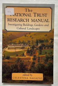
Book, Sagazio, Celestina, The National Trust research manual : investigating buildings, gardens and cultural landscapes, 1992
... buildings historic gardens historic sites xiv, 177 p. : ill., plans ...xiv, 177 p. : ill., plans :Includes index. Bibliography: p. 147-168.non-fictionhistoric buildings, historic gardens, historic sites -
 Bendigo Historical Society Inc.
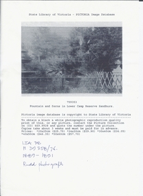
Photograph - LOWER CAMP RESERVE, SANDHURST, 1889 ?
Black and white photocopy of fountain and ferns in Lower Camp Reserve Sandhurst. It shows a garden with ferns, trees, fences an urn at right and a fountain at left. Copy of photograph held by state library. On front at top ' State Library of Victoria - pictoria image. Database '/759353/ ' Fountain and ferns in Lower Camp Reserve, Sandhurst. 'Handwritten ' LTA 38/H39358/76' Rudd Photograph.Ruddplace, landscape view, lower camp reserve sandhurst, photographs, sandhurst, garden, reserve, bendigo, photography, fountains, ferns -
 Bendigo Historical Society Inc.
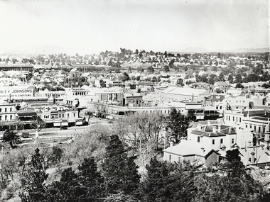
Photograph - BENDIGO LANDSCAPE 1937, 1937
black and white photo: view of Bendigo CBD from lookout tower looking east of south towards Railway Station, shows Sandhurst Club at bottom right corner, Queen Victoria statue in gardens, intersection of Pall Mall, Mitchell and View Strets. In image ' ...rley Johnsons ' Mathews Bros' ' Plume' ' Plaza' ' A.E. Sayer' On back ' Bendigo, Victoria, 1937, Ellison Coll'place, landscape view, bendigo -
 Bendigo Historical Society Inc.
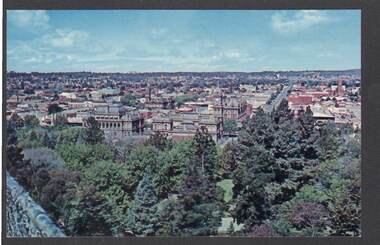
Postcard - PANORAMA FROM ROSALIND PARK LOOKOUT TOWER
Colour postcard, showing landscape view of Bendigo taken from lookout tower in Rosalind Park. Trees in foreground, looking eastward, Shamrock Hotel, city block in foreground.Nu-Color-Vuebendigo, parks and gardens, lookout tower view, bendigo, rosalind park -
 Bendigo Historical Society Inc.
Painting - SMALL PRINT
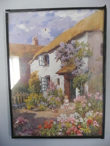
Small print of a child with a doll in a pull along cart standing in the garden of a thatched roofed cottage.artwork, print, landscape, u5749 old cat ref -
 Women's Art Register
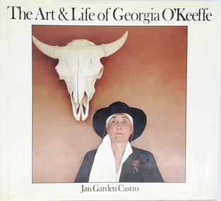
Book, Virago Press Limited, The Art & Life of Georgia O'Keeffe, 1986
Illustrated, extensively researched overview of O'Keeffe's life and practice including images of works, photographs by her partner Stieglitz, letters and interviews.Booknon-fictionIllustrated, extensively researched overview of O'Keeffe's life and practice including images of works, photographs by her partner Stieglitz, letters and interviews.painting, abstraction, watercolour