Showing 518 items
matching map of mine
-
 Clunes Museum
Photograph, EXTENT OF MINE WORKINGS AT CLUNES, 1987
MINE WORKINGS IN CLUNESAERIAL PHOTOGRAPH CLUNES GOLD WORKINGS MAP SUPERIMPOSED. MOUNTED ON CARDBOARD WITH DETAILS OF MINE LOCATION. TYPED DESCRIPTION PASTED BELOW.port phillip mine, aerial photograph, quartz mining -
Clunes Museum
Map - CLUNES MAP SHOWING STREETS AND LOT NUMBERS, CHARLES FENTON, 1987
FORMERLY USED FOR DISPLAY IN CLUNES MUSEUM BEFORE RENOVATIONWOOD LOOK FRAMED MAP OF CLUNES, UNDER GLASS. COMPILED BY CHARLES FENTON 1987. CLUNES SHOWING HOUSES, MINES, STREETS AND SURROUNDING ESTATES. LEGEND BOTTOM LEFT.clunes, map -
Clunes Museum
Plan - PLAN/MAP, SOUTH CLUNES GOLD MINE
... AND MAP OF SOUTH CLUNES GOLDMINE LOCAL HISTORY DOCUMENT MINING ...PLAN AND MAP OF SOUTH CLUNES GOLDMINEPLAN OF SOUTH CLUNES UNITED G.M.CO.CLUNES PRODUCED OR DRAWN BY F.W.NIVEN & CO LITH BALLARATlocal history, document, mining, plans -
Clunes Museum
Map - MAPS/DOCUMENTS
... AND MAPS DESCRIBING THE WORKINGS OF THE PORT PHILLIP MINE, SHOWING ...INFORMATIONDOCUMENTATION AND MAPS DESCRIBING THE WORKINGS OF THE PORT PHILLIP MINE, SHOWING 54 FEET DEEP OF THE UNDERGROUND WORKINGS.local history, mining, port phillip mine -
 Wonthaggi & District Historical Society
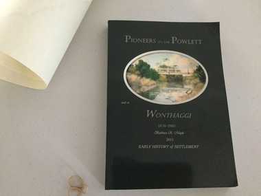
Book and Map, Barbara Moyle, Pioneers on tthe Powlett and at Wonthaggi 1878-1910, 2015
Book - families social histories, maps, photograps Map - block numbers town names physical / geographical featuresFarming and social history of pioneers of the Powlett River are prior to the establishment of the State Coal Mine at Wonthaggi. Significant land marks, buildings and photographs are included. Dark green cover with oval artists impression of Powlett river and bridge Associated map which covers the parishes plus key places of interestlPioneers on the Powlett and at Wonthaggi 1878-1910 Barbara R Moyle 2015 Early History of Settlement Map - Parish names, significant sitesfarming, pioneers of wonthaggi and district, wonthaggi families -
Stawell Historical Society Inc
Map, Stawell Gold Mines Pty Ltd, Plan of Magdala Mine. May 1994, May 1994
... Workings and Portal Plan of Magdala Mine. May 1994 Map Stawell Gold ...Moonlight Junction, Big Newington Co. Pleasants Creek and Newington, Prince Patrick, North Cross Extended, Prince Alfred, Robson and Party, North Magdala, Galatea and Pioneer Co., Duke Magdal, Moonlight, Moonlight Extended, Sliding Shaft, Extended Cross, Crown Cross United, Great Northern, Sloanes and Scotchmans, Marinees, North Waterloo, Scothmans United, Waterloo, Scotchmans Iron Duke and Bulcher, Perthen Shire, Prince of Wales, Roberts, Shafts of Rose of Denmark, Emerald Isle Shafts, O'Donnels, Darlington,, Albion, Federal, Ulster, Goldenpoint and Wexford.AO Printed Map In Colour. Showing Underground Workings and PortalScale 1 : 2500 -
Stawell Historical Society Inc
Map, Stawell Gold Mines, Plan View of Township Area Showing Known Old Workings. 2003, 13/06/2003
... grampians Scale 1 : 5000 Two AO Maps that Overlap Showing Old ...Two AO Maps that Overlap Showing Old workings on Map of Town North of Patrick StreetScale 1 : 5000 -
Stawell Historical Society Inc
Map, Easton Johnstone, Map of Stawell Surveyed by Easton Johnstone 1872, 1872
Victoria Co Crushing Machine. St Georges Co Crushing machine. Wimmera Co Crushing Machine. Government Reservoir and Drainage. Sloan Street, Skene Street Mines. old Mine WorkingsA2 map of Stawell Reefs Area. Showing Crushing Machines & Title InfoSurveyed by Easton Johnstone Contract Surveyor. Photo-Lithographed at the Department of Lands & Survey. Melbourne By J Noone 9th May 1872mining -
Stawell Historical Society Inc
Map, Stawell Gold Mines, Stawell Township proposed Town zoning showing Special Uses ( Mining) 1998, 1998
... ( Mining) 1998 Map Stawell Gold Mines ...Shows Mining activity Stockpiles Tracks, Plant, Dams, Waste heap, Tailing Dams, IronbarksMap Printed in Colour with Coloured LegendStawell Gold Mines Pty Ltd Date April 1998mining -
Stawell Historical Society Inc
Map, Underground Mine Workings Stawell, 1894
... Glass Underground Mine Workings Stawell Map ...Plan and Elevations of mine workings 12 September 1894. J H Bate Mining Surveyor. Framed under Glassstawell, mining, plans -
Stawell Historical Society Inc
Map, Department of Mines Victoria, The Reefs. The Principle Reefs at Quartz Reefs, 1868
... . The Principle Reefs at Quartz Reefs Map Department of Mines Victoria ...c1868 Map showing the position of principal Reefs at Quartz ReefsTracing Shewing the position of the principle reefs at Quartz Reefs. Scale 8 Chains to an inch mining, gold, map -
Stawell Historical Society Inc
Map, Department of Mines Victoria, Alluvial Map Stawell Region, 1870's
... grampians mining gold map Department Mines Victoria 1952/G/2 c1870 ...c1870 Coloured map showing Black Range North to Stawell and Illawarra. Shows geological layout.Department Mines Victoria 1952/G/2 mining, gold, map -
Stawell Historical Society Inc
Map, Stawell Gold Mine, Provisional Plan Wonga Area, c1980
... Map Stawell Gold Mine ...c1980 Preliminary Provisional Reconnaissance Plan Showing Workings Above and Below water LevelWonga Area 1:1000 Base Geological Sheet mining, gold, map -
Stawell Historical Society Inc
Map, Geological Survey Office, Sloanes & Scotchmans united Mine, December 1916
... Underground Drives Sloanes & Scotchmans united Mine Map Geological ...Sloane & Scotchman's Geological Survey Map 1916 Showing Underground DrivesGeological Survey Office Ballarat December 1916 mining, gold, map -
Stawell Historical Society Inc
Map, Charles C Reilly, Oriental & North Cross Reef Mine showing underground drives, 3/5/1900
... grampians mining gold map Charles C Reilley 3.5.00 Underground ...Underground Survey of Mines Stawell c1900Charles C Reilley 3.5.00 mining, gold, map -
Stawell Historical Society Inc
Map, Gold Mines of Australia, Gold Mines of Australia underground workings. Newington Rd Darlington Rd Area 1950, 1950
... grampians mining gold map Gold Mines of Australia Stawell Investment ...Plans Showing Surveys & Drilling Stawell InvestmentGold Mines of Australia Stawell Investment 2003 mining, gold, map -
Stawell Historical Society Inc
Map, Gold Mines of Australia, Geological Plan Wonga Mine Area Stawell Investigation, 1950
... grampians mining gold map Gold Mines of Australia Ltd Plans Showing ...Plans Showing Stawell Investment 1950Gold Mines of Australia Ltd mining, gold, map -
Stawell Historical Society Inc
Map, Gold Mines of Australia, Stawell Investment Geological Plan. Mine Area showing Mineshafts
... grampians mining gold map Gold Mines of Australia Ltd The Reefs Mine ...The Reefs Mine shaft locationsGold Mines of Australia Ltd mining, gold, map -
Stawell Historical Society Inc
Map, Western Mining Corp / Stawell Joint Venture, Stawell & District with Mine Working Areas shown in red, 1987
... grampians mining gold map Legend of Mine workings numbered. 1980's ...Covers from Magdala East site to Germania in North and Hand in Hand at West Legend of Mine workings numbered. 1980's mining, gold, map -
Stawell Historical Society Inc
Map, Stawell Gold Mine, SGM Mineralized System Longitudinal Projection showing Diamond Drilling Holes 2007, June 2007
... grampians mining gold map Legend of Mine workings numbered. 1980's ...Section of Big Hill showing Diamond Drill holes through Magdala, Magdala North and Golden Gift Ore bodies to 2000m levelLegend of Mine workings numbered. 1980's mining, gold, map -
Stawell Historical Society Inc
Map, Stawell Gold Mine, Stawell Gold Mine Photo Map of Stawell Township showing Underground Declines in mining lease, 2007
... Stawell Gold Mine Photo Map of Stawell Township showing.... Stawell Gold Mine Photo Map of Stawell Township showing ...SGM photo Map 2007 Produced for Public Consultation over Big Hill Open Pit Proposal. Aerial Views Stawellmining, gold, map -
Stawell Historical Society Inc
Map, Gold Mines of Australia, Plan of Stawell Goldfield. Mining Leases, 1952
... grampians mining gold map G G Birch Mining Surveyor And Shaft ...And Shaft Locations 1952 G G Birch Mining Surveyormining, gold, map -
Stawell Historical Society Inc
Map, Stawell Joint Venture, Mine Site Detail Plan, September 1989
... grampians mining gold map 1989 Mine Site Detail Plan Map Stawell ...1989mining, gold, map -
Stawell Historical Society Inc
Map, MPI Mines, Plan View of Township Area 2003, 13/6/2003
... Area 2003 Map MPI Mines ...goldShowing known gold workings & Houses Stawell Gold Mines. 13 June 2003 1 : 7500 MPI Minesmining -
Stawell Historical Society Inc
Map, MPI Mines, Plan View of Township Area 2003, 13/6/2003
... Area 2003 Map MPI Mines ...goldShowing known old gold workings Stawell Gold Mines. 13 June 2003 1 : 7500 MPI Minesmining -
Stawell Historical Society Inc
Map, Stawell Gold Mine, Three dimensional View of Magdala Decline, March 1994
... Decline Map Stawell Gold Mine ...View of Mine looking from Stawell Hospital towards Big Hill Levels indicate depth in metres below hillParallel View Scale 1 : 2600mining, gold -
Stawell Historical Society Inc
Map, Stawell Gold Mine, Plan Showing Wonga Pit and Underground Development, August 2001
... grampians mining gold Stawell Gold Mines Victoria Scale 1 : 2500 ...Stawell Gold Mines Victoria Scale 1 : 2500mining, gold -
Stawell Historical Society Inc
Map, Stawell Gold Mine, Tenement Boundaries Stawell Township 2001, August 2001
... Township 2001 Map Stawell Gold Mine ...Showing Underground Development Stawell Gold Mines Victoria Scale 1 : 20000mining, gold -
Stawell Historical Society Inc
Map, Stawell Gold Mine, Milling Area Site Arrangement 2002, 12/6/2002
... grampians mining gold Stawell Gold Mines Victoria Scale 1 : 20000 ...Plus Bench Mark Levels Stawell Gold Mines Victoria Scale 1 : 20000mining, gold -
Stawell Historical Society Inc
Map, Stawell Gold Mine, Perspective View Magdala Decline August 1989, August 1989
... August 1989 Map Stawell Gold Mine D Bosher ...Shows Mining Levels Drawn By D. Bosher Stawell Joint Venture Victoria SJVmining, gold