Showing 513 items matching "mining - maps"
-
 Bendigo Historical Society Inc.
Slide - DIGGERS & MINING. GETTING THE GOLD, c1860
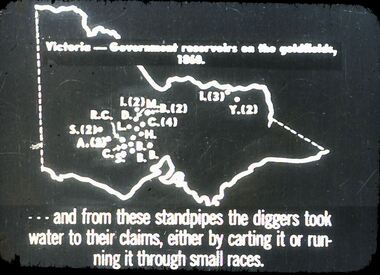
Diggers & Mining. Getting the Gold. Slide: Map of Victoria. Victoria - Government reservoirs on the goldfields, 1860. Letters on map relate to the position of the reservoirs standpipes. And from these standpipes the diggers took water to their claims, either by carting it or running it through small races. Markings: 72 994.LIF:4. Used as a teaching aid.hanimounteducation, tertiary, goldfields -
 Bendigo Historical Society Inc.
Slide - DIGGERS & MINING. GETTING THE GOLD, c1860
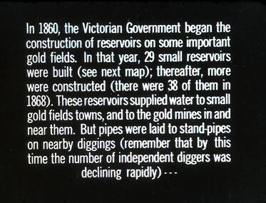
Diggers & Mining. Getting the Gold. Slide: In 1860, the Victorian Government began the construction of Reservoirs on some important gold fields. In that year, 29 small reservoirs were built (see next map); thereafter, more were constructed (there were 38 of them in 1868). These reservoirs supplied water to small gold fields towns, and to the gold mines in and near them. But pipes were laid to stand-pipes on nearby diggings (remember that by this time the number of independent diggers was declining rapidly) Markings: 71 994.LIF:4. Used as a teaching aid.hanimounteducation, tertiary, goldfields -
 Bendigo Historical Society Inc.
Map - BENDIGO GOLD FIELDS
... BENDIGO Mining mining leases Map, Bendigo Gold Fields, copy ...Map, Bendigo Gold Fields, copy, mining leases, the numbers of their leases, as well as streets of Bendigo.( number 408 in Map Cupboard 1).bendigo, mining, mining leases -
 Bendigo Historical Society Inc.
Slide - DIGGERS & MINING. THE GOLD LICENCE, c1854
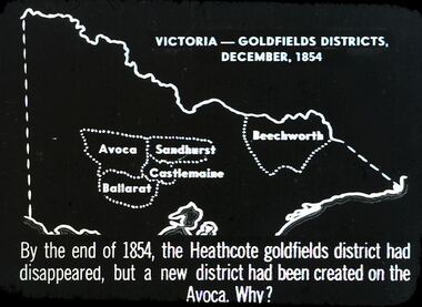
Diggers & Mining. The gold licence. The Government Camp. Slide depicts map of Victoria with the 5 gold rush regions marked on it. Beechworth, Sandhurst Avoca, Castlemaine and Ballarat. By the end of 1854, the Heathcote goldfields district had disappeared, but a district had been created on the Avoca. Why? Markings: 31 994.LIF. 4. Used as a teaching aid.hanimounteducation, tertiary, goldfields -
 Bendigo Historical Society Inc.
Slide - DIGGERS & MINING: THE DIGGINGS - THE DIGGERS
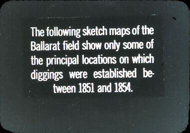
Diggers & Mining: The Digging - The Diggers. Slide reads: The following sketch maps of the Ballarat field show only some of the principal locations on which diggings were established between 1851 and 1854. Markings: 9 994.LIF:6. Used as a teaching aid.hanimounteducation, tertiary, goldfields -
 Bendigo Historical Society Inc.
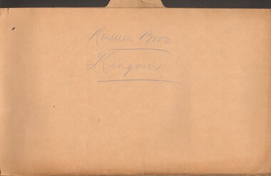
Document - MCCOLL, RANKIN AND STANISTREET COLLECTION: REIMER BROS. KINGOWER
Manilla folder containing correspondence relating to Reimer Brothers claim at Kingower, also contains a large scale parish map of Kingower showing the position of the claim and leases 6278 held by Andrew Thomas Berriman and 6279 held by Florence Adelaide BerrimanMcColl Rankin & Stanistreetgold mining, miners' safety cage, kingower/union reef mines, gold mining, kingower, reimer brothers berriman -
 Bendigo Historical Society Inc.
Document - MCCOLL, RANKIN AND STANISTREET COLLECTION: SUNDRY REPORTS, 1930's
Manilla Folder containing reports from various mines in Bendigo and surrounding areas. 1. 4 page typewritten report on the Balaclava Hill Mine at Rushworth and some newspaper clippings about the mine with a plan of the underground workings; 2. Page from the Árgus' dated 2nd August 1900 featuring an article on the survey of the Garden line of Reefs; 3. 5 page report with maps on the Tooleen Gold Field; 4. Single page report about an unnamed mining area claimed to be on the southern end of the Deborah line of reef. (this could be the 'Three Jays' mine in Sedgwick. P. Wilkin); 5. Hand written report on the Coronation Mine, 2 miles east of Walhalla.; 6. Hand written report dated 1935, of the Queen Mary mine, St. Arnaud.; 7. 1932 report on the North Neangar lease.; 8 4 page report on the Kings Prize Gold Mining Syndicate.; 9. Description of the plant of the Marong Alluvial Company? Also a guide for marking out leases.; 10. Crushing details (1 page) from the 'Enterprise' Mine South of and adjacent to Perseverence.; 11. 1 page crushing details from Rowe Brothers, Mosquito Mine, Fryerstown.; 12 hand written report mentions Arthur Hatfield, Scarsdale.; 13. Map with lines of reef showing the position of the New Moon Consolidated and the New Moon United shafts.; 14, Large scale map from Harrison/Victoria street to Havilah Road showing the positions of the Carlisle, North Garden and Unity Shafts.gold mining, miners' safety cage, sundry reports, mining. bendigo, rushworth, balaclava hill, garden line of reef, toolleen, coronation mine, walhalla, queen mary mine, st. arnaud. north neangar, kings prize gold mining syndicate, marong, enterprise mine, perseverence, rowe brothers, mosquito mine, fryerstown, arthur hatfield, scarsdale, new moon consolidate, new moon united, carlisle, north garden, unity. -
 Bendigo Historical Society Inc.
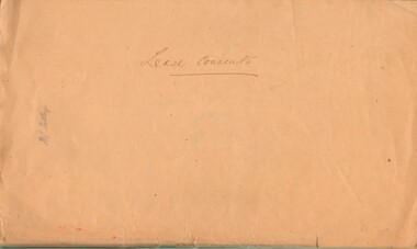
Document - MCCOLL, RANKIN AND STANISTREET COLLECTION: LEASE CONSENTS
Manilla Folder containing correspondence and consents relating to the following Gold Mining Leases; 10819, 10027 (North Virginia Gold Mining Co.);, 10370 Great Eastern (Bendigo), includes map; 10014, South monument; 10059 North Neanger, with map; 10072 ; 10104; North Virginia; 10068 New Don Company with Map; 10032 New Balaclava, Whroo; 10026 East Clarence Gold M/C. Dated 1933 - 34gold mines, bendigo, gold mines, north virginia, great eastern, south monument, north neanger, new don, east clarence, new balaclava -
 Bendigo Historical Society Inc.
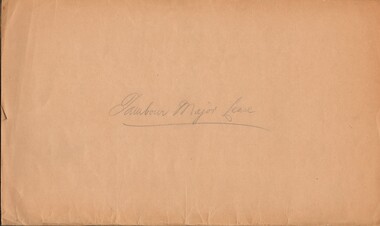
Document - MCCOLL, RANKIN AND STANISTREET COLLECTION: TAMBOUR MAJOR LEASE, 1939/1940
Manilla Folder containing Lease application and correspondence for lease No. 11007 (Tambour Major). Includes Map of lease. Also references to lease Numbers 10168 and 10899. Dated September 1939McColl Rankin & Stanistreet, Charing Cross Bendigo.gold mining, miners' safety cage, tambour major lease, gold mines, bendigo tambour major -
 Bendigo Historical Society Inc.
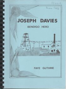
Book - Joseph Davies Bendigo Hero
Joseph Davis : Bendigo Hero (1988) Written by Faye Guthrie. Published by Guthrigg Genealogy, Ringwood Victoria. 224pg Includes b/w photos, copies of letters, maps, and index Acknowledgements - ….and June Parry of the Bendigo Historical Society. Review Copy. Plastic binding.joseph davies, mining rescue, medal -
 Kew Historical Society Inc
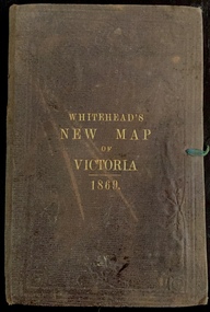
Map, Whitehead's Map of Victoria, With Alphabetical Key, 1869, 1869
When E. Whitehead's New Map of Victoria was released in 1869, an advertisement in the Bendigo Advertiser (16 July 1869) noted that: "This beautifully engraved Map has been revised and brought down to the present time; and, with the Alphabetical Key, is the most complete and the cheapest Map ever published; Price, 6d plain; 1s colored; 2s 6d in case; on linen, post free, 2d extra. E.. WHITEHEAD and CO, Publishers, 67 Collins-street east." The following year, 1870, Whitehead's promoted the edition in the Portland Guardian and Normanby General Advertiser (3 January 1870), advising that: "WHITEHEAD'S NEW MAP OF VICTORIA, 1869 ... is corrected to the latest date, and around is arranged an Alphabetical Key, with Post Towns and Money Order Olffices marked. The Map being divided into squares and numbered, by reference to the Key any place can be found immediately. Price Is beautifully colored, or mounted on linen in case, 2s 6d. Post free, 2d extra, in Victoria. B. Whitehead and C0., Puolishers, 67 Collins-street East, Melbourne". In the same edition of the Portland Advertiser, they also promoted their business generally, saying: "E WHITEHEAD and Co., Stationers, Engravers, Lithographers, 67 Collins street East, execute every description of Lithographic PRINTING, BILL-HEADS. NOTE Headings. Business Dies Engraved and Embossed on Envelopes &c. ARMS, MONOGRAMS, AND CRESTS Engraved and Embossed in Colour, superior to any other house in the Colony. Specimens, post free, 2d. Lithographers, &c, to H.R.H. the Duke of Edinburgh, and Die-inkers and Embossers to His Excellency Sir J. H. T. Manners-Sutton, K C.B. Orders executed for the Trade". Whitehead’s New Map of Victoria 1869 is is an important record of region created towards the end of the Victorian Gold Rush (1851-1869). In addition to its historical significance, this is a rare map, of which the only known copies in Australian public collections are those held at the National Library of Australia, the State Library of Victoria, State Library of New South Wales and the University of Queensland Library.Map of Victoria with gold mining areas, notes on topography, transport routes. Relief shown by hachures. List of towns with distance from Melbourne in map margin. [Melbourne] : Printed & Published by ... E Whitehead & Co ... 67 Collins Street East, 1869 1 map : col., mounted on linen ; 38.4 x 55.4 cm, folded to 18 x 12 cm.Cover "WHITEHEAD'S NEW MAP OF VICTORIA 1869"maps - victoria - 1860s, e whitehead's new map of victoria 1869, whitehead's map of victoria with alphabetical key 1869, cartography, gold rush -
Kew Historical Society Inc
Book, Geoff Hocking, Castlemaine : from camp to city 1835-1900, a pictorial history of Forest Creek & the Mount Alexander goldfields, 1994
230 p. : ill. (some col.), facsims, maps, ports. ; 22 x 25 cm.non-fictiongold mines and mining -- victoria -- castlemaine -- history, castlemaine (vic.) -- history -
 Bendigo Tramways (managed by the Bendigo Heritage Attractions)
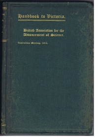
Reference Book, Albert J. Mullett, Government Printer, Melbourne, Handbook to Victoria- British Association for the Advancement of Science, CIRCA 1914
1914 Handbook prepared for the members of the "British Association for the advancement of science" on the occasion of their visit to Victoria, under the direction of the Victorian Executive Committee. Hard covered green handbook, gold leaf lettering. Printed text with Illustrations, Maps, Plans and Diagrams.Stamped: "WITH THE COMPLEMENTS OF THE GOVERNMENT STATIST." victoria, 1914, education, population, immigration, mining, geology, land, law, government, forestry, maps, public works. -
Stawell Historical Society Inc
Archive, Amalgamated Scotchman’s Company Cyanide Works Records. 1899, 1898 - 1901
... grampians Stawell Mining Assorted Papers forms, maps etc Amalgamated ...Assorted Papers forms, maps etcstawell, mining -
Stawell Historical Society Inc
Map, Victorian Geological Map, 1963
... grampians Stawell Mining Victorian Geological Map Victorian ...Victorian Geological Mapstawell, mining -
Stawell Historical Society Inc
Map, Plan of the Principal Underground Workings at Stawell, 1894
Plan of the Principal Underground Workings at Stawellstawell, mining -
Stawell Historical Society Inc
Map, Stawell Gold Field 1878, 1878
Stawell Gold Field 1878stawell, mining -
Stawell Historical Society Inc
Map, Sloane and Scotchmans United mine 1916, 1916
Sloane's & Scotchmans United Mine, Stawell large map, heading across the top. Stamp on top right side 144/T/1stawell, mining -
Stawell Historical Society Inc
Map, Three Jacks Mine 1920, 1920
Three Jacks Mine 1920stawell, mining -
Stawell Historical Society Inc
Map, Western Mining Corporation Limited, Shaft Location Plan April 1981, 1981
Western Mining Corporation Ltd Shaft Location Plan 1981 Very Large Plot Showing Contours and Streets Without names. Sheet 1 0f 2 stawell, mining -
Stawell Historical Society Inc
Map, Western Mining Corporation Ltd Shaft Location Plan 1981, 1981
Western Mining Corporation Ltd Shaft Location Plan 1981 Very Large Plot Showing Contours and Streets Without names. Sheet 2 0f 2 stawell, mining -
Stawell Historical Society Inc
Map, Portion of Stawell Goldfield
Portion of Stawell Goldfieldstawell, mining -
Stawell Historical Society Inc
Map, Plan of Apsley Co. Prospectus Apsley Gold Mining Company, 1895
... grampians stawell Plan of Apsley Co. Prospectus Apsley Gold Mining ...Plan of Apsley Co. Prospectus Apsley Gold Mining Companystawell -
 Port Fairy Historical Society Museum and Archives
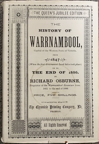
Book, Richard Osburne, The history of Warrnambool, capital of the western ports of Victoria, from 1847 (when the first government land sales took place) up to the end of 1886, 1980
The history of Warrnambool, capital of the western ports of Victoria, from 1847 (when the first government land sales took place) up to the end of 1886 / by Richard Osburne Other Authors, Fraser, Malcolm, 1930-2015, (author of introduction, etc.) Tylee Memorial Collection368 pages, unnumbered and folded leaves of plates : illustrations (some colour), maps, portraits, plans ; 19 cmnon-fictionThe history of Warrnambool, capital of the western ports of Victoria, from 1847 (when the first government land sales took place) up to the end of 1886 / by Richard Osburne Other Authors, Fraser, Malcolm, 1930-2015, (author of introduction, etc.) Tylee Memorial Collectionvictoria. warrnambool, 1847-1886. facsimiles, government policy - initial period and protectionism., settlement and contacts - 19th century., mining industry - gold., race relations - violent - massacres, religions - christianity - missions., warrnambool (vic.) -- history., framlingham / purnim (w vic sj54-11), demography - census data, book -
Friends of Ballarat Botanical Gardens History Group
Work on paper - Victoria Park Precinct, City of Ballarat, Victorian Heritage Database place details -19/9/2017, 19/9/2017
Victoria Park is associated with gold mining in the 1860's, military manoevres in the late 19th century; as an army base during World War 2 and a recreation area.Victoria Park is a "landmark cultural landscape" in the city of Ballarat. This parkland established 1890-1910, was modelled on English country estates and London Parks. It demonstrates the civic pride of Ballarat citizens and is an important parkland for the local community. There is a collection of exotic and early planted native trees and areas of native grasslands.6 pages of print. p.1. is a front page with a map and Victoria Park marked in purple with a bibliography on p.4 and footnotes on p.6.None.john garner, victoria park, friends of ballarat botanical gardens, heritage overlay, gold mining, parkland, late nineteenth century, native grasslands, exotic and native trees, royal park, mullock heap, mount holled-smith, arbor day, messrs clegg&nicholls, william guilfoyle, w.o.allen, significant tree register, john garner collection, gardens, ballarat -
 Tarnagulla History Archive
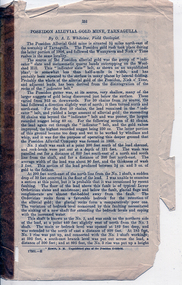
Pages from a book: Poseidon Alluvial Gold Mine, Tarnagulla, Poseidon Alluvial Gold Mine, Tarnagulla, circa 1916
Murray Comrie Collection. Pages from a book (unknown), this excerpt titled 'Poseidon Alluvial Gold Mine, Tarnagulla' by O.A.L. Whitelaw, Field Geologist. Includes a map (also extracted from the book) with title 'Poseidon Alluvial Gold Mines'. Map of the mines entire workings, above and below ground. tarnagulla, poseidon, mine, mining, gold -
 Wodonga & District Historical Society Inc
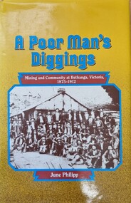
Book - A Poor Man's Diggings, June Philipp, 1987
The town of Bethanga is located in the mountainous north-east of Victoria, near the Murray River. In the 1870s miners and itinerant workers came to the area to seek their fortunes.This history of Bethanga, covering the period from 1875 to 1912, tells the story of these people and the community they created.A publication relating the history of mining at Bethanga in Northeast Victoria, the miners and semi-itinerant workers, who came to the area in the 1870s in search of a fortune and the community they created. Thus publication of 222 pages includes text, images, maps and a detailed index.non-fictionThe town of Bethanga is located in the mountainous north-east of Victoria, near the Murray River. In the 1870s miners and itinerant workers came to the area to seek their fortunes.This history of Bethanga, covering the period from 1875 to 1912, tells the story of these people and the community they created. gold mining bethanga, miners victoria, history of bethanga -
 Wodonga & District Historical Society Inc
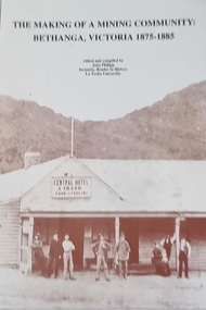
Book - The Making of a Mining Community: Bethanga, Victoria 1875 - 1885
A publication by La Trobe University to support the teaching of V.C.E History Unit 1: Local History. It is presented as 6 investigations focused on aspects of community through a case study of the Upper Bethanga district in Northeast Victoria from 1875 to 1885.A publication by La Trobe University to support the teaching of V.C.E History Unit 1: Local History. It consists of 94 pages including images, maps and document extracts.A publication by La Trobe University to support the teaching of V.C.E History Unit 1: Local History. It is presented as 6 investigations focused on aspects of community through a case study of the Upper Bethanga district in Northeast Victoria from 1875 to 1885.local history, vce resources, bethanga community, bethanga history -
 Wodonga & District Historical Society Inc
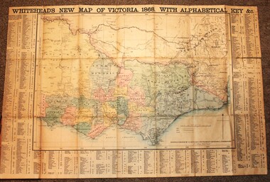
Map - Whiteheads New Map of Victoria, E. Whitehead & Co., engravers & lithographers, 1868
Edward Whitehead was a printer and publisher active in Melbourne during the latter half of the 19th century. Whitehead founded his printing business at 67 Collins Street East in 1864 and, though not focused on maps, began publishing his own series of maps of Victoria in 1867. He focussed on producing highly detailed folding maps of Victoria which included a very detailed index of place names. His series of maps of Victoria became one of the most successful and most profitable series of regional maps of Australia ever produced.This is a very early map of Victoria showing Belvoir (Wodonga)A detailed early map of Victoria with counties clearly marked and shaded and a detailed index. It also shows roads, post office towns, railways, telegraphs, gold mining areas and notes on topography. Relief shown by hachures and spot heights. Includes a list of towns with distances from Melbourne on 3 sides of map. It is produced on paper mounted on linen.victoria cartography, rare maps victoria, whiteheads maps -
Bendigo Historical Society Inc.
Map - STRUGNELL COLLECTION: BENDIGO GOLD FIELD GEOLOGICAL SURVEY, 1936
... BHS Collection BENDIGO Gold mining geological map Dept ...BHS CollectionBendigo Goldfieds Geological Survey. Prepared in the Bendigo Office Bottom Section of original map.Dept of Mines Victoriabendigo, gold mining, geological map