Showing 428 items
matching north greensborough
-
 Greensborough Historical Society
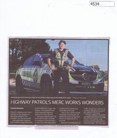
Newspaper Clipping, Diamond Valley Leader, Highway Patrol’s Merc Works Wonders, 25/01/2017
Police in Melbourne’s north will take to the streets in a Mercedes dubbed 'The Guardian' for the next week.News article 1 page, white text, colour image.police, highway patrol, mercedes benz, greensborough police -
 Greensborough Historical Society
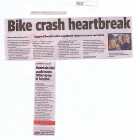
Newspaper Clipping, Diamond Valley Leader et al, Bike crash heartbreak, 01/02/2017
The Diamond Valley community is rallying around an Eltham North expectant father, Josh Young, who may never walk again following a horrific bike accident.News article 1 page, black text.bike crash, josh young, eltham north -
 Greensborough Historical Society
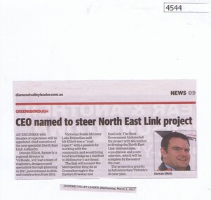
Newspaper Clipping, Diamond Valley Leader, CEO named to steer North East Link project, 01/03/2017
An engineer with decades of experience will be appointed chief executive of the new specialist North East Link Authority.News article 1 page, black text, colour image.north east link, metropolitan ring road, duncan elliott -
 Greensborough Historical Society
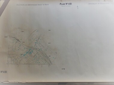
Map, Melbourne & Metropolitan Board of Works, MMBW Plan No.481, 23/09/1949
MMBW plan of part of central Greensborough, Main Street and surrounds, from sports ovals in North to Grimshaw Street in South.Map shows buildings and topography for the area.MMBW plan, black and colour ink on beige parchment, 2 copies."Scale:160 feet to 1 inch"melbourne and metropolitan board of works, mmbw, greensborough -
 Greensborough Historical Society
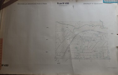
Map, Melbourne & Metropolitan Board of Works, MMBW Plan No.480, 17/10/1949
MMBW plan of part of central Greensborough, from Plenty River in North to Grimshaw Street in South, Sellars Street in West to Kerr Street in East.Map shows buildings and topography for the area.MMBW plan, black and colour ink on beige parchment, 4 copies."Scale:160 feet to 1 inch"melbourne and metropolitan board of works, mmbw, greensborough -
 Greensborough Historical Society
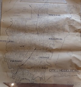
Map, City of Heidelberg. Engineers Dept, City of Heidelberg, 1960s
Map of the City of Heidelberg from the Yarra River in the South to North of Watsonia Military Camp. Shire of Diamond Valley is shown to the north.Map showing municipal and ward boundaries, black text on light brown paper."Scale: 20 CHS = to 1 IN"city of heidelberg -
 Greensborough Historical Society
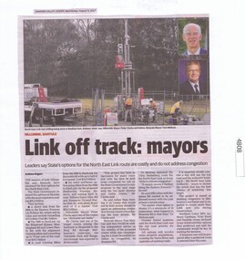
Newspaper Clipping, Diamond Valley Leader, Link off track: mayors, 09/08/2017
The mayors of both Nillumbik and Banyule have slammed the four options for the North East Link.News article 1 page, black text, colour image.north east link, banyule city council, nillumbik council -
 Greensborough Historical Society
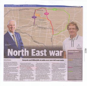
Newspaper Clipping, Diamond Valley Leader, North East war, 06/09/2017
Battle lines have been drawn between Banyule and Nillumbik councils with neither wanting the North East link to run through their patch.News article 1 page, black text, colour image.north east link, banyule city council, nillumbik council -
 Greensborough Historical Society
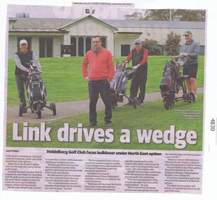
Newspaper Clipping, Diamond Valley Leader, Link drives a wedge, 20/09/2017
The historic Heidelberg Golf Club could be bulldozed under one of the North East Link options.News article 1 page, black text, colour image.heidelberg golf club, north east link -
 Greensborough Historical Society
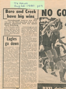
Newspaper Clipping, Diamond Valley Leader, Boro and Creek have big wins, 26/08/1980
... final in which Greensborough Reserves won against North...Greensborough Historical Society 34A Glenauburn Road Lower ...This article reports the results of the 1980 elimination final in which Greensborough Reserves won against North Heidelberg. Includes other match results for the day.Photocopy of news clipping.greensborough football club -
 Greensborough Historical Society
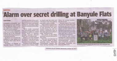
Newspaper Clipping, Diamond Valley Leader, Alarm over secret drilling at Banyule Flats, 18/10/2017
Conservationists fear the unexpected test drilling at the Banyule Flats is just the beginning of damage to the native environment. Preliminary drilling is for one proposal for the North East Link. News article 1 page, black text and colour image.banyule flats, north east link, native environment, warringal parklands -
 Greensborough Historical Society
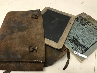
School Equipment, School satchel with exercise book and slate, 1931-1934
Slate and satchel commonly used in primary schools prior to World War 2; exercise book was produced by local traders in the Brunswick and Brunswick West area for free distribution to students.Leather school satchel, with slate and exercise book. Exercise book entitled "Brunswick West and North-West State Schools Homework Exercise Book", probably produced between 1926 and mid 1930s. The Advertised Bruce Small/Malvern Star business was located at 134 Sydney Road in the 1931-1934 period. Slate and exercise book marked "Doug Elliott"school slates, school satchels -
 Greensborough Historical Society
Photograph - Digital Image, Willis Vale site, 2014_
Photograph of the site of the 'Willis Vale' homestead, home of the Partington family. The derelict Willis Vale house was destroyed in 1964 when a fire originating from North Plenty Gorge - Kurrak Road - was lit by two teenage boys and made its way several kilometres down to Partington's Flat Greensborough.Digital copy of colour photograph."This house is where Willis Vale homestead was on Partingtons Flat"partington family, willis vale -
 Greensborough Historical Society
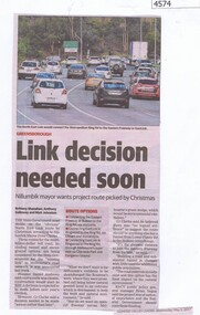
Newspaper Clipping, Diamond Valley Leader, Link decision needed soon, 03/05/2017
The State Government must decide on the “obvious” North East Link route by Christmas, according to Nillumbik Mayor Peter Clarke.News article 1 page, black text, colour image.north east link, nillumbik council -
 Greensborough Historical Society
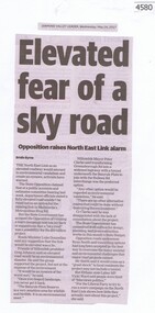
Newspaper Clipping, Diamond Valley Leader, Elevated fear of a sky road, 24/05/2017
The North East Link as an elevated roadway would amount to environmental vandalism and create an eyesore, activists have warnedNews article 1 page, black text.north east link -
 Greensborough Historical Society
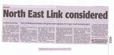
Newspaper Clipping, Diamond Valley Leader, North East Link considered, 28/09/2016
The proposed North East Link will connect the Western Ring Road and the Eastern Freeway.News clipping, black text.north east link, western ring road -
 Greensborough Historical Society
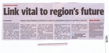
Newspaper Clipping, Diamond Valley Leader, Link vital to region's future, 09/11/2016
A recent report says the North East Link is a priority for the northern suburbs,News clipping, black text. north east link -
 Greensborough Historical Society
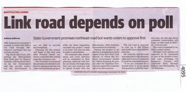
Newspaper Clipping, Diamond Valley Leader, Link road depends on poll, 14/12/2016
The North East Link will connect the Metropolitan Ring Road and Eastern Freeway. It is under consideration by the Victorian Government.News clipping, black text. north east link, metropolitan ring road -
 Greensborough Historical Society
Magazine, Banyule City Council, Banyule Banner November/December 2017, 2017_11
The Banyule Banner is published bi-monthly by Banyule City Council to advertise upcoming events in the City of Banyule and to report on past events. This edition covers Christmas in Banyule, Banyule Flats and Warringal Parklands, and an update on the North East Link.A record of events within the City of Banyule.20 pages (approx.), colour illustrations. banyule banner -
 Greensborough Historical Society
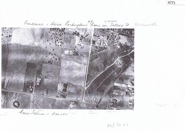
Aerial Photograph, Watsonia North 1945, 1945_
Part of 1945 aerial survey, area of Watsonia North, including Grimshaw Street, Sellars Street and Macorna Street, indicating the home of Prudence and Maria Partington in Sellars Street.Photocopy of part 1945 aerial survey"Prudence and Maria Partington's home in Sellars St. Watsonia North"watsonia north, partington family -
 Greensborough Historical Society
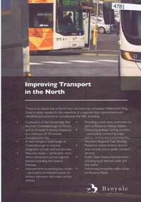
Leaflet, Banyule - Improving transport in the north, 2017_
Banyule City Council's statement of priorities for the improvement of transport facilities in the region, including the North East Link.2 pages, colour leaflettransportation -
 Greensborough Historical Society
Newspaper Clipping, Diamond Valley Leader, Homes face bulldozer, 29/11/2017
... - The North East Link north east link traffic greensborough homes ...Dozens of Greensborough homes will be bulldozed to make way for Victoria's largest ever transport project - The North East LinkNews article 1 page, black text and colour image .north east link, traffic, greensborough homes, compulsory acquisition -
 Greensborough Historical Society
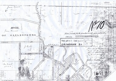
Plan, Parish Plan Map of Land North of Grimshaw Street, 11/12/1879
Part of Parish plan of land north of Grimshaw Street bounded by the Plenty River. Includes annotation signed by John Scotland and J. W. Britnell, dated Dec. 11th 1879.Photocopy of part of Parish plan of land north of Grimshaw Street bounded by the Plenty River. Includes annotation signed by John Scotland and J. W. Britnell, dated Dec. 11th 1879greensborough, grimshaw street greensborough, jonah britnell, john scotland -
 Greensborough Historical Society
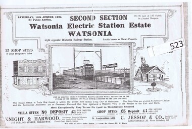
Advertising Leaflet, Knight & Harwood, Electric Station Estate, Second Section, Watsonia, 16/08/1924
Auction leaflet (copy) for sale of second section of land north of Watsonia Railway Station, Saturday 16th August 1924. Auctioneer Knight & Harwood in conjunction with C. Jessop.Photocopy of auction leaflet 1 p.watsonia railway station estate, watsonia -
 Greensborough Historical Society
CD-ROM, Lynne Moore, Binnak Park, 1985-2012
Series of 69 colour photographs of Binnak Park area, Watsonia North, taken from 1985 to March 2012 by Lynne MooreOne CD-ROM in plastic envelopeBinnak Park 1985- Mar. 2012binnak park, watsonia north -
 Greensborough Historical Society
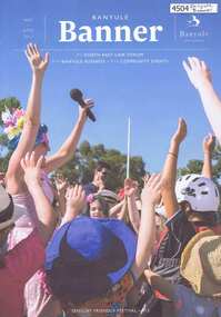
Magazine, Banyule City Council, Banyule Banner May/June 2017, 2017_05
The Banyule Banner is published quarterly by Banyule City Council to advertise upcoming events in the City of Banyule and to report on past events. This edition covers the North East Link Forum and a sensory friendly festival.A record of events within the City of Banyule.20 pages (approx.), colour illustrations. 2 copies.banyule banner, north east link -
 Greensborough Historical Society
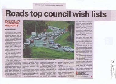
Newspaper Clipping, Diamond Valley Leader, Roads top council wish lists, 29/06/2016
Traffic issues in Banyule and surrounding areas are discussed.News clipping, black text and colour imagetraffic, north east link, banyule council, metropolitan ring road, banyule city council -
 Greensborough Historical Society
DVD, Channel 5 Productions et al, The Inner Circle Railway Line, 1888o
The Inner Circle was a steam era suburban railway line (later electrified) in Melbourne, Australia. It served the inner-northern suburbs of Parkville, Carlton North, Fitzroy North, and Fitzroy and later expanded to outer suburbs. It opened in 1888. In this video, the viewer is taken on a train journey around the Melbourne rail network and also looks at the stations and lines that have since closed.Original footage of Melbourne's railways.1 x DVD in black case. DVD of approx 43 minutes.melbourne rail network, transportation, railways -
 Greensborough Historical Society
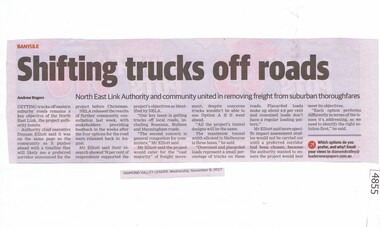
Newspaper Clipping, Diamond Valley Leader, Shifting trucks off roads, 08/11/2017
Getting trucks off eastern suburbs' roads remains a key objective of North East Link, the project authority insists.News article 1 page, black text.north east link, rosanna, banyule, rosanna road, trucks -
 Greensborough Historical Society
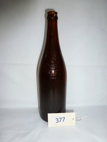
Bottle, MBCV brown beer bottle, circa 1930s, 1930s
... WAAAF base, north west of Greensborough. beer bottle mbcv world ...Made as bitter ale container in the 1930s to 1940s, World War 11 era.Found near the former WW2 WAAAF base, north west of Greensborough.Brown glass bottle, 26 fluid ounce capacity. MBCV in small spade on shoulder, Carlton "C" on base.MBCV (Manufacturers Bottle Company of Victoria)beer bottle, mbcv, world war ii, glass, spade mark