Showing 9459 items
matching the road to lower plenty
-
 Greensborough Historical Society
Business card, Peak Removals, Bundoora 2018, 2018_
... Greensborough Historical Society 34A Glenauburn Road Lower ...Business card for a local furniture removalists,Peak Removals, at 16 Warrenwood Place Bundoora. Business card, white card with black and yellow text and logo.business cards, peak removals bundoora, warrenwood place bundoora, furniture removalists -
 Greensborough Historical Society
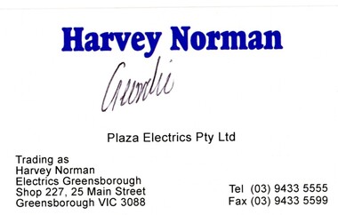
Business card, Harvey Norman, Greensborough 2016, 2016_
... Greensborough Historical Society 34A Glenauburn Road Lower ...Business card for a Greensborough Plaza business, now closed, Harvey Norman, trading as Plaza Electrics Pty Ltd or Harvey Norman Electrics Greensborough.Business card, white card with blue text.business cards, harvey norman greensborough, greensborough plaza, plaza electrics, harvey norman electrics greensborough -
 Greensborough Historical Society
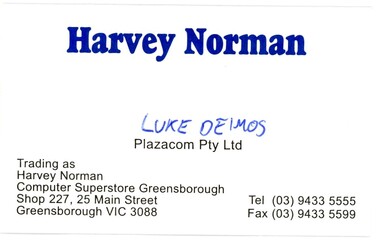
Business card, Harvey Norman, Greensborough 2016, 2016_
... Greensborough Historical Society 34A Glenauburn Road Lower ...Business card for a Greensborough Plaza business, now closed, Harvey Norman, trading as Plazacom Pty Ltd or Harvey Norman Computer Superstore Greensborough.Business card, white card with blue text.business cards, harvey norman greensborough, greensborough plaza, harvey norman computer superstore, plazacom, computer retailers -
 Greensborough Historical Society
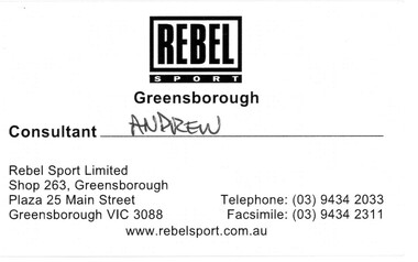
Business card, Rebel Sport, Greensborough 2016, 2016_
... Greensborough Historical Society 34A Glenauburn Road Lower ...Business card for a Greensborough Plaza business, Rebel Sport Greensborough.Business card, white card with black text.business cards, greensborough plaza, rebel sport, sports equipment -
 Greensborough Historical Society
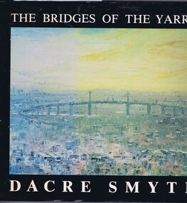
Book, The Bridges of the Yarra: a book of paintings, poetry and prose, by Dacre Smyth, 1980_
... Greensborough Historical Society 34A Glenauburn Road Lower ...Unpaged, dustjacket, colour illustrationsyarra river, bridges, dacre smyth, poetry, paintings -
 Greensborough Historical Society
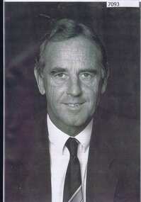
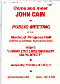
Book - Collection of articles, Parliamentary Library, John Cain, 2020
... Greensborough Historical Society 34A Glenauburn Road Lower ...John Cain, 1931-2019 was the 41st Premier of Victoria 1982-1990, Member for Bundoora 1976-1992.This collection of articles was produced by the Parliamentary Library, Victoria.Compilation of articles and tributes relating to John Cain 1931-2019. Bound with plastic cover.john cain, victoria politics, politicians -
 Greensborough Historical Society
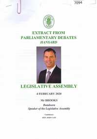
Pamphlet, Colin Brooks, Condolences, Hon. John Cain: Extract from Parliamentary Debates, Hansard, Legislative Assembly, Parliament of Victoria:, 04/02/2020
... Greensborough Historical Society 34A Glenauburn Road Lower ...Speech of Condolence by the Speaker of the Legislative Assembly, Parliament of Victoria, Colin Brooks MLA, on the death of former Premier of Victoria John Cain.3 p. typescriptjohn cain, colin brooks, parliament of victoria -
 Greensborough Historical Society
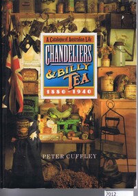
Book, Peter Cuffley, Chandeliers and billy tea: a catalogue of Australian life 1880-1940, by Peter Cuffley, 1984
... Greensborough Historical Society 34A Glenauburn Road Lower ...This book is a catalogue of items used in Australian homes from 1880-1940. Includes items as diverse as jewellery to household furnishings and farm equipment.224 p., Black and white illustrations.non-fictionThis book is a catalogue of items used in Australian homes from 1880-1940. Includes items as diverse as jewellery to household furnishings and farm equipment.catalogues, household equipment, farm implements -
 Greensborough Historical Society
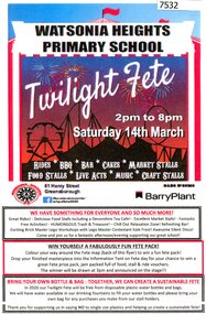
Flyer - Leaflet, Watsonia Heights Primary School Fete 2020 WH4935, 14/03/2020
... Greensborough Historical Society 34A Glenauburn Road Lower ...The Watsonia Primary School Fete, held on Saturday 14th March, was one of the last activities held before the Covid lockdown in 2020Single page, printed in colour on front and black and white map of school on back.watsonia primary school, school fetes, henry street greensborough -
 Greensborough Historical Society
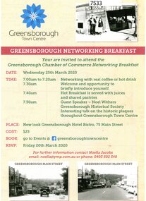
Flyer - Leaflet, Greensborough Networking Breakfast 2020, 25/03/2020
... Greensborough Historical Society 34A Glenauburn Road Lower ...The Greensborough Chamber of Commerce Networking Breakfast was held at the Greensborough Hotel Bistro on Wednesday 25th March 2020 with guest speaker Noel Withers of GHS speaking about the historic plaques in the town centre.Single page, printed in colour on one side.greensborough chamber of commerce, noel withers, main street plaques project -
![Flyer - Leaflet, Montmorency Train Station: Call to action [Oct. 2020], 2020_10](/media/collectors/4f729f5697f83e03086015b8/items/6014f1be2bef110c704f4c77/item-media/6014f2592bef110c704f5110/item-fit-380x285.jpg) Greensborough Historical Society
Greensborough Historical SocietyFlyer - Leaflet, Montmorency Train Station: Call to action [Oct. 2020], 2020_10
... Greensborough Historical Society 34A Glenauburn Road Lower ...The Montmorency Train Station Group is a group of local people concerned about the relocation of Montmorency Station and the impact this will have on local residents, traffic, flora and fauna, as well as the impact on train services during upgrade works.2 page leaflet, colour images and text.hurstbridge rail line, montmorency station, montmorency train station group -
 Greensborough Historical Society
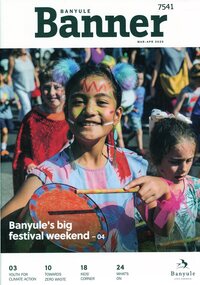
Magazine, Banyule Banner Mar-Apr 2020, 2020_03
... Greensborough Historical Society 34A Glenauburn Road Lower ...The Banyule Banner is published bi-monthly by Banyule City Council to advertise upcoming events in the City of Banyule and to report on past events. This edition covers 2020 Festivals, climate change and youth forums.A record of events within the City of Banyule.20 pages (approx.), colour illustrations. banyule banner, banyule council, climate change, banyule festivals -
 Greensborough Historical Society
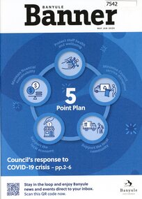
Magazine, Banyule Banner May-Jun 2020, 2020_05
... Greensborough Historical Society 34A Glenauburn Road Lower ...The Banyule Banner is published bi-monthly by Banyule City Council to advertise upcoming events in the City of Banyule and to report on past events. This edition covers Council's response to COVID-19 crisis.A record of events within the City of Banyule.20 pages (approx.), colour illustrations. banyule banner, banyule council, covid-19 -
 Greensborough Historical Society
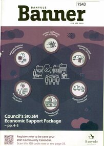
Magazine, Banyule Banner Aug-Sep 2020, 2020_08
... Greensborough Historical Society 34A Glenauburn Road Lower ...The Banyule Banner is published bi-monthly by Banyule City Council to advertise upcoming events in the City of Banyule and to report on past events. This edition covers Council's response to COVID-19 including an economic support package.A record of events within the City of Banyule.20 pages (approx.), colour illustrations. 2 copiesbanyule banner, banyule council, covid-19 -
 Greensborough Historical Society
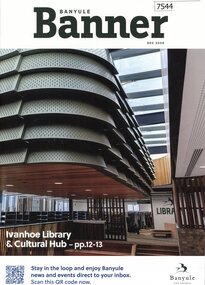
Magazine, Banyule Banner Dec 2020, 2020_12
... Greensborough Historical Society 34A Glenauburn Road Lower ...The Banyule Banner is published bi-monthly by Banyule City Council to advertise upcoming events in the City of Banyule and to report on past events. This edition includes the Ivanhoe Library and Cultural Hub.A record of events within the City of Banyule.20 pages (approx.), colour illustrations. 2 copies.banyule banner, banyule council, ivanhoe library, ivanhoe cultural hub -
 Greensborough Historical Society
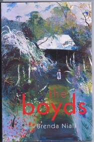
Book, The Boyds: a family biography, 2002
... Greensborough Historical Society 34A Glenauburn Road Lower ...Biography of the Boyd family of Australian artists437 p., col. and black and white illustrationsnon-fictionBiography of the Boyd family of Australian artistsboyd family, artists -
 Greensborough Historical Society
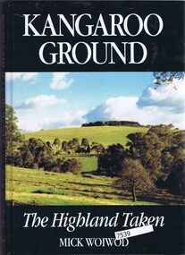
Book, Mick Woiwod, Kangaroo Ground: the highland taken, 1994_
... Greensborough Historical Society 34A Glenauburn Road Lower ...History of Kangaroo Ground, Victoria312 p. black and white illustrationsnon-fictionHistory of Kangaroo Ground, Victoriakangaroo ground, mick woiwod -
 Greensborough Historical Society
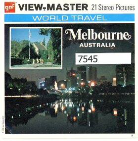
Leisure object - View-Master, GAF Corporation, Melbourne Australia, 1973
... Greensborough Historical Society 34A Glenauburn Road Lower ...View-Masters were a popular toy, the Reels showed stereo pictures of many subjects. This set is of Melbourne landmarks in the 1970s.3 View-Master reels in paper cover. Each reel has 7 stereo photographs.view-master, toys, melbourne -
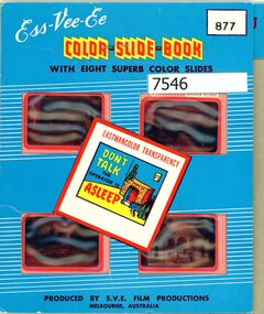 Greensborough Historical Society
Slide - Slide Set, S.V.E. Film Productions, Views of Melbourne, No.26 Victoria, 1970s
... Greensborough Historical Society 34A Glenauburn Road Lower ...Travel slides were often purchased as a memento of a city visited. This set of slides is of Melbourne circa 1970s.8 colour slides in cardboard folderslide sets, travel slides, melbourne -
 Greensborough Historical Society
Document - Booklet, Jagajaga Community Volunteer Awards 2020, 07/03/2020
... Greensborough Historical Society 34A Glenauburn Road Lower ...This booklet lists the recipients of the Jagajaga Community Volunteer Awards 2020, hosted by Kate Thwaites, Federal Member for Jagajaga. GHS Member Rosie Bray received a Jagajaga Volunteer Community Award for services as a volunteer with Greensborough Historical Society, Diamond Valley Community Support, Foodshare and her work with "What's On" in the local paper. A supplementary page with colour photographs of Rosie receiving her award accompanies the booklet. 34 p. booklet, with 2 letters and a single page of colour photographs jagajaga, jagajaga community volunteer awards 2020, rosie bray, kate thwaites -
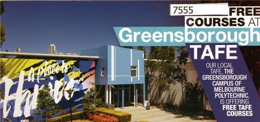 Greensborough Historical Society
Pamphlet, Free courses at Greensborough TAFE 2020, 2020_
... Greensborough Historical Society 34A Glenauburn Road Lower ...Advertisement for free courses offered in 2020 at Greensborough TAFE, the Greensborough Campus of Melbourne Polytechnic, formerly NMIT. Light card pamphlet, folded once. Colour text and images.nmit, melbourne polytechnic, greensborough tafe -
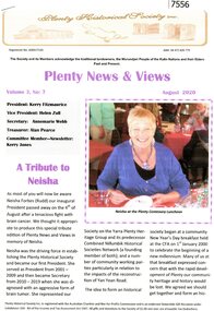 Greensborough Historical Society
Article - Article, Newsletter, Kerry Fitzmaurice, A Tribute to Neisha: Plenty News & Views, August 2020, 2020_08
... Greensborough Historical Society 34A Glenauburn Road Lower ...A tribute to the late Neisha Forbes (nee Rudd), inaugural President of the Plenty Historical Society (2001-2009). It outlines her work with the Society over many years. This article written by current President Kerry Fitzmaurice.3 Pages, text and colour images, printed. 2 copies. Also PDF copyneisha forbes, plenty historical society, plenty -
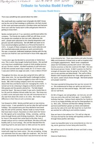 Greensborough Historical Society
Article - Article, Newsletter, Plenty Historical Society, Tribute to Neisha Rudd Forbes: Plenty News & Views, October 2020, 2020_08
... Greensborough Historical Society 34A Glenauburn Road Lower ...A tribute to the late Neisha Forbes (nee Rudd), inaugural President of the Plenty Historical Society (2001-2009). It outlines her work with the Society and personal life over many years. This article written by Neisha's sister Vivienne Rudd Henry.1 Page, text and colour image, printed. Also PDF copyneisha forbes, plenty historical society, plenty -
 Greensborough Historical Society
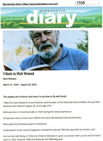
Article - Article, Internet, Warrandyte Diary, Tribute to Mick Woiwod: Warrandyte Diary, 2020, 2020_08
... Greensborough Historical Society 34A Glenauburn Road Lower ...A tribute to the late Mick Woiwod author and historian. It outlines his work with many local groups and includes tributes from members of these groups. Printed copy of online article, 5 pages, text and colour images.mick woiwod, kangaroo ground tower -
 Greensborough Historical Society
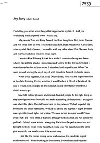
Memoir, Betty Bennell, My Story, by Betty Bennell
... Greensborough Historical Society 34A Glenauburn Road Lower ...A personal recollection by Betty Bennell of her early life, her time spent at Janefield Training Centre and later living with friends away from Janefield.3 pages typescript, 1 colour image.janefield, betty bennell, janefield training centre -
 Greensborough Historical Society
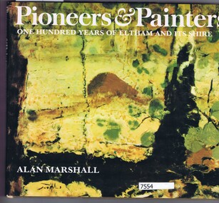
Book, alan marshall, Pioneers & painters: one hundred years of Eltham and its Shire, 1971_
... Greensborough Historical Society 34A Glenauburn Road Lower ...Hardback, 144 p. colour and black and white illustrations, dust jacketnon-fictioneltham, shire of eltham, artists -
 Greensborough Historical Society
Booklet - Collection of articles, Parliament of Victoria, Come and meet John Cain: public meeting, 2020
... Greensborough Historical Society 34A Glenauburn Road Lower ...Folder of newspaper articles and eulogies about John Cain, 1932-2020, Premier of Victoria and member for Bundoora.36 pages, text and black and white and colour images. Copies of media articles relating to John Cain.john cain, politicians, victoria politics -
 Greensborough Historical Society
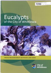
Booklet, City of Whittlesea, Eucalypts of the City of Whittlesea, 2015c
... Greensborough Historical Society 34A Glenauburn Road Lower ...30 p. booklet, stapled, colour illustrationseucalypts, native flora, whittlesea -
 Greensborough Historical Society
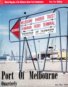
Article - Article, Journal, Melbourne Harbor Trust, "The Word is Progress": by Robin Hay, 1960_03
... Greensborough Historical Society 34A Glenauburn Road Lower ...The opening of Reid's Lightweight Aggregate Pty Ltd ( a subsidiary of Reid's Quarries Ltd) in Greensborough, circa 1960. Explains the method of manufacture and uses of shalite in building industry. Reid's later became Albion Reid before being taken over by Boral. The shalite quarry, now closed, was on the site now called Blue Lake in Yellow Gum Park, Plenty.7 photocopied pages, text and colour and black nd white illustrations.reids quarries, shalite, aggregate, yellow gum park, plenty -
 Greensborough Historical Society
Article - Article, Journal, Fitzroy Historical Society, The garden of the Beale family in Fitzroy; by Tim Gatehouse
... Greensborough Historical Society 34A Glenauburn Road Lower ...A discussion of the garden of Major Anthony Beale in Fitzroy, prior to the family's relocation to St Helena in Greensborough. The history of the garden's creation was taken from Major Beale's diary (held in the State Library of Victoria). A second article in this newsletter describes a walk around the MacRoberton factory in Fitzroy. 2 pages, text and colour images.anthony beale, beale family, gardens, st helena, mac robertson