Showing 731 items matching " kangaroo road"
-
 Eltham District Historical Society Inc
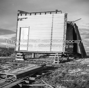
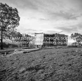
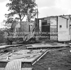
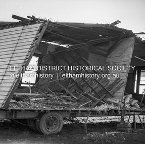
Negative - Photograph, J.A. McDonald, Inspection of storm damaged Abraham house at Kangaroo Ground, c. May 1962
Showing the effect of a wind storm that destroyed the house circa May 1962.. The Abraham family owned land near the Aqueduct and east of Nicholas Lane at Kangaroo Ground (based on photos, at or near 40 Nicholas Lane).Record of various Shire of Eltham infrastructure works undertaken during the period of 1952-1962 involving bridge and road reconstruction projects, sometimes with Eltham Shire Council Project Reference numbers quoted. It was during this period that a number of significant improvements were made to roads and new bridges constructed within the shire that remain in place as of present day (2022). In many situations, the photos provide a tangible visible record of infrastructure that existed throughout the early days of the Shire. The album was put together by or under the direction of the Shire Engineer, J.A. McDonald.1962-05, abraham house, kangaroo ground, nicholas lane, property damage, storm damage -
 Eltham District Historical Society Inc
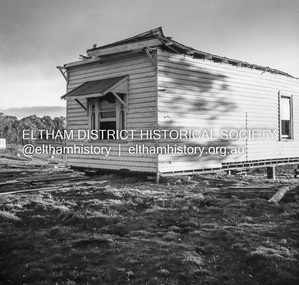
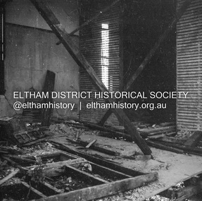
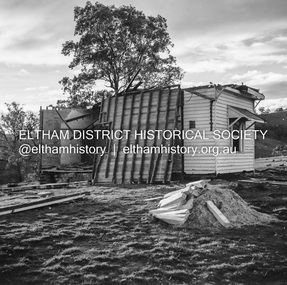
Negative - Photograph, J.A. McDonald, Inspection of storm damaged Abraham house at Kangaroo Ground, c. May 1962
Showing the effect of a wind storm that destroyed the house circa May 1962.. The Abraham family owned land near the Aqueduct and east of Nicholas Lane at Kangaroo Ground (based on photos, at or near 40 Nicholas Lane).Record of various Shire of Eltham infrastructure works undertaken during the period of 1952-1962 involving bridge and road reconstruction projects, sometimes with Eltham Shire Council Project Reference numbers quoted. It was during this period that a number of significant improvements were made to roads and new bridges constructed within the shire that remain in place as of present day (2022). In many situations, the photos provide a tangible visible record of infrastructure that existed throughout the early days of the Shire. The album was put together by or under the direction of the Shire Engineer, J.A. McDonald.1962-05, abraham house, kangaroo ground, nicholas lane, property damage, storm damage, building surveyor, george e. newton -
 Eltham District Historical Society Inc
Negative - Photograph, J.A. McDonald, Inspection of storm damaged Abraham house at Kangaroo Ground, c. May 1962
Showing the effect of a wind storm that destroyed the house circa May 1962.. The Abraham family owned land near the Aqueduct and east of Nicholas Lane at Kangaroo Ground (based on photos, at or near 40 Nicholas Lane).Record of various Shire of Eltham infrastructure works undertaken during the period of 1952-1962 involving bridge and road reconstruction projects, sometimes with Eltham Shire Council Project Reference numbers quoted. It was during this period that a number of significant improvements were made to roads and new bridges constructed within the shire that remain in place as of present day (2022). In many situations, the photos provide a tangible visible record of infrastructure that existed throughout the early days of the Shire. The album was put together by or under the direction of the Shire Engineer, J.A. McDonald.1962-05, abraham house, kangaroo ground, nicholas lane, property damage, storm damage -
 Eltham District Historical Society Inc
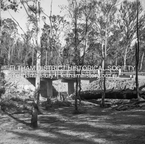
Negative - Photograph, J.A. McDonald, Henley Road Bridge at Watsons Creek, c. May 1962
... Henley Road Bridge Infrastructure Kangaroo Ground Oxley Bridge ...Completed early January 1962Record of various Shire of Eltham infrastructure works undertaken during the period of 1952-1962 involving bridge and road reconstruction projects, sometimes with Eltham Shire Council Project Reference numbers quoted. It was during this period that a number of significant improvements were made to roads and new bridges constructed within the shire that remain in place as of present day (2022). In many situations, the photos provide a tangible visible record of infrastructure that existed throughout the early days of the Shire. The album was put together by or under the direction of the Shire Engineer, J.A. McDonald.1962-05, bend of islands, bridge construction, henley road, henley road bridge, infrastructure, kangaroo ground, oxley bridge, road construction, shire of eltham, watsons creek -
 Eltham District Historical Society Inc
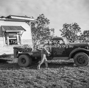
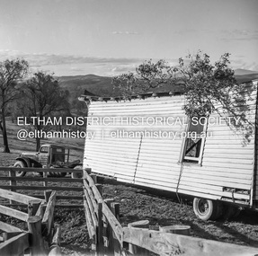
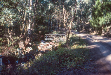
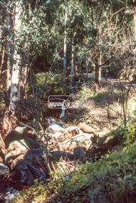
Negative - Photograph, J.A. McDonald, Removal of the remains of the Abraham house at Kangaroo Ground, c. May 1962
Martin Bros House Removing of Seaford was contracted to remove the remains of the storm damaged Abraham house from the property circa May 1962. The Abraham family owned land near the Aqueduct and east of Nicholas Lane at Kangaroo Ground (based on photos, at or near 40 Nicholas Lane).Record of various Shire of Eltham infrastructure works undertaken during the period of 1952-1962 involving bridge and road reconstruction projects, sometimes with Eltham Shire Council Project Reference numbers quoted. It was during this period that a number of significant improvements were made to roads and new bridges constructed within the shire that remain in place as of present day (2022). In many situations, the photos provide a tangible visible record of infrastructure that existed throughout the early days of the Shire. The album was put together by or under the direction of the Shire Engineer, J.A. McDonald.1962-05, abraham house, kangaroo ground, martin bros house removing seaford, nicholas lane, property damage -
 Eltham District Historical Society Inc
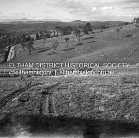
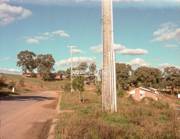
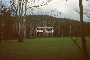
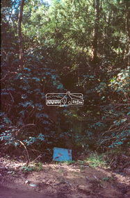
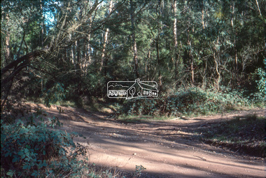
Slide - Photograph, Unidentified location, Eltham district, possibly Research / Kangaroo Ground, c.1990
35mm colour positive transparency Mount - Perutz GreyInscribed (i) RYinfrastructure, streets, roads, unidentified -
 Eltham District Historical Society Inc
Slide - Photograph, Unidentified location, Eltham district, possibly Research / Kangaroo Ground, c.1990
35mm colour positive transparency Mount - Perutz GreyInscribed (i) RYinfrastructure, streets, roads, unidentified -
 Eltham District Historical Society Inc
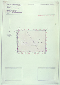
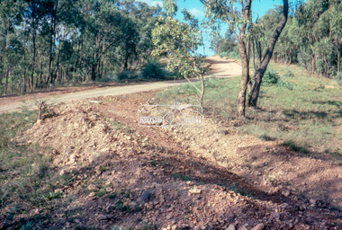
Slide - Photograph, Eltham Shire Council, Plan of Subdivision of Part of Crown Allotment 4, Section 2 at Kangaroo Ground, Parish of Nillumbik, County of Evelyn, 1969
... C6, Kimse, Kangaroo Ground-St Andrews Road, 4 August 1969..., Kimse, Kangaroo Ground-St Andrews Road, 4 August 1969 35mm ...35mm colour positive transparency blue Agfacolour Service plastic mountC6, Kimse, Kangaroo Ground-St Andrews Road, 4 August 1969infrastructure, kangaroo ground, kangaroo ground-st andrews rd, kimse, map, plan of subdivision, planning, subdivison lots -
 Eltham District Historical Society Inc
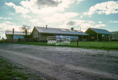
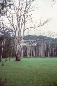
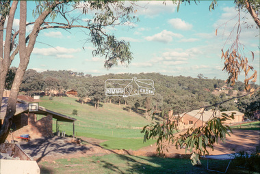
Slide - Photograph, Unidentified rural scene, possibly Research / Kangaroo Ground district, c.May 1988
Montsalvat, Eltham, c.May 198835mm colour positive transparency (1 of 19) Mount - Kodak KodachromeProcess Date MAY 88Minfrastructure, roads, rural areas, shire of eltham -
 Eltham District Historical Society Inc
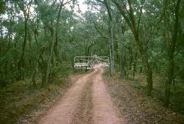
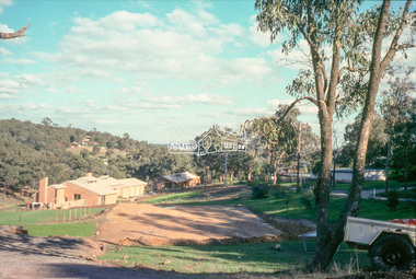
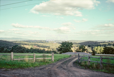
Slide - Photograph, Unidentified rural scene, possibly Research / Kangaroo Ground district, c.May 1988
Montsalvat, Eltham, c.May 198835mm colour positive transparency (1 of 13) Mount - Kodak KodachromeProcess Date MAY 88Minfrastructure, roads, rural areas, shire of eltham -
 Eltham District Historical Society Inc
Slide - Photograph, Unidentified rural scene, possibly Research / Kangaroo Ground district, c.May 1988
Montsalvat, Eltham, c.May 198835mm colour positive transparency (1 of 19) Mount - Kodak KodachromeProcess Date MAY 88Minfrastructure, roads, rural areas, shire of eltham -
 Eltham District Historical Society Inc
Slide - Photograph, Unidentified rural scene, possibly Research / Kangaroo Ground district, c.May 1988
Montsalvat, Eltham, c.May 198835mm colour positive transparency (1 of 13) Mount - Kodak KodachromeProcess Date MAY 88Minfrastructure, roads, rural areas, shire of eltham