Showing 1773 items
matching maps and plans
-
 Warrnambool and District Historical Society Inc.
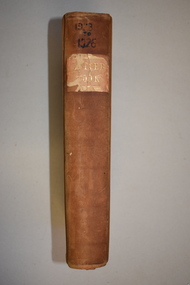
Letter book 14, 1923
This letter book contains letters, sketch maps and plans and dates from 1923 to 1926. It came from the office of John William Crawley, Junior, an engineer, surveyor and architect in private practice in Warrnambool and also the engineer for the Shire of Warrnambool from 1895 to 1935. His father, brother and son were also engineers, working in that capacity or as the Shire Secretary for the Shire of Warrnambool, with the Crawley family recording a total of 132 years of service to the Shire. The Shire of Warrnambool existed from 1863 to 1994. This letter book was passed on to John Crawley’s son, Rolf, the engineer for the Shire of Warrnambool from 1935 to 1968. It then came into the possession of Michael Hand who took over the private surveying business of Rolf Crawley in Warrnambool. The Warrnambool and District Historical Society acquired the letter book, along with several other Crawley ledgers, from the estate of Michael Hand.This letter book is of considerable significance as it contains letters, maps and plans drawn up by John William Crawley, an engineer and surveyor in private practice in Warrnambool and the engineer for the Shire of Warrnambool for 40 years. It will be useful for researchers. This is a brown hard cover letter book of 1010 pages, with brown binding on the corners of the cover and on the spine. The cover is cuffed and torn. There is gold lettering on the spine. The book contains handwritten letters, maps and plans and an alphabetical index at the front, The pages are water-stained. There is a mauve stamp on the first page.‘Letter Book 1923 to 1926’ ‘J. Wm. Crawley Shire Hall Warrnambool (Private)’ ‘Rolf L. Crawley Civil Engineer, Drainage and Water Supply Engineer, Licensed Surveyor, Registered Architect, Warrnambool’ john william crawley junior, warrnambool, rolf crawley, warrnambool, shire of warrnambool -
 Bendigo Historical Society Inc.
Map - PARISHES OF CORNELLA AND TOOLLEEN, Circa 1880
Map: Parishes of Cornella and Toolleen, Compilation of 2 hand draughted parish plans applied to vanvas backing. Originally in Map Cupboard. Relocated to Map Drawer 5 on 5.22.9.22. Too long for the map cupboard.map, parish plan, cornella , toolleen -
 Wodonga & District Historical Society Inc
Album - Hume Reservoir Australia Album - Plans and Progress Photos - River Murray Water Scheme, Department of Public Works, N.S.W, 1927
This set of photos is from a leather bound album bearing the inscription "HUME RESERVOIR AUSTRALIA" plus 'The Rt. Hon. L. C. M. S. Amery, P. C., M .P.' all inscribed in gold. It was presented to The Rt. Hon. L. C. M. S. Amery, P. C., M. P, Secretary of State for Dominion Affairs on the occasion of his visit to the Hume Reservoir on 2nd November 1927. This album is of local and national significance as it documents the planning and development of the Hume Reservoir up to 1927. It was the largest water reservoir in the British Empire. The album records the pioneering engineering work that went into its construction.1. Locality Plan and Plan of Dam. The dam is about ten miles by road upstream from Albury and about three-quarters of a mile below the confluence of the Mitta Mitta River and the Murray River. Its main features consist of a concrete portion across the bed of the river with earth embankment at both ends. The foundations throughout are on hard granite, found at an average depth of about 40 feet below the surface, the centre line being located to take advantage of the most favourable rock levels.Heading on page "WORKS UNDER RIVER MURRAY WATERS AGREEMENT/HUME RESERVOIR" Beneath top diagram "FIG. 1. ELEVATION" Beneath second diagram "FIG. 2. PLAN" On map "LOCALITY PLAN"hume reservoir australia, river murray waters scheme, hume weir diagrams, hume weir location -
Bendigo Historical Society Inc.
Map - PART PARISHES OF MARONG AND LOCKWOOD, No date visible
Map: Section of Parish plan of Bendigo, covering Kangaroo Flat, Golden Square, and Specimen Hill ( number 146 in Map Cupboard 1)Map 10map, bendigo, city streets, parish of marong, parish of lockwood, kangaroo flat, golden square, specimen hill -
Bendigo Historical Society Inc.
Map - PARISH OF HUNTLY(PART) AND SANDHURST(PART), No date visible
Map: Part of parish plan of Bendigo, covering Strathdale, White Hills, Huntly and North Bendigo ( number 144 in Map Cupboard 1)map, bendigo, city streets, parish of hunlty, parish of sandhurst, strathdale, white hills, huntly, north bendigo -
Bendigo Historical Society Inc.
Map - PORTION OF ELMORE ESTATE, 19/10/1920
Map: Portion of Elmore Estate, Parish of Egerton, County of Bendigo. Parish plan Canvas backed ( number 135 in Map Cupboard 1)map, bendigo, rural, elmore estate, egerton, county of bendigo -
Bendigo Historical Society Inc.
Map - PORTION OF ELMORE ESTATE, 19/10/1920
Map: Portion of Elmore Estate, Parish of Minto, County of Bendigo. Parish plan Canvas backed ( number 131 in Map Cupboard 1)map, bendigo, rural, elmore estate, minto, county of bendigo -
Bendigo Historical Society Inc.
Map - SANDHURST (PART), No date Visible
Map: Hand Draughted parish plan showing the area North and East of Spring Gully Reservoir ( number 206 in Map Cupboard 1)map, bendigo, parish plan, parish of sandhurst, spring gully -
Bendigo Historical Society Inc.
Map - DINGEE SUBDIVISION, 25/11/1913
Map: Dingee Subdivision, Parishes of Talambe and Yallook, County of Bendigo, Parish Plan, Canvas Backed ( number 128 in Map Cupboard 1)map, bendigo, rural, dingee subdivision, talambe, yallook, county of bendigo -
Bendigo Historical Society Inc.
Map - RESURVEY PARISH OF SANDHURST, 23/07/1891
Map: Resurvey, Parish of Sandhhurst sheet No. IV, Enlargement of part of sheet No. III. Parish plan ( number 204 in Map Cupboard 1)map, bendigo, parish plan, parish of sandhurst, resurvey -
Bendigo Historical Society Inc.
Map - RODNEY, No date visible
Map: Rodney, plan of the whole County of Rodney showing reserves under the Forest Act 1907 (number 257 in map cupboard 1)map, rodney, reserves, rodney, forest act 1907, reserves -
Bendigo Historical Society Inc.
Map - PARISH OF MARONG, 24/09/1874
Map; Parish of Marong ,County of Bendigo. This plan has been cut and then applied to a different backing. ( number 234 in Map Cupboard 1)map, bendigo, parish plan, marong -
Bendigo Historical Society Inc.
Map - COUNTRY LANDS, 4/06/1874
Map: Country lands, Parishes of Goornong, Egerton, Elmore and Nolan, County of Bendigo. Parish plan (number 298 in map cupboard 1)map, bendigo, country lands, country lands, goornong, elmore, egerton, nolan -
Bendigo Historical Society Inc.
Map - AVAILABLE ALLOTMENTS, 10/08/1908
map: Available Allotments, Parishes of Whirrakee, Bagshot and Egerton, County of Bendigo. Parish plan (coloured) (number 330 in map cupboard 1)map, bendigo, allotments, available allotments, whirrakee, bagshot, egerton -
 Merbein District Historical Society
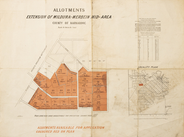
Map - Allotments Extension of Mildura-Merbein Mid-Area, Allotments available, 23 November 1920
Allotments available to Discharged Soldiers Discharged Soldier's Settlement Act Historic Large map, folded in 4, coloured map of Merbein indicating allotments available and locality plan. Scale 10 chain to 1 inchPhoto-Lithographed at Department of lands Survey, Melbourne J. Butson 23.11.20discharged soldiers, ww1, soldier settlement, irrigation -
 Warrnambool and District Historical Society Inc.
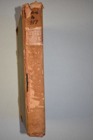
Letter book 6, Jan 1914 - 1917, 1914
This letter book contains letters, plans and sketch maps dating from 1914 to 1917. It came from the office of John William Crawley Junior, an engineer, architect and surveyor in private practice in Warrnambool and also the engineer for the Shire of Warrnambool from 1895 to 1935. His father, brother and son were also engineers and worked in that capacity or as the Shire Secretary for the Shire of Warrnambool, with the Crawley family recording a total of 132 years of service to the Shire of Warrnambool. This Shire existed from 1863 to 1994. The letter book was passed on the John Crawley’s son, Rolf, engineer for the Shire of Warrnambool from 1935 to 1968. It then came into the possession of Michael Hand who took over the private surveying practice of Rolf Crawley in Warrnambool. The Warrnambool and District Historical Society has acquired the letter book, along with several other Crawley ledgers, from the Michael Hand estate. This letter book is of considerable significance as it contains letters, maps and plans drawn up by John William Crawley, Junior, the engineer for the Shire of Warrnambool for 40 years. It will be very useful for researchers. This is a brown hard cover letter book with leather binding on the edges of the cover and on the spine. The leather is worn away in several places. There is gold lettering on the spine. The book has 750 pages of handwritten letters, maps and plans. The inside cover is of a mottled blue colour. There is an alphabetical index at the beginning of the book. ‘6’ ‘Letter Book 1914 to 1917’ john william crawley junior, warrnambool, rolf crawley, warrnambool, shire of warrnambool -
Bendigo Historical Society Inc.
Map - STRATHFIELDSAYE, See above
Map: Township of Strathfieldsaye, Group of 4 plans, 2 hand drafted and 2 printed. Applied to canvas and stapled to the backing. The printed plans are dated January 1859 and 6th January 1871 (number 267 in map cupboard 1)map, bendigo, township, strathfieldsaye -
 City of Moorabbin Historical Society (Operating the Box Cottage Museum)
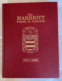
Book - Family History, Marriott, Ralph, The Marriott family in Australia, 1871-1986, 1986
The History and family tree of John Marriott and his wife Emma Kitchen and their descendants in Australia, 1871-1986371 p. : ill., facsims., geneal. tables, maps, plans, ports.: includes indexnon-fictionThe History and family tree of John Marriott and his wife Emma Kitchen and their descendants in Australia, 1871-1986marriott, family history, market gardening, moorabbin, bentleigh, pioneer -
 City of Moorabbin Historical Society (Operating the Box Cottage Museum)
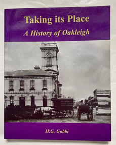
Book, Gobbi, H. G. (Helen Grace), Taking its place : a history of Oakleigh marking its sesquicentenary, 1853-2003, 2004
243 p. : ill., maps, plans; Includes index. Bibliography: p. 232-235.oakleigh, history -
Bendigo Historical Society Inc.
Map - KIMBOLTON, 24/05/1921
Maqp: Kimbolton, County of Bendigo. Parish plan ( number 175 in Map Cupboard 1)map, bendigo, parish plan, kimbolton -
Bendigo Historical Society Inc.
Map - SHEEPSHEAD LINE OF REEF, Circa 1940's
Map: Plan showing a Longitudinal section of the Sheepshead line of Reefs , Bendigo. (34 Copies)map, bendigo, mining plan, sheepshead line of reef, gold mines , mining -
University of Melbourne, Burnley Campus Archives
Book, Olive Mellor, Complete Australian Gardener Illustrated, 1950
Olive Mellor was a past student and staff member at Burnley College.304 p., [1] leaf of col. plates : ill., map, plans ; 24 cm.olive mellor (nee holttum), staff, female students, gardening, australia -
Federation University Historical Collection
Book, Wendy Jacobs et al, Maldon Conservation Study, 1977, 1977
Brown soft covered book of 94 pages. It includes pull out maps and plans. conservation, maldon, planning, john templeton, porcupine flat, tarrengower, mining, architecture, town and country planning board, wendy jacobs, miles lewis, elizabeth vines -
 Ringwood and District Historical Society
Document - Folder, Byways Estate Residential Subdivision, Ringwood East, Victoria 1965-1970
Collection of Subdivision brochures, plans, maps and sales information for sectional releases of Byways Estate.Subdivision plans include: First and second release (1965-66) - Alexandra Road, Isabel Avenue, Byways Drive and Buronga Avenue. Third release (1967) - Byways Drive, Buronga Avenue, Hender Street, Lester Avenue and Jess Court. Fourth and final release (1970) - Hume Street, Walhalla Drive and Hender Street. (Agent) C.E. Carter & Son R.E.S.I. 126 Whitehorse Road, Ringwood, 3134 (Telephone) 870 2519, 870 6830, 870 6024, A.H. 723 3298, 870 4604, 870 6454. Accompanying handwritten sales notes researched in 2024 by Richard Carter - Carter Real Estate - "Vendors - Jessie May Cleland & Alan Cleland of (what became) 4 Bywats Drive. Vendors retired to Buronga near Mildura. Rex was (I think) their son. Jess Court reflects vendor's name. See also History of Byways & Coolooli by Richard Carter in RDHS archives." (Vic Collections RDHS 18023 refers.) -
 Bendigo Historical Society Inc.
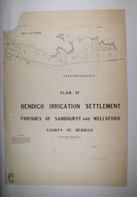
Map - BENDIGO IRRIGATION SETTLEMENT, 20/10/1908
Map: Bendigo Irrigation Settlement, Parishes of Sandhurst and Wellsford, County of Bendigo, Parish planmap, bendigo, irrigation settlement, bendigo irrigation settlement -
 Bendigo Historical Society Inc.
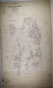
Map - BOROUGH OF EAGLEHAWK SHEET 1, 9/12/1902
Map: Borough of Eaglehawk, sheet No. 1, Parish of Sandhurst, County of Bendigo. Parish planmap, bendigo, parish plan, borough of eaglehawk -
 Bendigo Historical Society Inc.
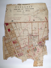
Map - TOOLLEEN ALLOTMENTS, circa 1870
Map: Parish plan showing Village allotments at Toolleen, Parish of Toolleen, County of Rodneymap, rodney, toolleen, parish of toolleen, county of rodney -
Bendigo Historical Society Inc.
Map - PORTION OF ELMORE ESTATE, 19/10/1920
Map: Portion of Elmore Estate, Parishes of Warragamba and Diggorra, County of Bendigo. Parish plan Canvas backed ( number 143 in Map Cupboard 1)map, bendigo, rural, elmore estate , warragamba, diggorra , county of bendigo. -
Bendigo Historical Society Inc.
Map - MAHER'S AND PRETTY'S ESTATE, 8/02/1926
Map: Maher's and Pretty's Estate, Parish of Toolamba West, County of Rodney. Parish plan Canvas backed. ( number 131 in Map Cupboard 1)map, rodney, rural, maher's , pretty's, toolamba west, county of rodney -
Bendigo Historical Society Inc.
Map - BURNEWANG PARK ESTATE, circa 1920
Map: Burnewang Park Estate, Parishes of Diggorra and Minto, County of Bendigo, Parish Plan ,Canvas backed ( number 127 in Map Cupboard 1)map, bendigo, rural, burnewang, diggorra, minto, county of bendigo