Showing 2588 items matching "aerial"
-
 Whitehorse Historical Society Inc.
Map, Aerial photographs Nunawading, 1976
Department of Crown Lands and Survey, Melbourne, 1976 Project.Department of Crown Lands and Survey, Melbourne, 1976 Project. Runs 29 - 33 City of Nunawading. Frames numbered from South to North boundaries, each strip numbered from West to East. No index map. Sheets 30/8 and 30/9 missing.non-fictionDepartment of Crown Lands and Survey, Melbourne, 1976 Project. victoria. department of crown lands and survey, aerial photographs, nunawading, mitcham, blackburn, blackburn north, blackburn south, forest hill, vermont, vermont south, burwood east, box hill, ringwood -
Whitehorse Historical Society Inc.
Map, Aerial maps, 2/04/1966 12:00:00 AM
Melbourne 1966 project, runs 10A and 11A, lens 122 151.75 mm 9,800. Photo nos 77, 107, 109, 161, 163, 165.Melbourne 1966 project, runs 10A and 11A, lens 122 151.75 mm 9,800. Photo nos 77, 107, 109, 161, 163, 165. Areas and boundaries: Map no 77 W. Park and Cook Roads; E. Dubon Rd; N Oban Rd; S Reilly St. Map No 107. W. Indra Rd and Pakenham St; E. Rooks Rd & McLares Rd; N. Maroondah Hwy; S. Hawthorn Rd & Eley Rd. Map No 109 W. Elgar Rd. E. Blackburn Rd & McKean St; S. Eley Rd & Burwood Hwy. Map No 161. W. Elgar Rd & Huntingdale Rd; E. Blackburn Rd; N. Burwood Hwy; S. Waverley Rd. Map No 163. W. Blackburn Rd; S. Springvale Rd; N. Eley Rd & Hawthorn Rd; S. Glen Waverley Railway Line. Map No 165. W. Stanley Rd, Vermont South; E. Cathies Lane, Wantirna South; N. North of Burwood Hwy; S. High Street. Melbourne 1966 project, runs 10A and 11A, lens 122 151.75 mm 9,800. Photo nos 77, 107, 109, 161, 163, 165. aerial photographs, blackburn, blackburn south, forest hill, nunawading, box hill, burwood, burwood east, donvale, mount waverley, glen waverley, wantirna, vermont south, mitcham, ringwood north, ringwood -
 Ballarat Heritage Services
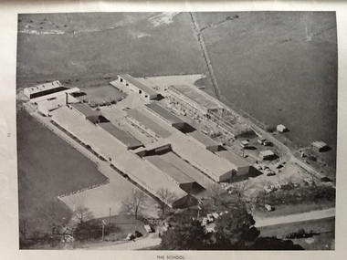
Photograph - Black and White, Ballarat East High School, aerial photographs
Three black and white photographs of the Ballarat East High School. ballarat east high school, education -
 Ballarat Heritage Services
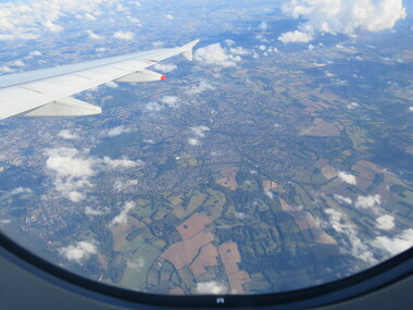
Photograph - Colour, London Aerial Photograph, 2016
Photograph of London from the air.aerial photograph, london -
 Dandenong/Cranbourne RSL Sub Branch
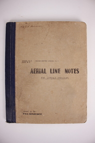
Book, Aerial Line Notes, Circa. 1944
Carried by Sig. Robinson on operations. P rinted in Melbourne. By Postmaster.s General Department. Brown cardboard cover. White paper pagesSig.J.S.Robinson. -
 City of Ballarat Libraries
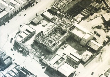
Photograph - Card Box Photographs, Aerial view of the Civic Hall under construction, Ballarat circa 1951
This photo shows the buildings still standing around the Civic Hall as it was being constructed.civic hall, ballarat, mair street, aerial view, armstrong street north, building, construction, public building -
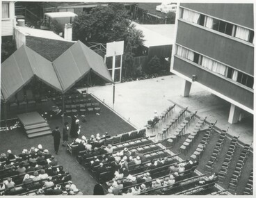 International House, The University of Melbourne
Photograph (Item), Aerial view of the official opening of the Samuel Wadham Wing at International House, 1963
The Samuel Wadham Wing was the second purpose-built accommodation building at International House at the University of Melbourne. The building was officially opened by Lord Richard Casey (1890–1976) on 23 March 1963. -
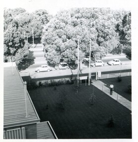 International House, The University of Melbourne
Photograph (Item), Aerial view of a young man standing on the front pathway at the main entry to International House
-
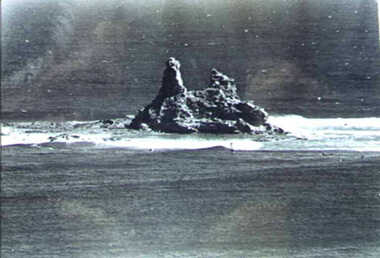 Inverloch Historical Society
001246 - Photograph - Aerial View of Eagles Nest - from L Bailey
-
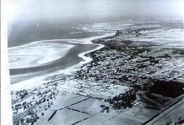 Inverloch Historical Society
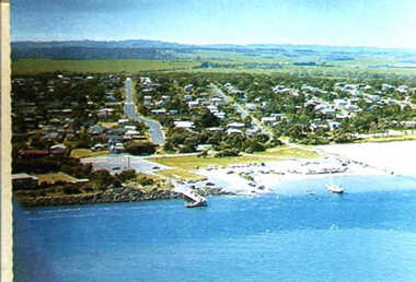
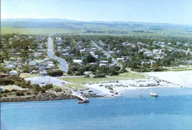
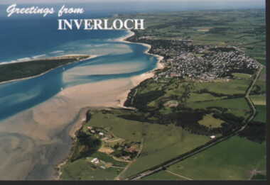
001247 - Photograph - circa 1960's - Aerial Photograph - Inverloch from North East (looking South West) - from L Bailey
-
 Inverloch Historical Society
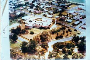
001031 - Photograph - Inverloch - aerial view looking NE from pier - 1978 - from James Wyeth
-
 Inverloch Historical Society
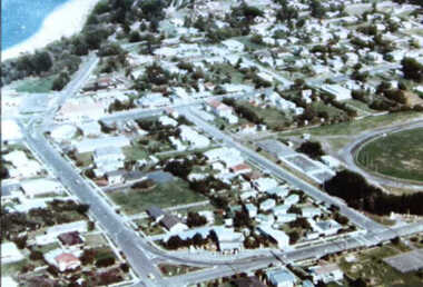
000638 Photograph - 1978 - Aerial View looking accross William, Reilly and A'Beckett Streets, Inverloch - from Ruth Tipping
-
 Inverloch Historical Society
000639 Photograph - 1978 - Aerial View looking to Pier, Inverloch - from Ruth Tipping
-
 Inverloch Historical Society
000640 Photograph - 1978 - Aerial View looking South West, Inverloch - from Ruth Tipping
-
 Inverloch Historical Society
000641 Photograph - 1978 - Aerial View Pier looking North East, Inverloch - from Ruth Tipping
-
 Inverloch Historical Society
000642 Photograph - 1978 - Aerial View looking South West, Inverloch - from Ruth Tipping
-
 Inverloch Historical Society
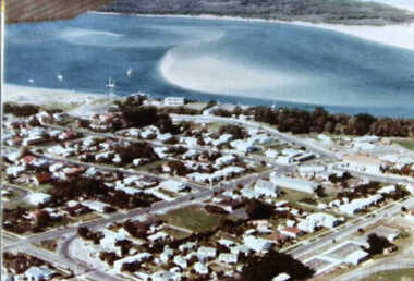
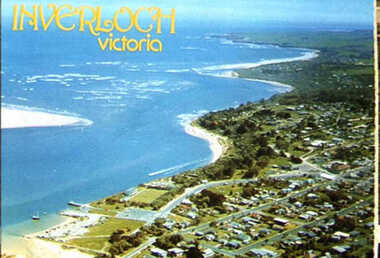
000694 - Photograph - 1993 - Aerial View of Inverloch looking to Anderson Inlet Entrance & Eagles Nest - from Ruth Tipping
-
 Inverloch Historical Society
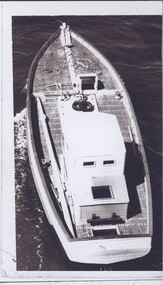
004397 - Photograph - Aerial view of boat possibly Kyeema - on same photo sheet at 4396 - from Bob Young
-
 Inverloch Historical Society
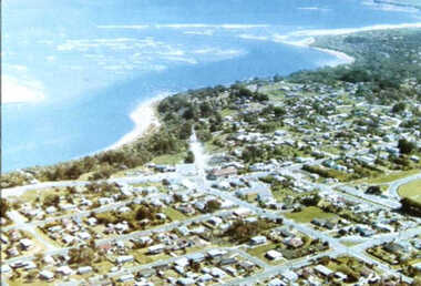
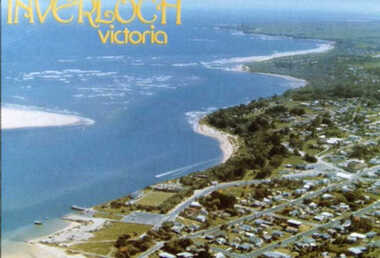
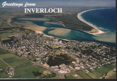
000986 - Postcard - Aerial view of Inverloch and coast - November 1996 - from Nancye Durham
-
 Inverloch Historical Society
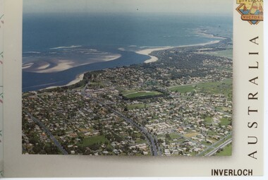
000987 - Postcard - Aerial view of Inverloch, Anderson Inlet and Venus Bay - taken November 1996 - from Nancye Durham
-
 Inverloch Historical Society
001024 - Photograph - Inverloch - c1982 - Pine Lodge aerial view - from James Wyeth
-
 Inverloch Historical Society
001029 - Photograph - Inverloch aerial view pier looking west - from James Wyeth
-
 Department of Health and Human Services
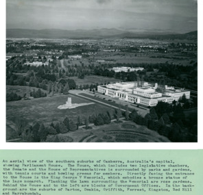
An aerial view of the Southern suburbs of Canberra, Australia's Capital showing Old Parliament House circa 1958 - Department of Health – National Fitness Office (Sports & Recreation) – Historical Press Release Photo Collection
Department of Health – National Fitness Office (Sports & Recreation) – Historical Press Release Photo - Empire Youth Day & Royals on Tour CollectionDepartment of Health – National Fitness Office (Sports & Recreation) – Historical Press Release Photo - Empire Youth Day & Royals on Tour Collection -
 Department of Health and Human Services
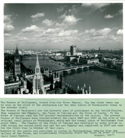
An aerial view with the Houses of Parliament & Big Ben on left of photo August 1957 - Department of Health – National Fitness Office (Sports & Recreation) – Historical Press Release Photo Collection
Department of Health – National Fitness Office (Sports & Recreation) – Historical Press Release Photo - Empire Youth Day & Royals on Tour CollectionDepartment of Health – National Fitness Office (Sports & Recreation) – Historical Press Release Photo - Empire Youth Day & Royals on Tour Collection -
 Department of Health and Human Services
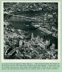
An aerial view of London's River Thames, The Houses of Parliament, and Big Ben - Department of Health – National Fitness Office (Sports & Recreation) – Historical Press Release Photo Collection
Department of Health – National Fitness Office (Sports & Recreation) – Historical Press Release Photo - Empire Youth Day & Royals on Tour CollectionDepartment of Health – National Fitness Office (Sports & Recreation) – Historical Press Release Photo - Empire Youth Day & Royals on Tour Collection -
 Department of Health and Human Services
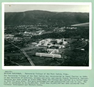
An aerial photo of University College, on a 700 acre site, in the West Indies at Mona Jamaica - Department of Health – National Fitness Office (Sports & Recreation) – Press Release Photo - Empire Youth Day & Royal Tours
Department of Health – National Fitness Office (Sports & Recreation) – Historical Press Release Photo - Empire Youth Day & Royals on Tour CollectionDepartment of Health – National Fitness Office (Sports & Recreation) – Historical Press Release Photo - Empire Youth Day & Royals on Tour Collection -
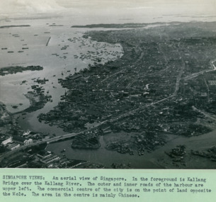 Department of Health and Human Services
An aerial view of with the Kallang Bridge over the Kallang River in the foreground left Singapore - 3 of 3 photos - Department of Health – National Fitness Office (Sports & Recreation) – Historical Press Release Photo Collection
Department of Health – National Fitness Office (Sports & Recreation) – Historical Press Release Photo - Empire Youth Day & Royals on Tour CollectionDepartment of Health – National Fitness Office (Sports & Recreation) – Historical Press Release Photo - Empire Youth Day & Royals on Tour Collection -
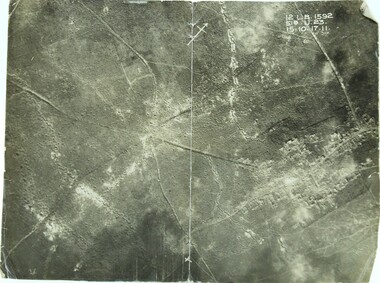 Ringwood RSL Sub-Branch
Photograph WW1, Aerial photograph
WW1 front line12 L.B. 1592 51B.U.23. 15.10.17.11 -
Moorabbin Air Museum
Photograph (Item) - Assorted Aerial Photos Of Lae, Rabaul, Horn Island, Kahili, Buna, Gona , Ballale Island
-
Moorabbin Air Museum
Book - A HISTORY OF AERIAL WARFARE, THE HAMLYN PUBLISHING GROUP LIMITED, 1974