Showing 4603 items matching "melbourne maps"
-
 Eltham District Historical Society Inc
Slide - Photograph, Eltham Shire Council, Tentative Plan of Subdivision, Part of Crown Allotment 20A and Part 20B, Parish of Nillumbik, County of Evelyn, 1969
... melbourne Infrastructure Map planning Subdivison Lots Kangaroo ...35mm colour positive transparency blue Agfacolour Service plastic mountE2, N899, Young subdivision, Kangaroo Ground-Warrandyte Road, North Warrandyte, 4 August 1969infrastructure, map, planning, subdivison lots, kangaroo ground-warrandyte road, north warrandyte -
 Eltham District Historical Society Inc
Slide - Photograph, Eltham Shire Council, Proposed extension of Railway Road, Briar Hill, 1969
... melbourne Infrastructure Map planning Subdivison Lots railway road ...35mm colour positive transparency blue Agfacolour Service plastic mountA4, Railway Road intersection, 4 August 1969infrastructure, map, planning, subdivison lots, railway road, carter street bridge, para road, para road bridge, briar hill -
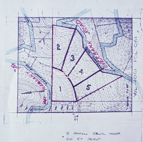 Eltham District Historical Society Inc
Slide - Photograph, Eltham Shire Council, Proposed subdivision of five approximately equal areas of 5 acres, Vol. 4061, Fol. 061, Overbank Road, North Warrandyte, 1969
... melbourne Infrastructure Map planning Subdivison Lots Overbank Road ...35mm colour positive transparency blue Agfacolour Service plastic mountD4, 55341, Peck subdivision, Mount Pleasant Road, 4 August 1969infrastructure, map, planning, subdivison lots, overbank road, mount pleasant road, north warrandyte -
 Eltham District Historical Society Inc
Slide - Photograph, Eltham Shire Council, Plan of Subdivision, Part of Crown Allotments 5 & 6, Section 10, Parish of Nillumbik, County of Evelyn (Foster Road, Eltham East), 1969
... melbourne Infrastructure Map planning Subdivison Lots Abersham Court ...35mm colour positive transparency blue Agfacolour Service plastic mountC5(a) DU (Vic) D/L Foster Road, Eltham East, 4 August 1969infrastructure, map, planning, subdivison lots, abersham court, ancona close, eltham east, floriston grove, foster road, frank street, gladwyn court -
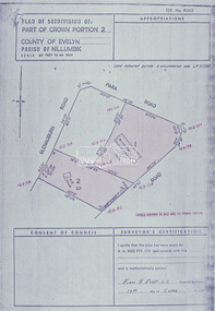 Eltham District Historical Society Inc
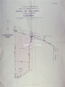
Slide - Photograph, Eltham Shire Council, Plan of Subdivision of Part of Crown Portion 2, Parish of Nillumbik, County of Evelyn, 1969
... melbourne Infrastructure Map planning Subdivison Lots Glenauburn ...35mm colour positive transparency blue Agfacolour Service plastic mountC2, Grant of subdivision, Para and Glenauburn, 4 August 1969infrastructure, map, planning, subdivison lots, glenauburn road, para road -
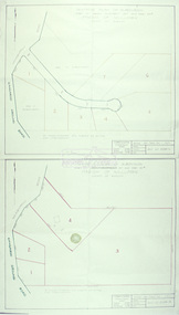
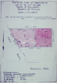 Eltham District Historical Society Inc
Slide - Photograph, Eltham Shire Council, Tentative Plan of Subdivision of Part of Lot 4 on L.P. 44 686, Parish of Nillumbik, County of Evelyn, 1969
... melbourne Infrastructure Map planning Subdivison Lots View Road ...35mm colour positive transparency blue Agfacolour Service plastic mountB3 Robinson prelim subdivision, View Road, 4 August 1969infrastructure, map, planning, subdivison lots, view road, rosehill road, lower plenty -
 Eltham District Historical Society Inc
Slide - Photograph, Eltham Shire Council, Plan of Subdivision, Part of Crown Portion 3, Parish of Nillumbik, County of Bourke, 1969
... melbourne Infrastructure Map planning Subdivison Lots Rattray Road ...35mm colour positive transparency blue Agfacolour Service plastic mountB3 Robinson prelim subdivision, View Road, 4 August 1969infrastructure, map, planning, subdivison lots, rattray road -
 Eltham District Historical Society Inc
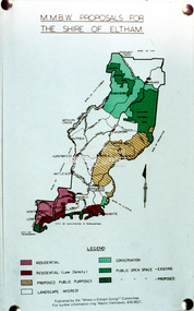
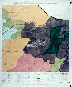
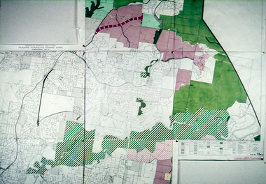
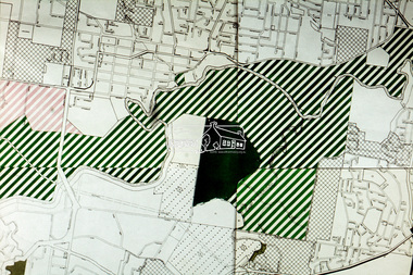
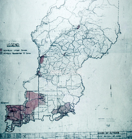
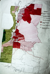
Slide - Photograph, Eltham Shire Council, Shire of Eltham, Melbourne Metropolitan Planning Scheme, Amendment No. 3, Melbourne and Metropolitan Board of Works, Apr 1972
... melbourne Map Melbourne Metropolitan Board of Works MMBW Planning ...35mm colour positive transparency blue Agfacolour Service plastic mountmap, melbourne metropolitan board of works, mmbw, planning proposals, shire of eltham, planning -
 Eltham District Historical Society Inc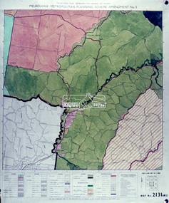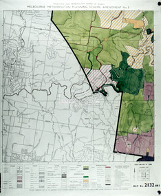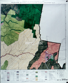
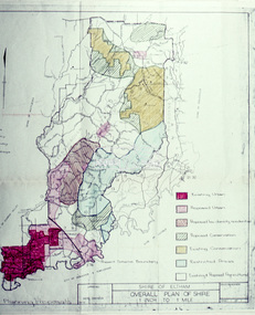
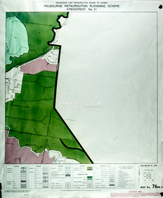
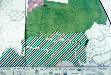
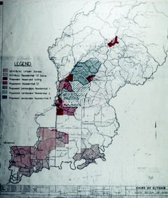
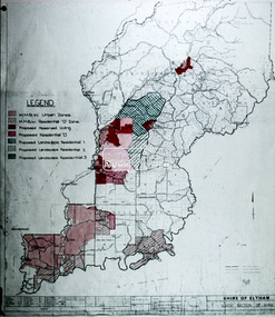
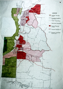
Slide - Photograph, Eltham Shire Council, Shire of Eltham, Melbourne Metropolitan Planning Scheme, Amendment No. 21, Melbourne and Metropolitan Board of Works, Apr 1972
... melbourne Map Melbourne Metropolitan Board of Works MMBW Planning ...35mm colour positive transparency blue Agfacolour Service plastic mountmap, melbourne metropolitan board of works, mmbw, planning proposals, shire of eltham, planning -
 Eltham District Historical Society Inc
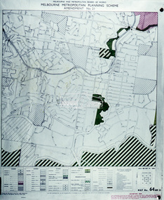
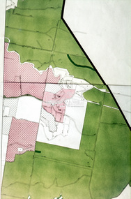
Slide - Photograph, Eltham Shire Council, Proposed public open space, Lower Plenty, Eltham Council proposal, Apr 1972
... melbourne Map Melbourne Metropolitan Board of Works MMBW Planning ...35mm colour positive transparency blue Agfacolour Service plastic mountmap, melbourne metropolitan board of works, mmbw, planning proposals, shire of eltham, planning -
 Eltham District Historical Society Inc
Slide - Photograph, Eltham Shire Council, Proposed public open space, Yarra Braes, Melbourne Metropolitan Planning Scheme, Amendment No. 21, Melbourne and Metropolitan Board of Works, Apr 1972
... melbourne Map Melbourne Metropolitan Board of Works MMBW Planning ...35mm colour positive transparency blue Agfacolour Service plastic mountmap, melbourne metropolitan board of works, mmbw, planning proposals, shire of eltham, planning -
 Eltham District Historical Society Inc
Slide - Photograph, Eltham Shire Council, Proposed public open space, Yarra Braes, Eltham Council proposal, Apr 1972
... melbourne Map Melbourne Metropolitan Board of Works MMBW Planning ...35mm colour positive transparency blue Agfacolour Service plastic mountmap, melbourne metropolitan board of works, mmbw, planning proposals, shire of eltham, planning -
 Eltham District Historical Society Inc
Slide - Photograph, Eltham Shire Council, Proposed public open space, Research, Melbourne Metropolitan Planning Scheme, Amendment No. 21, Melbourne and Metropolitan Board of Works, Apr 1972
... melbourne Map Melbourne Metropolitan Board of Works MMBW Planning ...35mm colour positive transparency blue Agfacolour Service plastic mountmap, melbourne metropolitan board of works, mmbw, planning proposals, shire of eltham, planning -
 Eltham District Historical Society Inc
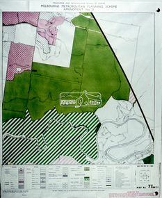
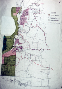
Slide - Photograph, Eltham Shire Council, Proposed Residential, Shire of Eltham, Melbourne Metropolitan Planning Scheme, Amendment No. 21, Melbourne and Metropolitan Board of Works, Apr 1972
... melbourne Map Melbourne Metropolitan Board of Works MMBW Planning ...35mm colour positive transparency blue Agfacolour Service plastic mountmap, melbourne metropolitan board of works, mmbw, planning proposals, shire of eltham, planning -
 Eltham District Historical Society Inc
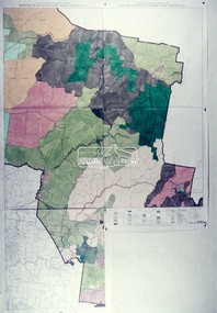
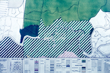
Slide - Photograph, Eltham Shire Council, Hurstbridge area, Melbourne Metropolitan Planning Scheme, Amendment No. 21, Melbourne and Metropolitan Board of Works, Apr 1972
... melbourne Map Melbourne Metropolitan Board of Works MMBW Planning ...35mm colour positive transparency blue Agfacolour Service plastic mountmap, melbourne metropolitan board of works, mmbw, planning proposals, shire of eltham, planning -
 Eltham District Historical Society Inc
Slide - Photograph, Eltham Shire Council, Hurstbridge area, Melbourne Metropolitan Planning Scheme, Amendment No. 21, Melbourne and Metropolitan Board of Works, Apr 1972
... melbourne Map Melbourne Metropolitan Board of Works MMBW Planning ...35mm colour positive transparency blue Agfacolour Service plastic mountmap, melbourne metropolitan board of works, mmbw, planning proposals, shire of eltham, planning