Showing 923 items matching "railway park"
-
 Eltham District Historical Society Inc
Scrapbook Album, The Colour and Texture of Eltham, 1997, 1997
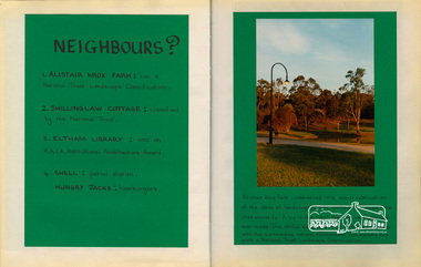
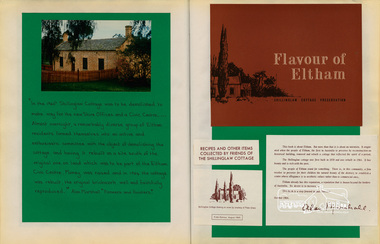
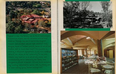
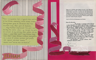
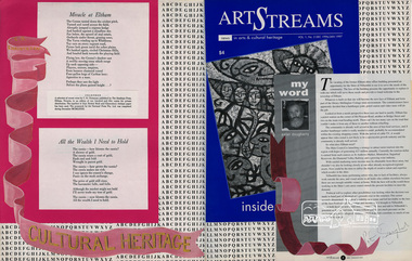
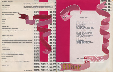
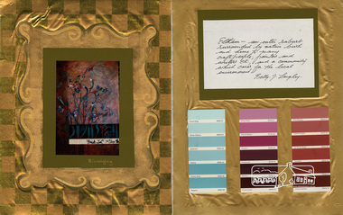
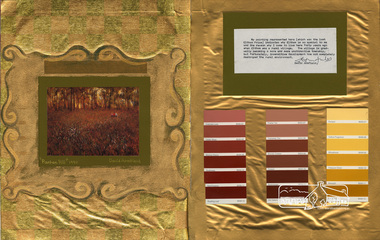
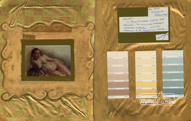
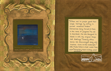
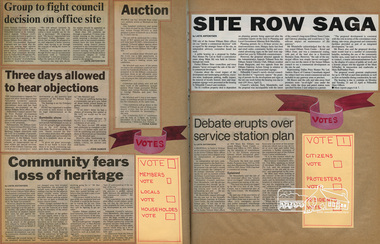
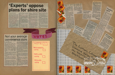
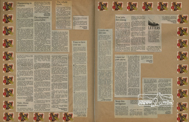
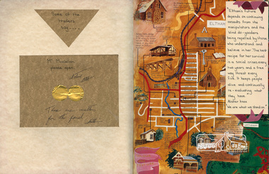
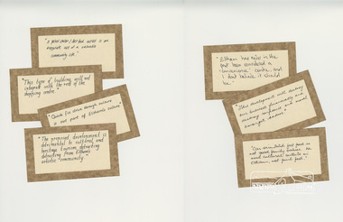
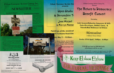
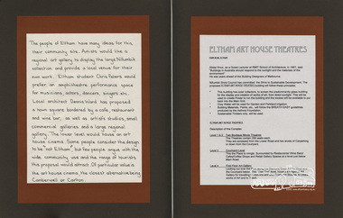
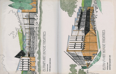
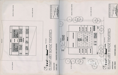
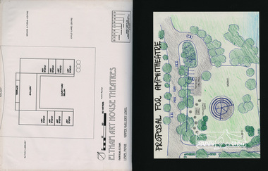
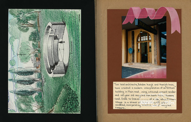
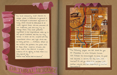
Put together by a member of the Eltham Community Action Group in participation with various artists, writers, local business people and other local citizens and sent to Minister Maclellan, Planning Minister in the Kennet Government in protest of proposed plans to sell the former Eltham Shire Office site at 895 Main Road Eltham in order to develop a Shell Service Station and Hungry Jacks fast food outlet. The purpose was to express what is unique about the character of Eltham, why people live and work there and why such a development would be out of character and inappropriate for the Eltham Gateway along with alternative development proposals. This protest was the catalyst for the formation of the Eltham Community Action Group.Scrapbook album approx 40 x 30 x 4 cm, black hardcovers and 36 double page openings, numerous blank pages.alan marshall, alistair knox park, alistair knox, alternative proposals, ampitheatre, artists, betty langley, bohdan kucyk, bootmakers cottage, bridge street, cultural heritage map, david armfield, diamond creek, diamnond valley news, eltham art house theatres, eltham community action group, eltham library, eltham traders, eltham, flavour of eltham, george stebbing, gordon ford, hamish knox, helen lucas, hungry jacks, janet r boddy, jarrold cottage, jarrold family, john pizzey, jon weaving, lena skipper, letters, local business register, 895 main road, main road, eltham shire office, matcham skipper, ming mackay, minister maclellan, montsalvat, mudbrick, newspaper clippings, peter dougherty, peter glass, pioneers and painters, railway line, shell service station, shelltham, protests, shillinglaw cottage, shire of eltham, nillumbik shire, st margaret's anglican church, todaro, trestle bridge, wingrove cottage, charles symons wingrove -
 Eltham District Historical Society Inc
Scrapbook Album, The Colour and Texture of Eltham, 1997, 1997
Put together by a member of the Eltham Community Action Group in participation with various artists, writers, local business people and other local citizens and sent to Minister Maclellan, Planning Minister in the Kennett Government in protest of proposed plans to sell the former Eltham Shire Office site at 895 Main Road Eltham in order to develop a Shell Service Station and Hungry Jacks fast food outlet. The purpose was to express what is unique about the character of Eltham, why people live and work there and why such a development would be out of character and inappropriate for the Eltham Gateway along with alternative development proposals. This protest was the catalyst for the formation of the Eltham Community Action Group.Scrapbook album approx 40 x 30 x 4 cm, black hardcovers and 36 double page openings, numerous blank pages.alan marshall, alistair knox park, alistair knox, alternative proposals, ampitheatre, artists, betty langley, bohdan kucyk, bootmakers cottage, bridge street, cultural heritage map, david armfield, diamond creek, diamnond valley news, eltham art house theatres, eltham community action group, eltham library, eltham traders, eltham, flavour of eltham, george stebbing, gordon ford, hamish knox, helen lucas, hungry jacks, janet r boddy, jarrold cottage, jarrold family, john pizzey, jon weaving, lena skipper, letters, local business register, 895 main road, main road, eltham shire office, matcham skipper, ming mackay, minister maclellan, montsalvat, mudbrick, newspaper clippings, peter dougherty, peter glass, pioneers and painters, railway line, shell service station, shelltham, protests, shillinglaw cottage, shire of eltham, nillumbik shire, st margaret's anglican church, todaro, trestle bridge, wingrove cottage, charles symons wingrove -
 Eltham District Historical Society Inc
Scrapbook Album, The Colour and Texture of Eltham, 1997, 1997
Put together by a member of the Eltham Community Action Group in participation with various artists, writers, local business people and other local citizens and sent to Minister Maclellan, Planning Minister in the Kennet Government in protest of proposed plans to sell the former Eltham Shire Office site at 895 Main Road Eltham in order to develop a Shell Service Station and Hungry Jacks fast food outlet. The purpose was to express what is unique about the character of Eltham, why people live and work there and why such a development would be out of character and inappropriate for the Eltham Gateway along with alternative development proposals. This protest was the catalyst for the formation of the Eltham Community Action Group.Scrapbook album approx 40 x 30 x 4 cm, black hardcovers and 36 double page openings, numerous blank pages.alan marshall, alistair knox park, alistair knox, alternative proposals, ampitheatre, artists, betty langley, bohdan kucyk, bootmakers cottage, bridge street, cultural heritage map, david armfield, diamond creek, diamnond valley news, eltham art house theatres, eltham community action group, eltham library, eltham traders, eltham, flavour of eltham, george stebbing, gordon ford, hamish knox, helen lucas, hungry jacks, janet r boddy, jarrold cottage, jarrold family, john pizzey, jon weaving, lena skipper, letters, local business register, 895 main road, main road, eltham shire office, matcham skipper, ming mackay, minister maclellan, montsalvat, mudbrick, newspaper clippings, peter dougherty, peter glass, pioneers and painters, railway line, shell service station, shelltham, protests, shillinglaw cottage, shire of eltham, nillumbik shire, st margaret's anglican church, todaro, trestle bridge, wingrove cottage, charles symons wingrove -
 Eltham District Historical Society Inc
Scrapbook Album, The Colour and Texture of Eltham, 1997, 1997
Put together by a member of the Eltham Community Action Group in participation with various artists, writers, local business people and other local citizens and sent to Minister Maclellan, Planning Minister in the Kennet Government in protest of proposed plans to sell the former Eltham Shire Office site at 895 Main Road Eltham in order to develop a Shell Service Station and Hungry Jacks fast food outlet. The purpose was to express what is unique about the character of Eltham, why people live and work there and why such a development would be out of character and inappropriate for the Eltham Gateway along with alternative development proposals. This protest was the catalyst for the formation of the Eltham Community Action Group.Scrapbook album approx 40 x 30 x 4 cm, black hardcovers and 36 double page openings, numerous blank pages.alan marshall, alistair knox park, alistair knox, alternative proposals, ampitheatre, artists, betty langley, bohdan kucyk, bootmakers cottage, bridge street, cultural heritage map, david armfield, diamond creek, diamnond valley news, eltham art house theatres, eltham community action group, eltham library, eltham traders, eltham, flavour of eltham, george stebbing, gordon ford, hamish knox, helen lucas, hungry jacks, janet r boddy, jarrold cottage, jarrold family, john pizzey, jon weaving, lena skipper, letters, local business register, 895 main road, main road, eltham shire office, matcham skipper, ming mackay, minister maclellan, montsalvat, mudbrick, newspaper clippings, peter dougherty, peter glass, pioneers and painters, railway line, shell service station, shelltham, protests, shillinglaw cottage, shire of eltham, nillumbik shire, st margaret's anglican church, todaro, trestle bridge, wingrove cottage, charles symons wingrove -
 Eltham District Historical Society Inc
Photograph, Henley Bridge, Spring Excursion, Exploring the Upper Yarra, 22 October 1995, 22/10/1995
[article by Bettina Woodburn in EDHS Newsletter No. 105, November 1995:] EXPLORING THE UPPER YARRA - We enjoyed the Spring Excursion, this year "Exploring the Upper Yarra" - in spite of the constant rain and the countryside under the cloud cover, especially in the valleys, being mainly shiny shades of green. The occasional fields of buttercups, clumps of arum lilies and splendid rhododendron and other flowering bushes became very special. The Cobb and Co coach was warm and a cosy retreat as we zig-zagged on the highways and byways to glimpse the Yarra River, upstream and down, its secret places, and particularly the many bridges. Russell excelled as 'Poet Laureate', reading from Dacre Smyth's book. This 1979 publication includes paintings of all the bridges along the river with poems and brief descriptions of each one. Some of the bridges are in out-of-the-way places and are not very well known. We looked forward to hearing the poetry as much as seeing the 'constructions'… Big Pat (was he short or tall, lean or fat? - he did win the £200 reward for discovering gold and had the creek named after him), about the 'Eddies'?, and the disliked 'meccano' bridge in Warburton, etc. etc. The hot roast lunch in the old Reefton Hotel was also most welcome. It was easy to imagine it peopled by miners and early settlers. Starting by crossing the new (1974) concrete bridge at Warrandyte we headed through Wonga Park with views to the Christmas Hills and to the escarpment of the Yering Gorge, which causes flood waters to back up through the Yarra Glen plain, so avoiding disasters downstream. At the end of a long driveway we found the wooden, privately owned Henley Bridge (1935 after the 1934 floods). This facilitates access to different parts of Henley Farm and to Lilydale. Everard Park, named after Blanche Shallard's father, a State Member for 17 years, below the Highway Yarra crossing was in need of care. It is 10 miles from Yarra Glen by road but, as "Yarra Marra” canoeists well know, 32 winding miles down by water. After more delightful countryside scenes we joined the Warburton Highway at Woori Yallock. From the old Railway Station at Launching Place the Centennial Trail for walkers, cyclists and horse riders has replaced the rails. The line from Lilydale was opened in 1901, and the last diesel freight train ran to Warburton in 1965. It continued to rain as we had morning tea in Warburton in a shelter between footbridges. From here we continued upstream past the Bridge to O'Shannassy Lodge and Reservoir, Starvation Creek, and the Peninsular tunnel (miners dug it as at Pound Bend) which we visited (scrambling down those steps!) on our return after lunch. Our furthermost point was the Upper Yarra Dam Reserve (and vast catchment area). Finished in 1957 after ten years' work and 100 years after Yan Yean, it supplies much of Melbourne's water. After crossing the 30m Launching Place Bridge to the Eltham side of the Yarra and Healesville, we saw in the distance the Yarra Glen Timber Trestle Bridge over the river flats "the longest for years in the land it was said!" Harry's dream of "better weather over the Divide" unfortunately didn't come true, but I'm sure we 36 members will retain happy memories of a day that was wet and green and filled with Bridges. Situated on the Yarra River, 5.5 kms south of Christmas Hills on private property. This timber trestle bridge is said to have been built some time after 1907 by Melbourne master-builder, David Mitchell (the father of Dame Nellie Melba), to connect his two "Henley Farm" properties with Lilydale. In earlier days, when the McPhersons owned the property, their children used a punt to cross the river to attend Yering Primary School. This private bridge is best viewed from the end of Wendy Way. - Source: Christmas Hills Past and Present, Yarra Glen & District Historical Society, 2004.Two colour photographsactivities, henley bridge, upper yarra -
 Eltham District Historical Society Inc
Photograph, Spring Excursion, Exploring the Upper Yarra, 22 October 1995, 22/10/1995
[article by Bettina Woodburn in EDHS Newsletter No. 105, November 1995:] EXPLORING THE UPPER YARRA - We enjoyed the Spring Excursion, this year "Exploring the Upper Yarra" - in spite of the constant rain and the countryside under the cloud cover, especially in the valleys, being mainly shiny shades of green. The occasional fields of buttercups, clumps of arum lilies and splendid rhododendron and other flowering bushes became very special. The Cobb and Co coach was warm and a cosy retreat as we zig-zagged on the highways and byways to glimpse the Yarra River, upstream and down, its secret places, and particularly the many bridges. Russell excelled as 'Poet Laureate', reading from Dacre Smyth's book. This 1979 publication includes paintings of all the bridges along the river with poems and brief descriptions of each one. Some of the bridges are in out-of-the-way places and are not very well known. We looked forward to hearing the poetry as much as seeing the 'constructions'… Big Pat (was he short or tall, lean or fat? - he did win the £200 reward for discovering gold and had the creek named after him), about the 'Eddies'?, and the disliked 'meccano' bridge in Warburton, etc. etc. The hot roast lunch in the old Reefton Hotel was also most welcome. It was easy to imagine it peopled by miners and early settlers. Starting by crossing the new (1974) concrete bridge at Warrandyte we headed through Wonga Park with views to the Christmas Hills and to the escarpment of the Yering Gorge, which causes flood waters to back up through the Yarra Glen plain, so avoiding disasters downstream. At the end of a long driveway we found the wooden, privately owned Henley Bridge (1935 after the 1934 floods). This facilitates access to different parts of Henley Farm and to Lilydale. Everard Park, named after Blanche Shallard's father, a State Member for 17 years, below the Highway Yarra crossing was in need of care. It is 10 miles from Yarra Glen by road but, as "Yarra Marra” canoeists well know, 32 winding miles down by water. After more delightful countryside scenes we joined the Warburton Highway at Woori Yallock. From the old Railway Station at Launching Place the Centennial Trail for walkers, cyclists and horse riders has replaced the rails. The line from Lilydale was opened in 1901, and the last diesel freight train ran to Warburton in 1965. It continued to rain as we had morning tea in Warburton in a shelter between footbridges. From here we continued upstream past the Bridge to O'Shannassy Lodge and Reservoir, Starvation Creek, and the Peninsular tunnel (miners dug it as at Pound Bend) which we visited (scrambling down those steps!) on our return after lunch. Our furthermost point was the Upper Yarra Dam Reserve (and vast catchment area). Finished in 1957 after ten years' work and 100 years after Yan Yean, it supplies much of Melbourne's water. After crossing the 30m Launching Place Bridge to the Eltham side of the Yarra and Healesville, we saw in the distance the Yarra Glen Timber Trestle Bridge over the river flats "the longest for years in the land it was said!" Harry's dream of "better weather over the Divide" unfortunately didn't come true, but I'm sure we 36 members will retain happy memories of a day that was wet and green and filled with Bridges.Two colour photographsactivities, upper yarra, upper yarra dam -
 Eltham District Historical Society Inc
Photograph, Yarra River from Henley Bridge, Kangaroo Ground, Spring Excursion, Exploring the Upper Yarra, 22 October 1995, 22/10/1995
[article by Bettina Woodburn in EDHS Newsletter No. 105, November 1995:] EXPLORING THE UPPER YARRA - We enjoyed the Spring Excursion, this year "Exploring the Upper Yarra" - in spite of the constant rain and the countryside under the cloud cover, especially in the valleys, being mainly shiny shades of green. The occasional fields of buttercups, clumps of arum lilies and splendid rhododendron and other flowering bushes became very special. The Cobb and Co coach was warm and a cosy retreat as we zig-zagged on the highways and byways to glimpse the Yarra River, upstream and down, its secret places, and particularly the many bridges. Russell excelled as 'Poet Laureate', reading from Dacre Smyth's book. This 1979 publication includes paintings of all the bridges along the river with poems and brief descriptions of each one. Some of the bridges are in out-of-the-way places and are not very well known. We looked forward to hearing the poetry as much as seeing the 'constructions'… Big Pat (was he short or tall, lean or fat? - he did win the £200 reward for discovering gold and had the creek named after him), about the 'Eddies'?, and the disliked 'meccano' bridge in Warburton, etc. etc. The hot roast lunch in the old Reefton Hotel was also most welcome. It was easy to imagine it peopled by miners and early settlers. Starting by crossing the new (1974) concrete bridge at Warrandyte we headed through Wonga Park with views to the Christmas Hills and to the escarpment of the Yering Gorge, which causes flood waters to back up through the Yarra Glen plain, so avoiding disasters downstream. At the end of a long driveway we found the wooden, privately owned Henley Bridge (1935 after the 1934 floods). This facilitates access to different parts of Henley Farm and to Lilydale. Everard Park, named after Blanche Shallard's father, a State Member for 17 years, below the Highway Yarra crossing was in need of care. It is 10 miles from Yarra Glen by road but, as "Yarra Marra” canoeists well know, 32 winding miles down by water. After more delightful countryside scenes we joined the Warburton Highway at Woori Yallock. From the old Railway Station at Launching Place the Centennial Trail for walkers, cyclists and horse riders has replaced the rails. The line from Lilydale was opened in 1901, and the last diesel freight train ran to Warburton in 1965. It continued to rain as we had morning tea in Warburton in a shelter between footbridges. From here we continued upstream past the Bridge to O'Shannassy Lodge and Reservoir, Starvation Creek, and the Peninsular tunnel (miners dug it as at Pound Bend) which we visited (scrambling down those steps!) on our return after lunch. Our furthermost point was the Upper Yarra Dam Reserve (and vast catchment area). Finished in 1957 after ten years' work and 100 years after Yan Yean, it supplies much of Melbourne's water. After crossing the 30m Launching Place Bridge to the Eltham side of the Yarra and Healesville, we saw in the distance the Yarra Glen Timber Trestle Bridge over the river flats "the longest for years in the land it was said!" Harry's dream of "better weather over the Divide" unfortunately didn't come true, but I'm sure we 36 members will retain happy memories of a day that was wet and green and filled with Bridges.Colour photographactivities, upper yarra, henley bridge -
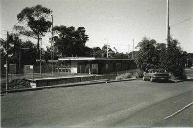 Ringwood and District Historical Society
Photograph-B&W, Joan Walker, East Ringwood 2000-The East Ringwood Railway Station from the car park opposite IGA Supermarket, 2000
East Ringwood 2000-The East Ringwood Railway Station from the car park opposite IGA Supermarket- B&W Photo from Album 6501