Showing 40540 items matching "roads and streets"
-
 Ringwood and District Historical Society
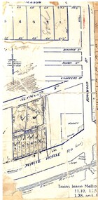
Map, Partially trimmed copy of a retail and residential auction advertisement, Ringwood, Vic. - 1926
One of 3 unrelated land subdivision maps on cardboard backing. Numbered allotments on Nelson Street, Seymour Street and Whitehorse Road, Ringwood.W.J. Bonwick, Licensed Surveyor, Phone WU4830. Location map also includes Bourke Street, Bond Street, Charter Street, Ringwood Street, and Shops and Market sites in Ringwood. -
 Kew Historical Society Inc
Plan - Subdivision Plan, Jas R Mathers Son & McMillan, East Kew Tramway Estate, 1915
Pru Sanderson, in her groundbreaking ‘City of Kew Urban Conservation Study : Volume 2 - Development History’ (1988), summarised the periods of urban development and subdivisions of land in Kew. The periods that she identified included 1845-1880, 1880-1893, 1893-1921, 1921-1933, 1933-1943, and Post-War Development. These periods were selected as they represented periods of rapid growth or decline in urban development. An obvious starting point for Sanderson’s groupings involved population growth and the associated economic cycles. These cycles also highlighted urban expansion onto land that was predominantly rural, although in other cases it represented the decline and breakup of large estates. A number of the plans in the Kew Historical Society’s collection can also be found in other collections, such as those of the State Library of Victoria and the Boroondara Library Service. A number are however unique to the collection.The Kew Historical Society collection includes almost 100 subdivision plans pertaining to suburbs of the City of Melbourne. Most of these are of Kew, Kew East or Studley Park, although a smaller number are plans of Camberwell, Deepdene, Balwyn and Hawthorn. It is believed that the majority of the plans were gifted to the Society by persons connected with the real estate firm - J. R. Mathers and McMillan, 136 Cotham Road, Kew. The Plans in the collection are rarely in pristine form, being working plans on which the agent would write notes and record lots sold and the prices of these. The subdivision plans are historically significant examples of the growth of urban Melbourne from the beginning of the 20th Century up until the 1980s. A number of the plans are double-sided and often include a photograph on the reverse. A number of the latter are by noted photographers such as J.E. Barnes.The East Kew Tramway Estate was a subdivision of two separate parcels of land between Adeney Avenue and Normanby Road. The larger section included 54 lots facing Adeney Avenue, Argyle Road, and Campbell, Hunter and Wishart Streets. [Hunter and Wishart Streets were created as part of the subdivision.] A further 17 allotments faced Normanby Road, Hubert and Campbell Streets. [The name of Hubert Street was later to be changed to Cecil Street.] The promotion of the sale referred to the advantages of living between two tram routes, in High Street and Cotham Road. On the plan, quaintly drawn trams mark these routes. Also on the plan is the route of part of the Outer Circle [Railway] Line.east kew tramway estate, subdivision plans - east kew -
 Whitehorse Historical Society Inc.
Photograph, Northcote Street, Mitcham, 8/09/1958 12:00:00 AM
Black and white photo of Northcote Street, Mitcham.- Eastern end of what is now Brunswick Road- Road (track ) conditions indicative of that part of the city.o'rourke, l. -
 Tarnagulla History Archive
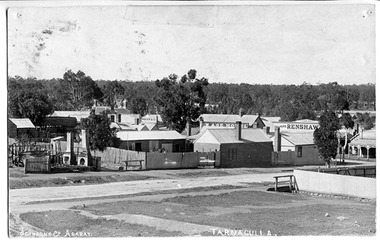
Photograph of Tarnagulla from Poverty Street, behind Bank, Tarnagulla from Poverty Street, behind Bank, Between 1886 and 1899
Murray Comrie Collection. Information collated by Murray Comrie: Photo after 1886 and before 1899. Shows bakers shop at corner of Commercial Rd and Poverty St, bakery stables and horse. Clouston's, Renshaw's Victoria House, Golden Age Hotel, Renshaw's Commerce House and Post Office. This is an original photographic postcard. Monochrome photographic postcard. View of part of Commercial Road and Poverty Streets, Tarnagulla, from a position on Poverty Street behind the Bank site. Premises on Commercial Road which are visible include the Golden Age Hotel and Renshaw's Drapers.Text near bottom edge: 'Johnsn & Co. Ararat' and 'Tarnagulla'.tarnagulla, commerce, shops, businesses, streetscapes, horses, stables, poverty street, commercial road, main street, golden age hotel, renshaw's, bakery, clouston's -
 Eltham District Historical Society Inc
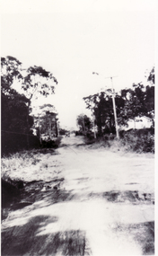
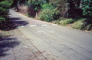
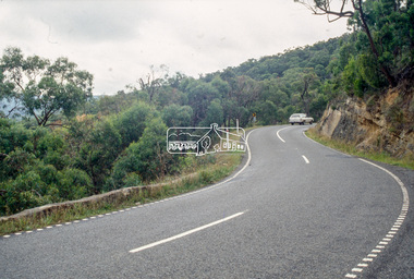
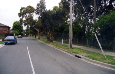
Slide - Photograph, Unidentified location, Eltham district, c.1992
... streets ...35mm colour positive transparency Mount - Black and Whiteunidentified, infrastructure, speedhumps, streets, roads -
 Eltham District Historical Society Inc
Slide - Photograph, Unidentified location, Eltham district, c.1992
... streets ...35mm colour positive transparency Mount - Black and Whiteunidentified, infrastructure, speedhumps, streets, roads -
 Eltham District Historical Society Inc
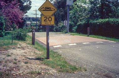
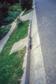
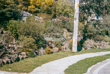
Slide - Photograph, Unidentified location, Eltham district, 1993
... streets ...35mm colour positive transparency Mount - Black and Whiteunidentified, infrastructure, streets, roads, footpaths and gutters -
 Eltham District Historical Society Inc
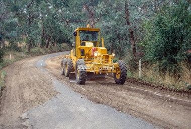
Slide - Photograph, Unidentified location, Eltham district, 1993
... streets ...35mm colour positive transparency Mount - Black and Whiteunidentified, infrastructure, streets, roads, graders -
 Eltham District Historical Society Inc
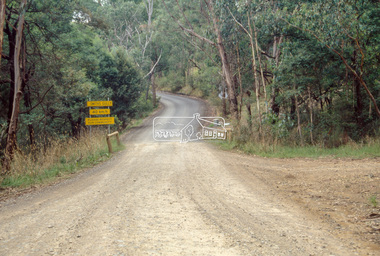
Slide - Photograph, Unidentified location, Smiths Gully, 1993
... streets ...35mm colour positive transparency Mount - Black and Whiteunidentified, infrastructure, streets, roads, smiths gully -
 Eltham District Historical Society Inc
Slide - Photograph, Heidelberg-Kinglake Road, St Andrews, 1993
... streets ...35mm colour positive transparency Mount - Black and Whiteinfrastructure, streets, roads, heidelberg-kinglake road, st andrews -
 Eltham District Historical Society Inc
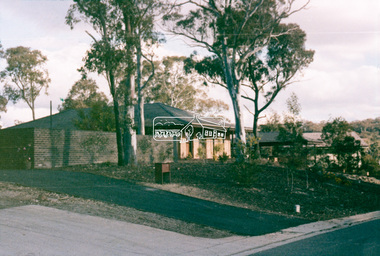
Slide - Photograph, Unidentified location, Eltham district, c.1990
... Roads ...35mm colour positive transparency Mount - Blank Cardhouses, infrastructure, residential, roads, streets -
 Eltham District Historical Society Inc
Slide - Photograph, Unidentified location, Eltham district, c.1990
... Roads ...35mm colour positive transparency Mount - Blank Cardhouses, infrastructure, residential, roads, streets -
 Eltham District Historical Society Inc
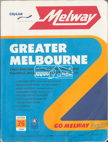
Book, Melway Greater Melbourne street directory : including Geelong, Phillip Island, Healesville, Bellarine & Mornington Peninsulas; Edition 26, 1999, 1999
... streets ...Street directory with plastic cover, coloured maps, 772 pages 28 cm x 21.5 cm 1998streets, roads, melbourne, maps, melway -
 Eltham District Historical Society Inc
Book, Melway Publishing, Melway Greater Melbourne street directory : including Geelong, Phillip Island, Healesville, Bellarine & Mornington Peninsulas, 2002
... streets ...Edition 29. Coloured detailed maps accessed by a street or location index. Cover: 20 additional pages of new maps, extended coverage of Bellarine Peninsula, further coverage of Werribee South, Public Transport Information, latest official suburb boundaries, CBD "hook turn" intersections map, over 1200 new streets, 1 atlas (24, 886 p.) : col. maps ; ISSN 03113957streets, roads, melbourne, maps, melway -
 Hume City Civic Collection
Print - Street Directory, Gregory"s Melbourne Street Directory, c1972
... Streets ...This street directory was published by Gregory's Guides & Maps Pty Ltd of 142 Clarence Street, Sydney NSW in c1972. It was used by the donor's family for many years to navigate their way around Melbourne and the metropolitan area. A street directory enclosed in a black leather detachable cover with gold embossing of a car on the front cover.Gold embossed vintage car on front of detachable cover.joan houston, streets, roads, maps, street directory -
Whitehorse Historical Society Inc.
Map, City of Whitehorse, 1/03/1995 12:00:00 AM
Map showing streets of the City of Whitehorse from Mullum Mullum Creek to the north to Highbury Road and Warrigal Road in the west, to Heatherdale Road in the east.Map showing streets of the City of Whitehorse from Mullum Mullum Creek to the north to Highbury Road and Warrigal Road in the west, to Heatherdale Road in the east. Prep. by Richard Meloni. Scale 1:15,000Map showing streets of the City of Whitehorse from Mullum Mullum Creek to the north to Highbury Road and Warrigal Road in the west, to Heatherdale Road in the east. city of whitehorse, mullum mullum creek -
 Whitehorse Historical Society Inc.
Photograph, Narmara Primary School, 13/01/1994 12:00:00 AM
Coloured photo of Narmara Primary School, Namara Street, looking North. School on North side of Highbury Road, between Middleborough Road and Blackburn Road. Since demolished and site developed for housing.narmara primary school, warner, philip -
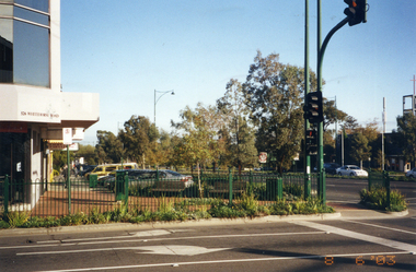
 Ringwood and District Historical Society
Photograph, Composite Aerial Views of Ringwood, Victoria - 1972
Two composite black & white aerial photographs with north-facing view over Maroondah Highway, including Railway Station precinct, Civic Centre precinct, Eastland, Mount Dandenong Road, Bedford Road, Ringwood Street, Warrandyte Road, Mullum Road, Loughnan's Road.Department of Crown Lands and Survey. Maroondah Highway Project - Run 3 - 20.1.72 - 3,900' ASL. -
 Surrey Hills Historical Society Collection
Photograph, 215 Union Road, c 1920
The house was variously known as ‘Mintaro’, ‘Montiere’ and ‘Goonoo Goonoo’, the later after 1920 when it was purchased by Natale Cerini and his wife Ethel May (nee Swan), who were married in 1918. Built 1887-1888 by William Wigley. The original colour was deep cream with dark green trim. Property included a block of land on south side and also land to the north. The original coach house was on what became 213 Union Road and was used to build a yacht in by the then neighbours, the Flemings. The street plane trees were replaced in the 1970s with melaleucas and in 1987 new plane trees were planted between the melaleucas. Sepia copy of an older photo of 215 Union Road from diagonally across the road. Shows street surface, bluestone kerbing, a young tree within a guard and a Victorian style home with 3 chimneys, a slate roof and a veranda on at least the south and west side. Beyond the house are mature cypress and other trees and a spire. The spire belonged to Surrey College, a boys' boarding school (later Nethercourt Hospital and St Judes.)'mintaro', 'montiere', 'goonoo goonoo', william wigley, mrs ethel may cerini, miss ethel may swan, miss jocelyn cerini, mrs jocelyn hall, miss lynette cerini, victorian style, 215 union road -
 Marysville & District Historical Society
Photograph (Item) - Colour photograph, Travel Victoria, Unknown
A colour photograph of Murchison Street in Marysville in Victoria.A colour photograph of Murchison Street in Marysville in Victoria. Photograph shows the Marysville Police station which, along with most of the buildings along Murchison Street, was destroyed in the 2009 Black Saturday bushfires.murchison street, pack road, marysville, victoria, marysville police station, marysville country bakery, photograph, 2009 black saturday bushfires -
 Eltham District Historical Society Inc
Photograph, Brougham Street, Eltham, early 1980s, 1980c
Colour photograph from 32 Brougham Street, prior to surfacing of the road in the early 1980seltham, brougham street -
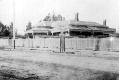
 Eltham District Historical Society Inc
Photograph, Hugh Fisher, The Old Bakery and House, York Street and Main Road, Eltham
Black and white photograph of the Old Bakery and house at the corner of York Street and Main RoadB350eltham, bakery, buildings, york street, main road -
 Glen Eira Historical Society
Album - Album page, Normanby Road, Circa 1972
This photograph is part of the Caulfield Historical Album 1972. This album was created in approximately 1972 as part of a project by the Caulfield Historical Society to assist in identifying buildings worthy of preservation. The album is related to a Survey the Caulfield Historical Society developed in collaboration with the National Trust of Australia (Victoria) and Caulfield City Council to identify historic buildings within the City of Caulfield that warranted the protection of a National Trust Classification. Principal photographer thought to be Trevor Hart, member of Caulfield Historical Society. Most photographs were taken between 1966-1972 with a small number of photographs being older and from unknown sources. All photographs are black and white except where stated, with 386 photographs over 198 pages. From: Glen Eira Heritage Management Plan (1996) - Vol 2 by Andrew Ward and Associates The widening of Dandenong Road during the late 1980's has resulted in the destruction of the houses in the path of the roadworks and the construction of a high fence serving as a visual barrier between that thoroughfare and the remaining houses. Where comparatively large villas once stood on spacious allotments, only "Wisteria" survives at No. 135 Normanby Road. Adopting forms and timber enrichment characteristic of the American Queen Anne style, it has this in common with the largely reconstructed timber villa at no. 11 Normanby Avenue and to a lesser extent, 746 Inkerman Road. Normanby Road retains its comparatively opulent Edwardian character in a mature landscaped setting with spacious gardens and mature planes parallel with the railway reserve which, on account of the low lying ground in its vicinity has a high embankment commencing on the alignment of Malvern Grove and continuing to Caulfield Station. The earliest villas are Edwardian. Page 148 of Photograph Album with one landscape photograph of a house on Normanby Road (not Street).Handwritten: Normanby St [top right] / 148 [bottom right]trevor hart, verandah, porch, bull nosed verandah, tower house, tower, stone fence, normanby road, wisteria, american queen anne style, queen anne style, 1890's, mayfield grove, normanby street, timber houses, caulfield north, house names, edwardian, edwardian style, gardens -
Federation University Historical Collection
Map, Robinson's Ballarat Street Map, c1972, 1970s
A coloured fold-out street map of Ballarat. It also includes a district road map.ballarat, map, ballarat streets -
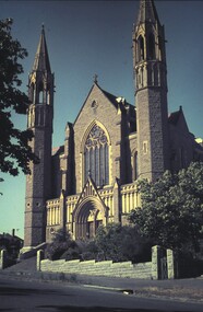 Bendigo Historical Society Inc.
Slide - VAL DENSWORTH COLLECTION: SACRED HEART CATHEDRAL,BENDIGO, 1966
Slide. Sacred Heart Cathedral,Bendigo. A view from across the road in Wattle Street.slide, bendigo, sacred heart cathedral, bendigo., sacred heart cathedral, bendigo. -
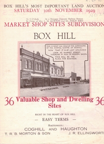 Whitehorse Historical Society Inc.
Document, Market Shop Sites subdivision, 20/11/1929 12:00:00 AM
5 pages describing sale of land in Whitehorse Road,5 pages describing sale of land in Whitehorse Road, Market Street, Box Hill5 pages describing sale of land in Whitehorse Road,land subdivision, market street, box hill, coghill & haughton, t.r.b. morton & son, ellingworth, john roger -
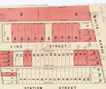 Whitehorse Historical Society Inc.
Document, Plan of Blackburn
Copy of plan of Blackburn areaCopy of plan of Blackburn area bounded by Whitehorse Road, Station Street and Railway ParadeCopy of plan of Blackburn arealand subdivision, blackburn, whitehorse road, station street, railway road, vine street -
Whitehorse Historical Society Inc.
Map, City of Nunawading, 1980?
Map of the City of Nunawading showing streets to south of Burwood Highway and east of Springvale Road.Map of the City of Nunawading showing streets to south of Burwood Highway and east of Springvale Road.Map of the City of Nunawading showing streets to south of Burwood Highway and east of Springvale Road.city of nunawading, historical -
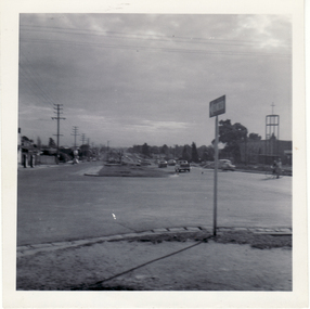 Whitehorse Historical Society Inc.
Photograph, Corner of Station Street and Whitehorse Road, Mitcham, 1962
Black and white photo of Corner of Station Street and Whitehorse Road, Mitcham. Looking West.station street mitcham, whitehorse road mitcham -
 Whitehorse Historical Society Inc.
Photograph, Whitehorse Road, Mitcham
Coloured photo of the corner of Whitehorse Road and Station Street, looking west; taken 2003whitehorse road, mitcham