Showing 10763 items
matching sites
-
 Ballarat Heritage Services
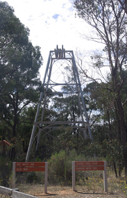
Photograph - Colour, Red, White and Blue Mine near Maldon, 2017, 17/10/2017
The Red, White and Blue mine is a site of historical, areaological and scientific importance to Victoria, and is listed on the Victorian Heritage Register of significant heritage places. It was also known as the Golden Age Mine and as Malney's Red, White and Blue Mine. Colour photograph of the Red, White and Blue historic mine site in the Muckleford State Forest, showing an intact poppet head with tubular steel legs, winding wheels and remains of timberwork.red, white and blue mine, maldon, golden age mine, maloney's red, white and blue, muckleford state forest -
 Glenelg Shire Council Cultural Collection
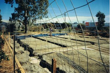
Slide - Slide - Cashmore Airport, Portland, 1980s
Coloured slide. Runway construction site. Earthmoving equipment back right, site buildings back left.portland airport, cashmore airport, construction site, runway, engineering -
 Bendigo Historical Society Inc.
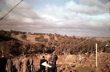
Slide - DAVID MCDONALD COLLECTION: EPPALOCK. CONSTRUCTION, c1960
Eppalock. Construction. Adults looking over the site of Lake Eppalock. Markings: Eppalock Dam Site 1960kodakcivil engineering, water supply, eppalock -
 Bendigo Historical Society Inc.
Photograph - CASTLEMAINE GAS COMPANY COLLECTION: BUILDING SITE
Building Site Date and Location Unknown - building with Coca Cola Sign in the Background, Man walking on siteFujicolorbuildings, commercial, gas and fuel -
 The Beechworth Burke Museum
Photograph, 1907-8
The photo from 1907-8 is a sepia print, depicting a small valley with building at base. There are flumes visible above areas of water, trees on hills and a few small cottages on the hillside. Cock's Pioneer Gold & Tin Sluicing Co NZ No 2 Site. The photo was taken of Matthews Gully looking west. Sluicing was undertaken in the area from 1900 to 1942 with some short breaks between these periods. The image depicts a location mined by Cocks Pioneer Gold and Tin Sluicing Company (as recorded on the annotation on the card mount) The Cocks Pioneer Gold and Tin Mines N.L was one of El Dorado's two largest open cut sluicing mines of the 20th Century. The other was named the Cocks El Dorado Gold Dredging Company. The Cocks Pioneer Mines operated from 1901 until 1941 and found a total of 117,378 ounces of Gold and 1,673 tones of tin concentrates over these years. The Cocks company was formed in 1898 and operated until 1941. Open cut sluicing involved the use of high-powered hoses which used the centrifugal sand pump system (known as hydraulic sluicing) which broke down the soil which was then processed for gold and other precious metals. From 1914 , four years after this image was captured, the company reformed to Cocks Pioneer Gold and Tin Mines NL (previously it was known as Cocks Pioneer Sluicing Co) and undertook large scale sluicing operations until 1929 and then 1934-1941. El Dorado is located on Reedy Creek and is surrounded by forested country to the north and east. It is 20 km east of Wangaratta in Victoria's regional north-east. John Cock was the son of a Cornish minor who arrived in El Dorado in 1858. Cock founded his gold and tin mining company which ran successfully for many years in the El Dorado region. It was an open cut sluicing company because of the abandonment of underground mining after this was deemed too dangerous. In 1935 Cock's El Dorado Company commissioned the floating dredge which is still visible in El Dorado today. The dredge was built by the Thompson engineering works, Castlemaine, and weighed over 2,000 tones and today has a place on the Victorian Registers of historic buildings. Interestingly, the name El Dorado does not derive from the gold in the region, but from the Barambogie pastoral run completed by William Baker in 1840-1841. Gold was discovered in El Dorado 1854 but the gold was too deep for individual prospectors to find, it required the use of heavy machinery.The search for gold is ingrained into the history of Victoria and therefore, images like this one which portray an open cut sluicing site can reveal important information for society and technology for the date when the photograph was taken. This image is of important historical significance for its ability to convey information about sluicing and the methods used to find gold in 1910. It also shows a location where sluicing was undertook which provides insight into the impact of sluicing on the environment at a time when it was done. This image is important for current research into the history of El Dorado, a small regional location near Wangaratta in Victoria's North East. Therefore, this image has the capacity to be beneficial for research into society and the motivations of those living and working in this region during this period and therefore, has social significance. The Beechworth Burke Museum has additional images relating to gold sluicing and El Dorado which can be analysed and studied alongside images like this one.Sepia coloured rectangle photograph printed on gloss photographic paper Reverse: 1997. 2613/ A02613/ No2 site/ Matthews Gully/ Cocks Pioneer G&T. ?? Co NZ/ No2 Site looking West/ 1907-8/ (7)sluicing, hydraulic sluicing, 1907, 1908, mining, cock's pioneer gold & tin sluicing co nz, nz, site no 2, matthews gully, west, valley, building, cottages, hillside, trees, water, gold and tin mine -
Port Melbourne Historical & Preservation Society
Plan - Multi-unit development, 164 Ingles Street, Port Melbourne, Site Plan 164 Ingles Street, 2015
Site plan for multi unit development. 164 Ingles St, Port Melbourne 2015-2016 A3 sheet black and white printing On the site of Symex, J KItchen &Sons factory sitebuilt environment - domestic, woodruff street development pty ltd, canny building pty ltd, j kitchen & sons pty ltd, symex holdings ltd -
 City of Moorabbin Historical Society (Operating the Box Cottage Museum)
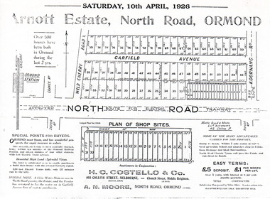
Flyer - Arnott Estate, North Road, Ormond
At the end of World War One, there was a renewed interest in residential land and a number of estates opened up in the Municipality of Moorabbin.Example of the progress of the Municipality of MoorabbinPhotocopy of Advertising flyer for auction of real estate sales - plan of building blocks for saleArnott Estate, North Road, Ormond. Auction Satire 10 April 1926 - 42 home sites & 20 shop sitesnorth road, ormond, real estate, auctions, garfield avenue -
 Bendigo Military Museum
Memorabilia - TAPE RECORDER, 1960’s
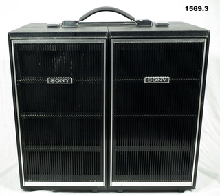
The item was purchased at a PX store in South vietnam during the warSony Tape Recorder .1) Reel to reel tape recorder with two dismountable speakers attached with clips and open hinges in nickle plated metal. Two reels and tape on tape deck. Exterior of case covered in black leatherette. .2) .3) Speaker dismountable - exterior of speakers covered in black leatherette, with silver coloured plastic trim.Various sites on unit - "Sony Stereo Tapecorder"personal effects, communications, radio, tap recorder -
 Ringwood and District Historical Society
Photograph, Ringwood black and white photographs - Maroondah Hwy. Old Town Hall site
Black and white photographMaroondah Hwy. Old Town Hall site -
 City of Moorabbin Historical Society (Operating the Box Cottage Museum)
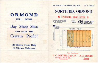
Flyer - North Road, Ormond - H. C. Costello & Co A. N. Moore, 1923
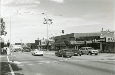
The train line from the city to Frankston was electrified which intensified the sale in the municipality of Moorabbin, particularly land which was in the vicinity of the railway stations.Example of the progress of the Municipality of MoorabbinAdvertising flyer for auction of real estate sales - plan of building blocks for shops for saleNorth Road, Ormond - 8 shop sitesnorth road, ormond, real estate, auctions -
 Kew Historical Society Inc
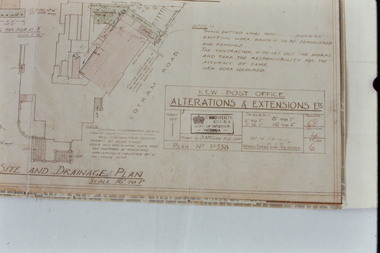
Slide - Architectural Drawing, Kew Public Offices, 1887
A civic campaign for new public offices developed in Kew in the 1880s. After much deliberation, the location chosen was the junction of Bulleen and Cotham Roads. The buildings were designed by George Watson and John Henry Harvey, architects within the Department of Public Works (Victoria). Building was commenced in 1887, and after one year, the buildings were opened. The Post Office was transferred to the new Commonwealth Government in 1901. The Police Station and Court House, sold by the Victorian Government to the City of Boroondara in 2007, are now a community cultural centre and performing arts venue.The buildings were listed on the Victorian Heritage Register Register (HO885) in 1991. They are historically and architecturally significant to the State Of Victoria because Watson and Harvey's designs exhibit diversity in integrating civil offices, they accommodate the apex of road junctions, and they demonstrate a departure from the contemporaneously favoured High Victorian Classical to the Queen Anne style in the design of civic buildings. 35mm colour transparency of an original plan by George Watson and John Henry Harvey, architects of the Department of Public Works (Victoria), in 1887 for New Public Offices at Kew. This plan was copied by the donor from an original held at the Commonwealth Archives in Brighton (Vic). The copy was made to illustrate a report that the donor made on ‘The functional planning design, building materials and construction methods of the Kew Post Office’ as part of course work at RMIT.SITE AND DRAINAGE PLAN / SCALE 16' TO 1"kew court house, kew police station, kew post office, architectural drawings, khs - slides, new public offices -- kew (vic.), architecture — queen anne style -
 Greensborough Historical Society
Booklet and article, Diamond Valley Local History Tour 2019, by Yarra Plenty Regional Library, 22/10/2019
Cover article written by Rosie Bray. In addition to YPRL booklets which have a brief history of each site visited, there are leaflets on Anglican parish of Diamond Creek; Nillumbik Cemetery; Ellis Cottage; Greensborough Cemetery and Sutherland Homes for ChildrenBooklet (2 copies) containing a brief history of sites visited on the Library's Diamond Valley Tour 2019, with 21 p. of supplementary information by various writers and 6 photographs taken on the tour.diamond valley, yarra plenty regional library, sutherland homes, st katherines church st helena, andrew yandell reserve, greensborough rsl, greensborough war memorial park, greensborough cemetery -
 Ballarat Heritage Services
Photograph - Colour, Sign Explaining toilets, Old Sarum, England, English Heritage Site, 01/11/2016
William the Conqueror inherited Old Sarum from the last Saxon king of England. It was an ideal site for a royal castle. It was here in 1070 that William paid off his army after a long and bitter campaign in northern England. It was here in 1086 that he called together all the major landholders in England so they could swear allegiance to him. It was a crucial moment. The Domesday Book was being written, a threatened Viking invasion had only just been averted and William's eldest son was in armed rebellion. Old Sarum was an important place where this Norman king of England held power. In 1794 the Ordnance Survey set out to check the accuracy of the first mapping of Southern England, which had begun ten years earlier. From a point just below Old Sarum Lieutenant William Mudge laid out a base-line 36,574 feet (11,253 metres) long. From each end of the line the positions of distant places were plotted using a huge theodolite made in 1791 by Jesse Ramsden. The accuracy of the process, which was repeated all over England, depended on Jesse Ramsden's craftsmanship and on William Mudge's surveying skill in setting out this first base-line from Old Sarum. The nearer end of Mudge's line is marked by an inscribed stone beside the modern A345 at Old Sarum. Colour photograph of a sign explaining toilets at Old Sarum, English Heritage Siteordnance survey, william mudge, jesse ramsden, william the conqueror, old sarum, saxon, 1086,, england -
 Ballarat Heritage Services
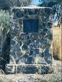
Photograph - Photograph - Colour, Clare Gervasoni, Edward Stone Parker Memorial, Franklinford, 25/10/2015
Franklinford is in the 'shadow' of Mt Franklin, the site of Edward Stone Parker's Aboriginal Protectorate.Photograph of a stone memorial cairn to Edward Stone Parker, Protector of Aborigines. "Edward Stone Parker 1802-1865 Regional Pioneer, Protector of Aborigines Established the Loddon Aboriginal Station Homestead, Church and School near this site in 1841. His devoted service remains a challenge and an Inspiration. April 1965."edward stone parker, protector of aboriginies, aboriginal protectorate, loddon aboriginal protectorate, franklinford aboriginal protectorate, franklinford -
 Bendigo Historical Society Inc.
Book - ADELAIDE NEW MOON MINE GARDEN GULLY REEF WOODVALE TO ULSTER UNITED MINE SITE, WOODVALE, 1992
Book 2 - Site 9.1, Adelaide New Moon Mine site, Garden Gully Reef, Woodvale to site 9.27, Ulster United Mine Site, Garden Gully Reef, Woodvale. Book contains details of significance reports prepared for North Central Goldfields Project: Bendigo Goldfield.David Bannearbendigo, mining, goldfields report, bendigo, goldfields, gold, mining, reports, history -
 Port Melbourne Historical & Preservation Society
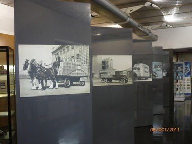
Photograph - Pental/Symex Museum, Woodruff Street, Port Melbourne, Oct 2011
The pictures were taken in October 2011 by PMHPS members and in February 2013 the contents of the museum were given to PMHPS for safekeeping prior to the closure of the site.Pictures taken inside the Pental/Symex museum in Woodruff St building. Displaying historical items and photos of interest in relation to the activities of J Kitchen & Sons on this site. (.01) some of the display boards within the museum (.02) a framed aerial photographic view of the site (.03) Ledgers, photographs, trophies (.04) bench with books, photos, candlesticks (.05) framed aerial view of the site plus other photos and ledgers (.06) full wall and bench of display (.07) Horse drwan cart of Velvet soap - one of the display boards mentioned in .01 (.08) Open truck loaded with Velvet soap - one of the display boards mentioned in .01 (.09) Framed photo of Candle Room - one of the display boards mentioned in .01 (.10) Velvet Soap truck, enclsed van - one of the display boards mentioned in .01built environment - industrial, business and traders - soaps/candles, j kitchen & sons pty ltd, pental products pty ltd, symex holdings ltd -
![Congregational Church, Walpole Street [Kew], 1977](/media/collectors/550653872162f11fb04854aa/items/58ce3037d0ce2f09d89eafac/item-media/58cf5d86d0ce9a3314909edb/item-fit-380x285.jpg) Kew Historical Society Inc
Kew Historical Society IncPhotograph, Unknown, Congregational Church, Walpole Street, 1977
The Congregational Church was built on the site of the first church in Kew. This church, the second on the site, was designed by the Kew architect Charles Vickers and opened in 1860. The distinctive polychrome brick façade designed by Vickers contrasted with the style that he employed for other churches he designed during this period; they were usually constructed in bluestone. In the 1960s, a new ministry saw the erection of a neon cross at the apex of the church. The illuminated cross could be seen from Church Street, Hawthorn. The church was later to be demolished, and the land sold for the construction of modern villas. Photograph of an historic church in Kew by noted architects Charles Vickers and Alfred Purchas.Congregational Church, Walpole Street, Kew, 1977 (now demolished). View of the polychrome facade facing Walpole Street. The use of polychrome brick by Alfred Purchas (the second architect) reflects his preference for this architectural style, such as in his design for Tarring (now Ruyton Girls' School)Inscriptions on reverse: "KH-100. Congregational Church Walpole St Kew. First church built in Kew 1860. Chapel on site 1854. Became a member of the United Churches 1970s". congregational church, walpole street (kew), charles vickers -
Whitehorse Historical Society Inc.
Article, Housing 'Monster' surprise, 2015
Whitehorse Council voted to approve a 118-dwelling development by Australia Hua Cheng Pty Ltd, Blackburn.Whitehorse Council voted to approve a 118-dwelling development by Australia Hua Cheng Pty Ltd, Blackburn, on the corner of Middleborough Road made up of two five-storey buildings and 15 double-storey buildings on the 7421 sm site.Whitehorse Council voted to approve a 118-dwelling development by Australia Hua Cheng Pty Ltd, Blackburn. city of whitehorse, massoud, denise, australia hua cheng pty ltd -
Port Melbourne Historical & Preservation Society
Photograph - J Kitchen & Sons perimeter survey, from North Port Oval, Dec 2013
As the former j Kitchen & Sons site was being cleared, Lionel Layfield, who had worked at the site for many years undertook several pictorial perimeter surveys. These photos were taken in Dec 2013.Series 1 of colour photographs taken by Lionel Layfield as he walked around the perimeter of the J Kitchen & Sons Pty Ltd factory site during the early demolition of most of the buildings. .55-.60 - panorama looking towards Kitchens (city views behind) from Port Melbourne football groundindustry - manufacturing, built environment - industrial, business and traders - soaps/candles, j kitchen & sons pty ltd, symex holdings ltd, north port oval, port melbourne cricket and football oval -
 Running Rabbits Military Museum operated by the Upwey Belgrave RSL Sub Branch
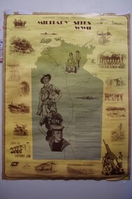
Poster
Norther Territory Military sitesposter, ww2, general -
 Bendigo Historical Society Inc.
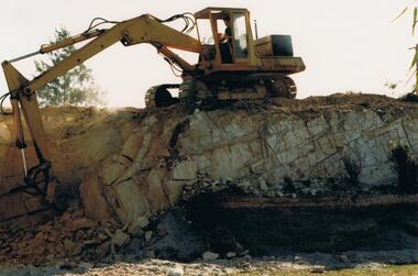
Photograph - GOLDEN SQUARE HIGH SCHOOL COLLECTION: PREPARATION OF THE SITE
Photographs showing the preparation of the site.education, secondary, golden square -
 Bendigo Historical Society Inc.
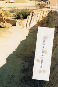
Photograph - GOLDEN SQUARE HIGH SCHOOL COLLECTION: PREPARATION OF THE SITE
Photographs showing the preparation of the site.education, secondary, golden square -
University of Melbourne, Burnley Campus Archives
Plan, BSL Rear Court 66 Brunswick St Fitzroy, 1980-1990
Tracing paper site plan.fitzroy, planning -
 Ballarat Heritage Services
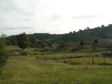
Photograph - Photograph - Colour, Agitation Hill, Chewton, 2011, 2011
The site of goldfields agitation at Chewton.chewton, goldfields reform league, agitation -
 Bendigo Historical Society Inc.
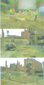
Photograph - FOREST STREET BUILDING SITE, ARCHAEOLOGICAL STUDY 2009
Copy of three colour images of demolition of building site in Forest Street in 2009/. Images show cleared site, workmen and women on site inspecting surface area prior to archaeological study being undertaken.buildings, commercial, forest street, forest street, archaeology -
Whitehorse Historical Society Inc.
Article, Kilns Inspected, 1994
Printedd Article in Nunawading Gazette.Article in Nunawading Gazette, Historic Buildings Council believes the old Kilns and Chimneys on the Monier site in Mitcham Road are of State significance and should be retained, but the Company has appealed to Mr. MacLellan to allow them to demolish.Printedd Article in Nunawading Gazette.pottery kilns, monier limited, historic buildings council -
Whitehorse Historical Society Inc.
Map, Site for Wesleyan Church, Nunawading, 1855
Photocopy of manuscript map showing names of landholders.Photocopy of manuscript map showing names of landholders. Note on verso: Plan of allotments in the City of Melbourne appropriated to the Wesleyans. Site for Wesleyan Church, Nunawading 1848 (Corner of Burwood and Elgar Roads - S of Burwood, W of Elgar)Photocopy of manuscript map showing names of landholders. churches, wesleyan church, burwood, burwood road, burwood, elgar road, burwood, maps -
Glenelg Shire Council Cultural Collection
Slide - Slide - Cashmore Airport, Portland, 1980s
Coloured slide. Run-way site. Several road-making vehicles. Clouds of dust. Cashmore airport construction site.portland airport, cashmore airport, air travel, engineering, construction -
Whitehorse Historical Society Inc.
Document, Auction Notice, c1955
Auction notice for 7 shop sites and 12 home sites in the Mount Vista Estate in Mount Pleasant Road, Nunawading.Auction notice for 7 shop sites and 12 home sites in the Mount Vista Estate in Mount Pleasant Road, Nunawading.Auction notice for 7 shop sites and 12 home sites in the Mount Vista Estate in Mount Pleasant Road, Nunawading.mount vista estate, auctions, land subdivision, mount pleasant road, nunawading, lorikeet street, nunawading -
 Lakes Entrance Historical Society
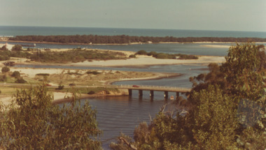
Photograph - North Arm Bridge, road to Bullock Island, build up of sand spit later site for Fishing Club and boat ramp, Lakes Entrance Victoria, G W Holding, North Arm Bridge, Lakes Entrance Victoria, 1/04/1979 12:00:00 AM
North Arm Bridge, road to Bullock Island, build up of sand spit later site for Fishing Club and boat ramp, Lakes Entrance Victoria. Taken during the King of the Straits eventColour photograph taken from Kalimna Heights showing North Arm Bridge, road to Bullock Island, build up of sand spit later site for Fishing Club and boat ramp, Lakes Entrance Victoriajetties, waterways, events, gippsland lakes