Showing 3705 items
matching landscaping
-
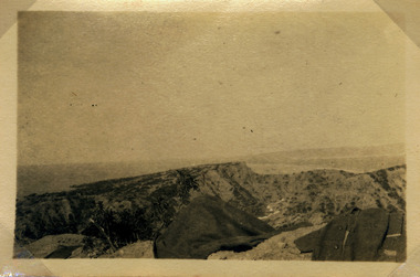
 Magnet Galleries Melbourne Inc
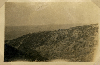
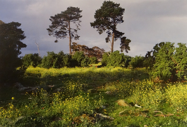
landscape view, red cliffs military 00010.tif
photoww1, world war 1, landscape view -
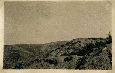
 Magnet Galleries Melbourne Inc
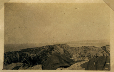
landscape view, red cliffs military 00011.tif
ww1, world war 1, landscape view -
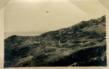
 Magnet Galleries Melbourne Inc
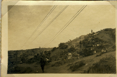
soldiers in landscape view, red cliffs military00012.tif
photo ww1, world war 1, landscape view, soldiers -
 Magnet Galleries Melbourne Inc
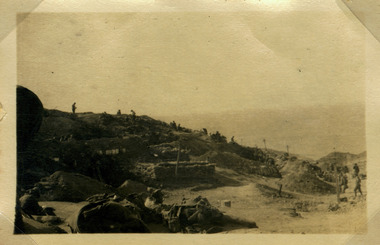
soldiers in landscape view, red cliffs military00013.tif
photolandscape view, ww1, soldiers, ww1, world war 1, aif, a.i.f -
 Magnet Galleries Melbourne Inc
view of country side
photoww1, world war 1, landscape, country views -
 Magnet Galleries Melbourne Inc
view of country side
ww1, world war 1, landscape, country views -
 Magnet Galleries Melbourne Inc
view of country side
photoww1, world war 1, country views, landscape -
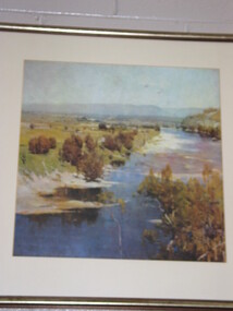
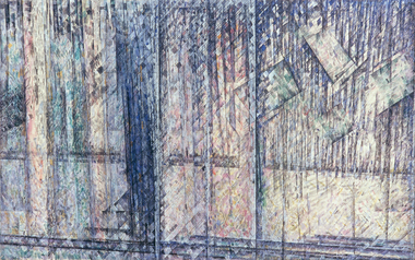
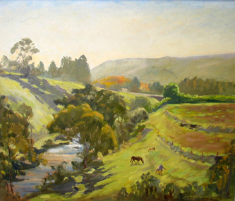 Brimbank City Council Art Collection
Painting, Maribyrnong River from Horseshoe Bend Road, Keilor, 1977
Local SceneImpressionistic view of valley with a creek running through it. Three horses in the foreground - AR0064Information about the artist on the back. "James Farrell is a member of the Victorian Artists Society" and "is represented at the Australian War Memorial, Canberra".keilor, maribyrnong, river, painting, impressionist, landscape -
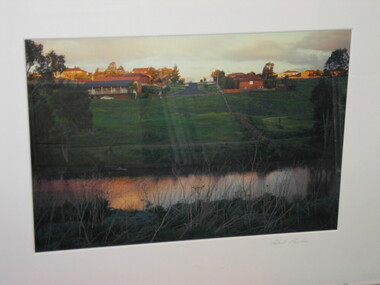
 Brimbank City Council Art Collection
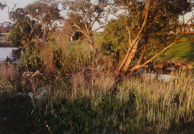
Photograph, Robert Pointon, Twin Pines, 1988
Local LandscapeEast of Fairbiarn Road, South Sunshine, looking east - AR0002landscape, photograph -
 Brimbank City Council Art Collection
Photograph, Kororoit Creek, Opposite Deer Park Hotel, 1994
Local LandscapeOpposite Deer Park Hotel, West Side Kororoit Creek looking East AR0108photograph, landscape -
 Brimbank City Council Art Collection
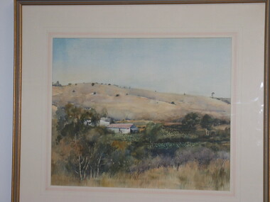
Painting, Summer Keilor, 1989
Local Scene, Market Garden landscapeSummer Keilor. Watercolour, 39 x 48cm -
 Brimbank City Council Art Collection
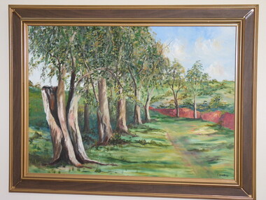
Painting, F Disch, Trees in a landscape
Oil on Board -
 Brimbank City Council Art Collection
Off-Set Lithograph, River Landscape
Off-set Lithograph -
 Brimbank City Council Art Collection
Colour Photograph, Robert Pointon, Autumnal landscape, circa 1994
Local SceneColour photograph -
 Brimbank City Council Art Collection
Photograph - Colour Photograph, Landscape, Unknown
UnknownPointon, Robert, Landscape, n.d, Colour Photograph, Brimbank City Council Art Collection, BrimbankColour Photographlandscape -
 Brimbank City Council Art Collection
Colour Photograph, Robert Pointon, Landscape
Local scene (?)Colour Photograph -
 Geelong Gallery
Painting - Landscape, river and rain, MILLER, Godfrey, c1960
Oil on canvas -
 Geelong Gallery
Photograph - Factory landscapes, Eltham: Chequered Flag, ROONEY, Robert, 1977
Colour photograph -
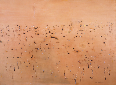 Geelong Gallery
Painting - Yellow landscape, WILLIAMS, Fred, 1968
Oil on canvas -
 Williamstown Botanic Gardens- Hobsons Bay City Council
Oral History_Williamstown Botanic Gardens_Shelley Wood, 25/09/2014
The interview is one of a series recorded in 2013-2014 to document memories and experiences of the Williamstown Botanic GardensA primary source of information on memories of the Gardens and witness to changes in the Gardens over those years. CD and transcript of interview with Shelley Wood. Shelley was born in Williamstown, as was her mother Margaret McLean. Shelley recalls her mother telling her about spending many hours in the Gardens when she was young with her friend Chic, who was the daughter of the Curator Ernie Anderson. Shelley, who was the first female gardener appointed in the western region, served her apprenticeship at Gardens and is currently the Curator. shelley wood, margaret mclean, tom wood, chic anderson, ernie anderson, 1979, apprentice, fish pond, pinetum, barry heath, golden elm, palms, brian turner, dean splatt, robert anderson, 1988, bicentennial funding, 1987, angela altair, helen page, mary klestadt, mike hirst, john hawker, landscape advisory group, williamstown technical school, gates, buffalo lawn, ian brown, storytime, adam lindsay gordon, statue, archie matthews, aviary, williamstown botanic gardens, hobsons bay city council -
 Beechworth Honey Archive
Publication, Mapping great change: the landscape of central Victoria. (Gill, Gerry and others). Bendigo, 2013, 2013
28 pages, illustrated. -
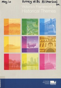 Surrey Hills Historical Society Collection
Book, Victoria's Framework of Historical Themes, 2010
"Highlights what is distinctive about Victoria and increases awareness and appreciation of the State's Heritage. Ensures heritage objects, places and events can be understood, assessed and presented within the context of a broad theme, rather than as singular items of interest" - publisher's website"Highlights what is distinctive about Victoria and increases awareness and appreciation of the State's Heritage. Ensures heritage objects, places and events can be understood, assessed and presented within the context of a broad theme, rather than as singular items of interest" - publisher's websitemigrants, environments, federation (1901), (mr) fletcher jones, land use, immigration, land transport objects, landscapes, landforms, cities and towns, law and order, groups, cultural events and activities -
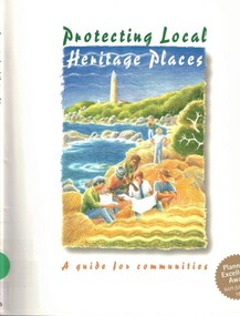 Surrey Hills Historical Society Collection
Book, Goanna Print, Canberra, Protecting Heritage Places : a guide for communities, 1999
This guide contains information to help individuals and groups working locally to identify, conserve and protect heritage places.This guide contains information to help individuals and groups working locally to identify, conserve and protect heritage places.conservation, heritage places, cultural property, historic sites, landscape protection -
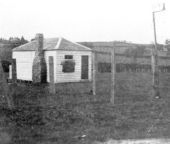 Surrey Hills Historical Society Collection
Photograph, The gate-keeper's shed, Surrey Hills Golf Club
Reproduced by permission of Mr John Arnold from his book: "The Riversdale Golf Club - a history, 1892-1977." Copyright to book: Riversdale Golf Club. Surrey Hills Golf Club operated from 1892-1908 then moved and became Riversdale Golf Club. The game was played across paddocks from Trafalgar Street, Mont Albert to Whitehorse Road and down Victoria Crescent to where Box Hill TAFE is now located in Elgar Road. There were problems with cows eating the tee flags! The clubhouse still exists as 30 Trafalgar Street.Apart from it association with the Surrey Hills Golf Club which is long gone, this image documents the landscape of pre-urban Surrey Hills.Black and white photo of a rectangular timber building with a slate hip roof and brick chimney on the LHS. The one visible window appears to be boarded up and has a door to its right. The building is fenced by posts and wire. A (?) street sign bearing the letters FLINT is at the right of the picture."The gate-keeper's shed was used as a clubhouse from 1895-1900."sports grounds, surrey hills golf club, riversdale golf club, timber building, john arnold -
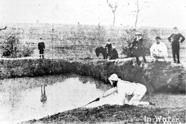 Surrey Hills Historical Society Collection
Photograph, Surrey Hills Golf Club water hazard, 1895, 1895
Reproduced by permission of Mr John Arnold from his book: "The Riversdale Golf Club - a history, 1892-1977." Copyright to book: Riversdale Golf Club. Surrey Hills Golf Club operated from 1892-1908 then moved and became Riversdale Golf Club. The game was played across paddocks from Trafalgar Street, Mont Albert to Whitehorse Road and down Victoria Crescent to where Box Hill TAFE is now located in Elgar Road. There were problems with cows eating the tee flags! The clubhouse still exists as 30 Trafalgar Street.Apart from its association in documenting the Surrey Hills Golf Club which has long disappeared, this image documents the landscape in the pre-urban era.Black and white photo of a scene at Surrey Hills Golf Club. There is a water hazard in the foreground with a lady on her knees trying to retrieve a ball from the water's edge. Three lads, one on a horse, are watching, as are 3 males to the right."In water" in the bottom right of the photo. Caption: "Captain Fred Andrew watches his partner's misfortunes during a game at Surrey Hills in 1895."sports grounds, surrey hills golf club, riversdale golf club -
 Surrey Hills Historical Society Collection
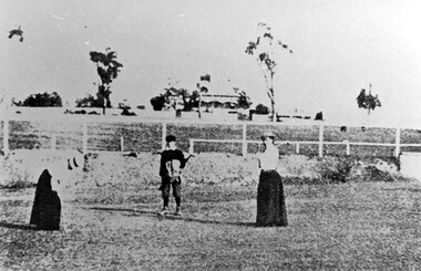
Photograph, Surrey Hills Golf Club eighth hole, 1902, 1902
Reproduced by permission of Mr John Arnold from his book: "The Riversdale Golf Club - a history, 1892-1977." Copyright to book: Riversdale Golf Club. Surrey Hills Golf Club operated from 1892-1908 then moved and became Riversdale Golf Club. The game was played across paddocks from Trafalgar Street, Mont Albert to Whitehorse Road and down Victoria Crescent to where Box Hill TAFE is now located in Elgar Road. There were problems with cows eating the tee flags! The clubhouse still exists as 30 Trafalgar Street. No 3 Beatty Street is in the background. The players are probably standing on what is now Zetland Road.This image is important not only for documentation of early sporting activities in the area but also for evidence of the pre-urban appearance of the landscape.Black and white photo with 2 ladies with golf clubs in the foreground and a lad (? caddy) with a golf bag under his arm. He is wearing a cap and 'plus fours'. The ladies are wearing long skirts, blouses and hats. Behind is a post-and-rail fence with a house and trees in the background.Caption: " Bottom: Putting out on the eighth hole, 1902."sports grounds, surrey hills golf club, riversdale golf club, clothing and dress, zetland road, surrey hills, john arnold -
 Surrey Hills Historical Society Collection
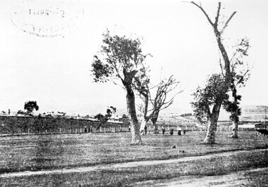
Photograph, Surrey Hills Golf Club - looking towards Doncaster, 1902, 1902
Reproduced by permission of Mr John Arnold from his book: "The Riversdale Golf Club - a history, 1892-1977." Copyright to book: Riversdale Golf Club. Surrey Hills Golf Club operated from 1892-1908 then moved and became Riversdale Golf Club. The game was played across paddocks from Trafalgar Street, Mont Albert to Whitehorse Road and down Victoria Crescent to where Box Hill TAFE is now located in Elgar Road. There were problems with cows eating the tee flags! The clubhouse still exists as 30 Trafalgar Street.This image is important for reference to the landscape and vegetation prior to urbanisation.Black and white photo in the foreground of which is a path running diagonally from left to right. Behind are 5 mature trees whose condition is not vigourous (showing signs of die-back). Several figures are beneath the trees, behind which is a post-and-wire fence, paddocks and distant houses. There is the shadow of a stamp in the top LH corner, suggestive of this having been copied from an earlier image.Caption: "Top: Looking towards Doncaster from the links in 1902."sports grounds, surrey hills golf club, riversdale golf club, john arnold -
 Surrey Hills Historical Society Collection
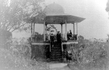
Photograph, John Gray Memorial Rotunda in Surrey gardens, Union Road, Surrey Hills, c 1925, c 1925
The rotunda was built in 1912 by Clarence Montgomery for the Surrey Hills Progress Association and the local community and dedicated to John Gray, "a highly respected and revered citizen". Surrey Hills Brass Band regularly gave concerts in the rotunda, provided music for regular 'loyal' celebrations and also for silent films held in the gardens. The rotunda was quite elevated off the ground due to the slope of the gardens and the bioscope was stored in the room underneath. This was later used as the infant welfare centre until the Progress Association built a dedicated facility for these purposes. The rotunda was demolished in 1972. Clarence Montgomery, carpenter, was living in Sunbury Crescent in 1914. By 1916 he had moved to 83 Croydon Road where he lived for the rest of his life. Clarence was born in 1869 in Taradale, son of John Montgomery and Jane Ford. He married Sarah Ann Ingram in Echuca in 1894. Their children were: 1. Annie (Mrs P Paynter) born Echuca in 1895 2. William Henry born Echuca in 1897 3. Christina Mary (Mrs F Meyers) born Echuca in 1898 4. Violet (Mrs G Ewing) born Echuca in 1902 5. Clarence George Ingram born Echuca in 1906 and died aged 7 months. Violet became a tailoress and Christina a dressmaker. William became a carpenter like his father. Sarah Ann Montgomery died at their home in June 1932 aged 62 years. Clarence died in August 1946 aged 77 years. They are buried in Box Hill Cemetery (P-EB-0020). John Gray was "actively associated with all movements for the benefit of neighbours and fellow citizens". [Quote from the official tribute on his death in 1909.] He was very active in the Surrey Hills Progress Association in the early 1900's. The rotunda built in the Surrey Gardens by the Progress Association in 1912 was dedicated to him. John Gray was born in 1861 in Eldorado. He died on 7 December 1909 in Surrey Hills and is buried in Box Hill Cemetery (M0472). He married Emma Beckett in 1888 at 'Guildford Villa' in Essex Road, the Beckett home. They are listed in both the 1903 and 1906 electoral rolls in Arundel Crescent; his occupation is given as bootmaker. The Alan Holt property register identifies this as 24 Arundel Crescent, known as 'Tumberumba'. John and Emma had a large family: (Gunner) John Robert Gray (1888, Surrey Hills - 21 June 1917, France) Benjamin Walter Gray (1890, Surrey Hills - 1949, Heidelberg) Herbert Harry Gray (1892, Surrey Hills - 1959, Queensland) William Beckett Gray (1897, Surrey Hills - 1899, Surrey Hills) Norman Douglas Gray (1901, Surrey Hills - 1947, Sydney) Evelyn Lizzie Gray (1906, Surrey Hills - 1983) Evelyn married Reginald Roberts and donated a number of photos to the collection. The donor Violet Ewing (nee Montgomery) was Clarence's daughter. She married George Isaac Henry Ewing (blacksmith) in 1934. They inherited the family home at 83 Croydon Road. Although constructed 5 years after their opening, this rotunda was a central feature of the Surrey Gardens which was planted to a design adapted from one suggested by the renowned landscape gardener and botanist William Robert Guilfoyle (1840-1912). Rotundas were a key feature of many late nineteenth and early twentieth century public parks. This particular rotunda was notable for the Chinoiserie influence reflected in its roof. Surrey Gardens are now regarded as one of the City of Boroondara's heritage gardens and this image is significant as evidence of the design of the rotunda which is no longer extant. It is also significant as evidence of the extent of the role of the Surrey Hills Progress Association in the provision of public facilities. A black and white photo of an octagonal rotunda situated within Surrey Gardens taken from the perspective of the main entrance. It is a largely wooden structure with a domed chinoiserie-style roof. The rotunda is enclosed by established gardens. There are 4 people in the photo, with 2 women standing on the steps at the rotunda's entrance. A man and a young person are seated within the rotunda. It has 8 support pillars, which are open with balustrades to 7 sides.rotundas, surrey gardens, union road, surrey hills progress association, surrey hills brass band, parks and reserves, 1925, john gray, clarence montgomery, box hill cemetery, cinema, john gray memorial rotunda, bandstands -
 Surrey Hills Historical Society Collection
Photograph, Grovedale Road Quarry in the 1920s - looking south, c1920
The quarry was part of John Butler Maling's property. He was one of the original settlers of the area and farmed the area between Weybridge Street and Whitehorse Road. Clay was quarried from part of this area and used to make the bricks used in the construction of his home, known as 'Ancyra'. This is still extant at the corner of Weybridge and James Streets. Maling grazed cows and used the quarry as a water source. He was the uncle of John Butler Maling, Mayor of Camberwell. He was married to Kate Conlon in 1882. They had 3 children: Silas Young, Alick and Zillah. Maling was born in c1829 in Shepreth, Cambridgeshire; he died in Surrey Hills on 9 October 1912 and is buried in Box Hill Cemetery - CE-*-0586. Mrs Kate Maling (born c1859 in Co Meath, Ireland) died at the property on 8 March 1921. She is buried in Brighton General Cemetery. Probate was valued at over 10,000 pounds and included other properties in Sandringham, Hawthorn and Macedon. At the time of her death the Surrey Hills property was described as being 23 acres with 2 brick houses, 1 cow, 2 heifers and 40 fowls or chickens. The property was subdivided after her death. The property was subdivided into 110 house blocks in c1923 - see Maling's Estate subdivision flyer on the State Library of Victoria's website. This shows that the Grovedale Park site had been acquired by Camberwell Council by this time. An attached newspaper clipping documents prices realised for a cross-section of blocks. The MMBW map of 1925, also on the SLV website, shows the outline of the clayhole / quarry. The quarry was filled in after several drownings or near drownings and the land is now occupied by a park and playground, known as Grovedale Road Park, maintained by the City of Boroondara. Beckett Park is sited on horizon to the left beyond the trees. This documents the landscape prior to close settlement and is material to early building and farming in the Surrey Hills area.Black and white photo of the quarry between Grovedale Road and James Street taken in the 1920s and looking south. In the foreground is an area of water with reeds in the LH corner. Beyond on the high banks there are single storey houses in the background and (?) some light poles. An object that looks like a tank on posts is in a cutting on the far bank.quarries, grovedale road, james street, clay quarries, farming, kate conlon, kate maling, john butler maling, ancyra -
 Surrey Hills Historical Society Collection
Photograph, Grovedale Road Quarry in the 1920s - looking north, c1920
The quarry was part of John Butler Maling's property. He was one of the original settlers of the area and farmed the area between Weybridge Street and Whitehorse Road. Clay was quarried from part of this area and used to make the bricks used in the construction of his home, known as 'Ancyra'. This is still extant at the corner of Weybridge and James Streets. Maling grazed cows and used the quarry as a water source. He was the uncle of John Butler Maling, Mayor of Camberwell. He was married to Kate Conlon in 1882. They had 3 children: Silas Young, Alick and Zillah. Maling was born in c1829 in Shepreth, Cambridgeshire; he died in Surrey Hills on 9 October 1912 and is buried in Box Hill Cemetery - CE-*-0586. Mrs Kate Maling (born c1859 in Co Meath, Ireland) died at the property on 8 March 1921. She is buried in Brighton General Cemetery. Probate was valued at over 10,000 pounds and included other properties in Sandringham, Hawthorn and Macedon. At the time of her death the Surrey Hills property was described as being 23 cres with 2 brick houses, 1 cow, 2 heifers and 40 fowls or chickens. The property was subdivided after her death. The quarry was filled in after several drownings or near drownings and the land is now occupied by a park and playground maintained by the City of Boroondara. Beckett Park is sited on horizon to the left beyond the trees. This documents the landscape prior to close settlement and is material to early building and farming in the Surrey Hills area.Black and white photo of the quarry between Grovedale Road and James Street taken in the 1920s and looking north. In the foreground is an area of water with high banks dividing the horizontal centre. Beyond are paddocks and trees behind which is a row of at least 3 single-storey houses. Light poles can be seen along a distant street. There are many mature trees in the background. The houses and trees are positioned along Whitehorse Road in the vicinity of Westminster Street. Shadows indicate the photo was taken in early morning or evening.quarries, grovedale road, james street, surrey hills, balwyn, clay quarries, ancyra, kate conlon, kate maling, john butler maling, farming