Showing 34680 items matching "1980's"
-
 Orbost & District Historical Society
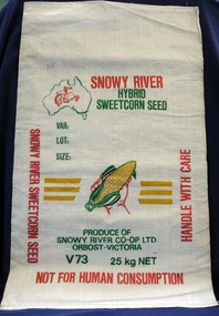
seed bag
This unused bag would have been used by Snowy River Co-Op Ltd to pack sweet corn in the late 1960's -1980's Snowy River Seeds started life as a farmers' co-operative (Snowy River Co-op) in 1967 specialising in horticulture. Snowy River Co-op were the original creators of Snowy Seeds.This item is significant because it was specially made for the seed bean industry which is a major industry in the Orbost district.A white synthetic woven fibre bag used to pack sweet corn prior to sale. It has red, green, yellow print.On front of bag - Logo of Man From Snowy River in outline map of Australia with a hand holding corn cob in the centre, Produce of Snowy River Co-Op Ltd Orbost- Victoria V73 25kg NETsweet-corn seed-bags snowy-river-co-op -
 Hume City Civic Collection
Sticker, Shire of Bulla
This adhesive sticker with Shire of Bulla Sunbury printed on it along with City Living/Country Style a slogan used by the Shire in the 1980's to early 1990's. They were used to stick on any type of flat surface to help promote the area within the Shire of Bulla especially Sunbury.This is a rectangle shape adhesive sticker promoting the Shire of Bulla.Shire of Bulla/City Living/Country Styleshire of bulla, councils, advertising -
 Eltham District Historical Society Inc
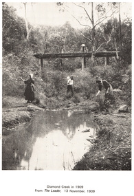
Work on paper (Sub-Item) - Photograph, Diamond Creek in 1909
People along the Diamond Creek, probably at Eltham with wooden bridge in backgrounddiamond creek, bridge -
 Eltham District Historical Society Inc
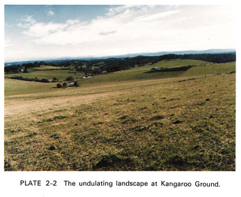
Work on paper (Sub-Item) - Photograph, The undulating landscape at Kangaroo Ground
kangaroo ground -
 Eltham District Historical Society Inc
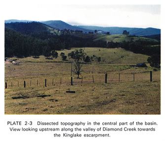
Work on paper (Sub-Item) - Photograph, Dissected topography in the central part of the Diamond Creek basin. View looking upstream along the valley of Diamond Creek towards the Kinglake escarpment
kinglake, escarpment -
 Eltham District Historical Society Inc
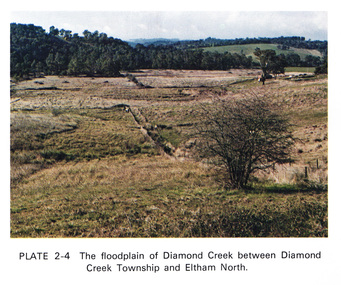
Work on paper (Sub-Item) - Photograph, The floodplain of Diamond Creek between Diamond Creek township and Eltham North
floodplain, eltham north -
 Eltham District Historical Society Inc
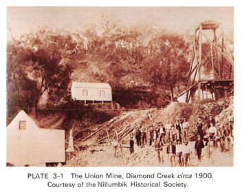
Work on paper (Sub-Item) - Photograph, The Union Mine, Diamond Creek circa 1900
The Union Mine operated until 1916.diamond creek, gold mine, miners, nillumbik historical society -
 Eltham District Historical Society Inc
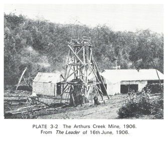
Work on paper (Sub-Item) - Photograph, The Arthurs Creek Mine, 1906
gold mine, arthurs creek -
 Eltham District Historical Society Inc
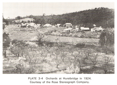
Work on paper (Sub-Item) - Photograph, Orchards at Hurstbridge, 1924
With the extension of the railway to Hurstbridge in 1912, large commercial orchards were able to expand. By 1914, 1,886 acres of orchards were under cultivation, with a considerable proprotion of the fruit being exported overseas. After World War One, the industry declined, mainly due to competition from other areas. This photo shows an orchard in the foreground with the township of Hurstbridge in the distance. The photo was taken in 1924, the same year that Hurstbridge was declared a township. orchard, hurstbridge, rose postcard -
 Eltham District Historical Society Inc
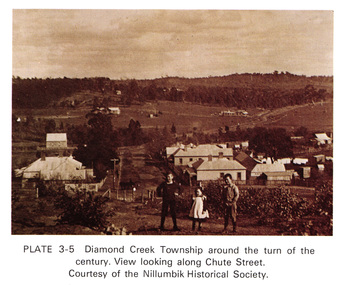
Work on paper (Sub-Item) - Photograph, View along Chute Street, Diamond Creek township, about 1901
diamond creek, chute street, view, nillumbik historical society -
 Eltham District Historical Society Inc
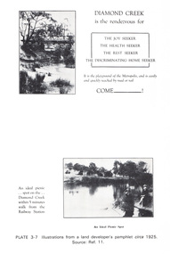
Work on paper (Sub-Item) - Photograph, Illustrations from a land developer's pamphlet promoting Diamond Creek, circa 1925
Photos illustrating the Diamond Creek with a bridge over it and two people sitting by the creek, one is fishing with text describing the kind of person who may like to come to the township. diamond creek, advertising, promotion, land development, real estate -
 Eltham District Historical Society Inc
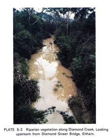
Work on paper (Sub-Item) - Photograph, Riparian vegetation along Diamond Creek. Looking upstream from Diamond Street Bridge, Eltham
Colour photograph of a muddy creek (probably after a downpour) with plants growing on the water's edge along both banks of the creek, including trees, shrubs, grasses and vines. eltham, creek, vegetation, diamond street, bridge, diamond creek -
 Eltham District Historical Society Inc
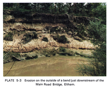
Work on paper (Sub-Item) - Photograph, Erosion on the outside of a bend just downstream of the Main Road Bridge, Eltham
Colour photograph of a muddy Diamond Creek (probably after a downpour) with siginificant water erosion apparent at the bend of the creek in Eltham.eltham, creek, vegetation, diamond creek, erosion -
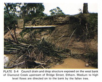 Eltham District Historical Society Inc
Work on paper (Sub-Item) - Photograph, Council drain and drop structure exposed on the west bank of Diamond Creek upstream of Bridge Street, Eltham
Colour photograph of a muddy creek (probably after a downpour) showing council drain and drop structure exposed on the west bank of Diamond Creek upstream of Bridge Street, Eltham. Mediun to high level water flows are directed on to the bank by the fallen tree.eltham, creek, diamond creek, bridge street, drainage, waterflow, vegetation -
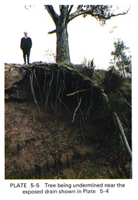 Eltham District Historical Society Inc
Work on paper (Sub-Item) - Photograph, Tree being undermined near an exposed drain on the west bank of Diamond Creek upstream of Bridge Street, Eltham
Colour photograph of tree on the side of the Diamond Creek upstream at Bridge Street, Eltham. The tree has been undermined with roots exposed near a council drain.eltham, diamond creek, bridge street, drainage, roots, tree -
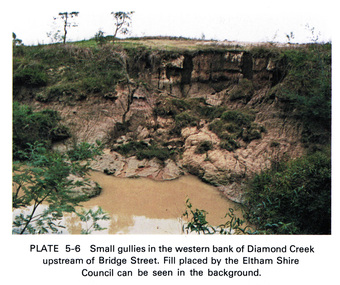 Eltham District Historical Society Inc
Work on paper (Sub-Item) - Photograph, Small gullies in the western bank of Diamond Creek upstream of Bridge Street, Eltham
Colour photograph of a muddy creek (probably after a downpour) on the western bank of Diamond Creek upstream of Bridge Street, Eltham. Fill placed by the Eltham Shire Council can be seen in the backgroundeltham, diamond creek, bridge street, gullies, fill -
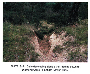 Eltham District Historical Society Inc
Work on paper (Sub-Item) - Photograph, Gully developing along a trail leading down to the Diamond Creek in Eltham Lower Park
Colour photograph of a gully on a trail leading down to the Diamond Creek in Eltham Lower Park. eltham, diamond creek, gully, eltham lower park, trail -
 Eltham District Historical Society Inc
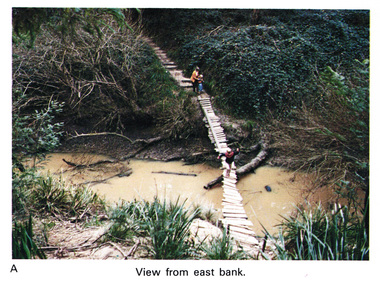
Work on paper (Sub-Item) - Photograph, Home-made footbridge across Diamond Creek, opposite Gum Glade, Eltham
Colour photograph of home-made footbridge across the Diamond Creek opposite Gum Glade, Eltham. View from east bank.eltham, diamond creek, footbridge, gum glade -
 Eltham District Historical Society Inc
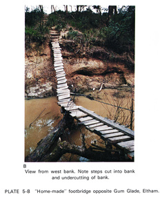
Work on paper (Sub-Item) - Photograph, Home-made footbridge across Diamond Creek, opposite Gum Glade, Eltham
Colour photograph of home-made footbridge across the Diamond Creek opposite Gum Glade, Eltham. View from west bank. Note steps cut into bank and undercutting of bankeltham, diamond creek, footbridge, gum glade, creek bank -
 Eltham District Historical Society Inc
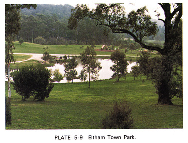
Work on paper (Sub-Item) - Photograph, Eltham Town park
Colour photograph of Eltham Town Park showing duck pond and children's playground in the background. This photograph was taken soon after the council reclaimed the site from a tip and before it was named for Alistair Knox. eltham, diamond creek, eltham town park, alistair knox park, pond, playground -
 Eltham District Historical Society Inc
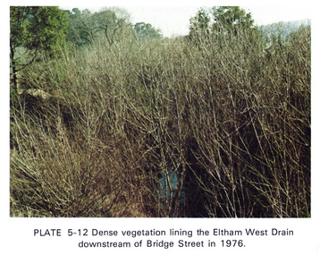
Work on paper (Sub-Item) - Photograph, Dense vegetaton lining the Eltham West Drain downstream of Bridge Street in 1976, 1976
Colour photograph of dense vegetation lining the Eltham West drain downstream of Bridge Street, Elthameltham, vegetation, weeds, eltham west drain -
 Eltham District Historical Society Inc
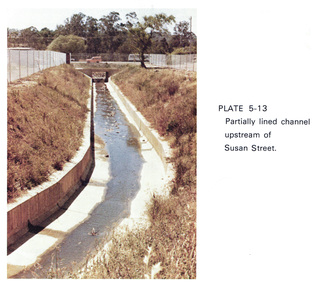
Work on paper (Sub-Item) - Photograph, Partially lined channel upstream of Susan Street
Colour photograph of Partially lined concrete channel upstream of Susan Street, Elthameltham, susan street, concrete, channel, drain -
 Eltham District Historical Society Inc
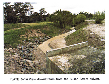
Work on paper (Sub-Item) - Photograph, View downstream from the Susan Street culvert
Colour photograph of the view downstream from the Susan Street culvert, Elthameltham, susan street, culvert, drain, channel -
 Eltham District Historical Society Inc
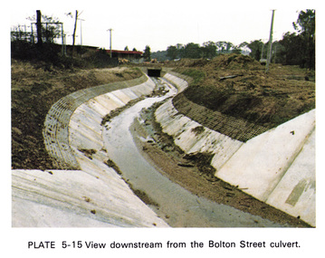
Work on paper (Sub-Item) - Photograph, View downstream from the Bolton Street culvert
Colour photograph of the view downstream from the Bolton Street culvert, Elthameltham, channel, concrete, drain, bolton street -
 Eltham District Historical Society Inc
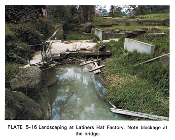
Work on paper (Sub-Item) - Photograph, Landscaping at Latiners Hat Factory
Colour photograph of Landscaping at Latiners Hat Factory, Sherbourne Road, Eltham. Note blockage at the bridgeeltham, drain, latiners, hat factory, landscaping, footbridge, blockage -
 Eltham District Historical Society Inc
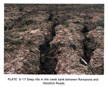
Work on paper (Sub-Item) - Photograph, Deep rills in the creek bank between Rampstons and Weidlich Roads
Colour photograph of deep rills in the Diamond Creek bank between Rampstons and Weidlich Roads, Eltham North. The shallow channels are cut into the soil by the erosive action of flowing water.eltham, creek bank, erosion, eltham north -
 Eltham District Historical Society Inc
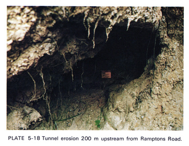
Work on paper (Sub-Item) - Photograph, Tunnel erosion 220 m upstream from Ramptons Road
Colour photograph of tunnel erosion 220 metres upstream from Ramptons Road, Eltham North eltham, erosion, eltham north, drain -
 Eltham District Historical Society Inc
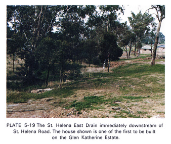
Work on paper (Sub-Item) - Photograph, St Helena East drain immediately downstream of St Helena Road
Colour photograph of St Helena East drain immediately downstream of St Helena Road, Greensborough. The house shown is one of the first to be built on the Glen Katherine Estate.eltham, drain, st helena, glen katherine estate, greensborough -
 Eltham District Historical Society Inc
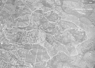
Work on paper (Sub-Item) - Photograph, Research Creek
Black and White aerial photograph of Research witht the Research Creek and Main Road highlighted.eltham, research, aerial view, research creek -
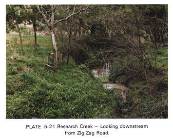 Eltham District Historical Society Inc
Work on paper (Sub-Item) - Photograph, Research Creek, looking downstream from Zig Zag Road
Colour photograph of Research Creek looking downstream from Zig Zag Road, Elthameltham, research creek, zig zag road