Showing 644 items
matching eastern and australian
-
 Falls Creek Historical Society
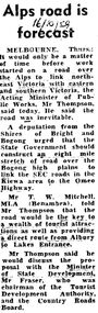
Newspaper - Press clippings - Alpine Road
These clippings are part of the Fred Griffith Collection. Frederick Charles “Fred” Griffith was born in Albury, NSW on 2 March 1910. Educated in Albury and Geelong Grammar. Beginning in 1927 he spent many years working first as a jackeroo and on a range of prominent pastoral and merino stud properties in NSW and Queensland. In 1935 he repurchased his former family property “Toonallook", Bowna, NSW and developed it to be the largest Romney Marsh stud in the world, exporting rams to Argentina. He introduced many innovative practices on his property including rabbit control measures and aerial crop dusting. He was an active member of the Albury Show Society and in 1949 established the Albury Sheep Show. Fred was also the Albury representative on the Graziers’ Association Council for over 30 years. He became a life member of both the Albury and Commercial Clubs. Fred’s greatest hobby was snow skiing. His first visit to the snow was to Kosciusko in 1919. The Albury Ski Club was formed in 1935 and Fred was an inaugural member. In 1949 they were granted a site at Falls Creek to build their own lodge. Fred guaranteed the Club for finance from the Bank of NSW. The first portion of the prefabricated building was constructed in Albury. It was transported to Falls Creek on the back of Fred’s truck and erected in one day. This was the bathroom section and the rest was completed in 1950. The original lodge was burned down in 1952 and a new one built the following year. In 1955, Fred also built the Bowna Lodge for his family in partnership with David Fairbairn. He became head of the North Eastern District Skiing Association (N.E.D.S.A.) and successfully applied to run the Australian Ski Championships. Fred also inaugurated children’s races at Falls Creek and ran them for about 20 years. He also formed the company “Falls Creek Ski Tows”. In 1956 Fred along with a group of key people selected the site for Thredbo Village. Fred and his brother sold Toonallook in sections between 1951 and 1974. He moved to Albury and set up as a landscape gardener and fencing contractor. After a serious work accident, Fred retired in 1985 and moved to Rosebud, Victoria where he died on 19 August 1992.These images are part of an important collection donated by Fred GriffithA collection of articles which document the development of the Alpine Road and its impact on Falls Creek.skiers at bogong, fred griffith -
 Falls Creek Historical Society
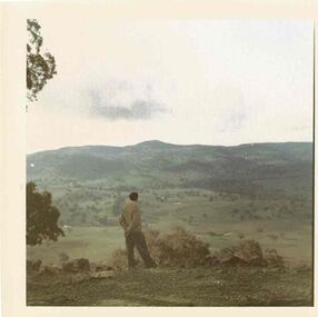
Photograph - At Toonallook
These photos are part of the Fred Griffith Collection. Frederick Charles “Fred” Griffith was born in Albury, NSW on 2 March 1910. Educated in Albury and Geelong Grammar. Beginning in 1927 he spent many years working first as a jackeroo and on a range of prominent pastoral and merino stud properties in NSW and Queensland. In 1935 he repurchased his former family property “Toonallook, Bowna, NSW and developed it to be the largest Romney Marsh stud in the world, exporting rams to Argentina. He introduced many innovative practices on his property including rabbit control measures and aerial crop dusting. He was an active member of the Albury Show Society and in 1949 established the Albury Sheep Show. Fred was also the Albury representative on the Graziers’ Association Council for over 30 years. He became a life member of both the Albury and Commercial Clubs. Fred’s greatest hobby was snow skiing. His first visit to the snow was to Kosciusko in 1919. The Albury Ski Club was formed in 1935 and Fred was an inaugural member. In 1949 they were granted a site at Falls Creek to build their own lodge. Fred guaranteed the Club for finance from the Bank of NSW. The first portion of the prefabricated building was constructed in Albury. It was transported to Falls Creek on the back of Fred’s truck and erected in one day. This was the bathroom section and the rest was completed in 1950. The original lodge was burned down in 1952 and a new one built the following year. In 1955, Fred also built the Bowna Lodge for his family in partnership with David Fairbairn. He became head of the North Eastern District Skiing Association (N.E.D.S.A.) and successfully applied to run the Australian Ski Championships. Fred also inaugurated children’s races at Falls Creek and ran them for about 20 years. He also formed the company “Falls Creek Ski Tows”. In 1956 Fred along with a group of key people selected the site for Thredbo Village. Fred and his brother sold Toonallook in sections between 1951 and 1974. He moved to Albury and set up as a landscape gardener and fencing contractor. After a serious work accident, Fred retired in 1985 and moved to Rosebud, Victoria where he died on 19 August 1992.These images are part of an important collection donated by Fred Griffith which document Falls Creek in the 1950s & 1960sA collection of colour images of mountain views and one of farm work.falls creek, falls creek lodges, norma tullo -
 Falls Creek Historical Society
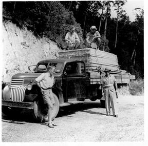
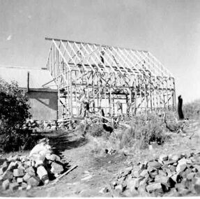
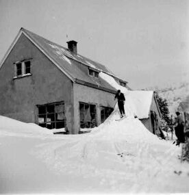
Photograph - Building Lodge at Bogong 1949 - 1950
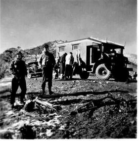
These photos are part of the Fred Griffith Collection. Frederick Charles “Fred” Griffith was born in Albury, NSW on 2 March 1910. Educated in Albury and Geelong Grammar. Beginning in 1927 he spent many years working first as a jackeroo and on a range of prominent pastoral and merino stud properties in NSW and Queensland. In 1935 he repurchased his former family property “Toonallook", Bowna, NSW and developed it to be the largest Romney Marsh stud in the world, exporting rams to Argentina. He introduced many innovative practices on his property including rabbit control measures and aerial crop dusting. He was an active member of the Albury Show Society and in 1949 established the Albury Sheep Show. Fred was also the Albury representative on the Graziers’ Association Council for over 30 years. He became a life member of both the Albury and Commercial Clubs. Fred’s greatest hobby was snow skiing. His first visit to the snow was to Kosciusko in 1919. The Albury Ski Club was formed in 1935 and Fred was an inaugural member. In 1949 they were granted a site at Falls Creek to build their own lodge. Fred guaranteed the Club for finance from the Bank of NSW. The first portion of the prefabricated building was constructed in Albury. It was transported to Falls Creek on the back of Fred’s truck and erected in one day. This was the bathroom section and the rest was completed in 1950. The original lodge was burned down in 1952 and a new one built the following year. In 1955, Fred also built the Bowna Lodge for his family in partnership with David Fairbairn. He became head of the North Eastern District Skiing Association (N.E.D.S.A.) and successfully applied to run the Australian Ski Championships. Fred also inaugurated children’s races at Falls Creek and ran them for about 20 years. He also formed the company “Falls Creek Ski Tows”. In 1956 Fred along with a group of key people selected the site for Thredbo Village. Fred and his brother sold Toonallook in sections between 1951 and 1974. He moved to Albury and set up as a landscape gardener and fencing contractor. After a serious work accident, Fred retired in 1985 and moved to Rosebud, Victoria where he died on 19 August 1992.These images record a working bee to build the lodge at Bogong, VictoriaA set of black and white photographs showing the construction of the lodge at Bogong Christmas and New Year 1949/1950 On back of photos. No. 1 - The complete prefabricated timber framework, also "SOLOMIT" straw sheets for sides, of the first portion at the Albury Ski Club's lodge to be erected at Falls Creek, Mt Bogong, shown loaded in F. C. Griffith;s truck. Taken at Bogong Township at 9 A.M. when there was a 3 hours delay owing to a broken fan belt. Date 13/3/49. No. 2 - The arrival of the material at the site on Falls Creek. Time 1.30 P.M. Club's Conveyancer "Jackson" in background. No. 3. - Unloading material at the site. "Jackson" again in background. No. 4 - Members of the Club's working party at work (?) on the foundations and floor joists. No. 5 - More action this time! No. 6 - The first pre-fabricated wall going into place. Time start 3.30 P.M. No. 7. - The final wall section going up' No. 8 -Timber framework complete. Time 5.30 P. M.fred griffith, falls creek, bogong -
 Falls Creek Historical Society
Photograph - More Building Lodge at Bogong 1949/1950
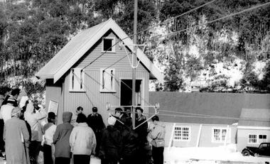
These photos are part of the Fred Griffith Collection. Frederick Charles “Fred” Griffith was born in Albury, NSW on 2 March 1910. Educated in Albury and Geelong Grammar. Beginning in 1927 he spent many years working first as a jackeroo and on a range of prominent pastoral and merino stud properties in NSW and Queensland. In 1935 he repurchased his former family property “Toonallook", Bowna, NSW and developed it to be the largest Romney Marsh stud in the world, exporting rams to Argentina. He introduced many innovative practices on his property including rabbit control measures and aerial crop dusting. He was an active member of the Albury Show Society and in 1949 established the Albury Sheep Show. Fred was also the Albury representative on the Graziers’ Association Council for over 30 years. He became a life member of both the Albury and Commercial Clubs. Fred’s greatest hobby was snow skiing. His first visit to the snow was to Kosciusko in 1919. The Albury Ski Club was formed in 1935 and Fred was an inaugural member. In 1949 they were granted a site at Falls Creek to build their own lodge. Fred guaranteed the Club for finance from the Bank of NSW. The first portion of the prefabricated building was constructed in Albury. It was transported to Falls Creek on the back of Fred’s truck and erected in one day. This was the bathroom section and the rest was completed in 1950. The original lodge was burned down in 1952 and a new one built the following year. In 1955, Fred also built the Bowna Lodge for his family in partnership with David Fairbairn. He became head of the North Eastern District Skiing Association (N.E.D.S.A.) and successfully applied to run the Australian Ski Championships. Fred also inaugurated children’s races at Falls Creek and ran them for about 20 years. He also formed the company “Falls Creek Ski Tows”. In 1956 Fred along with a group of key people selected the site for Thredbo Village. Fred and his brother sold Toonallook in sections between 1951 and 1974. He moved to Albury and set up as a landscape gardener and fencing contractor. After a serious work accident, Fred retired in 1985 and moved to Rosebud, Victoria where he died on 19 August 1992.These images record a working bee to build the lodge at Bogong, Victoria in January 1950A set of black and white photographs showing the construction of the lodge at Bogong in January 1950fred griffith, falls creek, bogong -
 Falls Creek Historical Society
Photograph - Building Lodge at Bogong 1949/1950
These photos are part of the Fred Griffith Collection. Frederick Charles “Fred” Griffith was born in Albury, NSW on 2 March 1910. Educated in Albury and Geelong Grammar. Beginning in 1927 he spent many years working first as a jackeroo and on a range of prominent pastoral and merino stud properties in NSW and Queensland. In 1935 he repurchased his former family property “Toonallook", Bowna, NSW and developed it to be the largest Romney Marsh stud in the world, exporting rams to Argentina. He introduced many innovative practices on his property including rabbit control measures and aerial crop dusting. He was an active member of the Albury Show Society and in 1949 established the Albury Sheep Show. Fred was also the Albury representative on the Graziers’ Association Council for over 30 years. He became a life member of both the Albury and Commercial Clubs. Fred’s greatest hobby was snow skiing. His first visit to the snow was to Kosciusko in 1919. The Albury Ski Club was formed in 1935 and Fred was an inaugural member. In 1949 they were granted a site at Falls Creek to build their own lodge. Fred guaranteed the Club for finance from the Bank of NSW. The first portion of the prefabricated building was constructed in Albury. It was transported to Falls Creek on the back of Fred’s truck and erected in one day. This was the bathroom section and the rest was completed in 1950. The original lodge was burned down in 1952 and a new one built the following year. In 1955, Fred also built the Bowna Lodge for his family in partnership with David Fairbairn. He became head of the North Eastern District Skiing Association (N.E.D.S.A.) and successfully applied to run the Australian Ski Championships. Fred also inaugurated children’s races at Falls Creek and ran them for about 20 years. He also formed the company “Falls Creek Ski Tows”. In 1956 Fred along with a group of key people selected the site for Thredbo Village. Fred and his brother sold Toonallook in sections between 1951 and 1974. He moved to Albury and set up as a landscape gardener and fencing contractor. After a serious work accident, Fred retired in 1985 and moved to Rosebud, Victoria where he died on 19 August 1992.These images record a working bee to build the lodge at Bogong, Victoria in January 1950A set of black and white photographs showing the construction of the lodge at Bogong in January 1950fred griffith, falls creek, bogong -
 Falls Creek Historical Society
Photograph - Albury Ski Club Trip 1948
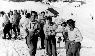
These photos are part of the Fred Griffith Collection. Frederick Charles “Fred” Griffith was born in Albury, NSW on 2 March 1910. Educated in Albury and Geelong Grammar. Beginning in 1927 he spent many years working first as a jackeroo and on a range of prominent pastoral and merino stud properties in NSW and Queensland. In 1935 he repurchased his former family property “Toonallook", Bowna, NSW and developed it to be the largest Romney Marsh stud in the world, exporting rams to Argentina. He introduced many innovative practices on his property including rabbit control measures and aerial crop dusting. He was an active member of the Albury Show Society and in 1949 established the Albury Sheep Show. Fred was also the Albury representative on the Graziers’ Association Council for over 30 years. He became a life member of both the Albury and Commercial Clubs. Fred’s greatest hobby was snow skiing. His first visit to the snow was to Kosciusko in 1919. The Albury Ski Club was formed in 1935 and Fred was an inaugural member. In 1949 they were granted a site at Falls Creek to build their own lodge. Fred guaranteed the Club for finance from the Bank of NSW. The first portion of the prefabricated building was constructed in Albury. It was transported to Falls Creek on the back of Fred’s truck and erected in one day. This was the bathroom section and the rest was completed in 1950. The original lodge was burned down in 1952 and a new one built the following year. In 1955, Fred also built the Bowna Lodge for his family in partnership with David Fairbairn. He became head of the North Eastern District Skiing Association (N.E.D.S.A.) and successfully applied to run the Australian Ski Championships. Fred also inaugurated children’s races at Falls Creek and ran them for about 20 years. He also formed the company “Falls Creek Ski Tows”. In 1956 Fred along with a group of key people selected the site for Thredbo Village. Fred and his brother sold Toonallook in sections between 1951 and 1974. He moved to Albury and set up as a landscape gardener and fencing contractor. After a serious work accident, Fred retired in 1985 and moved to Rosebud, Victoria where he died on 19 August 1992.These images record members of Albury Ski Club in 1948A set of black and white photographs showing members of Albury Ski Club on club trip in 1948, possibly to Hotham.fred griffith, falls creek, bogong -
 Falls Creek Historical Society
Photograph - Race Events at Falls Creek 1953 Part 1
These photos are part of the Fred Griffith Collection. Frederick Charles “Fred” Griffith was born in Albury, NSW on 2 March 1910. Educated in Albury and Geelong Grammar. Beginning in 1927 he spent many years working first as a jackeroo and on a range of prominent pastoral and merino stud properties in NSW and Queensland. In 1935 he repurchased his former family property “Toonallook, Bowna, NSW and developed it to be the largest Romney Marsh stud in the world, exporting rams to Argentina. He introduced many innovative practices on his property including rabbit control measures and aerial crop dusting. He was an active member of the Albury Show Society and in 1949 established the Albury Sheep Show. Fred was also the Albury representative on the Graziers’ Association Council for over 30 years. He became a life member of both the Albury and Commercial Clubs. Fred’s greatest hobby was snow skiing. His first visit to the snow was to Kosciusko in 1919. The Albury Ski Club was formed in 1935 and Fred was an inaugural member. In 1949 they were granted a site at Falls Creek to build their own lodge. Fred guaranteed the Club for finance from the Bank of NSW. The first portion of the prefabricated building was constructed in Albury. It was transported to Falls Creek on the back of Fred’s truck and erected in one day. This was the bathroom section and the rest was completed in 1950. The original lodge was burned down in 1952 and a new one built the following year. In 1955, Fred also built the Bowna Lodge for his family in partnership with David Fairbairn. He became head of the North Eastern District Skiing Association (N.E.D.S.A.) and successfully applied to run the Australian Ski Championships. Fred also inaugurated children’s races at Falls Creek and ran them for about 20 years. He also formed the company “Falls Creek Ski Tows”. In 1956 Fred along with a group of key people selected the site for Thredbo Village. Fred and his brother sold Toonallook in sections between 1951 and 1974. He moved to Albury and set up as a landscape gardener and fencing contractor. After a serious work accident, Fred retired in 1985 and moved to Rosebud, Victoria where he died on 19 August 1992.These images record a race event held at Falls Creek in 1953A set of black and white photographs which document a ski race event at Falls Creek in 1953fred griffith, falls creek, bogong -
 Falls Creek Historical Society
Photograph - Race Events at Falls Creek 1953 Part 2
These photos are part of the Fred Griffith Collection. Frederick Charles “Fred” Griffith was born in Albury, NSW on 2 March 1910. Educated in Albury and Geelong Grammar. Beginning in 1927 he spent many years working first as a jackeroo and on a range of prominent pastoral and merino stud properties in NSW and Queensland. In 1935 he repurchased his former family property “Toonallook", Bowna, NSW and developed it to be the largest Romney Marsh stud in the world, exporting rams to Argentina. He introduced many innovative practices on his property including rabbit control measures and aerial crop dusting. He was an active member of the Albury Show Society and in 1949 established the Albury Sheep Show. Fred was also the Albury representative on the Graziers’ Association Council for over 30 years. He became a life member of both the Albury and Commercial Clubs. Fred’s greatest hobby was snow skiing. His first visit to the snow was to Kosciusko in 1919. The Albury Ski Club was formed in 1935 and Fred was an inaugural member. In 1949 they were granted a site at Falls Creek to build their own lodge. Fred guaranteed the Club for finance from the Bank of NSW. The first portion of the prefabricated building was constructed in Albury. It was transported to Falls Creek on the back of Fred’s truck and erected in one day. This was the bathroom section and the rest was completed in 1950. The original lodge was burned down in 1952 and a new one built the following year. In 1955, Fred also built the Bowna Lodge for his family in partnership with David Fairbairn. He became head of the North Eastern District Skiing Association (N.E.D.S.A.) and successfully applied to run the Australian Ski Championships. Fred also inaugurated children’s races at Falls Creek and ran them for about 20 years. He also formed the company “Falls Creek Ski Tows”. In 1956 Fred along with a group of key people selected the site for Thredbo Village. Fred and his brother sold Toonallook in sections between 1951 and 1974. He moved to Albury and set up as a landscape gardener and fencing contractor. After a serious work accident, Fred retired in 1985 and moved to Rosebud, Victoria where he died on 19 August 1992.These images record a race event held at Falls Creek in 1953A set of black and white photographs which document a ski race event at Falls Creek in 1953fred griffith, falls creek, bogong -
 Falls Creek Historical Society
Photograph - Relaxing at Bogong 1954
These photos are part of the Fred Griffith Collection. Frederick Charles “Fred” Griffith was born in Albury, NSW on 2 March 1910. Educated in Albury and Geelong Grammar. Beginning in 1927 he spent many years working first as a jackeroo and on a range of prominent pastoral and merino stud properties in NSW and Queensland. In 1935 he repurchased his former family property “Toonallook", Bowna, NSW and developed it to be the largest Romney Marsh stud in the world, exporting rams to Argentina. He introduced many innovative practices on his property including rabbit control measures and aerial crop dusting. He was an active member of the Albury Show Society and in 1949 established the Albury Sheep Show. Fred was also the Albury representative on the Graziers’ Association Council for over 30 years. He became a life member of both the Albury and Commercial Clubs. Fred’s greatest hobby was snow skiing. His first visit to the snow was to Kosciusko in 1919. The Albury Ski Club was formed in 1935 and Fred was an inaugural member. In 1949 they were granted a site at Falls Creek to build their own lodge. Fred guaranteed the Club for finance from the Bank of NSW. The first portion of the prefabricated building was constructed in Albury. It was transported to Falls Creek on the back of Fred’s truck and erected in one day. This was the bathroom section and the rest was completed in 1950. The original lodge was burned down in 1952 and a new one built the following year. In 1955, Fred also built the Bowna Lodge for his family in partnership with David Fairbairn. He became head of the North Eastern District Skiing Association (N.E.D.S.A.) and successfully applied to run the Australian Ski Championships. Fred also inaugurated children’s races at Falls Creek and ran them for about 20 years. He also formed the company “Falls Creek Ski Tows”. In 1956 Fred along with a group of key people selected the site for Thredbo Village. Fred and his brother sold Toonallook in sections between 1951 and 1974. He moved to Albury and set up as a landscape gardener and fencing contractor. After a serious work accident, Fred retired in 1985 and moved to Rosebud, Victoria where he died on 19 August 1992.These images record a friends of the photographer relaxing at Mt. BogongA set of black and white photographs which document people enjoying the snow at Bogong in 1954fred griffith, falls creek, bogong -
 Victorian Aboriginal Corporation for Languages
Book, Brett Baker, Indigenous language and social identity : papers in honour of Michael Walsh, 2010
For almost 40 years, Michael Walsh has been working alongside Indigenous people: documenting language, music and other traditional knowledge, acting on behalf of claimants to land in the Northern Territory, and making crucial contributions to the revitalisation of Aboriginal languages in NSW. This volume, with contributions from his colleagues and students, celebrates his abiding interest in and commitment to Indigenous society with papers in two broad themes. ?Language, identity and country? addresses the often complex relations between Aboriginal social groups and countries, and linguistic identity. In ?Language, identity and social action? authors discuss the role that language plays in maintaining social identities in the realms of conversation, story-telling, music, language games, and in education. ?Language and Social Identity in Australian Indigenous Communities? will be of interest to students of linguistics, Indigenous studies, anthropology, and sociology. Contents: 1. Introduction /? Rod Gardner ... [et al.] 2. Michael Walsh : a personal reflection /? Ros Fraser 3. Place and property at Yintjingga/?Port Stewart under Aboriginal Law and Queensland Law /? Bruce Rigsby and Diane Hafner 4. Linguistic identities in the eastern Western Desert : the Tindale evidence /? Peter Sutton Juwaliny : dialectal variation and ethnolinguistic identity in the Great Sandy Desert /? Sally Dixon 6. Who were the 'Yukul'? and who are they now? /? Brett Baker 7. Colonisation and Aboriginal concepts of land tenure in the Darwin region /? Mark Harvey 8. Aboriginal languages and social groups in the Canberra region : interpreting the historical documentation /? Harold Koch 9. The Kuringgai puzzle : languages and dialects on the NSW Mid Coast /? Jim Wafer and Amanda Lissarrague 10. Dawes' Law generalised : cluster simplification in the coastal dialect of the Sydney language /? David Nash 11. Space, time and environment in Kala Lagaw Ya /? Lesley Stirling 12. Turn management in Garrwa mixed-language conversations /? Ilana Mushin and Rod Gardner 13. Laughter is the best medicine : roles for prosody in a Murriny Patha conversational narrative /? Joe Blythe 14. Collaborative narration and cross-speaker repetition in Umpila and Kuuku Ya'u /? Clair Hill 15. Co-narration of a Koko-Bera story : giants in Cape York Peninsula /? Paul BlackMaps, b&w photographs, charts, word listslanguage and identity, language maintenance, language and culture, language and country -
 Federation University Historical Collection
Book, Ballarat College of Advanced Education Annual Report, 1980
In 1980 M.B.John was Council President. In 1980 the School of Arts moved into their new building, 1870 Founders Hall was financed - at a cost of $800,000 - from the proceeds of the SMB Centenary Appeal, and was completed late in 1980. Extensive work was carried out on the Student Residences and the former Education Department Hostel in Victorian Street. The amphitheatre adjacent to the eastern side of the Education Buildings was constructed, together with the nearby disabled ramp. Negotiations with the Shire of Buninyong were continued for access to the campus from the Green Hill Road. Following the creation by Act of Parliament in 1978 of the Victorian Post-Secondary Education Commission (VPSEC) amendments to the same Act early in 1980 made provision for the repeal of the VIC and SCV Acts. From mid-December 1980 these latter two bodies ceased to exist when the provisions for repeal of their Acts were proclaimed. The Victorian Institute of Colleges had been set up in 1965 to aid in the co-ordination and development of a number of non-university tertiary institutions that affiliated with it from 1965 on to become Colleges of Advanced Education. In taking up this role which had been spelt out in 1964 by the martin Committee, the VIC broke new ground in a whole range of operations. It became responsible for the physical development of new building programmes and new campuses from many of its colleges, for the procurement of operating funds from the Commonwealth, for the accreditation of new courses of study, for the first non-university degrees to be awarded in Australia and so on. The Former Ballarat Institute of Advanced Education (the tertiary division of the School of Mines) was affiliated with the VIC from the outset and its progress towards a new status, rapid growth and vastly improved physical resources was closely linked to and dependent upon the efforts of the VIC. The similar co-ordinating authority - The State College of Victoria - was established in 1973 to similarly foster the autonomous development of the former teachers colleges. its early work was highly influential in the transition of the Ballarat Teachers' College into the State College of Victoria at Ballarat. On the merging of the BIAE and the SCVB in 1976, the new college continued under the co-ordination of the Victorian Institute of Colleges. The major contribution made to the progress and stature of became the Ballarat College of advanced Education by both the VIC and SCV, and their Councils and officers, over the formative years of rapid change and evolution is acknowledged and recorded with appreciation. Such efforts by the two central authorities have markedly assisted in bringing the College to the present point where its accumulated experiences and traditions provide a sound basis on which it can confidently and responsibly exercise the greater autonomy gradually passing it. Purple soft covered book of 47 pages. Contents include: development of a Nurse education course, College organisational Structure, Role of Head of School, resignation of Norman Baggaley, appointment of R. Macgowan, opening of Business Resource Centre, Librarianship, resignation of M.J. Sandow-Quirk, E.A. Widdop, J. Leeuwenburg, Thelma Rungkat, Erica Myers, former Acting Head of School John Mildren elected to the Federal seat of Ballarat, Ray Watson, Resignation of A.C. Burrow, return of W.J. Vermeend, P.L. McCarthy, P.R. Calder, J.A. Fulcher, L.E. Taylor, L.J. McGrath, Teaching Resource Centreballarat college of advanced education, bcae, mt helen, mount helen, sandow-quirk, widdop, leeuwenburg, rungkat, myers, burrow, vermeend, mccarthy, calder, fulcher, taylor, victoria street -
 Glen Eira City Council History and Heritage Collection
Document (Item) - Newspaper (digital), Caulfield Contact
The Caulfield Contact was the official newspaper of the City of Caulfield from 1976-1994. The City of Caulfield was the Municipal Council for an area of the South Eastern suburbs of Melbourne, including Brighton East, Carnegie, Caulfield, Elsternwick, Gardenvale, Glen Huntly, McKinnon, Murrumbeena, Ormond and St Kilda East. Following Amalgamation of City of Caulfield and parts of the City of Moorabbin in 1994, the Caulfield Contact was followed by the Glen Eira News. Contains References to the following Freedom of Entry to 3rd ordinance of the RAAOC, visit by Sir Zelman Cowen, Return to Rosstown, A 'spacy new home' (nursery at Caulfield Park), Profile on Gus Theobold, Meals on Wheels Aviary completed Caulfield Park. Profile resident Gus Theobold. Cr Irene Capek win Herald Australia Day essay prize. Caulfields Meals on Wheels set Victorian record. Historical feature Return to Rosstown. New ambulance station Glenhuntly and Clarinda roads opens. Volume 4 Number 5 Date 03 August 1978 Features Where and How to Vote in council election. Cr Irene Capek retires from council. Profiles election candidates. Image: Image Cr Irene Capek. Images of election candidates. Volume 5 Number 1 Date 14 September 1978 Freedom of Entry to 3rd ordinance of the RAAOC, visit by Sir Zelman Cowen, Subjects from Carol: GG Sir Zelman Cowen and Lady Cowen offical visit. Off street carpark project underway Pyne St and Hawthorn Rd. City Manager Graeme Caldwell submits plans for Townhall renovations. Action plan for development of Elsternwich Shopping precint to be developed. Freedom of Entry ceremony. Profile Rosemary Keppel. Booran Motors Glenhuntly donate dual control Holden Gemini to Caulfield Tech school pre-driver education program. council election results. Comments from elected Crs Jack Campell, Bob Baxter, Dorothy Ford, Brian Rudzki. Promotion of Caulfield Institute of Technology and TAFE. Image: Image Sir Zelman Cowen, Lady Cowen. Images Freedom of Entry ceremony and citizens attending. Image Rosemary Keppel. Cartoon pre-driver education program. Image Mayor Cr Geoff Patience in robes. Volume 5 Number 2 Date 26 October 1978 Rate rise 5.73% announced. Readership of Caulfield Contact surveyed. Caulfield ranger Reg Dixon and members of works dept rescue duck family from drain and reinstate them to Caulfield Racecourse dam. Profile resident and teacher Claire Manning. Image: Image of Reg Dixon and the rescued ducks. Image Claire Manning and students at Waverley Private school. city of caulfield, caulfield, glen eira, city of glen eira, caulfield contact, freedom of entry to 3rd ordinance of the raaoc, visit by sir zelman cowen, return to rosstown, a 'spacy new home' (nursery at caulfield park), profile on gus theobold, meals on wheels -
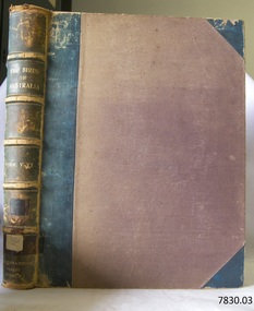
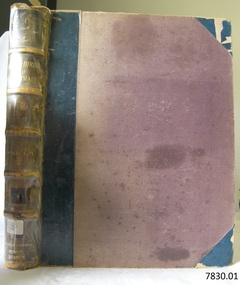
 Flagstaff Hill Maritime Museum and Village
Book, The Birds of Australia Vol 3 - 4
The Work “The Birds of Australia; containing over 300 full-page illustrations, with a descriptive account of the life and characteristic habits of over 700 species” by Gracius J. [Joseph] Broinowski – Australian author, artist and ornithologist - was created in 40 parts for subscribers and sold for 10s [shillings]., These parts were later published in six volumes, which were later published and bound in pairs to make three volumes, each of which contain two of the six original volumes, numbered volumes, “I”, “III” and “V” on their fly page, but numbered “Vols. I-II”, “Vols. III-IV” and “Vols. V-VI” on their respective spines. The volumes were all published by Charles Stuart & Co. (Melbourne, Sydney, Adelaide, Brisbane, New Zealand, and Tasmania). All of the beautifully drawn and coloured illustrations in The Birds of Australia were illustrated by Broinowski. They were printed using a new 19th century method called chromolithography. This is the art of making multi-coloured prints. The skilled lithographer would work from an original coloured painting and create a copy for every one of the many layers of colour used to build the painting. These layers were then printed carefully over each other to re-build the picture. Gracius J. Broinowski’s Work “The Birds of Australia” was described by Jean.Anker as “a semi-popular but comprehensive treatment of the subject” in the book “Bird Books and Bird Art: an outline of the Literary History and Iconology of Descriptive Ornithology” 1979. It may be that these books were donated to, or ordered specifically for, the Warrnambool Public Museum, due to the embossing on the spine “WARRNAMBOOL PUBLIC LIBRARY”. The acquisition of these books would most likely to have made 1891-1910, between the date the books were published and the date that the Museum amalgamated with the Mechanics Institute, which then became part of The Museum and Art Gallery. These three books were part of the collection of books belonging to the Warrnambool Public Museum, established 1873 by Joseph Archibald. The Museum moved into the back of the Mechanics’ Institute in 1885, along with the Art Gallery and School of Dancing. In 1886 it was officially opened as The Warrnambool Museum and Art Gallery, with Joseph Archibald as its curator. In 1887 the Museum section was moved to the former court house in Timor Street, with Joseph Archibald as Curator until 1897. In 1910 the Museum was transferred back to the original building and the management of the Mechanics' Institute was handed over to the Warrnambool City Council. In 1935 Ralph Pattison was appointed as City Librarian. He developed his own sorting and cataloguing system and organised the collection of books accordingly. In the 1960’s the Warrnambool City Council closed down the Museum and Art Gallery and the books and artefacts were redistributed to other organisations in Warrnambool. Each spine of this book set, The Birds of Australia by Gracius Broinowski, shows a space on which a previous cataloguing label may have been affixed. The volumes are amongst the many books at Flagstaff Hill Maritime Village that display stamps and markings from Pattison as well as a variety of other institutions including the Mechanics’ Institute itself. Some other Australian Libraries also include these books in their collections; Australian National University, University of NSW, University of Western Australia, State Library of Western Australia, Deakin University, Queen Victoria Museum and Art Gallery, University of Adelaide, University of Queensland, University of Tasmania. The Library of Congress and the University of British Columbia also have sets of these volumes. These books are considered as Rare Book; a set of Broinowski’s 3 volumes was advertised in Melbourne’s Rare Book Fair 2012, “for ornithological collectors”. (See the more detailed information below in “Warrnambool Public Museum and Mechanics Institute” and the “Pattison Collection”.) GRACIUS JOSEP BROINOWSKI Gracius Joseph Broinowski (7/3/1837 – 11/4/1913), artist and ornithologist, was born in Walichnowy, Poland, son of a landowner and military officer of the same name. He was educated privately then later, at the Munich University, he was a student of languages, classics and art. To avoid conscription into the Russian army, he migrated to Germany. At the age of about 20 years he migrated to Portland (Victoria, Australia), working his passage as part of the crew of a windjammer. Broinowski worked in the country for a few years then found employment working for a Melbourne publisher and later sold his own paintings. In about 1863, while on one of his many travels in eastern Australia painting landscapes and scenes, he married Jane Smith in Richmond, Victoria (her father was captain of a whaler). In 1880 he settled in Sydney where his work involved teaching painting, lecturing on art and exhibiting his own work at showings of the Royal Art Society. Also in the 1880s he began to publish illustrated works on Australian natural history, including; - illustrations of the birds and mammals of Australia, commissioned by the Department of Public Instruction, New South Wales, and mounted, varnished and hung on walls in many classrooms - "The Birds and Mammals of Australia"; a bound collection of illustrations with appropriated text - 1888 "The Cockatoos and Nestors of Australia and New Zealand" - 1890-1891, "The Birds of Australia" Broinowski died in 1913 at Mosman, Sydney, survived by his wife, six sons and a daughter. His son, Leopold, became a significant political journalist in Tasmania. WARRNAMBOOL PUBLIC MUSEUM & MECHANICS INSTITUTE Warrnambool's Mechanics' Institute (or Institution as it was sometimes called) was one of the earliest in Victoria. On 17th October 1853 a meeting was held where it was resolved to request the Lieutenant Governor of the Colony to grant land for the erection of a Mechanics' Institutes building. A committee was formed at the meeting and Richard Osburne chaired the first meeting of this committee. The land on the North West corner of Banyan and Merri Streets was granted but there were no funds to erect the building. The Formal Rights of the Warrnambool Mechanics' Institute's encompassed its aims and these were officially adopted in1859; "This Institution has for its object the diffusion of literary, scientific, and other useful knowledge amongst its members, excluding all controversial subjects, religious or political. These objects are sought to be obtained by means of a circulating library, a reading room, the establishment of classes, debates, and the occasional delivery of lectures on natural and experimental philosophy, mechanics, astronomy, chemistry, natural history, literature, and the useful and ornamental arts, particularly those which have a more immediate reference to the colony." The Warrnambool Mechanics' Institute opened its first reading room in December 1854 in the National School building at the corner of Banyan and Timor Streets. The Institute was funded by member subscription, payable on a quarterly, half yearly or yearly basis. Samuel Hannaford, the Manager of the Warrnambool Bank of Australasia, was the first Honorary Secretary of the Mechanics' Institutes, and an early President and Vice-President. He also gave several of the early lectures in the Reading Room. Another early Secretary, Librarian and lecturer was Marmaduke Fisher, the teacher at the National School. Lecture topics included The Poets and Poetry of Ireland', 'The Birth and Development of the Earth', 'The Vertebrae - with Remarks on the pleasures resulting from the study of Natural History' and 'Architecture'. In 1856 the Reading Room was moved to James Hider's shop in Timor Street, and by 1864 it was located in the bookshop of Davies and Read. In the 1860's the Mechanics' Institute struggled as membership waned but in 1866, after a series of fund raising efforts, the committee was able to purchase land in Liebig Street, on a site then called Market Square, between the weighbridge and the fire station. A Mechanics' Institute building was opened at this site in August 1871. The following year four more rooms were added to the main Reading Room and in 1873 the Artisan School of Design was incorporated into the Institute. The same year, 1873, Joseph Archibald established the Warrnambool Public Museum [Warrnambool Museum], however it deteriorated when he was transferred to Bendigo in 1877. In 1880, with Archibald's return to Warrnambool, the Museum was re-established and he served as Curator 1882-1897. In 1885 a new building was added to the back of the Mechanics’ Institute to accommodate the re-created School of Design, the Art Gallery and the Museum. It was officially opened as the Warrnambool Museum and Art Gallery on 26th July 1886 with Mr Joseph Archibald as Curator. In 1887 the Museum section was moved to the former court house in Timor Street (for some time the walls of the building formed part of the TAFE cafeteria but all is now demolished). In 1910 the Museum was transferred back to the original building and the management of the Mechanics' Institute was handed over to the Warrnambool City Council. The Museum and Art Gallery became one and housed many fine works of art, and the Library continued to grow. The building was well patronised, with records showing that at the beginning of the 20th century there were between 500 and 800 visitors. During World War One the monthly figures were in the thousands, with 3,400 people visiting in January 1915. The Museum was a much loved Institution in Warrnambool until 1963 when the Museum and Art Gallery was closed and the contents removed to make room for the Warrnambool City Council Engineers' Department. The contents were stored but many of the items were scattered or lost. The Museum has never been re-opened. When the original building was demolished the site became occupied by the Civic Centre, which included the new City Library. (The library was temporarily located in the old Palais building in Koroit Street.) In the process of reorganisation the Collection was distributed amongst the community groups: -The new City Library took some of the historic books and some important documents, historic photographs and newspapers. -The Art Gallery kept the 19th Century art collection and some of the artefacts from the museum. -The Historic Society has some items -The State Museum has some items -Some items were destroyed -Flagstaff Hill Maritime Village has old newspapers, Government Gazettes, most of the Mechanics' Institute Library (which included books from the Warrnambool Public Museum), ledgers and documents connected to the Mechanics' Institute Library, some framed and unframed art works and some photographs. THE PATTISON COLLECTION These books “The Birds of Australia” by Broinowsky, are also listed as part of the ‘Pattison Collection’, a collection of books and records that was originally owned by the Warrnambool Mechanics’ Institute, which was founded in Warrnambool in 1853. In 1935 Ralph Pattison was appointed as City Librarian to establish and organise the Warrnambool Library, as the Warrnambool Mechanics’ Institute was then called. When the Warrnambool Mechanics’ Institute building was pulled down in 1963 a new civic building was erected on the site and the new Warrnambool Library, on behalf of the City Council, took over all the holdings of the Warrnambool Mechanics’ Institute. At this time some of the items were separated and identified as the ‘Pattison Collection’, named after Ralph Pattison. Eventually the components of the Warrnambool Mechanics’ Institute were distributed from the Warrnambool Library to various places, including the Art Gallery, Historical Society and Flagstaff Hill. Later some were even distributed to other regional branches of Corangamite Regional Library and passed to and fro. It is difficult now to trace just where all of the items have ended up. The books at Flagstaff Hill Maritime Village generally display stamps and markings from Pattison as well as a variety of other institutions including the Mechanics’ Institute itself. RALPH ERIC PATTISON Ralph Eric Pattison was born in Rockhampton, Queensland, in 1891. He married Maude Swan from Warrnambool in 1920 and they set up home in Warrnambool. In 1935 Pattison accepted a position as City Librarian for the Warrnambool City Council. His huge challenge was to make a functional library within two rooms of the Mechanics’ Institute. He tirelessly cleaned, cleared and sorted a disarrayed collection of old books, jars of preserved specimens and other items reserved for exhibition in the city’s museum. He developed and updated the library with a wide variety of books for all tastes, including reference books for students; a difficult task to fulfil during the years following the Depression. He converted all of the lower area of the building into a library, reference room and reading room for members and the public. The books were sorted and stored using a cataloguing and card index system that he had developed himself. He also prepared the upper floor of the building and established the Art Gallery and later the Museum, a place to exhibit the many old relics that had been stored for years for this purpose. One of the treasures he found was a beautiful ancient clock, which he repaired, restored and enjoyed using in his office during the years of his service there. Ralph Pattison was described as “a meticulous gentleman whose punctuality, floorless courtesy and distinctive neat dress were hallmarks of his character, and ‘his’ clock controlled his daily routine, and his opening and closing of the library’s large heavy doors to the minute.” Pattison took leave during 1942 to 1945 to serve in the Royal Australian Navy, Volunteer Reserve as Lieutenant. A few years later he converted one of the Museum’s rooms into a Children’s Library, stocking it with suitable books for the younger generation. This was an instant success. In the 1950’s he had the honour of being appointed to the Victorian Library Board and received more inspiration from the monthly conferences in Melbourne. He was sadly retired in 1959 after over 23 years of service, due to the fact that he had gone over the working age of council officers. However he continued to take a very keen interest in the continual development of the Library until his death in 1969. References: Archibald Street, Discover the History of Warrnambool Streets, https://www.warrnambool.vic.gov.au/sites/warrnambool.vic.gov.au/files/images/Property/roads/The%20story%20of%20Warrnambool's%20streets.pdf Broinowski, Bird Books and Bird Art etc, Jean Anker 1979, https://books.google.com.au/books?id=B5TpCAAAQBAJ&pg=PA66&lpg=PA66&dq=the+birds+of+australia,+broinowski,+bird+books+and+bird+art&source=bl&ots=nQroxqePdY&sig=a3lnn-_FqB-ZcFAwqRYVK6Y7ZeM&hl=en&sa=X&ved=0ahUKEwj5sL7-2JTSAhWIyLwKHaCHAJcQ6AEIUTAN#v=onepage&q=the%20birds%20of%20australia%2C%20broinowski%2C%20bird%20books%20and%20bird%20art&f=false Broinowski, Gracius Joseph, by A.H. Chisholm, Australian Dictionary of Biography http://adb.anu.edu.au/biography/broinowski-gracius-joseph-3061 Chromolithography, Wikipedia https://en.wikipedia.org/wiki/Chromolithography Document, Flagstaff Hill, ‘Mechanics’ Institute Collection’: Books on Dean, Melbourne Rare Book Fare 2015, BookFare Newsletter #5, www.anzaab.com/newsletters/BookFare_1207.pdf Flagstaff Hill archives; document “Re: Ralph Eric Pattison”] Gracius Broinowski, Wikipedia https://en.wikipedia.org/wiki/Gracius_Broinowski Gracius Joseph Broinowski, Design & Art Australia online, https://www.daao.org.au/bio/gracius-joseph-broinowski/biography/ Mechanics' Institutes of Victoria Pg ix, 283; Significance Assessment, Warrnambool Mechanics’ Institute Books, FHMV, 2010 The Birds of Australia by Gracius J. Broinowski, Libraries of Australia, Trove http://trove.nla.gov.au/work/12425131?q&sort=holdings+desc&_=1487246530281&versionId=210683608 The Birds of Australia, Broinowski; www.Librarything.com The History of Warrnambool, R. Osburne, 1887, p.72, p. 283 The Warrnambool Mechanics’ Institute – FHMV datasheet Warrnambool Art Gallery History, Warrnambool Art Gallery Foundation Information Booklet, http://www.wagf.com.au/cms/downloads/WAGF-Information-Booklet.pdf Warrnambool Museum and Art Gallery, The Argus, 29th July 1886 Web; The Birds of Australia (Broinowski), Wikipedia The Birds of Australia by Gracius J. Broinowski is a respected source of scientific information. It is also significant for its rarity and as an early Australian Work. The book is significant for its association with the Warrnambool Public Museum, which played an important educational and social role in the early settlement of Warrnambool and District. The book is also significant for its association with the Warrnambool Mechanics' Institute Library book collection, which is deemed to be of great importance because it is one of the few collections in an almost intact state, and many of the books are now very rare and of great value. The Warrnambool Mechanics’ Institute Collection is primarily significant in its totality, rather than for the individual objects it contains. Its contents are highly representative of the development of Mechanics' Institute libraries across Australia, particularly Victoria. A diversity of publications and themes has been amassed, and these provide clues to our understanding of the nature of and changes in the reading habits of Victorians from the 1850s to the middle of the 20th century. The Warrnambool Mechanics Institute book collection has historical and social significance for its strong association with the Mechanics Institute movement and the important role it played in the intellectual, cultural and social development of people throughout the latter part of the nineteenth century and the early twentieth century. The collection of books is a rare example of an early lending library and its significance is enhanced by the survival of an original collection of many volumes. The collection also highlights the Warrnambool community’s commitment to the Mechanics’ Institute, reading, literacy and learning in the regions, and proves that access to knowledge was not impeded by distance. These items help to provide a more complete picture of our community’s ideals and aspirations. The book is also significant for its inclusion in the Pattison Collection, a collection that as a whole shows a snapshot of the types of reading material offered to the local public at that point in time. The Birds of Australia Vol 3 - 4 Author and Illustrator: Gracius J Broinowski Publisher: Charles Stuart & Co Date: 1890Label on spine cover with typed text RA 598.2 BRO Pastedown front endpaper has sticker from Warrnambool Mechanics Institute and Free Library Embossing added to spine “WARRNAMBOOL PUBLIC MUSEUM” flagstaff hill, warrnambool, shipwrecked coast, flagstaff hill maritime museum, maritime museum, shipwreck coast, flagstaff hill maritime village, great ocean road, the birds of australia, gracius joseph broinowski, charles stuart & co, joseph archibald, warrnambool public museum, warrnambool museum, warrnambool library, warrnambool art gallery, warrnambool city librarian, pattison collection, ralph eric pattison, samuel hannaford, warrnambool mechanics’ institute and free library, mechanics’ institute library, victorian library board, warrnambool books and records, rare books, australian bird illustrations, australian bird text, australian natural history, the birds of australia vol 3 - 4 -
 Flagstaff Hill Maritime Museum and Village
Book, The Birds of Australia Vol 5 - 6
The Work “The Birds of Australia; containing over 300 full-page illustrations, with a descriptive account of the life and characteristic habits of over 700 species” by Gracius J. [Joseph] Broinowski – Australian author, artist and ornithologist - was created in 40 parts for subscribers and sold for 10s [shillings]., These parts were later published in six volumes, which were later published and bound in pairs to make three volumes, each of which contain two of the six original volumes, numbered volumes, “I”, “III” and “V” on their fly page, but numbered “Vols. I-II”, “Vols. III-IV” and “Vols. V-VI” on their respective spines. The volumes were all published by Charles Stuart & Co. (Melbourne, Sydney, Adelaide, Brisbane, New Zealand, and Tasmania). All of the beautifully drawn and coloured illustrations in The Birds of Australia were illustrated by Broinowski. They were printed using a new 19th century method called chromolithography. This is the art of making multi-coloured prints. The skilled lithographer would work from an original coloured painting and create a copy for every one of the many layers of colour used to build the painting. These layers were then printed carefully over each other to re-build the picture. Gracius J. Broinowski’s Work “The Birds of Australia” was described by Jean.Anker as “a semi-popular but comprehensive treatment of the subject” in the book “Bird Books and Bird Art: an outline of the Literary History and Iconology of Descriptive Ornithology” 1979. It may be that these books were donated to, or ordered specifically for, the Warrnambool Public Museum, due to the embossing on the spine “WARRNAMBOOL PUBLIC LIBRARY”. The acquisition of these books would most likely to have made 1891-1910, between the date the books were published and the date that the Museum amalgamated with the Mechanics Institute, which then became part of The Museum and Art Gallery. These three books were part of the collection of books belonging to the Warrnambool Public Museum, established 1873 by Joseph Archibald. The Museum moved into the back of the Mechanics’ Institute in 1885, along with the Art Gallery and School of Dancing. In 1886 it was officially opened as The Warrnambool Museum and Art Gallery, with Joseph Archibald as its curator. In 1887 the Museum section was moved to the former court house in Timor Street, with Joseph Archibald as Curator until 1897. In 1910 the Museum was transferred back to the original building and the management of the Mechanics' Institute was handed over to the Warrnambool City Council. In 1935 Ralph Pattison was appointed as City Librarian. He developed his own sorting and cataloguing system and organised the collection of books accordingly. In the 1960’s the Warrnambool City Council closed down the Museum and Art Gallery and the books and artefacts were redistributed to other organisations in Warrnambool. Each spine of this book set, The Birds of Australia by Gracius Broinowski, shows a space on which a previous cataloguing label may have been affixed. The volumes are amongst the many books at Flagstaff Hill Maritime Village that display stamps and markings from Pattison as well as a variety of other institutions including the Mechanics’ Institute itself. Some other Australian Libraries also include these books in their collections; Australian National University, University of NSW, University of Western Australia, State Library of Western Australia, Deakin University, Queen Victoria Museum and Art Gallery, University of Adelaide, University of Queensland, University of Tasmania. The Library of Congress and the University of British Columbia also have sets of these volumes. These books are considered as Rare Book; a set of Broinowski’s 3 volumes was advertised in Melbourne’s Rare Book Fair 2012, “for ornithological collectors”. (See the more detailed information below in “Warrnambool Public Museum and Mechanics Institute” and the “Pattison Collection”.) GRACIUS JOSEP BROINOWSKI Gracius Joseph Broinowski (7/3/1837 – 11/4/1913), artist and ornithologist, was born in Walichnowy, Poland, son of a landowner and military officer of the same name. He was educated privately then later, at the Munich University, he was a student of languages, classics and art. To avoid conscription into the Russian army, he migrated to Germany. At the age of about 20 years he migrated to Portland (Victoria, Australia), working his passage as part of the crew of a windjammer. Broinowski worked in the country for a few years then found employment working for a Melbourne publisher and later sold his own paintings. In about 1863, while on one of his many travels in eastern Australia painting landscapes and scenes, he married Jane Smith in Richmond, Victoria (her father was captain of a whaler). In 1880 he settled in Sydney where his work involved teaching painting, lecturing on art and exhibiting his own work at showings of the Royal Art Society. Also in the 1880s he began to publish illustrated works on Australian natural history, including; - illustrations of the birds and mammals of Australia, commissioned by the Department of Public Instruction, New South Wales, and mounted, varnished and hung on walls in many classrooms - "The Birds and Mammals of Australia"; a bound collection of illustrations with appropriated text - 1888 "The Cockatoos and Nestors of Australia and New Zealand" - 1890-1891, "The Birds of Australia" Broinowski died in 1913 at Mosman, Sydney, survived by his wife, six sons and a daughter. His son, Leopold, became a significant political journalist in Tasmania. WARRNAMBOOL PUBLIC MUSEUM & MECHANICS INSTITUTE Warrnambool's Mechanics' Institute (or Institution as it was sometimes called) was one of the earliest in Victoria. On 17th October 1853 a meeting was held where it was resolved to request the Lieutenant Governor of the Colony to grant land for the erection of a Mechanics' Institutes building. A committee was formed at the meeting and Richard Osburne chaired the first meeting of this committee. The land on the North West corner of Banyan and Merri Streets was granted but there were no funds to erect the building. The Formal Rights of the Warrnambool Mechanics' Institute's encompassed its aims and these were officially adopted in1859; "This Institution has for its object the diffusion of literary, scientific, and other useful knowledge amongst its members, excluding all controversial subjects, religious or political. These objects are sought to be obtained by means of a circulating library, a reading room, the establishment of classes, debates, and the occasional delivery of lectures on natural and experimental philosophy, mechanics, astronomy, chemistry, natural history, literature, and the useful and ornamental arts, particularly those which have a more immediate reference to the colony." The Warrnambool Mechanics' Institute opened its first reading room in December 1854 in the National School building at the corner of Banyan and Timor Streets. The Institute was funded by member subscription, payable on a quarterly, half yearly or yearly basis. Samuel Hannaford, the Manager of the Warrnambool Bank of Australasia, was the first Honorary Secretary of the Mechanics' Institutes, and an early President and Vice-President. He also gave several of the early lectures in the Reading Room. Another early Secretary, Librarian and lecturer was Marmaduke Fisher, the teacher at the National School. Lecture topics included The Poets and Poetry of Ireland', 'The Birth and Development of the Earth', 'The Vertebrae - with Remarks on the pleasures resulting from the study of Natural History' and 'Architecture'. In 1856 the Reading Room was moved to James Hider's shop in Timor Street, and by 1864 it was located in the bookshop of Davies and Read. In the 1860's the Mechanics' Institute struggled as membership waned but in 1866, after a series of fund raising efforts, the committee was able to purchase land in Liebig Street, on a site then called Market Square, between the weighbridge and the fire station. A Mechanics' Institute building was opened at this site in August 1871. The following year four more rooms were added to the main Reading Room and in 1873 the Artisan School of Design was incorporated into the Institute. The same year, 1873, Joseph Archibald established the Warrnambool Public Museum [Warrnambool Museum], however it deteriorated when he was transferred to Bendigo in 1877. In 1880, with Archibald's return to Warrnambool, the Museum was re-established and he served as Curator 1882-1897. In 1885 a new building was added to the back of the Mechanics’ Institute to accommodate the re-created School of Design, the Art Gallery and the Museum. It was officially opened as the Warrnambool Museum and Art Gallery on 26th July 1886 with Mr Joseph Archibald as Curator. In 1887 the Museum section was moved to the former court house in Timor Street (for some time the walls of the building formed part of the TAFE cafeteria but all is now demolished). In 1910 the Museum was transferred back to the original building and the management of the Mechanics' Institute was handed over to the Warrnambool City Council. The Museum and Art Gallery became one and housed many fine works of art, and the Library continued to grow. The building was well patronised, with records showing that at the beginning of the 20th century there were between 500 and 800 visitors. During World War One the monthly figures were in the thousands, with 3,400 people visiting in January 1915. The Museum was a much loved Institution in Warrnambool until 1963 when the Museum and Art Gallery was closed and the contents removed to make room for the Warrnambool City Council Engineers' Department. The contents were stored but many of the items were scattered or lost. The Museum has never been re-opened. When the original building was demolished the site became occupied by the Civic Centre, which included the new City Library. (The library was temporarily located in the old Palais building in Koroit Street.) In the process of reorganisation the Collection was distributed amongst the community groups: -The new City Library took some of the historic books and some important documents, historic photographs and newspapers. -The Art Gallery kept the 19th Century art collection and some of the artefacts from the museum. -The Historic Society has some items -The State Museum has some items -Some items were destroyed -Flagstaff Hill Maritime Village has old newspapers, Government Gazettes, most of the Mechanics' Institute Library (which included books from the Warrnambool Public Museum), ledgers and documents connected to the Mechanics' Institute Library, some framed and unframed art works and some photographs. THE PATTISON COLLECTION These books “The Birds of Australia” by Broinowsky, are also listed as part of the ‘Pattison Collection’, a collection of books and records that was originally owned by the Warrnambool Mechanics’ Institute, which was founded in Warrnambool in 1853. In 1935 Ralph Pattison was appointed as City Librarian to establish and organise the Warrnambool Library, as the Warrnambool Mechanics’ Institute was then called. When the Warrnambool Mechanics’ Institute building was pulled down in 1963 a new civic building was erected on the site and the new Warrnambool Library, on behalf of the City Council, took over all the holdings of the Warrnambool Mechanics’ Institute. At this time some of the items were separated and identified as the ‘Pattison Collection’, named after Ralph Pattison. Eventually the components of the Warrnambool Mechanics’ Institute were distributed from the Warrnambool Library to various places, including the Art Gallery, Historical Society and Flagstaff Hill. Later some were even distributed to other regional branches of Corangamite Regional Library and passed to and fro. It is difficult now to trace just where all of the items have ended up. The books at Flagstaff Hill Maritime Village generally display stamps and markings from Pattison as well as a variety of other institutions including the Mechanics’ Institute itself. RALPH ERIC PATTISON Ralph Eric Pattison was born in Rockhampton, Queensland, in 1891. He married Maude Swan from Warrnambool in 1920 and they set up home in Warrnambool. In 1935 Pattison accepted a position as City Librarian for the Warrnambool City Council. His huge challenge was to make a functional library within two rooms of the Mechanics’ Institute. He tirelessly cleaned, cleared and sorted a disarrayed collection of old books, jars of preserved specimens and other items reserved for exhibition in the city’s museum. He developed and updated the library with a wide variety of books for all tastes, including reference books for students; a difficult task to fulfil during the years following the Depression. He converted all of the lower area of the building into a library, reference room and reading room for members and the public. The books were sorted and stored using a cataloguing and card index system that he had developed himself. He also prepared the upper floor of the building and established the Art Gallery and later the Museum, a place to exhibit the many old relics that had been stored for years for this purpose. One of the treasures he found was a beautiful ancient clock, which he repaired, restored and enjoyed using in his office during the years of his service there. Ralph Pattison was described as “a meticulous gentleman whose punctuality, floorless courtesy and distinctive neat dress were hallmarks of his character, and ‘his’ clock controlled his daily routine, and his opening and closing of the library’s large heavy doors to the minute.” Pattison took leave during 1942 to 1945 to serve in the Royal Australian Navy, Volunteer Reserve as Lieutenant. A few years later he converted one of the Museum’s rooms into a Children’s Library, stocking it with suitable books for the younger generation. This was an instant success. In the 1950’s he had the honour of being appointed to the Victorian Library Board and received more inspiration from the monthly conferences in Melbourne. He was sadly retired in 1959 after over 23 years of service, due to the fact that he had gone over the working age of council officers. However he continued to take a very keen interest in the continual development of the Library until his death in 1969. References: Archibald Street, Discover the History of Warrnambool Streets, https://www.warrnambool.vic.gov.au/sites/warrnambool.vic.gov.au/files/images/Property/roads/The%20story%20of%20Warrnambool's%20streets.pdf Broinowski, Bird Books and Bird Art etc, Jean Anker 1979, https://books.google.com.au/books?id=B5TpCAAAQBAJ&pg=PA66&lpg=PA66&dq=the+birds+of+australia,+broinowski,+bird+books+and+bird+art&source=bl&ots=nQroxqePdY&sig=a3lnn-_FqB-ZcFAwqRYVK6Y7ZeM&hl=en&sa=X&ved=0ahUKEwj5sL7-2JTSAhWIyLwKHaCHAJcQ6AEIUTAN#v=onepage&q=the%20birds%20of%20australia%2C%20broinowski%2C%20bird%20books%20and%20bird%20art&f=false Broinowski, Gracius Joseph, by A.H. Chisholm, Australian Dictionary of Biography http://adb.anu.edu.au/biography/broinowski-gracius-joseph-3061 Chromolithography, Wikipedia https://en.wikipedia.org/wiki/Chromolithography Document, Flagstaff Hill, ‘Mechanics’ Institute Collection’: Books on Dean, Melbourne Rare Book Fare 2015, BookFare Newsletter #5, www.anzaab.com/newsletters/BookFare_1207.pdf Flagstaff Hill archives; document “Re: Ralph Eric Pattison”] Gracius Broinowski, Wikipedia https://en.wikipedia.org/wiki/Gracius_Broinowski Gracius Joseph Broinowski, Design & Art Australia online, https://www.daao.org.au/bio/gracius-joseph-broinowski/biography/ Mechanics' Institutes of Victoria Pg ix, 283; Significance Assessment, Warrnambool Mechanics’ Institute Books, FHMV, 2010 The Birds of Australia by Gracius J. Broinowski, Libraries of Australia, Trove http://trove.nla.gov.au/work/12425131?q&sort=holdings+desc&_=1487246530281&versionId=210683608 The Birds of Australia, Broinowski; www.Librarything.com The History of Warrnambool, R. Osburne, 1887, p.72, p. 283 The Warrnambool Mechanics’ Institute – FHMV datasheet Warrnambool Art Gallery History, Warrnambool Art Gallery Foundation Information Booklet, http://www.wagf.com.au/cms/downloads/WAGF-Information-Booklet.pdf Warrnambool Museum and Art Gallery, The Argus, 29th July 1886 Web; The Birds of Australia (Broinowski), Wikipedia The Birds of Australia by Gracius J. Broinowski is a respected source of scientific information. It is also significant for its rarity and as an early Australian Work. The book is significant for its association with the Warrnambool Public Museum, which played an important educational and social role in the early settlement of Warrnambool and District. The book is also significant for its association with the Warrnambool Mechanics' Institute Library book collection, which is deemed to be of great importance because it is one of the few collections in an almost intact state, and many of the books are now very rare and of great value. The Warrnambool Mechanics’ Institute Collection is primarily significant in its totality, rather than for the individual objects it contains. Its contents are highly representative of the development of Mechanics' Institute libraries across Australia, particularly Victoria. A diversity of publications and themes has been amassed, and these provide clues to our understanding of the nature of and changes in the reading habits of Victorians from the 1850s to the middle of the 20th century. The Warrnambool Mechanics Institute book collection has historical and social significance for its strong association with the Mechanics Institute movement and the important role it played in the intellectual, cultural and social development of people throughout the latter part of the nineteenth century and the early twentieth century. The collection of books is a rare example of an early lending library and its significance is enhanced by the survival of an original collection of many volumes. The collection also highlights the Warrnambool community’s commitment to the Mechanics’ Institute, reading, literacy and learning in the regions, and proves that access to knowledge was not impeded by distance. These items help to provide a more complete picture of our community’s ideals and aspirations. The book is also significant for its inclusion in the Pattison Collection, a collection that as a whole shows a snapshot of the types of reading material offered to the local public at that point in time. The Birds of Australia Vol 5 - 6 Author and Illustrator: Gracius J Broinowski Publisher: Charles Stuart & Co Date: 1891 Label on spine cover with typed text RA 598.2 BRO Pastedown front endpaper has sticker from Warrnambool Mechanics Institute and Free Library Embossing added to spine “WARRNAMBOOL PUBLIC MUSEUM” flagstaff hill, warrnambool, shipwrecked coast, flagstaff hill maritime museum, maritime museum, shipwreck coast, flagstaff hill maritime village, great ocean road, the birds of australia, gracius joseph broinowski, charles stuart & co, joseph archibald, warrnambool public museum, warrnambool museum, warrnambool library, warrnambool art gallery, warrnambool city librarian, pattison collection, ralph eric pattison, samuel hannaford, warrnambool mechanics’ institute and free library, mechanics’ institute library, victorian library board, warrnambool books and records, rare books, australian bird illustrations, australian bird text, australian natural history, the birds of australia vol 5 - 6 -
 Flagstaff Hill Maritime Museum and Village
Book - Reference Book, The Birds of Australia Vol 1-2, 1890-1891
The Work “The Birds of Australia; containing over 300 full-page illustrations, with a descriptive account of the life and characteristic habits of over 700 species” by Gracius J. [Joseph] Broinowski – Australian author, artist and ornithologist - was created in 40 parts for subscribers and sold for 10s [shillings]., These parts were later published in six volumes, which were later published and bound in pairs to make three volumes, each of which contain two of the six original volumes, numbered volumes, “I”, “III” and “V” on their fly page, but numbered “Vols. I-II”, “Vols. III-IV” and “Vols. V-VI” on their respective spines. The volumes were all published by Charles Stuart & Co. (Melbourne, Sydney, Adelaide, Brisbane, New Zealand, and Tasmania). All of the beautifully drawn and coloured illustrations in The Birds of Australia were illustrated by Broinowski. They were printed using a new 19th century method called chromolithography. This is the art of making multi-coloured prints. The skilled lithographer would work from an original coloured painting and create a copy for every one of the many layers of colour used to build the painting. These layers were then printed carefully over each other to re-build the picture. Gracius J. Broinowski’s Work “The Birds of Australia” was described by Jean.Anker as “a semi-popular but comprehensive treatment of the subject” in the book “Bird Books and Bird Art: an outline of the Literary History and Iconology of Descriptive Ornithology” 1979. It may be that these books were donated to, or ordered specifically for, the Warrnambool Public Museum, due to the embossing on the spine “WARRNAMBOOL PUBLIC LIBRARY”. The acquisition of these books would most likely to have made 1891-1910, between the date the books were published and the date that the Museum amalgamated with the Mechanics Institute, which then became part of The Museum and Art Gallery. These three books were part of the collection of books belonging to the Warrnambool Public Museum, established 1873 by Joseph Archibald. The Museum moved into the back of the Mechanics’ Institute in 1885, along with the Art Gallery and School of Dancing. In 1886 it was officially opened as The Warrnambool Museum and Art Gallery, with Joseph Archibald as its curator. In 1887 the Museum section was moved to the former court house in Timor Street, with Joseph Archibald as Curator until 1897. In 1910 the Museum was transferred back to the original building and the management of the Mechanics' Institute was handed over to the Warrnambool City Council. In 1935 Ralph Pattison was appointed as City Librarian. He developed his own sorting and cataloguing system and organised the collection of books accordingly. In the 1960’s the Warrnambool City Council closed down the Museum and Art Gallery and the books and artefacts were redistributed to other organisations in Warrnambool. Each spine of this book set, The Birds of Australia by Gracius Broinowski, shows a space on which a previous cataloguing label may have been affixed. The volumes are amongst the many books at Flagstaff Hill Maritime Village that display stamps and markings from Pattison as well as a variety of other institutions including the Mechanics’ Institute itself. Some other Australian Libraries also include these books in their collections; Australian National University, University of NSW, University of Western Australia, State Library of Western Australia, Deakin University, Queen Victoria Museum and Art Gallery, University of Adelaide, University of Queensland, University of Tasmania. The Library of Congress and the University of British Columbia also have sets of these volumes. These books are considered as Rare Book; a set of Broinowski’s 3 volumes was advertised in Melbourne’s Rare Book Fair 2012, “for ornithological collectors”. (See the more detailed information below in “Warrnambool Public Museum and Mechanics Institute” and the “Pattison Collection”.) GRACIUS JOSEP BROINOWSKI Gracius Joseph Broinowski (7/3/1837 – 11/4/1913), artist and ornithologist, was born in Walichnowy, Poland, son of a landowner and military officer of the same name. He was educated privately then later, at the Munich University, he was a student of languages, classics and art. To avoid conscription into the Russian army, he migrated to Germany. At the age of about 20 years he migrated to Portland (Victoria, Australia), working his passage as part of the crew of a windjammer. Broinowski worked in the country for a few years then found employment working for a Melbourne publisher and later sold his own paintings. In about 1863, while on one of his many travels in eastern Australia painting landscapes and scenes, he married Jane Smith in Richmond, Victoria (her father was captain of a whaler). In 1880 he settled in Sydney where his work involved teaching painting, lecturing on art and exhibiting his own work at showings of the Royal Art Society. Also in the 1880s he began to publish illustrated works on Australian natural history, including; - illustrations of the birds and mammals of Australia, commissioned by the Department of Public Instruction, New South Wales, and mounted, varnished and hung on walls in many classrooms - "The Birds and Mammals of Australia"; a bound collection of illustrations with appropriated text - 1888 "The Cockatoos and Nestors of Australia and New Zealand" - 1890-1891, "The Birds of Australia" Broinowski died in 1913 at Mosman, Sydney, survived by his wife, six sons and a daughter. His son, Leopold, became a significant political journalist in Tasmania. WARRNAMBOOL PUBLIC MUSEUM & MECHANICS INSTITUTE Warrnambool's Mechanics' Institute (or Institution as it was sometimes called) was one of the earliest in Victoria. On 17th October 1853 a meeting was held where it was resolved to request the Lieutenant Governor of the Colony to grant land for the erection of a Mechanics' Institutes building. A committee was formed at the meeting and Richard Osburne chaired the first meeting of this committee. The land on the North West corner of Banyan and Merri Streets was granted but there were no funds to erect the building. The Formal Rights of the Warrnambool Mechanics' Institute's encompassed its aims and these were officially adopted in1859; "This Institution has for its object the diffusion of literary, scientific, and other useful knowledge amongst its members, excluding all controversial subjects, religious or political. These objects are sought to be obtained by means of a circulating library, a reading room, the establishment of classes, debates, and the occasional delivery of lectures on natural and experimental philosophy, mechanics, astronomy, chemistry, natural history, literature, and the useful and ornamental arts, particularly those which have a more immediate reference to the colony." The Warrnambool Mechanics' Institute opened its first reading room in December 1854 in the National School building at the corner of Banyan and Timor Streets. The Institute was funded by member subscription, payable on a quarterly, half yearly or yearly basis. Samuel Hannaford, the Manager of the Warrnambool Bank of Australasia, was the first Honorary Secretary of the Mechanics' Institutes, and an early President and Vice-President. He also gave several of the early lectures in the Reading Room. Another early Secretary, Librarian and lecturer was Marmaduke Fisher, the teacher at the National School. Lecture topics included The Poets and Poetry of Ireland', 'The Birth and Development of the Earth', 'The Vertebrae - with Remarks on the pleasures resulting from the study of Natural History' and 'Architecture'. In 1856 the Reading Room was moved to James Hider's shop in Timor Street, and by 1864 it was located in the bookshop of Davies and Read. In the 1860's the Mechanics' Institute struggled as membership waned but in 1866, after a series of fund raising efforts, the committee was able to purchase land in Liebig Street, on a site then called Market Square, between the weighbridge and the fire station. A Mechanics' Institute building was opened at this site in August 1871. The following year four more rooms were added to the main Reading Room and in 1873 the Artisan School of Design was incorporated into the Institute. The same year, 1873, Joseph Archibald established the Warrnambool Public Museum [Warrnambool Museum], however it deteriorated when he was transferred to Bendigo in 1877. In 1880, with Archibald's return to Warrnambool, the Museum was re-established and he served as Curator 1882-1897. In 1885 a new building was added to the back of the Mechanics’ Institute to accommodate the re-created School of Design, the Art Gallery and the Museum. It was officially opened as the Warrnambool Museum and Art Gallery on 26th July 1886 with Mr Joseph Archibald as Curator. In 1887 the Museum section was moved to the former court house in Timor Street (for some time the walls of the building formed part of the TAFE cafeteria but all is now demolished). In 1910 the Museum was transferred back to the original building and the management of the Mechanics' Institute was handed over to the Warrnambool City Council. The Museum and Art Gallery became one and housed many fine works of art, and the Library continued to grow. The building was well patronised, with records showing that at the beginning of the 20th century there were between 500 and 800 visitors. During World War One the monthly figures were in the thousands, with 3,400 people visiting in January 1915. The Museum was a much loved Institution in Warrnambool until 1963 when the Museum and Art Gallery was closed and the contents removed to make room for the Warrnambool City Council Engineers' Department. The contents were stored but many of the items were scattered or lost. The Museum has never been re-opened. When the original building was demolished the site became occupied by the Civic Centre, which included the new City Library. (The library was temporarily located in the old Palais building in Koroit Street.) In the process of reorganisation the Collection was distributed amongst the community groups: -The new City Library took some of the historic books and some important documents, historic photographs and newspapers. -The Art Gallery kept the 19th Century art collection and some of the artefacts from the museum. -The Historic Society has some items -The State Museum has some items -Some items were destroyed -Flagstaff Hill Maritime Village has old newspapers, Government Gazettes, most of the Mechanics' Institute Library (which included books from the Warrnambool Public Museum), ledgers and documents connected to the Mechanics' Institute Library, some framed and unframed art works and some photographs. THE PATTISON COLLECTION These books “The Birds of Australia” by Broinowsky, are also listed as part of the ‘Pattison Collection’, a collection of books and records that was originally owned by the Warrnambool Mechanics’ Institute, which was founded in Warrnambool in 1853. In 1935 Ralph Pattison was appointed as City Librarian to establish and organise the Warrnambool Library, as the Warrnambool Mechanics’ Institute was then called. When the Warrnambool Mechanics’ Institute building was pulled down in 1963 a new civic building was erected on the site and the new Warrnambool Library, on behalf of the City Council, took over all the holdings of the Warrnambool Mechanics’ Institute. At this time some of the items were separated and identified as the ‘Pattison Collection’, named after Ralph Pattison. Eventually the components of the Warrnambool Mechanics’ Institute were distributed from the Warrnambool Library to various places, including the Art Gallery, Historical Society and Flagstaff Hill. Later some were even distributed to other regional branches of Corangamite Regional Library and passed to and fro. It is difficult now to trace just where all of the items have ended up. The books at Flagstaff Hill Maritime Village generally display stamps and markings from Pattison as well as a variety of other institutions including the Mechanics’ Institute itself. RALPH ERIC PATTISON Ralph Eric Pattison was born in Rockhampton, Queensland, in 1891. He married Maude Swan from Warrnambool in 1920 and they set up home in Warrnambool. In 1935 Pattison accepted a position as City Librarian for the Warrnambool City Council. His huge challenge was to make a functional library within two rooms of the Mechanics’ Institute. He tirelessly cleaned, cleared and sorted a disarrayed collection of old books, jars of preserved specimens and other items reserved for exhibition in the city’s museum. He developed and updated the library with a wide variety of books for all tastes, including reference books for students; a difficult task to fulfil during the years following the Depression. He converted all of the lower area of the building into a library, reference room and reading room for members and the public. The books were sorted and stored using a cataloguing and card index system that he had developed himself. He also prepared the upper floor of the building and established the Art Gallery and later the Museum, a place to exhibit the many old relics that had been stored for years for this purpose. One of the treasures he found was a beautiful ancient clock, which he repaired, restored and enjoyed using in his office during the years of his service there. Ralph Pattison was described as “a meticulous gentleman whose punctuality, floorless courtesy and distinctive neat dress were hallmarks of his character, and ‘his’ clock controlled his daily routine, and his opening and closing of the library’s large heavy doors to the minute.” Pattison took leave during 1942 to 1945 to serve in the Royal Australian Navy, Volunteer Reserve as Lieutenant. A few years later he converted one of the Museum’s rooms into a Children’s Library, stocking it with suitable books for the younger generation. This was an instant success. In the 1950’s he had the honour of being appointed to the Victorian Library Board and received more inspiration from the monthly conferences in Melbourne. He was sadly retired in 1959 after over 23 years of service, due to the fact that he had gone over the working age of council officers. However he continued to take a very keen interest in the continual development of the Library until his death in 1969. References: Archibald Street, Discover the History of Warrnambool Streets, https://www.warrnambool.vic.gov.au/sites/warrnambool.vic.gov.au/files/images/Property/roads/The%20story%20of%20Warrnambool's%20streets.pdf Broinowski, Bird Books and Bird Art etc, Jean Anker 1979, https://books.google.com.au/books?id=B5TpCAAAQBAJ&pg=PA66&lpg=PA66&dq=the+birds+of+australia,+broinowski,+bird+books+and+bird+art&source=bl&ots=nQroxqePdY&sig=a3lnn-_FqB-ZcFAwqRYVK6Y7ZeM&hl=en&sa=X&ved=0ahUKEwj5sL7-2JTSAhWIyLwKHaCHAJcQ6AEIUTAN#v=onepage&q=the%20birds%20of%20australia%2C%20broinowski%2C%20bird%20books%20and%20bird%20art&f=false Broinowski, Gracius Joseph, by A.H. Chisholm, Australian Dictionary of Biography http://adb.anu.edu.au/biography/broinowski-gracius-joseph-3061 Chromolithography, Wikipedia https://en.wikipedia.org/wiki/Chromolithography Document, Flagstaff Hill, ‘Mechanics’ Institute Collection’: Books on Dean, Melbourne Rare Book Fare 2015, BookFare Newsletter #5, www.anzaab.com/newsletters/BookFare_1207.pdf Flagstaff Hill archives; document “Re: Ralph Eric Pattison”] Gracius Broinowski, Wikipedia https://en.wikipedia.org/wiki/Gracius_Broinowski Gracius Joseph Broinowski, Design & Art Australia online, https://www.daao.org.au/bio/gracius-joseph-broinowski/biography/ Mechanics' Institutes of Victoria Pg ix, 283; Significance Assessment, Warrnambool Mechanics’ Institute Books, FHMV, 2010 The Birds of Australia by Gracius J. Broinowski, Libraries of Australia, Trove http://trove.nla.gov.au/work/12425131?q&sort=holdings+desc&_=1487246530281&versionId=210683608 The Birds of Australia, Broinowski; www.Librarything.com The History of Warrnambool, R. Osburne, 1887, p.72, p. 283 The Warrnambool Mechanics’ Institute – FHMV datasheet Warrnambool Art Gallery History, Warrnambool Art Gallery Foundation Information Booklet, http://www.wagf.com.au/cms/downloads/WAGF-Information-Booklet.pdf Warrnambool Museum and Art Gallery, The Argus, 29th July 1886 Web; The Birds of Australia (Broinowski), Wikipedia The Birds of Australia by Gracius J. Broinowski is a respected source of scientific information. It is also significant for its rarity and as an early Australian Work. The book is significant for its association with the Warrnambool Public Museum, which played an important educational and social role in the early settlement of Warrnambool and District. The book is also significant for its association with the Warrnambool Mechanics' Institute Library book collection, which is deemed to be of great importance because it is one of the few collections in an almost intact state, and many of the books are now very rare and of great value. The Warrnambool Mechanics’ Institute Collection is primarily significant in its totality, rather than for the individual objects it contains. Its contents are highly representative of the development of Mechanics' Institute libraries across Australia, particularly Victoria. A diversity of publications and themes has been amassed, and these provide clues to our understanding of the nature of and changes in the reading habits of Victorians from the 1850s to the middle of the 20th century. The Warrnambool Mechanics Institute book collection has historical and social significance for its strong association with the Mechanics Institute movement and the important role it played in the intellectual, cultural and social development of people throughout the latter part of the nineteenth century and the early twentieth century. The collection of books is a rare example of an early lending library and its significance is enhanced by the survival of an original collection of many volumes. The collection also highlights the Warrnambool community’s commitment to the Mechanics’ Institute, reading, literacy and learning in the regions, and proves that access to knowledge was not impeded by distance. These items help to provide a more complete picture of our community’s ideals and aspirations. The book is also significant for its inclusion in the Pattison Collection, a collection that as a whole shows a snapshot of the types of reading material offered to the local public at that point in time The Birds of Australia Vol 1-2 Author and Illustrator: Gracius J Broinowski Publisher: Charles Stuart & Co Date: 1890 - 1891Label on spine cover with typed text RA 598.2 BRO Embossing added to spine “WARRNAMBOOL PUBLIC MUSEUM" Pastedown front endpaper has sticker from Warrnambool Mechanics Institute and Free Librarythe birds of australia vol 1-2, flagstaff hill, warrnambool, shipwrecked coast, flagstaff hill maritime museum, maritime museum, shipwreck coast, flagstaff hill maritime village, great ocean road, the birds of australia, gracius joseph broinowski, charles stuart & co, joseph archibald, warrnambool public museum, warrnambool museum, warrnambool library, warrnambool art gallery, warrnambool city librarian, pattison collection, ralph eric pattison, samuel hannaford, warrnambool mechanics’ institute and free library, mechanics’ institute library, victorian library board, warrnambool books and records, rare books, australian bird illustrations, australian bird text, australian natural history -
 Federation University Historical Collection
Newspaper - Newsclippings, Tantanoola Tiger Newsclippings
In the early 1880s a small circus travelled between Millicent and Mt Gambier, South Australia. After camping overnight they discovered their Bengal Tiger at escaped and disappeared into dense scrub. After searching for hours they continued to Mt Gambier and reported the loss of the tiger to police. Police and local volunteers continued the search for the escaped tiger, but no sighting were made. In the early 1890s sheep in the Tantanoola area started to disappear with the still unsighted tiger being blamed. In 1893 reports of an unusual animal in the Tantanoola area started, with many describing the animal as the missing tiger, or a large dog. One eye witness claimed to have seen the animal carrying a full grown sheep in its mouth. The reports grew in number and exaggeration with sightings from Robe to Bendigo. In the Tantanoola district children were escorted with shotgun guards to and from school, with many homes keeping guns at the ready in case the tiger suddenly appeared. In August 1895 Tom Donovan shot the "Tantanoola Tiger" on Mt Salt Station, around 20 kms south of Tantanoola. The corpse was taken to Marks, a Mount Gambier taxidermist, at which time the animal was identified as an Assyrian or Northern Russian Wolf. Donovan displayed the animal far and wide. Despite the animal's death sheep continued to disappear from properties in the district over many years. It was of particular concern between 1909 and 1910. At that time Herbert Allchurch, an Adelaide detective, was sent to solve the mystery. A few days after his arrival Allchruch went to the front bar of the Tiger Hotel and arrested local rabbit shooter and trapper, Charlie Edmunson, with sheep stealing. After his 1911 trial Edmunson admitted to stealing over 4,000 sheep during the previous 20 years. He was gaoled for six years with hard-labour in January 1911. Edmunson had been selling the skins of the stolen sheep, leaving the carcusses to rot. He earned around five pounds per week during the 1990s and early 1900s, a time when the economy was depressed. It is not known had the animal known as the Tantanoola Tiger came to Australia, but it is believed it survived one of three ships wrecked of the coast between 1890 and 1893, making it to shore along with some of the shipwrecked passengers. (From a card produced by the Tantanoola Tiger Hotel, where the 'tiger' is on display.)A collection of Newsclippings from 1892 - 1895 photocopied onto A4 white paper. The clippings relate to the Tantanoola Tiger. Clippings include: * Border Watch 1892 - Tantanoola Tiger Reward * Sydney Morning Herald, 04/07/1857 - Animals in Zoological Gardens, including a number of large cats. * Claims the Tantanoola Tiger was an escaped circus animal (ie The Advertiser [Adelaide], 31 October 1893) * Search parties for the Tantanoola Tiger (ie Barrier Miner 19/05/1893; Barrier Miner 03/1081893) * Thylacine claim (ie Morning Bulletin [Rockhampton] 11/03/1895 * Afghan and Indian Hunters (ie Barrier Miner 07/02/1895) * Sighting by John Bird of Scarsdale - Wanganui Herald 15/12/1900. " ... Mr Bird was travelling on foot along a lonely track through very dense scrub, when he was stricken with amazement to see a full-grown tiger standing in a small dam about 30ft away, and holding in its jaws the carcass of a newly-killed lamb. He remained long enough to thoroughly take in the animals appearance, and then beat a hasty retreat unmolested. His description of the animal is as follows: A tawny-coloured creature, with a dirty mottled skin; in general appearance like an immense cat; body 4ft long, and of a uniform thickness from shoulder to hindquarters; in bulk equal to a very large pig. The legs were hidden in the water. A similar animal is reported to gave been seen near Canico, some miles away. ..." * Victorian country sightings # Bullarto - Argus 06/05/1905 # Dean - Launceston Examiner 28/01/1895 # Bendigo - Hobart Mercury 15/03/1895 # Ballan - Launceston Examiner 03/08/1895 * South Australian register 17/06/1885 " There is a tiger or panther wandering at large in Victoria, according to a rumour. It has taken the place of the Bunyip, whom hundreds have seen but none captured. This tiger is supposed to have broken loose from a travelling menagerie in the North-eastern district. At the beginning we should like it roved that such an escape ever took place. Perhaps the showmen were afraid to report the fact to the police; at any rate they did not do so. The first story about the tiger being seen came from the neighborhood of Wangaratta, 60 miles from the place where it is said to have commenced business on its own account. He was followed, but vanished among trees. Next we hear of a strange animal, bigger than a St Bernard's dog, but shorter legged, having appeared at least 150 miles from Wangaratta. Between Lilydale and Wangaratta there is a dividing range 2,000 feet high in the lowest past, besides several large rivers. An finally, the tiger - changed from a panther - is reported as having been seen within the suburban circle, about 8 miles from the general Post Office. They show you footprints, and point to the carcasses of mangled cows and calves. Casts have been taken of the footprints for examination by scientific men, who pronounce them doglike, and yet not doglike, but panther-like, which gives a nervous turn, for the panther may take up killing children and grown-up people. One tiger will not account for so many apparitions. There must have been a general strike among the menageries, and a breaking-up companies. ... * Research article by Philip A. Clarke "Indigenous Spirit and Ghost Folklore of 'Settled' Australia. australian animal folklore collection, tantanoola tiger, tom donovan, herbert allchurch, charles edmunson, sheep, charlie edmunson, mythical, myth, folklore -
 Ballarat Tramway Museum
Magazine, Jack Richardson, "Tram Tracks - The Electric Traction Monthly", Jan to June 1947
Six issues of "Tram Tracks - The Electric Traction Monthly" of the Australian Electric Traction Association. Each issue has a standard cover, of the magazine name etc, featuring "Wee Folks Productions" models but are in different colours, all have been saddled stapled with two staples, except No. 6. The Volume and date details have been over printed. Back covers inside back covers have the same advertisements but the font varies vary. The six issues contain advertisements for the Wee Folks productions, Hartleys Sports store, Hearns Hobbies, Wattle Park, Johnson's Variety Store, Barnes Tennis Centre, The Model Dockyard, Robilt Models, Meadmore Model Engineering and Austral Bronze Pty Ltd, Hearns Hobbies, Christie Scale Model Railway and Equipment, Herbert Small (Meccano), the American Subscription Agency, Manufacturers' Mutual Insurance Ltd. 2465.1 - Vol. 2 No. 1 - 16 pages, Jan 1947, with cover printed in red. Has articles on the tram / car debate, Dunedin Tramways, Overlapping fare sections, type of trucks under Sydney tramcars, Brisbane Electric Railway (Power station), The Balmain Counterweight and Trolley buses in Australia. News items include Brisbane, Newcastle, Sydney, Melbourne, SEC, Hobart, VR, Adelaide, Kalgoorlie, Broome, electric trains in Melbourne and Sydney, and AETA notes. Photos include Sydney O, OP and P, VR PERM 63 and interior photo of a MMTB W4 class tram. 2465.2 - Vol. 2, No. 2 - 16 pages, Feb. 1947, with cover printed in dark blue. Has articles on Brisbane 400 class tramcar, Adelaide to Glenelg Brighton - Le Sands tramway, Melbourne Suburban railways, Diesel Electrics on the Southern Railway (US)and Birney Safety Car. News items include Brisbane, Sydney, Melbourne, VR, Fremantle and AETA notes. 2465.3 - Vol. 2, No. 3 - 12 pages, Mar. 1947, with cover printed in brown. Has articles on why NSW trams lose money, Duncan and Frazer, new trams in Johannesburg, Melbourne Suburban railways, and Sydney New Railway (Eastern Suburbs). News items Sydney, Melbourne, SEC, VR and Adelaide and AETA notes. 2465.4 - Vol. 2, No. 4 - 16 pages, Apr. 1947, with cover printed in green. Has articles on Duncan and Fraser (continued), In search of Ancient Warriors (old trams), Brisbane Electric Railway and some unusual fares arrangements. News items include Brisbane, Newcastle, Melbourne, Sydney, SEC, Launceston, Kalgoorlie, overseas, and AETA notes. Editorial looks at claims that the SW6 cars are the finest in the world, back numbers (notes that Tram Tracks started with a mimeographed club news sheet and now have circulation of nearly 200), costs of production etc. Has photographs of the interior of a SW6 850, a plan for Melbourne underground railway, the VR power operations room at Flinders St., Hobart trolley bus and a cartoon about Sydney traffic. 2465.5 - Vol. 2, No. 5 - 16 pages, May 1947, with cover printed in red. Has articles on Australian Light railways, Sydney's relief lines and the start of an article on NSWGT 600/1200V tramcars. Has news items on Brisbane, Sydney, MMTB, VR, Geelong, Ballarat, Launceston, Hobart and AETA notes. Editorial notes the first anniversary of the magazine and has a number of letters regarding this, content and the tram/car debate. 2465.6 - Vol. 2, No. 6 - 20 pages, June 1947, with cover printed in blue. Has articles on Cremorne bridge replacement (with photos), Neutral bay line and Tramcar transmission gears. News items include photos of MMTB track replacements, crowded trams, Brisbane, Sydney, Melbourne, and a photo of a Sydney tram passing under the new bridge work for Circular Quay station. 2465.7 - Vol. 2, No. 12 - pages 1-12, cover has an advert for Hartley Sporting Goods. Has cartoon on fares on Sydney trams by Peterson, not regarding retirement of Mr. H. Bell of MMTB, Melbourne Latrobe St and bus construction, Sydney tram cartoons from Emile Mercier, electric trains and other tramway news. (Item added 24-3-18 - from consolidation of Melbourne Tram Museum and BTM collections) trams, tramways, electric traction, aeta, models, australian tramways, duncan fraser, cartoons -
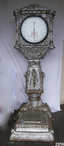 Flagstaff Hill Maritime Museum and Village
Scale, 1920
Inventor Biography: Percival Everitt was a Norfolk-born engineer and regarded as the father of the coin-op industry. in 1884 he patented one of his many inventions the coin-operated scales. For many people, it was their first exposure to coin-operated machines. As a young man in 1877, Everitt invented a hay and corn pitcher, a turnip thinner in 1878 and an “Automatic Travelling Anchor” in 1880. But he hit his stride in 1883 with the first postcard-vending machine over a hundred of which he distributed around London. Everitt went on to invent the one penny scale which prompted the formation of the Weighing Machine Company in 1885. Further inventions followed a blow tester in 1887 also the machine for testing a person grip in 1888 and the dispensing machine that opera glasses could be hired from in 1889 also the fortune-telling machine in 1890. He also invented a mechanism to shut coin slots when vending machines were empty, but then as now vandals posed a problem by jamming paper into the slot. Everitt sadly did not make his fortune he died suddenly in February 1893, in his late forties with £71 to his name. Penny Slot Weighing Machine: When the Australian colonies federated to form the Commonwealth of Australia in 1901 their post and telegraph departments were merged to form the national Postmaster General's (PMG) Department. The subject scale is an automatic public weighing machine, No.387, made in England by George Salter and Co. of West Bromwich. The Australasian Automatic Weighing Machine Co. Ltd in 1923 tendered for the right to place Automatic Weighing Machines on railway and tram premises throughout New South Wales subsequently for five-year terms in return for a fixed payment per machine and a portion of the revenue to the NSW Government. The company also made arrangements with the Postmaster General's Department to place machines outside post offices across the country. Weights were measured in stones and pound's up to 20 stone (127 kg) and average weights were shown separately for men, women, boys and girls by various heights in feet and inches. The subject item has had its scale change by the Eastern Scale Company to metric and it is believed to have occurred shortly after April 2000 as the company was first registered and began trading on this date. This weighing machine was originally installed by the Australasian Automatic Weighing Machine Co. Ltd at Warrnambool Post Office and was made by the firm, George Salter and Company, in West Bromwich, England to the Percival Everitt patent. Salter advertised that these machines were suitable for hotels, pleasure gardens, theaters, exhibition halls, clubs, baths and places of public resort. The company had been established in 1760 by the brothers, Richard and William Salter, manufacturing springs and pocket steelyards (spring balances). After several generations, the company was taken over by a nephew, George, and in 1884 the Salter trademark was registered to show a Staffordshire knot pierced by an arrow. The company's expanded range of products included the first coin-operated public weighing machines in the 1880s and in 1895 the first English made typewriter. When the last George Salter died in 1917, the company passed into the hands of other relatives but continued to grow before being bought out by Staveley Industries in 1973. Despite several subsequent mergers, the Salter name continues today on home ware products such as digital scales.A very rare example of a penny in the slot weighing machine imported into Australia and used in public places the item is significant as it gives a snapshot into community life at the time where the public could go and get weighed given there were no personal weighing machines or equipment that people could use at home. So if they needed to post a letter or go on a train journey they could use a machine to check their weight. Whats interesting is that this patent by Percival Everitt was the worlds first slot machine and the start of casino, arcade and other types of slot machines. Personal weighing scale metal large silver painted penny coin operated. Weight measurements are in stones and pounds. Australian Automatic Weighing Machine 60 lb Everitt Patent. flagstaff hill, warrnambool, shipwrecked-coast, flagstaff-hill, flagstaff-hill-maritime-museum, maritime-museum, shipwreck-coast, flagstaff-hill-maritime-village -
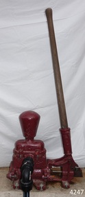 Flagstaff Hill Maritime Museum and Village
Equipment - Pump, circa 1930's - 1940's
This pump is an Ajax Type L2 Series A model, made and sold by McPherson’s Pty Ltd of Melbourne circa 1930’s to 1940’s, is a mechanical, hand operated, constant flow pressure pump. It would have been used to pump fluids from one area to another, for example from a dam to a tank or used as a bilge pump on a small vessel, mounted on the vessel’s bulkhead, floor or deck. This type of hand pump is sometimes called a ‘Reciprocating Suction Pump’. It has a mechanical pumping action of the lever moves the piston inside the pump up and down. The water is lifted from below the pump through the inlet pipe and into the pump’s cylinder. This action causes the lower valve to close and the piston’s valve opens and the pressure within the pump forces the water out of the pump through the exit pipe. The limitation of this type of pump is that it can only raise the water a maximum of about 7 metres from beneath the ground and yields 24-26 Litres per minute. This type of pump could be used for many purposes such as pumping water or fuel. McPherson’s 1940’s advertisement proclaims “For all jobs on the land – irrigation, spraying, tank, plumbing, fire-fighting – there’s a suitable “Ajax” pump. Send us the details of you pumping problem. Our Expert’s advice will help you choose the right pump – the one that will give you most years of PROFITABLE PUMPING.” (The Australasian (Melbourne) Sat. 26th October 1940.) McPherson’s Pty Ltd, the manufacturer, advertised a similar pump to this one in The Australasian (Melbourne) in 1936, calling it the Ajax Double Acting Hand Pump. In 1942 another advertisement advised that a representative for a fire-fighting equipment supplier was visiting the western district of Victoria. The company could now supply double-action two-spray Ajax pumps at lower prices than similar pumps the district had recently purchased from Adelaide. McPHERSON’S FOUNDER and COMPANY TIMELINE 1860 – Thomas McPherson, a Scottish immigrant (c. 1853 ), founded McPherson’s in Melbourne, supplying pig iron (lead ingots imported as ballast in ships) to local manufacturers. 1882 – Thomas McPherson established a warehouse in Collins St Melbourne and included tools, steam fittings and machinery in his wares. The business expanded to include steam saw mills and became known as Thomas McPherson and Sons (William Murray and Edward). 1888 – Thomas passed away and his sons inherited the business. In 1896 William Murray became the sole proprietor after his brother Edward’s death. 1900 – The firm expanded, establishing Acme Bolt Company to manufacture nuts and bolts. 1912 – McPhersons Pty Ltd established a machinery warehouse and showroom in 554-556 Collins St Melbourne. McPherson’s went on to establish branches in Sydney (1911), Adelaide (1921) and Perth (1930) 1917 - McPherson’s supplied ‘dog spikes’ for the transcontinental railway, running from Eastern to Western Australia. 1918 – A tool works set up in Kensington, Melbourne, manufacturing Macson lathes and made machine tools that previously had to be imported. 1924 – The Bolt Works was transferred to a new building in Melbourne. McPhersons began making pumps. 1929 – McPherson retired. His son (Sir) William Edward McPherson (known as ‘WE’), was born in Hawthorne, Melbourne, in 1898. After his education he began work in his father’s Melbourne hardware and machinery business He took over as governing director when his father retired. 1929-1932 – McPherson’s supplied thousands of tons of rivets from its Richmond (Melbourne) Bolt Works for the construction of the Sydney Harbour Bridge. 1936 – McPherson’s Pty Ltd is advertising Ajax Pumps in newspapers 1934 – McPhersons purchased the property adjoining the warehouse in Collins Street, and during 1935-1936 built a new office and showrooms on the site of 546-445 Collins St. 1939 - McPherson’s acquired the Tool Equipment Co. Pty. Ltd and Associated Machine Tools Australia Pty Ltd was formed to separate McPherson’s machine-tool manufacturing and merchandising interests. 1939 – Ajax Pump Works, a foundry and pump manufacturing plant, was established in Tottenham, Melbourne, and the Ajax Bolt and Rivet Co Pty Ltd began manufacturing in New Zealand. 1944 - McPherson’s became a public company, McPherson’s Ltd. 1948 - The Ajax Pump Foundry opened at Kyneton, Victoria and in the post war years it grew to became a large manufacturer. 1980’s – Ajax Pumps brochure lists the address as 6 Buckhurst St, South Melbourne, Vic 3205 with the Telephone number 03 669 3588 1988 - Ajax Pumps acquired the Forrers Company, which was established in 1921. Manufacturing in Ipswich, Queensland, specialising in submersible sewage pumps. 1991 – KSB Ajax was formed, bringing together the companies KSB and Ajax Pumps 1993 – Manufacturing was moved to state-of-the-art premises in Tottenham, Victoria 2001 - The Forrers facility was moved to Tottenham. 2007 - Company name KSB Ajax Pumps was changed to KSB Australia Pty Ltd. 2009 - KSB Australia opened a branch in Townsville, Queensland. 2011 - KSB Australia moved to its dedicated Water and Waste Water Competence Centre in Bundamba, Queensland. DISPLAY OF THIS AJAX PUMP This pump was installed at Flagstaff Hill Maritime Village as part of a working display in the village by the Friends of Flagstaff Hill, in acknowledgement of the dedicated involvement of one of its long serving members, Bob Crossman. The display was officially opened 31st March 2018 and incorporates a restored Furphy Tank and Water Pipe Stand. The pump is used to draw water from the lake, through the water stand pipe and into the reconditioned Furphy Tank. This Ajax pump made by McPherson’s Pty Ltd is significant for its association with McPherson’s, a prominent manufacturer of hardware in Victoria. McPherson’s is famous for supplying ‘dog-spikes’ for the transcontinental railway (eastern to western Australia, 1917) and rivets for the Sydney Harbour Bridge (1929-1932). The Ajax pump is also of significance because of its association with McPherson’s Governing Director (Sir) William McPherson, former premier and treasurer in Victoria 1928-1929. The former McPherson’s Pty Ltd building in Collins Street Melbourne is now on the Victorian Heritage Register VHR H0942 This pump is representative of mechanical pumps popular in the early to mid-1900’s and still used today. Hand operated pressure pump, double acting. Cast metal case, painted red, with steel hose attachments and long metal lever. Pump is bolted to wooden plank. Model of pump is AJAX, Type L2, Series A pump. Embossed on lower section of pump "L2 - 10", "L2 - -1", "AJAX" “(?) –2-1” Embossed on lower handle “3-7” “L – 4” Embossed on attached plate “FOR SPARE PARTS / TYPE L2 / SERIES A / PUMP ASSEMBLED BY T R” Manufactured by McPherson’s Pty Ltd of Melbourne circa 1930’s - 1940’s.flagstaff hill, warrnambool, flagstaff hill maritime museum, shipwreck coast, flagstaff hill maritime village, great ocean road, ajax pump works tottenham melbourne, ajax pump factory kyneton, william edward mcpherson, thomas mcpherson of melbourne, mcpherson’s pty ltd melbourne, acme bolt company, tool equipment co. pty. ltd, associated machine tools australia pty ltd, ajax bolt and rivet co. pty ltd new zealand, forrers company ipswich queensland, ksb ajax pumps, ksb australia pty ltd, macson lathes, tool manufacturer early to mid- 20th century, ajax double acting hand pump, ajax type l2 series a pump, qisjax pumps, water pump 1940’s, fuel pump 1940’s, hand operated constant flow pressure pump, reciprocating suction pump, agricultural hand pump, plumber’s hand pump, portable hand pump -
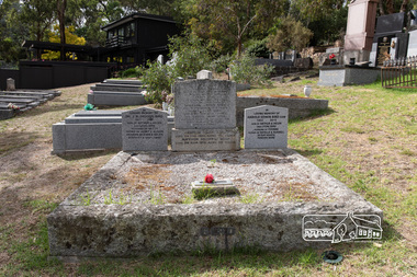 Eltham District Historical Society Inc
Photograph, Peter Pidgeon, Graves of George and Janet Bird and family, Eltham Cemetery, Victoria, 5 April 2021
George Bird was born in England in 1845 and arrived in Australia in 1856 as a child of assisted migrants. Soon afterwards he came out to Eltham to live with his uncle George Stebbings, working for him as bricklayer's assistant in building, amongst others, Shillinglaw Cottage and the Anglican and Methodist Churches in Eltham. He later purchased 72 acres at the eastern end of Pitt Street (bounded by Eucalyptus Road, Mount Pleasant Road and present-day Rockliffe Street) and established the property ‘View Hill’, which was worked as a mixed farm and orchard (including berries). In 1878 he married Janet Kilpatrick, who had emigrated from Scotland. They had ten children, three of whom died in infancy. The wedding in 1904 of their eldest surviving daughter Sarah (‘Sis’) to Edward Pepper appears to have been quite a society event. George was a staunch Methodist and was a Church Steward and a Sunday School Superintendent in about 1890. Janet died in 1915 and George died in 1920 (though his gravestone says 1921). George's will stated that his property was to be divided between all his children in equal shares. This necessitated subdivision of the View Hill property, which took place progressively between 1922 and 1926. One son, George Hugh Bird, operated a drapery store in Main Road (near Bridge Street) in around 1915. Later, in the 1920s, he ran a greengrocer's shop (also selling confectionery) in Main Road opposite Eltham Station. It was the first shop in Eltham to have plate glass windows. At the same time, his brother Reg had a grocery store on the station side of Main Road. George and Janet are buried together in a family plot in Eltham Cemetery. Several descendants are also buried in the cemetery. In Loving Memory Of George Bird Died 5 December 1921 aged 76 years And his beloved wife Janet Bird Died 5 Sept 1915 aged 57 years Also their children William James Bird Died 25 Feb 1888 aged 8 years Mary Jane Bird Died 8 Oct 1891 aged 7 years Pte Edwin John Bird Killed in action in the Great War 11 Aug 1918 aged 30 years Buried in France And on the base stone George Hugh Bird Died 26 Feb. 1965. Aged 79 years Arthur Andrew Bird Died 25 Mar. 1970 Aged 75 years To the left In Loving Memory of Dr. J. R. (Roger) Bird 1927 2001 Son of Arthur & Helen (nee Lyon) Bird Husband of Betty Father of Janet & Alison Grandpa of Evan & Helen Scientist & Gentleman To the right In Loving Memory of Harold Edwin Bird OAM 1922 - 2015 Son of Arthur & Helen (nee Lyon) Bird Husband of Yvonne Father of Estell & Russell In our hearts Forever moreBorn Digitaleltham cemetery, gravestones, arthur andrew bird, arthur bird, edwin john bird, george bird, george hugh bird, harold edwin bird, helen bird (nee lyon), j. r. (roger) bird, janet bird (nee kilpatrick), william james bird, yvonne bird -
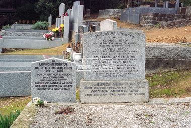 Eltham District Historical Society Inc
Negative - Photograph, Harry Gilham, Grave of Christopher Watson, Eltham Cemetery, Victoria, 1 Aug 2007
George Bird was born in England in 1845 and arrived in Australia in 1856 as a child of assisted migrants. Soon afterwards he came out to Eltham to live with his uncle George Stebbings, working for him as bricklayer's assistant in building, amongst others, Shillinglaw Cottage and the Anglican and Methodist Churches in Eltham. He later purchased 72 acres at the eastern end of Pitt Street (bounded by Eucalyptus Road, Mount Pleasant Road and present-day Rockliffe Street) and established the property ‘View Hill’, which was worked as a mixed farm and orchard (including berries). In 1878 he married Janet Kilpatrick, who had emigrated from Scotland. They had ten children, three of whom died in infancy. The wedding in 1904 of their eldest surviving daughter Sarah (‘Sis’) to Edward Pepper appears to have been quite a society event. George was a staunch Methodist and was a Church Steward and a Sunday School Superintendent in about 1890. Janet died in 1915 and George died in 1920 (though his gravestone says 1921). George's will stated that his property was to be divided between all his children in equal shares. This necessitated subdivision of the View Hill property, which took place progressively between 1922 and 1926. One son, George Hugh Bird, operated a drapery store in Main Road (near Bridge Street) in around 1915. Later, in the 1920s, he ran a greengrocer's shop (also selling confectionery) in Main Road opposite Eltham Station. It was the first shop in Eltham to have plate glass windows. At the same time, his brother Reg had a grocery store on the station side of Main Road. George and Janet are buried together in a family plot in Eltham Cemetery. Several descendants are also buried in the cemetery. In Loving Memory Of George Bird Died 5 December 1921 aged 76 years And his beloved wife Janet Bird Died 5 Sept 1915 aged 57 years Also their children William James Bird Died 25 Feb 1888 aged 8 years Mary Jane Bird Died 8 Oct 1891 aged 7 years Pte Edwin John Bird Killed in action in the Great War 11 Aug 1918 aged 30 years Buried in France And on the base stone George Hugh Bird Died 26 Feb. 1965. Aged 79 years Arthur Andrew Bird Died 25 Mar. 1970 Aged 75 years To the left In Loving Memory of Dr. J. R. (Roger) Bird 1927 2001 Son of Arthur & Helen (nee Lyon) Bird Husband of Betty Father of Janet & Alison Grandpa of Evan & Helen Scientist & Gentleman To the right In Loving Memory of Harold Edwin Bird OAM 1922 - 2015 Son of Arthur & Helen (nee Lyon) Bird Husband of Yvonne Father of Estell & Russell In our hearts Forever moreeltham cemetery, gravestones, memorials, arthur andrew bird, arthur bird, edwin john bird, george bird, george hugh bird, harold edwin bird, helen bird (nee lyon), j. r. (roger) bird, j.r. (roger) bird, janet bird, janet bird (nee kilpatrick), william james bird, yvonne bird -
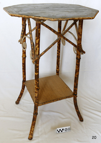 Flagstaff Hill Maritime Museum and Village
Furniture - Plant Stand, Late 19th Century (1898)
During the years 1869-1935 there were well over 250 registered bamboo furniture producers in Britain. The earliest recorded firm was Hubert Bill of 14 Little Camden St, London N.W., who claimed to have been established in (1869) while Daniel Jacobs & Sons of Hackney Road, London, were still in business in 1915, after 45 years of production. Design, quality, price and methods of construction were fairly consistent throughout the whole period, but it was the imaginative and often eccentric choice of subject matter that marked differentiation between the various firms. While most produced standard tables, stands and fire-screens, the more adventurous offered for sale items such as corner shelve units, charcoal barbecue grills and musical tea tables. Shelves were often covered with embossed leather paper designs, at first imported from Japan and then later produced in England. Some firms incorporated the knobbly roots of the bamboo stems into their designs, generally to form feet. Occasionally handles to drawers and cupboards were made with these roots although they were more commonly carved as imitations. Handles were mostly of cheap metal or brass. The ends of the bamboo canes were capped with stamped metal or turned bone, ivory or wooden discs. Methods of construction fell into three categories. First and most common is that of pegging. Bamboo stems being hollow, thick dowels can easily be glued into the joints. Some firms farmed out this work of `plugging' the ends of the canes to part-time workers at home. The second method, that of pinning, was far less satisfactory as bamboo tends to split lengthwise and therefore the jointed pieces eventually disintegrated. The most efficient method was that patented in 1888 (patent No 2383) by the firm of W. F. Needham in Birmingham. It consisted of metal shoes and covers for all joints which were made by wrapping a metal strip around the stems and soldering the overlapping ends. Some joints were further strengthened by a small pin or screw. Needham was by far the largest and most successful manufacturer and their individual and superior method of construction undoubtedly gained them their reputation. A. Englander & Searle of 34 Gt Eastern St and 31 Mare St, Hackney, London, were a firm particularly concerned with methods of construction. Although they seem to have entered the bamboo furniture market at a comparatively late date, about 1898, they produced inexpensive' bamboo, aimed particularly at the export trade. Stating in their catalogue that bamboo furniture “can be exported in one piece or it can be exported in pieces and put together again. The fixing up is much facilitated by a system of marking and numbering. Further, no glue is required for putting together as the screw system only is applied”. This method of construction best fits the Etagere and this item in the flagstaff collection and it is believed to have been made by A Englander & Searle, exported in a knock down form to Australia, purchased in kit form from a dealer here and put together by the purchaser. The bamboo plant stand is a significant item as it highlight furniture fashion of the late Victorian era. This item was highly sort after in its time and although mass produced, not many examples remain because the item is so fragile so this example is a valuable addition to the Flagstaff collection. It is believed,the construction method used is by a notable and respected maker in England of bamboo furniture that was aimed specifically at the export market and probably came to Australia in kit form to be assembled by the purchaser.Bamboo plant stand with octagonal top edged with tortoise shell bamboo the top is of wood and supported by four tortoise shell bamboo legs joined at the base by a square cane covered shelf. The tortoise shell appearance is brown lacquer. Item is part of the Giles Collection. flagstaff hill, warrnambool, shipwrecked coast, flagstaff hill maritime museum, shipwreck coast, furniture, plant stand, bamboo furniture, etagere, victorian furniture, simulated bamboo, tortise shell, a englander & searle, domestic furniture, giles collection, henry giles, cooramook, mailor’s flat, wangoom, 19th century household goods -
 Victorian Aboriginal Corporation for Languages
Periodical, Australian Institute of Aboriginal and Torres Strait Islander Studies, Australian Aboriginal studies : journal of the Australian Institute of Aboriginal and Torres Strait Islander Studies, 2008
... Australian Aboriginal studies : journal of the Australian...Australian Institute of Aboriginal and Torres Strait ...Mawul Rom Project: Openness, obligation and reconciliation Morgan Brigg (Universtiy of Queensland) and Anke Tonnaer (University of Aarhus, Denmark) Aboriginal Australian initiatives to restore balanced relationships with White Australians have recently become part of reconciliation efforts. This paper provides a contextualised report on one such initiative, the Mawul Rom crosscultural mediation project. Viewing Mawul Rom as a diplomatic venture in the lineage of adjustment and earlier Rom rituals raises questions about receptiveness, individual responsibility and the role of Indigenous ceremony in reconciliation efforts. Yolngu ceremonial leaders successfully draw participants into relationship and personally commit them to the tasks of cross-cultural advocacy and reconciliation. But Mawul Rom must also negotiate a paradox because emphasis on the cultural difference of ceremony risks increasing the very social distance that the ritual attempts to confront. Managing this tension will be a key challenge if Mawul Rom is to become an effective diplomatic mechanism for cross-cultural conflict resolution and reconciliation. Living in two camps: the strategies Goldfields Aboriginal people use to manage in the customary economy and the mainstream economy at the same time Howard Sercombe (Strathclyde University, Glasgow) The economic sustainability of Aboriginal households has been a matter of public concern across a range of contexts. This research, conducted in the Eastern Goldfields of Western Australia, shows how economically successful Aboriginal persons manage ?dual economic engagement?, or involvement in the customary economy and the mainstream economy at the same time. The two economies sometimes reinforce each other but are more often in conflict, and management of conflicting obligations requires high degrees of skill and innovation. As well as creating financially sustainable households, the participants contributed significantly to the health of their extended families and communities. The research also shows that many Aboriginal people, no matter what their material and personal resources, are conscious of how fragile and unpredictable their economic lives can be, and that involvement in the customary economy is a kind of mutual insurance to guarantee survival if times get tough. Indigenous population data for evaluation and performance measurement: A cautionary note Gaminiratne Wijesekere (Dept. of Families, Housing, Community Services and Indigenous Affairs, Canberra) I outline the status of population census counts for Indigenous peoples, identifying information on Indigenous births and deaths, and internal migration estimates. I comment on the ?experimental? Indigenous population projections and question the rationale for having two sets of projections. Program managers and evaluators need to be mindful of limitations of the data when using these projections for monitoring, evaluating and measuring Indigenous programs. Reaching out to a younger generation using a 3D computer game for storytelling: Vincent Serico?s legacy Theodor G Wyeld (Flinders University, Adeliade) and Brett Leavy (CyberDreaming Australia) Sadly, Vincent Serico (1949?2008), artist, activist and humanist, recently passed away. Born in southern Queensland in Wakka Wakka/Kabi Kabi Country (Carnarvon Gorge region) in 1949, Vincent was a member of the Stolen Generations. He was separated from his family by White administration at four years of age. He grew up on the Cherbourg Aboriginal Reserve in the 1950s, when the policies of segregation and assimilation were at their peak. Only returning to his Country in his early forties, Vincent started painting his stories and the stories that had been passed on to him about the region. These paintings manifest Vincent?s sanctity for tradition, storytelling, language, spirit and beliefs. A team of researchers was honoured and fortunate to have worked closely with Vincent to develop a 3D simulation of his Country using a 3D computer game toolkit. Embedded in this simulation of his Country, in the locations that their stories speak to, are some of Vincent?s important contemporary art works. They are accompanied by a narration of Vincent?s oral history about the places, people and events depicted. Vincent was deeply concerned about members of the younger generation around him ?losing their way? in modern times. In a similar vein, Brett Leavy (Kooma) sees the 3D game engine as an opportunity to engage the younger generation in its own cultural heritage in an activity that capitalises on a common pastime. Vincent was an enthusiastic advocate of this approach. Working in consultation with Vincent and the research team, CyberDreaming developed a simulation of Vincent?s Country for young Aboriginal and non-Aboriginal persons from the Carnarvon Gorge region to explore Vincent?s life stories of the region. The use of Vincent?s contemporary paintings as storyboards provides a traditional medium for the local people to interactively re-engage with traditional values. Called Serico?s World, it represents a legacy to his life?s works, joys and regrets. Here we discuss the background to this project and Vincent?s contribution. A singular beeswax representation of Namarrkon, the Lightning Man, from western Arnhem Land RG Gunn (La Trobe University) and RL Whear (Jawoyn Association) Samples from a beeswax representation of Namarrkon, the Lightning Man, from western Arnhem Land were analysed for radiocarbon and dated to be about 150 years old. An underlying beeswax figure was found to be approximately 1100 years old. The Dreaming Being Namarrkon is well known throughout Arnhem Land, although his sphere of activity is concentrated around the northern half of the Arnhem Land plateau. Namarrkon is well represented in rock-paintings in this area and continues to be well represented in contemporary canvas-paintings by artists from the broader plateau region. We conclude that representations of Namarrkon in both painted and beeswax forms appear to be parallel manifestations of the late Holocene regionalisation of Arnhem Land. ?Missing the point? or ?what to believe ? the theory or the data?: Rationales for the production of Kimberley points Kim Akerman (Moonah) In a recent article, Rodney Harrison presented an interesting view on the role glass Kimberley points played in the lives of the Aborigines who made and used them. Harrison employed ethnographic and historical data to argue that glass Kimberley points were not part of the normal suite of post-contact artefacts used primarily for hunting and fighting or Indigenous exchange purposes, but primarily were created to service a non-Indigenous market for aesthetically pleasing artefacts. Harrison asserted that this market determined the form that these points took. A critical analysis of the data does not substantiate either of these claims. Here I do not deal with Harrison?s theoretical material or arguments; I focus on the ethnographic and historical material that he has either omitted or failed to appreciate in developing his thesis and which, in turn, renders it invalid. The intensity of raw material utilisation as an indication of occupational history in surface stone artefact assemblages from the Strathbogie Ranges, central Victoria Justin Ian Shiner (La Trobe University, Bundoora) Stone artefact assemblages are a major source of information on past human?landscape relationships throughout much of Australia. These relationships are not well understood in the Strathbogie Ranges of central Victoria, where few detailed analyses of stone artefact assemblages have been undertaken. The purpose of this paper is to redress this situation through the analysis of two surface stone artefact assemblages recorded in early 2000 during a wider investigation of the region?s potential for postgraduate archaeological fieldwork. Analysis of raw material utilisation is used to assess the characteristics of the occupational histories of two locations with similar landscape settings. The analysis indicates variability in the intensity of raw material use between the assemblages, which suggests subtle differences in the occupational history of each location. The results of this work provide a direction for future stone artefact studies within this poorly understood region.document reproductions, maps, b&w photographs, colour photographskimberley, mawul rom project, 3d computer game, storytelling, vincent serico, beeswax, namarrkon, artefact assemblages, strathbogie ranges, groote eylandt, budd billy ii -
 Victorian Aboriginal Corporation for Languages
Periodical, Australian Institute of Aboriginal and Torres Strait Islander Studies, Australian Aboriginal studies : journal of the Australian Institute of Aboriginal and Torres Strait Islander Studies, 2007
... Australian Aboriginal studies : journal of the Australian...Australian Institute of Aboriginal and Torres Strait ...1. Musical and linguistic perspectives on Aboriginal song Allan Marett and Linda Barwick Song brings language and music together. Great singers are at once musicians and wordsmiths, who toss rhythm, melody and word against one another in complex cross-play. In this paper we outline some initial findings that are emerging from our interdisciplinary study of the musical traditions of the Cobourg region of western Arnhem Land, a coastal area situated in the far north of the Australian continent 350 kilometres northeast of Darwin. We focus on a set of songs called Jurtbirrk, sung in Iwaidja, a highly endangered language, whose core speaker base is now located in the community of Minjilang on Croker Island. We bring to bear analytical methodologies from both musicology and linguistics to illuminate this hitherto undocumented genre of love songs. 2. Iwaidja Jurtbirrk songs: Bringing language and music together Linda Barwick (University of Sydney), Bruce Birch and Nicholas Evans (University of Melbourne) Song brings language and music together. Great singers are at once musicians and wordsmiths, who toss rhythm, melody and word against one another in complex cross-play. In this paper we outline some initial findings that are emerging from our interdisciplinary study of the musical traditions of the Cobourg region of western Arnhem Land, a coastal area situated in the far north of the Australian continent 350 kilometres northeast of Darwin. We focus on a set of songs called Jurtbirrk, sung in Iwaidja, a highly endangered language, whose core speaker base is now located in the community of Minjilang on Croker Island. We bring to bear analytical methodologies from both musicology and linguistics to illuminate this hitherto undocumented genre of love songs. 3. Morrdjdjanjno ngan-marnbom story nakka, ?songs that turn me into a story teller?: The morrdjdjanjno of western Arnhem Land Murray Garde (University of Melbourne) Morrdjdjanjno is the name of a song genre from the Arnhem Land plateau in the Top End of the Northern Territory and this paper is a first description of this previously undocumented song tradition. Morrdjdjanjno are songs owned neither by individuals or clans, but are handed down as ?open domain? songs with some singers having knowledge of certain songs unknown to others. Many morrdjdjanjno were once performed as part of animal increase rituals and each song is associated with a particular animal species, especially macropods. Sung only by men, they can be accompanied by clap sticks alone or both clap sticks and didjeridu. First investigations reveal that the song texts are not in everyday speech but include, among other things, totemic referential terms for animals which are exclusive to morrdjdjanjno. Translations from song language into ordinary register speech can often be ?worked up? when the song texts are discussed in their cultural and performance context. The transmission of these songs is severely endangered at present as there are only two known singers remaining both of whom are elderly. 4. Sung and spoken: An analysis of two different versions of a Kun-barlang love song Isabel O?Keeffe (nee Bickerdike) (University of Melbourne) In examining a sung version and a spoken version of a Kun-barlang love song text recorded by Alice Moyle in 1962, I outline the context and overall structure of the song, then provide a detailed comparative analysis of the two versions. I draw some preliminary conclusions about the nature of Kun-barlang song language, particularly in relation to the rhythmic setting of words in song texts and the use of vocables as structural markers. 5. Simplifying musical practice in order to enhance local identity: Rhythmic modes in the Walakandha wangga (Wadeye, Northern Territory) Allan Marett (University of Sydney) Around 1982, senior performers of the Walakandha wangga, a repertory of song and dance from the northern Australian community of Wadeye (Port Keats), made a conscious decision to simplify their complex musical and dance practice in order to strengthen the articulation of a group identity in ceremonial performance. Recordings from the period 1972?82 attest to a rich diversity of rhythmic modes, each of which was associated with a different style of dance. By the mid-1980s, however, this complexity had been significantly reduced. I trace the origin of the original complexity, explore the reasons why this was subsequently reduced, and trace the resultant changes in musical practice. 6. ?Too long, that wangga?: Analysing wangga texts over time Lysbeth Ford (University of Sydney) For the past forty or so years, Daly region song-men have joined with musicologists and linguists to document their wangga songs. This work has revealed a corpus of more than one hundred wangga songs composed in five language varieties Within this corpus are a few wangga texts recorded with their prose versions. I compare sung and spoken texts in an attempt to show not only what makes wangga texts consistently different from prose texts, but also how the most recent wangga texts differ from those composed some forty years ago. 7. Flesh with country: Juxtaposition and minimal contrast in the construction and melodic treatment of jadmi song texts Sally Treloyn (University of Sydney) For some time researchers of Centralian-style songs have found that compositional and performance practices that guide the construction and musical treatment of song texts have a broader social function. Most recently, Barwick has identified an ?aesthetics of parataxis or juxtaposition? in the design of Warumungu song texts and musical organisation (as well as visual arts and dances), that mirrors social values (such as the skin system) and forms 'inductive space' in which relationships between distinct classes of being, places, and groups of persons are established. Here I set out how juxtaposition and minimal contrast in the construction and melodic treatment of jadmi-type junba texts from the north and north-central Kimberley region similarly create 'inductive space' within which living performers, ancestral beings, and the country to which they are attached, are drawn into dynamic, contiguous relationships. 8. The poetics of central Australian Aboriginal song Myfany Turpin (University of Sydney) An often cited feature of traditional songs from Central Australia (CA songs) is the obfuscation of meaning. This arises partly from the difficulties of translation and partly from the difficulties in identifying words in song. The latter is the subject of this paper, where I argue it is a by-product of adhering to the requirements of a highly structured art form. Drawing upon a set of songs from the Arandic language group, I describe the CA song as having three independent obligatory components (text, rhythm and melody) and specify how text is set to rhythm within a rhythmic and a phonological constraint. I show how syllable counting, for the purposes of text setting, reflects a feature of the Arandic sound system. The resultant rhythmic text is then set to melody while adhering to a pattern of text alliteration. 9. Budutthun ratja wiyinymirri: Formal flexibility in the Yol?u manikay tradition and the challenge of recording a complete repertoire Aaron Corn (University of Sydney) with Neparr? a Gumbula (University of Sydney) Among the Yol?u (people) of north-eastern Arnhem Land, manikay (song) series serve as records of sacred relationships between humans, country and ancestors. Their formal structures constitute the overarching order of all ceremonial actions, and their lyrics comprise sacred esoteric lexicons held nowhere else in the Yol?u languages. A consummate knowledge of manikay and its interpenetrability with ancestors, country, and parallel canons of sacred y�ku (names), bu?gul (dances) and miny'tji (designs) is an essential prerequisite to traditional leadership in Yol?u society. Drawing on our recordings of the Baripuy manikay series from 2004 and 2005, we explore the aesthetics and functions of formal flexibility in the manikay tradition. We examine the individuation of lyrical realisations among singers, and the role of rhythmic modes in articulating between luku (root) and bu?gul'mirri (ceremonial) components of repertoire. Our findings will contribute significantly to intercultural understandings of manikay theory and aesthetics, and the centrality of manikay to Yol?u intellectual traditions. 10. Australian Aboriginal song language: So many questions, so little to work with Michael Walsh Review of the questions related to the analysis of Aboriginal song language; requirements for morpheme glossing, component package, interpretations, prose and song text comparison, separation of Indigenous and ethnographic explanations, candour about collection methods, limitations and interpretative origins.maps, colour photographs, tablesyolgnu, wadeye, music and culture -
 Flagstaff Hill Maritime Museum and Village
Photograph - Historical, building, Late 19th to early 20th century
The black and white photograph depicts the Lady Bay Lighthouse Complex at Flagstaff Hill, Warrnambool. It was opened on this site in 1871. From left to right, the Chartroom (previously named the Store), Upper Lighthouse, Flagstaff, Lighthouse Keeper's Quarters. The bluestone buildings are facing North on Merri Street. The Harbour Pilot's Lodgings were on the east of the Complex. There are two unknown male figures standing in front of the light-coloured picket fence that encompasses the Complex. The photograph is mounted on card. WARRNAMBOOL'S LADY BAY LIGHTHOUSES In the 1800s ships sailing from England to Australia began to use Bass Strait as a faster route to Melbourne. Small navigation errors led to many tragic shipwrecks. From 1848 lighthouses were operating along Victoria’s southern coast as a guide for sailors. Coastal towns such as Warrnambool grew and the exchange of trade and passengers was of great benefit. However, the uncertain weather changes, relatively shallow waters and treacherous, hidden rocky reefs were not really suitable for a Harbour and in the 1840s and 1850s, there were many shipwrecks in the area, with some even stranded in its Lady Bay harbour. A jetty was built in 1850 and a flagstaff to guide seafarers was placed up high on what became known now as Flagstaff Hill. In November 1857 the Victorian Government recommended that Warrnambool Harbour had beacons and two lighthouses to guide vessels into and out of the Harbour safely. The white light of the Middle Island lighthouse was to be used for the first time on September 1, 1859. The red light of the Beach Lighthouse, a wooden obelisk structure, was first operated on March 25, 1860, but in 1868 this light was ‘discontinued’ due to it being too low. Melbourne’s Department of Public Works decided to relocate the Middle Island Lighthouse Complex - Lighthouse, Keeper’s Quarters, Privy, Store Room and even water tanks - to Flagstaff Hill. The lower obelisk was shortened, and a protruding gallery, railing, and external ladder were added, and the light from the Beach Lighthouse. A green guiding light was erected on the end of the jetty. The transfer of the Complex began in March 1871. Each shaped stone of the lighthouse was carefully numbered, removed then reassembled on Flagstaff Hill. In 1872 the well was sunk behind the Lighthouse Keeper’s Cottage. The Keepers and families had left Middle Island in April and moved to Flagstaff Hill in October 1871. Vessels entering Lady Bay align the Upper and Lower Lighthouse towers during the day and the lights at night. The Upper Lighthouse is a round tower, and the Lower Light is square. The Lighthouses were categorised as harbour lights rather than coastal lights, so they remain under the control of the Victorian Government’s Ports and Harbours section. The lights were originally powered by oil, then acetylene gas, later by electricity, and then converted to solar power in 1988. In 1993 the solar panel was replaced by a battery charger. A decision was made in 1936 to replace the lighthouses’ lights with unattended lights that no longer required Keepers and Assistants. At least 29 Keepers had attended to the lighthouse from its opening in 1859 to when the last official Lightkeepers left In April 1916. The Warrnambool Harbour Board rented out the Quarters from 1916 to 1936. The Board closed down but the rentals continued with other unknown landlords. In the 1970s the Flagstaff Hill Planning Board was set up under the chairmanship of John Lindsay. The Board was to make recommendations to the Warrnambool City Council regarding using the buildings and the rest of the Crown Land on the site. The Flagstaff Hill Maritime Village opened in 1975 and began renovating the Cottage in stages, during which time evidence of a 1920s fire was found in the eastern section of the cottage. Additions of a porch on the west and a washroom on the east were made in the 1980s. The western part of the building is now a Shipwreck Museum and the east has returned to a late 19th-century Lighthouse Keeper’s cottage and includes the screen made by Assistant Lighthouse Keeper Thomas Hope in the late 19th century. He served as Assistant Keeper in Warrnambool for two periods.The Warrnambool Lighthouse Complex is now listed on the Victorian Heritage Register, H1520, for being of historical, scientific (technological) and architectural significance to the State of Victoria. The Complex is significant as an example of early colonial development. The buildings are significant for their connection with the important navigational function of the Lighthouses, a function still being performed to this day. The buildings are also significant as an example of structures designed and works carried out by the Public Works Department in Victoria in the mid-to-late 19th century. The structures still stand strong. Photograph; Warrnambool Lighthouse Keeper's cottage, lighthouse, flagstaff and chartroom at Flagstaff Hill, and a light-coloured picket fence with gate. Two male figures are in front of the fence. Black and white print glued to a yellow card. The inscription is indecipherable. The right side of the cottage has a built-in, enclosed addition.Ink stamped in lower right hand corner, too faded to be legible.flagstaff hill, flagstaff hill maritime museum, flagstaff hill maritime village, warrnambool, maritime museum, shipwreck coast, lighthouse keeper's cottage, lighthouse residence, lighthouse, chart room, quarters, privy, middle island, beach lighthouse, obelisk, lighthouse complex, lady bay complex, warrnambool port, warrnambool harbour, lady bay, keepers, lighthouse keeper, upper lighthouse, lower lighthouse, assistant keeper, ports and harbours, cottage -
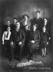 Melton City Libraries
Photograph, Charles Ernest and Jessie Barrie with family, Unknown
This document is has been compiled by Wendy Barrie daughter of Ernest (Bon) and Edna Barrie and granddaughter of Charles E and Jessie M Barrie. I was born in during WW 11 and the first child of my generation to live on the ‘ Darlingsford’ property at Melton. My grandfather was well known in the district and was mostly referred to as Ernie. He shared the same initials as his second son Edgar. His three eldest sons lived and farmed in Melton for their entire lives. His descendants are still associated with farming, engineering and earthmoving in Melton. Ernie Barrie operated a travelling Chaff Cutter in the St Arnaud area where his parents William and Mary Ann had taken up land at Coonooer West in 1873. Ernie commenced his working life with a team of bullocks and a chaff cutter. The earliest connection he had with Melton was in 1887. By the beginning of the 20th century Ernie and his father William and brothers, William, Samuel, James Edwin,[Ted] Robert, Arthur and Albert have been associated with farming and milling in the Melton district. In the early 1900’s Ernie and his brother Ted were in partnership in a Chaff cutting and Hay processing Mill on the corner of Station and Brooklyn road Melton South. The mill was managed by William for a time. By 1906 Charles Ernest and James Edwin were in partnership in the Station Road mill when a connecting rail line across Brooklyn Road for a siding was constructed to the Melton Railway Station. In 1911 the Mill’s letterhead shows C.E. BARRIE Hay Pressing and Chaff Cutting Mills. Melton Railway Station. Telephone No 1 Melton. This Mill as sold to H S K Ward in 1916 and stood until 1977 when it burnt down in a spectacular fire. Ernie built a house at Melton South beside the Chaff Mill at Station Road in 1906 and married Jessie May Lang in August at the Methodist Church. Jessie’s father was Thomas Lang. He came to Melton in 1896 and was the Head Teacher at Melton State School No 430 until he retired in 1917. They had 9 children with 8 surviving to adulthood. Jessie and Ernie had 6 sons and 3 daughters. All the children lived at Darlingsford. In April 1910 the family left Melton for a brief period and moved to a farm in Trundle in NSW. They returned to Melton and purchased Darlingsford in May 1911. For a time during WW1 they lived at Moonee Ponds near the Lang grandparents at Ascot Vale. Mary and Bon attended Bank St State School. The children developed diphtheria in 1916 and their youngest boy, Cecil died of complications. Mary and Bon were taken to Fairfield Hospital and both recovered. At the end of the war influenza broke out the family returned to Darlingsford and shared the home for a short while with the Pearcey family who had been working the farm. By 1922 the family had and grown and Edgar, Tom, Horace, Jessie, Joyce and Jim were living a Darlingsford. Ernie continued during the 1920’s working the farm and attend his many civic and community commitments. Two 8 clydesdale horse teams were used to work the land which meant early rising for the horses to be fed and harnessed to commence the days work. In 1916 Ernie also became involved in a Chaff Mill on the corner of Sunshine and Geelong Road West Footscray, which at the time was being run by John Ralph Schutt. It was known an Schutt Barrie. A flour mill was added at a later stage. Other Schutt and Barrie mills were situated at Parwan and Diggers Rest. Another mill was situated beside the railway line at Rockbank. The Footscray mill ceased operation in 1968 Ernie spent a lot of time and energy at the Parwan Mill and travelling around Parwan and Balliang farms, where he came to know many of the families in the district. Ernies commitment to the civic development to the Melton and district was extensive, he was involved with a number of large events during the 1920’s such as the Melton Exhibitions and the 1929 Back to Melton Celebrations. He was a member of the Australian Natives Association at the turn of the century. He was Chairman of the School Committee at Melton State School 430 and the Melton South State School in thw1920s. He donated the land for a Hall for Melton South in 1909, known as Exford Hall and later in 1919 renamed Victoria Hall. The Hall was demolished in 1992. He was a Councillor, JP, and Vice President and President of the Melton Mechanics Institute Hall Committee in 1915- 1916. He was a member of the Methodist Church and later the Scots Presbyterian Church. He was Superintendent of the Sunday School of the Methodist Church to 1910 and later Scots Presbyterian Church until 1931. This is reflected in the theme of children in the stained glass window which was dedicated in his memory by his wife Jessie as a gift to the Scots Church. Charles Ernest Barrie made many generous donations to many charities who supported young people and children. In 1918 Jessie and Ernie made the first donation to a very prominent Victorian charity whose work still continues. Yooralla. In July 1931 Ernie’s untimely death was a major blow to the family and the Melton community. To this day people still vividly recall the day they lined the streets for his funeral. The day of the funeral is recalled as the day Melton stood as two of their prominent citizens who tragically died on the same day. Their eldest daughter Mary had married Keith Robinson in 1930 and had just moved to Heatherdale Toolern Vale with their year old baby son. Bon the eldest son was 22, Edgar 18, Tom 16, Horace 15, Jessie and Joyce 10 and Jim 8 years old. A heavy burden of responsibility fell on the shoulders of the two eldest children, Mary particularly for her mother and Bon stepped in assuming head of the family for his mother, brothers and sisters living at the Darlingsford homestead. In the early 1930’s the three eldest sons took on many of the Civic and Church commitments which their father had held. This community involvement extended well into the 1980s. In 1941 Bon married Edna Myers and they moved into a house shifted from Harkness Lane to Harkness Lane on the eastern section of the Darlingford property. Edgar married Margaret Hodgkinson a Primary school teacher at Melton in 1949 and they lived in the Darlingsford house. Earlier Tom married May Ferris and lived on the eastern side of Ferris Lane in the Ferris home. Bon , Edgar and Tom often operated as a team effort, in particular at harvest time when a larger team of workers was needed. The three farms cultivated wheat, barley and oats and supplied the Mill with sheafed hay. They continued using horse teams until mechanisation in the 1940’s made the horses redundant. By the 1960s their five sons continued with farming. Many loads of hay were transported to the Mill in Footscray. Well into the 1960s hired harvest hands along with agricultural university students were involved in bringing in he harvest. Stacking was an art form in itself and Tom held the expertise for building and shaping the sides and roof. The stacks built in the district each had their own unique shape and could be recognized by their builders. The Barrie brothers developed a mechanical fork lift for picking up complete stooks and moving them to be loaded to the elevator to build the haystack. The prototype built by Bill Gillespie was attached to a Bedford truck. Later refinements in a collaborative effort with the Gillespie brothers a multi pronged fork was attached to the front of tractor which was hydraulically operated to raise each stook onto trucks to be transported to the site of the haystacks. This method of handling sheaves significantly reduced laborious pitchforking individual sheaves. This invention was soon taken up by farmers far and wide and was a common sight in the district at harvest time in the stacking season. I recall visiting farmers calling in at the house at Ferris Road farm to inspect this break through invention. The Clydesdale horse teams were used into the 1940s but by the 1950s the Barries’ farms were fully mechanised. When the demand for sheafed hay declined other crops were introduced these included barley, lucerne, wheat and peas. Sheep were added to the mix in the 1950s in an attempt to keep the farms more viable. In the 1970s part of the Barrie’s farms were facing a major disruption with the impending compulsorily acquisition of a strip of land for the construction the freeway bypass, which divided access between the Darlingsford homestead with those on Ferris Lane. Charles Ernest Barrie and Jessie May Lang's children: 1. Mary Ena BARRIE was born on 07 October 1907. She died on 29 April 1999. 2. Ernest Wesley BARRIE was born on 29 April 1909 in Ascot Vale, Victoria, Australia.He died on 25 December 1985 in Melton, Victoria, Australia. 3. Cecil William BARRIE was born on 23 February 1911.He died on 25 May 1916. 4. Charles Edgar BARRIE was born on 01 June 1913.He died on 06 October 1975. 5. Thomas Lindsay BARRIE was born on 25 November 1914.He died on 14 September 1990 in Melton, Victoria, Australia. 6. William Horace BARRIE was born on 11 October 1915.He died on 19 December 1950. 7. Jessie Maud BARRIE was born on 06 November 1920 in Bacchus Marsh, Victoria, Australia.She died on 26 February 1994. 8. Dorothy Joyce BARRIE was born on 06 November 1920 in Bacchus Marsh, Victoria, Australia.She died on 18 March 2003.. 9. James Edward BARRIE was born on 17 January 1922 in Bacchus Marsh, Victoria, Australia.He died on 23 August 2004Family Photo with Edgar, Tom, Mary, Ernest (Bon), Horace, Jim, Charles Ernest, Jessie and Joycelocal identities -
 Flagstaff Hill Maritime Museum and Village
Book, The Logbooks of The Lady Nelson, 1915
This hardcover book, The logbooks of the 'Lady Nelson' : with the journal of her first commander, Lieutenant James Grant, R.N., by Ida Lee (Mrs Charles Bruce Marriott) was published over 100 years after the Lady Nelson arrived in Australia to navigate and survey this ‘new colony’. Included in the book are sixteen charts and illustrations from the originals in the Admiralty Library, showing the surveyed land and water. The transcribed Contents, below, summarise the trips of the Lady Nelson during this time. Book’s Content PLUS text of the Chart of ‘Part of Bass Strait’ - Chapter 1: The Lady Nelson built with centreboards. Her voyage to Sydney under James Grant. The first ship to pass through Bass Strait. - Chapter 2: Returns to explore the Strait. Her visits to Jervis Bay and to Western Port in 1801 - Chapter 3: Colonel Paterson and Lieutenant Grant survey Hunter River - Chapter 4: Murray appointed commander of the Lady Nelson. His voyage to Norfolk Island. - Chapter 5: Murray’s exploration of Bass Strait. - Chapter 6: Discovery of Port Phillip. - Chapter 7: The Lady Nelson in company with HMS Investigator examines the North-Eastern shores of Australia. - Chapter 8: The French ships in Bass Strait. The founding of Hobart. - Chapter 9: Symons succeeds Curtoys as commander of the Lady Nelson. His voyages to Tasmania, Port Phillip and New Zealand. - Chapter 10: The Lady Nelson in Tasmania. The founding of Port Dalrymple. - Chapter 11: The Estramina is brought to Sydney. The Lady Nelson visits Norfolk Island and Port Dalrymple. - Chapter 12: Tippahee and his four sons are conveyed to New Zealand in the Lady Nelson. - Chapter 13: The Lady Nelson accompanies HMS Tamar to Melville Island. - Chapter 14: The loss of the Lady Nelson Text included with the ‘Chart of Bass Strait’ … “Part of Bass Strait, including the discoveries made by Acting Lieut. J. Murray, commander of His Majesty’s armed surveying vessel Lady Nelson, between November 1801 and March 1802. By command of His Excellency Governor King.” “This chart, which bears Murray’s autograph, shows his explorations of Western Port, Port Phillip and King Island. It should be noted that Flinders Island is named Grand Capuchin. This is one of the charts referred to as "unfortunately missing” in the Historical Records of N.S. Wales, vol. iv. P. 764” The story of the Lady Nelson In 1798 the British Admiralty ordered a cutter of 60 tons to be built along the design of the armed cutter Trial that was developed by Captain John Schanck, with three sliding keels or centreboards that could be individually raised and lowered, for use on the River Thames. The new cutter was to be named Lady Nelson. Philip Gidley King, prior to taking up his appointment as third Governor of the colony of New South Wales, was in England at the time of the Lady Nelson’s fit-out and was aware of the need for such a ship for survey work in the colony in New South Wales. He convinced Captain Schanck, the Commissioner of Transport in England, to construct and rig the Lady Nelson as a brig rather than a cutter, keeping the feature of the three sliding keels, which would be very useful for mapping in shallow waters. The new Lady Nelson was launched at Deptford, England on the River Thames in November 1798, with the official commission to discover and survey the unknown parts of the coast of New Holland (Australia) and establish British sovereignty over the continent. The Lady Nelson sailed from Portsmouth, England on March 1800 under the command of Lieutenant James Grant. She carried an armament of two original and four extra brass carronade carriage guns and set sail as part of a convoy heading to Port Jackson, in New South Wales, New Holland. After a while she continued to sail on her own. Her journey was troubled with problems at times; damaged and broken keels, troublesome crew and leaking topsides between the waterline and the deck due to poor seals. She arrived at the Cape of Good Hope in July and waited for the winter to pass to avoid the strong winds of the ‘Roaring Forties’. While at the Cape, Grant received a despatch to travel to Port Jackson via the newly discovered Bass Strait, rather than the usual route via the tip of Van Diemen’s Land (Tasmania). This also gave him the opportunity to survey the strait on the way. He departed the Cape in October and in December he made his first sighting of New Holland near Mount Gambier in what is now South Australia. A report by Ecclestone in 2012, ‘The Early Charting of Victoria’s Coastline’, mentions that Grant charted and named Capes Banks and Northumberland, and sighted inland hills that he named Mt Gambier and Mt Schanck, the latter after the designer of his ship. Grant then reached the south-western shores of what is now Victoria on 3-4 December 1800, and from Cape Bridgewater he examined the coast eastward to Cape Patton. Although he had not continuously sighted the coast in the vicinity of Port Fairy and Warrnambool, the western part of Victoria became known as Grant’s Land. The Lady Nelson continued eastward and passed through Bass Strait, becoming the first vessel to reach the east coast of New Holland from the west, and arrived at her destination of Port Jackson later in December 1800. Grant, in the Lady Nelson, then left Port Jackson and began survey work. He discovered Port Phillip on Victoria’s coast and explored King Island, he helped establish the first European settlement in Tasmania on the Derwent River, and Port Dalrymple, Newcastle and Port Macquarie. He made several trips from Norfolk Island to Hobart Town. Governor Macquarie sailed on with him to Van Diemen’s Land for a tour of inspection in 1811. Grant helped establish the first settlement on Melville Island in Northern Australia. The Lady Nelson was used to transport cargo, civilians and convicts and to source pigs from Timor. In February 1825 the Lady Nelson sailed again for Timor and never returned. One report said that “Every soul on board, we regret to state, was cruelly massacred, and the hull of the vessel was seen some time after with the name painted on her stern.” The hull was sighted on the island of Babar, which is almost 200 kilometres east of Timor. This particular copy of the book ... This item is from the ‘Pattison Collection’, a collection of books and records that was originally owned by the Warrnambool Mechanics’ Institute, which was founded in Warrnambool in 1853. By 1886 the Warrnambool Mechanics’ Institute (WMI) had grown to have a Library, Museum and Fine Arts Gallery, with a collection of “… choice productions of art, and valuable specimens in almost every branch and many wonderful national curiosities are now to be seen there, including historic relics of the town and district.” It later included a School of Design. Although it was very well patronised, the lack of financial support led the WMI in 1911 to ask the City Council to take it over. In 1935 Ralph Pattison was appointed as City Librarian to establish and organise the Warrnambool Library as it was then called. When the WMI building was pulled down in 1963 a new civic building was erected on the site and the new Warrnambool Library, on behalf of the City Council, took over all the holdings of the WMI. At this time some of the items were separated and identified as the ‘Pattison Collection’, named after Ralph Pattison. Eventually the components of the WMI were distributed from the Warrnambool Library to various places, including the Art Gallery, Historical Society and Flagstaff Hill. Later some were even distributed to other regional branches of Corangamite Regional Library and passed to and fro. It is difficult now to trace just where all of the items have ended up. The books at Flagstaff Hill Maritime Village generally display stamps and markings from Pattison as well as a variety of other institutions including the Mechanics’ Institute itself. RALPH ERIC PATTISON Ralph Eric Pattison was born in Rockhampton, Queensland, in 1891. He married Maude Swan from Warrnambool in 1920 and they set up home in Warrnambool. In 1935 Pattison accepted a position as City Librarian for the Warrnambool City Council. His huge challenge was to make a functional library within two rooms of the Mechanics’ Institute. He tirelessly cleaned, cleared and sorted a disarrayed collection of old books, jars of preserved specimens and other items reserved for exhibition in the city’s museum. He developed and updated the library with a wide variety of books for all tastes, including reference books for students; a difficult task to fulfil during the years following the Depression. He converted all of the lower area of the building into a library, reference room and reading room for members and the public. The books were sorted and stored using a cataloguing and card index system that he had developed himself. He also prepared the upper floor of the building and established the Art Gallery and later the Museum, a place to exhibit the many old relics that had been stored for years for this purpose. One of the treasures he found was a beautiful ancient clock, which he repaired, restored and enjoyed using in his office during the years of his service there. Ralph Pattison was described as “a meticulous gentleman whose punctuality, floorless courtesy and distinctive neat dress were hallmarks of his character, and ‘his’ clock controlled his daily routine, and his opening and closing of the library’s large heavy doors to the minute.” Pattison took leave during 1942 to 1945 to serve in the Royal Australian Navy, Volunteer Reserve as Lieutenant. A few years later he converted one of the Museum’s rooms into a Children’s Library, stocking it with suitable books for the younger generation. This was an instant success. In the 1950’s he had the honour of being appointed to the Victorian Library Board and received more inspiration from the monthly conferences in Melbourne. He was sadly retired in 1959 after over 23 years of service, due to the fact that he had gone over the working age of council officers. However he continued to take a very keen interest in the continual development of the Library until his death in 1969 This book about the logbooks of the Lady Nelson is locally significant for its association with the brig Lady Nelson, in which Lt. James Grant made the first documented European discovery of the area later known as Warrnambool in December 1800. This book is also nationally significant for its association with Grant in the Lady Nelson being the first to sail from west to east through Bass Strait, opening up a shorter, faster route to the colony of Port Jackson rather than going all the way south around Van Diemen’s Land. The book is nationally significant for its contents of the logbooks of the journeys of the Lady Nelson under various commanders and the copies of the charts created from the surveyed information and the new land of Australia was discovered. This book is also significant for its association with the full-size non-sailing replica of the Lady Nelson from Mount Gambier’s visitor centre, which was restored by Flagstaff Hill’s Master Boat Builder in Warrnambool in 2012, and with a ship mode of the Lady Nelson in our Collection The Pattison Collection, along with other items at Flagstaff Hill Maritime Village, was originally part of the Warrnambool Mechanics' Institute’s collection. The Warrnambool Mechanics’ Institute Collection is primarily significant in its totality, rather than for the individual objects it contains. Its contents are highly representative of the development of Mechanics' Institute libraries across Australia, particularly Victoria. A diversity of publications and themes has been amassed, and these provide clues to our understanding of the nature of and changes in the reading habits of Victorians from the 1850s to the middle of the 20th century. The collection also highlights the Warrnambool community’s commitment to the Mechanics’ Institute, reading, literacy and learning in the regions, and proves that access to knowledge was not impeded by distance. These items help to provide a more complete picture of our community’s ideals and aspirations. The Warrnambool Mechanics Institute book collection has historical and social significance for its strong association with the Mechanics Institute movement and the important role it played in the intellectual, cultural and social development of people throughout the latter part of the nineteenth century and the early twentieth century. The collection of books is a rare example of an early lending library and its significance is enhanced by the survival of an original collection of many volumes. The Warrnambool Mechanics' Institute’s publication collection is of both local and state significance. The Logbooks of The Lady Nelson Author: Ida Lee ( Mrs Charles Bruce Marriott) Publisher: Grafton & Co Date: 1915Label on spine with typed text RA 910.994 LEE Inside front cover has a sticker that reads Warrnambool Mechanics Institute and Free Library shipwrecked-coast, flagstaff-hill, warrnambool, flagstaff-hill-maritime-museum, maritime-museum, shipwreck-coast, flagstaff-hill-maritime-village, shipwrecked-artefact, book, warrnambool library, warrnambool mechanics’ institute, warrnambool city librarian, mechanics’ institute library, victorian library board, warrnambool books and records, warrnambool children’s library, great ocean road, the logbooks of the lady nelson, ida lee, mrs charles bruce marriott, captain john schanck, sliding keels or centreboards, lady nelson, british brig hms lady nelson, lieutennant james grant, bass strait discovery, surveying king island and port phillip bay, philip gidley king, survey map -
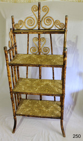 Flagstaff Hill Maritime Museum and Village
Furniture - Shelves, A. Englander & Searle, Late 19th Century (1898)
This music stand set of shelves is one of many 19th century items of furniture, linen and crockery donated to Flagstaff Hill Maritime Village by, Vera and Aurelin Giles. The items are associated with the Giles Family and are known as the “Giles Collection”. Many of the items of furniture, linen and crockery in the Lighthouse Keeper’s Cottage were donated by Vera and Aurelin Giles and mostly came from the simple home of Vera’s parents-in-law, Henry Giles and his wife Mary Jane (nee Freckleton) whose photos are in the parlour. They married in 1880. Henry, born at Tower Hill in 1858, was a labourer on the construction of the Breakwater before leaving in 1895 to build bridges in N.S.W. for about seven years. Mary Jane was born in 1860 at Cooramook. She attended Mailor’s Flat State School where she was also a student teacher before, as family legend has it, she became a governess at “Injemiara” where her grandfather, Francis Freckleton, once owned land. Henry and Mary’s family of six, some of whom were born at Mailor’s Flat and later children at Wangoom, lived with their parents at Wangoom and Purnim west, where Henry died in 1933 and Mary Jane in 1940. THE SHELVES During the years 1869-1935 there were well over 250 registered bamboo furniture producers in Britain. The earliest recorded firm was Hubert Bill of 14 Little Camden St, London N.W., who claimed to have been established in (1869 the first bamboo furniture maker), while Daniel Jacobs & Sons of Hackney Road, London, were still in business in 1915, after 45 years of production. Design, quality, price and methods of construction were fairly consistent throughout the whole period, but it was the imaginative and often eccentric choice of subject matter that marked the differentiation between the various firms. While most produced standard tables, stands and fire-screens, the more adventurous offered for sale items such as Corner shelve units, charcoal barbecue grills and musical tea tables. Shelves were often covered with embossed leather paper designs, at first imported from Japan and then later produced in England. Some firms incorporated the knobbly roots of the bamboo stems into their designs, generally to form feet. Occasionally handles to drawers and cupboards were made with these roots although they were more commonly carved as imitations. Handles were mostly of cheap metal or brass. The ends of the bamboo canes were capped with stamped metal or turned bone, ivory or wooden discs. Methods of construction fell into three categories. First and most common is that of pegging. Bamboo stems being hollow, thick dowels can easily be glued into the joints. Some firms farmed out this work of `plugging' the ends of the canes to part-time workers at home. The second method, that of pinning, was far less satisfactory as bamboo tends to split lengthwise and therefore the jointed pieces eventually disintegrated. The most efficient method was that patented in 1888 (patent No 2383) by the firm of W. F. Needham in Birmingham. It consisted of metal shoes and covers for all joints which were made by wrapping a metal strip around the stems and soldering the overlapping ends. Some joints were further strengthened by a small pin or screw. Needham was by far the largest and most successful manufacturer and their individual and superior method of construction undoubtedly gained them their reputation. A. Englander & Searle of 34 Gt Eastern St and 31 Mare St, Hackney, London, were a firm particularly concerned with methods of construction. Although they seem to have entered the bamboo furniture market at a comparatively late date, about 1898, they produced inexpensive bamboo, aimed particularly at the export trade. The company stated in their catalogue that bamboo furniture “can be exported in one piece or it can be exported in pieces and put together again. The fixing up is much facilitated by a system of marking and numbering. Further, no glue is required for putting together as the screw system only is applied”. This method of construction best fits the Etagere in the Flagstaff collection and it is believed to have been made by A Englander & Searle, exported in a knock down form to Australia, purchased in kit form from a dealer hear and put together by the owner. The Etagere is a significant item as it highlight furniture fashion of the late Victorian era. This item was highly sort after in its time and although mass produced, not many examples remain, so this example is a valuable addition to the Flagstaff collection. It is believed that the construction method used is by a notable and respected maker of bamboo furniture and that its production was aimed at the export market and probably came to Australia in kit form.Bamboo shelves: decorative free standing Etagere comprising three large shelves and one small shelf. Shelves are made of wood used to store either orange or bacon boxes (as there are no knots in the wood, imported from South America and cheap to recycle). Shelves are covered with embossed leather paper. Frame is made from tortoise shell bamboo (brown lacquer applied to simulate tortoise shell appearance). Ends of bamboo canes are covered with metal shoes and fixed with a pin. Other bamboo joints are fixed with round head steel screws. This item is part of the Giles Collection.Noneflagstaff hill, warrnambool, shipwrecked-coast, flagstaff-hill, flagstaff-hill-maritime-museum, maritime-museum, shipwreck-coast, flagstaff-hill-maritime-village, bamboo shelves, bamboo etagere, victorian furniture, furniture, bamboo furniture, embossed leather paper, simulated bamboo, tortise shell, a englander & searle, giles collection, henry giles, tower hill, cooramook, warrnambool breakwater, mailor’s flat, wangoom, 19th century furniture -
 Melbourne Tram Museum
Magazine, Melbourne & Metropolitan Tramways Board (MMTB), "Metra News", 1980 to 1982
.0 - Autumn 1980 - Passenger counting, Survey provides data, We lead the way with Z3, Wattle Park, transport in Moscow, Spike Milligan, Melbourne's decorated trams, transporting art, sports, training, and Raymond Stock, Assistant Traffic Manager Revenue .1 - Winter 1980 - Bourke St Mall is popular, Senior citizens help design new tram (Z3), A bus-only lane in Johnstone St., Depot Employees' Social and facility Melbourne. Has a profile on Mr R. C. Drummond, Traffic Manager. .2 - Spring 1980 - Christmas Message, supporting those children with polio in 1938, Trolley buses, Z3 trams being built, use of parafil in overhead, cleaning truck. Has a profile on Ken Hall, Assistant Chief Engineer - Mechanical and Reg Robinson who was the organiser for the 1938 polio event - bus driver / instructor. .3 - Summer 1981 - MMTB involvement with Australia Day pageant, note involvement of TMSV, Bendigo, BTPS 27 (26 Jan. 1981), film on apprentices, tram stop shelters, resilient track work, trolley buses, the supply and systems department including Hawthorn clothing workroom and printing department (photos) and profile on Mr Jerry Compton, Supply and systems department. (Two copies held) .4 - Autumn 1981 - new buildings at Footscray, South Melbourne, trolley buses for Melbourne?, building MAN buses, why join the Tramways Benefit Society, article that looks at the Engineering Branch and profile of John Grigg, Chief Engineer. (Two copies held) .5 - Winter 1981 - New passenger shelters, image of the Elizabeth St shelter proposal, where do old trams go?, "Around the Clock" Emergency Service (item on R10) (See Reg item 1004 for photo), formation of Tramway's Sporting Associations, retirement of Board's driver Peter Savage, bus driving school transferred to Hawthorn, Apprentices and Profile on Bill Sibbison, Depot Manager North Fitzroy. .6 - Spring 1981 - 8 pages - Making of Squizzy Taylor film - Flinders St station, Engineering Amenities at South Melbourne opened, traverser at Preston Workshops, track work - pressing curves at South Melbourne, Conductresses re-union, model tramway at the Royal Show, retirements, sporting association, tramway band, AVM, reducing noise levels, lists Editorial committee. .7 - Summer 1982 - 8 pages - Its Christmas Party time, want to charter a tram or bus?, portable radios, MMTB role in Paraplegic Games, MMTB Architect Gene Marshall retires, photo of WW2 most popular conductresses ball, MMTB Highlights, O-Bahn. Has a profile on Rob Downing - Deputy Chairman. Also Dick Newnham - lift operator at head office, Bob Moffatt - driver turned actor. Also has a follow up on the making of the Squizzy Taylor film "What's wrong with Squizzy" and a photo of the Editorial team and their names. .8 - Autumn 1982 - 8 pages - item on "Taking Melbourne by Storm", photo of Austerity bus 500, Radio Centre, Clifton Pugh tram 504, Essendon Depot (see Reg Item 1005) includes of photos of managers, revenue etc, story on the most popular conductress photo by Win Gibson (see Reg item 180 and 181), new apprentices, John Murdoch model train (Diamond Valley) builder, Sunday vintage tram service (V214) and L class to the zoo. Has a profile on Mr. Peter Saul, Architect. (two copies held) (see image 1178i5 for cover) .9 - Winter 1982 - 8 pages - changes to Doncaster bus - Eastern Free extension, changes to Ministry will affect Board - Steve Crabb, new uniforms, Footscray Depot, apprentice awards, follow up on Austerity buses, Norm Cross and Destination City, Profile on Alan Nolan Runningsheds Engineer, and Mike McLeod MMTB Photographer. (two copies held) .10 - Spring 1982 - book - see Melbourne by tram, Bundoora tramway work, new articulated vehicles (B class trams), Elizabeth St modal interchange shelter, Brunswick depot, demise of the F class bus (Mark VI), profile of Daryl Meade bus engineer, Joe Saccasan carpenter building branch and a list of Jargon. (two copies held).Demonstrates a MMTB employee newsletter, early 1980sMagazine, two colour printed on A2 sheet, folded to A3, "METRA News", published by the MMTB. Each issue unless noted otherwise four pages. Major items listed. Each issue has personnel news, including new staff, promotions, overseas items;trams, tramways, mmtb, z3 class, bourke st, track equipment, overhead, most popular conductress competition, hawthorn depot, clothing, trolley buses, fund raising, footscray, welfare, sale of trams, recovery, r10 vehicle, flinders st, films, radio centre, essendon depot, theatre, transporting art, austerity buses, footscray depot, doncaster, minister for transport, shelters, bundoora, brunswick depot, buses, mont albert, route 42 -
 Victorian Aboriginal Corporation for Languages
Periodical, Australian Institute of Aboriginal and Torres Strait Islander Studies, Australian Aboriginal studies : journal of the Australian Institute of Aboriginal and Torres Strait Islander Studies, 2010
... Australian Aboriginal studies : journal of the Australian...Australian Institute of Aboriginal and Torres Strait ...'Whose Ethics?':Codifying and enacting ethics in research settings Bringing ethics up to date? A review of the AIATSIS ethical guidelines Michael Davis (Independent Academic) A revision of the AIATSIS Guidelines for Ethical Research in Indigenous Studies was carried out during 2009-10. The purpose of the revision was to bring the Guidelines up to date in light of a range of critical developments that have occurred in Indigenous rights, research and knowledge management since the previous version of the Guidelines was released in 2000. In this paper I present an outline of these developments, and briefly discuss the review process. I argue that the review, and the developments that it responded to, have highlighted that ethical research needs to be thought about more as a type of behaviour and practice between engaged participants, and less as an institutionalised, document-focused and prescriptive approach. The arrogance of ethnography: Managing anthropological research knowledge Sarah Holcombe (ANU) The ethnographic method is a core feature of anthropological practice. This locally intensive research enables insight into local praxis and culturally relative practices that would otherwise not be possible. Indeed, empathetic engagement is only possible in this close and intimate encounter. However, this paper argues that this method can also provide the practitioner with a false sense of his or her own knowing and expertise and, indeed, with arrogance. And the boundaries between the anthropologist as knowledge sink - cultural translator and interpreter - and the knowledge of the local knowledge owners can become opaque. Globalisation and the knowledge ?commons?, exemplified by Google, also highlight the increasing complexities in this area of the governance and ownership of knowledge. Our stronghold of working in remote areas and/or with marginalised groups places us at the forefront of negotiating the multiple new technological knowledge spaces that are opening up in the form of Indigenous websites and knowledge centres in these areas. Anthropology is not immune from the increasing awareness of the limitations and risks of the intellectual property regime for protecting or managing Indigenous knowledge. The relevance of the Declaration on the Rights of Indigenous Peoples in opening up a ?rights-based? discourse, especially in the area of knowledge ownership, brings these issues to the fore. For anthropology to remain relevant, we have to engage locally with these global discourses. This paper begins to traverse some of this ground. Protocols: Devices for translating moralities, controlling knowledge and defining actors in Indigenous research, and critical ethical reflection Margaret Raven (Institute for Sustainability and Technology Policy (ISTP), Murdoch University) Protocols are devices that act to assist with ethical research behaviour in Indigenous research contexts. Protocols also attempt to play a mediating role in the power and control inherent in research. While the development of bureaucratically derived protocols is on the increase, critiques and review of protocols have been undertaken in an ad hoc manner and in the absence of an overarching ethical framework or standard. Additionally, actors implicated in research networks are seldom theorised. This paper sketches out a typology of research characters and the different moral positioning that each of them plays in the research game. It argues that by understanding the ways actors enact research protocols we are better able to understand what protocols are, and how they seek to build ethical research practices. Ethics and research: Dilemmas raised in managing research collections of Aboriginal and Torres Strait Islander materials Grace Koch (AIATSIS) This paper examines some of the ethical dilemmas for the proper management of research collections of Indigenous cultural materials, concentrating upon the use of such material for Native Title purposes. It refers directly to a number of points in the draft of the revised AIATSIS Guidelines for Ethical Research in Indigenous Studies and draws upon both actual and hypothetical examples of issues that may arise when requests are made for Indigenous material. Specific concerns about ethical practices in collecting data and the subsequent control of access to both the data itself and to published works based upon it are raised within the context of several types of collections, including those held by AIATSIS and by Native Title Representative Bodies. Ethics or social justice? Heritage and the politics of recognition Laurajane Smith (ANU) Nancy Fraser?s model of the politics of recognition is used to examine how ethical practices are interconnected with wider struggles for recognition and social justice. This paper focuses on the concept of 'heritage' and the way it is often uncritically linked to 'identity' to illustrate how expert knowledge can become implicated in struggles for recognition. The consequences of this for ethical practice and for rethinking the role of expertise, professional discourses and disciplinary identity are discussed. The ethics of teaching from country Michael Christie (CDU), with the assistance of Yi?iya Guyula, Kathy Gotha and Dh�?gal Gurruwiwi The 'Teaching from Country' program provided the opportunity and the funding for Yol?u (north-east Arnhem Land Aboriginal) knowledge authorities to participate actively in the academic teaching of their languages and cultures from their remote homeland centres using new digital technologies. As two knowledge systems and their practices came to work together, so too did two divergent epistemologies and metaphysics, and challenges to our understandings of our ethical behaviour. This paper uses an examination of the philosophical and pedagogical work of the Yol?u Elders and their students to reflect upon ethical teaching and research in postcolonial knowledge practices. Closing the gaps in and through Indigenous health research: Guidelines, processes and practices Pat Dudgeon (UWA), Kerrie Kelly (Australian Indigenous Psychologists Association) and Roz Walker (UWA) Research in Aboriginal contexts remains a vexed issue given the ongoing inequities and injustices in Indigenous health. It is widely accepted that good research providing a sound evidence base is critical to closing the gap in Aboriginal health and wellbeing outcomes. However, key contemporary research issues still remain regarding how that research is prioritised, carried out, disseminated and translated so that Aboriginal people are the main beneficiaries of the research in every sense. It is widely acknowledged that, historically, research on Indigenous groups by non-Indigenous researchers has benefited the careers and reputations of researchers, often with little benefit and considerably more harm for Indigenous peoples in Australia and internationally. This paper argues that genuine collaborative and equal partnerships in Indigenous health research are critical to enable Aboriginal and Torres Islander people to determine the solutions to close the gap on many contemporary health issues. It suggests that greater recognition of research methodologies, such as community participatory action research, is necessary to ensure that Aboriginal people have control of, or significant input into, determining the Indigenous health research agenda at all levels. This can occur at a national level, such as through the National Health and Medical Research Council (NHMRC) Road Map on Indigenous research priorities (RAWG 2002), and at a local level through the development of structural mechanisms and processes, including research ethics committees? research protocols to hold researchers accountable to the NHMRC ethical guidelines and values which recognise Indigenous culture in all aspects of research. Researching on Ngarrindjeri Ruwe/Ruwar: Methodologies for positive transformation Steve Hemming (Flinders University) , Daryle Rigney (Flinders University) and Shaun Berg (Berg Lawyers) Ngarrindjeri engagement with cultural and natural resource management over the past decade provides a useful case study for examining the relationship between research, colonialism and improved Indigenous wellbeing. The Ngarrindjeri nation is located in south-eastern Australia, a ?white? space framed by Aboriginalist myths of cultural extinction recycled through burgeoning heritage, Native Title, natural resource management ?industries?. Research is a central element of this network of intrusive interests and colonising practices. Government management regimes such as natural resource management draw upon the research and business sectors to form complex alliances to access funds to support their research, monitoring, policy development, management and on-ground works programs. We argue that understanding the political and ethical location of research in this contemporary management landscape is crucial to any assessment of the potential positive contribution of research to 'Bridging the Gap' or improving Indigenous wellbeing. Recognition that research conducted on Ngarrindjeri Ruwe/Ruwar (country/body/spirit) has impacts on Ngarrindjeri and that Ngarrindjeri have a right and responsibility to care for their lands and waters are important platforms for any just or ethical research. Ngarrindjeri have linked these rights and responsibilities to long-term community development focused on Ngarrindjeri capacity building and shifts in Ngarrindjeri power in programs designed to research and manage Ngarrindjeri Ruwe/Ruwar. Research agreements that protect Ngarrindjeri interests, including cultural knowledge and intellectual property, are crucial elements in these shifts in power. A preliminary review of ethics resources, with particular focus on those available online from Indigenous organisations in WA, NT and Qld Sarah Holcombe (ANU) and Natalia Gould (La Trobe University) In light of a growing interest in Indigenous knowledge, this preliminary review maps the forms and contents of some existing resources and processes currently available and under development in the Northern Territory, Queensland and Western Australia, along with those enacted through several cross-jurisdictional initiatives. A significant majority of ethics resources have been developed in response to a growing interest in the application of Indigenous knowledge in land and natural resource management. The aim of these resources is to ?manage? (i.e. protect and maintain) Indigenous knowledge by ensuring ethical engagement with the knowledge holders. Case studies are drawn on from each jurisdiction to illustrate both the diversity and commonality in the approach to managing this intercultural engagement. Such resources include protocols, guidelines, memorandums of understanding, research agreements and strategic plans. In conducting this review we encourage greater awareness of the range of approaches in practice and under development today, while emphasising that systematic, localised processes for establishing these mechanisms is of fundamental importance to ensuring equitable collaboration. Likewise, making available a range of ethics tools and resources also enables the sharing of the local and regional initiatives in this very dynamic area of Indigenous knowledge rights.b&w photographs, colour photographsngarrindjeri, ethics, ethnography, indigenous research, social justice, indigenous health