Showing 3019 items
matching lanes
-
 Tatura Irrigation & Wartime Camps Museum
Programme, Kleines Theater Tatura Dreary Lane, April 1941
Programme for Kleines theater Tatura Dreary Lane in April 1941Cream coloured paper. Black German text and sketches. Programme for play - Bunbury (die wichtigkeit ernst zu sein)kleines theatre tatura, dreary lane, camp 3 theatre programmes -
 Eltham District Historical Society Inc
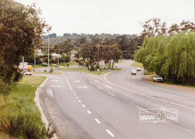
Photograph, Main Road-Fitzsimons Lane Roundabout, c. Oct 1987, 1987
Fitzsimons Lane was originally known as the Eltham-Templestowe Road north of the Yarra and Fitzsimons Lane south of the Yarra River. Date based on other similar display panels visible in images of the Shire of Eltham display at the Eltham Community Festival, 7 November 1987Colour photographdisplay panel, eltham festival, infrastructure, shire of eltham, main road, roundabouts, fitzsimons lane -
 Ringwood and District Historical Society
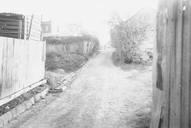
Photograph, Lane running from Warrandyte Rd. back to Bamfords through to Adelaide Street, Ringwood, 1959
Written next to photograph, "Lane running from Warrandyte Rd. back to Bamfords through to Adelaide Street, opposite post office, 1959." -
 Ringwood and District Historical Society
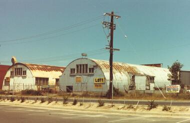
Photograph, Old Nissan Huts, Madden Lane Ringwood 1982
Catalogue card reads, "Seymour St. Ringwood. 1982. Old corrugated iron sheds." - this is incorrect. These Nissan huts were in Madden Lane -
Glenelg Shire Council Cultural Collection
Photograph - Photograph - Opening of Spa at Portland YMCA, 1980s
Glenelg Shire Council recordsBlack and white photograph of 18 women in a spa or sitting on edge of spa with legs dangling in. One man and one women stand behind them. Shows the opening of Portland spa. Athalie Lane (centre) in spa. Unframed.Front: 57/45 (blue pen, lower right) Back: 39 (red pen, lower left)portland spa, ymca -
 Bendigo Historical Society Inc.
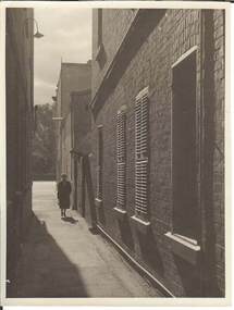
Photograph - LANEWAY, MCCRAE ST. TO HOWARD PL, approx. 1960
black and white photograph: laneway, brick building with windows with shutters, female figure walking towards photographer. Lane opposite School of Mines, running from Mc Crae St. to Howard Place, adjoining the Albert Hotel.place, laneway -
 Bendigo Historical Society Inc.
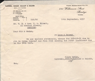
Document - CONNOLLY, TATCHELL, DUNLOP COLLECTION: INVOICES
Two statements dated 16th. September, 1957 to Mr W.E. & Mrs. V.M. Rivett of 25 Grattan Street, Bendigo. First Reference: Lane the second reference Oatway and a cover letter dated 18th September, 1957.business, legal, connelly & tatchell -
 Ballarat Heritage Services
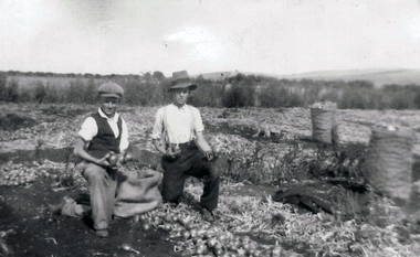
Photograph - Photograph - Black and White, Bagging Onions at 'Hillside', Crossley, Late 1930s
Tom Fitzgerald and his brother Greg Fitzgerald dig potatoes at the Carroll family farm, 'Hillside', McCartney's Lane, Crossley. The Fitzgerald brothers were brothers of Mary Matilda Carroll who was married to Patrick Edmund Carroll.crossley, carroll, patrick edmund carroll, mary matilda carroll, mary matilda fitzgerald, greg fitzgerald, tom fitzgerald, onions, farming -
Port Melbourne Historical & Preservation Society
Container - Bottle, Burke's Pale Ale, excavated from cesspit behind All England Eleven Hotel, Port Melbourne, 1850s
When house in Rouse Street was demolished in November 1997, Peter LIBBIS obtained this from the bottle diggers who emptied the former cesspit behind All England Eleven Hotel.Beer bottle c1850-60s Burke's Pale Ale. Dug from cesspit behind All England Eleven Hotel, in Little Princes lane (ref photos of cesspit excavation 895)/ Dark green, fragments of label.business and traders - hotels, all england eleven hotel -
 St Patrick's Old Collegians Association (SPOCA)
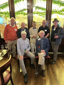
Photograph - SPOCA, Class Reunions, Feb 2025, Glenferrie Hotel
-
 Greensborough Historical Society
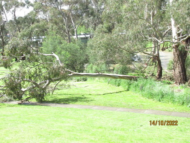
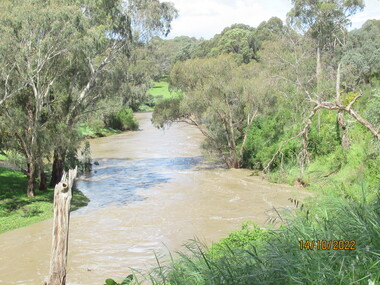
Photograph - Photograph - Digital Image, Peter Simmenauer, Plenty River floods near Plenty Lane 2022, 14/10/2022
Plenty River in flood near Plenty Lane Greensborough, October 2022. Colour digital photographDate stamped: 14/10/2022plenty lane greensborough, plenty river, floods -
 Greensborough Historical Society
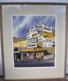
Painting - Digital Image, Tom Lane Pharmacy, by Alan Sartori, 2018_
Photograph of painting by Alan Sartori of the Tom Lane Pharmacy, a Greensborough landmark.Alan Sartori was a local Greensborough artist who captured many images of the local area.Digital image of a painting of a Greensborough landmark.alan sartori, tom lane pharmacy, main street greensborough -
 Eltham District Historical Society Inc
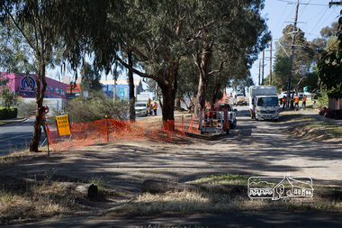
Photograph, Peter Pidgeon, Bolton Street upgrade, Eltham, 13 November, 2017, 13/11/2017
North bound lane closure, near Bridge Street, McDonalds on left. Born Digitalbolton street, bolton street upgrade, eltham, streets, mcdonalds restaurant -
 Eltham District Historical Society Inc
Photograph, Peter Pidgeon, Bolton Street upgrade, Eltham, 13 November, 2017, 13/11/2017
North bound lane closure, near Bridge Street, McDonalds on left. Born Digitalbolton street, bolton street upgrade, eltham, streets, mcdonalds restaurant -
 Eltham District Historical Society Inc
Photograph, Peter Pidgeon, Bolton Street upgrade, Eltham, 13 November, 2017, 13/11/2017
North bound lane closure, near Bridge Street, McDonalds on left. Born Digitalbolton street, bolton street upgrade, eltham, streets, middy's -
 Eltham District Historical Society Inc
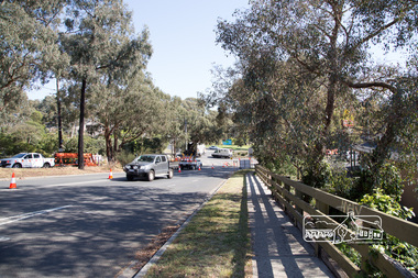
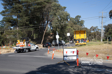
Photograph, Peter Pidgeon, Intersection with Grand Boulevard, Bolton Street upgrade, Eltham, 13 November, 2017, 13/11/2017
North bound lane closure, near Bridge Street, McDonalds on left. Born Digitalbolton street, bolton street upgrade, eltham, streets, grand boulevard -
 Eltham District Historical Society Inc
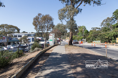
Photograph, Peter Pidgeon, Bolton Street upgrade, Eltham, 13 November, 2017, 13/11/2017
North bound lane closure, near Bridge Street, McDonalds on left. Born Digitalbolton street, bolton street upgrade, eltham, streets, eltham ridge, shops -
 Eltham District Historical Society Inc
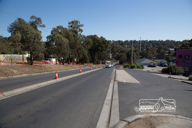
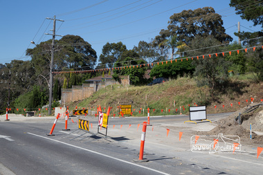
Photograph, Peter Pidgeon, Intersection with Pedersen Way, Bolton Street upgrade, Eltham, 13 November, 2017, 13/11/2017
North bound lane closure, near Bridge Street, McDonalds on left. Born Digitalbolton street, bolton street upgrade, eltham, streets, pedersen way -
 Federation University Historical Collection
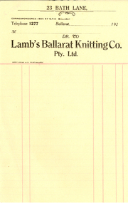
Book, Lamb's Ballarat Knitting Co. Records of Stock and Despatches
Lamb's Ballarat Knitting Co. was situated at 23 Bath Lane, Ballarat.1) A foolscap book showing stock and despatches - records of capes, caps, dresses and scarves. .2) Invoice for Lamb's Ballarat Knitting Co. Pty Lmdlamb, lamb's ballarat knitting co, robert lamb, rash -
 Stawell Historical Society Inc
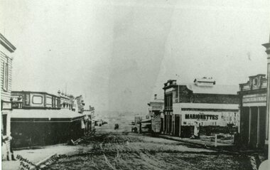
Photograph, Main Street Stawell looking West from Doyle Lane c1916
Main St. looking West from area of Doyle Lane. c1916stawell business streetscape -
 Greensborough Historical Society
Photograph - Photograph - Digital Image, Peter Simmenauer, Plenty River floods near Plenty Lane 2022, 14/10/2022
Plenty River in flood near Plenty Lane October 2022 Greensborough. Colour digital photographDate stamped: 14/10/2022plenty lane greensborough, plenty river, floods -
 Stawell Historical Society Inc
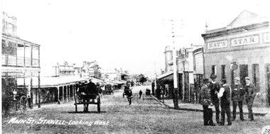
Photograph, Main Street Stawell looking West from Doyle Lane c1916
Main St. looking West from area of Doyle Lane. c1916stawell business streetscape -
Ballarat Heritage Services
Photograph - Ceramics, Jill Jones, Vessel with crystaline glaze by Jill Jones, 1086
Jill and Lloyd Jones ran Golf Lane Pottery in Rye, Victoria.VICSmall vessel by Jill Jones.jill jones, australia studio pottery, ceramics -
 Eltham District Historical Society Inc
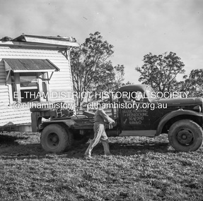
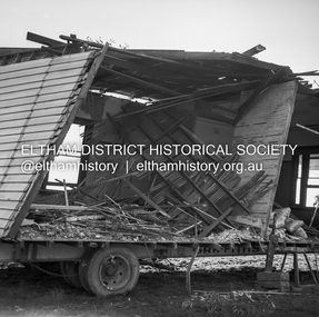
Negative - Photograph, J.A. McDonald, Removal of the remains of the Abraham house at Kangaroo Ground, c. May 1962
Martin Bros House Removing of Seaford was contracted to remove the remains of the storm damaged Abraham house from the property circa May 1962. The Abraham family owned land near the Aqueduct and east of Nicholas Lane at Kangaroo Ground (based on photos, at or near 40 Nicholas Lane).Record of various Shire of Eltham infrastructure works undertaken during the period of 1952-1962 involving bridge and road reconstruction projects, sometimes with Eltham Shire Council Project Reference numbers quoted. It was during this period that a number of significant improvements were made to roads and new bridges constructed within the shire that remain in place as of present day (2022). In many situations, the photos provide a tangible visible record of infrastructure that existed throughout the early days of the Shire. The album was put together by or under the direction of the Shire Engineer, J.A. McDonald.1962-05, abraham house, kangaroo ground, martin bros house removing seaford, nicholas lane, property damage -
 Eltham District Historical Society Inc
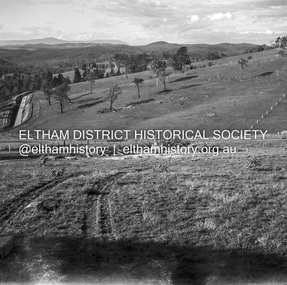
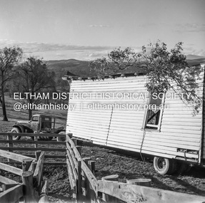
Negative - Photograph, J.A. McDonald, Removal of the remains of the Abraham house at Kangaroo Ground, c. May 1962
Martin Bros House Removing of Seaford was contracted to remove the remains of the storm damaged Abraham house from the property circa May 1962. The Abraham family owned land near the Aqueduct and east of Nicholas Lane at Kangaroo Ground (based on photos, at or near 40 Nicholas Lane).Record of various Shire of Eltham infrastructure works undertaken during the period of 1952-1962 involving bridge and road reconstruction projects, sometimes with Eltham Shire Council Project Reference numbers quoted. It was during this period that a number of significant improvements were made to roads and new bridges constructed within the shire that remain in place as of present day (2022). In many situations, the photos provide a tangible visible record of infrastructure that existed throughout the early days of the Shire. The album was put together by or under the direction of the Shire Engineer, J.A. McDonald.1962-05, abraham house, kangaroo ground, martin bros house removing seaford, nicholas lane, property damage -
 Stawell Historical Society Inc
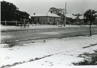
Photograph, Snow in the Lane between Shire Hall & Court House Stawell West 1949
Lane between Shire Hall & Court House Stawell West Snow 1949stawell -
 Stawell Historical Society Inc
Photograph, Snow in the Lane between Shire Hall & Court House Stawell West 1949
Lane between Shire Hall & Court House Stawell West Snow 1949stawell