Showing 894 items matching "weatherboard houses"
-
 Eltham District Historical Society Inc
Photograph - Digital Photograph, Alan King, Edendale Farm Homestead, 29 January 2008
... Palace in Melbourne. His single-storey weatherboard house built... Palace in Melbourne. His single-storey weatherboard house built ...Edendale Farm is Nillumbik Shire Council's environment centre situated in Gastons Road, Eltham between the railway and the Diamond Creek. The homestead on the property was built in 1896 and is of historical significance, being the subject of a Heritage Overlay under the Nillumbik Planning Scheme. The Edendale property was originally part of an extensive land purchase in 1852 from the Crown by pioneer Eltham farmer Henry Stooke. He initially purchased 51 acres and later expanded his holdings by purchasing another three adjacent Crown allotments extending northerly from Josiah Holloway's Little Eltham subdivision. Despite clearing the land, Stooke did not build on this property, choosing to live on his property "Rosehill" at Lower Plenty. In 1896 Thomas Cool, Club Manager of the Victoria Coffee Palace in Melbourne purchased 7 acres of the original Stooke land and built the house now known as Edendale. Cool did not farm the land, instead using it as a gentleman’s residence, retiring to Eltham at weekends. In 1918 he purchased an additional 7 acres but in 1919 he sold the property. Later owners included J.W. Cox, the Gaston family and D. Mummery. In the 1980s the Eltham Shire Council purchased the site for use as a Council depot, but this use did not proceed. Subsequently, it was used as the Council pound. The Edendale Farm Pet Education and Retention Centre was established in the summer of 1988/1989 and was set up to replace the existing dog kennels with a high standard pet retention centre. The design style of the building was established to compliment the features of the existing house. It was equipped with 10 retention pens, a veterinary room and a pet education area where school children and other interested parties learnt about pet care procedures. It was later developed into a community farm and was run by an advisory committee and in 2000 it became an Environment Centre. In early 2006 an advisory committee was established for the development of a master plan for future development at Edendale Farm. The committee included Russell Yeoman, a former long-time shire planner and founding member of the Eltham District Historical Society. At the time of filming the Master Plan and future for Edendale was about continuing to develop Edendale as a centre of environment learning and looking at expanding displays and school program, running a lot more of life-long learning and workshops around sustainable living. Covered under Heritage Overlay, Nillumbik Planning Scheme. Published: Nillumbik Now and Then / Marguerite Marshall 2008; photographs Alan King with Marguerite Marshall.; p101 A sharp turn from busy Wattletree Road by the railway line, brings a surprise. Only 1.4 km from Eltham’s centre, sheep feed, blissfully unaware of the hectic suburban activity so close by. At the entrance to the 5.6ha Edendale Farm is another surprise. A work of art that looks like huge tree trunks transformed into bowler and top-hatted men. The Fences Act 1968 by Tony Trembath with Mark Cain and John Doyle, 1996, is classified by the National Trust of Australia as having Regional Significance. The title refers to a government act on disputes between neighbors over the placement of fences and boundaries. This takes a ‘wry swipe’ at a community divided by trivial squabbles. It also celebrates making do with limited resources.1 Further along on the left, the office wall is decorated with a massive Eltham Copper Butterfly, designed by Robert Tickner and made by school children with used plastic bottles and other waste material. Nillumbik Council runs Edendale as an Environmental Education Centre, to help preserve and enhance the local environment. As early as 1988 the former Eltham Shire Council realised Edendale’s importance in meeting people’s needs, particularly of children, to enjoy farmland. The centre, with the Eltham North Reserve to the north - including remnant bushland and open parkland - makes up the major part of the public open space for this area. The council considers this area will become increasingly important to the local community for recreational use.2 Educational programs aim to encourage community involvement to ensure the long-term rehabilitation and protection of natural bushland areas. Edendale is used by people of all ages - from school children to adults - for environmental programs and workshops, as well as for recreation, to enjoy the domestic animals and to picnic. Edendale is also home to the Environmental Works staff who manage reserves and roadsides and support Nillumbik Friends environmental groups. The Friends propagate plants at the nursery, which grows indigenous plants and sells these to the public.3 The centre demonstrates the sustainable living the farm teaches, with features like solar hot water and drive lighting and for the fireplace, logs of recycled cardboard. Edendale has had a varied history as a dog pound and even as a retreat for Thomas Cool, Club Manager of the Victoria Coffee Palace in Melbourne. His single-storey weatherboard house built in 1896, which still stands, was grander than most homes in Eltham. Although such buildings were common in many other parts of Melbourne, Eltham’s poverty and remoteness did not encourage such construction. The Victorian rectangular-shaped house, with a corrugated iron roof and veranda, has elegant large rooms, leadlight windows, ceiling roses, two bay windows and ornately carved wooden fireplace surrounds. Cool bought seven acres (2.8ha) from pioneer Eltham farmer Henry Stooke’s 200 acre (81ha) farm, which he had bought from the Crown in 1852. In 1918 Cool bought an extra seven acres (2.8ha) but in 1919 sold the estate to farmer John Cox. In 1933 Cox sold Edendale to Mrs Elizabeth Gaston, after whom the road leading to the centre was named. The property was owned by several Gaston family members, who called it Edendale, then by a police constable, Douglas Mummery, until the Shire of Eltham bought it in 1970. Oddly Edendale was known as Mummery’s for almost 20 years, although Mummery owned it only for a short time.4 The shire used Edendale as a dog pound until amalgamation with other municipalities in 1996. The pound then moved to the Yan Yean Road, Plenty site, which had been used by the former Diamond Valley Shire Council. To the west and north the centre is bounded by Diamond Creek and on the east by the Melbourne-Hurstbridge railway line. Part of the Research creek forms the centre’s southern boundary.This collection of almost 130 photos about places and people within the Shire of Nillumbik, an urban and rural municipality in Melbourne's north, contributes to an understanding of the history of the Shire. Published in 2008 immediately prior to the Black Saturday bushfires of February 7, 2009, it documents sites that were impacted, and in some cases destroyed by the fires. It includes photographs taken especially for the publication, creating a unique time capsule representing the Shire in the early 21st century. It remains the most recent comprehenesive publication devoted to the Shire's history connecting local residents to the past. nillumbik now and then (marshall-king) collection, edendale farm -
 Bendigo Historical Society Inc.
Photograph - HILDA HILL COLLECTION: BLACK AND WHITE PHOTOS, 1917-1924
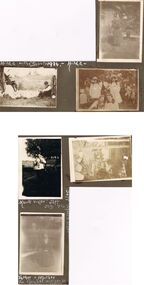
... reclining on cane lounge chair on verandah, weatherboard wall... on cane lounge chair on verandah, weatherboard wall of house ...Series of Black & White Photos Total 6 Hill Family & Friends During the First World War and after. Rita, wearing a dark dress with white collar and holding a dark coloured hat, background is large brick structure with windows to right and small section of veranda, pal tree, Railway Reserve Kyneton 1918. Man and two women wearing white dresses and dark hats, man wears dark suit white shirt and dark tie with his back against a large wheel, white sheet on ground between them and indistinguishable articles on sheet, Hibernian Picnic Axedale November 13th 1918. Group of young girls and boys all dressed in light coloured clothing gathering Botanical gardens January 1917, Miss N. Linnane reclining on cane lounge chair on verandah, weatherboard wall of house, verandah post, rock garden edging in foreground, May 1918. Monte Video Property Queensland Jeff, dressed in dark trousers and white shirt, holding a skinned rabbit, water tank in background, wire fence, July 1924. Father & Mother, Father wears a grey suit with white shirt and dark tie, Mother seated is wearing a dark dress with striped collar and white blouse, 'The Ranche' Mollison Street Eppalock.Hilda Hill Personal Collectionaustralia, history, post war life -
 Eltham District Historical Society Inc
Photograph, Fay Bridge, Former Glynn's Dairy Farm, Glynns Road, North Warrandyte, 31 August 2018
... and weatherboard wash house, stables, workshop, feed room, cow bails, large... and weatherboard wash house, stables, workshop, feed room, cow bails, large ...Glynn’s farm Originally Section 7, Parish of Nillumbik marked Aborigine Reserve in 1866 Crown Allotment 8, Section 7, Parish of Nillumbik, County of Evelyn, Certificate of Title Volume 4095, Folio 818.835, approx. 93 acres purchased by Joseph Panton in 1881 for £1/acre and known as Panton’s Point. By 1924 owned by S.S. Sergeant and called Riverswood. Sergeant commissioned Edna Walling to design the garden. In September 1929 the property was sold at auction by Mortgagee’s sale. Described as well built, brick, tile roof, Attic Villa containing downstairs 7 good rooms, bath, scullery, inside lavatory, etc. Upstairs 2 bedrooms and sleep out. Outbuildings compromising of brick and weatherboard wash house, stables, workshop, feed room, cow bails, large G.I. Hay shed, etc In January 1931 Riverswood property was proclaimed a sanctuary for native game for the entire year. A private swing bridge crossed the river at Pound Bend was known as Pearson’s bridge after C.W.K. Pearson who bought Riverswood in the early 1930s. The bridge was swept away in the December 1934 floods. Riverswood was sold by C.W.K. Pearson at auction on 25 November 1936. Described as a beautiful farm home of 93 acres and over one mile of River Yarra frontage, modern brick residence, lovely garden, rich river flat pastures, model poultry farm. The fine brick home was destroyed on Black Friday (13 Jan.) 1939. It was still a ruin when the Evelyn Evans purchased Waikowhane above Riverswood in 1940. The Glynn family purchased the Riverswood property in 1941 from Robert and Emily Hannon. Their son Kenneth Patrick Glynn inherited the property and he set about clearing the land during WW2 selling wood. Prior to marriage, Kenneth was living alone on the farm in a house he had built from whatever was available. He used the bluestone foundations from the original fine brick home. He met and married Honora Elizabeth Drew in early 1945 and their daughter Anna grew up on the farm. It was compulsorily acquired by the Board of Works in 1976 who then rented the house out in the 1980s. The property was transferred to Melbourne Parks and Waterways in 1996. Waikowhane was a pretty timber house built on top of the hill on 50 acres above Riverswood by retired nurse Jessie MacBeth. (This would be at the intersection of Glynns Road and Overbank Road where the big water tank is now situated on what was once James Orford’s property.) It was also destroyed Black Friday and she rebuilt it from the plans living in a caravan on site supervising the build. It was almost complete when she died May 1939. The property was bought by Evelyn Evans (a city girl) and her estranged husband in 1940. She had two sons, one only 9 months old at the time. It was a timber house with no power or water connected. The Ewen Cameron family bought Waikowhane in 1957. They had to evacuate when the 1961 bushfires swept through. The house was saved by Matcham Skipper. It was demolished by Melbourne Water in the 1990s when they acquired it.fay bridge collection, 2018-08-31, glynn's, glynn's dairy farm, glynns road, north warrandyte, parks victoria, ruins, riverswood, kenneth patrick glynn -
 Eltham District Historical Society Inc
Document - Photocopy, Diamond Valley News, Newspaper article: Fred looks back by Linley Hartley, Diamond Valley News, c.1985
... on the old property where a weatherboard house had now been built... on the old property where a weatherboard house had now been built ...Fred looks back; Report: Linley Hartley, Picture: Ron Grant Teaching himself German again after 70 years is just one of the many tasks Fred Golgerth, of Greensborough, has undertaken and succeeded in during his lifetime. As the two year old tenth child of a German descendent, Fred learnt to speak German from an Aunt. But World War 1 was raging. Fred’s older brother had gone to Europe with the Australian forces, changing his name … to ….. to sound less German. “I used to get my bottom slapped for speaking German at home,” Fred said. Even his name was changed from Otto to the more anglicised Frederick. Fred claims his involvement with Eltham started two years before he was born! His sister, two years older than him, was a babe in arms when his parents bought a piece of grazing property in Mount Pleasant Rd. “It was about 24 acres on a spur of Mt Pleasant,” Fred said. “My parents bought it from Mr and Mrs Hughes. There was a two-room mud hut in wattle and daub that we lived in from time to time. “My parents had a dairy farm and dairy in West Coburg, and they bought the Mt Pleasant land to put the dry stock on. “At one stage my mother got very ill and my older sister took my younger sister and myself to Eltham for four or five months. I went down to Eltham Primary School then.” That wasn’t the only time Fred stayed in Eltham. His sister, Wilhemina, known as Willa, married Jim Watson who had the Eltham hotel for some years from the end of World War 1. Pillar to post living was the way Fred described his youth, when he stayed with one married sister after another. “After a while Will and Jim lived in the big house at the top of Pitt St, next to the Council depot, and the hotel was managed by Fitzsimmons who had a big place near the river down there on Fitzsimons Lane. There was no bridge in Fitzsimons Lane but we used to cross the river at a ford, rolling up our trouser legs so they wouldn’t get wet, and carrying our shoes. I’d o down to visit some friends I had in Templestowe. And sometimes Jim Watson took his horse drawn lorry across the ford on his way to the brewery, instead of going don through Heidelberg.” “The bridge across the Yarra in Fitzsimons was not built until 1961.” Fred Golgerth, was only a teenager when he was rolled off his pushbike under a car on the bend between Mt Pleasant Rd and the Diamond Creek bridge. He was hospitalised in the little hospital on the east side of Eltham village that served the district in those days. He still carries the scars of the burns he received from the exhaust pipe and recent x-rays have revealed several broken vertebrae. At the time of the accident he was treated for a dislocated neck and was in plaster from his hip to the base of his head for about seven months. But nothing daunted Fred. Bouncing back he began work as an apprentice to a motor mechanic in Bell St, Preston, a man who is still living (at 90) in Queensland and who still communicates with Fred frequently. “He was like a father to me,” Fred declared. He was a marine engineer as well, so I …. that as well as blacksmithing. They taught us properly then.” After finishing his apprenticeship, Fred bought himself a 30 hundredweight Fargo truck and began his own contract carting business, doing most of the work for a firm called Carnegie’s and a subsidiary of that, Howard Radio. It was in the office Fred met his wife. “He taught me to drive the truck giving me lessons in my lunch hours up the Bourke St and Flinders St extension,” she said. “After work I’d have a driving lesson and all the girls from the Howard Radio would pile in the back to get a lift to Richmond Station.” In the 1939 bushfires, the Mt Pleasant Rd property was burnt out and the hut raised. Two years later, Fred and Dorothy were married. Fred paid £7.15.0 ($15.50) for the suit in which he was married. Dorothy had pulled out of the Women’s Air Training Corps to be married. Others with whom she trained went to Darwin and were in a convoy that was bombed. Fred went into the garage business in Brighton and continued his cartage business for a while. His company was employed to do all Brown Gouge’s motor repairs and factory maintenance. Because Fred had a certificate to do steam repair work he often got jobs maintaining industrial boilers. While he was in Brighton, Fred bought an eight-seater 1925 Silver Ghost Rolls Royce from Sir Keith Murdoch. When the couple moved to Rosanna in about 1943, it became a delivery van for the dairy they operated. “I thought I’d like to get back into a dairy business” Fred said. “We used to deliver the milk in the Rolls. “But it was hard work. We couldn’t get the labour and we’d drive to the farm and pick up the milk cans, take them back to the dairy, cool the milk, bottle it and deliver it. The inspectors would come regularly and the walls for bacteria.” Fred was exhausted. The couple gave up the dairy and moved to Eltham to live on the old property where a weatherboard house had now been built. It wasn’t a big house and the glassed in Rolls Royce limousine became the daytime nursery for the Golgerth’s second daughter. We’d put her in there to sleep during the day.” “Dorothy Golgerth was known to drive the Rolls at breakneck speed along Mt Pleasant Rd. Fred took some time off work then began driving a little local bus run by the Lyon Brothers before taking a maintenance job at the Athenaeum Club in the city. He’d ride an old Harley-Davidson to the station and travel into the city by train. Later, when the family moved to Pryor St. (their house stood where McEwans car park is now) Fred could walk to and from the station. “There was no resident doctor in the early days of Eltham,” Fred said. “Dr Cordner used to come from Greensborough to a room in the old house next to the old grocery shop on the corner of York St and Main Rd, Eltham (the grocery shop is now the Eltham Feed and Grain Store). The Golgerths lived in Eltham until “Dollar Day” – the day decimal currency became official. They eventually moved to Greensborough, when they have lived since. Fred has had his share of interesting jobs since then, retiring at 65 seven years ago when he was working in the engineering department at Larundel. Recently, two of his older sisters and a brother died, within a month. They were all in their 80s. They all had a profound influence on Fred, especially during his youth. His sharp wit and amusing anecdotes are the richer for his having been the youngest of a family that made the best of every circumstance. And now, as he enjoys his retirement, he is concentrating on relearning the language of his infancy; teaching himself German from tapes and a ‘teach yourself’ manual. He is fiercely proud of his German ancestry and treasures the diary, written in German in Gothic script, kept by his grandparents during their journey to Australia. On the inside in blue pen: "To Sadie, Wal Margaret & Elizabeth with lots & lots of love & best wishes from Mother"marg ball collection, eltham hotel, herbert james watson, otto (fred) golgerth, wilhemina watson (nee golgerth) -
 Southern Sherbrooke Historical Society Inc.
Photograph - Bert and Minnie Sutton c.mid 1940s
... at their property in Lockwood Road. The house was next door to Edward's... at their property in Lockwood Road. The house was next door to Edward's ...B&W photo of Bert (Gilbert William) and Minnie (Williamina Wilson) Sutton (daughter of Charles Macauley and Minnie Gray) standing outside their original home in Belgrave Heights. The photo shows the couple standing at their post-and-wire front fence at their property in Lockwood Road. The house was next door to Edward's store. Bert is in shirtsleeves and Minnie is wearing a cardigan over a dress. Their house is a single gabled house of weatherboard and fibro sheeting with an L-shaped open verandah. After purchasing the house Bert altered it, eventually enclosing the verandah and turning it into a sleepout. The house has been extensively altered since but is still standing in Lockwood Rd. The block is treed and the garden appears to be rather wild. A tiled roofed building is behind the house and to the left, possibly a garage. On the nature strip in front of the Suttons' house is a wooden bench, and attached to a tree are the signs, "Lockwood House" (with a hand pointing right), "To golf links" (with an arrow pointing right) and "Central Park Tennis Courts" (with an arrow pointing left). The sun is shining. Bert, who was a carpenter, died in 1969 and Minnie died in 1977. Copy of original photo donated to our society by Kath Oram, a founding member. -
 Kiewa Valley Historical Society
Photographs- Kiewa Valley House (before and after extensions) & Tawonga District General Hospital- Set of 6 colour photographs
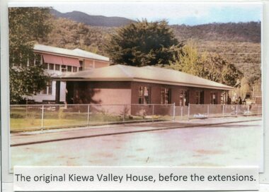
The establishment of Kiewa Valley House, was a significant victory for residents and senior citizens in the Kiewa Valley district. Plans were laid in the mid 1970’s and a proposal was formulated for a 12 bed unit nursing home to be attached to the Tawonga District General Hospital. The need for an aged care facility in Mount Beauty was prompted by recognition of the high ratio of senior citizens residing in the area. At the time residents had to travel to Beechworth, Wangaratta or Wodonga for care. On June 6th, 1980, an appeal to finance a 12 bed nursing wing was launched at a public meeting in Mount Beauty The Hospital and Charities Commission’s development board finally approved the application for government funds to build the 12 bed nursing home in early 1981. The official opening of the nursing home was on March 6th, 1985. Opening of the lounge extensions occurred in May, 1993 Many local residents have taken advantage of facilities at Kiewa Valley House when they became unable to manage independently in their own homes. This has meant they did not have to face the stress of leaving the area and being separated from their local family and friends. Many SEC workers and their families have been residents of Kiewa Valley House over the years.Set of 6 colour photographs of Kiewa Valley House and original Tawonga District General Hospital in Mt Beauty 1 Kiewa Valley House, before extensions, with old weatherboard hospital in background 2 & 3 Official opening of Kiewa Valley House. 4 & 5 Gardens between Kiewa Valley House and Hospital 5. Kiewa Valley lounge extension 1. The original Kiewa Valley House, before extensions 2. No markings 3. No markings 4. View of the gardens between the weatherboard hospital and Kiewa Valley House 5. Walkway between Hospital & Kiewa Valley House 6. Kiewa Valley House Lounge Room extension tawonga district hospital, kiewa valley house, mt beauty district hospital -
 Kiewa Valley Historical Society
Photographs – Photographs of staff from Tawonga District General Hospital & Alpine Health – Set of 13 colour photographs
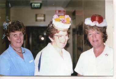
In the early stages of the Kiewa Hydro-Electric Scheme the State Electricity Commission took over the financial and construction responsibility of the Tawonga District General Hospital building at a cost of 27,000 pounds. This included the removal and re-erection of the ex-military Bonegilla ward from Wodonga while in addition they carried out all the necessary building works that allowed the hospital to operate as a functional unit. The work was completed and handed over to the Hospital Committee of Management on September 1, 1949. Local residents raised 3,400 pounds through fund raising. The balance was met by the SEC and the Hospital and Charities Commission. The initial project was to provide for a basic temporary hospital which was later to include an Operating Theatre, Offices, Store, Mortuary and a Nurse’s Home, until the establishment of a permanent medical premises. Following the opening, 455 patients were admitted to the Tawonga District General Hospital and 254 operations were performed in the first year. The hospital relocated to Mount Beauty in the former SEC administration offices located in the town centre. Official opening of the 18 bed Tawonga District General Hospital on April 29 in 1961. Kiewa Valley House nursing home was officially opened on March 6th, 1985, with a new lounge extension opening in May, 1993. Prior to this, residents had to travel to Beechworth, Wangaratta or Wodonga for care. The old weatherboard building was demolished around the late 1900’s to early 2000’s and replaced with a new modern brick building. Alpine Health CEO Mr Lyndon Seys oversaw the opening of the new Mount Beauty Hospital in November 2001 alongside Board of Management President Mr Andrew Randell, other board members and politicians.The Kiewa Hydro-Electric Scheme the State Electricity Commission played a pivotal part in the planning and initial funding of the Tawonga District General Hospital, with a view to providing medical support for its many workers on the Hydro scheme. Later, spouse and family members of workers were also able to access medical assistance. Many SEC workers and their families have received high medical care at Tawonga District General Hospital and Alpine Health and/or as residents of Kiewa Valley House over the years. A number of family members of SECV workers as well as other dedicated staff have provided high quality medical attention and support in all three facilities as nursing staff, support staff and volunteers. Many past staff members and their families still remain living in the Kiewa Valley area Set of 13 colour photographs of past nursing staff and support staff from Tawonga District General Hospital, Kiewa Valley House & Alpine Health 1. Marg Hickey, Barbara Clark & Margaret Ranton 2. Cheryl Clutterbuck & Rosemary Forrest 3. Margaret Ranton 4. Margaret Ranton holding unknown infant 5. Gwen Goss 6. Barbara Clark & Margaret Ranton 7. Margaret Ranton, Sue Zeinert & Jenny Piera 8. Margaret Ranton, Gloria Ryder & Jenny Piera 9. Sue Wesley, Ruth Barton, Margaret Ranton, Rosemary Forrest & Nola Henry 10. F Bogaski & H Sigmund 11. Maintenance Supervisor H Sigmund 12. Gardener Fred Keat & Handyman Joe Trezise (1977) 13. Nursing staff in new hospital 1-9 No markings 10 F Bogaski & H Sigmund 11. Maintenance Supervisor H Sigmund 12. Gardener Fred Keat & Handyman Joe Trezise (1977) 13. Nursing staff in new hospital tawonga district general hospital, kiewa valley house, alpine health -
 Eltham District Historical Society Inc
Photograph, Officers in charge of Eltham Police Station (1857-2015), 22 Sep 2018
The first Eltham Police Station was in the small building opposite Dalton Street rented from Mr Jarrold in 1857. In 1859 a dedicated Police Residence was built at 728 Main Road. A small weatherboard Police Station was attached to the side of the residence and a blue stone cell at the rear. Also on site were stables for the police horses. The Eltham Courthouse was built in 1860 and is the oldest public building in the district. In 1959 the Victoria Police purchased a house in Pryor Street to be refurbished as the Eltham Police Station. In 1961 the Police in Eltham move into Pryor Street refurbished buildings and office. During 2001 to 2002, the Eltham Police Station was demolished and a new complex constructed on site. The original 1859 Police residence is now home to the Eltham District Historical Society.albert frederick charles glover, allan fenton, arthur eggleston dungey, bertie stanton, charles briant, charles thomas martin, clyne harold mcphan, ebenezer williamson, eltham police station, gerard joseph o'toole, graham vincent joyce, harold shields, ian william bruce, isaac newton stevens, james boxhall, james chester draper, john scully, john stanley mcgough, john stuart bateman, john thomas cone, myles archibald lyons, peter lawlor, richard roberts, robert harry chrisfield, robert llewellyn, samuel james king, samuel o'donnell, sidney frederick little, thomas maher, victoria police, william charles sargeant, james francis fitzpatrick -
 Eltham District Historical Society Inc
Photograph - Slide, Joan Castledine, 87 Bible Street, Eltham, c.Dec. 1970
... at the time. The house is a white weatherboard cottage with corrugated... at the time. The house is a white weatherboard cottage with corrugated ...View looking northwest from 83 Bible Street towards Henry Street and the property on the corner of Henry and Bible streets - 87 Bible Street. 85 Bible Street is a vacant block at the time. The house is a white weatherboard cottage with corrugated iron roof and belonged to Len Jarrold at the time, a builder who was closely associated with the building of Montsalvat with Justus Jorgenson. The house has since been demolished and repolaced with a unit developmet which faces Henry Street. len jarrold, henry street, bible street, eltham, houses, montsalvat -
 Eltham District Historical Society Inc
Photograph - Digital Photograph, Jim Connor, 84 Brougham Street, Eltham, 13 July 2009
This cottage is at 84 Brougham Street and this photograph was taken just prior to it being sold in August 2009. The told history is this cottage was built c 1920s, then on the bank of a creek that flowed through the area, which was later barrel drained by Council. It was supposedly built by a retired sea captain and the building is unusual in that it has a brick front, while the rest of the cottage is clad in weatherboard. After being purchased in 2009, the new owner completely rebuilt the house whilst retaining the brick front.jim connor collection, brougham steet, eltham, houses -
 Glen Eira Historical Society
Article - Prentice Street, 32, Elsternwick
Three items about sales of this property: 1/Property Review Weekly article dated 14/07/2006 on newly built, neo classical Edwardian style weatherboard home called Khya. Home includes period style elements to maintain Edward Style of home. Includes four coloured photographs. 2/Advertising dated 19/07/2006 giving brief details of house features. Includes one coloured photograph of exterior. 3/Advertisement hand-dated as 08/08/2012 with one colour exterior photo. Described as modern period home.prentice street, elsternwick, edwardian style, khya, plaster moulds, harleston park, peer gary, bricker glenn, krongold darren, orrong road, caulfield north, estate agents, timber houses, house names, biggin scott -
Glen Eira Historical Society
Plan - Ristori
Real Estate leaflet for the subdivision sale of the Ristori Estate & Residence on 31/05/1919 by Yeo, Crosthwaite & Co. A map of the 24 subdivisions available plus a locality plan are included along with details of separate sale on 04/06/1919 of the weatherboard buildings, rooms, stables & glass house.house names, 'ristori', land sales, sewerage, glen eira road, brick houses, land subdivision, orrong road, glasshouses, yeo crosthwaite & co melbourne, ripponlea, stables, ristori estate, auctions, drainage, liscard street, st. georges road, balaclava road, glen huntly road, glenhuntly road, elsternwick station, hotham street, weatherboard buildings, elsternwick -
Glen Eira Historical Society
Document - Wisteria, Normanby Road, 135, Caulfield North
... Features Weatherboard Buildings House Names Mayfield Grove Blake ...Caulfield Conservation study by Andrew Ward on the residence Wisteria. Includes history of the property, the owners from 1897 to 1905, and a description of the architectural features.caulfield north, normanby road, wisteria, architectural features, weatherboard buildings, house names, mayfield grove, blake a.h., luke ida mrs., luke edmund, artists, queen anne style, ward andrew, e.s.a. bank -
Glen Eira Historical Society
Document - Hopetoun Street, 10, Elsternwick
... Weatherboard house... Hopetoun Street Elsternwick Weatherboard house Garages Korong Road ...Three items relating to valuations for this property: 1/One page typed letter from Weigall and Crowther Solicitors to S P Simmonds Estate Agency on behalf of Flora Lee, dated 03/10/1962, requesting valuation of 10 Hopetoun Street, Elsternwick re the Estate of G R Lee. 2/Four page typed valuation of 10 Hopetoun Street, Elsternwick, by Edward J K Callaghan, dated 10/10/1962. The valuation includes property measurements, title particulars, zoning, detailed information about the facilities in the surrounding area and also expansive details about the house on the property and other improvements. 3/Copy of a two page typed letter, from valuator WV Scott to George Lee, dated 22/12/1971, to Mr George Lee providing another later valuation of 10 Hopetoun Street, Elsternwick re the Estate late Flora Lee. Accompanying is a one page handwritten, undated and unattributed document of working notes.lee flora, lee george ralph, hopetoun street, elsternwick, weatherboard house, garages, korong road, king street, glenhuntly road, morton street, orong road, orrong road, kooyong road, lee george, callaghan edward j k, s p simmonds real estate agents auctioneer, scott w v, timber houses, murray street -
Glen Eira Historical Society
Article - Glen Huntly (House)
Photocopy of a short newspaper article from the Southern Cross, dated 18/06/1986, about Thomas Watt, who built Glen Huntly in 1855, one of the first substantial homes in the area. Refers briefly to the suburb’s residential and commercial development and includes a photograph (60mm x 145mm) of the exterior of Glen Huntly house and two photographs (37mm x 57mm) of the surrounding suburb. The file also includes a copy of a one page letter to the Historical Society of St Kilda from Nancy Renfree, dated 11/02/2000, about her great-grandfathers Thomas Watt and Henry Bunn, giving brief biographical information about both.glen huntly, glenhuntly, watts thomas, wilson john w, pioneers, huntly street, grange road, glenhuntly road, glen huntly road, architects, caulfield, station place, glenhuntly traders’ association, murray street, holy cross church, ricketson henry, glen eira, caulfield military hospital, caulfield, roads board, bunn henry, hotham street, ripponlea, weatherboard buildings, renfree nancy -
 Eltham District Historical Society Inc
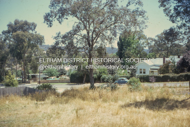
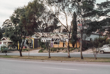
Photograph, Looking southeast from Main Road at intersection with Brougham Street, c. September 1966, 1966c
View looking across the front grounds of the former Police Station towards the weatherboard building on the opposite corner of Brougham Street which was once used as a Doctor's surgery by Dr R. Bradbury in the 1930s. The property was known as Cooinda. The Bradbury family also owned the houses adjacent to Napoleon Street. Succeeding Dr Bradbury was Dr R.B. Loosli, resident from 1947 to 1961. The house was later developed into a series of restaurants, Marcella's in the 1980s/1990s, Gennaro's Pizza Restaurant 2010s, Franco Pizza, presently being Franco and Co.Black and white photographic printOriginally located in a Filmpro King Size Prints processing envelope $3.01 Shire of Eltham 9/9/66 and noted as Calrossie Ave area and crossed out Eltham-Yarra Glen Road, Bridge Street to Elsa Court existing conditions mid 1967brougham steet, franco and co, local history centre, main road, restaurants, road construction, streets, cooinda -
 Eltham District Historical Society Inc
Slide - Photograph, 728 Main Road, cnr of Brougham Street, Eltham, May 1988, c.May 1988
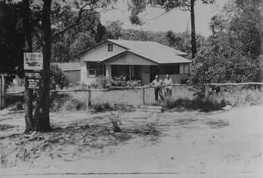
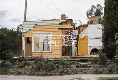
728 Main Road, cnr of Brougham Street, Eltham, May 1988. Former Police House (1859) which at time of photo was the offices of the Shire of Eltham Parks and Environment. This photo was taken prior to the building of the replica Police Station to serve as a lunch room. The origional timber weatherboard building had been relocated around the rear of the residence years earlier but had since been demolished due to termite infestation. Ten years later (1998) the residence was made available by Nillumbik Shire Council for occupation by the Eltham District Historical Society (former Shire of Eltham Historical Society) to be used as their Local History Centre.35mm colour positive transparency (1 of 36) Mount - Kodak KodachromeProcess Date MAY 88Meltham, infrastructure, main road, brougham steet, eltham justice precinct, local history centre, parks and environment, police residence, shire of eltham -
 Eltham District Historical Society Inc
Slide, Joh Ebeli, The old Baker's house prior to demolition, corner of York Street and Main Road, Eltham, c.Sep. 1979
... of the house. The old weatherboard building, possibly dating from... of the house. The old weatherboard building, possibly dating from ...Photo taken immediately prior to the demolition of the old baker's shop on the corner of Main Road and York Street, Eltham. Joh Ebeli and Elwers Howard endeavoured to preserve some parts of the house. The old weatherboard building, possibly dating from the 1860s, comprised a dwelling with a shop in the front room opening off a timber verandah deck which directly fronted the Main Road footpath. At the rear is a brick building of much later date which was for many years used for the bakery. The buildings were demolished for flat construction. Publicity at the time was oriented toward moves to preserve the weatherboard building which came from a number of individuals including members of this society. The society had no official connection with any proposal to retain the building or any part of it on any other site. The issues involved were part of a wider consideration of the matter of preservation of historic buildings. In this case the Society and in particular the committee had been aware for some years of the impending demolition. The possibility of the preservation of the building had been canvassed on a number of occasions. The Society’s view was that whilst the baker’s shop was an interesting old building which contributed to the character of Main Road, it was not of sufficient importance to wage an organised campaign for its preservation. It considered that if the building were to be preserved for historical reasons it would be far more feasible to retain it in its present location than to re-build it on another site.35 mm colour positive transparency Mount - Agfachrome Professional black (Germany) 4 dotsmain road, old eltham bakery, york street -
 Eltham District Historical Society Inc
Slide, Joh Ebeli, Preserving parts of the old Baker's house, corner of York Street and Main Road, Eltham, c.Sep. 1979
The old weatherboard building, possibly dating from the 1860s, comprised a dwelling with a shop in the front room opening off a timber verandah deck which directly fronted the Main Road footpath. At the rear is a brick building of much later date which was for many years used for the bakery. The buildings were demolished for flat construction. Joh Ebeli and Elwers Howard endeavoured to preserve some parts of the house.35 mm colour positive transparency Mount - Agfachrome Professional black (Germany) 4 dotsmain road, old eltham bakery, york street -
 Eltham District Historical Society Inc
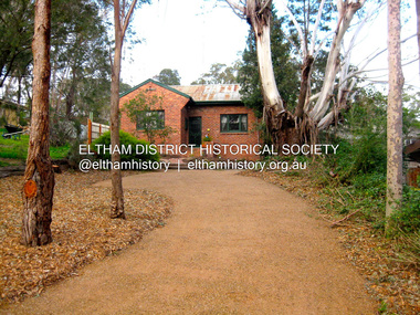
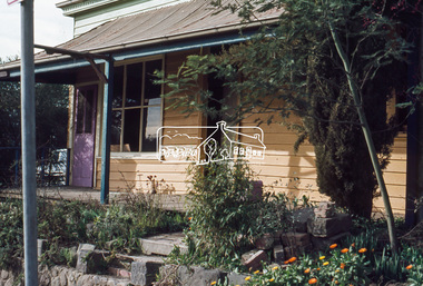
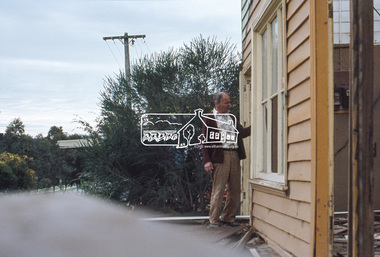
Photograph, Former Eltham Police Residence, 728 Main Road, Eltham, c.1985, 1985c
This photo is believed to have been taken circa 1985 when the Shire of Eltham Parks and Environment occupied the site. This photo was originally mounted on 3mm MDF fibre board with notes and stickers applied as part of a display on the former Police Residence and now present day Local History Centre, home to Eltham District Historical Society; possibly put together by Harry Gilham during his time as president of the society. Eltham Police Station and Residence: A brief history 1860 Eltham Courthouse built in Main Road, together with an adjoining police residence, office, lock–up and stables. 1959 Police Department purchases a house in Pryor Street to be refurbished as Eltham Police Station 1961 Police in Eltham move into Pryor Street refurbished buildings and office. c.1961-1981 Occupied by Vermin and Noxious Weeds Destruction Section of the Department of Crown Lands and Survey. Former Police Station dragged around to rear of Police Residence (prior to August 1967) to make way for the construction of a driveway and access from Main Road. The building was placed on the site of a former Scullery and modified for Lands Department use. 1981 Shire of Eltham take over management of old Police Residence in Eltham. It remains unoccupied for a period of time whilst its future is discussed in Council. 1981-1985 Used for community job creation scheme 1985 Shire of Eltham Parks and Environment occupy the residence. Council improve the driveway but later add a second rear access from Brougham Street due to the dangerous nature of the Main Road entrance. Also add a rear toilet facility between the Police Residence and former Police Station, which was doubling up as a lunch room. Council also commence discussions to re-establish a replica Police Station. c.1986 November. Former Police Station demolished; believed to have been suffering termite damage. c.1989 After some years of discussion a replica Police Station is built, based on photographs, to act as a lunch room and meeting room for Parks and Environment staff and volunteers doing community service. 1996 Eltham District Historical Society in discussions with Nillumbik Shire Council commisioners throughout the year regarding a home for the Society. A proposal put forward by the Society in October to occupy the former Police Residence. 1997 March. Eltham District Historical Society gains access to former Police Residence. 1998 July 12th. Eltham District Historical Society Inc moves into its Local History Centre, 728 Main Road Eltham (the former Police Residnce built in 1860). 2018 July. Eltham District Historical Society gains access to the replica Police Station for use as part of regular heritage tours for schools and community based groups.Colour printHandwritten in faded blue felt pen ink "No. 2 - Backyard of 728 #5 Weatherboard 'Office'. Note 1860 Court House over the fence."728 main road, eltham, local history centre, parks and environment, police residence, police station, shire of eltham -
 Eltham District Historical Society Inc
Photograph, Former Eltham Police Residence, 728 Main Road, Eltham, c.1985, 1985c
This photo is believed to have been taken circa 1985 when the Shire of Eltham Parks and Environment occupied the site. This photo was originally mounted on 3mm MDF fibre board with notes and stickers applied as part of a display on the former Police Residence and now present day Local History Centre, home to Eltham District Historical Society; possibly put together by Harry Gilham during his time as president of the society. Eltham Police Station and Residence: A brief history 1860 Eltham Courthouse built in Main Road, together with an adjoining police residence, office, lock–up and stables. 1959 Police Department purchases a house in Pryor Street to be refurbished as Eltham Police Station 1961 Police in Eltham move into Pryor Street refurbished buildings and office. c.1961-1981 Occupied by Vermin and Noxious Weeds Destruction Section of the Department of Crown Lands and Survey. Former Police Station dragged around to rear of Police Residence (prior to August 1967) to make way for the construction of a driveway and access from Main Road. The building was placed on the site of a former Scullery and modified for Lands Department use. 1981 Shire of Eltham take over management of old Police Residence in Eltham. It remains unoccupied for a period of time whilst its future is discussed in Council. 1981-1985 Used for community job creation scheme 1985 Shire of Eltham Parks and Environment occupy the residence. Council improve the driveway but later add a second rear access from Brougham Street due to the dangerous nature of the Main Road entrance. Also add a rear toilet facility between the Police Residence and former Police Station, which was doubling up as a lunch room. Council also commence discussions to re-establish a replica Police Station. c.1986 November. Former Police Station demolished; believed to have been suffering termite damage. c.1989 After some years of discussion a replica Police Station is built, based on photographs, to act as a lunch room and meeting room for Parks and Environment staff and volunteers doing community service. 1996 Eltham District Historical Society in discussions with Nillumbik Shire Council commisioners throughout the year regarding a home for the Society. A proposal put forward by the Society in October to occupy the former Police Residence. 1997 March. Eltham District Historical Society gains access to former Police Residence. 1998 July 12th. Eltham District Historical Society Inc moves into its Local History Centre, 728 Main Road Eltham (the former Police Residnce built in 1860). 2018 July. Eltham District Historical Society gains access to the replica Police Station for use as part of regular heritage tours for schools and community based groups.Colour printHandwritten in faded blue felt pen ink "No. 1 South wall of 728 & back of house built 1860 [1859]. Demolition of weatherboard extension into yard area"728 main road, eltham, local history centre, parks and environment, police residence, police station, shire of eltham -
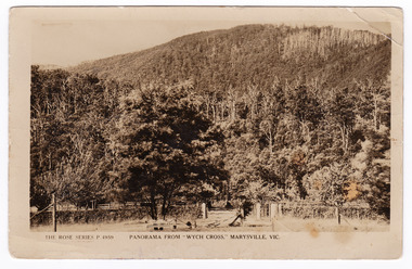 Marysville & District Historical Society
Postcard (item) - Black and white postcard, Rose Stereograph Company, Panorama From "Wych Cross," Marysville, Vic, 1913-1967
A postcard in a series produced by the Rose Stereograph Company in Victoria, Australia as a souvenir of Marysville.A black and white photograph showing a panoramic view from Wych Cross which was a guesthouse in Marysville. The Wych Cross Private Guesthouse was part of the Wych Cross Private Hotel Co. Ltd of which Mr. Felix Jellicoe was Managing Director at the time. The guesthouse burnt down in a fire on the 14th of November, 1926. This fire started in the kitchen where it was soon extinguished by one of the employees. However, it is believed that sparks from the earlier fire, which were not noticed at the time, ignited the second fire which destroyed the weatherboard guesthouse in 20 minutes. Guests who were staying at the guesthouse were all away from the premises at the time of the fire and lost all their belongings; including one guest who lost a considerable sum of money.POST CARD REAL PHOTO/ THE "ROSE" SERIES DE LUXE PRODUCED IN AUSTRALIA Published by "The Rose Stereographs"/ Armadale, Victoria. "Sunnyside"/ Marysville/ 18/12/26 Dear Mr & Mrs De La Rue/ Just a line/ or two in which to convey the very/ best of good wishes. A very happy/ Christmas and Happy New Year/ to you and your family./ Yours sincerely Mrs. & Miss Newman. wych cross, marysville, victoria, p. 4959, rose series postcard, postcard, souvenir, wych cross hotel co ltd, felix jellicoe, guest house, 14th november 1926