Showing 23052 items
matching john
-
 Greensborough Historical Society
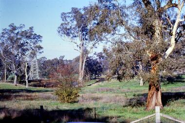
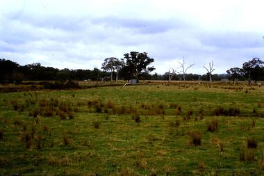
Slide - Photograph, John Ramsdale, Near the confluence of the Plenty and Yarra Rivers, Lower Plenty: Slide 118, 1990s
Photograph shows a rural scene with gumtrees and pylon. This is near the confluence of the Plenty and Yarra Rivers, Lower PlentyPart of the John Ramsdale collection of slides and audio visual material.Colour photograph scanned from slide.No maker's marks. No caption on slide.yarra river, plenty river, lower plenty -
 Greensborough Historical Society
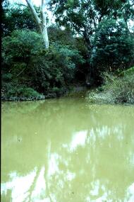
Slide - Photograph, John Ramsdale, Plenty River catchment: Slide 123, 1990s
Photograph shows a river and bushland, part of the Plenty River catchmentPart of the John Ramsdale collection of slides and audio visual material.Colour photograph scanned from slide.No maker's marks. No caption on slide.plenty river -
 Greensborough Historical Society
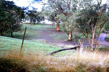
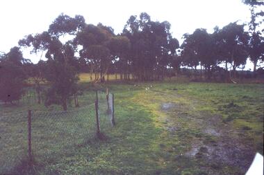
Slide - Photograph, John Ramsdale, Erosion on overgrazed property: Slide 124, 1990s
Photograph shows a fenced paddock and gum trees; this is sheet erosion on an overgrazed property near Whittlesea.Part of the John Ramsdale collection of slides and audio visual material.Colour photograph scanned from slide.No maker's marks. No caption on slide.whittlesea, erosion, farming -
 Greensborough Historical Society
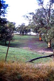
Slide - Photograph, John Ramsdale, Erosion on overgrazed property: Slide 125, 1990s
Photograph shows a fenced paddock and gum trees; erosion on overgrazed property near Whittlesea.Part of the John Ramsdale collection of slides and audio visual material.Colour photograph scanned from slide.No maker's marks. No caption on slide.whittlesea, erosion, farming -
 Greensborough Historical Society
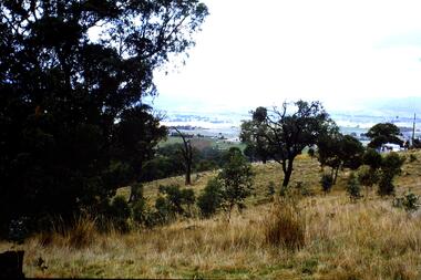
Slide - Photograph, John Ramsdale, Mt Disappointment: Slide 127, 1990s
Photograph shows a rural view from Mount Disappointment, north of Whittlesea.Part of the John Ramsdale collection of slides and audio visual material.Colour photograph scanned from slide.No maker's marks. No caption on slide.mt disappointment, mount disappointment, whittlesea -
 Greensborough Historical Society
Slide - Photograph, John Ramsdale, Plenty River near Apollo Parkways: Slide 128, 1990s
Photograph shows a river and trees - the Plenty River near Apollo Parkways.Part of the John Ramsdale collection of slides and audio visual material.Colour photograph scanned from slide.No maker's marks. No caption on slide.plenty river, apollo parkways -
 Greensborough Historical Society
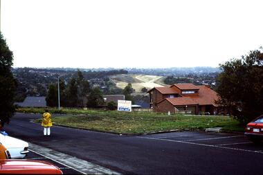
Slide - Photograph, John Ramsdale, Apollo Parkways: Slide 129, 1990s
Photograph shows a residential area among trees with auction sign in foreground. This is Apollo Parkways in the 1990s.Part of the John Ramsdale collection of slides and audio visual material.Colour photograph scanned from slide.No maker's marks. No caption on slide.apollo parkways, residential development -
 Greensborough Historical Society
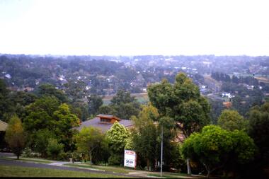
Slide - Photograph, John Ramsdale, Apollo Parkways with Greensborough Bypass in background: Slide 130, 1990s
Photograph shows a residential area in foreground and a new development in background. This is Apollo Parkways with Greensborough Bypass in background in 1990s.Part of the John Ramsdale collection of slides and audio visual material.Colour photograph scanned from slide.No maker's marks. No caption on slide.apollo parkways, greensborough bypass -
 Greensborough Historical Society
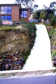
Slide - Photograph, John Ramsdale, Apollo Parkways: Slide 131, 1990s
Photograph shows a house with steep drive and sold sign in the Apollo Parkways estate Greensborough.Part of the John Ramsdale collection of slides and audio visual material.Colour photograph scanned from slide.No maker's marks. No caption on slide.apollo parkways -
 Greensborough Historical Society
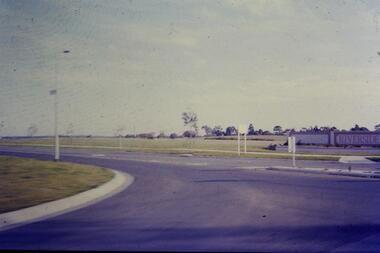
Slide - Photograph, John Ramsdale, Riverside: Slide 1, 1990s
Photograph shows a new land subdivision, with the name "Riverside" on a wall.Part of the John Ramsdale collection of slides and audio visual material.Colour photograph scanned from slide.No maker's marks or captions -
 Greensborough Historical Society
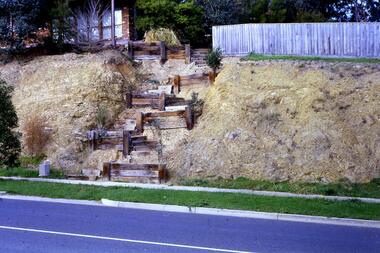
Slide - Photograph, John Ramsdale, Rattray Road erosion: Slide 2, 1990s
Photograph shows a retaining wall leading up an embankment to a fence line. This shows erosion on Rattray Road Montmorency.Part of the John Ramsdale collection of slides and audio visual material.Colour photograph scanned from slide.erosion, rattray road montmorency -
 Greensborough Historical Society
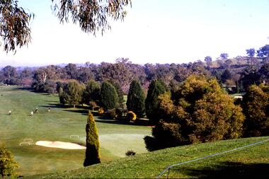
Slide - Photograph, John Ramsdale, Rosanna Golf Club: Slide 3, 1990s
A view of Rosanna Golf CoursePart of the John Ramsdale collection of slides and audio visual material.Colour photograph scanned from slide.No maker's marks or captionsrosanna golf course -
 Greensborough Historical Society
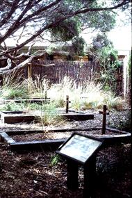
Slide - Photograph, John Ramsdale, Early settlers' graves Sorrento: Slide 4, 1990s
Photograph shows early settlers' graves at Sorrento.Part of the John Ramsdale collection of slides and audio visual material.Colour photograph scanned from slide.No maker's marks. Caption on slide "1st settlers' graves Sorrento"graves, sorrento -
 Greensborough Historical Society
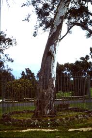
Slide - Photograph, John Ramsdale, Canoe tree: Slide 5, 1970s
Photograph shows a large gum tree encircled by an iron fence. This tree is known as a canoe or scar tree - a section of bark has been removed by first nations people to make a canoe.Part of the John Ramsdale collection of slides and audio visual material.Colour photograph scanned from slide.No caption. Printed maker's mark on slide "Kodak Kodachrome Slide"canoe tree, scar tree, first nations -
 Greensborough Historical Society
Slide - Photograph, John Ramsdale, Rural scene: Slide 17, 1990s
Photograph shows a rural scene with post and wire fence and trees. Location unknown.Part of the John Ramsdale collection of slides and audio visual material.Colour photograph scanned from slide.No caption. Printed maker's mark on slide "Kodak Kodachrome Slide"rural landscape -
 Greensborough Historical Society
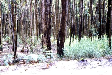
Slide - Photograph, John Ramsdale, Post bushfire regrowth, Upper Plenty: Slide 31, 1990s
Photograph shows a bush scene with trees that are regenerating after a bushfire in the Upper Plenty area.Part of the John Ramsdale collection of slides and audio visual material.Colour photograph scanned from slide.No maker's marks. Caption on slide "T & Bs"bushfires, upper plenty, vegetation -
 Greensborough Historical Society
Slide - Photograph, John Ramsdale, Plenty River behind football ground: Slide 51, 1990s
Photograph shows a river and bushland. This is the Plenty River behind the football ground in Greensborough.Part of the John Ramsdale collection of slides and audio visual material.Colour photograph scanned from slide.No maker's marks. Caption on slide "Plenty"plenty river greensborough, plenty river -
 Greensborough Historical Society
Slide - Photograph, John Ramsdale, Flood plain of the Plenty River: Slide 90, 1990s
Photograph shows farmland on the flood plain of the Plenty River, north of MerndaPart of the John Ramsdale collection of slides and audio visual material.Colour photograph scanned from slide.No maker's marks. Caption on slide "Plenty"plenty river, mernda -
 Greensborough Historical Society
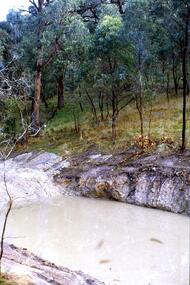
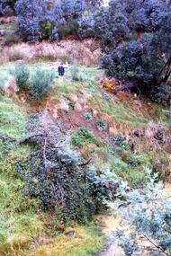
Slide - Photograph, John Ramsdale, Slumping erosion along the Plenty River: Slide 110, 1990s
Photograph shows a man standing on an embankment which is being eroded. This is slumping erosion along the Plenty River.Part of the John Ramsdale collection of slides and audio visual material.Colour photograph scanned from slide.No maker's marks. Caption on slide "Plenty"plenty river, erosion -
 Greensborough Historical Society
Slide - Photograph, John Ramsdale, Plenty River with European trees: Slide 27, 1990s
Photograph shows the Plenty River at Greensborough with European trees on the bank.Part of the John Ramsdale collection of slides and audio visual material.Colour photograph scanned from slide.No caption. Printed maker's mark on slide "Kodak Kodachrome Slide"plenty river, vegetation -
 Greensborough Historical Society
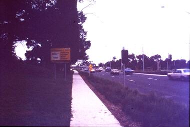
Slide - Photograph, John Ramsdale, Plenty Road near Parade College: Slide 29, 1990s
Photograph shows a 3-lane road with "Federally funded" sign This is Plenty Road Bundoora, near Parade college.Part of the John Ramsdale collection of slides and audio visual material.Colour photograph scanned from slide.No caption. Printed maker's mark on slide "Kodak Kodachrome Slide"plenty road bundoora, parade college -
 Greensborough Historical Society
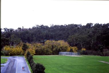
Slide - Photograph, John Ramsdale, Looking from Kalparrin to Partington's Flat: Slide 34, 1990s
Photograph shows a sports ground with cricket nets. Looking toward Partington Flat from Kalparrin.Part of the John Ramsdale collection of slides and audio visual material.Colour photograph scanned from slide.No caption. Printed maker's mark on slide "Kodak Kodachrome Slide"partingtons flat, cricket, public reserves -
 Greensborough Historical Society
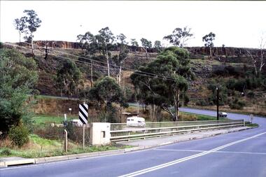
Slide - Photograph, John Ramsdale, Middle Gorge Park on Gorge Road: Slide 41, 1990s
Photograph shows a bridge with van, road is on steep hill. This is the carpark at Middle Gorge Park on Kurrak Road Yarrambat.Part of the John Ramsdale collection of slides and audio visual material.Colour photograph scanned from slide.No caption. Printed maker's mark on slide "Kodak Kodachrome Slide"middle gorge park, kurrak road yarrambat, plenty gorge metropolitan park -
 Greensborough Historical Society
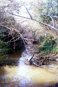
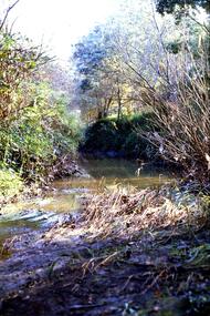
Slide - Photograph, John Ramsdale, Plenty River, upstream from Gorge: Slide 42, 1990s
Photograph shows creek bed with vegetation, upstream from Plenty Gorge.Part of the John Ramsdale collection of slides and audio visual material.Colour photograph scanned from slide.No caption. Printed maker's mark on slide "Kodak Kodachrome Slide"plenty gorge, plenty river, mernda -
 Greensborough Historical Society
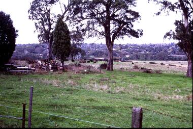
Slide - Photograph, John Ramsdale, Near scar tree Yallambie: Slide 48, 1990s
Photograph shows rural view with cattle and trees. This is the scar or canoe tree in Yallambie. Part of the John Ramsdale collection of slides and audio visual material.Colour photograph scanned from slide.No caption. Printed maker's mark on slide "Kodak Kodachrome Slide"scar tree, canoe tree, yallambie -
 Greensborough Historical Society
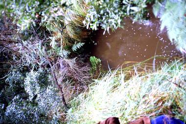
Slide - Photograph, John Ramsdale, Run off into Plenty River: Slide 64, 1990s
Photograph shows water over ground. This is run off into the Plenty RiverPart of the John Ramsdale collection of slides and audio visual material.Colour photograph scanned from slide.No caption. Printed maker's mark on slide "Kodak Kodachrome Slide"plenty river -
 Greensborough Historical Society
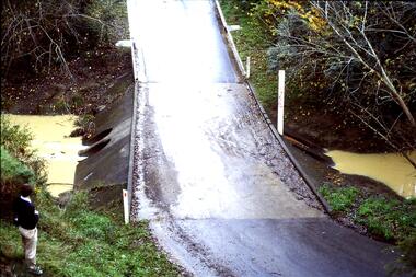
Slide - Photograph, John Ramsdale, Ford over Plenty River to Partington's Flat: Slide 72, 1990s
Photograph shows road or path over culvert. This is the ford over Plenty River to Partington's FlatPart of the John Ramsdale collection of slides and audio visual material.Colour photograph scanned from slide.No caption. Printed maker's mark on slide "Kodak Kodachrome Slide"ford over plenty river, plenty river, partington's flat -
 Greensborough Historical Society
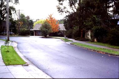
Slide - Photograph, John Ramsdale, Lower Plenty houses: Slide 79, 1990s
Photograph shows a residential street in Lower Plenty - the Plenty River is behind.Part of the John Ramsdale collection of slides and audio visual material.Colour photograph scanned from slide.No caption. Printed maker's mark on slide "Kodak Kodachrome Slide"lower plenty, plenty river, residential development -
 Greensborough Historical Society
Slide - Photograph, John Ramsdale, Greensborough Bypass near Apollo Parkways: Slide 91, 1990s
Photograph shows houses in foreground and further development in background, including Greensborough Bypass near Apollo Parkways.Part of the John Ramsdale collection of slides and audio visual material.Colour photograph scanned from slide.No caption. Printed maker's mark on slide "Kodak Kodachrome Slide"greensborough bypass, apollo parkways -
 Greensborough Historical Society
Slide - Photograph, John Ramsdale, Looking towards Bulleen from Lower Plenty; Slide 115, 1990s
Photograph shows a rural scene with gum tree and pylon, looking towards Bulleen from Lower Plenty.Part of the John Ramsdale collection of slides and audio visual material.Colour photograph scanned from slide.No caption. Printed maker's mark on slide "Kodak Kodachrome Slide"bulleen, lower plenty