Showing 10833 items
matching maps
-
 The Celtic Club
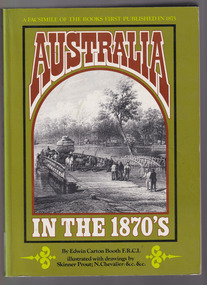
Book, Edwin Carton Booth, Australia in the 1870s, 1975
A facsimile of the original volume. First published 1873-1876 with engravings. There are brief references to aborigines.Maps, ill, facsim, p.232, 2 vols.non-fictionA facsimile of the original volume. First published 1873-1876 with engravings. There are brief references to aborigines.australia - pictorial works, australia - description and travel -
 The Celtic Club
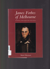
Book, Mairi Harman, James Forbes of Melbourne: Pioneer clergyman and educator, 2001
James Forbes' one great object was the advancement of pure religion and education among the people of Port Phillip. He was the first settled clergyman of Port Phillip District.Index, bib, maps, plates, ill, p.164.non-fictionJames Forbes' one great object was the advancement of pure religion and education among the people of Port Phillip. He was the first settled clergyman of Port Phillip District.presbyterian clergy - melbourne - biography, educators - victoria -
 The Celtic Club
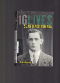
Book, Brian Feeney, 16 lives: Sean Macdiarmada, 2014
The first of a series of biographies of the 16 men executed by the British Government following the Easter Rising in 1916.Index, map, Ill, plates, bib. p.336.non-fictionThe first of a series of biographies of the 16 men executed by the British Government following the Easter Rising in 1916.ireland - biography - sean macdiarmada, ireland - uprising 1916 -
 Melbourne Tram Museum
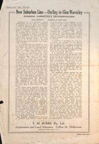
Pamphlet - Real estate sale, T M Burke, "New Suburban line - Darling to Glen Waverley", July 1926
Pamphlet advising potential land purchasers of the recommendation to extend the railway line from Darling to Glen Waverley, extracted from The Age 26/6/1926. Advises that the land and losses would be paid for by the residents through their rates. Gives costs of the proposed new line. Has a plan showing the estates for sale along the line, the Ashburton line (later extended to Alamein) and Burwood Road. Published by T M Burke Pty Ltd. Demonstrates the style of land sale pamphlet including the proposed availability of train services to prospective purchasers.Pamphlet - single quarto sheet with map on rear - printed.sale of land, real estate, railways, glen waverley, suburban railways -
 Federation University Historical Collection
Map - Geological Survey, J. Phillips, Geological Survey of Victoria - Ballarat, 1857, 10/1858
Geological map of the Ballarat District featuring four colours.ballarat, geological, geology, geological plan, main road, camp, golden point, pennyweight hill, clayton hill, ballaarat cemetery, bakery hill, specimen hill, soldiers hill, nightingale lead, native youth black hill flat, white flat, mining, mines, eureka lead, old post office hill -
 Melbourne Tram Museum
Letter (Series), Melbourne & Metropolitan Tramways Board (MMTB), Darling and Koornang Road extensions from Carnegie, 1937
Melbourne and Metropolitan Tramways BoardRecord of correspondenceLetters in date orderDetails correspondence both internal and external with Councils about a possible tram line along Waverley Road, Darling Rd, Koornang Rd to the the Carnegie tram terminus in Trugannini Road. Inlcudes cost estimate, and sketch plan.tramways, new track, extensions, correspondence, darling road, carnegie, koornang rdtramways, new track, extensions, correspondence, darling road, carnegie, koornang rd -
 Bendigo Historical Society Inc.
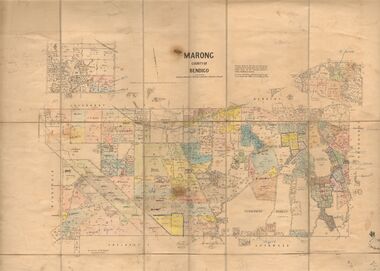
Map - JACK FLYNN COLLECTION: MARONG, June 1933
Map: Parish of Marong, County of Bendigo. Parish plan.By Authority W.M. Houston, Government Printer. Drawn and reporduced at the Dept., of Lands and Survey, Melbourne, Victoria.map, bendigo, parish plan, marong -
 Phillip Island and District Historical Society Inc.
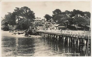
Photographs-Postcards, Valentine Publishing Co. Pty. Ltd. et al, 1940's
Five of a collection of 12 photographs and postcards donated by Jill Palmer.Five black & white postcards taken around Phillip Island. 357-08: Looking from the Cowes Pier towards the Isle of Wight Hotel. Shows camel rides on the beach. 357-09: Bayview Guest House on The Esplanade, Cowes. 357-10: A koala and young on tree. 357-11: Penguins coming in at dusk at the Penguin Parade. 357-12: Broadbent's Official Map of Phillip Island.357-08: The Pier, Cowes. No. 9. 357-09: Photo Shop Series. Bayview Guest House. Cowes. 357-10: Native Bears (Koala) at Cowes No. 55B. 357-11: Photo Shop Series. Parade of the Penguins. Phillip Island. 357-12: Broadbent's Official Map. Phillip Island.cowes pier, cowes beach, wildlife - koalas, wildlife - penguins, bayview guest house cowes phillip island, map of phillip island -
4th/19th Prince of Wales's Light Horse Regiment Unit History Room
Badge, Remembrance Day 1918, 1918
Produced for sale for Remembrance Day 1918A plastic covered paper badge. It is a a shield shape and has a map of Australia in gold surmounted by a red crown. Under the map is a blue ribbon with the word Australia in white. There is a laurel either side of the map in green with a yellow scroll under with 'Heroes, Gallipoli" under with April 25th 1915. On back: Proceeds in aid of State War Council for Soldiers, Widows and orphans and R.S.S.I.L.A.badge, remembrance day -
Bendigo Historical Society Inc.
Map - INFANCY OF BENDIGO, Original dated 28/10/1890
Map: Photocopy of the First sketch map of the Bendigo Diggings. Has been assembled from several photocopies taped together. Laid before the Frencham Committee by William Sandbach , a witness, 18 September 1890. There are Two of these maps. ( x ref 5673 , 8235 , Box 83 , 9077 )map, bendigo, city streets, infancy of bendigo, gold diggings, henry frencham, william sandbach, where was gold first found -
 Bendigo Historical Society Inc.
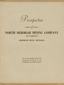
Document - MCCOLL, RANKIN AND STANISTREET COLLECTION: PROSPECTUS OF NORTH DEBORAH MINING COMPANY NL, 1937
McColl Rankin & Stanistreet, Prospectus of North Deborah Mining Co NL. Date: 17 April 1937. Book soft cover 6 copies; A/ Excellent condition map and applicant form intact. B/ Good condition. Map and application form intact, copy has been folded down middle. Inscription on front cover, date altered to 1938, No 1978. C/ Good condition. Map and application intact. D/ Map intact, application removed. Good condition. Map intact, application removed. Good condition. F/ Application removed, map intact, prospectus removed, fair condition. Markings: on page 2, 3, 4, & 6. G/ Application removed, map intact, fair condition. Markings on page;2, 3, 4, & 5.organization, mining, north deborah mining company nl, mccoll rankin & stanistreet, prospectus of north deborah mining co nl. date: 17 april 1937 map application form -
 Greensborough Historical Society
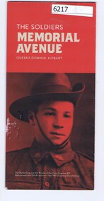
Pamphlet, The Soldiers Memorial Avenue, Queens Domain, Hobart, 2015_
History, description and maps of the Soldiers Memorial Avenue Hobart. Includes map, with location of memorial trees.Single sheet printed in colour both sideswar memorials, hobart -
 Melbourne Tram Museum
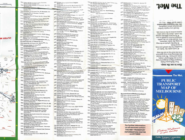
Map, The Met, "Public Transport Map of Melbourne", June 1992
Map - 36 fold - 9 x 2 x 2- colour map of public transport including buses, titled "Public Transport Map of Melbourne", published by the Public Transport Corporation, Effective June 1992. Gives rail and tram maps, information on tickets. Has The Met contact details. 2 copies held .1 - as above but a 6 fold DL, dated Jan 8, 1995trams, tramways, map, ptc, melbourne, the met -
 Federation University Historical Collection
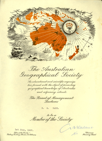
Certificate, Australian Geographical Society, Australian Geographical Society certificate made out to Keith Rash, 1957, 01/06/1957
Certificate of the Australian Geographical Society made out to Keith Rash. One printed page, map of Oceania including sailing ship, torch, map of Australia and surrounding islands. G. B. Walker (signature)rash, keith rash, australian geographical society, g.b. walker -
Bendigo Historical Society Inc.
Map - SERPENTINE, No date Visible
Map: Township of Janiember (name crossed out and 'Serpentine' hand written in its place, Parish of Janiember east, County of Bendigo ( number 156 in Map Cupboard 1)map, bendigo, township, serpentine, janiember, parish of janiember east, county of bendigo -
Bendigo Historical Society Inc.
Map - PASTORAL HOLDINGS, See above
Map: Copy of 'Map showing the Pastoral Holdings of the Port Phillip District 1835-51, Now Victoria'. Comiled by A.S.Kenyon M.I.E. Aus. Historical society of Victoria 1932map, victoria, pastoral holdings, pastoral holdings, port phillip district -
 National Vietnam Veterans Museum (NVVM)
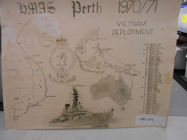
Document, HMAS Perth 1970/71 Vietnam Deployment
Black and white Collage with Map of Vietnam, HMAS Perth Badge, Photograph of HMAS Perth, Map and History of Hmas Perth's Deployment from Sept 1970 to April 1971.Flight & Flourishdocument, hmas perth, d38 -
Tatura Irrigation & Wartime Camps Museum
Map - Plaster Cast, Map of Australia, 1940's
Made by POW at Dhurringile Internment CampMap of Australia, plaster cast, bell shaped, in which is a copper penny and a rosella atop Cape York. Dated 1940 words "Tatura Vic" below map of Australia1940 Tatura- Dhurringile intern Campplaster caste, map of australia, layton family, dhurringile camp, tatura, camp, ornament, plaster -
 Sunshine and District Historical Society Incorporated
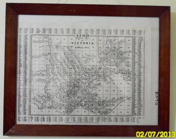
Map (1939), RAILWAYS OF VICTORIA, Including Passenger Mileage, 4 April 1939, 1939
Historical record of the railway line system in the state of Victoria in 1939. Many of the railway lines no longer exist.Map showing the RAILWAY LINES of VICTORIA plus PASSENGER MILEAGES as of 4.4.1939. The white map with black printing is enclosed within a glass faced brown stained wooden frame.victoria, railway map, 1939, rail, passenger mileage -
Stawell Historical Society Inc
Map, Township of Stawell
B/W map of Stawell Surveyed by Easton Johnston Contract surveyor Scale in Chains. Showing Special Allotments Reefs, Pleasant Creek Parish of Stawell. Map No L4000 -
Beechworth Honey Archive
Map- Albury
Map centred on Albury, showing Wodonga, Beechworth, Yackandandah and Chiltern. Topographic survey scale 1:100,000. Map is colour, printed on paper. Produced by Department of Minerals and EnergySheet 8225 (ed.1) series R. 652 Notes written on side regarding brigade boundaries, constructed access roads and fire trails, dams suitable for quick fill pump and areas 'fuel reduction burns Autumn 76'.map, albury, wodonga, beechworth, yackandandah, chiltern, paper, topographic, beechworth honey -
 Wodonga & District Historical Society Inc
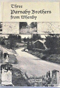
Book - Three Parnaby Brothers from Whenby, Julie Walker and Judy Crook, 2000
This book documents the story of the Parnaby Brothers who migrated to Australia from Whenby in North Yorkshire, England via Natal in South Africa. They settled in the Wodonga district of Victoria. The dedication on page 3 of the book says "To George, William and Matthew Parnaby. We can only wonder at the adventurous spirit, courage and fortitude of the three brothers who arrived in this country with an ambition to better themselves and provide for their families." George arrived at Port Melbourne from Port Natal on 11 January 1864. On the same voyage was his brother William and a nephew Charles. George and his wife Rachel settled at Howlong on the Victoria/NSW border where he worked as a farmer and labourer. George died at Howlong on 26 JUne 1887. William and his son Charles settled in Albury. In 1869/70 he was listed as a property owner at Wooragee, including a house, farm and vineyard. William died in Albury on 20 February 1894. Matthew originally arrived in Hobsons Bay, Victoria in 1854. After 6 years on the goldfields he returned to South Africa and then to England to marry. They eventually returned to Australia in 1863. After some time in Melbourne, Matthew moved to Belvoir (Wodonga). By August 1877 he owned 104 acres of grazing land at House Creek. He steadily became one of the most successful farmers in the district and increased his landholdings. He spent the remainder of his life in Wodonga where he served as a member of the Shire Council for some years. Matthew never forgot his birthplace and called his property "Whenby Grange". He died in Wodonga on 7 October 1903.A volume of 342 pages, including photos and maps. The cover includes images of the town of Whenby, maps and the grave of Matthew Parnaby who died in Wodonga on 7 October 1903.This book documents the story of the Parnaby Brothers who migrated to Australia from Whenby in North Yorkshire, England via Natal in South Africa. They settled in the Wodonga district of Victoria. The dedication on page 3 of the book says "To George, William and Matthew Parnaby. We can only wonder at the adventurous spirit, courage and fortitude of the three brothers who arrived in this country with an ambition to better themselves and provide for their families." George arrived at Port Melbourne from Port Natal on 11 January 1864. On the same voyage was his brother William and a nephew Charles. George and his wife Rachel settled at Howlong on the Victoria/NSW border where he worked as a farmer and labourer. George died at Howlong on 26 JUne 1887. William and his son Charles settled in Albury. In 1869/70 he was listed as a property owner at Wooragee, including a house, farm and vineyard. William died in Albury on 20 February 1894. Matthew originally arrived in Hobsons Bay, Victoria in 1854. After 6 years on the goldfields he returned to South Africa and then to England to marry. They eventually returned to Australia in 1863. After some time in Melbourne, Matthew moved to Belvoir (Wodonga). By August 1877 he owned 104 acres of grazing land at House Creek. He steadily became one of the most successful farmers in the district and increased his landholdings. He spent the remainder of his life in Wodonga where he served as a member of the Shire Council for some years. Matthew never forgot his birthplace and called his property "Whenby Grange". He died in Wodonga on 7 October 1903.parnaby family, whenby england, whenby grange wodonga -
 Ringwood and District Historical Society
Poster, Land Sale Advertisement - Pinemont Estate, Ringwood, Victoria - circa 1924
Map of residential allotments for sale, with terms of sale, summary of subdivision features and local services and facilities, and photographs of local street scene and lake (Loughnan's Lake - location not marked), Subdivision includes Wonga Road (later Loughnan's Road), Glenvale Road, Kubba Road, Felix Crescent, Summit Crescent, Pine Crescent, Aurum Crescent, Hygeia Parade, Panorama Avenue, Avalon Grove, Montalbo Road, Cielterre Avenue. Sole Agents T.M. Burke Pty Ltd, 340 Collins Street Melbourne Phones 6294, 6779. Map by S. Callanan, Licensed Surveyor, 107 Elizabeth Street Melbourne. Date of poster estimated from railway services information extract " ... 36 fast electric trains to Flinders Street daily ... proposed electrification to Croydon ..." . Timeline for electrification of Lilydale Line record indicates Box Hill to Ringwood January 1923, Ringwood to Croydon November 1924 (Source: History of Croydon - McGivern, Vol.1 p20). -
 Melbourne Tram Museum
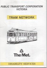
Book, Public Transport Corporation (PTC), "Tram Network Disability Services", c1990
... Maps ...Book - 36 sheets - A4, two colour - printed on off white paper, titled "Tram Network Disability Services" published by Public Transport Corporation Victoria, with a drawing of SW5 758 on the cover along with a The Met logo. Provides information in map form on each tram route in a large print format, contact numbers and some general information. No date of publication. Port Melbourne route shown as route 111; Reg Item 252 notes that this route ran between Port Melbourne and the Exhibition Buildings between 12/1987 and 12/1993. See Reg Item 1865 for pamphlet version and 6000 for a PTC 1998 version. 2nd copy added 24-5-2023 - larger size issue - 248H x 242W - wire boundtrams, tramways, ptc, the met, maps, disability services, tram routes, routes -
 Warrnambool and District Historical Society Inc.
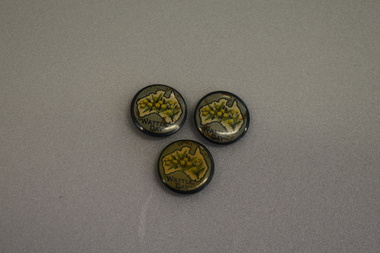
Badges, Wattle Day
These badges appear to have been issued as part of Wattle Day celebrations in the period 19910 to 1919. The use of wattle as an Australian symbol was strong during the pre- Federation and Federation days and was particularly promoted by the Australian Natives Association, a prominent campaigner for Federation. Wattle Day was established in Melbourne, Sydney and Adelaide in 1910 and the wattle symbol was a strong one for servicemen serving overseas in World War One and wattle badges and pins were used to raise funds for funds such organisations as the Red Cross.These badges are of interest as an example of the strong national sentiment engendered on Australia by World War One..1 circular metal concave badge featuring a cream map of Australia with dark green outline. An image of wattle flowers and leaves is in the centre of the map. Surrounding the map is a pale green border with text. The edge is dark green. It has a pin clip on the reverse. .2 As above .3 As above .1 WATTLE DAY .2 WATTLE DAY .3 WATTLE DAY -
Bendigo Historical Society Inc.
Map - CAMPBELL COLLECTION: BENDIGO AND DISTRICT MAPS, 2-2-29
Map. Wellsford, Parishes of Wellsford and Axedale, Scale 20 chains to 1 inch. Total area 4994 acres. Prepared in W.P.B. from A and P Plans, by W.J.G.2-2-29. Top left of map are directions to Fosterville, Huntly & Bendigo. (number 361 in map cupboard 1)W.J.Galbraithmap, bendigo, parish plan -
 Emerald Museum & Nobelius Heritage Park
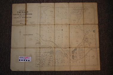
Two maps of Emerald Township 1955 and 1922, Emerald Township
The Photo Lithographed Maps belonged to George and Mary A'Vard. They are early maps of Emerald Township in 1955 and 1922.VEMU1659.1 Township of Emerald, Parish of Gembrook, Counties of Evelyn and Mornington; September 1955 VEMU1659.2 Township of Emerald, Parish of Gembrook, Counties of Evelyn and Mornington: Drafted 12 Sep 1892, Examined 30 Sep 1892, Additions 17 Jun 1922 -
 Rutherglen Historical Society
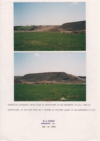
Image, W. H. Pleming, 13/10/1992
Two colour photographs printed on A4 paper with typed caption and a donor stamp. Date of photos in bottom right hand of each image.Date on images: "92-10-13" Caption below photos: "Asphelting aggregate stock piled at Springhurst at map reference 512-927, used at Springhurst on the Hume Free Way & crushed at Chiltern Quarry at map reference 671-969."hume freeway, chiltern quarry, road works -
 Federation University Art Collection
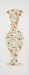
Artwork, other - Handcut & Collaged maps on paper, 'Survey Vessel I' by Carole Wilson, 2008
... maps ...Carole WILSON (1960- ) Born Canberra, Australia Carole Wilson undertook undergraduate studies at the Canberra School of Arts and Phillip Institute of Technology. She completed a Graduate Diploma in Education at the University of Ballarat in 1987, and a Doctor of Philosophy in 2000. She has chosen central motifs in her work, which she incorporates throughout a series. The urn has been a unifying motif in Wilson's map work and testifies to the way in which function drives form across cultures. Carole's work is held in many public collections including the National Gallery of Australia, the Powerhouse Museum, State Library of Victoria and a number of regional Victorian galleries. Her posters are in museum collections in Finland, Moscow and Poland. In 2001 Dr Wilson was awarded a Doctor of Philosophy (Visual Art) from the University of Ballarat (Now Federation University). She graduated with a Graduate Diploma in Education from University of Ballarat in 1987, and a Diploma of Art from the Phillip Institute of Technology (RMIT) in 1984. Carole Wilson lectures at Federation University Australia: 2010- Senior Lecturer in Visual Arts, Honours and Research Degrees Co-ordinator 2009-2011 Lecturer in Studio Practice and Postgraduate Co-ordinator 1999-2008 Lecturer in Visual Arts (Sessional) This item is part of the Federation University Art Collection. The Art Collection features over 2000 works and was listed as a 'Ballarat Treasure' in 2007. Donated through the Australian Government's Cultural Gifts Program by Anne M. Drum, 2011art, artwork, carole wilson, maps, urn, alumni, available, staffmember -
 Bendigo Military Museum
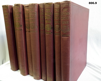
Book - SET OF BOOKS, Sir John Hammerton, The Second Great War - 9 Volumes, 1946
All volumes are of buckram hard cover, colour maroon. In the centre are the letters BWC embossed into the cover. Gold writing on the spine. .1) Volume 1. Pages 1-400 illustrated with photos and maps up to 1939 A.D. .2 ) Volume 2. Pages 401-816 illustrated photos and maps, years 1939-1940. .3) Volume 3. Pages 817-1240 illustrated photos and maps, years 1939-1940. .4) Volume 4. Pages 1241-1636 illustrated photos and maps, years 1940-1941. .5) Volume 5 Pages 1637-2096 illustrated photos and maps, years 1941-1942 .6) Volume 6 Pages 2091-2588 illustrated photos and maps, years 1942. .7) Volume 7 Pages 2589-3084 illustrated photos and maps, years 1943-1944. .8) Volume 8 Pages 3085-3576 illustrated photos and maps, years 1944-1945. .9) Volume 9 Pages 3577-4076 illustrated photos and maps, years 1945.books, military history