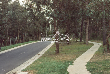
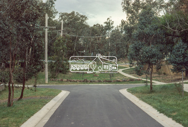
Showing 5101 items
matching 1980
-
 Eltham District Historical Society Inc
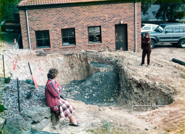
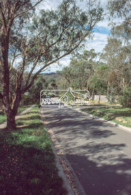
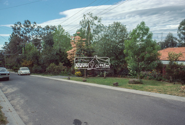
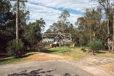
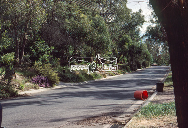
Photograph, Swimming pool construction, 14 Stokes Place, Eltham, March 1984, 1980
14 Stokes Place was the home of Peter and Carla Vermey who had migrated to Australia from Holland. The land was purchased in May 1979 and the home built by Peter and Carla Vermey after the developer, Macquarie Builders went bankrupt. Sold October 2017 by Morrison and Kleeman Real Estate. Stokes Place was part of the Stokes Orchard Estate which was developed from the break-up of the the orchard owned by Frank Stokes who lived on the northeast corner of Nyora Road and Eucalyptus Road. His daughter Beryl advised that the Shire had levied a rate assessment on individual parcels of land within the orchard which became unaffordable resulting in its sub-division and sell off. The Stokes Orchard Estate was developed by Macquarie Builders in two stages starting with stage 1 in 1976. Stokes Place was part of Stage 2 in 1979. The Estate was bounded between Nyora Road, Eucalyptus Road, Diosma Road and Stokes Place. The original orchard only just reached the left most portions of Stokes Place and did not go fully up to Diosma, rather to just beyond the extant of Stokes Place. Stokes Place was known within the family as "The Oats" as that is where they grew oats. Frank Stokes moved to Eltham c.1945 after visiting Harold Bird to view his orchard, located diagonally opposite Stokes Orchard from the intersection of Eucalyptus Road, Pitt Street and Nyora Road. It was on Harold Bird's recommendation that Frank purchased the land.The Stokes Orchard Estate collection is typical of housing developments of the late 1970s and 1980s. It was one of the earliest estates in Eltham following the nearby Woodridge Estate development.Digital fileScanned from a print contained in owner's photo album (81 prints in total digitised)stokes place, eltham, stokes orchard, stokes orchard estate, streets, houses, peter and carla vermey -
 Eltham District Historical Society Inc
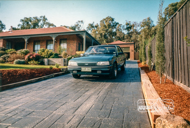
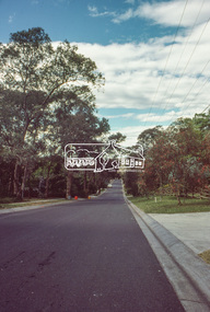
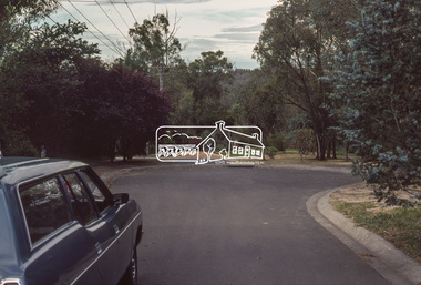
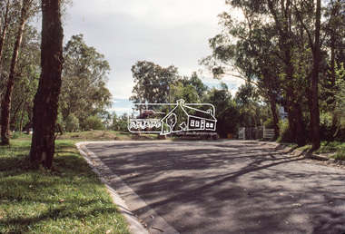
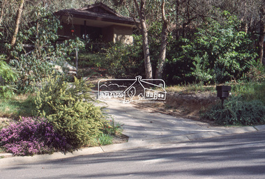
Photograph, 14 Stokes Place, Eltham, June 1986, 1980
14 Stokes Place was the home of Peter and Carla Vermey who had migrated to Australia from Holland. The land was purchased in May 1979 and the home built by Peter and Carla Vermey after the developer, Macquarie Builders went bankrupt. Sold October 2017 by Morrison and Kleeman Real Estate. Stokes Place was part of the Stokes Orchard Estate which was developed from the break-up of the the orchard owned by Frank Stokes who lived on the northeast corner of Nyora Road and Eucalyptus Road. His daughter Beryl advised that the Shire had levied a rate assessment on individual parcels of land within the orchard which became unaffordable resulting in its sub-division and sell off. The Stokes Orchard Estate was developed by Macquarie Builders in two stages starting with stage 1 in 1976. Stokes Place was part of Stage 2 in 1979. The Estate was bounded between Nyora Road, Eucalyptus Road, Diosma Road and Stokes Place. The original orchard only just reached the left most portions of Stokes Place and did not go fully up to Diosma, rather to just beyond the extant of Stokes Place. Stokes Place was known within the family as "The Oats" as that is where they grew oats. Frank Stokes moved to Eltham c.1945 after visiting Harold Bird to view his orchard, located diagonally opposite Stokes Orchard from the intersection of Eucalyptus Road, Pitt Street and Nyora Road. It was on Harold Bird's recommendation that Frank purchased the land.The Stokes Orchard Estate collection is typical of housing developments of the late 1970s and 1980s. It was one of the earliest estates in Eltham following the nearby Woodridge Estate development.Digital fileScanned from a print contained in owner's photo album (81 prints in total digitised)stokes place, eltham, stokes orchard, stokes orchard estate, streets, houses, peter and carla vermey -
 Eltham District Historical Society Inc
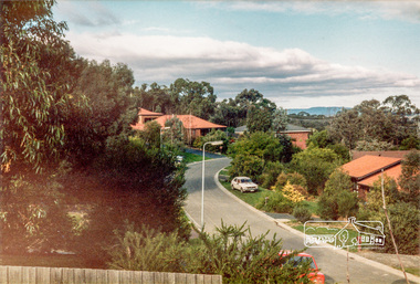
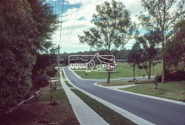
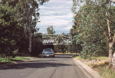
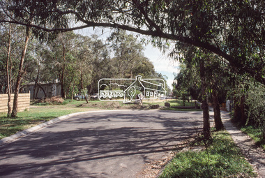
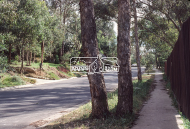
Photograph, Stokes Place, Eltham, June1986; looking southeast from linear park reserve near no. 10, 1980
14 Stokes Place was the home of Peter and Carla Vermey who had migrated to Australia from Holland. The land was purchased in May 1979 and the home built by Peter and Carla Vermey after the developer, Macquarie Builders went bankrupt. Sold October 2017 by Morrison and Kleeman Real Estate. Stokes Place was part of the Stokes Orchard Estate which was developed from the break-up of the the orchard owned by Frank Stokes who lived on the northeast corner of Nyora Road and Eucalyptus Road. His daughter Beryl advised that the Shire had levied a rate assessment on individual parcels of land within the orchard which became unaffordable resulting in its sub-division and sell off. The Stokes Orchard Estate was developed by Macquarie Builders in two stages starting with stage 1 in 1976. Stokes Place was part of Stage 2 in 1979. The Estate was bounded between Nyora Road, Eucalyptus Road, Diosma Road and Stokes Place. The original orchard only just reached the left most portions of Stokes Place and did not go fully up to Diosma, rather to just beyond the extant of Stokes Place. Stokes Place was known within the family as "The Oats" as that is where they grew oats. Frank Stokes moved to Eltham c.1945 after visiting Harold Bird to view his orchard, located diagonally opposite Stokes Orchard from the intersection of Eucalyptus Road, Pitt Street and Nyora Road. It was on Harold Bird's recommendation that Frank purchased the land.The Stokes Orchard Estate collection is typical of housing developments of the late 1970s and 1980s. It was one of the earliest estates in Eltham following the nearby Woodridge Estate development.Digital fileScanned from a print contained in owner's photo album (81 prints in total digitised)stokes place, eltham, stokes orchard, stokes orchard estate, streets, houses, peter and carla vermey -
 Eltham District Historical Society Inc
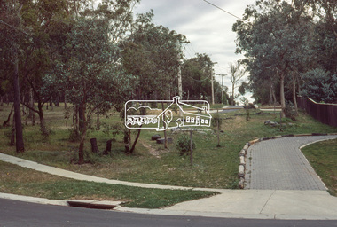
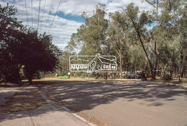
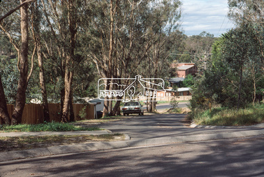
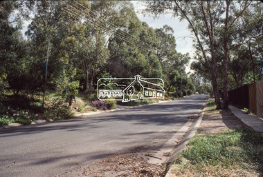
Photograph, 14 Stokes Place, Eltham, March 1987, 1980
14 Stokes Place was the home of Peter and Carla Vermey who had migrated to Australia from Holland. The land was purchased in May 1979 and the home built by Peter and Carla Vermey after the developer, Macquarie Builders went bankrupt. Sold October 2017 by Morrison and Kleeman Real Estate. Stokes Place was part of the Stokes Orchard Estate which was developed from the break-up of the the orchard owned by Frank Stokes who lived on the northeast corner of Nyora Road and Eucalyptus Road. His daughter Beryl advised that the Shire had levied a rate assessment on individual parcels of land within the orchard which became unaffordable resulting in its sub-division and sell off. The Stokes Orchard Estate was developed by Macquarie Builders in two stages starting with stage 1 in 1976. Stokes Place was part of Stage 2 in 1979. The Estate was bounded between Nyora Road, Eucalyptus Road, Diosma Road and Stokes Place. The original orchard only just reached the left most portions of Stokes Place and did not go fully up to Diosma, rather to just beyond the extant of Stokes Place. Stokes Place was known within the family as "The Oats" as that is where they grew oats. Frank Stokes moved to Eltham c.1945 after visiting Harold Bird to view his orchard, located diagonally opposite Stokes Orchard from the intersection of Eucalyptus Road, Pitt Street and Nyora Road. It was on Harold Bird's recommendation that Frank purchased the land.The Stokes Orchard Estate collection is typical of housing developments of the late 1970s and 1980s. It was one of the earliest estates in Eltham following the nearby Woodridge Estate development.Digital fileScanned from a print contained in owner's photo album (81 prints in total digitised)stokes place, eltham, stokes orchard, stokes orchard estate, streets, houses, peter and carla vermey -
 Eltham District Historical Society Inc
Slide, Price Avene, Montmorency, Oct. 1980
35mm colour positive transparency (1 of 24) Mount - Kodak Kodachrome Cardinfrastructure, lilicur road, montmorency, price avenue, roads -
 Eltham District Historical Society Inc
Slide, Price Avene, Montmorency, Oct. 1980
35mm colour positive transparency (1 of 24) Mount - Kodak Kodachrome Cardinfrastructure, lilicur road, montmorency, price avenue, roads -
 Eltham District Historical Society Inc
Photograph, Baldwin Avenue, Montmorency, Oct. 1980
35mm colour positive transparency (1 of 24) Mount - Kodak Kodachrome Cardbaldwin avenue, infrastructure, montmorency, roads -
 Eltham District Historical Society Inc
Photograph, Brixton Avenue, Eltham North, Oct. 1980
Diamond Valley Shire new street scheme35mm colour positive transparency (1 of 24) Mount - Kodak Kodachrome Cardinfrastructure, roads, brixton avenue, eltham north, glendale reserve, riversdale avenue -
 Eltham District Historical Society Inc
Photograph, Riversdale Avenue, Eltham North, Oct. 1980
Diamond Valley Shire new street scheme. Infrastructure benchmark studies35mm colour positive transparency (1 of 24) Mount - Kodak Kodachrome Cardinfrastructure, roads, eltham north, dale avenue, riversdale avenue -
 Eltham District Historical Society Inc
Photograph, Riversdale Avenue, Eltham North, Oct. 1980
Diamond Valley Shire new street scheme. Infrastructure benchmark studies35mm colour positive transparency (1 of 24) Mount - Kodak Kodachrome Card Colour print enlargement 27 x 35.5 cminfrastructure, roads, eltham north, gracedale avenue, riversdale avenue -
 Eltham District Historical Society Inc
Photograph, Riversdale Avenue, Eltham North, Oct. 1980
Diamond Valley Shire new street scheme. Infrastructure benchmark studies35mm colour positive transparency (1 of 24) Mount - Kodak Kodachrome Cardinfrastructure, roads, eltham north, gracedale avenue, riversdale avenue -
 Eltham District Historical Society Inc
Photograph - Photograoh, Wendy Wilson, Our Lady Help of Christians Primary School, 1-13 Henry St, Eltham, c.1980
Our Lady Help of Christians Primary School, - Hall on the left side used to be the Church before the current Church was built on opposite side of Henry Street (site of the former Wesleyan Church chapel in the 1850s, Eltham Rechabite Hall and Eltham Public Hall (1922-1940))Wendy Wilson (phone #)our lady help of christians primary school, henry street, eltham -
 Eltham District Historical Society Inc
Photograph - Colour Print, Unidentified, possibly Eltham area, c.1980
On reverse - Ex 5landscape, parks and gardens, unidentified -
 Eltham District Historical Society Inc
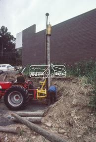
Slide - Photograph, Construction of Public Toilet, Research, c.Dec. 1980
35mm colour positive transparency Mount - Kodak Kodachrome Cardinfrastructure, public toilets, research (vic.), research comfort station, construction -
 Eltham District Historical Society Inc
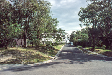
Slide - Photograph, Eltham Shire Council, Unidentified street, possibly Montmorency or Eltham North, c.Oct. 1980
35mm colour positive transparency (1 of 24) Mount - Kodak Kodachrome Cardeltham north, houses, infrastructure, roads, montmorency, unidentified -
 Eltham District Historical Society Inc
Slide - Photograph, Eltham Shire Council, Unidentified street, possibly Montmorency or Eltham North, c.Oct. 1980
35mm colour positive transparency (1 of 24) Mount - Kodak Kodachrome Cardeltham north, houses, infrastructure, roads, montmorency, unidentified -
 Eltham District Historical Society Inc
Slide - Photograph, Eltham Shire Council, Unidentified street, possibly Montmorency or Eltham North, c.Oct. 1980
35mm colour positive transparency (1 of 24) Mount - Kodak Kodachrome Cardeltham north, houses, infrastructure, roads, montmorency, unidentified -
 Eltham District Historical Society Inc
Slide - Photograph, Eltham Shire Council, Unidentified street, possibly Montmorency or Eltham North, c.Oct. 1980
35mm colour positive transparency (1 of 24) Mount - Kodak Kodachrome Cardeltham north, houses, infrastructure, roads, montmorency, unidentified -
 Eltham District Historical Society Inc
Book, Diamond Creek Basin Study. Part 1, A Compendium of Factors Relevant to Stormwater Flows, 1980
Basin Studies are studies to evaluate water supply and demand and help ensure reliable water supplies by identifying strategies to address imbalances in water supply and demand.Spiral Bound. 157 leaves in various foliations (some folded) : illustrated. (some colour.), maps (some colour.)aerial photographs, allendale road, arthurs creek mine, arthurs creek road bridge, arthurs creek, bald spur look-out, bank protection, bolton steet, bridge street bridge, bridge street, bridges, challenger street, chute street, construction, coolaroo drive, culvert, deep creek, diamond creek basin, diamond creek region, diamond creek, diamond street bridge, drainage works, eltham lower park, eltham town park, eltham trestle bridge, eltham west drains, eltham, erosion, flood management, floods, footbridge, glen katherine estate, gold mining, gum glade, hurstbridge, kangaroo ground, kinglake escarpment, kinglake national park, latiners hat factory, main road bridge, main road, masons falls, melbourne metropolitan board of works, monash bridge, mount sugarloaf, nillumbik park, orchards, railway culvert, railway line, ramptons road, real estate advertisement, research creek, st helena east drain, st helena road, st helena, storm sewers, stormwater, sugarloaf-preston transfer main crossing, susan street, union mine, village pond, water flow, watkins street, wattletree road, weidlich road, wingrove park, yarra river, zig zag road, water supply, basin study -
 Eltham District Historical Society Inc
Photograph, Pymm Avenue, Eltham North, Oct. 1980
35mm colour positive transparency (1 of 24) Mount - Kodak Kodachrome Cardeltham north, infrastructure, montmorency, pymm avenue, roads -
 Eltham District Historical Society Inc
Photograph, Pymm Avenue, Eltham North, Oct. 1980
35mm colour positive transparency (1 of 24) Mount - Kodak Kodachrome Cardeltham north, infrastructure, montmorency, pymm avenue, roads -
 Eltham District Historical Society Inc
Photograph, Pymm Avenue, Eltham North, Oct. 1980
35mm colour positive transparency (1 of 24) Mount - Kodak Kodachrome Cardeltham north, infrastructure, montmorency, pymm avenue, roads -
 Eltham District Historical Society Inc
Photograph, Pymm Avenue, Eltham North, Oct. 1980
35mm colour positive transparency (1 of 24) Mount - Kodak Kodachrome Card 27 x 35.5 cm colur print x 2eltham north, infrastructure, montmorency, pymm avenue, roads -
 Eltham District Historical Society Inc
Photograph, Pymm Avenue, Eltham North, Oct. 1980
35mm colour positive transparency (1 of 24) Mount - Kodak Kodachrome Cardeltham north, infrastructure, montmorency, pymm avenue, roads -
 Eltham District Historical Society Inc
Photograph, Pymm Avenue, Eltham North, Oct. 1980
35mm colour positive transparency (1 of 24) Mount - Kodak Kodachrome Card 27 x 35.5 cm colour printeltham north, infrastructure, montmorency, pymm avenue, roads -
 Eltham District Historical Society Inc
Photograph, Baldwin Avenue, Montmorency, Oct. 1980
35mm colour positive transparency (1 of 24) Mount - Kodak Kodachrome Cardbaldwin avenue, infrastructure, lilicur road, montmorency, roads, sherbourne road -
 Eltham District Historical Society Inc
Photograph, Baldwin Avenue, Montmorency, Oct. 1980
35mm colour positive transparency (1 of 24) Mount - Kodak Kodachrome Cardbaldwin avenue, infrastructure, montmorency, properties, roads -
 Eltham District Historical Society Inc
Photograph, Baldwin Avenue, Montmorency, Oct. 1980
35mm colour positive transparency (1 of 24) Mount - Kodak Kodachrome Card 27 x 35.5 cm colour printbaldwin avenue, houses, infrastructure, montmorency, roads -
 Eltham District Historical Society Inc
Photograph, Baldwin Avenue, Montmorency, Oct. 1980
35mm colour positive transparency (1 of 24) Mount - Kodak Kodachrome Card 27 x 35.5 cm colour printbaldwin avenue, houses, infrastructure, montmorency, roads -
 Eltham District Historical Society Inc
Photograph, Baldwin Avenue, Montmorency, Oct. 1980
35mm colour positive transparency (1 of 24) Mount - Kodak Kodachrome Card 27 x 35.5 cm colour printbaldwin avenue, infrastructure, montmorency, roads