Showing 10833 items
matching maps
-
 Tatura Irrigation & Wartime Camps Museum
Book, Edward M. Curr. The Tide of History
Map of the runs of the late E. M. Curr, St. Helliers. Recollections of squatting in Victoria. Map of Angerang Territory.Front cover profile in red of E. M. Curr. Cover images. Signed by Samuel Furphy, authoredward m curr, st helliers, angerang territory -
 Kew Historical Society Inc
Map, MMBW, MMBW Town of Kew, 1910-21
The Melbourne and Metropolitan Board of Works (MMBW) was established by an act of the Victorian Parliament in 1890 to prepare for and to implement a sewerage and water reticulation system across what was then inner Melbourne, its surrounding and middle distance suburbs, including Kew. The MMBW was disbanded in 1991.The map collection of the Kew Historical Society has at its core the historic maps assembled and originally stored in the City Engineer's Department of the City of Kew. These include maps in a number of scales. The vast majority of maps were produced by the MMBW in the first two decades of the twentieth century, and are solid working maps, backed by linen for durability. These maps are historically significant to Kew, the City of Boroondara and to the history of the development of state utilities in Victoria. A number of the Kew maps have additional details added by former municipal officers, including the levels reached by various floods. As these were working documents, information was added to them long after the period of their initial production and distribution.Early map of the Town of Kew, created after 1910, at a scale 440 ft to 1 inch. The 'assembled' map by the City of Kew Engineer's Department includes scaled down copies of The Melbourne and Metropolitan Board of Works maps, Nos. 39, 40, 64, 65, 66, 67, 68, and 117. The map covers the entirety of the Town of Kew, bordered on its north and west by the River Yarra, by Burke Road in the East and Barkers Road in the south. The map shows the extent of urban development by that time, prominent institutions and the outlines of built structures in the municipality. TOWN OF KEW / SCALE 400 FEET TO 1 INCHmelbourne & metropolitan board of works, mmbw maps, mmbw plans, town of kew, cartography -
 Ballarat Tramway Museum
Slide - 35mm slide/s - set of 2, Peter Moses, Aug. 1971
Set of two photographs of a map of Ballarat showing the tramway routes that have been published by the Greater Ballarat Association. .1 - close up view of the map, focusing on the tram routes. .2 - the whole map. Kodak cardboard mount slide, taken by Peter Moses, August 1971. See Reg Item 5613 for an actual copy of this map, though in poor condition. Also Reg Item 2776 for another version.On the rear of the slides in red ink. .1 - "Ballarat / Tram routes" .2 - Ballarat / Tram routes" and words "very good".tramways, trams, ballarat, map, greater ballarat association -
 Ballarat Tramway Museum
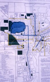
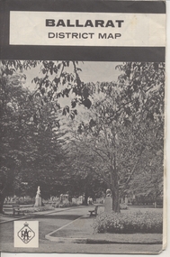
Map, Royal Automobile Club of Victoria, "Ballarat District Map - RACV", c1966
Yields information about the extent of Ballarat in the early to mid 1960's shows the tram lines and other rail lines in the district.Printed street map titled "Ballarat District Map", published by the RACV, showing the central part of Ballarat, Ballarat Outlets, streets, principal attractions, Ballarat and district maps and information, and a list of sporting and entertainment facilities. Has the tram lines shown dotted, does not run out to Sebastopol or the Lydiard St North terminus. Each map in the bottom left hand corner has the numbers "1166", possibly indicating the date.trams, tramways, map, ballarat, racv, railways -
 Warrnambool and District Historical Society Inc.
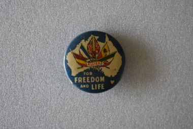
Badge, Allies for Freedom & Life
The badge predates 1917 and was a fund raiser in Australia for the war effort. It is one of the many badges produced during World War One.This badge is retained as an example of badges made for gaining funds for the War effort during World War One.Circular painted, slightly concave, metal badge. The front features a cream map of Australia on a blue background. Inside the map is an image of six flags Belgium. France, United Kingdom, Australia, Russia and Italy and red text in a small scroll. Underneath the map is further text. There is a pin clip on the reverse.ALLIES FOR FREEDOM AND LIFEallies, world war one, war effort fundraising -
 Melbourne Tram Museum
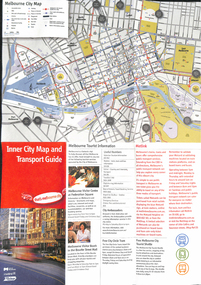
Map, City of Melbourne, "Inner City Transport Map", c1990
Map - 6 fold DL - full colour titled "Inner City Transport Map", providing information for Tourist Information centres, Metlink. Melbourne City Tourist Shuttle, and two maps, one provided by Melway giving a list of attractions. Published by City of Melbourne, Melway and Metlink with each of their logos.trams, tramways, map, public transport, city of melbourne, metlink -
 Warrnambool and District Historical Society Inc.
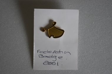
Badge, Federation Badge 2001
This was one of the many badges issued to celebrate the Federation of Australia. The colonies of Australia were federated into the Commonwealth of Australia in 1901 The first parliament was held in Melbourne in May, 1901. In the newly established capital of Australia, Canberra, the federal parliament sat in 1927. This of minor interest as a memento of the centenary of Australian Federation.This is a gold coloured metal stylised map of Australia and a star . The perimeter of the map is raised and links to the star. The reverse has a lapel badge mechanism. It is attached to a piece of white card with text. Federation Badge 2001federation of australia -
 Lara RSL Sub Branch
Book, Dawn of D Day, 1959
This book was issued in 1960 and is an impression of the experience of the men who landed in the light of dawn on D Day. An impression of what it was like to be dropped from the sky at morning or ship to shore from a landing craft under fire.Historical recount of D-Day landings and subsequent battlesHardcover - dark blue Front Back and spine. The spine has the title printed. Inside front and back cover have illustrated maps by Charles Green. Photographs, maps and illustrations.wwii, d day, battle of normandy, air drop, american air drop, canadian troops, french civilians, invasion fleet, paratroopers, juno beach, invasion beaches, dropping zones, utah beach, omaha beach -
 Bendigo Military Museum
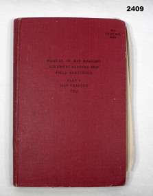
Manual - MANUAL 1955, Her Majesty's Stationary Office, London, Map Reading, Air Photo Reading and Field Sketching, Part 1 Map Reading 1955, 1955
Item in collection of Dave Waterston, refer Cat No 2410 for service details.Red hard cover manual, 131 pages with some fold out sheets, titled: Map Reading, Air Photo Reading and Field Sketching, Part 1 Map Reading1955“W O Code 8868”books - reference, military history - air force, map reading -
 Warrnambool RSL Sub Branch
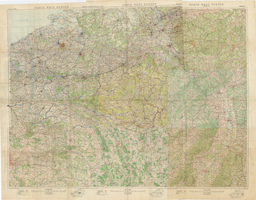
1:250,000 COMPOSITE WALL-MAP NORTHWEST EUROPE. Ordnance Survey Office, Southampton, 1914
Original Item recovered from possibly Australian Corps HQ, probably between the Armistice, 11 November 1918, and June 1919, when the Staff Sergeant R.O.(Bob) Snape was repatriated.Cloth-backed paper. 6 map sheets glued together to form one large wall map of NW Europe, covering from Normandy beaches to Cologne and Paris to Strasbourg.snape collection -
Bendigo Historical Society Inc.
Map - LEICHARDT, 23/05/1875
Map: Parish of Leichardt, County of Bendigo. Parish plan (coloured). Attached plan in the top left hand corner marked 'Building Lots' (number 323 in map cupboard 1)map, bendigo, building lots, leichardt -
Whitehorse Historical Society Inc.
Legal record - Land Title, Musk Street, Blackburn
Land Titles referring to No. 1 Musk Street, BlackburnLand Titles referring to No. 1 Musk Street, Blackburn : 1. Vol. 542 Fol. 108222, James William Barnes, 1872; 2. Vol. 1877, Fol. 375367, Freehold Investment and Banking Company of Australia Limited, 1886; 3. Transfer 1507851 to John Thomas Williams, 1932; 4. Vol. 8109 Fol. 997 William Henry Rogers, 1955, with Plan of Subdivision CP 21670; 5. cadastral map, AMA zone 55, Sep 2000.Land Titles referring to No. 1 Musk Street, Blackburn musk street, blackburn, no. 1, maple street, blackburn, lawson street, blackburn, elder street, blackburn, barnes, james william, freehold investment and banking company of australia ltd, springfield road, blackburn, whitehorse road, blackburn, barnes estate -
 Bendigo Military Museum
photograph - Cartographic Squadron Production – Army Survey Regiment, Fortuna, c1980
This collection of 12 photos was most likely taken in 1980. The photos were most likely taken in Cartographic Squadron’s Ante Room, the Attic and small offices on the top floor of Fortuna Villa. The computer based Editwriter typesetting system was introduced in 1975 as a replacement to the aging Fotosetter machine. It was operated by a specialised technician, who generated a large variety of map type styles and sizes quickly and reliably, as well as text panels. CPL Richards performed this task for several years and in photo .1P and .2P is reading off a type order next to the computer monitor. Output on Copy proof adhesive backed stripping type film replaced messy wax and spray adhesives in 1978. The Editwriter capability supported all RASvy units and contractor type setting requirements. Scribing was the cartographic process of drafting features such as drainage, relief, vegetation, roads and culture on specially coated map reproduction material. The cartographic technician scribed out the map feature such as a contour to a specified line width on the map sheet, using a tool affixed with a sapphire tipped cutter. The quality control edit (Proving) stage of map production was the first opportunity to inspect a proof of the map independently and systematically. Proving tasks were carried out by technicians conversant of the map product specification and task requirement, however, was not involved in its production. Corrections were identified, marked up and sent to back to the correcting section or contractors. Terrain Embossing was a manual map production technique to produce hill shading on medium to small scale graphics and air charts. SPR John Martin is seen in photos .8P to.10P using a fine embossing metal stylus to push down on the drainage impression on a thin malleable opaque plastic material (AK Poligraphy). Ridge lines were then pushed down using the contour impression as a guide, on the opposing side of the AK Poligraphy to create a 3D plastic model terrain effect. The map impression was sprayed with white paint and photographed to create a contone tone hill shade. SPR Gina (Coore) Neilson is seen in photo .11P washing a contone positive of a land mass in a solution. The contone components were registered to the map sheet, as shown in photo .12P and masked using an air brush and a halftone negative was then created. The terrain embossing method of producing hill shading was more efficient to produce than previous specialised artistic methods such pencil/eraser and air brush. Furthermore, a more consistent enhancement of terrain on charts was achieved between technicians.This is a set of 12 photographs of Cartographic Squadron performing four map production tasks at the Army Survey Regiment, Fortuna, Bendigo c1980. The first ten photographs were on 35mm negative film and were scanned at 96 dpi. Photos .11P and .12P were on photographic paper and scanned at 300 dpi. They are part of the Army Survey Regiment’s Collection. .1) - Photo, black & white, c1980, Editwriter typesetter, CPL Paul Richards. .2) - Photo, black & white, c1980, Editwriter typesetter, CPL Paul Richards. .3) - Photo, black & white, c1980, Scribing contours on a RAAF Chart, SPR Megan (McBurney) Reynolds. .4) - Photo, black & white, c1980, Scribing contours on a RAAF Chart, SPR Megan (McBurney) Reynolds. .5) - Photo, black & white, c1980, Scribing contours on a RAAF Chart, SPR Rod Skidmore. .6) - Photo, black & white, c1980, Scribing contours on a RAAF Chart, SPR Rod Skidmore. .7) - Photo, black & white, c1980, Formal quality control edit (Proving), CPL Ian Belmont. .8) - Photo, black & white, c1980, Hill Shade Terrain Embossing, SPR John Martin. .9) - Photo, black & white, c1980, Hill Shade Terrain Embossing, SPR John Martin. .10) - Photo, black & white, c1980, Hill Shade Terrain Embossing, SPR John Martin. .11) - Photo, black & white, c1980, Hill Shade Terrain Embossing, SPR Gina (Coore) Neilson. .12) - Photo, black & white, c1980, Hill Shade Terrain Embossing, unidentified..1P to .10P No personnel are identified. .11P and .12P annotated ‘Terrain Embossing’royal australian survey corps, rasvy, army survey regiment, army svy regt, fortuna, asr, carto -
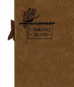 Phillip Island and District Historical Society Inc.
Booklet, Churchill Island Sale Booklet, 1938
Small booklet prepared for the Sale of Churchill Island - distributed by Martin & Co. Melbourne. The Island was owned from 1929 until this time by Gerald Buckley . An absentee owner, Buckley employed the Jeffery brothers, Bob and Ted, with the help of Harry Cleeland, to run the property. The Jeffrey brothers were promised by Buckley that Churchill Island would be passed to them on his death but this never happened. HistoricalBrown covered booklet with Information, maps and photos of Churchill Islandchurchill island, churchill island sale -
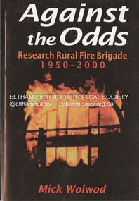 Eltham District Historical Society Inc
Book, Mick Woiwod, Against the Odds; Research Rural Fire Brigade 1950-2000, c.2001
A history of the brigade's first 50 yearsbushfire, eltham barrel, research fire brigade, victorian bushfires - 1969 -
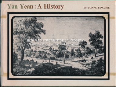 Eltham District Historical Society Inc
Book, Dianne H. Edwards, Yan Yean: A History, 1978
Wurunjerrai - Baluk tribe in the area; place names.Ex Eltham College Library; various library markings wurundjeri woi wurrung, yan yean -
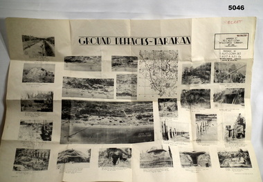 Bendigo Military Museum
Poster - POSTER, GROUND DEFENCES "TARAKAN", 1 Aust Corps Det. A.A.P.I. Gn, Ref map Tarakan 1/25000, 8 August 1945
Francis Hansen VX85668 2/3rd Infantry Battalion.Cream coloured Paper, Black Printed map with 23 photographs on it.Ground Defences Tarakanposter, photographs, tarakan -
 Federation University Historical Collection
Map, Wendouree (Alfredton and Ballarat North) Retail and Business Guide, 2005, 10/2005
Wendouree, Alfredton and Ballarat North Retail and business guide mapmap, guide, wendouree, alfredton, ballarat north -
 Federation University Historical Collection
Map, Sebastopol (Delacombe, Redan and Ballarat South) Retail and Business Guide, 2005, 10/2005
Sebasgtopol is a suburb of Ballarat.Sebastopol, Delacombe, Redan and Ballarat South and business guide map.map, guide, delacombe, redan, ballarat south, victorian park, bray raceway, sebastopol equestrian centre, western oval, city oval -
Federation University Historical Collection
Pamphlet, The Golden Plains Art Trail
Coloured pamphlet that folds out with a map of the locations on the Art Trailthe golden plains shire, helen lewers, dawn whitehead, edward coleridge-driver, ros lawson, arts trail -
 Greensborough Historical Society
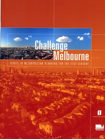
Book, Victoria. Department of Infrastructure, Challenge Melbourne: issues in metropolitan planning for the 21st century, 2000
A report on Melbourne's future growth and a strategic plan to manage this growth, 2000.36 p., text, col. illus., maps and col. plansmelbourne (victoria), town planning, infrastructure victoria -
 Greensborough Historical Society
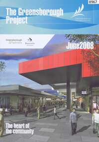
Newsletter, The Greensborough Project, 2008, 2016
The Greensborough Project June 2008 and Greensborough Community Update 2016 by Banyule City Council2 Newsletters, 4 pages each, colour illus., maps.urban development, greensborough, greensborough project -
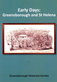 Greensborough Historical Society
Book, Peter Van Eeken, Early days: Greensborough and St Helena, 2021
History of the Greensborough and St Helena areas 1837-1900GHS produced publication113 p. black print on white paper, illus., maps.st helena, greensborough, greensborough historical society -
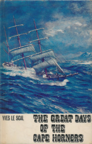 Mission to Seafarers Victoria
Book, Yves le Scal, The Great Days of the Cape Horners, 1966
vi, 222 p., [24] p. of plates : ill., maps .non-fictionkeith oliver, yves le scal, cape horn, cape horners -
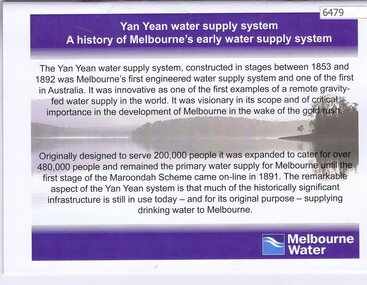 Greensborough Historical Society
Booklet, Yan Yean water supply system: a history of Melbourne's early water supply system, 2010c
History of the Yan Yean water supply system - Melbourne's earliest. This is an early version of the history.Link: 6479:6482 24 p., colour illus., mapsyan yean reservoir, melbourne water -
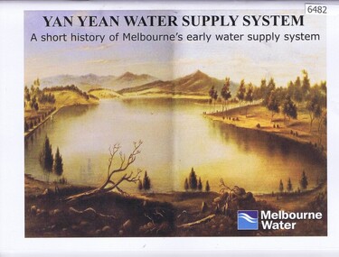 Greensborough Historical Society
Booklet, Yan Yean water supply system: a short history of Melbourne's early water supply system, 2011c
Early history of the Yan Yean water supply systemLink: 6479:6482 40 p., colour illus. and mapsyan yean reservoir, toorourrong reservoir, melbourne water -
 Greensborough Historical Society
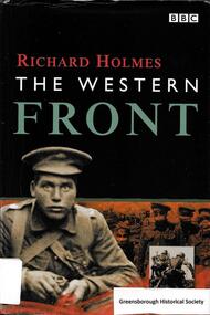
Book, BBC Worldwide, The Western Front / Richard Holmes, 1999_
Tells the story of the Western Front during World War I. 224 p., illus. (some col.), maps. Hard cover.world war i, western front -
 Greensborough Historical Society
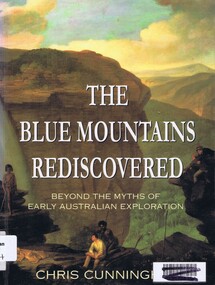
Book, Chris Cunningham, The Blue Mountains rediscovered: beyond the myths of early Australian exploration, by Chris Cunningham, 1996_
Written from both an historical and geographical view, this book tells the story of early inland exploration across the Blue Mountains.Paperback, 192 p., col. photographs, black and white maps.blue mountains nsw -
 Greensborough Historical Society
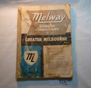
Book, Melway Street Directory of Greater Melbourne. Edition 1, 1966_
The first edition of this iconic Melbourne street directory published in 1966. The directory is accompanied by an outline of the history of the concept and publication of Melway.A surviving first edition of the Melway is rare as these directories are designed to be updated each year. Of interest in this edition is maps of the Greensborough area before large scale subdivision of the land in the late 1960s and 1970s.Soft cover street directory. Coloured maps.189 pages.melway, street directories, melbourne. -
4th/19th Prince of Wales's Light Horse Regiment Unit History Room
Book, H S Gullett, Official History of Australia in the War of 1914-18. Vol VII Sinai and Palestine. 8th Edition, 1939
Hard covered book, 844 pp. with illustrations, maps and photoshistory, light horse, ww1, gullett