Showing 11442 items
matching maps
-
 The Celtic Club
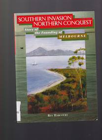
Book, Rex Harcourt, Southern invasion, northern conquest: Story of the founding of Melbourne, 2001
This book is an account of how exploration and settlement of Port Phillip paved the way for colonising present day Victoria.Index, bib, plates, maps, ill. p. 240.non-fictionThis book is an account of how exploration and settlement of Port Phillip paved the way for colonising present day Victoria.exploration and development - melbourne, john batman - melbourne - history -
 The Celtic Club
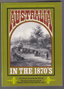
Book, Edwin Carton Booth, Australia in the 1870s, 1975
A facsimile of the original volume. First published 1873-1876 with engravings. There are brief references to aborigines.Maps, ill, facsim, p.232, 2 vols.non-fictionA facsimile of the original volume. First published 1873-1876 with engravings. There are brief references to aborigines.australia - pictorial works, australia - description and travel -
 The Celtic Club
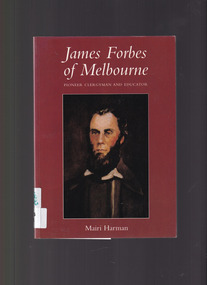
Book, Mairi Harman, James Forbes of Melbourne: Pioneer clergyman and educator, 2001
James Forbes' one great object was the advancement of pure religion and education among the people of Port Phillip. He was the first settled clergyman of Port Phillip District.Index, bib, maps, plates, ill, p.164.non-fictionJames Forbes' one great object was the advancement of pure religion and education among the people of Port Phillip. He was the first settled clergyman of Port Phillip District.presbyterian clergy - melbourne - biography, educators - victoria -
 The Celtic Club
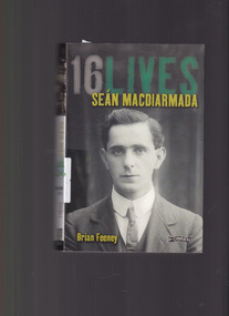
Book, Brian Feeney, 16 lives: Sean Macdiarmada, 2014
The first of a series of biographies of the 16 men executed by the British Government following the Easter Rising in 1916.Index, map, Ill, plates, bib. p.336.non-fictionThe first of a series of biographies of the 16 men executed by the British Government following the Easter Rising in 1916.ireland - biography - sean macdiarmada, ireland - uprising 1916 -
![Book, Leslie Arthur Schumer, Henry Dendy and his emigrants / [by] Leslie A. Schumer, 1975](/media/collectors/4f729f7b97f83e03086018a5/items/590860a8d0ce9c14e834a413/item-media/5bac378021eb061568d29027/item-fit-380x285.jpg) Eltham District Historical Society Inc
Eltham District Historical Society IncBook, Leslie Arthur Schumer, Henry Dendy and his emigrants / [by] Leslie A. Schumer, 1975
Henry Dendy (1800-1881) is best known as the founder of Brighton. It is not well known that years later he lived far longer at Eltham than he did at Brighton. In 1840 whilst still in England, he bought eight square miles of unspecified land in the Port Phillip district. This entitled him to bring a number of other people to the colony and in 1841 he arrived in Williamstown in the York with his family and 139 others. He took up this land entitlement at what is now Brighton and most of the emigrants settled there. He encountered financial problems and lost his interest in the estate in 1844. He left Brighton in 1847. He successfully not always successfully became a brewer at Geelong, a sheep farmer at Christmas Hills and Upper Moira, a flour miller at Eltham, a sheep farmer again at Werribee and finally a copper miner at Walhalla. Dendy came to Eltham in 1856 after having spent a year in England, he purchased about 5 acres of land in two parts situated each side of Maria Street (Main Road). There was a steam flour mill on that part of the land adjoining the Diamond Creek. He became prominent in local affairs serving for a time on the Eltham District Roads Board including one term as President. Dendy’s wife Sarah died at Eltham in 1860 and also in that year he was appointed Chairman of a committee to establish a Church of England in Eltham. He donated one of his Pitt Street lots for this purpose. St Margaret’s Church was opened on this site in 1861. In 1867 Dendy sold his mill to W F Ford and moved to Werribee and then Walhalla where he remained until his death. He is buried in the Walhalla cemetery. Part of the land on which the Eltham Community Reception Centre stands was the site of Dendy’s house and Mill. Some of the old trees on the site could well have been planted in Dendy’s time. Much of this information was obtained from the book “Henry Dendy and his Emigrants” by L A Schumer. ISBN 095971040X Paperback; viii, 88 p. : maps ; 22 cm. [written inside front cover] To J.W. Wainbech(?) with the author's compliments and thanks. 22/12/75 [and signed by the author on the cover page]henry dendy, brighton (vic.), emmigration, pioneers -
 Federation University Historical Collection
Map - Geological Survey, J. Phillips, Geological Survey of Victoria - Ballarat, 1857, 10/1858
Geological map of the Ballarat District featuring four colours.ballarat, geological, geology, geological plan, main road, camp, golden point, pennyweight hill, clayton hill, ballaarat cemetery, bakery hill, specimen hill, soldiers hill, nightingale lead, native youth black hill flat, white flat, mining, mines, eureka lead, old post office hill -
 Greensborough Historical Society
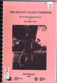
Book, Victoria Archaeological Survey, The Plenty Valley Corridor: the archaeological survey of Aboriginal sites / by Isabel Ellender 1989, 1989_
This archaeological survey of th Plenty Valley was conducted by Isabel Ellender in 1989 for the Ministry of Planning and Environment. The area studied is north of Greensborough to Whittlesea. A number of Aboriginal sites were identified and recommendations made for the future.103 p., illus., maps. Plastic spiral binding.plenty river, aboriginal heritage sites -
 Melbourne Tram Museum
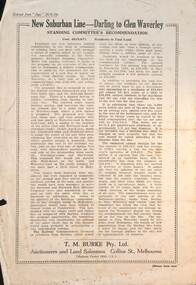
Pamphlet - Real estate sale, T M Burke, "New Suburban line - Darling to Glen Waverley", July 1926
Pamphlet advising potential land purchasers of the recommendation to extend the railway line from Darling to Glen Waverley, extracted from The Age 26/6/1926. Advises that the land and losses would be paid for by the residents through their rates. Gives costs of the proposed new line. Has a plan showing the estates for sale along the line, the Ashburton line (later extended to Alamein) and Burwood Road. Published by T M Burke Pty Ltd. Demonstrates the style of land sale pamphlet including the proposed availability of train services to prospective purchasers.Pamphlet - single quarto sheet with map on rear - printed.sale of land, real estate, railways, glen waverley, suburban railways -
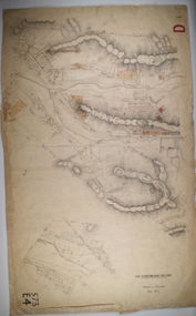
 Bendigo Historical Society Inc.
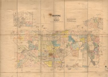
Map - JACK FLYNN COLLECTION: MARONG, June 1933
Map: Parish of Marong, County of Bendigo. Parish plan.By Authority W.M. Houston, Government Printer. Drawn and reporduced at the Dept., of Lands and Survey, Melbourne, Victoria.map, bendigo, parish plan, marong -
 Canterbury History Group
Book, Gwen McWilliam, Early Canterbury, 1994
Early history of Canterbury with a focus on the "Shrublands" property of Balwyn Road.22, [2 leaves] pages : illustrations, maps, facsimilesnon-fictionEarly history of Canterbury with a focus on the "Shrublands" property of Balwyn Road.canterbury, canterbury history, residential development, shrublands -
 Greensborough Historical Society
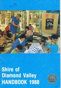
Booklet, Shire of Diamond Valley Handbook 1988, 1988_
Guide to services provided by Shire of Diamond Valley. The Shire of Diamond Valley was a Local Government Area located about 20 kilometres northeast of Melbourne. The shire covered an area of 74.38 square kilometres and existed from 1964 until 1994. Cover illustration of activity following pre-school story time for 3-5 year olds at the libraryAnnual guide to services in Shire of Diamond Valley32 pages, col illus., maps. . (3 copies)shire of diamond valley, greensborough, handbooks -
 Greensborough Historical Society
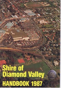
Booklet, Shire of Diamond Valley Handbook 1987, 1987_
Guide to services provided by Shire of Diamond Valley. The Shire of Diamond Valley was a Local Government Area located about 20 kilometres northeast of Melbourne. The shire covered an area of 74.38 square kilometres and existed from 1964 until 1994. Cover illustration of aerial view of Greensborough shopping area and environs.Annual guide to services in Shire of Diamond Valley32 pages, col illus., maps. 2 copies.shire of diamond valley, greensborough, handbooks -
 Greensborough Historical Society
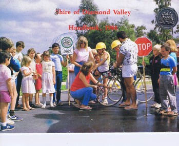
Booklet, Shire of Diamond Valley Handbook 1986, 1986_
Guide to services provided by Shire of Diamond Valley. The Shire of Diamond Valley was a Local Government Area located about 20 kilometres northeast of Melbourne. The shire covered an area of 74.38 square kilometres and existed from 1964 until 1994. . Cover illustration of Bike Education program sponsored by Shire of Diamond Valley in local schools.Annual guide to services in Shire of Diamond Valley32 pages, col illus., maps. (3 copies)shire of diamond valley, greensborough, handbooks -
 Greensborough Historical Society
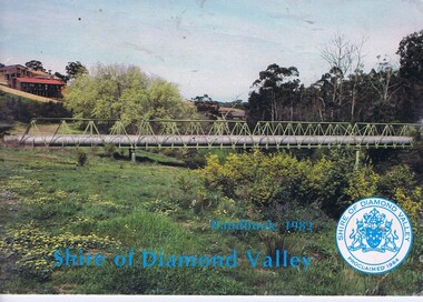
Booklet, The Shire of Diamond Valley Handbook 1982, 1982_
Guide to services provided by Shire of Diamond Valley. The Shire of Diamond Valley was a Local Government Area located about 20 kilometres northeast of Melbourne. The shire covered an area of 74.38 square kilometres and existed from 1964 until 1994. Cover illustration of aqueduct and bridge over Plenty River near Apollo Parkways estste.Annual guide to services in Shire of Diamond Valley32 pages, col illus., maps. 2 copiesshire of diamond valley, greensborough, handbooks -
 Greensborough Historical Society
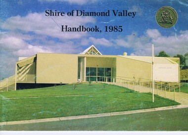
Booklet, Shire of Diamond Valley Handbook 1985, 1985_
Guide to services provided by Shire of Diamond Valley. The Shire of Diamond Valley was a Local Government Area located about 20 kilometres northeast of Melbourne. The shire covered an area of 74.38 square kilometres and existed from 1964 until 1994. Cover illustration of Library/Arts facility at Civic Centre Greensborough, opened 1985.Annual guide to services in Shire of Diamond Valley32 pages, col illus., maps. 2 copies.shire of diamond valley, greensborough, handbooks -
 Greensborough Historical Society
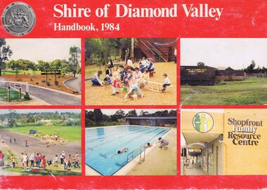
Booklet, Shire of Diamond Valley Handbook 1984, 1984_
Guide to services provided by Shire of Diamond Valley. The Shire of Diamond Valley was a Local Government Area located about 20 kilometres northeast of Melbourne. The shire covered an area of 74.38 square kilometres and existed from 1964 until 1994. Cover illustration of recreation facilities in Diamond Valley.Annual guide to services in Shire of Diamond Valley32 pages, col illus., maps. 2 copies.shire of diamond valley, greensborough, handbooks -
 Greensborough Historical Society
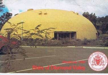
Booklet, The Shire of Diamond Valley Handbook 1981, 1981_
Guide to services provided by Shire of Diamond Valley. The Shire of Diamond Valley was a Local Government Area located about 20 kilometres northeast of Melbourne. The shire covered an area of 74.38 square kilometres and existed from 1964 until 1994. Cover illustration of "Diamond Creek Bini-shell".Annual guide to services in Shire of Diamond Valley28 pages, col illus., maps. (3 copies)shire of diamond valley, greensborough, handbooks -
Bendigo Historical Society Inc.
Map - GOLDEN SQUARE GEOLOGICAL SURVEY, 1992
BHS CollectionGolden Square Geological Survey of Goldfields Coloured map.Dept of manufacturing and Industry Development.bendigo, gold mining, geological survey -
 Greensborough Historical Society
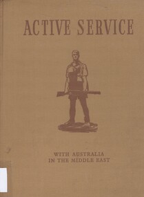
Book, Active Service; with Australia in the Middle East, 1941_
Tells the story of the Australian Imperial Force (AIF), serving in the Middle East during World War II129p., Illus. (some col.), maps. Hard cover. australian imperial force, australian army, middle east, world war ii -
 Bendigo Historical Society Inc.
Map - BOROUGH OF EAGLEHAWK SHEET 2, 9/12/1902
Map: Borough of Eaglehawk, sheet No. 2. Parish planmap, bendigo, parish plan, borough of eaglehawk -
 Bendigo Historical Society Inc.
Map - BOROUGH OF EAGLEHAWK SHEET 2, 9/12/1902
Map: Borough of Eaglehawk, Sheet No, 2. Parish planmap, bendigo, parish plan, borough of eaglehawk -
 Bendigo Historical Society Inc.
Map - BOROUGH OF EAGLEHAWK SHEET 3, Circa 1880's
Map: Borough of Eaglehawk , sheet No. 3. Parish planmap, bendigo, parish plan, `borough of eaglhawk -
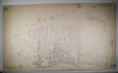
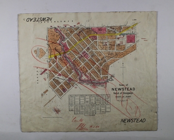 Bendigo Historical Society Inc.
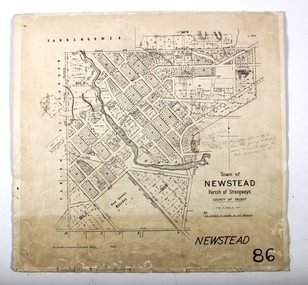
Map - NEWSTEAD, 1/11/1939
Map: Town of Newstead, Parish of Strangways, County of Talbotmap, talbot, township, newstead, parish of strangways, county of talbot -
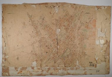 Bendigo Historical Society Inc.
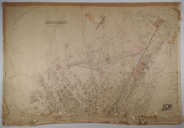
Map - SANDHURST SHEETS 1 AND 2, No date visible
Map: Sandhurst sheets 1 and 2. Parish planmap, bendigo, parish plan, sandhurst -
 Bendigo Historical Society Inc.
Map - SANDHURST, No date Visible
Map: Parish plan showing the Northern section of the Municipalitymap, bendigo, parish plan, sandhurst -
 Bendigo Historical Society Inc.
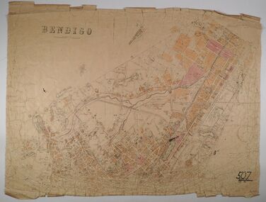
Map - BENDIGO, No date visible
Map: Parish plan showing the Northern section of the Municipalitymap, bendigo, parish plan, bendigo -
Canterbury History Group
Book, Lemon, Andrew, Box Hill, 1978
History of Box Hill published to mark Box Hill's Golden Jubilee yearIncludes appendices, notes, index, photographs, portraits and mapsnon-fictionHistory of Box Hill published to mark Box Hill's Golden Jubilee yearbox hill, local history, boroondara -
 Bendigo Historical Society Inc.
Map - NEWSTEAD, 15/10/1912
Map: Town of Newstead, Parish of Strangways, County of Talbotmap, talbot, township, newstead, county of talbot -
Melbourne Tram Museum
Archive (Series), Melbourne & Metropolitan Tramways Board (MMTB), Darling and Koornang Road extensions from Carnegie, 1937
Melbourne and Metropolitan Tramways BoardRecord of correspondenceLetters in date orderDetails correspondence both internal and external with Councils about a possible tram line along Waverley Road, Darling Rd, Koornang Rd to the the Carnegie tram terminus in Trugannini Road. Inlcudes cost estimate, and sketch plan.tramways, new track, extensions, correspondence, darling road, carnegie, koornang rdtramways, new track, extensions, correspondence, darling road, carnegie, koornang rd -
 Whitehorse Historical Society Inc.
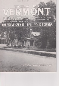
Pamphlet, This is Vermont, 1988?
A history of Vermont from 1830 to 1897, with maps and photographs.A history of Vermont from 1830 to 1897, with maps and photographs.A history of Vermont from 1830 to 1897, with maps and photographs.nunawading, vermont, shambrook, tim