Showing 10832 items
matching maps
-
 Bendigo Military Museum
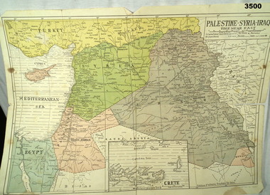
Map - MAP MIDDLE EAST, Dyag Press Ltd
Coloured map of Palestine, Syria, Iraq & Crete, countries involved in the war.documents - maps, military history, middle east -
 Federation University Historical Collection
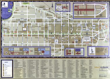
Map, Eastern Ballarat (c) Retail and Business Guide, 2004
Map of Ballarat East including Brown Hill, Mount Clear and Buninyong.brown hill, mount clear, mount helen, buninyong, university of ballarat -
 4th/19th Prince of Wales's Light Horse Regiment Unit History Room
Framed Map, Tallarook, 12/11/1923
Tallarook was a training area of the Regiment1 Inch: 1 Mile map of Tallarook in glass fronted frame -
 Greensborough Historical Society
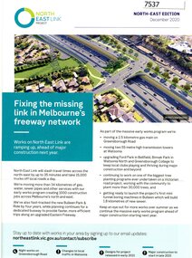
Pamphlet - Newsletter, Victorian Government, Fixing the missing link in Melbourne's freeway network, 2020_12
An update on major projects in Victoria, named "Victoria's Big Build" including the North East Link Project, M80 Ring Road upgrades, Hurstbridge rail line duplication and level crossing removals. Large sheet folded twice. Colour illus. and map. 2 copies.north east link, victoria's big build, western ring road, hurstbridge rail line -
 Greensborough Historical Society
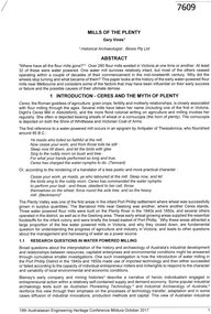
Article, Gary Vines, Mills of the Plenty River, by Gary Vines, 2017_10
Transcript of conference paper on flour mills on the Plenty River, including Arthur Sergeantson's Carome Mill, George Coulstock's Janefield Mill and Moses Thomas's Mayfield Mill. The paper was presented at the 19th Australasian Engineering Heritage Conference in Mildura, October 2017Transcript of conference paper, 26 pages, illus. (some col.), maps.plenty river, flour mills -
 Phillip Island and District Historical Society Inc.
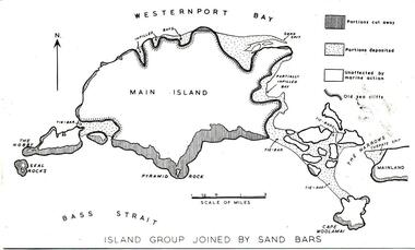
Photograph
One of a collection of over 400 photographs in an album commenced in 1960 and presented to the Phillip Island & Westernport Historical Society by the Shire of Phillip IslandPhotograph of a map of Phillip Island showing a late stage in the geological formationlocal history, photography, phillip island, black & white photograph, phillip island geology, map, map of phillip island, john jenner, bryant west -
 Greensborough Historical Society
Book, Arriving: The Victorians. By Richard Broome, 1984_
This volume deals with the life of immigrants to Victoria over 150 years.Part 1 of a 3-part series to commemorate the 150th anniversary of the founding of VictoriaHard cover. 258 pages, illus (some colour), end maps.victoria immigration, victoria history, victoria social conditions, richard broome -
 Greensborough Historical Society
Leaflet, Nillumbik Tourist Association, Where to stay in Nillumbik, 17/10/2015
Lists 10 major tourist accommodations in: Bundoora, Diamond Creek, Eltham, Hurstbridge, Kangaroo Ground, Panton Hill, Research, St AndrewsColour, printed both sides, map of area, A4 folded twicenillumbik -
 Greensborough Historical Society
Booklet, Watsonia and District Progress Association, Watsonia and District Progress Association Year Book 1959/60, 1960_03
This booklet provides a snapshot of Watsonia in the late 1950s and the improvements and advances in the area. 24 p. duplicated, stapled on white paper. With map of Watsonia insert.watsonia, watsonia and district progress association -
 Greensborough Historical Society
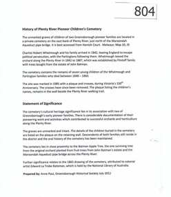
Article, History of Plenty River Children's Cemetery; by Anne Paul, 1848-1860
The unmarked graves of the children of two Greensborough pioneer families lie in a private cemetery on the Plenty River. Burials occurred between 1848 and 1860.The significance lies in the association with two of the pioneer families of the Greensborough district. Descendants of both families still live in the area.2 printed pages of text, one page map (item 848).pioneer childrens cemetery, plenty river, partington, whatmough -
Glenelg Shire Council Cultural Collection
Plan - Plan - Map Portland Harbour, n.d
Port of Portland Authority Archivesport of portland archives, portland harbour -
 City of Moorabbin Historical Society (Operating the Box Cottage Museum)
Document, laminated photocopy of 'Plan of Moorabbin 1850', 1853
Weston Bate, 'A history of Brighton' 1962 informs us that in 1840 Henry Dendy, who was a farmer in Sussex England, paid 5,120 pounds sterling @ 1pound per acre for a 'Special Survey of Land in Port Phillip , Australia. Henry arrived in Australia in 1841 on the frigate 'York' with his wife, son, and three servants. He also took advantage of the Government Assistance of Free Immigrants for Survey Purchasers, to help on his estate and persuaded some Sussex men with their families to follow him. However when Dendy arrived in Port Phillip he found that LaTrobe and Gipps were trying to raise the price of land close to Town to 15pounds per acre. Dendy asked merchant J.B.Were to manage his affairs and they went ahead with plans to subdivide the surveyed land called 'The Brighton Estate' This area of land extended easterly from the Port Phillip Bay to East Boundary Road and from North Road to South Road in the Parish of Bourke Victoria. The Privy Council, England , decide that Henry Dendy could purchase the land at 1pound per acre. Land Sales proceeded from 1844 as more immigrants established market gardens, farms and varied businesses in 'Moorabbin'This is a photocopy of a Map of the Moorabbin , County of Bourke c1850 showing the 'Henry Dendy Special Survey 1841'A photocopy of a Map of the Moorabbin , County of Bourke c1850. A3 size laminatedLeft corner : MOORABBIN / COUNTY OF / BOURKEdendy henry, dendy special survey 1841, brighton, moorabbin, ormond, bentleigh, market gardeners, pioneers early settlers, box william, box elizabeth -
 Eltham District Historical Society Inc
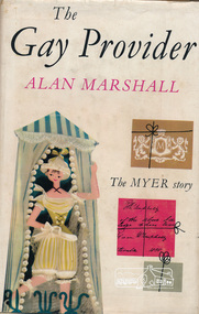
Book, Alan Marshall (1902-1984), The Gay Provider by Alan Marshall published by F.W. Cheshire Pty. Ltd, 1961
History of the Myer Emporium.279 p. : ill. (some col.), maps, ports ; 22 cm.22 cm.myer exmporium history -
 Eltham District Historical Society Inc
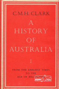
Book, Melbourne University Press, A History of Australia volume I by C.M.H. Clark, 1962
422 p. : ill., tables, maps, 17 plates ; 25 cm.ISBN 0522840086australia history -
 Eltham District Historical Society Inc
Book, Flour mills and millers of the Goulburn Valley, 1858-1980 / by Myrtle L. Ford, 1981
Paperback; [62] p. : ill., facsims., map, ports. ; 22 cm.ISBN 0959225501flour mills, goulburn valley -
 Eltham District Historical Society Inc
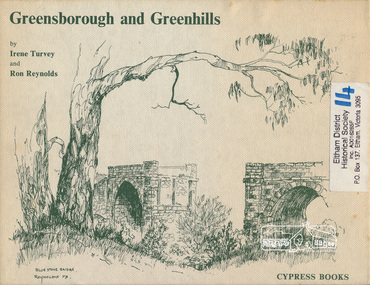
Book, Irene Turvey et al, Greensborough and Greenhills / words by Irene Turvey ; Drawings by Ron Reynolds, 1973
Pen and ink sketches accompanied by appropriate text in double page spreads. Contents cover : Blue stone bridge, Introduction, House cnr Church and Hailes Street, House - 25 Hailes Street, Yandell Reserve, Greensborough Hotel, Lobb's Kiosk, House - 49 Grimshaw Street, View of Greensborough (from Delphin Crescent), Railway Station, Old Barn (near Greensborough Railway Station), Partington's Flat and River Valley, Rand Street Bridge, Lower Main Street, Greenbriar Nursery, Hitching rail, Ashmead - Dr Cordner's Home, Greensborough Primary School, House - cnr St Helena and Diamond Creek Raods, Sondermeyer's Hill, Methodist Church, Football Pavilion, Cemetery, St Katherine's Church, St. Helena, Civic Centre, Briar Hill Timber Mill, 24 River Street, Kelly's Garden Supplies, 158 Main Street, Old Swimming pool, 105 Main Street.Hardback; 62 p. : ill., map ; 19 x 25 cm.ISBN 0909807108 Signed by author and illustrator Two copiesgreenhills, greensborough -
![Book, Roger Simmons, Eltham in the making / [editor] Roger Simmons. Vol.1, From Roman times until 1939, 1990](/media/collectors/4f729f7b97f83e03086018a5/items/591e43a4d0cddc20ec6ab5b1/item-media/5bac2d5821eacd1568437e51/item-fit-380x285.jpg) Eltham District Historical Society Inc
Eltham District Historical Society IncBook, Roger Simmons, Eltham in the making / [editor] Roger Simmons. Vol.1, From Roman times until 1939, 1990
Paperback; 128p. : ill,maps,ports,facsim,geneological table ; 23cm.ISBN 0951590707eltham society (london) -
 Eltham District Historical Society Inc
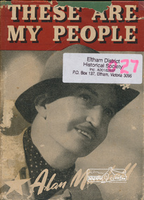
Book, Alan Marshall (1902-1984), These are my people / by Alan Marshall, 1944
Hardback with dust jacket; 202 p. : ill., map ; 19 cm.alan marshall, victoria description and travel, travel, reminiscences, anecdotes, country life -
![Book, Henry Dendy's account book / [introduction and editorial commentary by Leslie A. Schumer], 1983](/media/collectors/4f729f7b97f83e03086018a5/items/5927885fd0cdd112c0e8f02e/item-media/5bac375c21eb051568d9ac2a/item-fit-380x285.jpg) Eltham District Historical Society Inc
Eltham District Historical Society IncBook, Henry Dendy's account book / [introduction and editorial commentary by Leslie A. Schumer], 1983
Limited edition of 1000 numbered copies. Account book relating to Henry Dendy (1800-1881) of Brighton. Dendy was a special survey proprietor with an early association in Eltham where he operated a flour mill in the 1860s. Includes references to Were Brothers and Co. Henry Dendy’s Account book shows the recording of transactions on the frigate vessel York, on which Dendy sailed from England. The work also includes brief records of a brewery business Dendy conducted and the accounts of John Booker, one of Dendy’s emigrants. The records are in sterling currency and contain debit and credit columns while other accounting records included in the work cover transactions for a pastoral lease operated by Dendy. from 1848 until his return to England in 1855.Paperback; 63 p. : facsims., geneal. table, maps ; 25 cm.ISBN 0959710418henry dendy, accounting, were brothers -
![Book, Garrie Hutchinson, Remember them : a guide to Victoria's wartime heritage / [written & photographed by Garrie Hutchinson], 2009](/media/collectors/4f729f7b97f83e03086018a5/items/59278b33d0cdd112c0eaedec/item-media/5bac35ae21eafa1568280d77/item-fit-380x285.jpg) Eltham District Historical Society Inc
Eltham District Historical Society IncBook, Garrie Hutchinson, Remember them : a guide to Victoria's wartime heritage / [written & photographed by Garrie Hutchinson], 2009
Hardback; xii, 308 p. : col. ill., maps ; 24 cm. ISBN 9781740668408war memorials, monuments, world war 1, world war ii, boer war, victoria -
 Eltham District Historical Society Inc
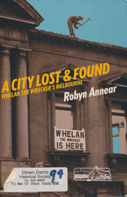
Book, Robyn Annear, A City Lost & Found: Whelan the Wrecker's Melbourne by Robyn Annear, 2005c
Paperback; xii, 303 p. : ill., maps, fascims. ; 24 cm.ISBN 1863953892whelan the wrecker, buildings, melbourne -
 Eltham District Historical Society Inc
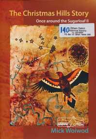
Book, Mick Woiwod, The Christmas Hills story : once around the Sugarloaf II / Mick Woiwod, 2010
Paperback; 275 p. : ill., facsims., maps, ports. ; 30 cm.Inscribed and signed by Author 2010christmas hills, sugraloaf reservoir, aborigines -
 Ringwood and District Historical Society
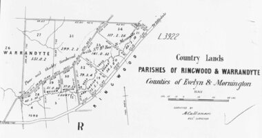
Photograph, Early map of parishes of Ringwood and Warrandyte in Counties of Evelyn and Mornington - c.1868, 1868
Copy of an early map of parishes of Ringwood and Warrandyte, Counties if Evelyn and MorningtonWritten on backing sheet, "c1868. Vol. 5, Fol.13/1224". -
 Federation University Historical Collection
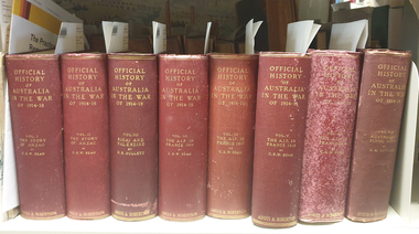
Book, Charles E.W. Bean, Official History of Australia in the War, Vol 3, The Australian Imperial Force in France, 1917, 1937
Red hard covered book of 1030 pages, with 423 illustrations and maps.world war, world war one, charles bean, aif, anzac, lagnicourt, messines, ypres, menin road, polygon wood, broodseinde ridge, passchendale, hill 60, hill 70, benafay wood, hindenburg line, hooge dump, butte, bapaume, bullecourt -
 Federation University Historical Collection
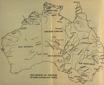
Map, Australia Showing Position of Some Australian Tribes, c1945, c1945
Digitised directly from "The Australian Aborigines: How to understand them" by A.P. ElkinMap of Australia showing states, river system and some Aboriginal Tribes.aboriginal, aborigines, kurnai, worworung, wongaibon, wiradjuri, dieri, wakelbura, pittapitta, waramunga, binbinga, anula, mara, waral, mulluk, larakia, worora, djaru, karadjerri, kogara, wongaii, pankala, tabalde, buandie -
Glenelg Shire Council Cultural Collection
Photograph - Photograph - Portland Harbour Development, n.d
Port of Portland Authority ArchivesBack: 3/s Blue & ? 1859 - blue biro several scribbles in blue pencilport of portland -
 City of Moorabbin Historical Society (Operating the Box Cottage Museum)
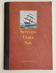
Book, Charlwood, D. E. (Donald Ernest), 1915-2012, Settlers under sail, 1978 © 1991
"Settlers Under Sail is Don Charlwood's account of the days of the sailing ship and a fascinating reconstruction of the wreck of the LOCH ARD. -- back cover49 p. : ill. (some col.), facsim., 1 map, portsnon-fiction"Settlers Under Sail is Don Charlwood's account of the days of the sailing ship and a fascinating reconstruction of the wreck of the LOCH ARD. -- back covershipwrecks, cape otway, sailing ships, ocean travel, emigration, immigration -
 City of Moorabbin Historical Society (Operating the Box Cottage Museum)
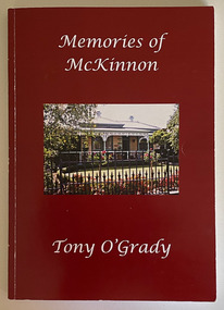
Book, O'Grady, Tony, Memories of McKinnon : growing up in Prince Edward Avenue, McKinnon, 2021
Personal recollections of the author growing up in the suburb of McKinnon, Victoria.150 pages : illustrations, maps, portraits : Includes bibliographical references and index.non-fictionPersonal recollections of the author growing up in the suburb of McKinnon, Victoria.mckinnon, prince edward avenue mckinnon, tony o'grady -
 City of Moorabbin Historical Society (Operating the Box Cottage Museum)
Book - Family History, Cohn, Alexander et al, Tablets of memory : the Bendigo Cohns and their descendants, 1853-1989, 1990
xxii, 270 p. : ill., facsims., geneal. tables, map, ports.non-fictionbendigo, cohn family -
 Running Rabbits Military Museum operated by the Upwey Belgrave RSL Sub Branch
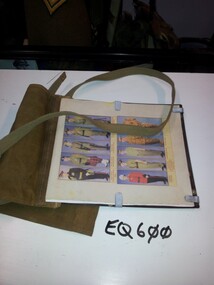
Map Case
Map Case with carry strap containing computer print of various uniformsequipment, 1943, army